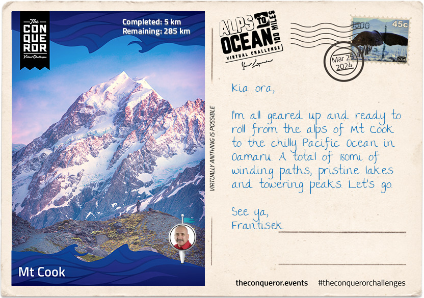
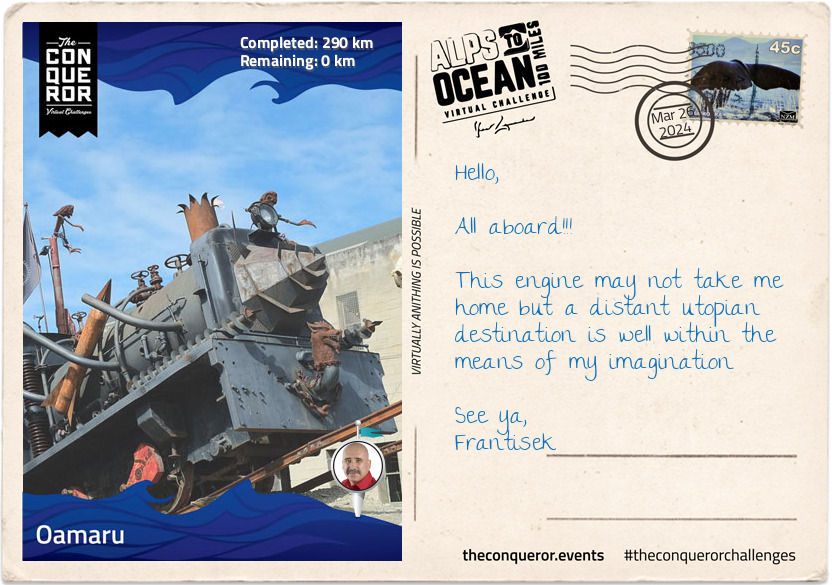
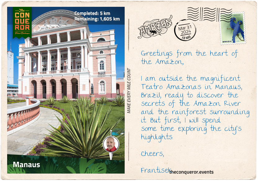
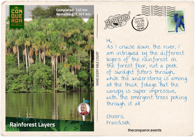
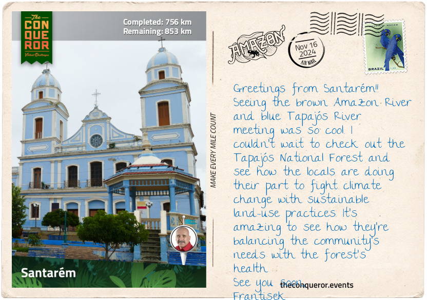
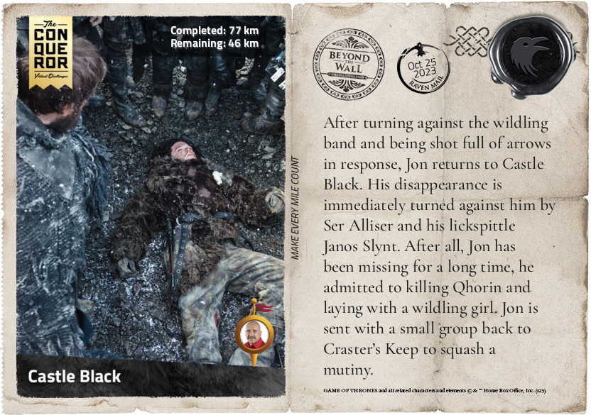
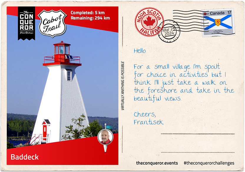
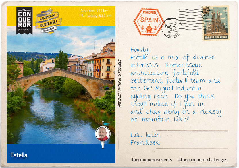
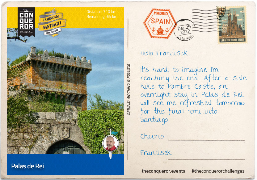
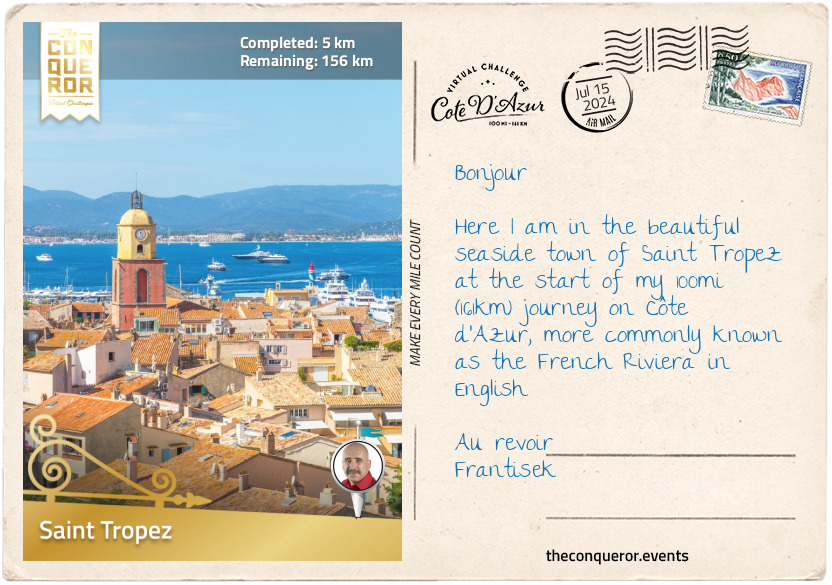
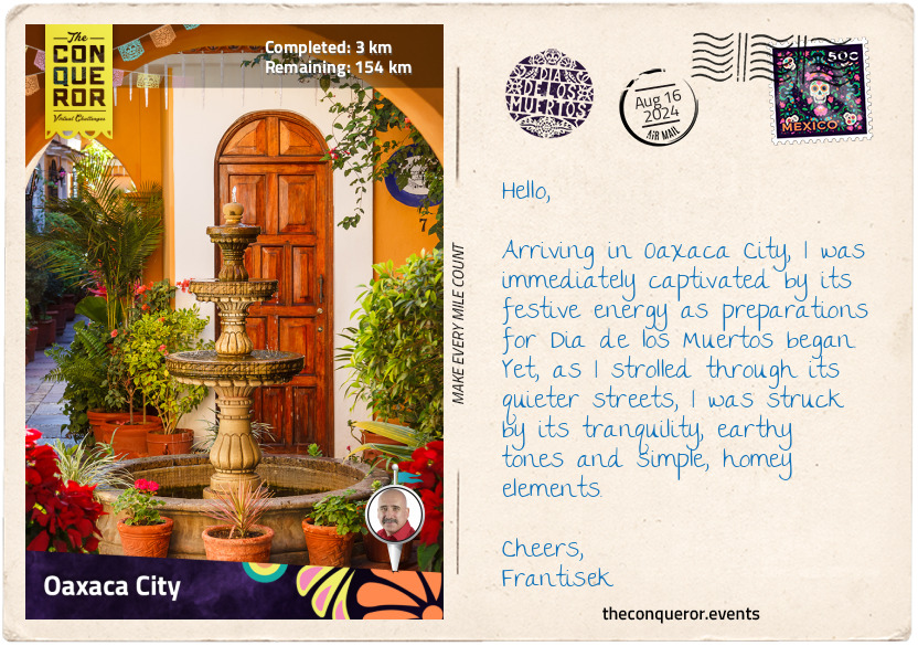
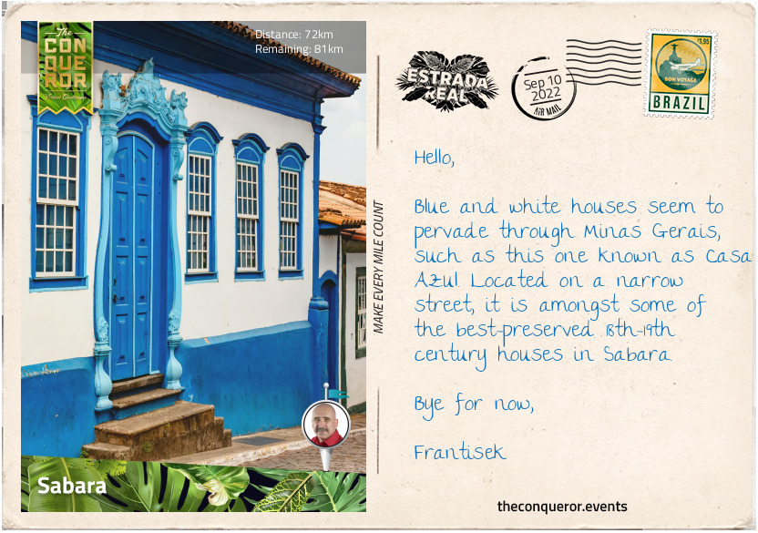
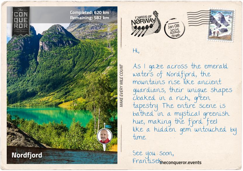
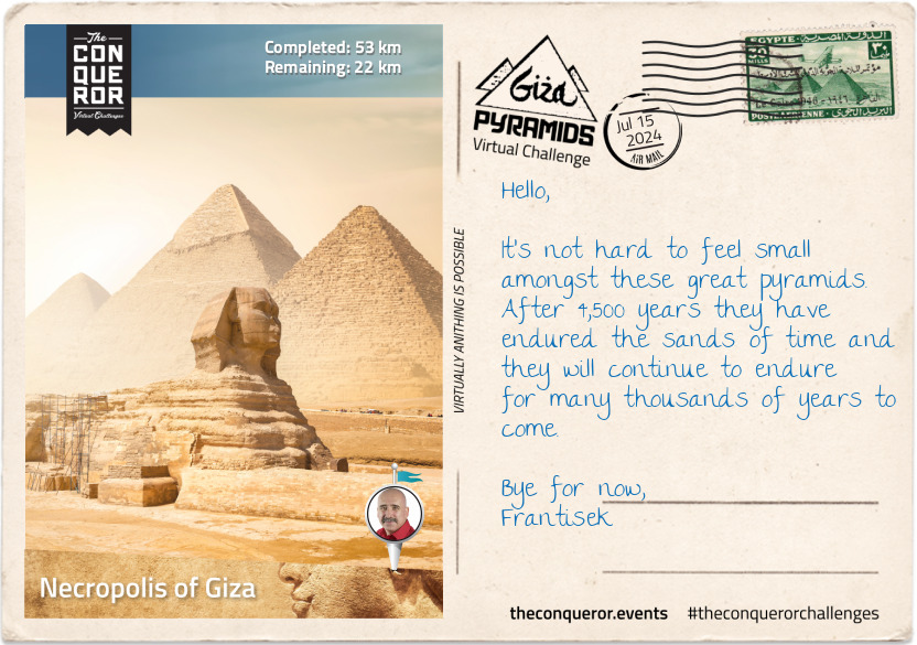
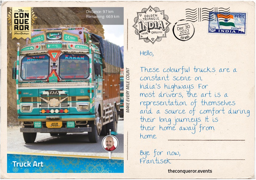
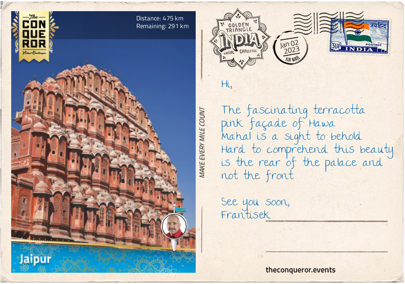
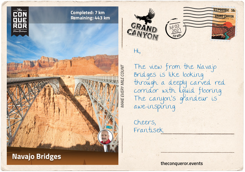
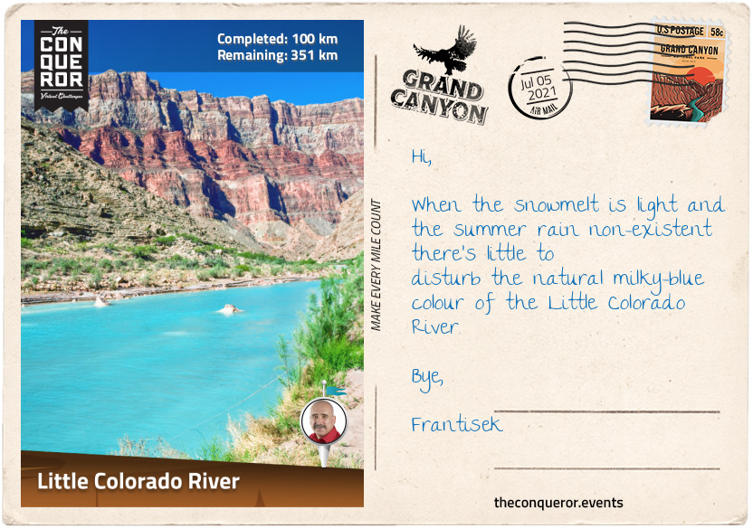
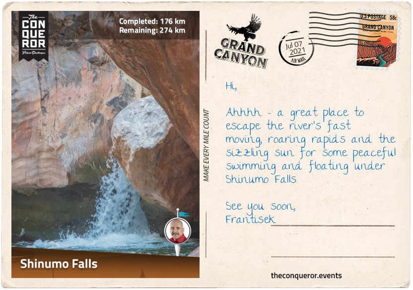
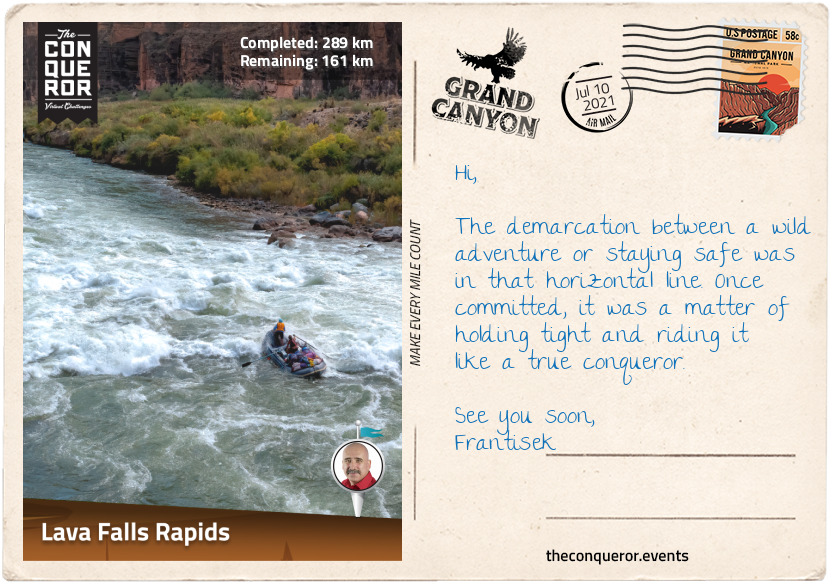
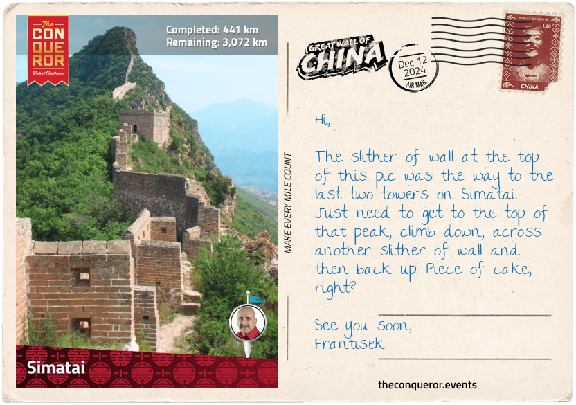
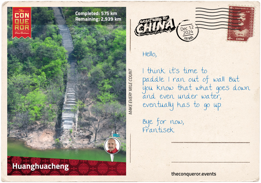
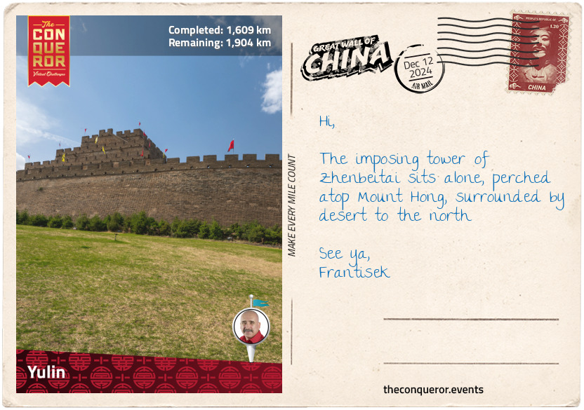
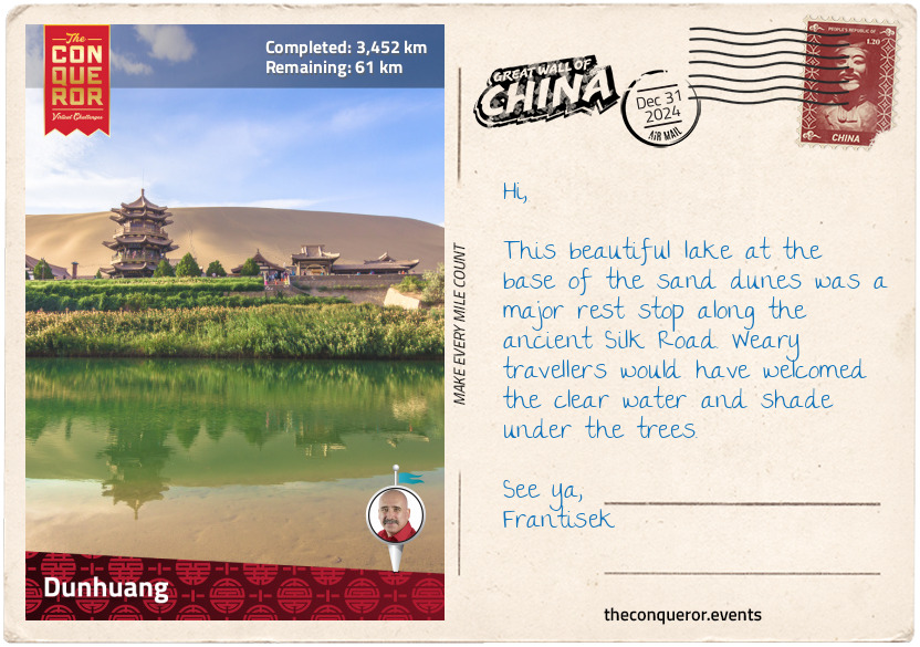
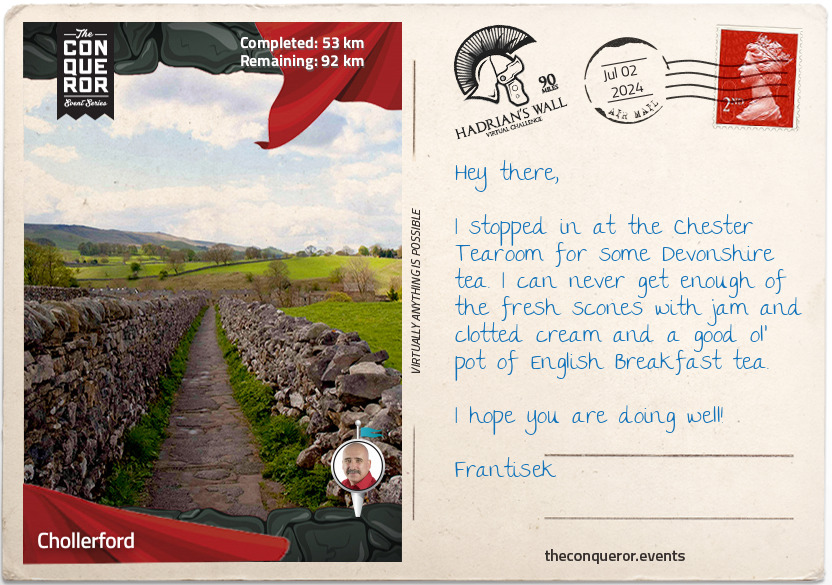
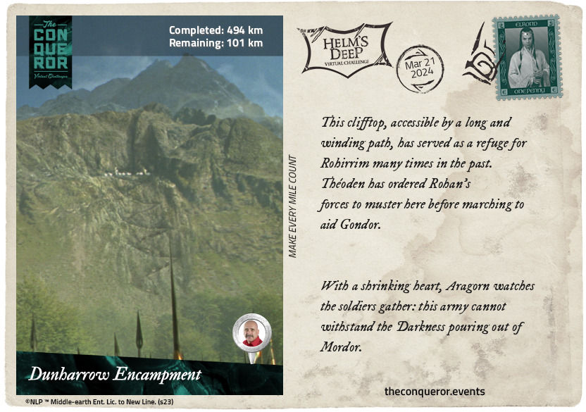
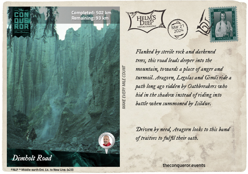
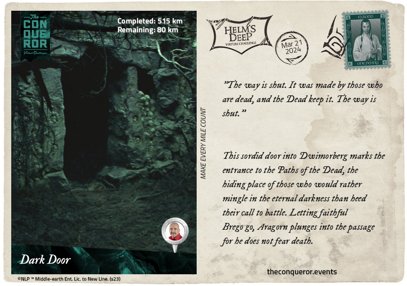
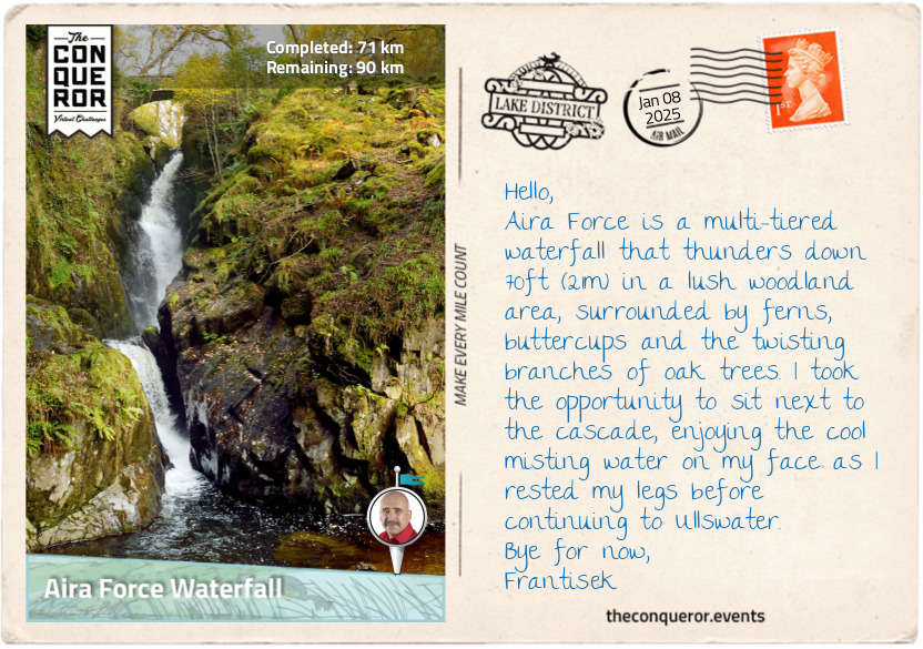
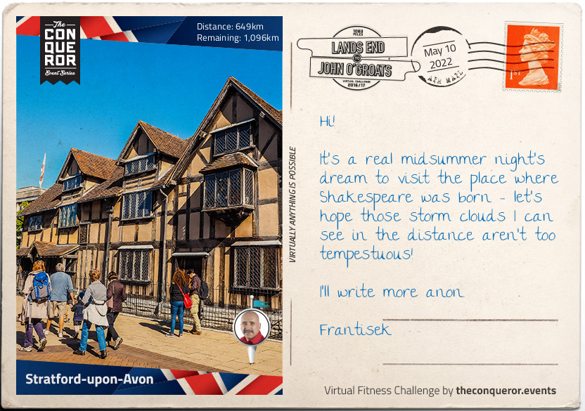
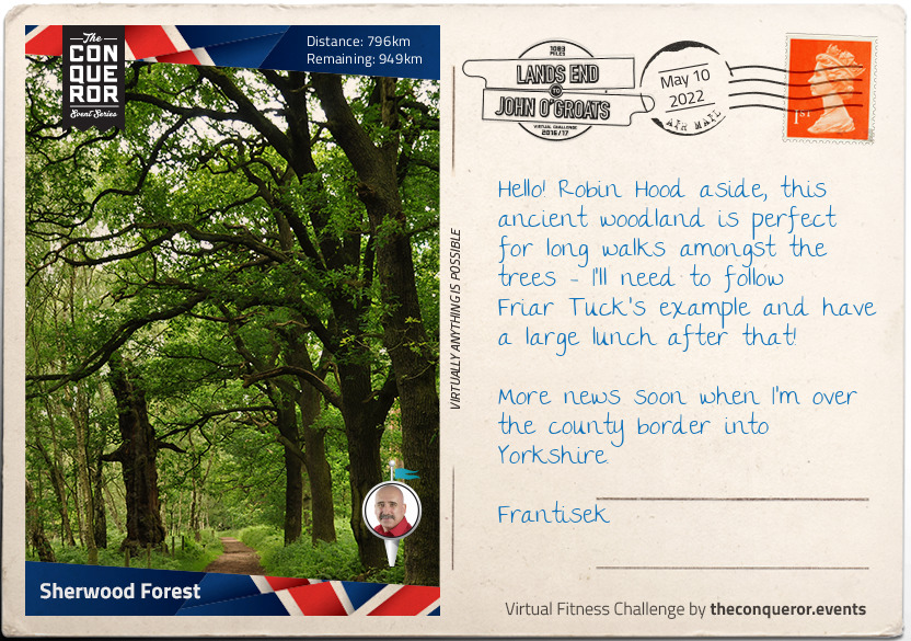
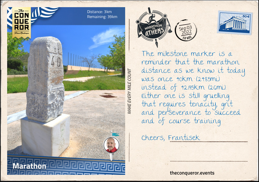
km od začátku : 0055
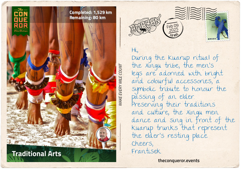
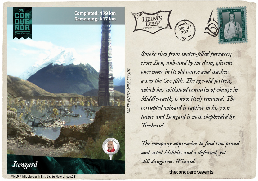
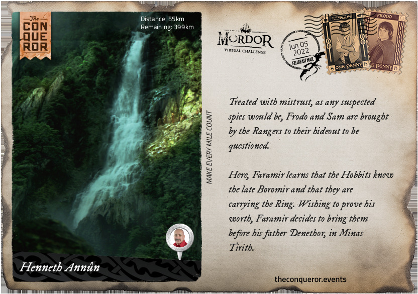
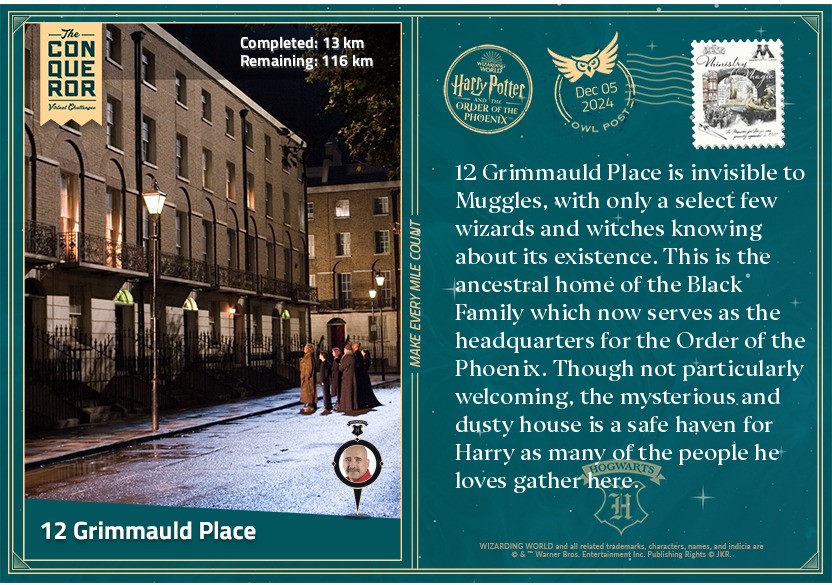
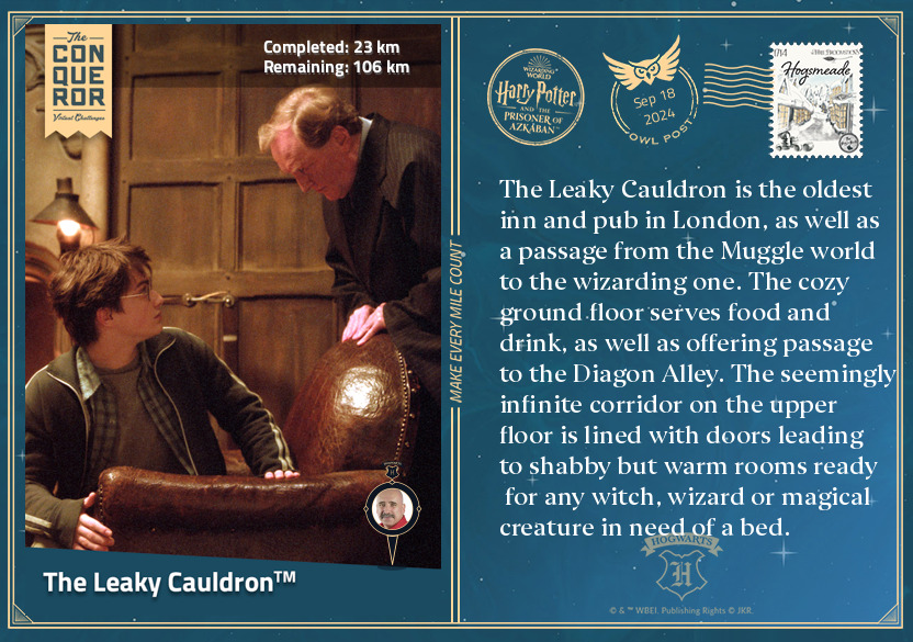
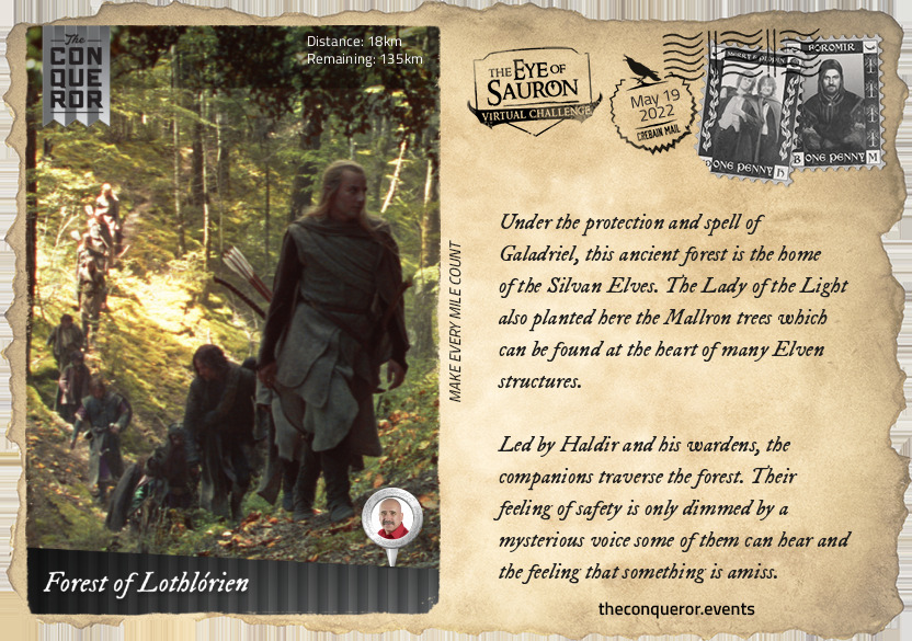
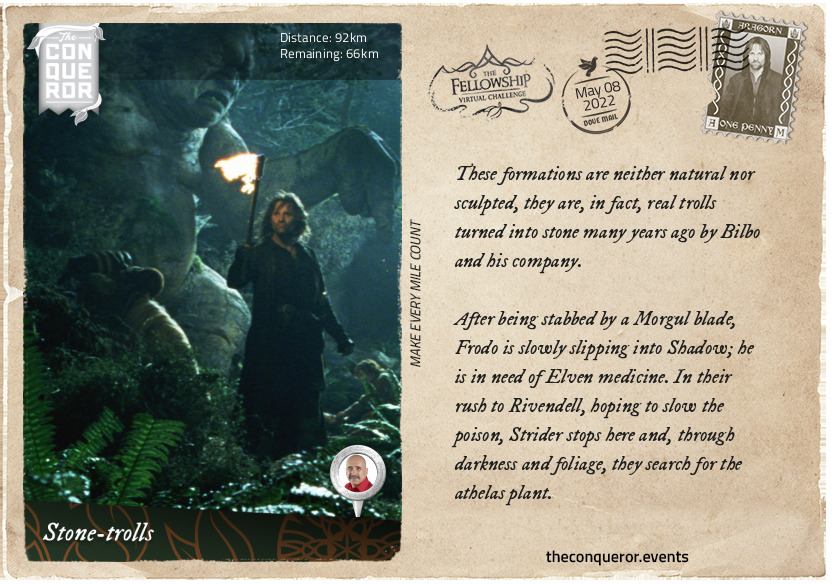
Henneth Annûn
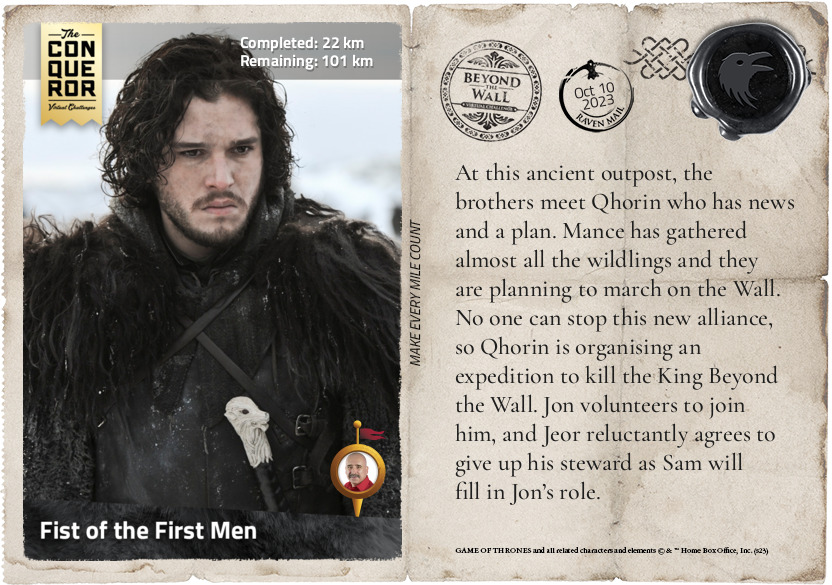
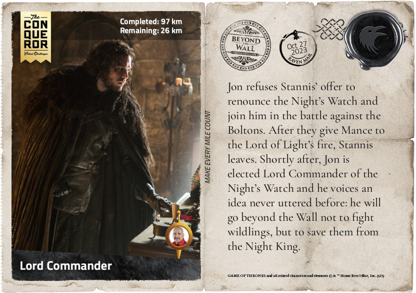
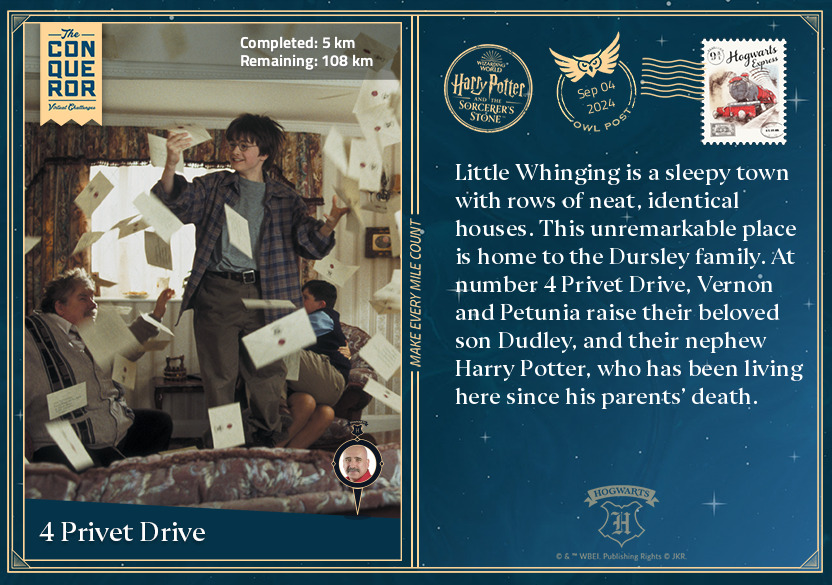
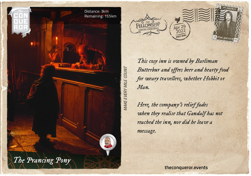
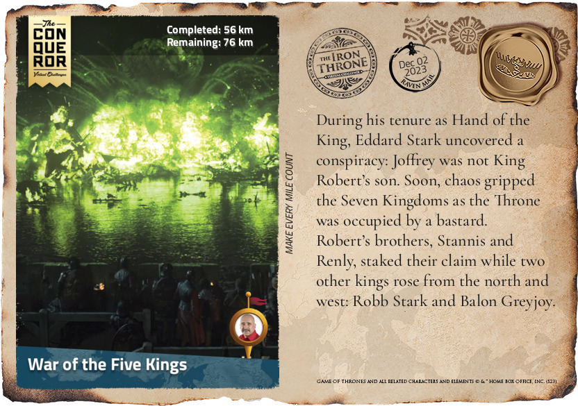
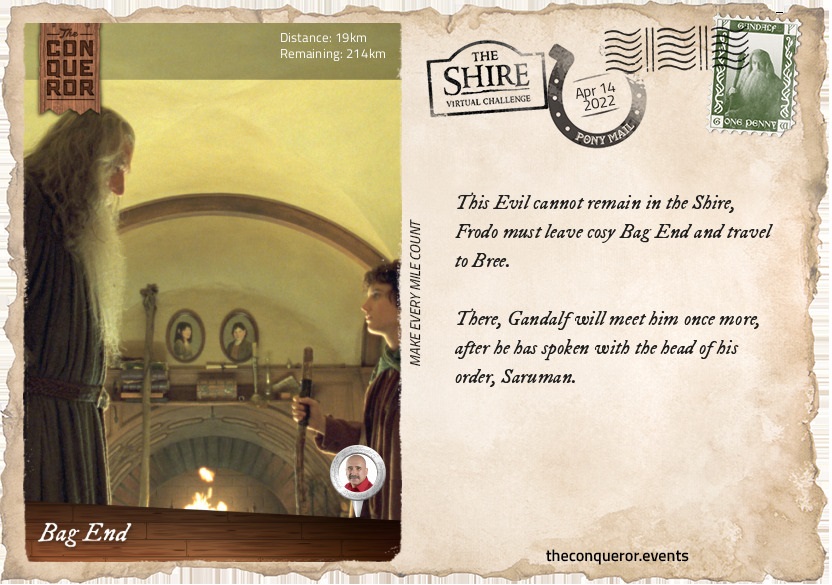
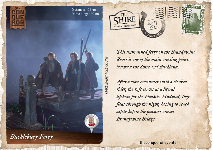
Treated with mistrust, as any suspected spies would be, Frodo and Sam are brought by the Rangers to their hideout to be questioned.
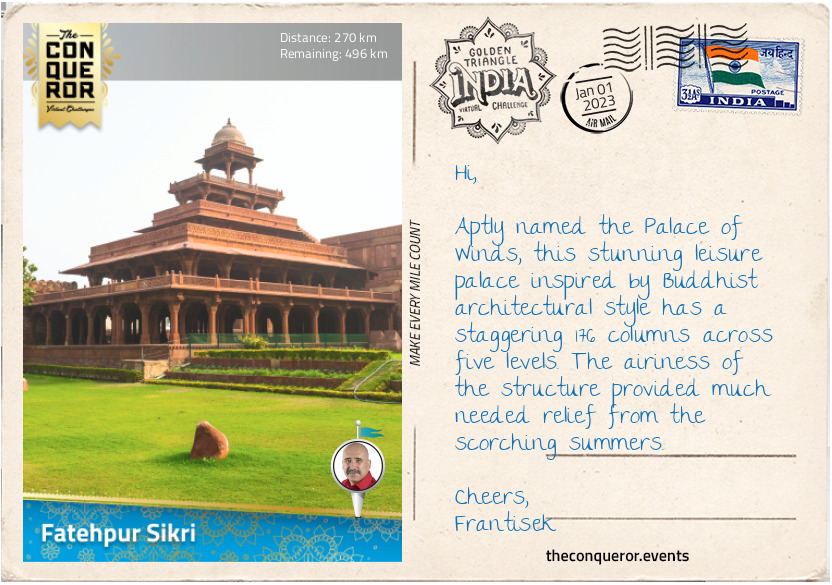
Here, Faramir learns that the Hobbits knew the late Boromir and that they are carrying the Ring. Wishing to prove his worth, Faramir decides to bring them before his father Denethor, in Minas Tirith.
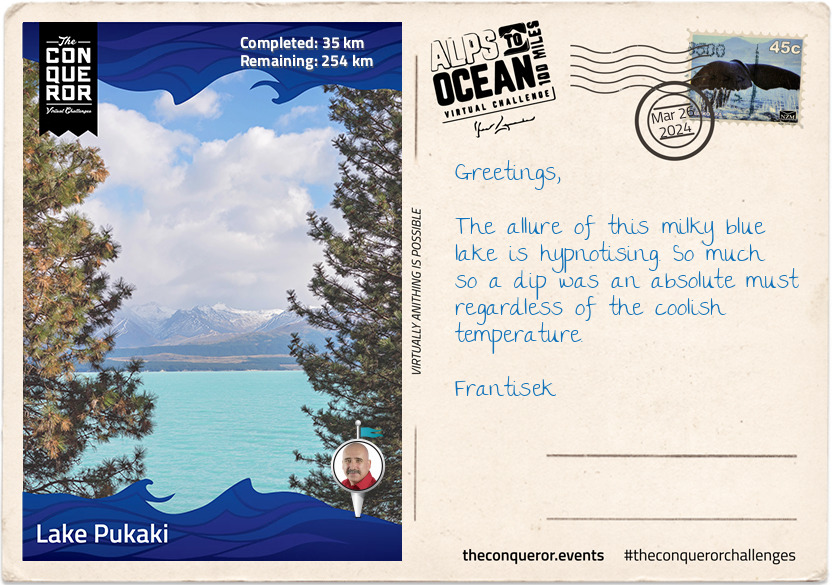
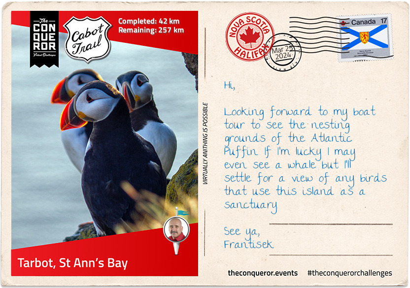
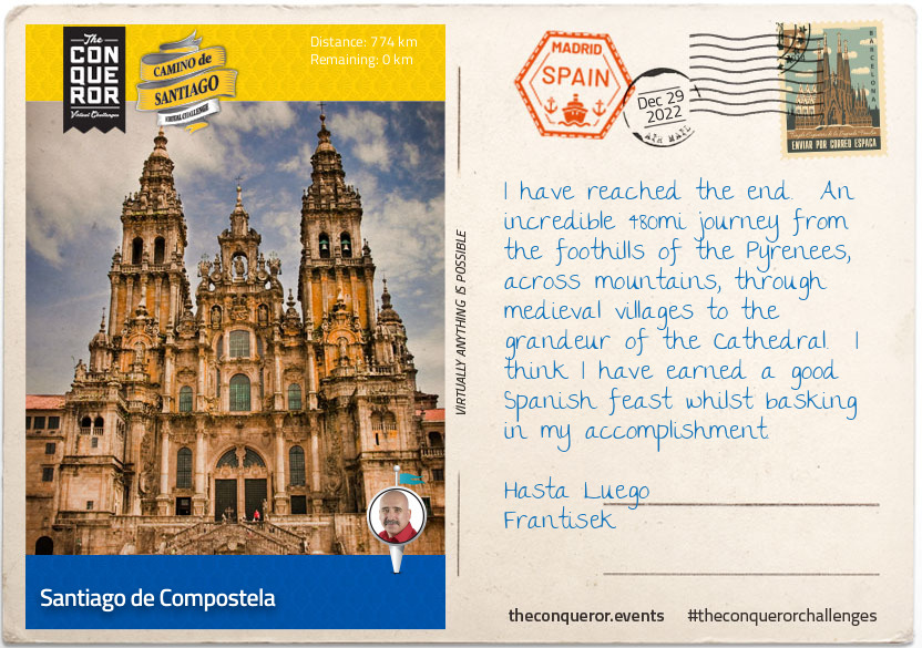
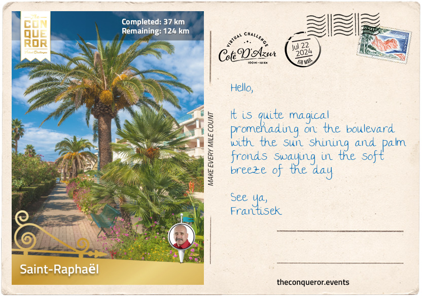
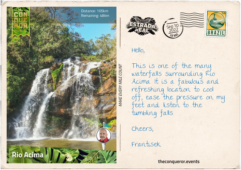
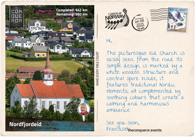
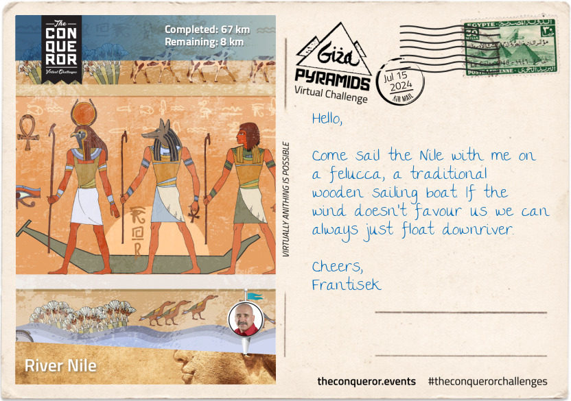
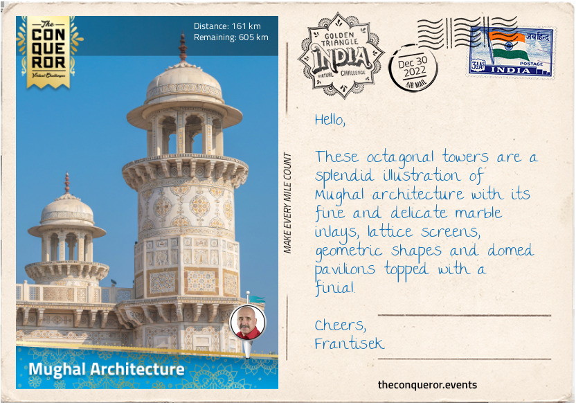
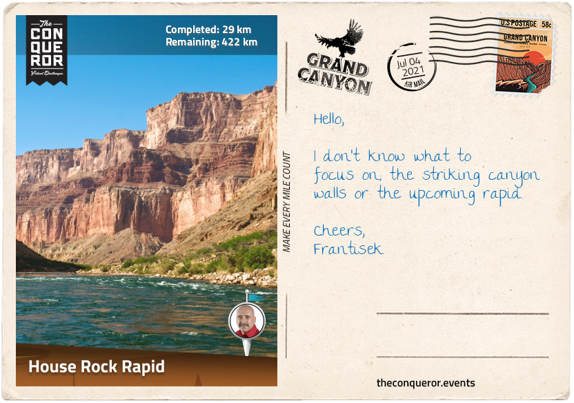
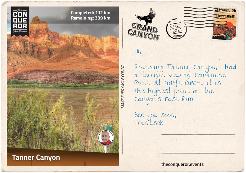
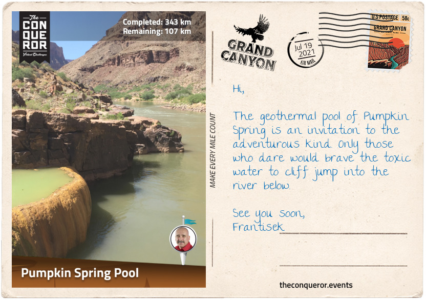
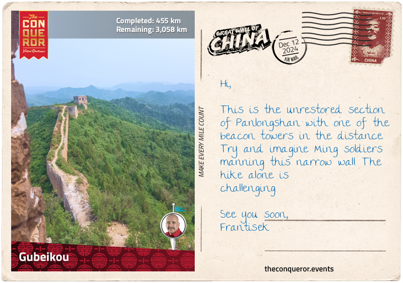
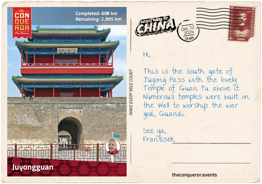
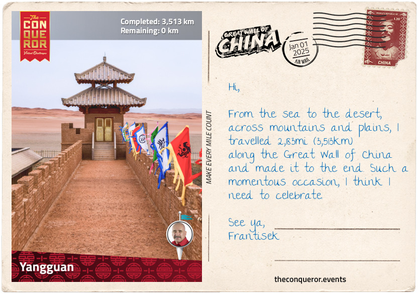
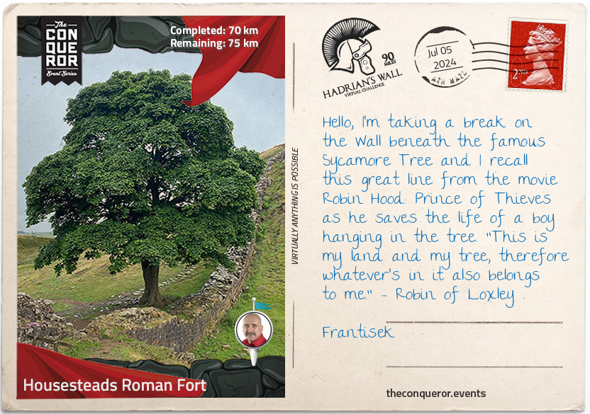
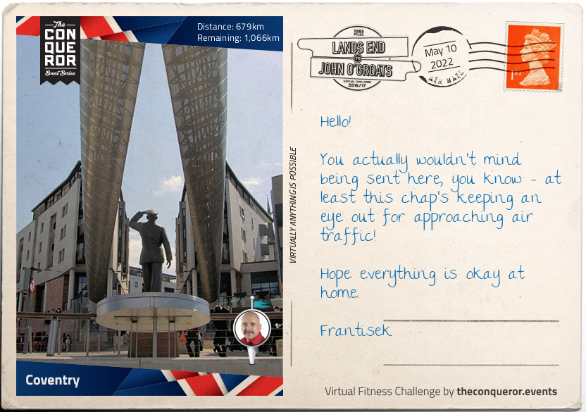
km od začátku : 0126
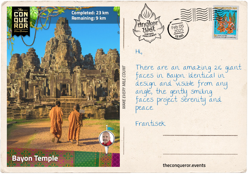
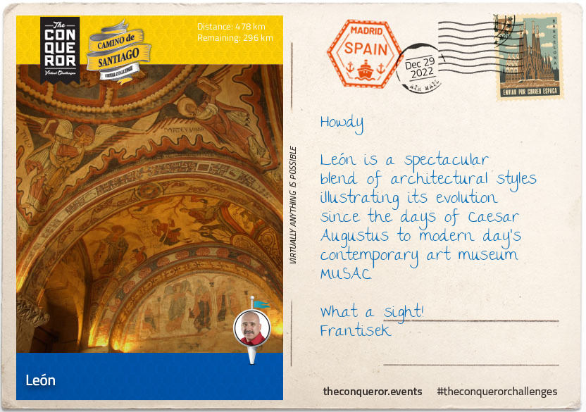
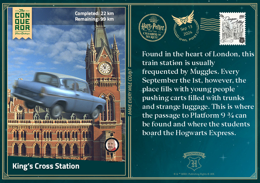
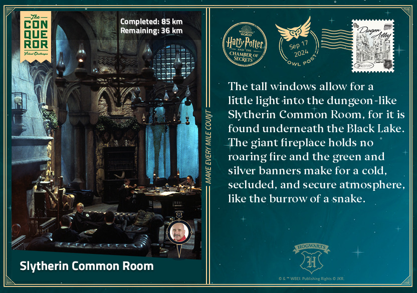
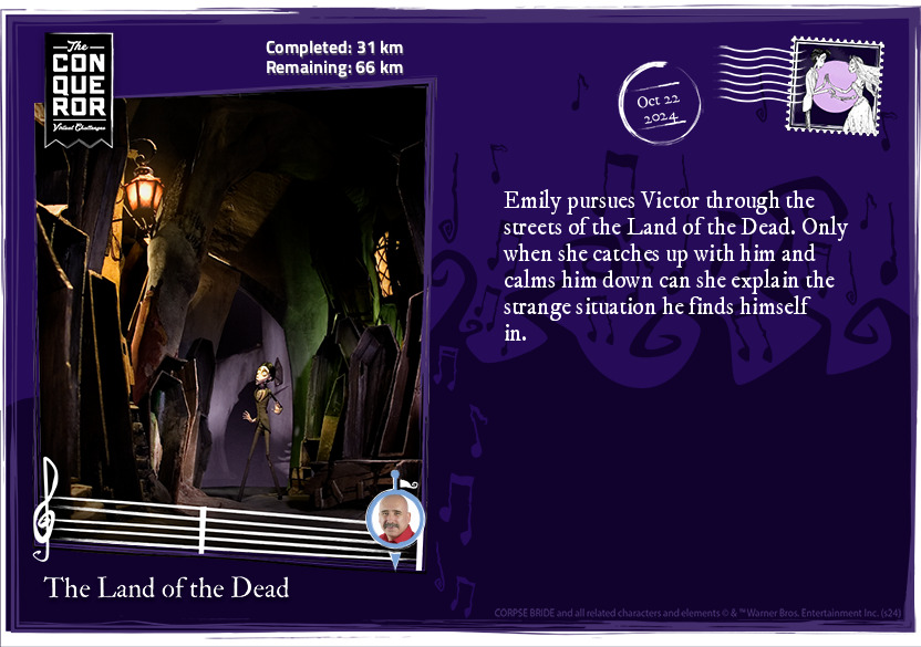
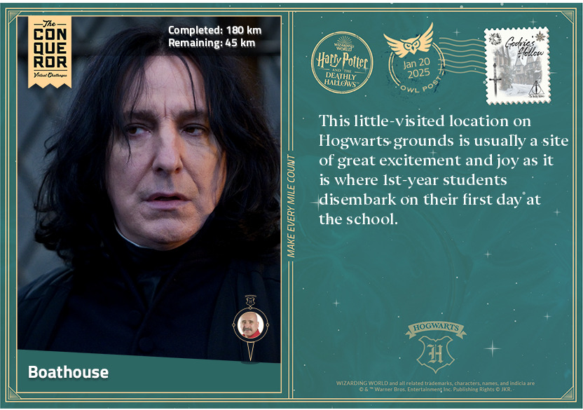
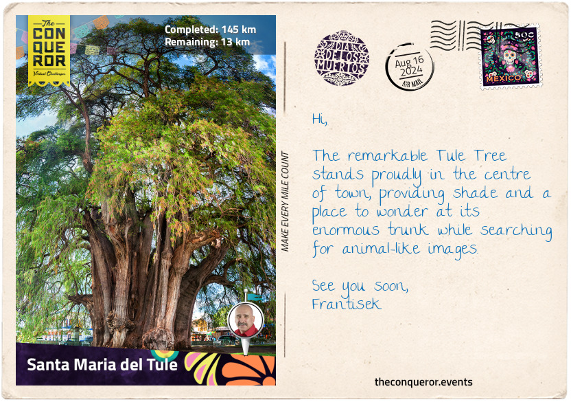
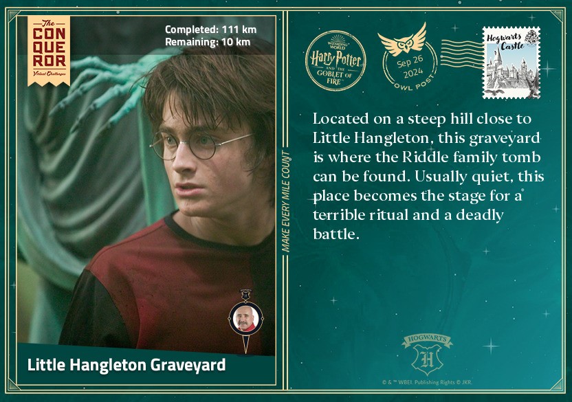
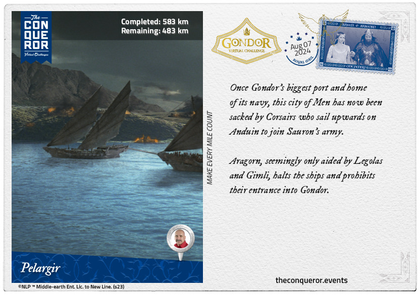
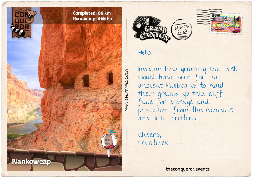
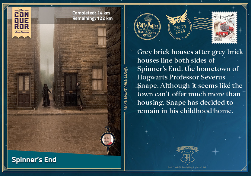
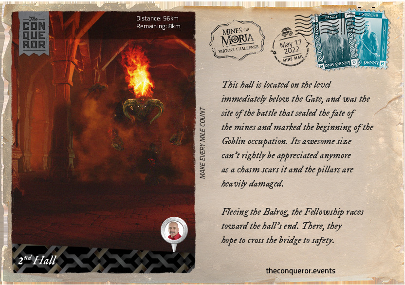
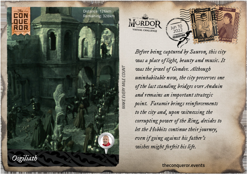
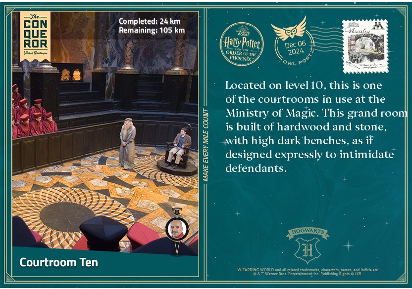
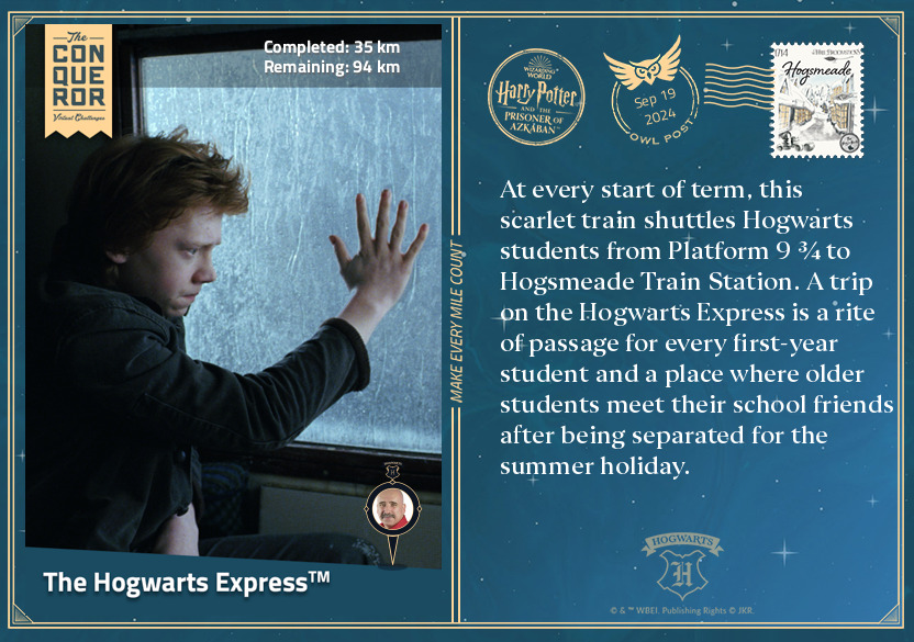
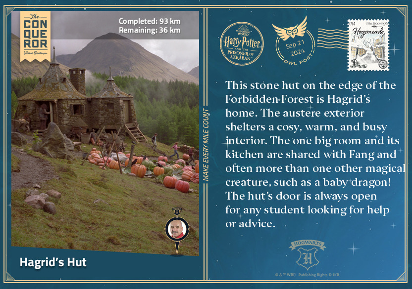
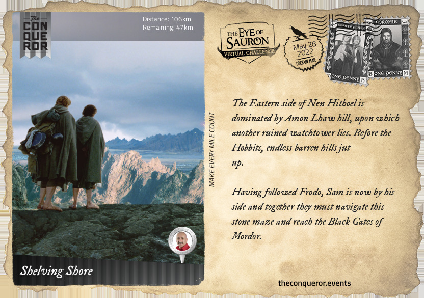
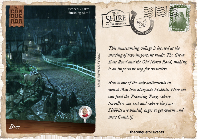
Osgiliath
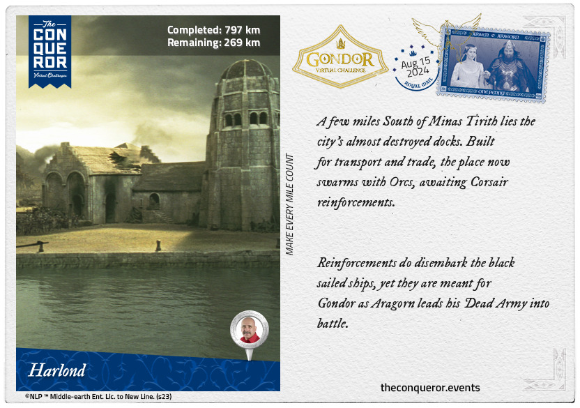
Before being captured by Sauron, this city was a place of light, beauty and music. It was the jewel of Gondor. Although uninhabitable now, the city preserves one of the last standing bridges over Anduin and remains an important strategic point.
Faramir brings reinforcements to the city and, upon witnessing the corrupting power of the Ring, decides to let the Hobbits continue their journey, even if going against his father’s wishes might forfeit his life.
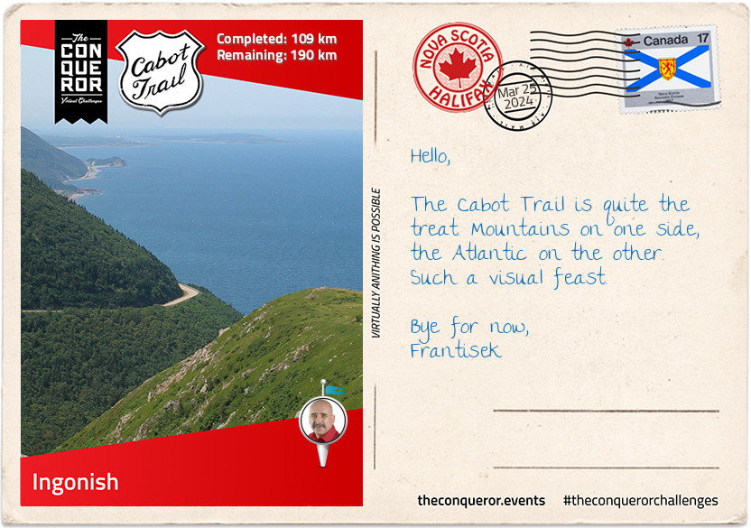
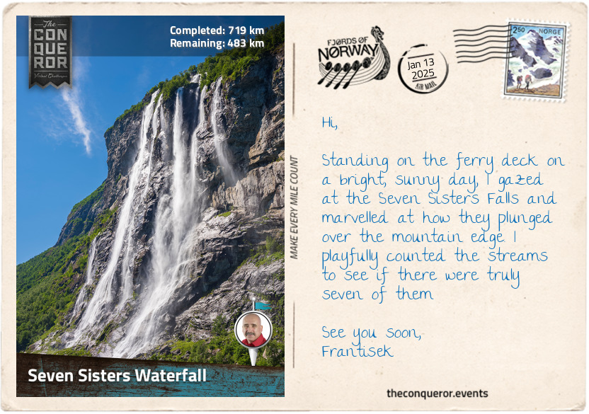
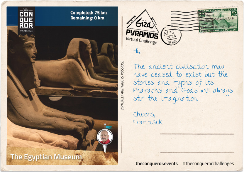
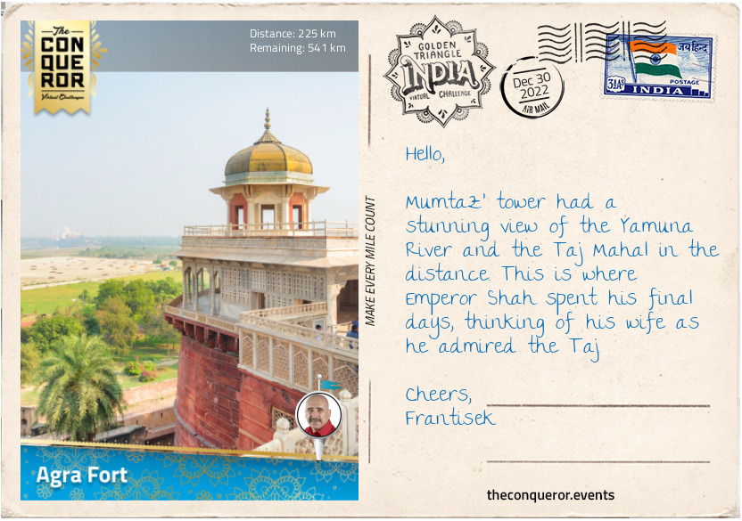
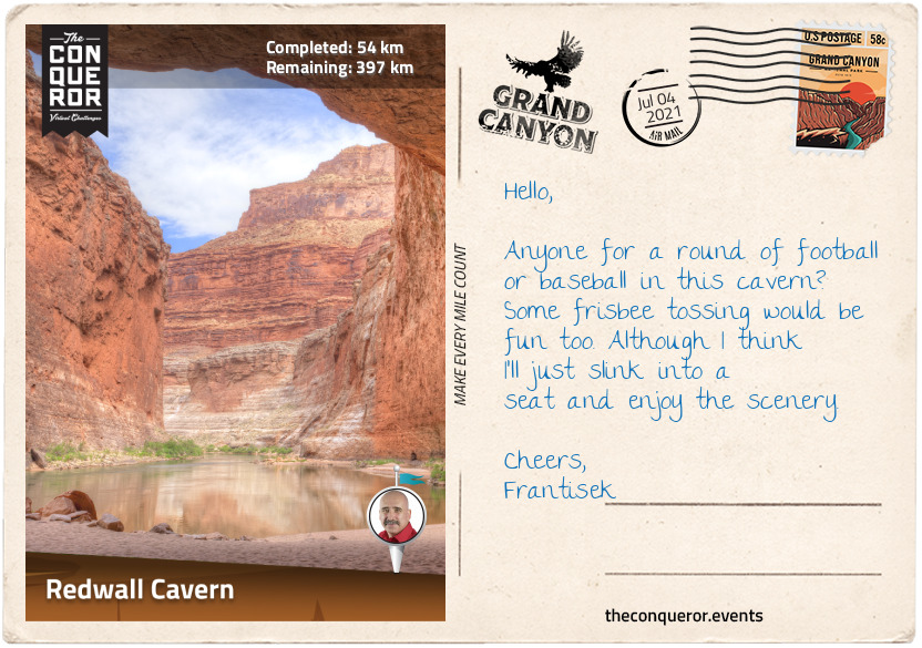
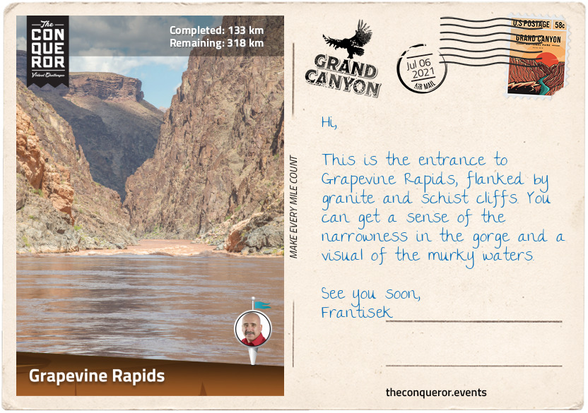
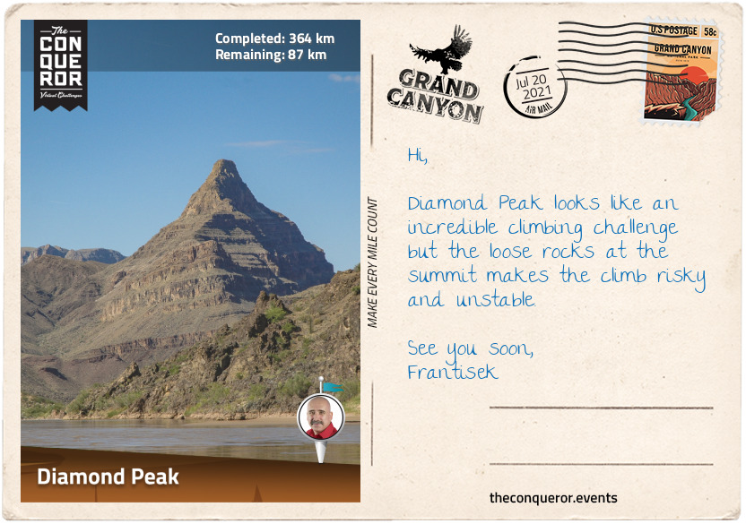
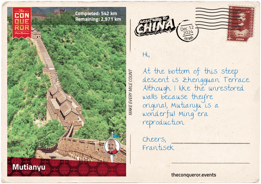
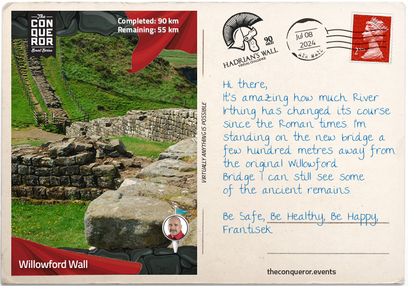
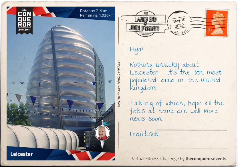
km od začátku : 0134
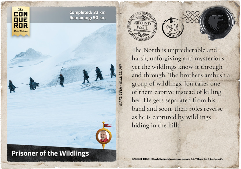
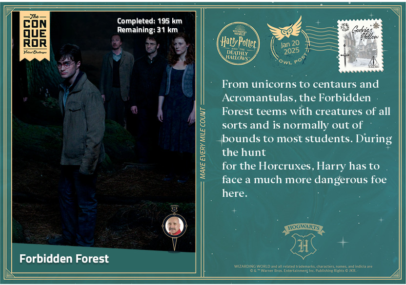
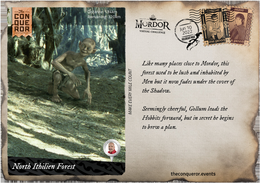
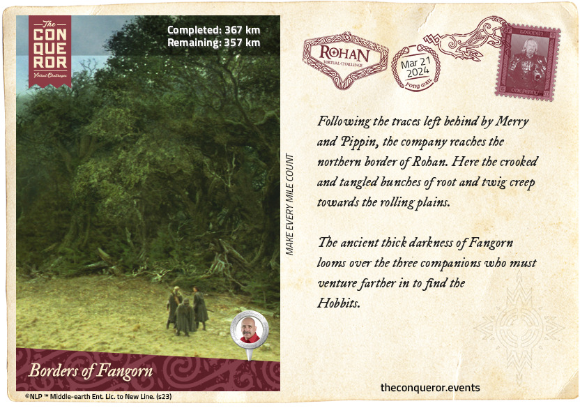
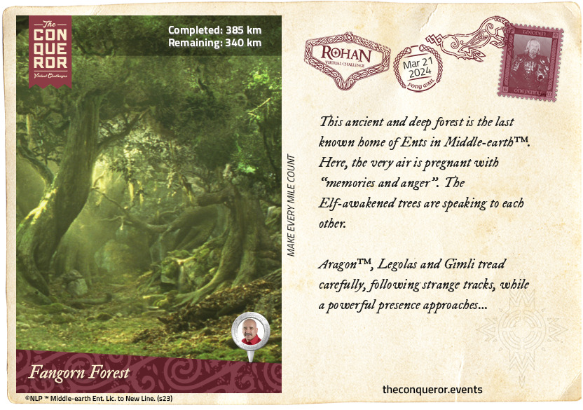
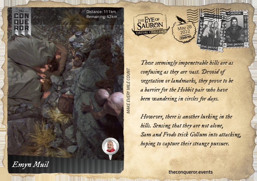
North Ithilien Forest
Like many places close to Mordor, this forest used to be lush and inhabited by Men but it now fades under the cover of the Shadow.
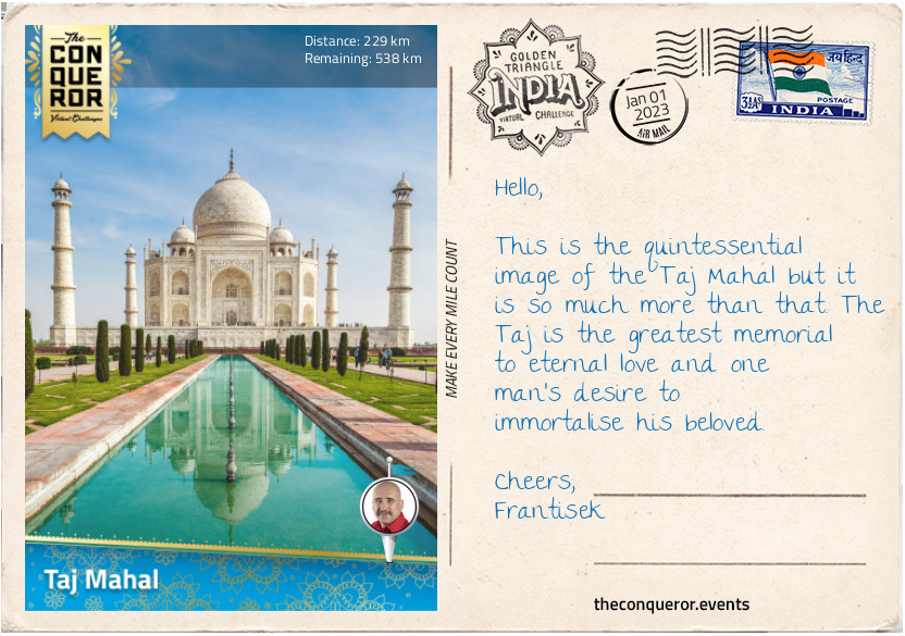
Seemingly cheerful, Gollum leads the Hobbits forward, but in secret he begins to brew a plan.
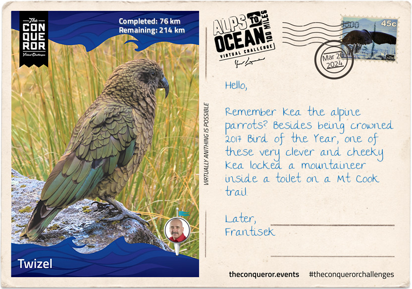
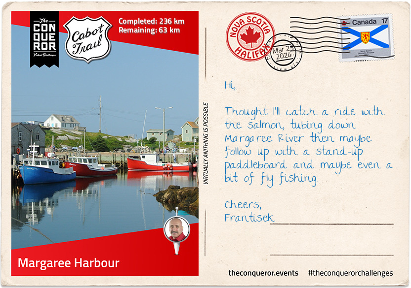
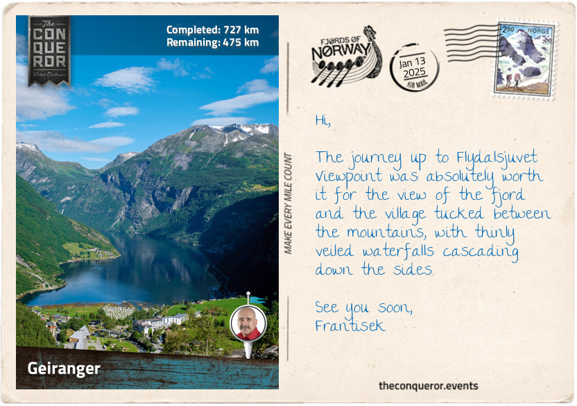
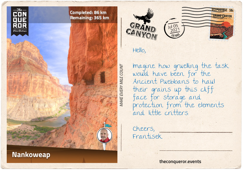
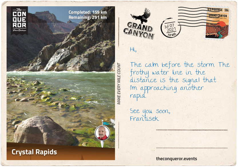
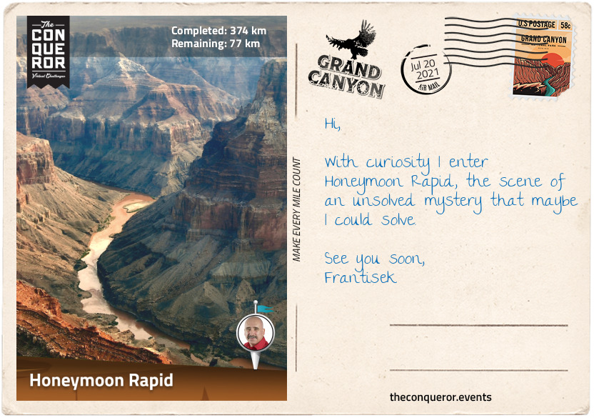
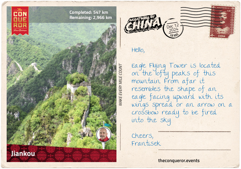
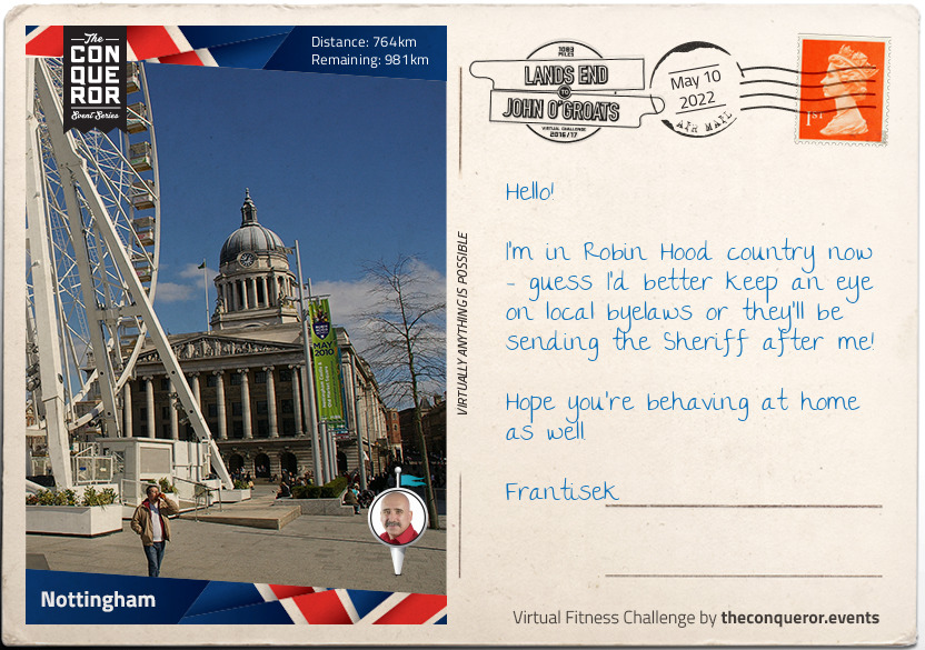
km od začátku : 0142
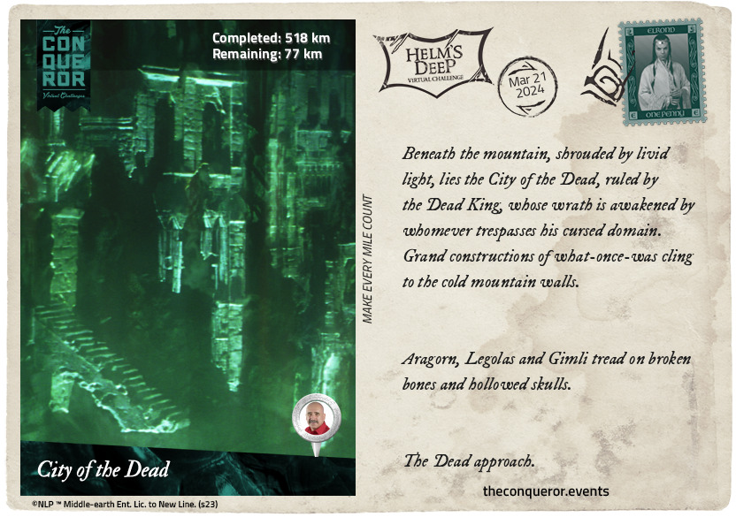
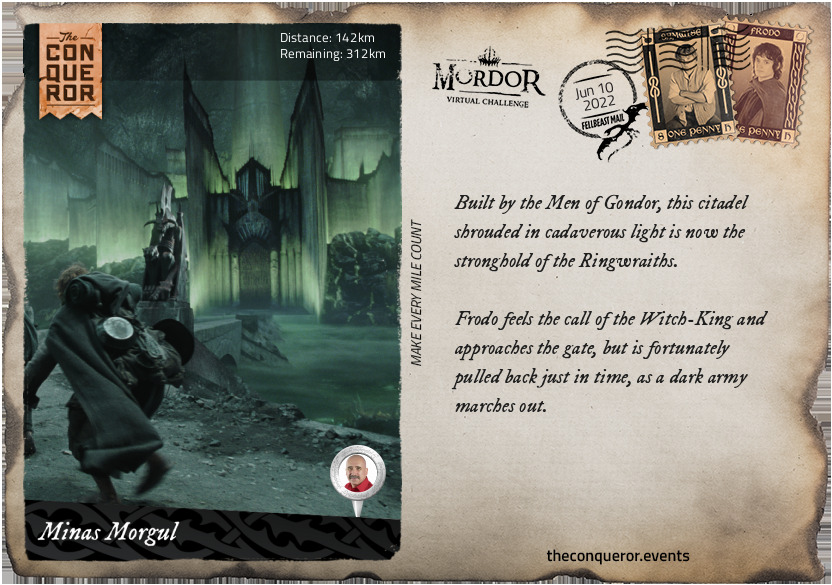
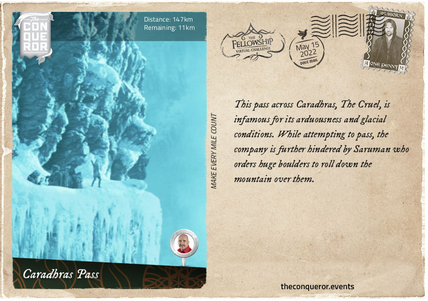
Minas Morgul
Built by the Men of Gondor, this citadel shrouded in cadaverous light is now the stronghold of the Ringwraiths.
Frodo feels the call of the Witch-King and approaches the gate, but is fortunately pulled back just in time, as a dark army marches out.
km od začátku : 0143
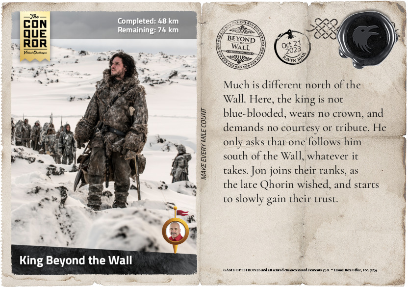
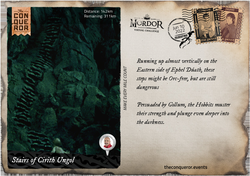
Stairs of Cirith Ungol
Running up almost vertically on the Eastern side of Ephel Dúath, these steps might be Orc-free, but are still dangerous.
Persuaded by Gollum, the Hobbits muster their strength and plunge even deeper into the darkness.
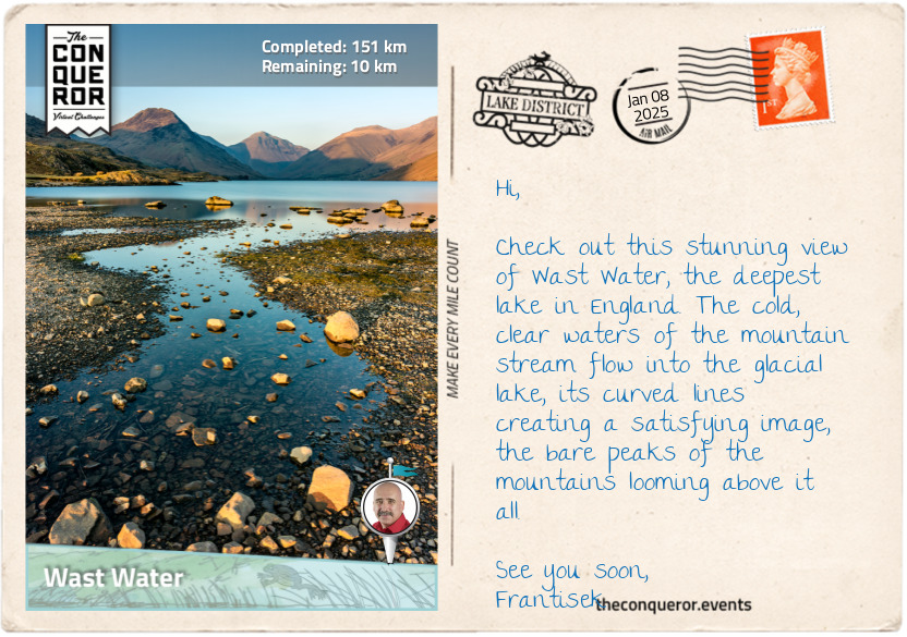
km od začátku : 0151
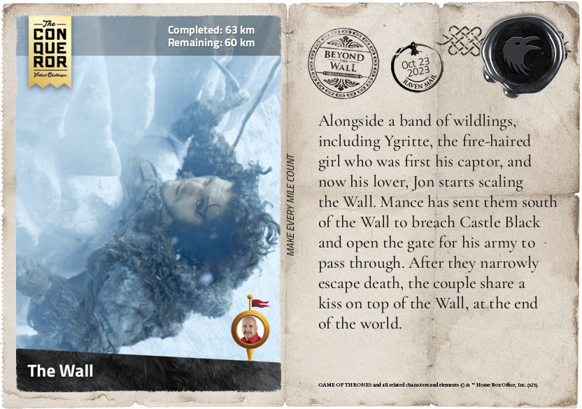
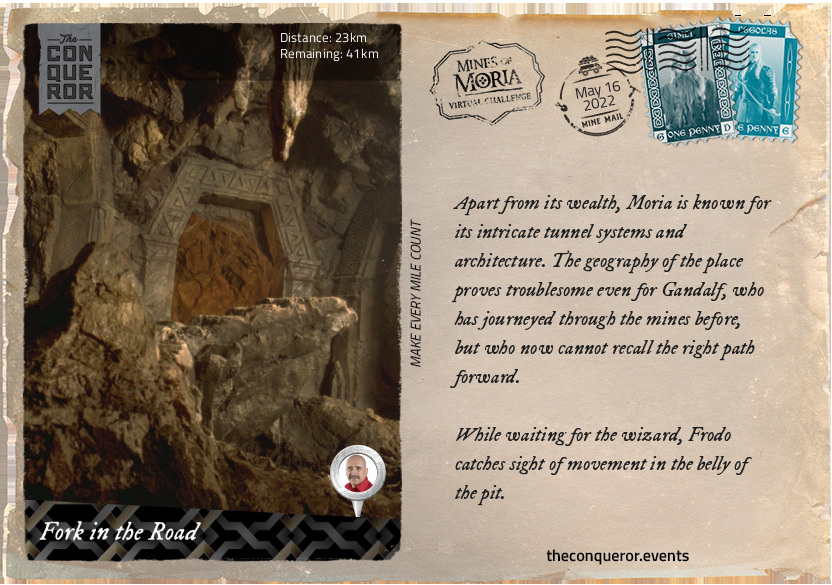
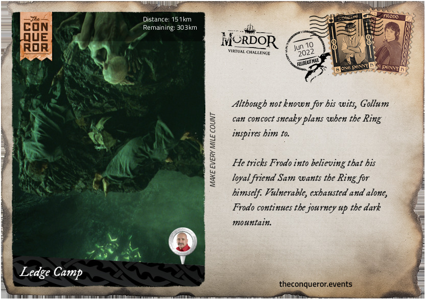
Ledge Camp
Although not known for his wits, Gollum can concoct sneaky plans when the Ring inspires him to.
He tricks Frodo into believing that his loyal friend Sam wants the Ring for himself. Vulnerable, exhausted and alone, Frodo continues the journey up the dark mountain.
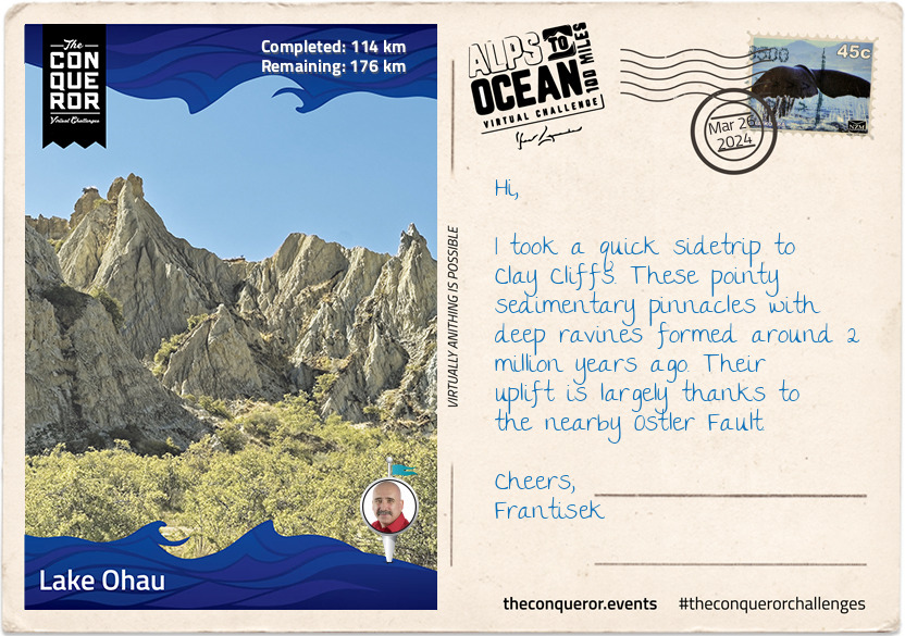
km od začátku : 0172
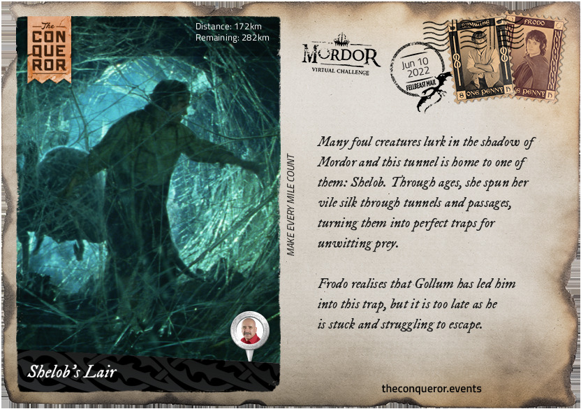
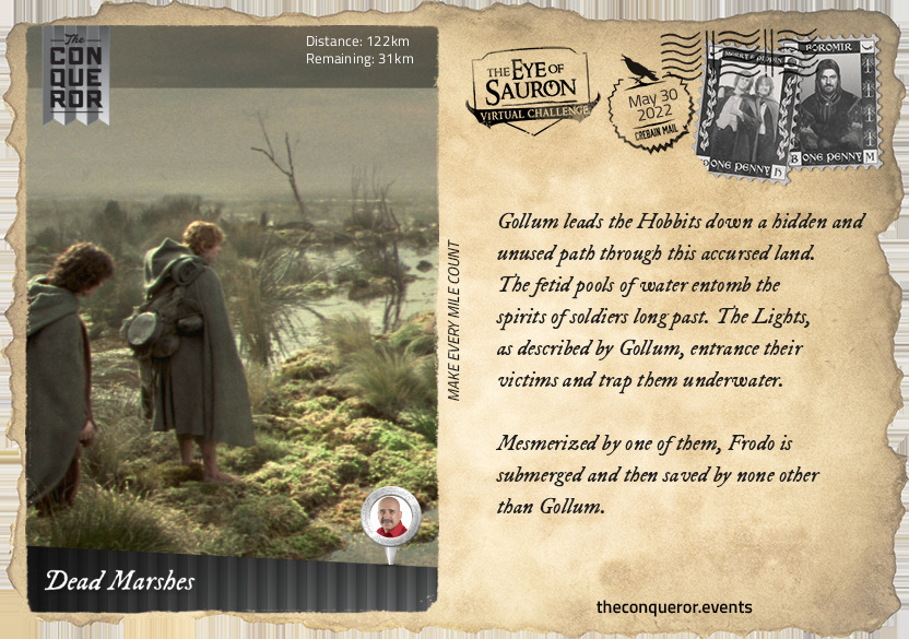
Shelob's Lair
Many foul creatures lurk in the shadow of Mordor and this tunnel is home to one of them: Shelob. Through ages, she spun her vile silk through tunnels and passages, turning them into perfect traps for unwitting prey.
Frodo realises that Gollum has led him into this trap, but it is too late as he is stuck and struggling to escape.
km od začátku : 0193
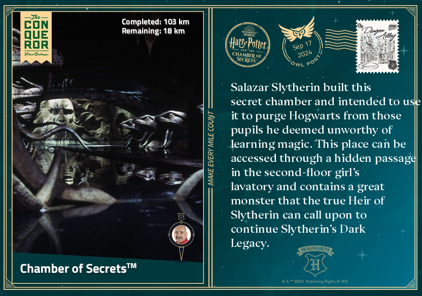
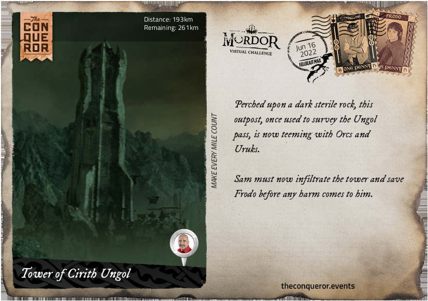
Tower of Cirith Ungol
Perched upon a dark sterile rock, this outpost, once used to survey the Ungol pass, is now teeming with Orcs and Uruks.
Sam must now infiltrate the tower and save Frodo before any harm comes to him.
km od začátku : 0195
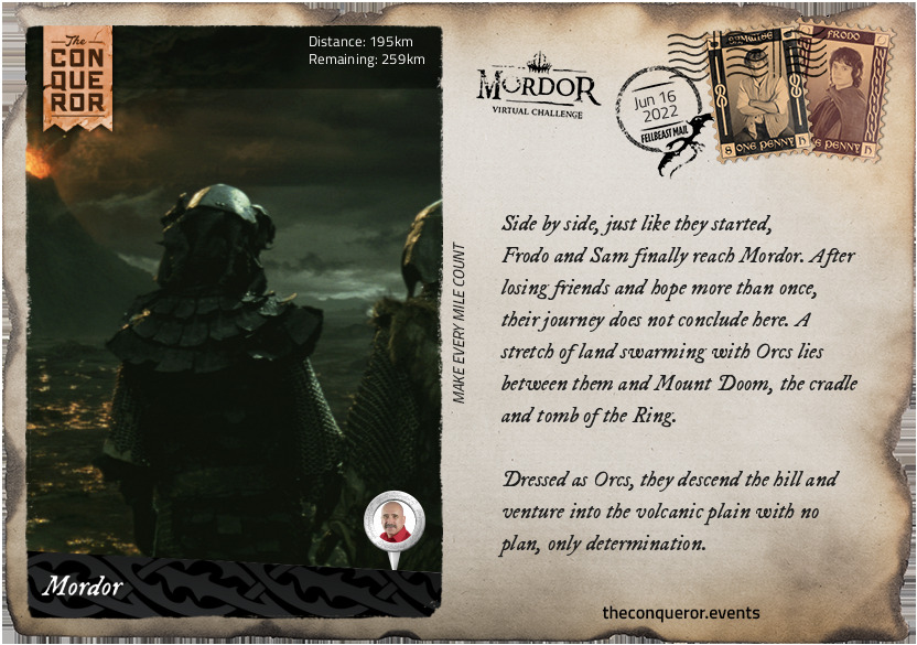
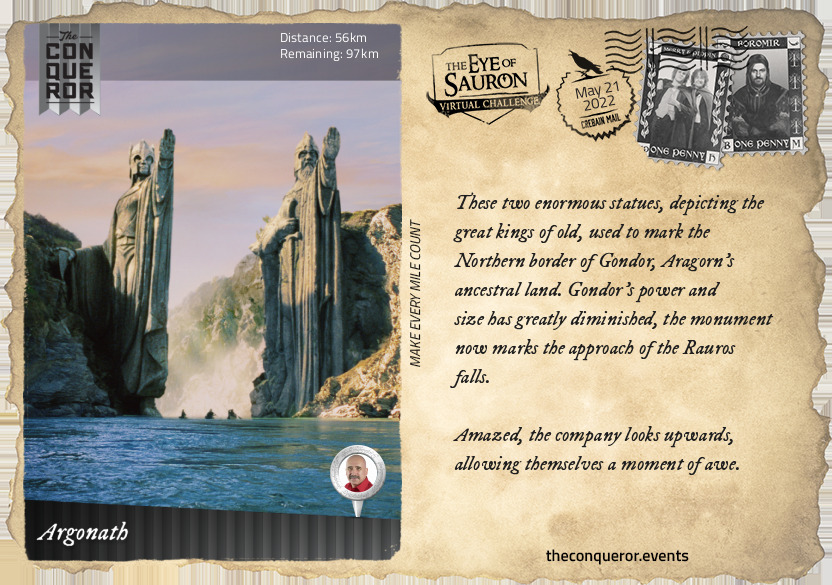
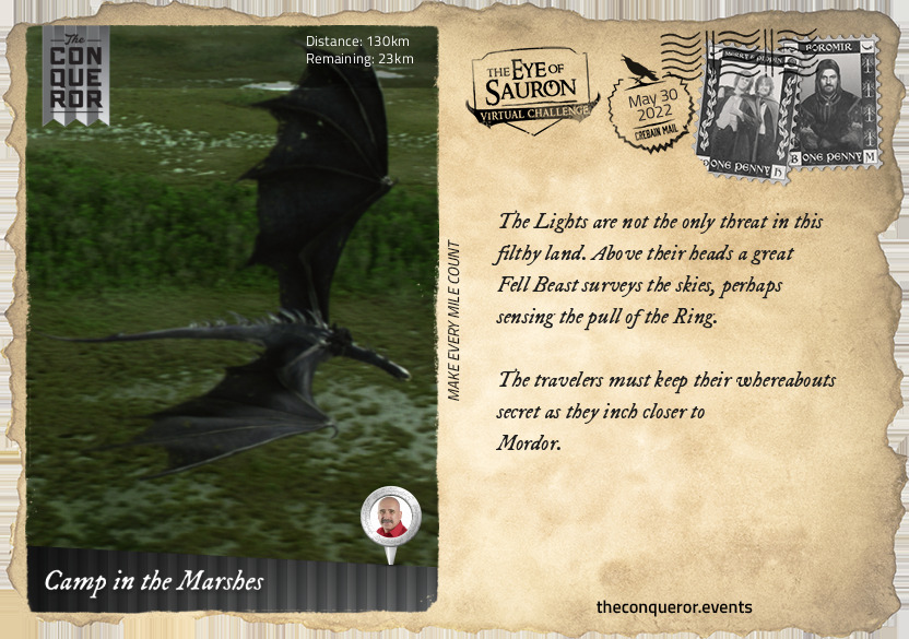
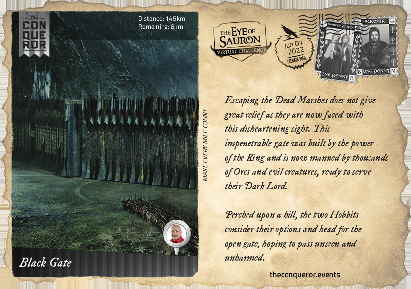
Mordor
Side by side, just like they started, Frodo and Sam finally reach Mordor. After losing friends and hope more than once, their journey does not conclude here. A stretch of land swarming with Orcs lies between them and Mount Doom, the cradle and tomb of the Ring.
Dressed as Orcs, they descend the hill and venture into the volcanic plain with no plan, only determination.
km od začátku : 0317
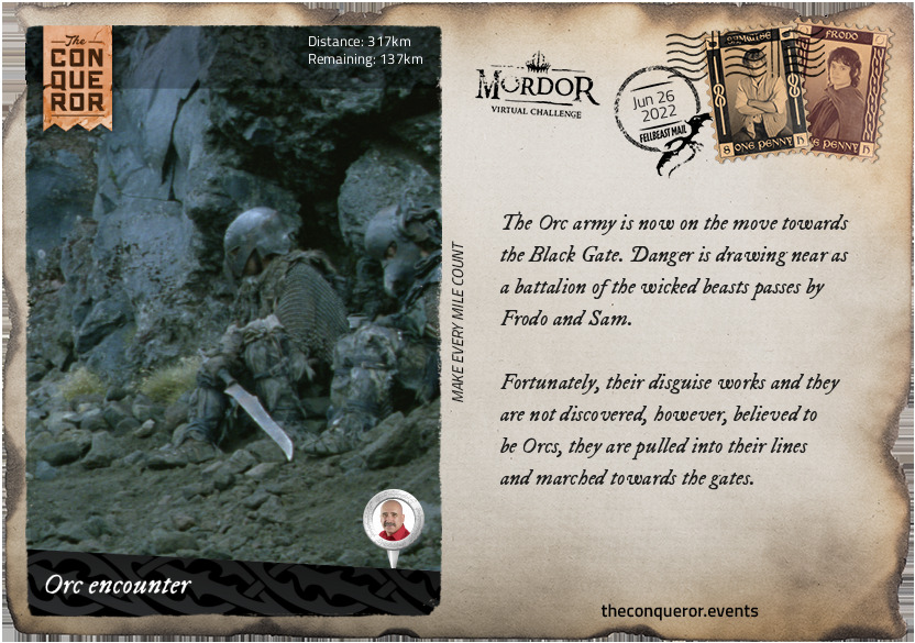
Orc Encounter
The Orc army is now on the move towards the Black Gate. Danger is drawing near as a battalion of the wicked beasts passes by Frodo and Sam.
Fortunately, their disguise works and they are not discovered, however, believed to be Orcs, they are pulled into their lines and marched towards the gates.
km od začátku : 0333
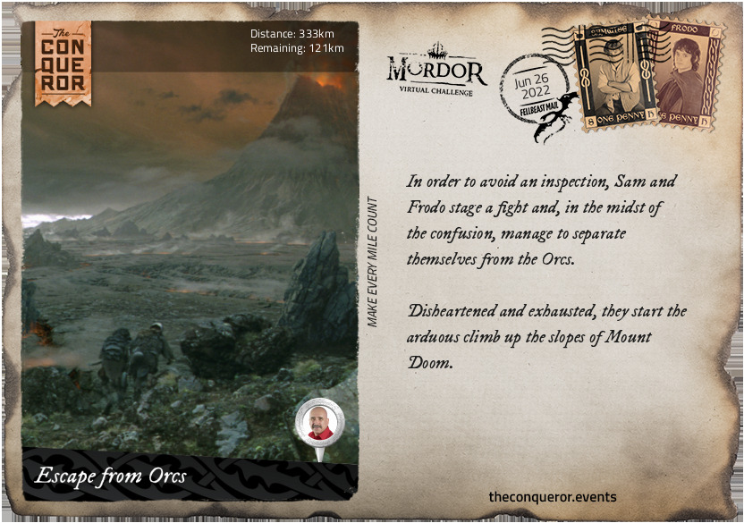
Escape from Orcs
In order to avoid an inspection, Sam and Frodo stage a fight and, in the midst of the confusion, manage to separate themselves from the Orcs
Disheartened and exhausted, they start the arduous climb up the slopes of Mount Doom.
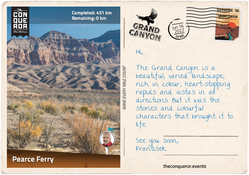
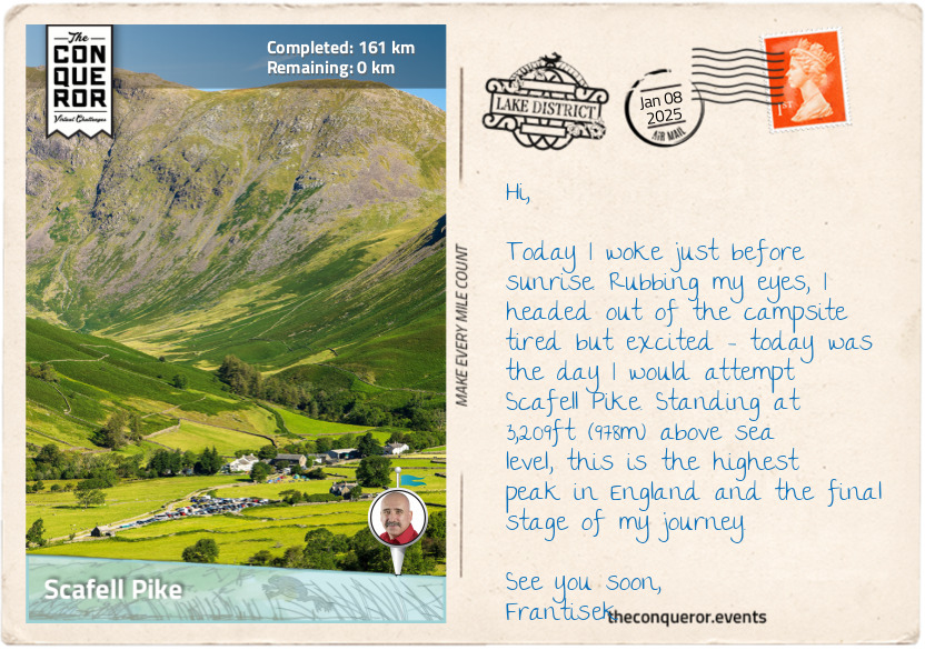
km od začátku : 0451
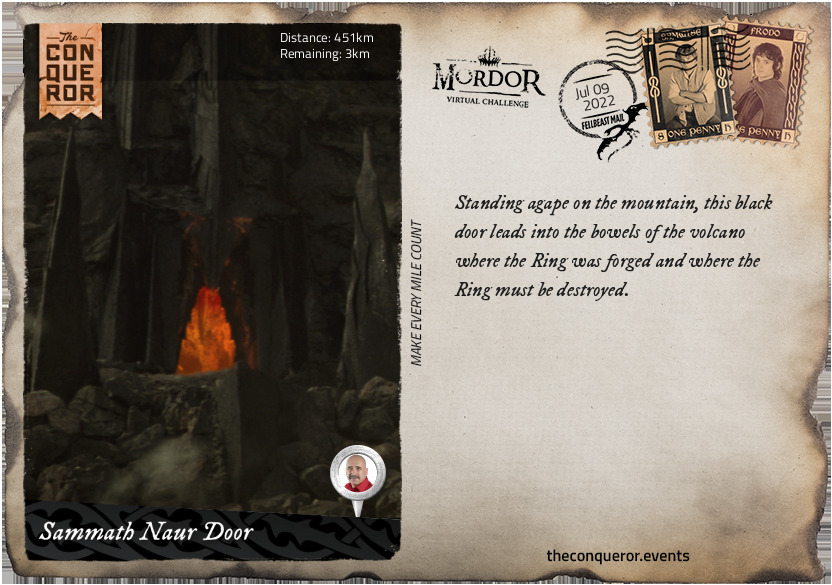
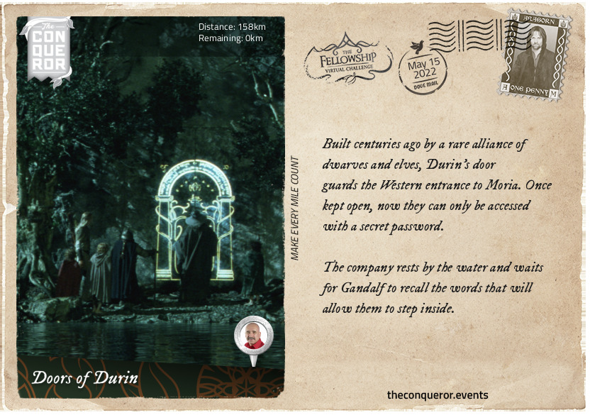
Sammath Naur Door
Standing agape on the mountain, this black door leads into the bowels of the volcano where the Ring was forged and where the Ring must be destroyed.
km od začátku : 0452
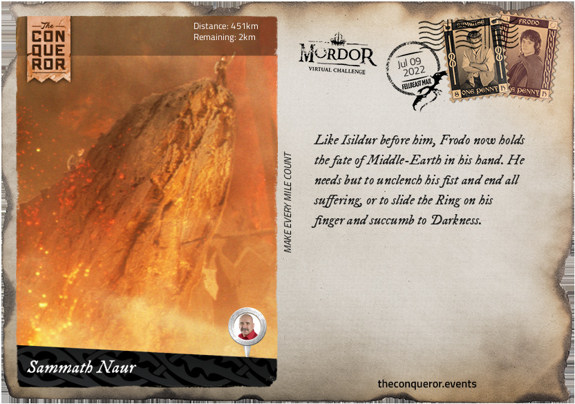
Sammath Naur
Like Isildur before him, Frodo now holds the fate of Middle-Earth in his hand. He needs but to unclench his fist and end all suffering, or to slide the Ring on his finger and succumb to Darkness.
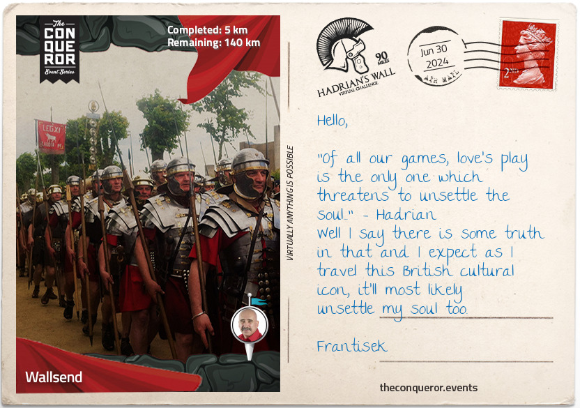
km od začátku : 0008
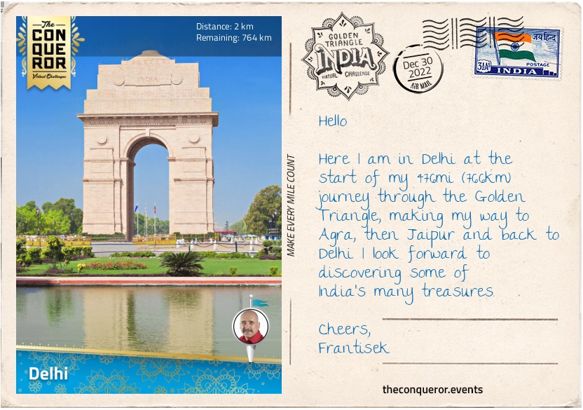
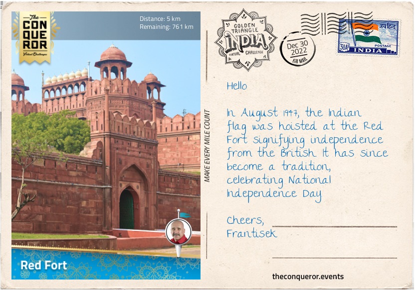
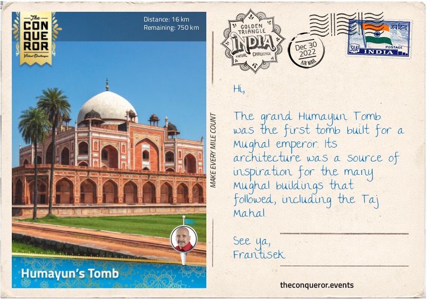
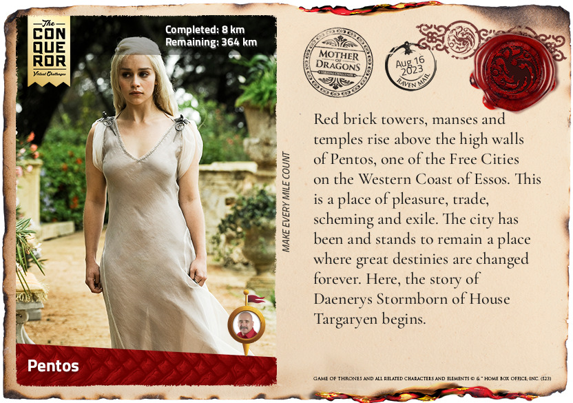
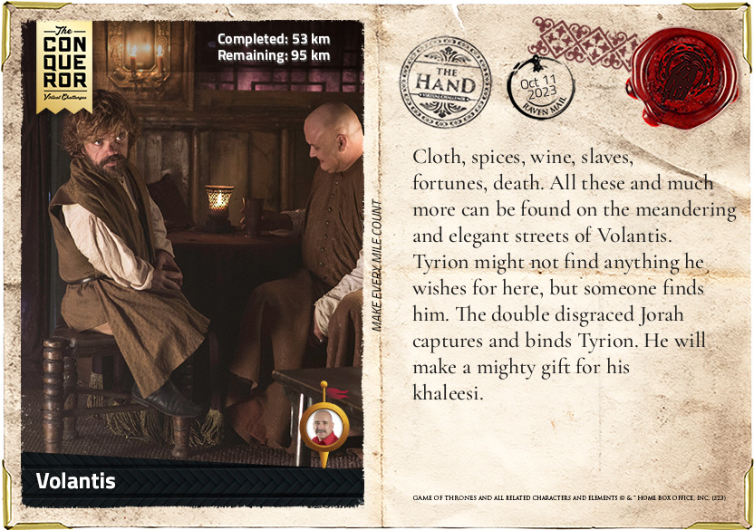
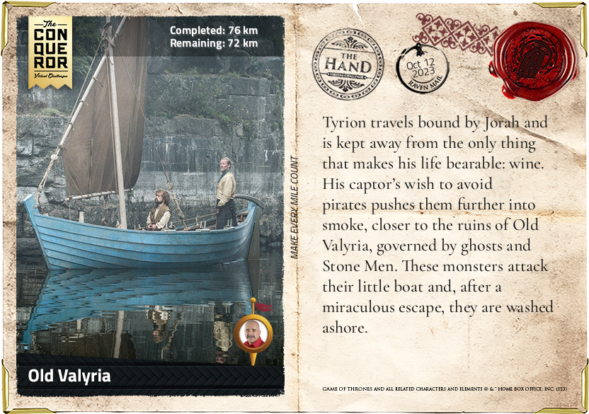
Pentos
Red brick towers, manses and temples rise above the high walls of Pentos, one of the Free Cities on the Western Coast of Essos. This is a place of pleasure, trade, scheming and exile. The city has been and stands to remain a place where great destinies are changed forever. Here, the story of Daenerys Stormborn of House Targaryen begins.
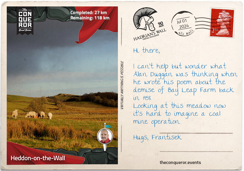
km od začátku : 0048
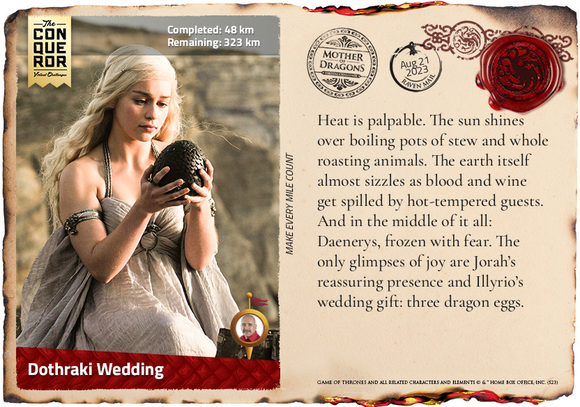
Dothraki Wedding
Heat is palpable. The sun shines over boiling pots of stew and whole roasting animals. The earth itself almost sizzles as blood and wine get spilled by hot-tempered guests. And in the middle of it all: Daenerys, frozen with fear. The only glimpses of joy are Jorah’s reassuring presence and Illyrio’s wedding gift: three dragon eggs.
km od začátku : 0175
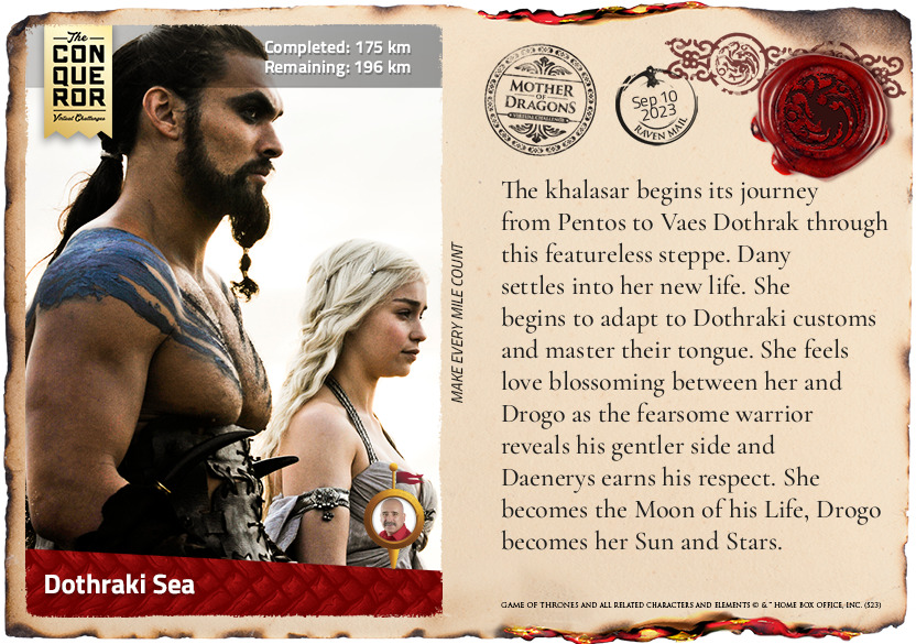
Dothraki Sea
The khalasar begins its journey from Pentos to Vaes Dothrak through this featureless steppe. Dany settles into her new life. She begins to adapt to Dothraki customs and master their tongue. She feels love blossoming between her and Drogo as the fearsome warrior reveals his gentler side and Daenerys earns his respect. She becomes the Moon of his Life, Drogo becomes her Sun and Stars.
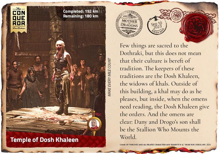
km od začátku : 0192
Temple of Dosh Khaleen
Few things are sacred to the Dothraki, but this does not mean that their culture is bereft of tradition. The keepers of these traditions are the Dosh Khaleen, the widows of khals. Outside of this building, a khal may do as he pleases, but inside, when the omens need reading, the Dosh Khaleen give the orders. And the omens are clear: Dany and Drogo’s son shall be the Stallion Who Mounts the World.
km od začátku : 0208
A Life for a Life
“Death is irreversible” is a dictum only for those who are not willing to wield magic and bend the laws of nature. For those versed in the dark matters, death can pay for life. Daenerys sacrifices the life of her unborn child for that of her husband. But not all lives are worth living. As she steps into Khal Drogo’s pyre, his burning flesh feeds new life.
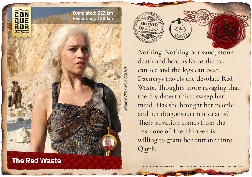
km od začátku : 0222
The Red Waste
Nothing. Nothing but sand, stone, death and heat as far as the eye can see and the legs can bear. Daenerys travels the desolate Red Waste. Thoughts more ravaging than the dry desert thirst sweep her mind. Has she brought her people and her dragons to their deaths? Their salvation comes from the East: one of The Thirteen is willing to grant her entrance into Qarth.
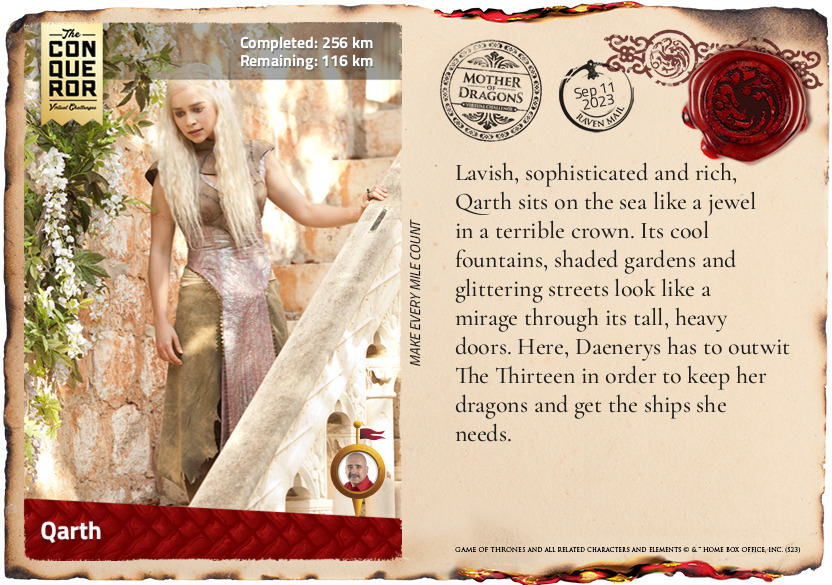
km od začátku : 0256
Qarth
Lavish, sophisticated and rich, Qarth sits on the sea like a jewel in a terrible crown. Its cool fountains, shaded gardens and glittering streets look like a mirage through its tall, heavy doors. Here, Daenerys has to outwit The Thirteen in order to keep her dragons and get the ships she needs.
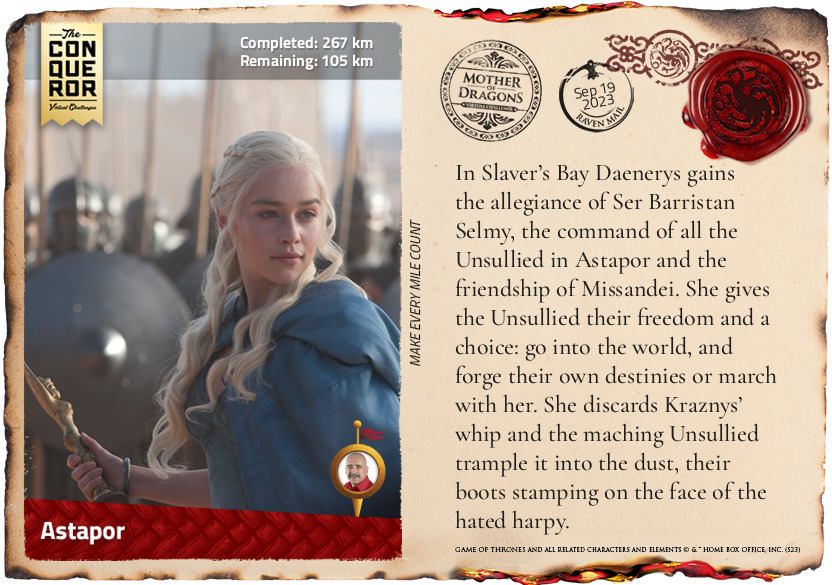
km od začátku : 0267
Astapor
In Slaver’s Bay Daenerys gains the allegiance of Ser Barristan Selmy, the command of all the Unsullied in Astapor and the friendship of Missandei. She gives the Unsullied their freedom and a choice: go into the world, and forge their own destinies or march with her. She discards Kraznys’ whip and as they march, the Unsullied trample it into the dust, their boots stamping on the face of the hated harpy.
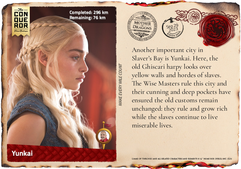
km od začátku : 0296
Yunkai
Another important city in Slaver’s Bay is Yunkai. Here, the old Ghiscari harpy looks over yellow walls and hordes of slaves. The Wise Masters rule this city and their cunning and deep pockets have ensured the old customs remain unchanged: they rule and grow rich while the slaves continue to live miserable lives.
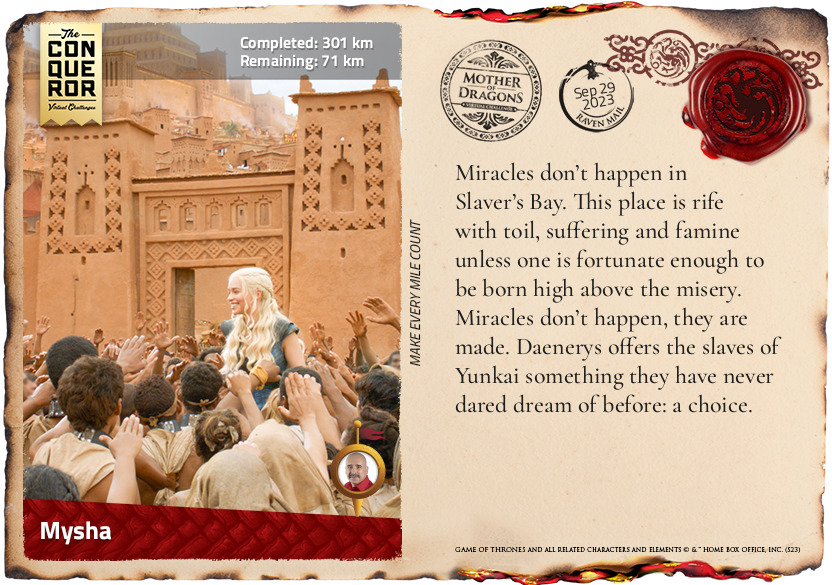
km od začátku : 0301
Mysha
Miracles don’t happen in Slaver’s Bay. This place is rife with toil, suffering and famine unless one is fortunate enough to be born high above the misery. Miracles don’t happen, they are made. Daenerys offers the slaves of Yunkai something they have never dared dream of before: a choice.
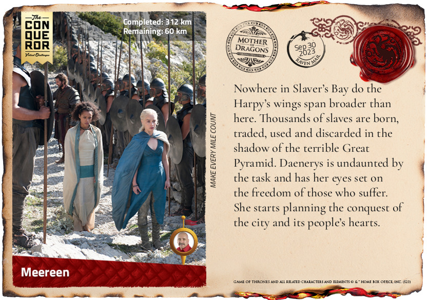
km od začátku : 0312
Meereen
Nowhere in Slaver’s Bay do the Harpy’s wings span broader than here. Thousands of slaves are born, traded, used and discarded in the shadow of the terrible Great Pyramid. Daenerys is undaunted by the task and has her eyes set on the freedom of those who suffer. She starts planning the conquest of the city and its people’s hearts.
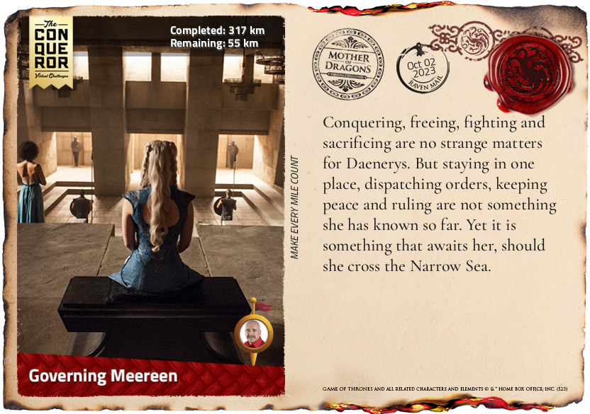
km od začátku : 0317
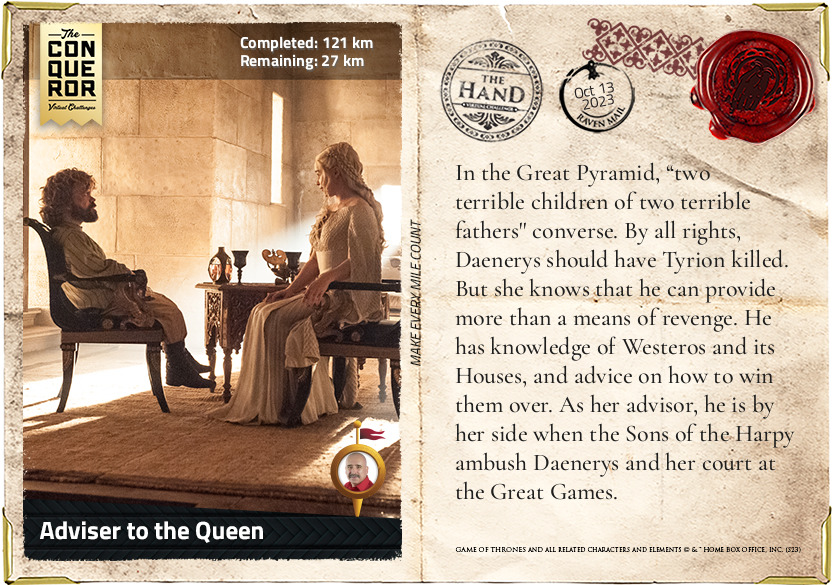
Governing Meereen
Conquering, freeing, fighting and sacrificing are no strange matters for Daenerys. But staying in one place, dispatching orders, keeping peace and ruling are not something she has known so far. Yet it is something that awaits her, should she cross the Narrow Sea.
km od začátku : 0322
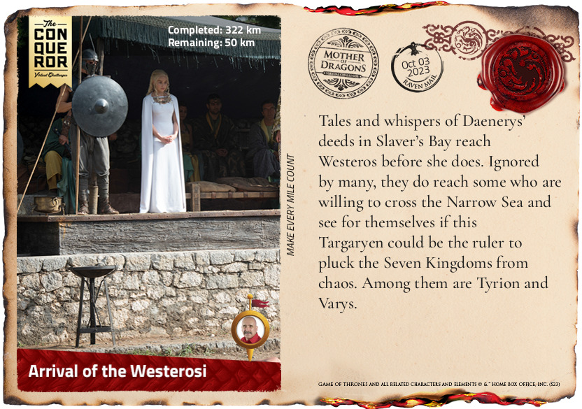
Arrival of the Westerosi
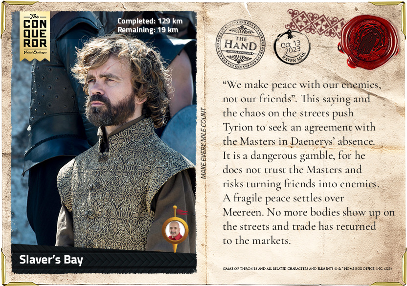
Tales and whispers of Daenerys' deeds in Slaver's Bay reach Westeros before she does. Ignored by many, they do reach some who are willing to cross the Narrow Sea and see for themselves if this Targaryen could be the ruler to pluck the Seven Kingdoms from chaos. Among them are Tyrion and Varys.
km od začátku : 0332
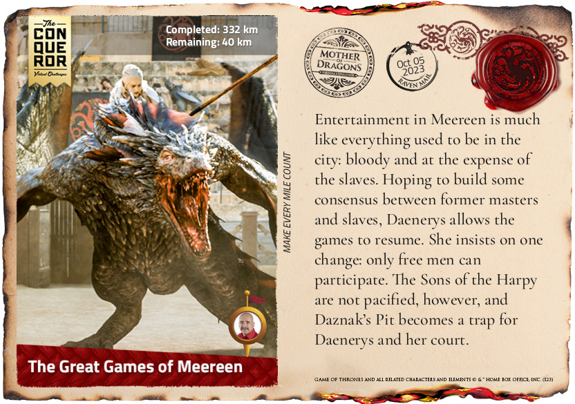
The Great Games of Meereen
Entertainment in Meereen is much like everything used to be in the city: bloody and at the expense of the slaves. Hoping to build some consensus between former masters and slaves, Daenerys allows the games to resume. She insists on one change: only free men can participate. The Sons of the Harpy are not pacified, however, and Daznak’s Pit becomes a trap for Daenerys and her court.
km od začátku : 0336
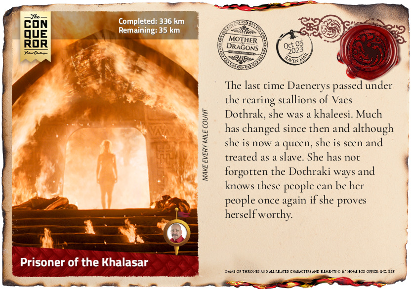
Prisoner of the Khalasar
The last time Daenerys passed under the rearing stallions of Vaes Dothrak, she was a khaleesi. Much has changed since then and although she is now a queen, she is seen and treated as a slave. She has not forgotten the Dothraki ways and knows these people can be her people once again if she proves herself worthy.
km od začátku : 0346
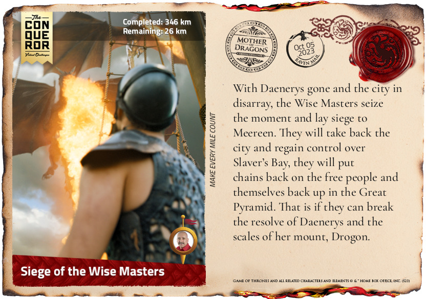
Siege of the Wise Masters
With Daenerys gone and the city in disarray, the Wise Masters seize the moment and lay siege to Meereen. They will take back the city and regain control over Slaver’s Bay, they will put chains back on the free people and themselves back up in the Great Pyramid. That is if they can break the resolve of Daenerys and the scales of her mount, Drogon.
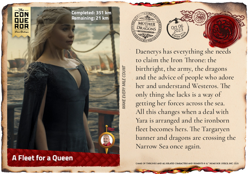
km od začátku : 0351
A Fleet for a Queen
Daenerys has everything she needs to claim the Iron Throne: the birthright, the army, the dragons and the advice of people who adore her and understand Westeros. The only thing she lacks is a way of getting her forces across the sea. All this changes when a deal with Yara is arranged and the ironborn fleet becomes hers. The Targaryen banner and dragons are crossing the Narrow Sea once again.
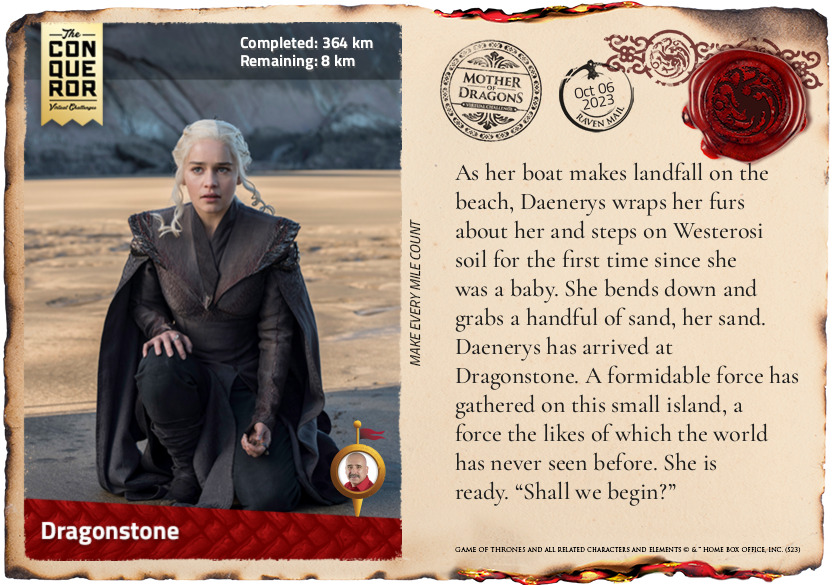
km od začátku : 0364
Dragonstone
As her boat makes landfall on the beach, Daenerys wraps her furs about her and steps on Westerosi soil for the first time since she was a baby. She bends down and grabs a handful of sand, her sand. Daenerys has arrived at Dragonstone. A formidable force has gathered on this small island, a force the likes of which the world has never seen before. She is ready. “Shall we begin?”
km od začátku : 0005
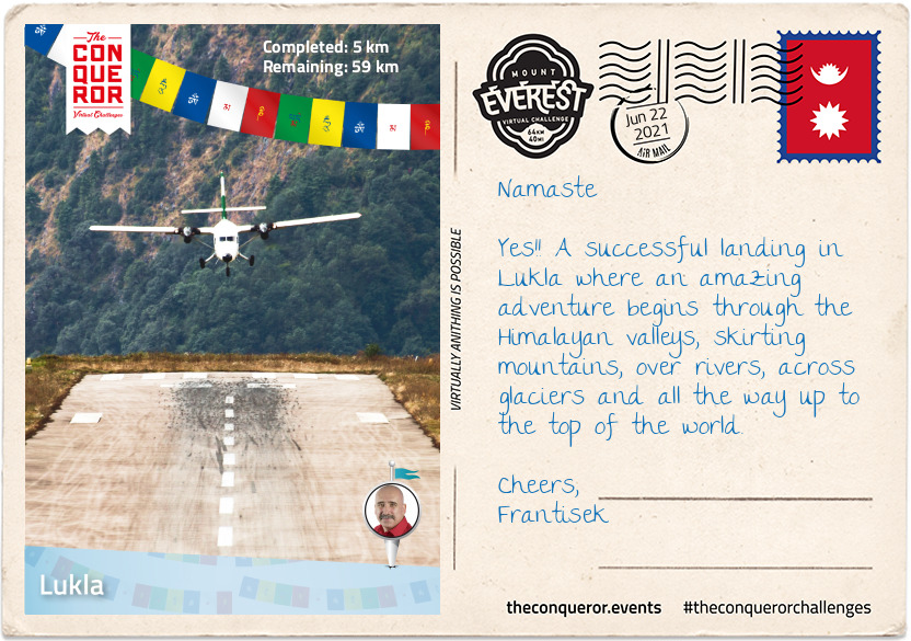
Lukla
Flying into Kathmandu is a walk in the park when compared to Lukla. Dubbed as the most dangerous airport in the world, Lukla's runway is a mere 1,729ft (527m) long, with mountainous terrain to the north and a steeply angled drop to the south. It is built on a 12% uphill gradient to help planes slow down. There are no go-around procedures if the planes miss their approach, as such only highly experienced pilots with short-takeoff-and-landing missions under their belt, experience in Nepal and ten flights in Lukla with a certified instructor, are permitted to land at the airport. In a nutshell if climbing Everest doesn't cause prickles on the back of your neck, then a high intensity landing in Lukla certainly should.
In 2008, Lukla airport was renamed Tenzing-Hillary Airport in honour of Sir Edmund Hillary and Sherpa Tenzing Norgay, the first climbers to reach the summit of Everest. Hillary was instrumental in the construction of the airfield in Lukla, building an unsurfaced airstrip on a mountain shelf in 1964. It took 37 years to finally asphalt the runway.
Home to 1200 people, the village sits at 9,383ft (2,860m) above sea level, nestled on a small plateau amongst the awe inspiring mountain peaks of the Himalayan Ranges. The nearly 40mi (64km) trek to Mount Everest, skirts steep mountainsides, through deep valleys and over alpine glaciers. The hike travels through small villages and teahouses, past prayer wheels and fluttering prayer flags to the memorial site honouring mountaineers and Sherpas who lost their lives climbing the mountain, continuing to Base Camp and then the final summit climb.
Leaving the viewing platform of the Lukla airport, I made my way through the centre of town on a narrow street that was sometimes cobbled and sometimes just compacted soil. Double-storey buildings lined the street filled with shops, teahouses and lodging services.
Shortly after leaving the village I passed through the National Luminary Pasan Lhamu Memorial Gate which was built to honour Pasan Lhamu, the first Sherpa woman to summit Everest in 1993. It is the gateway to the Khumbu Region that encompasses the Sagarmatha National Park and the Nepalese side of Mount Everest.
It was a gradual downhill hike, passing through a forest on narrow paths with the colossal mountainside ever present to my right. I continued on this downward hike, on a trail that wound itself up and down, passing through villages with teahouses until I reached Phakding, a small village that lies in the Dudh Kosi river valley. Here was the first of many suspension bridge crossings. The bridge, about 100ft (30m) above the river, stretched across what seemed to be an old landslide with large boulders and debris settling beside the river. As the bridge swayed and moved beneath my feet, I pondered about those whose fear of heights may find the crossing challenging. This isn't the tallest suspension bridge on this trek, that is yet to come.
Finally reaching the small village of Benkar with its tin-roofed, brightly painted window frames, four-storey residences/storefronts, I settled into one of the teahouses for a meal. Known to aid with altitude adaptation I had garlic soup with Tibetan flat bread. Between the warmth of the soup and the crusty on the outside, fluffy on the inside bread, I filled my belly and finished with a Tibetan tea.
Rested and fed, I resumed my hike crossing another suspension bridge. Soon I reached the entrance to Sagarmatha National Park. A UNESCO listed site since 1976, the 1,148km² park is home to the Sherpa people, rare species like the snow leopard and several mountains including Mount Everest.
After obtaining the necessary permits to enter the park, I walked through the Jorsalle Entrance Gate, a concrete structure with Buddhist artwork on its interior walls to a set of steps that began a steep descent into a gorge, onto Jorsalle village, alongside the thundering Dhudh Kosi river and over two more suspension bridges.
However, what goes down, must come up and it wasn't long before I engaged my hiking poles to start the steep ascent onto a woodland path until I reached a wide open low lying land beside the river filled with stones and boulders making trekking through it unstable and difficult.
But nothing prepared me for the next suspension bridge. Like all the others, Hillary Bridge was made of galvanized steel cables that's connected to the grated deck by interlinked wire fence. An old version of the bridge was right beneath this one just hanging, blowing in the wind, no longer in use. At 410ft (125m) above the Dhudh Kosi river, this 459ft (140m) long bridge was exposed to the elements swaying laterally and vertically as the strong wind blew through the valley. It was a heart thumping, adrenaline spiking exercise that on this trek one could do without. I was grateful to reach solid ground.
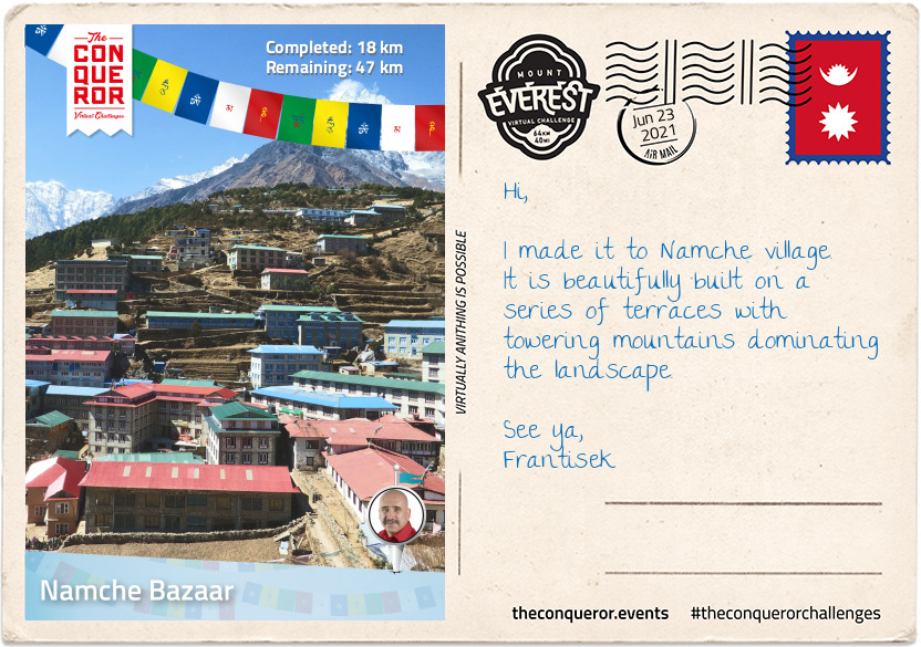
km od začátku : 0018
Namche Bazaar
Leaving Hillary Bridge behind at 9,514ft (2,900m) it was time for the next gripping ascent. Travelling uphill on single-lane switchbacks demanded patience, slowly shuffling along putting one step in front of the other, often needing to pull aside to let the steady stream of traffic pass me by. Mules, trekkers, porters and yaks were a common sight, breaking my already slow momentum. As I was gaining elevation, I could feel the change in the air, a shortness of breath, clearly indicating the change in altitude. I'd say more garlic soup was on the horizon.
Two hours later I arrived in Namche Bazaar, the largest village in the region. Namche was located on a plateau, rising up the hillside at 11,285ft (3,440m). On either side of the village were the 19,800ft+ (6,000m+) peaks of Kongde Ri to the west and Thamserku to the east.
From single-storey to triple-storey buildings, a plethora of teahouses and lodges are readily available to service visitors and trekkers. Anyone who was up for a pint of Guinness or a shot of Jameson or Teeling Irish whiskey would find it in the centre of town at the remotest Irish Pub in the world.
Namche is a trading centre, altitude acclimatization stop, gateway to the upper Himalayan region and the final stop to purchase any gear needed for the upcoming trek to Everest.
Resting here overnight and taking the time to acclimatize, I stopped at a teahouse to enjoy the national dish of Dal Bhat Tarkari, a lentil soup with steamed rice, accompanied by seasonal vegetables and curried meat. It is a staple meal of the Sherpa people eaten once or twice a day as a perfect combination of protein and carbs for their physical workouts at high altitude.
Just slightly out of town up a hill is the Sagarmatha National Park Museum with a statue of Tenzing Norgay on the grounds. A worthy visit not just for the museum but also the amazing views of the surrounding peaks.
I spent a full day acclimatising with a nearby hike to Khumjung at an ascent of about 2,000ft (600m). Khumjung is a village known for the Edmund Hillary School which when built in 1961 only had one classroom but today teaches children up to grade 10. Then onto Khumjung Monastery to check-out the mysterious yeti scalp. The yeti is steeped in Himalayan folklore as a large monster which in western culture is known as the Abominable Snowman.
Before descending back to Namche, I grabbed a pastry and hot drink from the closest bakery and whilst standing outside absorbing the mountainous vista I watched the Sherpa women harvest the potato fields, a staple crop and one of the few that can be grown at such high altitude.
One more night of rest in Namche. The long, slow, steady climb awaits.
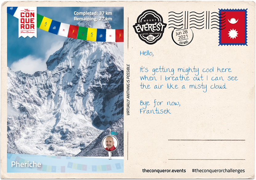
km od začátku : 0037
Pheriche
Leaving Namche Bazaar, the trail was wide and level following the curves of the Khumbu Yui Lha mountain. The mountain is 18,900ft (5,761m) above sea level and considered sacred by the Sherpa people. With the exception of one unsuccessful attempt in the 1980s, the mountain has never been climbed.
Winding my way up the trail, I could feel the climb in my legs as my muscles strained on sections of steep, stone steps then levelling out and just around the next bend it'd be another round of steep steps and on and on it went. Occasionally, I'd be rewarded with tiny peeks of Everest in the distance.
Suddenly, my trail began its descent to the valley floor and if I thought my muscles strained on the ascent, I now felt the strain on my knees during the descent. Reaching the village of Phungi Thenga, I traversed Dhudh Kosi river again and just as I made it into a gorge the trail took on another brutal ascent all the way to Tengboche. The highlight in the village is the Tengboche Monastery, a Tibetan Buddhist monastery for the Sherpa community. First built in 1916, the monastery has been destroyed and rebuilt a few times. Home to 60 monks, the prayer room is a kaleidoscope of colour with murals and paintings adorning the walls. A nunnery is a short trek away in Deboche.
Tengboche is beautifully located with its panoramic views of several peaks but the most outstanding was Ama Dablam and its imposing 22,349ft (6,812m) peak. Flanked by long ridges and a hanging glacier, it was first climbed in 1961 and it is the third most popular Himalayan peak for climbing.
The constant up and down trekking seemed a little self-defeating until I realised that since Lukla, I was an extra 3,280ft (1,000m) above sea level. I couldn't ponder that for long as down into the valley I went again to cross Imja Khola river, a tributary of Dhudh Kosi.
Once I crossed the river, I left the woodland behind. The trail from here was in the open, no more trees in the way of my view presenting me with the enormity of this place. Up and down went the trail, yet progressively gaining elevation. The air had changed. A little thinner, a little colder, no trees to provide shelter from the wind.
Eventually I reached the tiny village of Phiroche. It is located above the Tsola River at an altitude of 14,340ft (4,371m). It is a major stopping point for acclimatisation and also an evacuation point. The village has a hospital that runs during the climbing seasons and is operated by the Himalayan Rescue Association with Nepalis staff and volunteer doctors from the US, Europe, Canada and Australia.
Rather than sitting in a lodge, I dug out my gloves and beanie and very slowly over a period of about two hours, I hiked up to Nangkartshang peak (also referred to as the Dingboche Viewpoint) with an altitude of 16,676ft (5,083m). I was wonderfully rewarded at the top with a glorious view of several peaks such as Ama Dablam, Imja Tse, Tobuche and Lobuche and further afield even higher peaks Cho Oyu, Makalu, Lhotse and of course Everest.
As dusk was closing in I retired to my lodge for dinner. Looking for a warm and comforting dish, I settled on a hot noodle soup with pieces of meat and vegetables called Thukpa, accompanied by hot momos, steam filled dumplings.
km od začátku : 0048
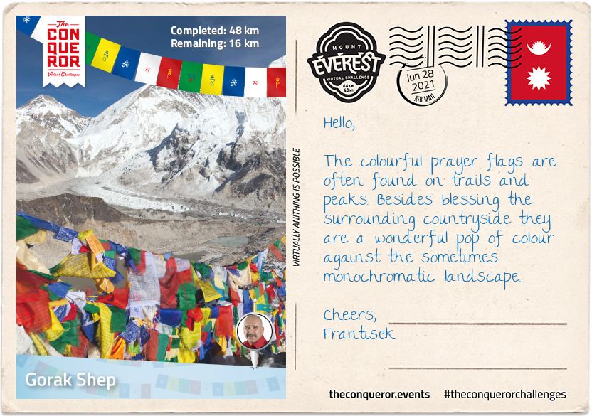
Gorak Shep
With the Himalayas towering on either side of the trail, I trudged on and I say trudged because as you may well imagine fatigue, high altitude, low oxygen level and the constantly changing terrain was having an impact but as you may also imagine the desire to climb Everest was even greater and gave me the impetus to carry on.
The terrain morphed from tundra with low level shrubs to rocks and boulders. It was rugged, remote and massive. Rounding the bend at Dughla, a small hamlet and resting point, I was confronted by a pile of rising rubble where high up on the hill at 16,100ft (4,900m) is the terminus of the Khumbu Glacier, the highest glacier in the world. To the right I could see the glacial meltwater as it was making its way down the hill into the Lobujya River flowing southward as the Imja River and into the Dhudh Kosi.
The next hour's climb was a steep 656ft (200m) trek to Chukpi Lhara. Set atop a large plateau, Chukpi Lhara is Everest's memorial ground. Monuments made of stone or cement, some covered in prayer flags were built to honour climbers and Sherpas who lost their lives on Everest. It was a sobering and reflective moment.
Located at the foot of the Khumbu Glacier to the east and the soaring peak of Mount Lobuche East to the west sits the seasonally busy village of Lobuche. The village is the second-last stop for overnight lodging before base camp. Mount Lobuche has two peaks and is differentiated by calling it East and West. Permits are required to climb the mountain with East (20,075ft/6,119m) being classed as a trekking peak, whereas West (20,160ft/6,145m) being classed as an expedition peak. The two peaks are connected by a long and deeply notched ridge with sheer drops on either side making the West peak inaccessible from the East but it can be climbed via the southern shoulder.
I didn't stop in Lobuche, I pressed on to Gorak Shep the absolutely last place to stay in a lodging. The village was buzzing with trekkers and climbers either coming or going. At an elevation of 16,942ft (5,164m), Gorak Shep was located at the base of Mount Pumo Ri on the edge of a frozen lakebed covered with sand with Khumbu Glacier to the east and Changri Shar Glacier to the west.
The village was completely barren and devoid of vegetation but the peaks were ever-present from every angle. The summit of Kala Patthar on the south ridge of Pumo Ri was a major landmark for any trekker who wanted a clear view of Everest and Nuptse's peaks. Because of Everest's structure view of its summit from base camp is blocked by Nuptse. Climbing Kala Patthar was another great way to acclimatise. With an elevation gain of 1,270ft (390m) it was a short-two hour return trip. After a hearty lunch of curry potato and paratha bread for dipping, I was ready for the last trek of the day.
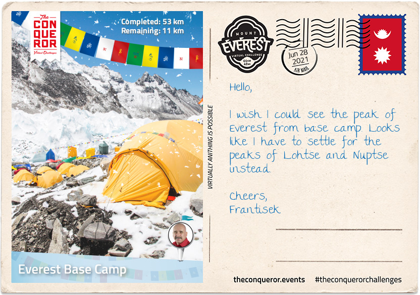
km od začátku : 0053
Everest Base Camp
Starting out with an easy hike, I nearly missed the iconic yellow and red sign against a huge boulder simply stating "Way to Everest B.C." with a big red arrow beneath the words pointing towards base camp. At least I was certain I was on the right path.
After what felt like hours of trekking, the treacherous Khumbu Icefall loomed into view spilling its way down the valley between Everest and Nuptse. Khumbu Icefall sits at the head of Khumbu Glacier, a constantly moving sheet of compacted ice. As the glacier makes its way down the valley it fractures, creating deep crevasses that are always in motion and large towers of ice called seracs that are known to suddenly collapse.
Making the final ascent I arrived at the cairn adorned in prayer flags with its rudimentary sign signalling that I have arrived at Everest Base Camp (17,477ft/5,327m). It was located on a scree-covered section (loose broken stones) at the foot of Khumbu Icefall. I settled into one of the yellow tents and mentally prepared for the high altitude acclimatisation process I would begin to endure.
As sea-level dwellers our bodies are not designed to live at high altitude but we are certainly capable of adapting to it through appropriate acclimatisation. The higher we go, our bodies go through physiological changes by producing more red blood cells in order to carry more oxygen to our muscles and organs whilst combating the thinner air.
The acclimatisation process on Everest is lengthy taking up to a month and done by exposing the body to higher and higher altitude then descending to sleep, recover and overcome any signs of acute mountain sickness due to sudden changes in altitude.
High altitude sickness can affect any person regardless of fitness or age. Ignored or left untreated altitude sickness can have serious consequences including fatality by developing either into cerebral oedema or pulmonary oedema which is fluid build-up in the brain or lungs. Some of the immediate ways to treat altitude sickness is by taking specific medication, supplemental oxygen and/or descending.
During that month I climbed and returned to base camp three times with each climb going higher. It looked something like this:
1. Base camp to icefall, return to base camp. Have a day of rest.
2. Base camp across icefall to Camp 1 and stay; then Camp 2 return to Camp 1 for sleep; then Lohtse Face return to Camp 2 for sleep; and descend back to base camp. Have four days of rest.
3. Climb to Camp 1 and stay; then Camp 2 and rest the next day; then Camp 3 return to sleep at Camp 2; and descend back to base camp. Have five days of rest and wait for the right weather to summit.
The anticipation was over and the much awaited good-weather window presented itself for the final part of the expedition: Summitting Everest.
Starting in the wee hours of the morning, geared up and harness on I negotiated my way through the camp under the light of my headlamp to Crampon Point and attached my crampons to my boots.
Staring out at Khumbu Icefall with a good dose of mixed emotions I began the perilous yet now more familiar climb across. Crevasses were crossed on horizontal ladders and towering ice blocks on vertical ones. Some crevasses were so wide that more than one ladder had to be tied together to bridge the gap. For safety I was clipped into fixed lines. If I was to lose my footing on the ladders and fall the fixed lines would help break my fall. Climbs in some areas fluctuated between 20 to 60 degree angles but there was no time to dwell as the ongoing shifting and settling of the glacier and icefall was a constant reminder how unsafe the area was and moving quickly was necessary.
Several hours passed crossing the icefall till I made it to a large flat expanse of snow with more ladders to climb all the way to Camp 1. Situated at 19,390ft (5,910m), Camp 1 was in the middle of the Western Cwm (Cwm is Welsh for valley), a broad and flat glacial valley. From here I could see the Pumo Ri Mountain to the west and Lhotse Face straight up the valley. I then climbed on to Camp 2 about 1.74mi (2.8km) further up from Camp 1. Located at the base of a gully on scree, Camp 2 was well provisioned and is often considered as Advanced Base Camp. I stopped for a day of rest.
Early next morning I began making my way across the Western Cwm to the base of Lhotse Face where I had to cross a short ladder over a bergschrund (a deep crevasse where the steep slope meets the glacier). Lhotse Face is a 3,690ft (1,125m) glacial wall of blue ice. Sections of Lhotse Face average 40 degrees incline thereby needing to kick my crampon points into the ice to secure my footing. Throughout this climb I was clipped into a fixed line which was attached to the face with ice screws and anchors. I could feel the altitude change, my breathing labouring as I slowly and steadily climbed my way into Camp 3. I was now at 24,015ft (7,320m) gaining an elevation of 6,538ft (1,993m) from base camp. There were several camping spots here, essentially wherever one could find a flat spot to pitch a tent. I remained fixed to my safety line. The sun was up bestowing me with glorious views of the valley below, the peak of Pumo Ri and the others beyond.
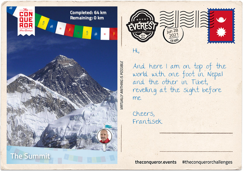
km od začátku : 0064
The Summit
On the border of Nepal and Tibet (autonomous region of China), standing proudly at 29,032ft (8,848m) is Mount Everest, the tallest mountain in the world and crown jewel of the Himalayas. First summitted in 1953 by Sir Edmund Hillary of New Zealand and Sherpa Tenzing Norgay, Everest has since been summitted by over 5,700 people a staggering 10,000+ times. Of course like any high risk activity, accidents and deaths do occur and in the last century just over 300 people have lost their lives on Everest. Although Everest has 17 different routes to the summit, only two of them are primarily used: the North Ridge route from Tibet and Southeast Ridge from Nepal.
As the air continued to thin the remainder of the climb was done with supplemental oxygen, using a full face mask with a rubber tube that connected my mask to a metal cylinder that held the oxygen tucked inside my backpack. The cylinder had a regulator on top that controlled the flow of oxygen.
Heading out from Camp 3 at sunrise I made my way up steep terrain for about 500ft (150m), traversed to a strip of limestone known as Yellow Band, across a stratified (layered) rock-ledge and up a 200ft (60m) at 40 degree angle stepped rock cresting the Geneva Spur. Following a rocky path I arrived at South Col (Camp 4) and had my first view of Everest's peak. The true summit wasn't visible from here but I could see most of the route to the South Summit (the secondary summit).
South Col was a waypoint for the final stretch at an elevation of 26,000ft (7,925m). Here I ate what little I could ingest as my appetite waned (a common problem at high altitude as the body no longer metabolises food efficiently), rested and waited for the night to roll in. Most climbers will depart for the summit between 10pm and 2am and take anywhere between 8 to 12 hours to reach the summit.
Wanting to catch the sunrise just before 5am, I checked my gear, put my headlamp on and headed across a broad plateau before ascending the steep 40 degree Triangular Face to the Balcony, a resting platform at 27,500ft (8,380m). Many of the early climbing teams including Edmund Hillary, put in a higher camp here in order to give them a shorter time to the summit and more time to climb in the warmth of the sun. Nowadays it's rarely used. I took the opportunity to change my oxygen bottle, rest, eat and hydrate.
Once I crossed over 26,246ft (8,000m), I was technically in what is known as the "Death Zone", where the oxygen is so thin that it is unable to sustain human life. Up here the oxygen level is 33% of what is available at sea level. At this altitude the body uses up its oxygen stores faster than it can replenish and without supplemental oxygen the body deteriorates and shuts down. That is not to say that experienced climbers haven't succeeded in reaching the summit without supplemental oxygen. In 1978, Reinhold Messner and Peter Habeler were the first climbers to summit without bottled oxygen. A mere 0.02% have succeeded to summit without oxygen since.
From the Balcony the route took a slight left on gentle terrain till the route moved north and I was met with a 200ft (60m) slab of steep rock and snow terrain. Clipped into my fixed line, I pulled myself up using a jumar (ascending device) and in some exceptional steep sections my crampon points were precariously placed on jutting rock, strongly hoping they wouldn't slip. It didn't end here. When I made it above the slab, I was met with an even steeper section with a 60 degrees incline but thankfully it was shorter at around 100ft (30m).
Cresting the South Summit, I stopped for a short hydration break and a snack. From here the next section was a 20ft (6m) vertical drop, followed by the Cornice Traverse, a knife edge-like ridge-crossing to what was once known as Hillary Step. The Step was a nearly vertical rock face of 39ft (12m) and a technically difficult climb but it was destroyed when the region was struck by an earthquake in 2015. What was left were snow steps at 45 degree angles. It was debatable whether this was an easier way to climb but the real loss was the "Hillary Step monument", a testament to Hillary and Tenzing's success as the first summiteers.
With the end in sight, it took a further 20minutes to reach the pinnacle of the world. Adorned in prayer flags the summit at 29,032ft (8,848m) was a breathtaking 360 degree view of mountain peaks, glaciers and valleys. I watched the sun rise, casting an orange-red hue across the diminishing night sky as I reflected at the magnitude of this journey.
In Edmund Hillary's words: "It is not the mountain we conquer but ourselves."
To bring this journey into visual perspective you may wish to watch this YouTube video illustrating the climb from base camp to summit in 3D using GoogleEarth: Everest Base Camp to Summit in 3D

km od začátku : 0005
Lake Motosu
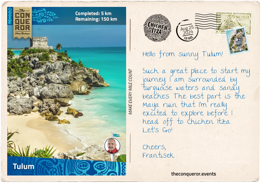
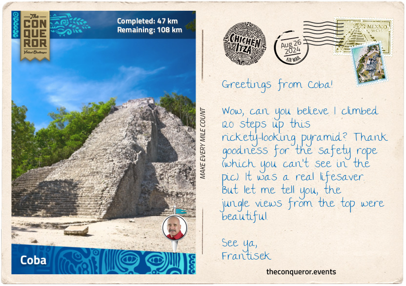
When I decided to hike Japan's tallest mountain, Mount Fuji, I pondered the best route that would capture its culture and spirit whilst travelling through its lush green landscape. The result was a 46mi (74km) journey starting at the base of the mountain, leading past lakes, caves, temples, shrines, dense forestry and ending with the final climb to the summit.
Mount Fuji is one of three holy mountains in Japan. At 12,388ft (3,776m) tall, Fuji sits atop a triple junction trench where three tectonic plates meet. Although geologists classify it as active, Fuji is a dormant volcano that last erupted in 1707. At the base it is surrounded by the Fuji Five Lakes which were formed by previous eruptions damming up the rivers with the lava flows.
Mount Fuji is a composite of four successive volcanoes meaning it's made up of layers. The first two layers were the result of an eruption more than 700,000 years ago known as Sen-Komitake and Komitake Fuji. The next eruption, about 100,000 years ago, engulfed Komitake Fuji and added the second layer creating Old Fuji. The third eruption about 10,000 years ago formed New Fuji and the summit zone producing the near perfect conical shape we know today.
Recognised as a sacred place and considered a symbol of Japan, Mount Fuji is a pilgrimage destination for practisers of Shinto. Each year between July and August, up to 400,000 tourists and pilgrims make the long trek to the summit. In 2013, Mount Fuji was added to UNESCO's World Heritage List.
Dotted throughout Japan are Shinto shrines and Torii gates. Shinto is the indigenous faith of the Japanese people and the shrines are places of worship and homes of the Kami (Gods). Practitioners come to pay their respects to the Kami or pray for good fortune. The entrance to a shrine is marked by a gate known as Torii and they symbolise the "transition from mundane to sacred". To enter through a Torii, one enters the world of the Kami (Shinto Gods).
I began my hike at the Yama Shrine near Lake Motosu, one of the Five Lakes. The third largest and deepest of the five lakes, it is subteranneously connected to Lake Shoji and Lake Saiko. Originally one lake, these three lakes were divided by one of Mount Fuji's enormous lava flows. The water temperature on Lake Motosu never drops below 39 °F (4°C) and as such it is the only lake of the five that never freezes over winter.
Northward bound, I passed by Lake Shoji, the second and smallest of the Five Lakes. On the left side of the lake you can still see large remnants of the lava flow jutting out of the water. With a greenish hue due to algae and rich in nutrients including plankton, locals can be seen standing on the lava rocks fishing.
My final stop for today was Lake Saiko, the third of the Five Lakes. With no natural outflow an artificial channel was made to connect it to Lake Kawaguchi. Lake Saiko's banks borders the Aokigahara Forest which I will write about in my next letter.
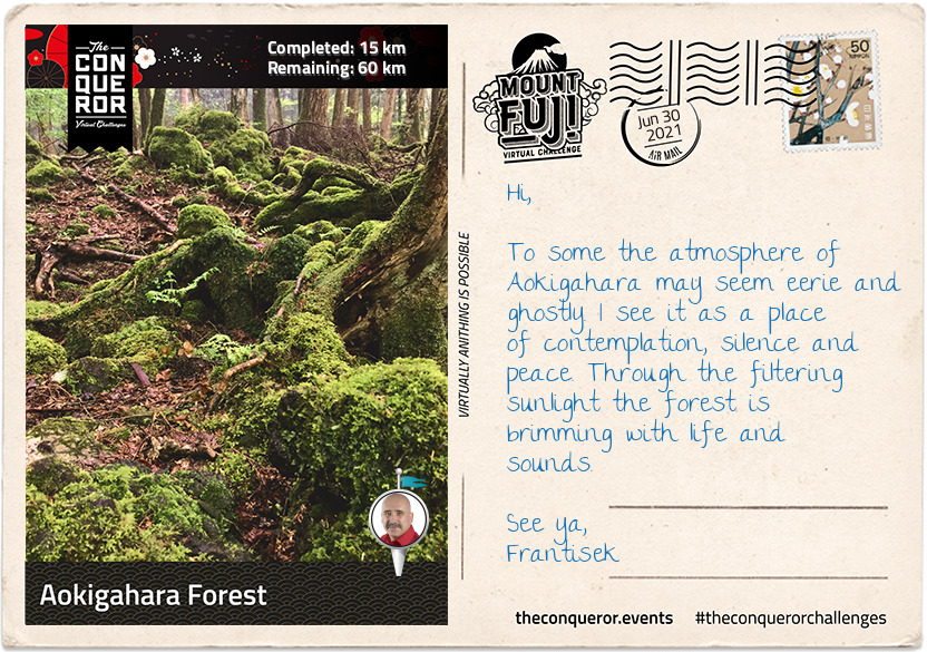
km od začátku : 0015
Aokigahara Forest
Aokigahara nicknamed Sea of Trees and at times infamously referred to as Suicide Forest, is a dense, moss-covered forest that sits within the Hakone Izu National Park. Registered as a National Natural Treasure the forest was born out of an eruption from Mount Fuji about 1,200 years ago, when new trees started sprouting from cooled lava. Because the forest is formed on top of dried magma, trees are unable to grow their roots deep into the ground. Although the thickness of the soil is only 10cm, the forest is filled with evergreen conifers, Mongolian oak, Fuji cherry and maple trees.
Hiking trails have been paved in the forest for visitors but anyone veering off the designated path can easily get lost and be difficult to rescue. Plastic tapes can often be seen rolled out to mark the path and assist visitors to find the way out. Then there are times when people have no intention of coming out and getting lost is a means to ending it all.
When I entered one of the trails on Aokigahara it was with the intent to find Fugaku Wind Cave and Narusawa Ice Cave. The trail was wide, well-marked and well-maintained with sunlight streaming through the canopies of the trees. I needn't worry that I might get lost.
Fugaku Wind Cave was a 659ft (201m) long lateral cave accessed via a staircase. Due to its natural ventilation and year-round average temperature of 37°F (3°C) the cave was used as a refrigerator during the 17th to early 20th century to store the eggs of silkworms.
Narusawa Ice Cave was a looped 492ft (150m) lava tube that maintained the same temperature as Fugaku and was also used as a natural fridge during the pre-electric refrigerator era. A small section of the cave was only 3ft (91cm) high where I needed to walk sideways in order to see remnants of trees from a thousand years ago. Ice pillars begin forming over the winter period here reaching their maximum size by April. They can grow up to 10ft (3m) high and as thick as 20in (50cm) wide.
Leaving the forest, trail and caves behind, I proceeded to trek through urban areas to Lake Kawaguchi.
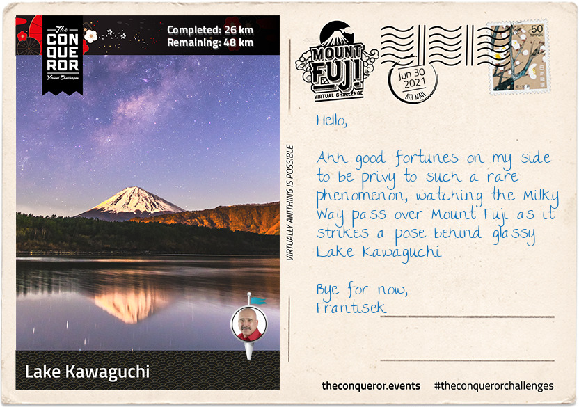
km od začátku : 0026
Lake Kawaguchi
Lake Kawaguchi is the second largest of the Five Lakes and has the longest shoreline of 12mi (19km). It is a popular holiday destination with well-developed resort facilities.
My hike along the southside of the lake began at Koumi Park, a sprawling green space with a narrow promenade, not particularly obvious but nicely maintained, near the shore that led to Shikkogo Park a mile away. Along the way I came across the literary monument of Junichiro Tanizaki, a popular novelist of the mid-20th century. The monument is in the form of an open book with a passage from one of his works carved in his handwriting.
I reached a cape-like place called "Sakuya Aino Kane" which translates as Sakuya Bell of Love. Near the tip of the cape is an arched structure about 13ft (4m) high with a bell hanging in the centre of it. Installed by the city of Katsuya in 2002, the arch was named after "Konohana Sakuyahime" the Shinto goddess of Mount Fuji. In Japanese mythology Sakuyahime is depicted as a blossom-princess in the image of the sakura (cherry blossom) and a symbol of delicate earthly life. It is said that if you ring the bell once love will come true and if you ring it twice your wish will come true. Of course I couldn't pass it by without ringing it at least once or maybe twice.
Veering off the promenade, I visited Fuji Omuro Sengen Shrine. The original shrine was built around the 9th century on Mount Fuji. Due to the mountain's frequent eruptions, it burnt down and was rebuilt many times. The current shrine was built on Mount Fuji in 1612 by Torri Naritsugu but in 1974 was moved to its current location for future preservation.
Naritsugu was a member of the Torri Clan, a samurai family and loyal retainers of the Tokugawa Shogunate (dynasty) from the 15th – 19th century. In 1600AD, his father Mototada changed the course of Japanese history when he refused to surrender Fushimi Castle to an oncoming enemy. With a garrison of 2,000 men, he fought valiantly against an army of 40,000, until he was the last man standing. As was custom rather than being taken alive, Mototada performed seppuku (suicide). This final stand gave his Shogun Tokugawa Ieyasu (commander-in-chief) sufficient time to escape. Ieyasu went on to raise an army of 90,000 and successfully won the Battle of Sekigahara, resulting in the unification of Japan and a ruling dynasty for the next 268 years.
Set within a dense old forest at the base of Fuji is "Kitaguchi Hongu Fuji Sengen" shrine complex. Covering 24 acres, the complex is one the largest forest shrines in Japan. The first shrine was built more than 1900 years ago when Yamato Takeru on an expedition to the east came across Mount Fuji and began worshipping Konohanasakuya-hime, Goddess of Mount Fuji. When the Edo Period (17thC) began Fuji-ko (Mount Fuji religion) spread and worshippers would begin their pilgrimage up the mountain from here using the Yoshida Route, one of four trails to the summit. Around the main shrine, trees were selected in each corner to designate the border of the area. About 1000 years old, only three trees remain today. With girths measuring 75ft (23m) the trees are believed to protect the shrine and are classified natural monuments.
Yamato has an interesting story or perhaps more like a legend himself. Born around 72AD he was the second son of Emperor Keiko, the first being his twin brother. He began his military career by first murdering his brother, simply because the Emperor was dissatisfied with his brother for failing to have his meals with the imperial household. At 16 Yamato was sent to quell a rebellious tribe. He succeeded by infiltrating the tribe dressed as a housemaid with a hidden holy sword, one of three Imperial Regalia. Upon his return home, the Emperor sent him on another mission. With his wife in tow, Yamato needed to cross the sea but a storm was hindering the voyage. His wife sacrificed herself to the sea in the hope the storm would die down and according to legend it did. Seven days later her comb washed ashore and a tomb was built around it. Yamato proceeded with his campaign and when the rivals saw his approach they surrendered immediately. Yamato never arrived home. He died of exposure at the age of 30. His aggrieved father built a mausoleum where his son died and it is believed that his soul transformed into a white bird and soared to Heaven.
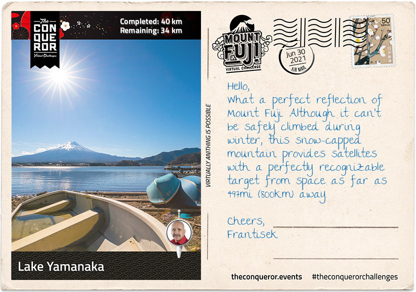
km od začátku : 0040
Lake Yamanaka
Just over halfway and I made it to Lake Yamanaka, the largest and the last of the Five Lakes. The lake is the only one of the five with a natural outflow, draining into Sagami River. Yamanaka is a popular recreational site for all types of watersports, boating, fishing and around the lake there are restaurants, parks, a small teddy bear museum and even a waterpark.
Back in 1985 aquatic adventurer Lynne Cox, was the first woman to swim across all Five Lakes. A long-distance open water swimmer, as part of her Swim Around the World in 80 Days quest, Lynne undertook a series of swimming challenges of which the Five Lakes was one of them. She is most famous for achieving the first diplomatic swim across Bering Strait (1987) and being the catalyst at opening the US-Soviet Border for the first time in 48 years, accomplishing the swim in 2:06hrs in 38°F (3°C) water.
There are several parks around the lake but Hana no Miyako Park is a wonderful 74 acres floral park. Every season is a kaleidoscopic display. Imagine tulips in spring; cosmos, zinnia, blue salvias or a field of sunflowers in summer; orange-red-russet colours of autumn; and whilst the soil is resting in the winter preparations are made for spring in the greenhouse.
Grapes are also harvested here to create Koshu wine, a white wine variety. Koshu wine is described as soft, fruity and aromatic with citrus overtones and considered a good match for Japanese cuisine. Yamanashi the prefecture that this Park sits within had the first proper winery established in the late 19th century. Locally grown grapes grew dramatically by the mid-late 20th century, so much so that more than 80 wineries can now be found in Yamanashi, producing 40% of Japan's domestic wine.
On a clear day Mount Fuji majestically reflects off Lake Yamanaka but right now I am more excited about finally starting the climb up the mountain.
However, before I go here's a final story. It's of Kakozaka Shrine that is on the way to the trail. The shrine is dedicated to Lord Fujiwara (Hamuro) Mitsuchika. In the early 13th century the retired Emperor Go-toba had his political manoeuvres blocked by the Kamakura shogunate. Wanting the power he believed was rightfully his, he conspired to overthrow the shogunate by gathering his allies. Lord Hamuro it seems, presented himself to the Emperor ahead of expected time, seeking an audience that was denied. He then decided to write a proposal on how to pursue the regent of the shogunate. The conspiracy was leaked to the shogunate who then launched an offensive and crushed the opposition with the force of his army. Unfortunately Lord Hamuro was captured and executed for his role in the conspiracy. His grave near the shrine has been protected by the people of Subashiri and a memorial service is held every May.
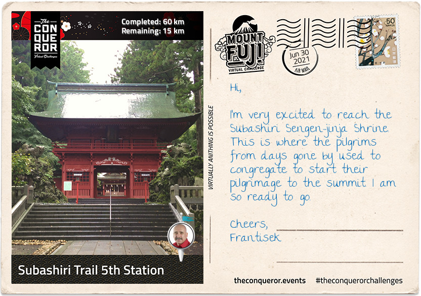
km od začátku : 0060
Subashiri Trail 5th Station
There are four trails to choose from to climb Mount Fuji. The most popular trail, Yoshida Trail, gets a whopping 150,000 climbers a year. Looking for more solitude and introspection I chose the less trodden trail called the Subashiri Trail, which sees an average 25,000 climbers per year. Where the Yoshida climb is from the north of the mountain, the Subashiri climb is from the east.
My target was to reach the 5th Station where the actual trail to the Summit really begins. Reaching the 5th Station can be made by vehicle but during the climbing season, which is July to September, private vehicles are prohibited from using the road. A shuttle buses services the area ferrying climbers from the base of the mountain to the station.
The ascending route to the 5th Station started at the Subashiri Sengen-jinja Shrine which was tucked away amongst giant pine trees. According to legend the shrine was built in 807AD and although it was damaged during the 1707 eruption, it was rebuilt in 1718. Followers of the Fuji-ko religion, a fusion of ancient Japanese mountain worship and Buddhism, congregated at this shrine to commence their pilgrimage to the summit. They continue to do that today and are usually seen dressed in white robes and carrying pilgrims' staffs.
Heading southwest, just before the Subashiri turn off, was a monument commemorating Prof Frederick Starr. He was a New Yorker who in the late 19th century took up a position as professor of anthropology with the University of Chicago. Upon request to undertake field work in Japan circa 1909, the Professor would eventually become a "student of Japan" visiting the country 15 times in his lifetime. He had a deep love of Mount Fuji having climbed it five times. His ultimate wish was to be buried in a place where he could always see Mount Fuji. In his words: "By climbing Mount Fuji, I found heaven on earth".
The road up to the 5th Station was a gently sloping, straight section with a beautifully manicured tree-lined road. Two miles (3km) in the landscape morphed into tall, dense pine trees until the road took a sharp, left turn and continued in a zig-zag fashion for the next 5mi (8km) up to the station. Halfway up the zig-zag the trees changed again taking on a rugged appearance indicating the kind of forest trail I will be travelling through on part of my climb.
The 5th Station is far less developed than the Yoshida Trail with limited amenities and shops, however near the main trail was a short hiking trail to a small peak called Kofuji (Little Fuji). Kofuji is a secondary peak that formed on the side of Mount Fuji and stands at 6,492ft (1,979m) tall. Access was via a nature trail through the forest. A twenty minute walk, I eventually emerged onto the peak of Kofuji. It was a large, long, oblong clearing with a beautiful 360 degree view of a lush forest, the peak of Mount Fuji to the west, Lake Yamanaka to the east and Fujiyoshida city to the north.
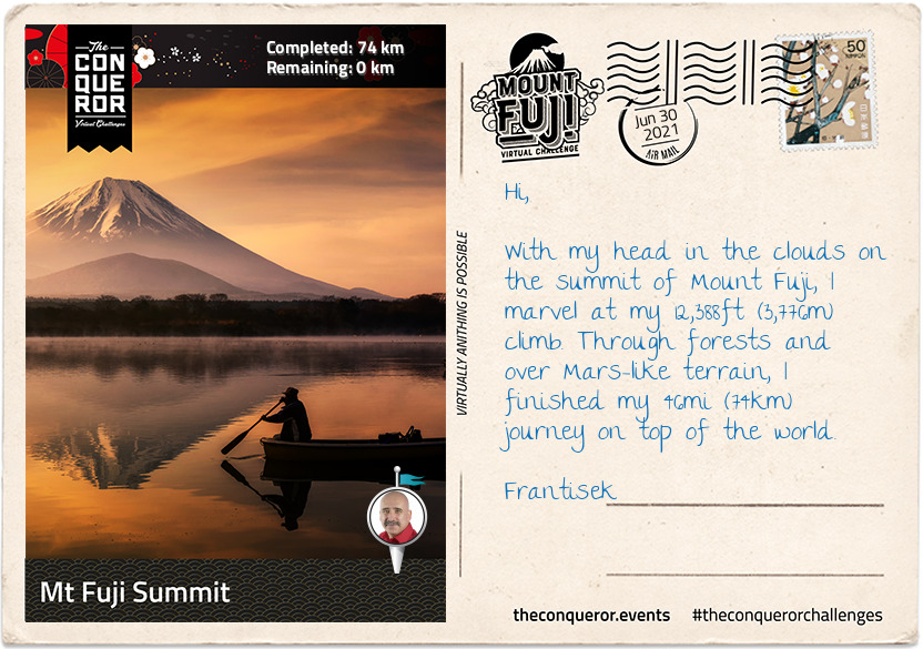
km od začátku : 0074
Mt Fuji Summit
I've enjoyed several days exploring the lakes, the forest, the ice caves and seeing Mount Fuji with its perfectly shaped cone from all angles but today was the day for the final climb to the summit.
Shortly after leaving the 5th Station I reached a fork in the trail. To the right was the trek to Fujiko. Heading left, I soon arrived at the Komitake Shrine, named after old Komitake Mountain which is now buried deep beneath Mount Fuji. The Shrine is important to many worshippers who each year on 1 July attend the Kaizansai festival and celebrate the opening of Mount Fuji.
From here to the 7th Station the trek weaved its way through a shady and dense forest. On hot summer days the forest provides a welcoming relief. The path itself was narrow and rough with rocks jutting out and tree branches stretching across the pathway. As with any climb sure-footedness was essential alongside some duck and weaving around branches. There were trail sections resembling carved out channels instead of just flat paths. I can imagine on foggy days this trail would be quite challenging with low visibility and for those who climb at night in order to catch the sunrise at the summit could run the risk of getting lost if not careful. Thankfully ropes line the route providing guidance and assistance up the mountain. Occasional openings in the forest canopy gave me glimpses of Fuji's peak, like small teasers of what is yet to come.
Leaving the forest zone behind, there were no more trees, just very low shrubs with small white flowers. The ground became more rocky and gravel-like, making it looser underfoot. It makes me realise that although Mount Fuji is not a technically difficult climb, it does however, present its own set of challenges such as a sudden change in weather, the steep inclines, long switchbacks and more importantly the potential for altitude sickness because the oxygen density is only two-thirds of the normal oxygen thereby making it more difficult to breathe.
I forged my way onto the 8th Station where my trail merged with the very popular Yoshida Trail. As expected it became quite congested. Taking a slow and steady approach it was time for the final push. The terrain here was barren, vegetation seemed non-existent.
I knew the summit was near when I made my way through the white Torii gate, which stood proudly on a set of steps signifying that "heaven on earth" is within my grasp.
Reaching the summit though was not the end, yet. The final part was a walk around the crater on the Ohachimeguri Trail. The crater has a 2,560ft (750m) surface diameter and a depth of 790ft (240m). With its jagged edge, the crater is encircled by eight sacred peaks, each with their own name: Oshaidake, Izudake, Jojudake, Komagatake, Mushimatake, Kengamine, Hukusandake, and Kusushidake.
My quest ended at the Kusushi Shrine near the last station. Here I stood to absorb the aerial views, reflecting on my journey and contemplating my descent but that's a story for another time.
On a final note, did you know that the top 1,312ft (400m) of Mount Fuji is actually private property? Here's an online excerpt explaining how this ownership evolved:
"... belongs to Fujisan Hongu Sengentaisha, a Shinto shrine. The land originally belonged to Tokugawa Ieyasu, the founder of the Edo Shogunate (1603 - 1867), and the area of Mt. Fuji from the 8th station to the top is said to have been given to this shrine as a gift by the Tokugawa clan in 1779. The land was re-designated as national property for a time after 1871, when the Tokugawa Shogunate relinquished power to the Imperial Court, but has since been returned to the Fujisan Hongu Sengentaisha. The Hongu (Main Shrine) of the shrine is at the foot of Mt. Fuji, and the Okumiya (Rear Shrine) is located at the mountain peak."
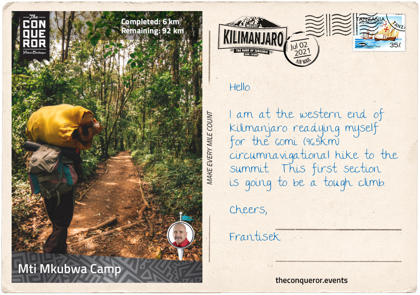
km od začátku : 0006
Mti Mkubwa Camp
Mount Kilimanjaro, Kili for short, is located in north-eastern Tanzania and it is the largest free-standing mountain in the world. It has three volcanic cones: Kibo (dormant), Mawenzi and Shira (both extinct). It stands at 19,341ft (5,895m) above sea level and is one of the 7 Summits in the world. Kili is within the Kilimanjaro National Park, a UNESCO Heritage Listed site since 1987.
The first successful summit of Uhuru Peak was made in 1889 by German geographer, Hans Meyer and Austrian mountaineer, Ludwig Purtscheller. It was Meyer’s third attempt to summit and Purtscheller had the privilege of celebrating his 40th birthday on the summit. It took another 20 years before someone else summitted again.
It took the better part of the 20th century before Kili became a trekking destination. In 1939 only 58 people visited and less than 1,000 visitors by the 1950s. Fast forward to the mid-1990s and it exploded to 11,000 trekkers and by the 21st century Kili sees an average of 35,000 climbers per year.
There are five climatic zones on Kili:
1. Cultivation [4000-6000ft / 1200-1800m] – a highly productive agricultural terrain due to the fertile volcanic soil. Small nocturnal mammals such as tree hyrax and galago reside here.
2. Forest [6000-9200ft / 1800-2800m] – a lush and dense ecosystem with high rainfall. Squirrels, antelopes, monkeys and leopard roam the area.
3. Heather and Moorland [9200-13,100ft / 2800-4000m] – the heather ecosystem connects the wet forest below with the arid moorland above. Due to lack of foliage the moorland is dry, cold and windy with overnight frost. Elands a type of antelope occupy this area.
4. Alpine desert [13,100-16,000ft / 4000-4900m] – this zone consists of almost no vegetation as it is cold and dry but with lots of sun. Temperatures fluctuate and water is scarce. Hardly any animals venture here except for the occasional African wild dog.
5. Arctic [16,000ft / 4900m and above] – below freezing temperatures at night with very little rain, plants or animals.
There are seven established routes on each cardinal point. The most popular being Machame and Marangu both from the southside of the mountain. Wanting to experience a more remote and quiet route, I opted for the Lemosho Route from the westside with a plan to swing left onto the Northern Circuit circumnavigating Kibo to Barranco Wall on the southside and wind up to the summit, Uhuru Peak. Lemosho is a relatively new trail, added by the National Park to reduce congestion on other routes.
Another reason for choosing Lemosho is that it is longer with shorter elevation gains thereby making it a slower and more natural acclimatisation experience. Camping all the way through, the route is a repeated “climb high, sleep low” which provides ample time to adjust to a higher altitude. Acclimatisation is an important part of the trek. My body is used to working at sea level where oxygen intake is at maximum. However, once I climb beyond 6561ft (2000m) the air thins out and I need time to adapt to less oxygen. The further up I go the more adaptation I need. By disregarding gradual adaptation, I could end up with Altitude Mountain Sickness (AMS) that could develop into pulmonary oedema or cerebral oedema which could prove fatal. Certainly if I was to show signs of AMS the best way to manage it would be by descending, taking AMS medication and/or resting an extra day as my body recovers and adapts.
The route begins at Lemosho Glades at 7380ft (2100m) above sea level. Standing at the Lemosho Gate I was surrounded by a dense rainforest very clearly indicating what I would be experiencing on the first stage of my climb. The path was narrow but very well maintained. Either side was a green wall of deep foliage with light filtering through the canopy.
With Kili only three degrees south of the equator, it means that the temperature does not fluctuate much, and the forest is quite humid especially after heavy rain. This is a great environment for plants to grow and thrive. Ferns, junipers, sycamore trees and moss are just some of the plants found in the forest zone along with the endemic ‘Impatiens Kilimanjari’. This flowering plant is only found in the jungle floor of Kilimanjaro. The inch-long flower is pinkish-red that’s a little orchid-like but it has a yellow tail that from a profile looks more like a tropical seahorse. As a perennial plant it blooms almost all year round.
Anyway this wondrous undisturbed forest was a constant visual delight as I ascended the trail at a steady pace up to Mti Mkubwa Camp. The trail itself didn’t deviate, it continued to be mostly narrow and well maintained, hiking single file. The camp’s elevation was 9120ft (2780m). It was nestled amongst tall trees with the tents setup ready to be occupied and the mess tent prepped and ready for dinner. After 4+ hours of trekking I was famished and looked forward to a hot stew, crunchy bread and a cuppa to replenish my burnt calories and fully fuel me for the next stage.
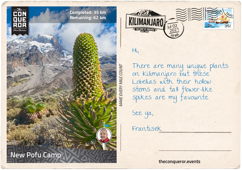
km od začátku : 0035
New Pofu Camp
As I continued on with the hike through the forest the trail gradually steepened crossing several streams. Rounding the northern slope of the Shira Ridge at 3937ft (3600m), I emerged from the rainforest onto the expansive Shira Plateau descending 328ft (100m). The pace has slowed to help with acclimatisation.
The Shira Plateau stretches over 8mi (13km) at an elevation of 12,998ft (3962m). It was originally one of the three volcanic cones and the first volcano to die out. About half a million years ago, Shira collapsed in upon itself creating a caldera. When the Kibo cone exploded 360,000 years ago for the last time, the lava and debris filled the Shira caldera turning it into the plateau it is today. Dark lava rock was visible as I hiked my way across it.
A heather and moorland zone, the plateau was filled with grasses, wild flowers and the unusual looking ‘Dendrosenecio kilimanjari’ a giant flowering plant from the sunflower family. Another beautiful and endemic plant to Tanzania found on the plateau was the ‘Lobelia deckenii”. Growing for several decades with multiple rosettes, the Lobelia produces one large inflorescence and hundreds of thousands of seeds, then dies. Due to the multiple rosettes the plant continues to reproduce and flower repeatedly.
Making my way over the plateau, I crossed more streams and large boulders whilst Kibo majestically loomed in the distance awaiting my arrival.
Reaching the intersection of Lemosho Route and the Northern Circuit, I swung a left turn and commenced my circumnavigational trek around the top quarter of Kili heading north. The terrain is quite arid with very low and desert-like vegetation slowly moving towards the alpine desert zone.
The elevation ascends and descends approximately 656ft (200m) hovering between 13,779-14,435ft (4200-4400m) for most of this northern route. Being the newest trail it was very quiet indeed.
Reaching New Pofu Camp late afternoon, I settled into my tent awaiting another feast to fill my belly and refuel. Looking forward to another soup, a casserole this time and finishing with a nice hot cuppa. From here I had magnificent views into Kenya’s wild lands to the north.
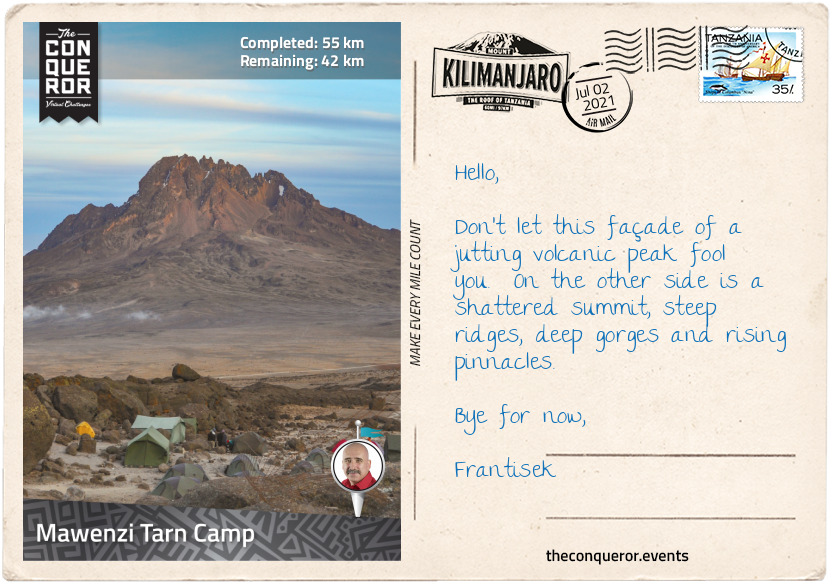
km od začátku : 0055
Mawenzi Tarn Camp
Leaving New Pofu Camp, the trail led me to the Upper 3rd Caves Camp where it intersected with several other trails such as the Rongai, Kibo Hut and School Hut Trails.
The camp was in a somewhat desolate grey-looking environment devoid of colour with only some shrubs and tufts of small grasses. Although it could’ve been perceived as aesthetically displeasing this alpine desert environment was still fascinating to experience with its raw and barren wide open space. If the terrain was rusty red you’d almost think you were on Mars.
With Mawenzi Tarn Camp as my next destination, the most direct route would have been to take the Rongai Trail. With this approach I would remain at the same elevation since I began the Northern Circuit and descended into Mawenzi Tarn Camp at the end. However, I chose to take a lower route by first descending approximately 1640ft (500m) and swung my way around the eastern side of the mountain to Kikelawa Camp and the Kikelawa Caves. The camp is located in a large meadow of tussock grasses and giant dendrosenecio plants. White-necked ravens were waiting around the campsite for scraps or unattended food.
The nearby cave was one of many on the flanks of Kili which in the past were used as overnight shelters but have now been superseded by designated camp spots with nearby water supplies.
With under two miles (3km) left the trail ascended steadily reaching a lake at the foot of the rising steep ridges of Mawenzi, the second highest volcano southeast of Kibo. Mawenzi along with Kibo began erupting about a million years ago. The two peaks were separated by the Saddle Plateau. From the western side Mawenzi looked like a single jagged rock jutting from the saddle which was vastly different from Kibo’s gentler-looking and trekkable slopes. This western side of Mawenzi was the highest point reaching 16,893 ft (5,149 m). It was named Hans Meyer Peak, after the first person to summit Kili.
However, Mawenzi was actually a horseshoe shape with three steep ridges and two deep gorges in between them. With such steep ridges, Mawenzi can’t hold any glaciers leaving no permanent snow, unlike Kibo with its permanent glaciers and year-round snow.
Although Hans Meyer attempted to climb the Mawenzi peak in 1889 after he summitted Kibo, he did not succeed due to illness. The first successful summit was made by two German climbers in 1912. Because Mawenzi is a technical and hazardous climb the peak was closed to climbers for more than a decade. Although reopened in 2017 climbers and guides must be experienced rock climbers and can only proceed two at a time.
Leaving the peaks of Mawenzi to the experts, I will gladly admire its jagged appearance from the lakeside camp. With a hot cuppa in hand and a load off my feet I reflected on my journey so far and what is yet to come.
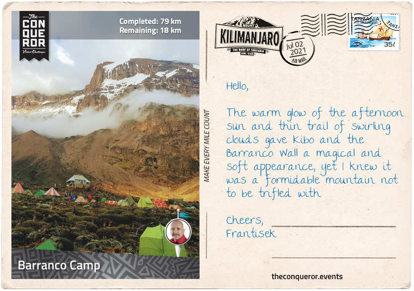
km od začátku : 0079
Barranco Camp
Heading south across the saddle that connects Kibo and Mawenzi, I descended about 1312ft (400m) till I reached Maua Route. Taking a right turn at the junction, I joined the Horombo-Barafu Trail on an upward westerly approach. Skirting one of Kibo’s lower ridges the elevation gained from the junction was 3280ft (1000m) slowly inching toward the top of the ridge. As the local guides say in Swahili “pole pole” meaning “slowly, slowly”.
At the top I continued across the edge of the ridge to Barafu Camp to rest, refuel and rehydrate. It was not unusual to drink 4-5 litres of water per day. Typically I had 2-3 litres during the trekking phase, a litre before dinner and another before I went to sleep. Staying well hydrated helped with acclimatisation and altitude sickness.
I traversed southwest for the next 2mi (3.2km) to Karanga Camp and then a northwest climb to Barranco Wall. Now for anyone on the southern or western trails up to Kibo would have had to contend with a 843ft (257m) scramble up this sheer cliff face making it even more challenging to those afraid of heights. Barranco Wall was vastly different to the mostly gentle slopes of Kibo. The Wall was the result of a huge landslide that occurred about 100,000 years ago. Kibo was originally taller, almost 19,500ft (5944m) when portions of its summit pyramid broke away, slid down the southern face and created Barranco Wall. Although not a technical climb, the scrambling needed all four limbs to climb up. Because the path was narrow and it cut back and forth along the rock face, solid placement of hands and legs throughout the climb was necessary.
Given that I took the circumnavigational route, I didn’t need to undertake this climb and was pleased to take in the views from the top of the Barranco Valley below. However, I did have to descend it in order to get to Barranco Camp for the night. An extra workout for my quads, hamstrings and knees.
Located in the Barranco Valley the campsite was amidst a grove of giant dendrosenecios. Looking at them in abundance, I couldn’t help but see them as these small compact hanging gardens atop tall thick trunks of trees.
Wondering into the mess tent, I eyed the hearty beef ghoulash with vegetables and the fresh bread but not before I indulged in a comforting potato and leek soup. The banana fritters for dessert were also well received along with my usual hot cuppa.
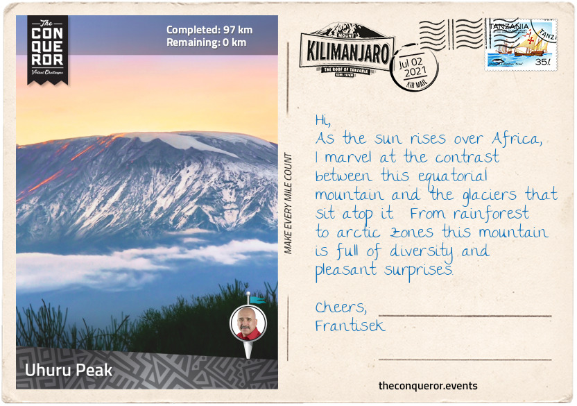
km od začátku : 0097
Uhuru Peak
This was the final stage of my journey. Having left Barranco camp, I carried on westwards in a zigzag fashion, descending 984ft (300m) until I reached the Machame Trail junction at 12,139ft (3700m). Turning right onto the trail I knew this was the final ascent but also where my breathing would be challenged the most.
Trekking through alpine desert, the sun was strong and glaring and the temperature cold and dry. As I gained more altitude, the air thinned out further. It became very important to set the right pace to manage my heart rate and oxygen intake. Move too fast and I would get dizzy, lose energy and fatigue the muscles. Move too slowly, I’d fall behind and potentially run out of time to summit.
With a slow and steady approach, I arrived at Lava Tower. At 300ft (91m) tall, Lava Tower is a volcanic plug. During one of Kili’s past volcanic explosions lava erupted out of a vent, cooled then hardened like a plug. Luckily Kili is no longer active because this kind of plug could build pressure below the surface that could potentially erupt violently.
There was a time when the tower was climbable but due to safety concerns it is now prohibited. Those who had the chance to climb it in the past said the views of Uhuru Peak were just amazing. At the base of the Tower is the Lava Tower Camp. Set a little lower, the camp provides an opportunity to rest and recover from the lengthy ascending hike and effects of high altitude.
From Lava Tower there are two ways to climb up to the Summit. Either via a descent to Barranco Camp, before an ascent to Stella Peak and then Uhuru Peak or the treacherous Western Breach Wall.
I opted for the latter. Although the Western Breach Wall is known as one of the most hazardous routes to the summit, I chose it for several reasons. One, it was the shortest route to the top. Summit is done during the day rather than overnight and no traffic jam at the top. I was also able to sleep in a crater and explore glaciers.
Now the downside is that the Breach Wall, which is a gap formed by lava flow, is made up of soft loose rocks, the result of a rockslide. The top third of this wall is very nearly vertical and the rocks here are often held together by the glaciers above. When the glaciers melt and retreat the previously bound rocks are released and tumble down the mountain. Beneath the wall is a 30-45 degree mountainside which collects the fallen rocks from above and shoots them down a narrow chute to the bottom.
As such, the difficulty was not in the climb itself, even though there were many switchbacks to tackle, but the ever-present glaciers that gave no indication if they had retreated and loosened the rocks above. Although I had to trek through the dangerous chute, my time was kept to a minimum and as quickly as was possible at that altitude I traversed to a safer pathway. It didn’t completely eliminate the danger but I was in a better position than if I had climbed directly through the ‘danger zone’.
When I reached the top the first thing I saw was the remnants of an ice cap that once used to cover the summit. Named Furtwängler Glacier, it seemed almost odd, looking at this large block of ice sitting atop very fine beach-like black sand. It was interesting to see the glacier and the sand cohabitating in the same space. Sadly in the last century almost 85% of the glacier had vanished. There was a time when Kili had 16 named glaciers and 3 icefields. In the last half a century at least four have vanished and at the rate they are melting it is predicted that in less than 50 years there will be no ice left on the mountain.
I skirted the crater rim to Crater Camp, elevation 18,865ft (5750m) to refuel and pondered that last stretch. I was a mere 475ft (145m) below the summit and about half a mile (800m) in terms of trekking distance. Of course without further ado, I pushed for that final ascent. Slow and steady over the next hour, focusing on just one step in front of the other, I wound my way up to the weathering summit sign and the spectacular views of Mount Meru, another volcanic mountain, to the southwest; Kibo’s three concentric craters; and the Northern Icefield beyond the crater.
In Swahili, Uhuru means Freedom. Here at the top of Africa, I felt free and unconstrained, just like this tall free-standing mountain called Kilimanjaro.
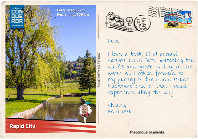
km od začátku : 0005
Rapid City
When I heard about the ‘City of Presidents’, I was intrigued and wanted to know more. To satisfy my curiosity, I booked a trip to Rapid City, South Dakota, USA.
Nestled in the eastern foothills of the Black Hills mountain range, the city was founded in 1876 by a group of settlers during the Black Hills Gold Rush. As prospectors, miners and entrepreneurs flocked to the area in search of wealth, the city prospered and became an important regional centre for commerce and a transportation hub.
The land that Rapid City occupies, which is within the boundaries of the Black Hills region, was originally inhabited by Native Americans, particularly the Lakota Sioux, who dominated the territory. A treaty was signed in 1868 between the United States and the Lakota Sioux, Yanktonai Dakota and the Arapaho Nation, establishing the Great Sioux Reservation that included the Black Hills. The discovery of gold in 1874 led to the terms of the treaty being broken by the United States, and the Black Hills were eventually taken from the Lakota Sioux.
When the gold rush declined, the city’s economy moved from prospecting and mining to agriculture, ranching, and tourism. The economy was further helped by the establishment of the Ellsworth Air Force Base and the presence of several government agencies, which serve as major employers.
These days, Rapid City is the second-largest city in South Dakota, and its major driver is tourism because of its proximity to Mount Rushmore, Crazy Horse Memorial, Custer State Park, and the Black Hills National Forest. All attractions I look forward to exploring on my journey.
The highlight of the city is a series of life-sized bronze statues of former presidents from George Washington to Barack Obama. Occupying 43 of downtown’s street corners, the statues were the brainchild of Don Perdue, a local businessman who wanted to “honor the legacy of the American Presidency” and bring some interest to the city’s main streets. The first installation of four presidents took place in 2000, and four more were added each year until 2010. At the time, it was decided that new presidents would only be added after they left office - Barack Obama was added in 2019, and Donald Trump is currently being sculpted. A wonderful feature of these life-sized statues is that each one matches the real president in height and weight, except for one that was trimmed to make the needed bronze more affordable. The sculptor spends significant time researching the habits, mannerisms, and interests of each president, which then helped them decide on the pose, the clothing and the unique details found on each statue, like Thomas Jefferson signing the Declaration of Independence or John F. Kennedy holding a small plane in one hand and his young son’s hand in the other.
As I walk up and down the street, I will spend some time checking out the small details of each president and maybe take a photo or two.
km od začátku : 0029
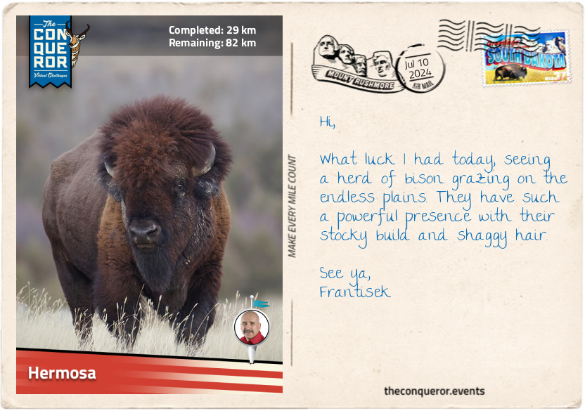
Hermosa
Having left Rapid City, I travelled south along the Heartland Expressway. I was amazed at the vast expanse of flat land, the odd farmhouse or ranch here or there, just miles and miles of open road. It felt desolate, yet amazingly peaceful, as I travelled in solitude toward Hermosa.
I can imagine, though, a time when this vastness was filled with bison freely roaming the landscape, with no roads to interfere with their crossings. These herbivorous creatures were nearly hunted to extinction by European settlers in the late 19th century, reducing the population from tens of millions to just over 1,000.
Bison were an important resource for Native Americans, who utilised every part of the animal: first as a food source, then the skin to make the teepees, the hide turned into a blanket, coat or bed, the horns were repurposed as utensils, sinews were transformed into bowstrings and thread, and the list goes on. The bison was sacred to many Native Americans, who cherished its value and treated it with deep respect.
This land I was travelling through is part of the Great Plains (the Plains). It is a massive region that stretches across the central part of the North American continent. Covering nearly a third of the United States, it extends from Texas in the south all the way into Canada in the north. Its main features are flat, wide-open spaces, extensive grasslands, gently rolling hills and few natural barriers, which makes the Black Hills mountain range rising from these plains an interesting anomaly.
Before European settlement, the Plains were home to Native Americans and held many benefits. Following the migratory patterns of bison, the Native Americans adopted a nomadic lifestyle, sourcing fresh grazing areas for their horses while hunting as needed. The Plains provided a trading network between Native American tribes, exchanging goods, culture and ideas. The flora on the Plains was fashioned into medicinal remedies, used as a food source, and turned into functional items like baskets.
Today, the Plains is an important agricultural landscape, producing various crops. In South Dakota, west of the Missouri River, ranching is the main activity, and tourism dominates closer to the Black Hills. The nearby Badlands National Park, with its otherworldly rock formations, and Custer State Park, with its lush forest and pristine lakes, showcase the Plains’ incredible diversity.
Hermosa is the eastern gateway to the Black Hills and Custer State Park. While it is a small community, one of its main attractions is the Custer County Fair, which has been running annually in Hermosa for nearly 80 years. Here, the townsfolk gather to participate in various activities such as livestock exhibitions, agricultural displays, car shows, and competitions while indulging in delicious home-baked goods and local refreshments.
Here, I will take a short break before heading into the Black Hills.
km od začátku : 0052
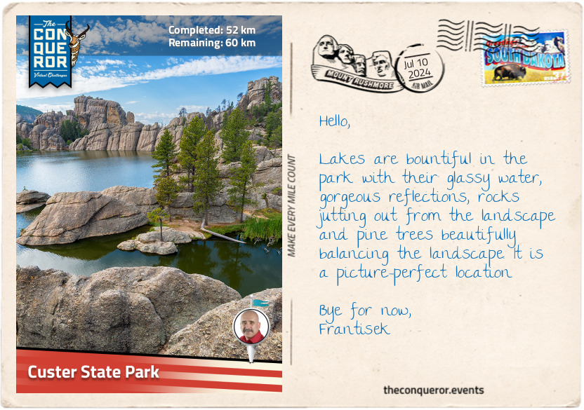
Custer State Park
As I entered Custer State Park, I was immediately awed by the beautiful ponderosa pine with its tall, straight trunk, distinctive bark, long needles and especially its sweet and slightly vanilla-like scent. The fragrance is quite calming, and since it’s reminiscent of the outdoors, it’s not surprising that it is a popular choice for scented products such as candles.
But there are many wonderful species within the park, from spruce trees with their evergreen needles and conical shapes to aspen groves and their yellow and gold foliage explosion during the fall. Paper birches make an interesting appearance with their papery white bark, peeling off the trunk in thin sheets, while willows thrive near streams where beavers busily use them to make dams or munch on the bark. Native Americans made medicine from willow bark because it contains a chemical similar to aspirin.
Among the trees and in the open plains are a variety of native grasses where bison, elks, big horn sheep and pronghorn graze. Native to South Dakota, the pronghorn is the fastest mammal in the Western Hemisphere, reaching speeds of 55 mph (88.5 km/h). Their unique anatomy allows them to adapt to such speeds, having large lungs and hearts and specialised leg muscles that store energy, allowing them to maintain high speeds for long distances.
The cheekiest ‘immigration’ to the park occurred in 1924 when six mountain goats escaped a small zoo. They loved the park so much that they stayed, and their descendants, numbering over 400, populate it today. Perhaps the wild burro (donkey) is the most humorous wildlife that continues to entertain visitors. Originally brought to the region by miners working the Black Hills in the mid-1870s, their descendants roam part of the park, often blocking the road, unashamedly approaching vehicles begging for food. Unsurprisingly, they are referred to as Begging Burros.
Custer State Park is a special place in South Dakota, being the oldest and the largest state park, covering an area of 71,000 acres. When travelling through the park, a wonderful experience is driving on the Needles Highway, a winding, narrow road passing rugged terrain, granite spires, rock formations and dense pine forests. A bit of excitement gathers when heading through a couple of single-laned low-clearance tunnels so tight that if I were to put my hand out of a car window, I’d be able to touch the rock wall. The tightest is the Needles Eye Tunnel, 8'9" wide by 9’8" high (2.7m x 3m), and the highlight near here is the Needle Eye, a unique rock formation that looks like a needle’s eye because at the top is an opening that was eroded by wind and rain.
Since I am heading toward Crazy Horse Memorial, I will give the highway a miss at this time and continue on the main road.
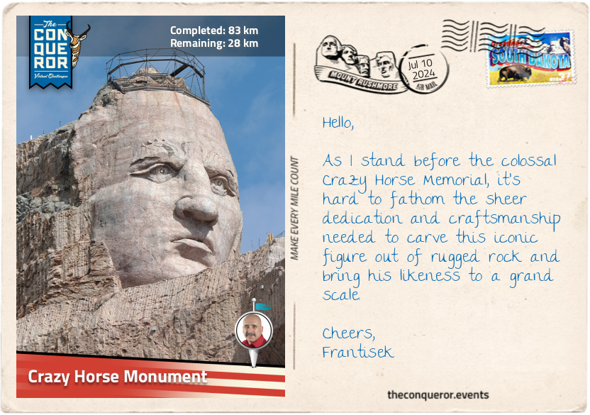
km od začátku : 0083
Crazy Horse Monument
The size of the Crazy Horse Memorial was astounding. Seen from more than 1.5mi (2.4km) away, this ongoing mountain carving project is dedicated to Crazy Horse, a Native American leader of the Oglala Lakota Nation. He played a key role in the resistance against the encroachment of European settlers on Native lands in the latter 19th century.
Crazy Horse, known as Tȟašúŋke Witkó in Lakota Sioux, was born sometime in the 1840s – the precise date is in dispute. He demonstrated bravery from a young age, and when he was a teenager, he had a vision of a man on horseback who told him not to wear a war bonnet, not to tie up his horse's tail (even though it was common Lakota practice), and never to take trophies in battle. Instead, he should rub dust on his body before going into battle. The most surprising part was that the man said Crazy Horse would not die at the hands of an enemy or from a bullet.
Crazy Horse took these instructions to heart and followed them throughout his life. His exceptional warrior skills and tactical leadership earned him respect within his tribe and beyond. Wanting to protect his tribal lands and preserve Lakota culture, he opposed treaties that led to that loss. Crazy Horse participated in the Battle of Little Bighorn in 1876, also known as Custer’s Last Stand, where he fought against the U.S. Army's 7th Cavalry Regiment led by Lieutenant Colonel George Armstrong Custer. He and other tribal leaders, including Sitting Bull, coordinated the defensive strategy and tactics that ultimately led to the defeat of Custer and his regiment.
A year later, defeated in another battle and pursued by the military, Crazy Horse knew that surrender was inevitable, leading his followers to Fort Robinson, Nebraska. While in captivity, a confrontation broke out and, shortly after, he was fatally wounded and passed away later that day. Crazy Horse became a symbol of Native American resistance and pride, and various memorials were established in his honour, such as the Crazy Horse Memorial.
The idea for the memorial was conceived by Henry Standing Bear, a Lakota elder, in the early 1940s. Construction began in 1948 with Korczak Ziolkowski as the principal designer, who also worked on Mount Rushmore. Korczak dedicated the rest of his life to carving Crazy Horse’s likeness into Thunderhead Mountain, a legacy his family continues today, with his daughter leading the project.
Since there are no known photographs of Crazy Horse, Korczak had to rely on historical accounts and individual descriptions such as facial features, hairstyle and clothing. He consulted significantly with Native American elders, aiming to capture his spirit and a portrayal of his face. As such, the memorial is an artistic representation and interpretation.
The memorial is a long way from completion, but when it is completed, it is expected to be the largest in the world, measuring 641ft (195m) long and 563ft (172m) high. The final design is intended to depict Crazy Horse riding a horse with his outstretched arm pointing into the distance.
The nearby cultural centre features a museum illustrating Native American history, and outside the building is a large model of the planned sculpture.
However, the memorial is not without controversy. Some Native American groups believe that the memorial is not an appropriate way to honour Crazy Horse and that it further disrupts sacred land. Others feel the project provides an educational opportunity about Native American history and culture.
Crazy Horse lived and died in a complex period in North American history, and his story and legacy are preserved through oral traditions, which elders and storytellers pass down to younger generations.

km od začátku : 0095
Black Hills
The Black Hills is an isolated mountain range that rises abruptly from the surrounding landscape, setting it apart from the nearby Rocky Mountains to the west and the Great Plains stretching to the east. Comprised of granite and metamorphic rock, these mountains bear a dark hue, which inspired their name, “Black Hills”.
The range holds immense spiritual and cultural significance to Native Americans, particularly the Lakota Sioux, who refer to them as the Pahá Sápa (Black Hills) or Ȟe Sápa (Black Mountains) in their language. According to Native American traditions, the Black Hills mark the sacred centre of the universe, where Earth meets the sky. Here, ceremonies, prayers, and cultural practices were held. The hills provided a place for gathering food, medicinal plants and building materials.
The highest point in the Black Hills and the United States east of the Rockies is Black Elk Peak, with an elevation of 7,244ft (2,208m). It was formerly known as Harney Peak; however, in 2016, it was renamed to honour Nicholas Black Elk, a highly respected Lakota medicine man and spiritual leader, for his contributions to preserving Native American heritage and in recognition of the mountain’s importance to Native Americans.
A stone fire lookout tower was built in the 1930s on the peak’s summit, which today is accessible for panoramic views of the diverse landscape, such as the towering granite spires and rocky outcrops jutting from the forested terrain. At the tower’s base are the interred remains of Valentine McGillycuddy, a surgeon who came to Crazy Horse’s aid when he was wounded and who was known for his “effort to build a sustainable relationship between the United States and the Native American people”. Oglala Lakota leader Red Cloud, nicknamed Valentine Wasicu Wakan, meaning Holy White Man, words noted on the installed plaque. Initially, Red Cloud was not fond of Valentine, but with time, observing Valentine’s efforts to help the Lakota, he grew to respect him and bestowed him with a Lakota name.
The Black Hills has a fascinating landscape and complex geology built in layers. At its core is ancient granite, formed about 1.8 billion years ago, surrounded by older metamorphic rocks and topped with sedimentary layers formed over different geological eras. When the uplift began around 80 million years ago, igneous rocks stacked themselves on top of the original ones along with gravel along its slopes, creating a visually captivating environment.
The Ponderosa pine dominates the hills, and as the name suggests, Black Hills spruce, known for its evergreen needles and conical shape, is native to the area and thrives here. Among these two primary tree species, the quaking aspen, paper birch and bur oak bring variety to the landscape, while flowers such as bergamot, blackeyed Susan and pasqueflower bring a pop of colour and mountain meadows are scattered through the hills.
Within this varied environment, the wildlife is just as wide-ranging. White-tailed and mule deer are often spotted foraging in forested areas. At the same time, elk are frequently seen in open meadows grazing. Elusive predators like mountain lions keep a close eye on their prey and stay in the shadows. Among the bird species found exclusively in the region are the pinyon jay, three-toed woodpecker, ruffled grouse, and the American dipper.
A journey through the Black Hills is filled with wonder, history, nature and abundant wildlife. It’s a visual feast brimming with unusual rock formations, lakes, winding roads, challenging trails, and a heady fragrance released by the ponderosa pine forest.
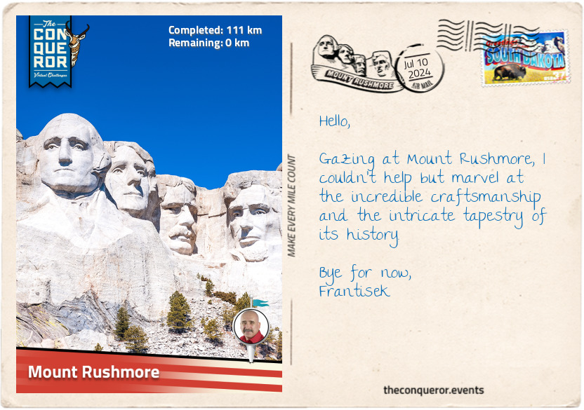
km od začátku : 0111
Mount Rushmore
Known by the Lakota Sioux as Tȟuŋkášila Šákpe Pahá, or Six Grandfathers Mountain, the granite formation that would later become known as Mount Rushmore, is located just south of the United States geographical centre. It's not surprising that Native Americans considered it the centre of the world. For the Lakota Sioux, the Six Grandfathers represents the "supernatural forces responsible for Lakota creation: North, South, East, West, the sky above, and the Earth below." It was a sacred mountain reserved for prayer and devotion, where the spirits of dead warriors lived, and young braves went on vision quests.
In the early 1920s, a South Dakota historian named Doane Robinson had an idea to sculpt a grand monument into a mountainside, hoping to draw visitors to the state. Robinson reached out to the renowned sculptor Gutzon Borglum, who travelled to South Dakota to assess the possibility of the construction on Mount Rushmore. Borglum concluded that the hard granite was ideal for carving a visually striking sculpture that could endure the elements and stand the test of time.
Borglum also sought a site easily accessible from nearby towns and appreciated that the mountain faced southeast, receiving sunlight most of the day. With that in mind, he selected four presidents to carve, each representing an important event in the country’s history:
George Washington – the birth of the United States
Thomas Jefferson – the growth of the United States
Theodore Roosevelt – the development of the United States
Abraham Lincoln – the preservation of the United States
Construction began in 1927. Initially, Borglum envisioned carving the monuments down to the presidents’ torsos. However, he underestimated the challenges of working with hard granite, and financial constraints were an ongoing difficulty. The carving process began with extensive rock blasting, after which sculptors utilised sling seats to hang in front of the cliff and shape the sculptures.
When Washington’s carving was finished, Borglum hired another sculptor to carve Jefferson while he was abroad. Unfortunately, Jefferson, carved on the left of Washington, was an incorrect size, leading Borglum to blast Jefferson off the cliff and reposition him to the right of Washington. When carving Roosevelt, they faced challenges due to cracks in the rock. They had to remove a huge amount of stone, leaving only 30ft (9m) before reaching the canyon behind. Undeterred, Borglum pressed on and successfully added Roosevelt’s likeness, including a fine outline of his glasses.
Borglum passed away six months before Mount Rushmore's completion. His son, Lincoln, continued the work, adding the finishing touches. In October 1941, Mount Rushmore was declared completed. The monument stands approximately 60ft (18m) high and took Borglum and 400 workers fourteen years to complete.
Walking toward the viewing terrace, I passed through the Avenue of Flags, a pathway bordered by 56 flags representing the 50 states, districts, commonwealths, and territories of the United States. To get a closer look, I walked the Presidential Trail that brought me right beneath the colossal structure.
Finishing my walk back at the viewing terrace, I took the time to contemplate all I had encountered and learned on this journey, understanding that history is full of challenging situations, such as the complex relationship between the United States and Native Americans. Mount Rushmore's location in the Black Hills, a region sacred to the Lakota Sioux, is a reminder of the struggles that have shaped the country and its stories and shared history are etched into the granite faces of the presidents and the landscape itself.
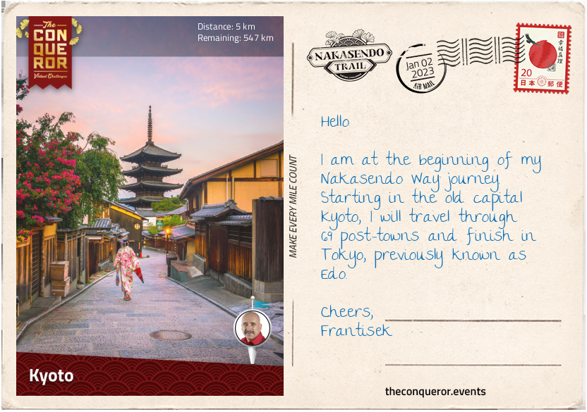
km od začátku : 0005
Kyoto
Japan is an island country located off the east coast of Asia. It is made up of four major islands and several smaller ones. Honshu is one of the four main islands where the current capital Tokyo, previously known as Edo, and former capital Kyoto, are situated.
It is on Honshu that the famous Nakasendo Way, also known as Kisokaido, was established by shogun Tokugawa Ieyasu. Known as one of the three Great Unifiers of Japan, Ieyasu was a powerful shogun in the early 1600s, who established a central government in Edo. To maintain order and control over the local feudal lords (aka daimyo), the Tokugawa shogunate had a policy requiring the lords to alternate living for a year in their domain and then in Edo. As such, the shogunate constructed five official routes that connected Edo with its outer provinces. One of those routes was the Nakasendo, which can be translated to Central Mountain Route, that began at Nihonbashi Bridge in Edo, travelled through the centre of the island, over several mountain passes and finished at Sanjo Ohashi Bridge in Kyoto.
To service the travellers’ accommodation and transportation needs, a system of 69 post-towns was set up on the route between the two main cities. Most towns had three different types of inns: honjin –reserved only for the daimyo or high-ranking officials; waki-honjin – reserved for lower ranking officials; and hatagoya – used by ordinary travellers.
The post-towns were on average 5-6 miles apart (8-10km) apart and the roads were maintained by the local lords. They were typically ‘one-street towns’ with the Nakasendo as the main road. Sometimes the street meandered in a snake-like fashion or took a sharp turn as a way to slow down any potential enemies wanting to make their way into Edo.
Pine and cypress trees were planted along the road to provide shade in the summer and protection from the cold in the winter. Distance markers were placed at regular intervals, around every 2.5mi (4km), often in the shape of large earthen mounds with a tree planted on top.
The whole expedition would take on average two weeks, of course much of that was dependent on the size of the retinue, age and health of the travellers and the load being carried. Crossing nine mountain passes made it more difficult as they were typically narrow and steep. Some sections were paved with stones to help the travellers and make it easier to maintain. Harsh winters added to that complexity.
The journey I am embarking on begins in Kyoto and ends in Tokyo. Kyoto is an ancient capital city having been the seat of Japan’s imperial court for 1,100 years (769-1869 AD). The capital was moved to Tokyo following the fall of the Tokugawa shogunate.
Kyoto is home to 17 UNESCO listed sites that include a number of temples; Nijo Castle – the Tokugawa shogunate’s Kyoto residence; and the 6th century Shimogamo Shrine – one of the oldest Shinto shrines in Japan. Kyoto is also where the famous 1,000 Torii Gates are located, within the Fushimi Inari Shrine. The vermillion gates cover a network of hiking trails through the woodlands of Mount Inari.
As I head east, I will meander through the cobblestone streets of Higashiyama Ward. The narrow lanes of this historic quarter are lined with traditional wooden buildings, beautifully restored and preserved, as a reminder of Japan’s feudal era.
Before I carry on though, I’ll stop at one of the tea-rooms to sample Uji matcha tea. Considered to be the highest quality of green tea in Japan, Uji tea is often presented to the Imperial Family and used in tea ceremonies.
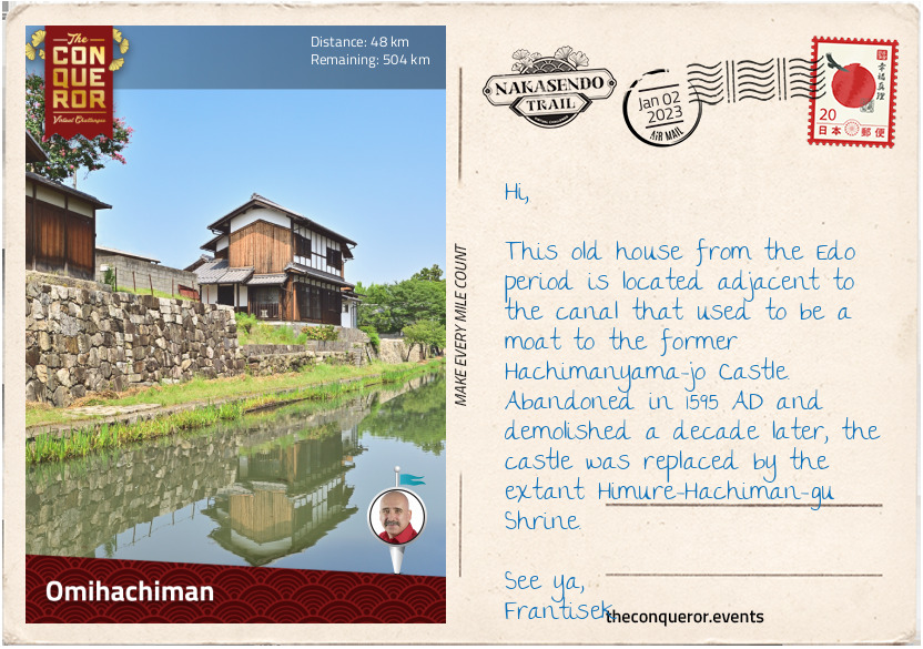
km od začátku : 0048
Omihachiman
Travelling to Nakasendo, one of the first things I had to learn is that many of the post-towns go by different names today. During the Edo period, the towns had -juku or -shuku on the end of their name, indicating it was a post-town. For instance, the very first post town after leaving Kyoto was known as Otsu-juku (#69). Today, it is just simply known as Otsu.
Otsu was and still is an important town due to its proximity to Lake Biwa, the largest body of freshwater in Japan. Otsu was also Japan’s capital for a brief period during the 7th century.
The next stop was Kusatsu-juku (#68), now Kusatsu, a very busy town because it was at the junction of two major highways, Nakasendo and Tokaido, which ran along the southern coast of Honshu Island. Being an important station, it had 74 inns. One of them has been restored and turned into a museum whilst another is a restaurant known for its soba buckwheat noodles.
Moriyama-juku (#67), now Moriyama, was a day’s travel from Kyoto and many travellers preferred this station over Kusatsu-juku which was always busy. Very few old buildings survive. One of them was once a sake brewery during the Edo period, then the childhood home of former Prime Minister Sosuke Uno and now it operates as a museum.
On my way to Omihachiman, previously known as Musa-juku (#66), I passed Mount Mikami, which is often nicknamed Omi Fuji due to its conical shape and similarity to Mount Fuji. However, Mount Mikami is really only a hilltop at 1417ft (432m) and doesn’t compare to Japan’s most sacred mountain.
When Musa-juku was a post-town, the surrounding countryside was relatively flat with several rivers needing to be crossed. One such river, the Hino-gawa, was traversed via a pontoon bridge made of wooden planks, tied together with ropes and supported by a series of boats. The pontoon bridge is long gone now but the path leading to the old location still exists.
Several houses and waki-honjin have survived that can be viewed by meandering through the north end of Shinmachi Street or from Haku’un-bashi Bridge. The canal that flows beneath the bridge had a dual purpose. First, as a moat protecting the Hachimanyama-jo Castle and secondly, as a transport route connecting the town to Lake Biwa.
I look forward to taking a slow boat cruise on the canal after my stroll through the old town and some lunch. Always a fan of tempura, I dream of large golden battered prawns and crisp tempura vegetables dipped in delicious tentsuyu sauce.
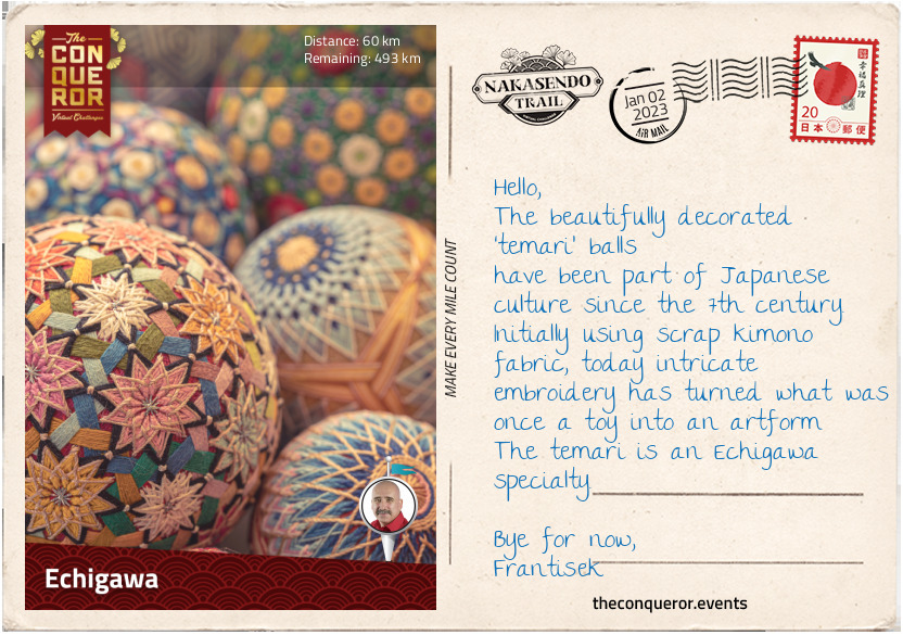
km od začátku : 0060
Echigawa
Leaving Omihachiman, for the next 6mi (10km) I pass by rice fields and as I reach Goka, I pass some old textile factories. The area between Goka and Hikone was well known for cotton and flax production during the Edo period with many of the wealthy merchants living around Goka. Building large mansions, those that survived are now open to visitors to explore. Southwest of Goka are the ruins of the 16th century Azuchi Castle. When the castle was built, it was considered revolutionary in terms of architecture. Most castles were built for defensive purposes, but Azuchi was meant to be a large mansion. It had a 7-storey keep with the upper floor being octagonal. Where the castles were typically painted white and black, Azuchi was colourfully decorated with tigers and dragons. Commissioned by shogun Oda Nobunaga, the first Great Unifier of Japan, the castle was built in 1579 AD. Following Nobunaga’s assassination, the castle and all its glorious decorations were demolished three years later. Reconstructions of the octagonal room and the top floor are on display in a museum near the ruins along with a model of the castle.
I travelled through Echigawa-juku (#65), now part of Aisho city, which was named after the river running through it. Villagers and travellers had to walk through the river to cross it, until a local businessman built the Miyuki Bridge in 1831. A signpost used to stand beside the bridge indicating that crossing was free of charge – paying to cross a bridge was customary practice.
Today Echigawa is known for its temari, a decorative handball made from old kimonos and scraps of silk that became popular during the Edo period. Temari balls were traditionally gifted to children on New Year’s Day but have now been elevated to a work of art due to their many beautiful and intricate patterns. Sometimes a hand strap and tassel were added to the ball to turn into an accessory for a kimono.
One of Echigawa’s longest running businesses is Takeheiro, an inn and restaurant that has been operating continuously since 1785 AD. Emperor Meiji, who ended the Tokugawa shogunate, is said to have rested here during his reign. It looks like a great place to have a warm miso soup and try one of their beef shabu-shabu, a hotpot dish of thinly sliced meat and vegetables boiled in water and served with dipping sauce.
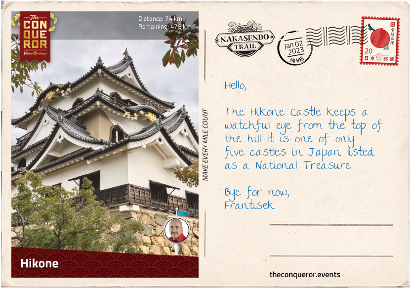
km od začátku : 0074
Hikone
Current day Hikone is a major city that includes two former post-towns, Takamiya-juku (#64) and Toriimoto-juku (#63). The area was a strategic point for protecting the capital from attack. Following shogun Tokugawa’s victory at the Battle of Sekigahara (next postcard), he made his most trusted adviser and capable general, Ii Naomasa, daimyo of the Hikone Domain and with that Ii Naomasa was given Sawayama Castle. Naomasa disliked the castle because it had been the home of his enemy and decided to demolish it and use it for parts to build Hikone Castle. Originally the Hikone Castle was on the shores of Lake Biwa but due to land reclamation the castle’s location is now inland about three-quarters of a mile (1km).
Hikone Castle isn’t particularly large when compared to others throughout Japan, but it is one of the few original castles that were spared when the feudal era was abolished, and it was left largely intact. Naomasa began construction of the castle in 1602 but after his death due to injuries sustained in battle, it was fully completed by his son in 1622. The castle remained in the family until 1944 when it was donated to the city of Hikone. Fortunately for the city and the castle, in 1945 the area was scheduled for an air raid but the war ended on the same day at noon and the bombing was not conducted.
Painted in black and white like most Japanese castles, it was constructed out of wood, stone, plaster, and tile. It is surrounded by a double moat and the inner enclosures are divided into three sections, each one accessed by a bridge over a dry moat. In the 20th century, the inner Palace was fully rebuilt and the grounds were planted with over 1,000 Yoshino cherry trees, a visual feast when blooming in spring.
Takamiya-juku was established in the 7th century, and it was the first town to be granted official status as a post-town. In the centre of town is a massive 36ft (11m) by 29ft (9m) wide Torii Gate with a large stone lantern.
Toriimoto-juku was a market town that used to have two teahouses up on a hilltop. With commanding views of Lake Biwa and Mount Hira in the distance, it would have been an amazing resting point. Today only the foundations remain with limited glimpses of the lake.
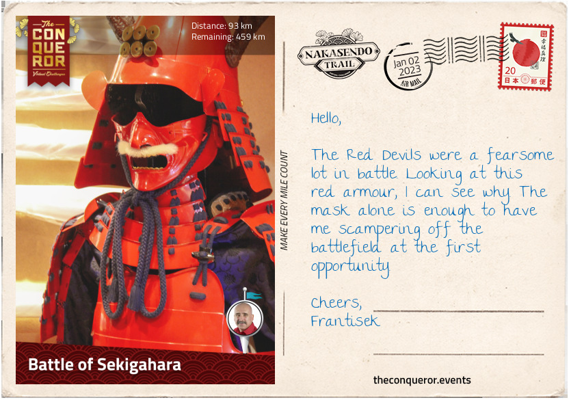
km od začátku : 0093
Battle of Sekigahara
The next three post-towns, Banba-juku (#62), Samegai-juku (#61) and Kashiwabara-juku (#60) merged into present-day Maibara.
Banba was a resting point for travelling merchants. Located in a valley, sometime in 1611 a cutting through the hills opened up access to the port on Lake Biwa. It helped travellers who could afford it to complete their journey with a lake crossing, reducing their travel time by two days.
Since the 10th century, Samegai has been renowned for its clean spring waters. By the Edo period the spring was used for goods transportation and the banks were lined with warehouses. Today, the canal is a calm and serene spot. During May to August, the surface of the water blooms with small white flowers referred to as water buttercups, whilst beneath it thrives with freshwater fish called hariyo, a type of stickleback species.
Kashiwabara is one of the oldest post-towns having been in service since the 11th century. It also had the longest street at over one mile (1.6km) lined with houses on both sides. Many buildings from the 18th-19th century survive but only a handful have been restored. The Kameya pharmacy has been in operation since 1616 AD and inside the store is a statue of Kintaro, a child folk hero with superhuman strength. It is customary to put up a Kintaro doll on Boy’s Day in the hope that boys will become brave and strong.
As I wandered through the post-towns of Imasu-juku (#59) and Sekigahara-juku (#58), both merged into modern-day Sekigahara, I progressed towards the famous battlefield that ended the Sengoku Period and gave rise to the Tokugawa shogunate and the start of the Edo Period.
The Battle of Sekigahara in 1600 AD was fought between the Western army led by Ishida Mitsunari and the Eastern army led by Tokugawa Ieyasu. Regarded as the most important battle in Japan’s feudal history, it lasted a mere 6.5 hours. Beginning early in the morning, the Western army took position on high ground west of the village whilst the Eastern army was approaching from the east.
A heavy fog delayed the battle but as it lifted Ii Naomasa and his troops (Eastern army) – known as The Red Devils because of the blood red suit of armour they wore in battle – joined by Masanori’s advance guard, charged the Western army through the centre and the left flank. Although Masanori made progress, he later became exposed and Naomasa was shot by a long gun. Both had to stop further pursuit.
During this time a Western army high ranking officer, Hideaki, who had secretly taken a bribe from Ieyasu defected to the East army. Along with 15,000 men, Hideaki attacked the Western army. Consequently, four more Western army units defected.
Those left on the Western side fell back, unable to hold their positions anymore, leaving Mitsunari completely exposed. By lunchtime, Mitsunari fled, but he didn’t get far as he was caught by villagers and later beheaded in Kyoto.
With the fall of the Western army, Tokugawa Ieyasu became the first shogun, founding a dynasty that ruled for 250 years.
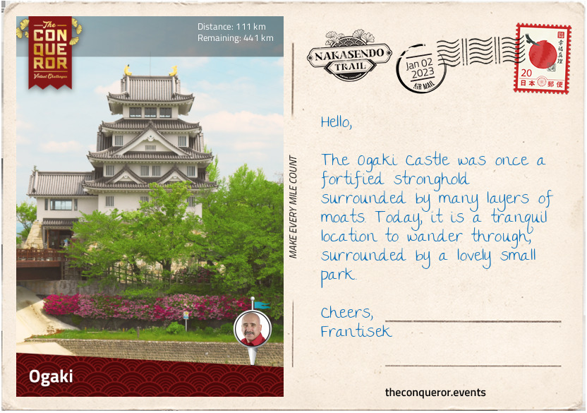
km od začátku : 0111
Ogaki
Leaving Sekigahara, I entered the extensive Nobi Plain and headed towards former post-towns Tarui-juku (#57) and Akasaka-juku (#56). The extensive Nobi Plain is surrounded by a chain of mountains that is broken to the west of Sekigahara, making it the only practical mountain pass for the Western and Eastern armies to battle it out and determine who would rule Japan. The pass was also the main connection between east and west and a thoroughfare for the transportation of goods. Today, it continues to maintain the connection with several train lines, including the bullet express and the national highway, passing through it.
Travelling along a quiet and narrow section of Nakasendo, I pass by small villages, a few suburban houses and occasional stretches of countryside. Some of the surviving trees that lined the Nakasendo have bright bands around them, signifying their historical importance. A short distance away, I arrive in Tarui, one of the oldest post-towns, having been in service since the 12th century, that is at the junction of the Nakasendo and the Tokaido roads. Three miles further (5km), is Akasaka, a marble mining town where locals used to make small marble trinkets in their spare time to sell to passing travellers. Both post-towns were absorbed into the city of Ogaki.
Ogaki used to be a castle town with an initial focus on military activity and was later a political and economic centre. Nearly half the population were military (samurai). Given the strict hierarchical order at the time, each castle town was specifically organised. In Ogaki at the centre, up on a hill was the castle – the daimyo’s home - surrounded by several layers of moats with a central keep and corner watchtowers. Adjacent to the castle, usually between the first and second moat, were the homes of the samurai. The townspeople were on the outskirts, with each group such as merchants, soldiers, labourers, artisans located in their own specific ward.
Ogaki Castle wasn’t particularly large but it was well fortified and during the Battle of Sekigahara it was used as headquarters by the commander of the Western Army. Drawn out of the castle and into battle, after a short skirmish the castle fell, with Todo Ujikane from the Eastern Army taking up lordship and control of the fief. His clan would remain in power until the end of the Edo Period.
In WWII the keep and watchtowers were bombed and completely destroyed. Replicas were constructed in 1959 with the keep as a museum displaying the history of the castle and various samurai arms and armour. Today, the castle is surrounded by a small park filled with several statues of historical figures including a fine equestrian statue of Todo.
After climbing the four floors of the keep for an aerial view of Ogaki, I left the castle in search of a plate of sashimi. I was dreaming of dipping thin slices of raw seafood (ie. salmon, tuna, sea bream) in light soy sauce with a little bit of wasabi and ginger for some zing, tantalising my tastebuds with the combined flavours and washing it down with green tea.
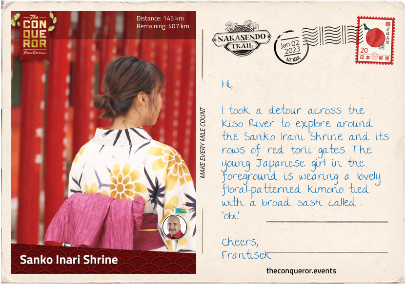
km od začátku : 0145
Sanko Inari Shrine
Located in the centre of the Nobi Plain was the infamous post-town of Mieji-juku (#55), now Mizuho. During the Edo period it was subject to constant flooding causing travellers much angst. The den of gamblers, thieves and numerous saloons gave Mieji a terrible reputation.
The next post-town, Godo-Juku (#54) was a minor town with only a handful of inns. It was located near Nagara River and known for cormorant fishing, a fishing technique where trained cormorants (birds) were used to catch fish in rivers. The fishing masters on the Nagara River are the only ones listed as the Imperial Fishermen of the Household Agency, a government agency that takes care of state matters for the Imperial Family.
Whilst tourism and trade increased in Godo, unfortunately the town didn’t benefit from it and with a new bridge installed further downstream, trade was taken away from the town. Very little remains as a reminder of its past.
Crossing the bridge, I left the Mino plains behind and in the distance to my left, I saw Gifu Castle, sitting precariously on top of the hill as I made my way into Kano-juku (#53) – together with Godo, Kano is now part of Gifu city. For a time, Kano was the local centre of activity and one of three places that served as both a castle-town and post-town. Kano’s road had numerous sharp turns - resembling the letter “M” – for defensive purposes preventing the enemy from seeing the way ahead. Today, Kano is a well preserved old town, as the local government moved back to Gifu after the Edo period ended.
A few miles further, I arrived in Unuma-juku (#52), now Kakamigahara, a small post-town that never expanded because of its proximity to Inuyama castle-town across the banks of Kiso River. Cormorant fishing can be observed from the traditional inns and restaurants located near the river. Kiso River is what gives Nakasendo the alternative name of Kisokaido.
Before I continued on my journey, I took a short detour across the river to visit Inuyama Castle and the Sanko Irani Shrine.
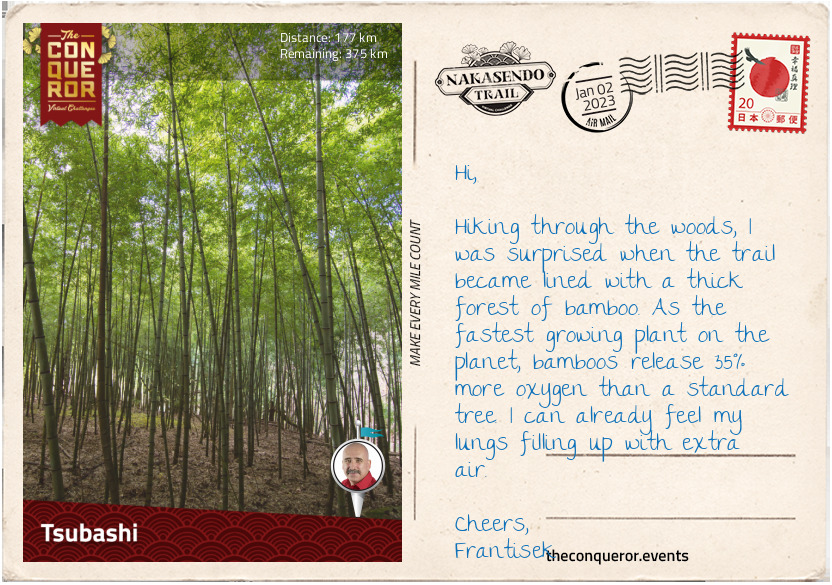
km od začátku : 0177
Tsubashi
I travelled along the banks of the Kiso River to Ota-juku (#51), now Minokamo, with delightful views of the river that was briefly interrupted by a short jaunt through a forest with a narrow trail beautifully paved in stone.
Ota was an important local administrative centre ruled by one of the strongest clans in Japan that was affiliated with the Tokugawa shogunate. Located at the confluence of Hida River and Kiso River, Ota was also an important river crossing location. Flooding was common after the snow thawed, making the crossing and this section of the journey one of the most difficult.
There is a famous story of Princess Kazu Chikako, who in 1862 travelled from Kyoto to Edo along the Nakasendo to get married to shogun Tokugawa Iemochi. Her retinue of 25,000 men banked up the highway creating a traffic jam that lasted for weeks. When she arrived in Ota she stayed at the local inn. Although her nuptials were arranged to repair the relationship between the Imperial court and the Tokugawa shogunate, her brief marriage to Iemochi was a happy one. When Iemochi died three years later, Princess Kazu became a nun and spent her days writing poetry and calligraphy. Memorial stones along the Nakasendo commemorate her journey.
The town of Mitake holds within its borders two former post-towns: Fushimi-juku (#50) and Mitake-juku (#49). Interestingly, Fushimi-juku was the last post-town built, whilst its neighbour Mitake-juku was the first official post-town on the Nakasendo. Fushimi was created in 1694 when the flow of the Kiso River shifted and a new location for ferries to cross the river was needed further upstream. It prospered for a while but with other nearby post-towns it remained small. Whereas Mitake-juku was built in the early 800s and served as a post-town for older routes before becoming part of the Nakasendo.
Passing through several hamlets, I entered the woods on a narrow and rugged trail. A thick forest of bamboo lined parts of the route and then it commenced a steady climb towards the next post-town.
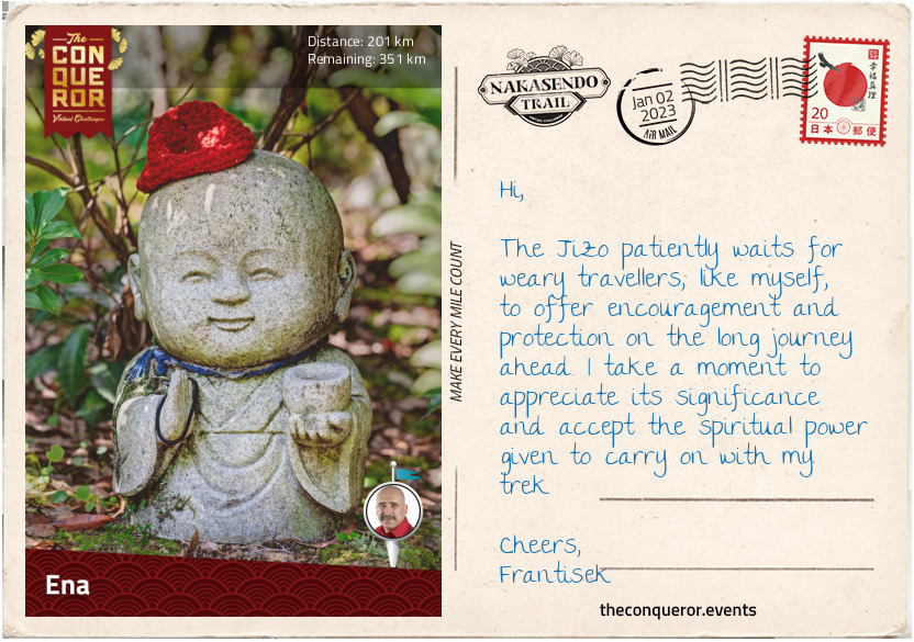
km od začátku : 0201
Ena
Surfacing from the woods, I arrived in Mizunami and its former post-towns Hosokute-juku (#48) and Okute-juku (#47). In between the two post-towns was Biwagi-pass, a very difficult pass to cross, mostly due to frequent inclement weather rather than the road itself. Stone paving was laid in this section to make it easier for the traveller to traverse and minimise the slipperiness.
The trail through the pass is lined with Jizo statues. The stone statues are shaped to look like children but in essence they are the image of Jizo Bosatsu, guardian deity of children and travellers. A kind and patient deity, the Jizo maintains a double duty by protecting travellers on their journey and also the spirits of dead children who are unable to cross the river into the afterlife. Jizo protects the children from the mean spirited Yokai by hiding them beneath his clothes and becomes their caretaker in place of their parents.
As the weather cools, locals dress the Jizo statues with red bibs and hats as a way of earning credit to get into the afterlife. The colour red is said to keep away sickness and danger, making it an appropriate colour to dress the deity.
I made my way into Ena, where the former post-town Oi-juku (#46) continues to exist as a suburb. Oi is located in the foothills of the Japanese Alps where the winters are extremely cold and very snowy. The area is well preserved with the typical sharp-turns in the road to deter enemies. Parts of the highway date back to 1100 AD. The gateway to the former honjin and several regular inns have survived to this day, including the 400 year old Ichikawa Ryokan, formerly Kakuya Inn, that continues to be in business today.
On my next stop I will enter the famous Kiso Valley.
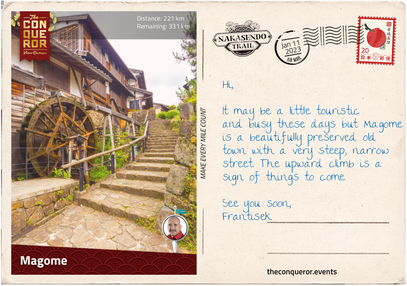
km od začátku : 0221
Magome
The city of Nakatsugawa is a thriving market town with a small industrial centre. It consists of three merged former post-towns: Nakatsugawa-juku (#45), Ochiai-juku (#44) and Magome-juku (#43). To the north is the winding Kiso River and to the southeast is Mount Ena with its hiking trails.
The post-town of Nakatsugawa-juku was also a busy market town and trading centre. It was one of the largest towns in the Edo period, with several shops selling rice, sake, soy sauce and salt, amongst other things. It had more than 30 inns, compared to the small towns that averaged about 8 inns.
The Hazama Sake Brewery has been making sake - a fermented rice drink with koji and water - in Nakatsugawa-juku since the 18th century. The brewers are the Ma family, originally a samurai family, moved to the area after the Battle of Sekigahara and became one of the wealthiest merchants of the Tokugawa shogunate. The brewery has an enviable view of Mt Ena but even better it has an abundant flow of clean, underground water that is used in the brewery. Calling the sake Mt Ena, their intent is to create a drink as pure and clear as the water.
Ochiai-juku was a small post-town and was dwarfed by its neighbouring Nakatsugawa-juku. It had only half the inns and a third of the population. The honjin survives in pristine condition but nothing else remains.
At the eastern end of Ochiai-juku is a large stone lantern that was used to light the way. Stone lanterns were located at both ends of a post-town and were lit from dusk till dawn. They were known as joyato, translated as “all-night lights”. Similar lanterns are also found outside shrines.
Stone lanterns, known as Toro, can be found all over Japan. They originated from China and were initially used in Buddhist temples only, lighting the paths. The lit lanterns were considered an offering to Buddha. Between the 8th-12th centuries they became part of Shinto shrines and private homes and then the tea masters popularised their use by having them as garden ornaments.
Leaving Ochiai-juku, the highway starts to climb and soon I find myself on a stone paved trail in woodland, with the sun streaming through the trees. It is short-lived and as I keep moving forward, wonderful rolling hills present themselves and soon after, I arrive in Magome-juku.
Magome is a rebuilt town - having been destroyed by fire in 1895 - using traditional architecture that preserves the feel of the Edo period. It is a very popular tourist location with shops lining both sides of the street. Closed to vehicular traffic, the walk up the street, whilst very steep indeed, is beautiful. However, Magome wasn’t always perceived this way. Earlier writings about the town described it as “provincial and loutish” or “leaders of the post town are often in debt, and the town is in bad shape”. Thankfully today, it is clean and lively.
Most visitors reach the top of the hill and then turn back, but it is from here that the trail enters the famous Kiso Valley, exposing the traveller to the prettiest natural section of the entire Nakasendo. I will certainly continue on towards Tsumago-juku.
Follow this link for a breathtaking walk on the Nakasendo from Magome to Tsumago which is the next postcard:
https://www.youtube.com/watch?v=PpUgBpeJqT0
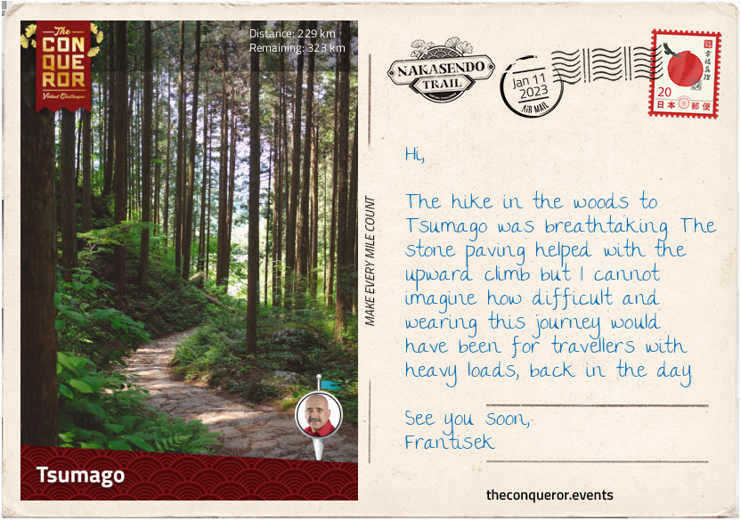
km od začátku : 0229
Tsumago
Heading out of Magome, the highway led me towards the Magome-toge (Pass). I travelled beside the main road for a while, weaving in and out of woodland, past an old water wheel turning, generating power from the flowing water.
As I trekked through open fields, the air was clean and crisp, the sky a deep blue and the autumn colours ever-present. The Kiso Valley lay before me, inviting, verdant and filled with cypress trees. Luckily, due to Tokugawa’s foresight, tight controls on deforestation were introduced and a keen interest in forest conservation saved the valley from timber depletion.
I passed by the small village of Toge with its Edo era ambience and soon found myself on the Magome pass, meandering through woodland on a narrow path. To my surprise, a little distance in was a bell attached to a pole with a long chain and a sign saying ‘ring the bell hard against bear’. A bit of an eye-popping moment, I hadn’t realised the woods were frequented by Asiatic black bears. Although their presence is controlled, I sure didn’t want to be confronted by one, so with a hearty swing, I rang the bell loud and clear.
Once through the pass, I arrived at a small teahouse. A lovely rest stop that once used to be an inspection post monitoring travellers and the goods passing through. Back in the woods, I enjoyed the silence of the forest and the musical sound of the spring flowing, trickling over rocks. About 3mi (5km) later, I came across the Odaki-Medaki Waterfalls, two waterfalls near each other that translate as Male-Female Falls.
I passed through another small village then began the final descent through woodlands, beside gurgling streams and into Tsumago-juku (#42), now part of Nagiso. A little more rustic than Magome, the road is wider and the town is charming. As a post-town Tsumago was quite small and of no particular note, mostly due to its remote location. Today though, it is a major tourist destination with most of the buildings restored and all power lines underground, preserving the feel of the Edo period. Even the mailman is dressed in a traditional Edo era costume.
In the mood for soba noodles, I’m off searching for a hot soup version of it. Nagano Prefecture, which Tsumago is part of, is famous for Shinshu Soba which is made of buckwheat flour. A nice hot soup is just what I need to end my beautiful enchanted forest trek.
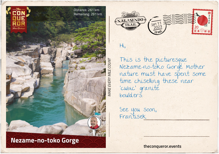
km od začátku : 0261
Nezame-no-toko George
Leaving Tsumago, I passed the site of an old castle with spectacular views of the valley. The trail narrowed as it re-joined the Kiso River.
The next post-town was the once prosperous Midono-juku (#41), now part of Nagiso. It has a fabulous wooden bridge, the Momosuke-bashi, that was built for small trolleys in 1922. Today it is a footbridge with views of the town and the Kiso River. In 1881, a huge fire destroyed the town. It was rebuilt around a railway station and its location moved. The few buildings left behind represent the various eras between the late 16th and early 20th centuries, along with remnants of an electric station from the early 1900s.
From Nagiso to Agematsu, the old highway is superseded by a modern one. Here the valley becomes very narrow and the highway, rail line and river compete for space. The trek is noisy until a few miles before the post-town of Nojiri-juku (#40), where it veers off into a quieter area for a short while and then re-joins the highway to Suhara-juku (#39). Both Nojiri and Suhara are now part of Okuwa.
Suhara was a lovely town to explore given its close proximity to the railway station. Many Edo period buildings survived, along with a joyato (stone lantern). Some of the buildings still had wooden water troughs at the front that in the past were provided for travellers. A specialty of Suhara is hanazuke, tea pickled with salt and cherry blossoms. Behind the village is Mt Komatagate, a popular hiking location and from the summit one can see Mount Fuji in the distance.
Five miles (8km) after Suhara, the Nakasendo veers from the modern highway, regaining the peacefulness of the old road. Just before I arrived in Agematsu (#38), I made a brief stop at Nezame-no-toko Gorge, a picturesque gorge with granite formations.
During the Edo era, Agematsu had an office for timber control where woodcutters would need to register. Strict rules were in place and tree felling without license was severely punished. When the trees were felled, they were loaded on rafts and floated downriver to Nagoya. Today, the timber from the Kiso Valley is still highly prized with several furniture factories and cabinet makers located in town.
After my delicious soba noodles in Tsumago, I thought I’d try ramen noodles this time. Ramen was imported from China and made its first appearance in a Chinese restaurant in Japan around 1910. Based on wheat flour, the prepared dough is risen before being rolled. The noodles in my curry ramen had a firm texture complemented by a good dose of spiciness mixed with the rich flavouring of pork bone broth.
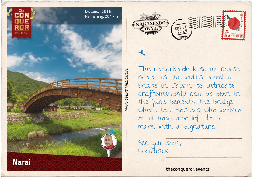
km od začátku : 0291
Narai
As I move through the Kiso district, I pass through three post-towns: Fukushima-juku (#37), Miyanokoshi-juku (#36) and Yabuhara-juku (#35).
Fukushima was a major post-town and a checkpoint location. Being nearly halfway between Edo and Kyoto, it was a strategic place for keeping an eye on traffic and preventing the illegal movement of people. Regardless of societal position, each traveller had to wait their turn to obtain permission to pass through. Fukushima had a lively trading centre with all sorts of items for sale. The community leaders were very wealthy. A horse market took place annually with cotton and hemp goods, salted fish and rock mushrooms amongst some of the items sold. Today, it continues to be a prosperous town. It's highly touristic with hikers or anglers coming in the summer and skiers in the winter.
The Kiso River cuts through the middle of Miyanokoshi and when it reaches Yabuhara it takes a westward direction whilst the route heads east. Miyanokoshi is the birthplace of the legendary Tomoe Gozen, an accomplished female samurai and mistress to General Kiso Yoshinaka, a member of the Minamoto clan. Tomoe fought alongside Yoshinaka in the 1180 AD Genpai War, toppling the opposing Taira clan. A few years later, Yoshinaka attempted to take control of the Minamoto clan from his cousin but failed. Knowing that he would be killed, he sent Tomoe away as he perceived his death beside a woman as shameful. Tomoe left but not before she beheaded a few more enemy warriors on her way out. What happened to her afterwards remains a mystery but her exploits on the battlefield are recorded in detail.
Beside a handful of antique shops from the Edo period, not much remains in Yabuhara. I pressed on through quiet countryside and into Narai-juku (#34), the first of five post-towns now part of Shiojiri district.
Narai has been beautifully preserved and although most of the buildings are barely a century old, they were built using traditional architecture. A very popular tourist destination there are many gift shops but in the centre of town are three former inns that continue to operate. Nearby is Nakamura’s Residence, a building from the 1830s that used to be the home of a lacquer comb trader. An important cultural property, today it is a museum exhibiting the interior of the house and lacquer combs.
About halfway through town is the beautiful 300 year old Kiso Bridge. Made of hinoki cypress, it is one of the largest arched bridges in Japan built without piers. The masterful timberwork can be appreciated at close range whilst the Narai River quietly flows beneath the bridge.
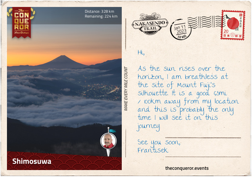
km od začátku : 0328
Shimosuwa
Not far from Narai is the small village of Harasawi, renowned for its lacquerware production. In the past, locals used to make utensils and bento boxes out of wood. Now, a finished product will have 6-18 layers of lacquer that requires 8-20 hours of drying time in a humid environment. The Kiso area is famous for the deep brown tone of its dishes. The lacquer comes from the sap of lacquer trees. Today, there are few surviving craftspeople but their work is nationally recognised.
Five miles on (8km), I trekked through a narrow stretch of the valley and arrived at Niekawa-juku (#33), once a border town between two domains (clan estates) with a checkpoint that was destroyed in 1869. The town, although small, had a large number of inns. At 6pm each evening, the highway would be closed to traffic, forcing travellers to stay the night in town. A fire in the 1930s wrecked the rest of the town. A 1970s reproduction of the checkpoint is all that is left of the era.
The next post-town was Motoyama-juku (#32) and its main industry was timber that was transported all the way to Edo. The Tokugawa shogunate maintained strict controls over the planting and felling of trees. Nothing remains of the post-town, having been destroyed by fire in the 19th century. Today, grapes have replaced the timber industry and it has important vineyards in the area.
The valley continues to be narrow and the old Nakasendo road is overlayed by the modern highway. The trail is rather noisy until I reach Seba-juku (#31). It used to be a weighing station, ensuring that cargo carried by porters did not exceed 85 pounds (38kg) - a regulation set by the Tokugawa shogunate.
Re-joining the modern highway, I passed through Shiojiri-juku (#30), a former post-town that served as a centre for salt production. Today, Shiojiri is a city with all the above-mentioned post-towns within its borders.
Exiting Shiojiri, the old road ran parallel to the main highway and began an upward climb to Shiojiri-toge (Pass). The roadside pine trees continued to provide shelter as they did during the Edo era when they were planted to protect travellers from the summer heat or winter cold.
The Shiojiri-toge was located at 3340ft (1018m) and it provided fabulous views of Lake Suwa, the town below and on a clear day, in the distance, Mount Fuji. The downhill trek through the woods was rather steep until I passed a few rice fields and entered the quiet and verdant town of Shimosuwa. During the Edo period, Shimosuwa-shuku (#29) was one of the earliest post-towns to be established. It was quite prosperous due to its location between two difficult mountain passes, Shiojiri-toge and Wada-toge, and its many hot springs. The passes are still there of course but the hot springs are now long gone.
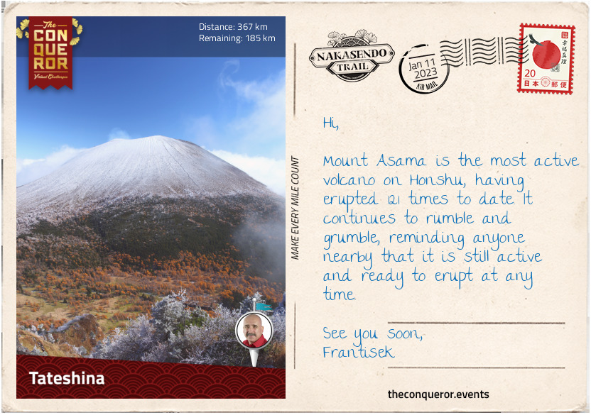
km od začátku : 0367
Tateshina
Heading north of Shimosuwa, I entered the highest, most difficult and most dangerous pass, the Wada-toge. The climb up was rocky and very steep, reaching the summit at 5300ft (1615m). During the Edo period, riding travellers had to dismount and remove their baggage as it was too steep for horses to carry a load. In the winter, special clothing was worn by porters with straw boots woven in a particular way that kept their feet warm even when the boots were wet. Sometimes metal spikes were attached to the boots to grip the path. Alternatively, they would make boots out of wisteria and attach thorns beneath for grip.
Once over the pass, the descent took me into Wada-shuku (#28), now part of Nagawa. Wada is a popular spot for winter sports but in the past it was an important resting point for travellers prior to tackling the Wada-toge. It had 30 inns altogether, however a fire in 1861 destroyed all the buildings. A few inns that were rebuilt soon after the fire are still intact.
Continuing my descent, I travelled through a wide valley filled with rice fields. Many of the farms here had thatched, rarely seen in Japan nowadays. After five miles (8km), I reached Nagakubo-shuku (#27), another necessary resting point as it was located between Wada-toge and the next pass, Kasadori-toge.
The next post-town was Ashida-shuku (#26), now Tateshina, which was described as a “shabby looking village”. It continues to have the “shabby” image except for the well-preserved honjin that claims to be the oldest on the highway and the location where Princess Kazu (postcard 8) rested for the night. The inn is classified as a National Treasure now.
Travelling towards Mochizuki, I got my first view of Mt Asama, a volcanic mountain that in 1783 erupted over a period of 15 hours with lasting effects that carried on for the next three months. The arable land in the area was already in poor condition because of cold weather but after the eruption the land became fallow for several years. These events led to the Great Tenmei famine that lasted for five years. Mt Asama continues to rumble and threaten with earthquakes and it is said that the mountain often wears a “benign plume of smoke”, as if to warn that it is always ready for another eruption.
I am happy to admire it from a distance and mentally wish that it keeps itself in check whilst I am passing through.
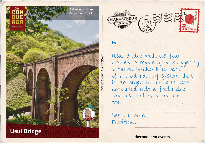
km od začátku : 0413
Usui Bridge
At the base of Mt Tateshina is the former post-town Mochizuki-shuku (#25). Together with Yawata-shuku (#24), Shionada-shuku (#23) and Iwamurada-shuku (#22), the town was absorbed into the city of Saku.
Mochizuki was known for horse breeding and supplying them to the Imperial Court. The post-town remained small and even though it had business passing through, it went into a slow decline.
Yawata and Shionada were only 500m apart, separated by the Shinano River, the longest and widest river in Japan. They were connected by a pontoon bridge until it was washed away by a flood and never rebuilt. Instead, ferry services were introduced and used to cross the river. Yawata remained a small post-town and was only used by travellers as a rest point when the river couldn’t be crossed. It also served as a distribution centre for rice.
Iwamurada was a castle town. It didn’t have any inns during the Edo era. The local daimyo rose to fame when he delayed the leader of the Western Army prior to the Battle of Sekigahara.
I moved through Otai-shuku (#21), now part of Miyota, to the city of Karuizawa and its former post-towns, Oiwake-shuku (#20), Kutsukake-shuku (#19) and Karuisawa-shuku (#18). As I get closer to Tokyo, I get the distinct feeling that many of the old post-towns have been taken over by big cities and modern life. Whilst there may be small remnants of Edo history, I will likely experience more and more modern aspects from here on. The flavour of this journey will shift from 17th century history to current times.
With that in mind I noted that Karuizawa, which nearly went into complete decline, was revitalised after WWII and became a summer resort location. It is visited by thousands of people who want to escape the hustle and bustle of Tokyo. Its local fame was sealed in the 1950s when former Emperor Heisei met his wife on a tennis court in Karuizawa and triggered a travel boom to the city.
Outside of town, I started my trek uphill through the Usui-toge (Pass) and found myself walking through a tunnel for about a mile (1.6km) and exiting on Usui Bridge, an arched 17th century bridge. The tunnel was part of a former railway station and the bridge is the largest arched brick bridge in Japan. Built in 1892, the bridge was used for 104 years until the railway line was closed and the bridge was converted into a footbridge.
During the Edo era, Usui Pass was a major checkpoint, ensuring that that the wives of the daimyos were not being smuggled out of Edo (they were kept as hostages as a way to keep the daimyos under control), that firearms were not being imported and that the peasants didn’t leave their clan’s territory.
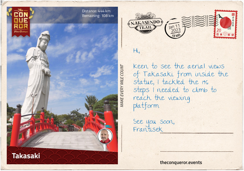
km od začátku : 0444
Takasaki
After Usui Pass I made my way into the city of Annaka, which absorbed four former post-towns: Sakamoto-shuku (#17), Matsuida-shuku (#16), Annaka-shuku (#15) and Itahana-shuku (#14).
Matsuida was an important town as it handled the overflow of travellers when the traffic at Usui checkpoint was backed up with a queue. There used to be a side road in town that was less trafficked which was often used by those who wanted to bypass the checkpoint, making it a perfect smuggler’s lane.
Annaka used to be a castle town. The first castle was burnt down after five years and another was built by Tokugawa Ieyasu’s son. It later became the seat of the Itakuna clan. In 1855, one of the clan members asked his retainers to run up the hill to Usui Pass 18mi (28km) away. This instance was the inspiration for the Usui Pass Run 184, an annual half marathon racing event. The 184 is in reference to the number of turns taken as one ascends the course, gaining 400 metres in elevation.
Less than a mile (800m) from Annaka is Itahana. This was the shortest distance between post-towns. The old route crossed the Usui River twice, as such a teahouse was established in-between the two crossings, aptly named Nakajuku ‘resting place in the middle’. Itahana had a lively nightlife and was a place to escape to, away from the watchful eyes of shogunate officials.
Three miles (5km) further, I arrived in the city of Takasaki and its former post-towns Takasaki-shuku (#13), Kuragano-shuku (#12) and Shinmachi-shuku (#11). Takasaki is known for its Daruma doll, a hollow, round doll, usually painted red, depicting a bearded man. It is meant to symbolise good luck. The town is also known for the towering 138ft (42m) and 6,000 tonne statue of the Goddess of Mercy (Byakue Dai-Kannon). During the Edo period, Takasaki was a castle town and one of the largest towns on the Nakasendo. Given its size it had few inns, most likely because travellers did not want to stay close to the castle and the ruling daimyo.
km od začátku : 0486
Kumagaya
What a fascinating journey this has been so far. I have travelled through 59 post-towns and am down to the last ten. Let’s see what the next three towns (the post-towns have the same name) have to offer.
The highway travels beside the Motokoyama River which flows through Honjo-shuku (#10). During the Edo period, travellers would have to hire a boat to cross the river that was split by land. A local businessman decided to build a bridge that can be crossed by travellers free of charge in the hope that they would come to his shop. Unfortunately, he didn’t have enough funds to build across the entire river, so the travellers still needed to hire a boat for a fee to complete their journey across the whole river.
Coming into Fukaya-shuku (#9), the scene is peaceful with craftspeople sitting on tatami mats doing business over a cup of tea. However, in the Edo era it was a wild place, known for its red-light district and the fierce competition amongst the 80 inns. Fukaya was also a communication hub and the railway station built in 1887 in a Victorian style echoes the Western influence of the late 19th century.
For the next seven miles (11km), the Nakasendo crosses the modern highway many times, all the way into Kumagaya-shuku (#8). Some sections of the highway were lined with ginkgo trees instead of the usual pine trees. Gingko trees are native to China and they are one of the oldest living tree species in the world. Dating back 290 million years, the ginkgo trees outlived the dinosaurs and are commonly referred to as a ‘living fossil’.
Kumagaya is located between Tone River in the north and Arakaway River in the south. In spring, the banks of the Arakawa River burst with colour as the pink cherry blossom trees and the bright yellow rapeseed flowers come into full bloom. Picnickers laden with food and sake flock to the area to celebrate the coming of spring.
In Kumagaya the go-to meal is udon noodles because the wheat used in the noodles is locally grown and rich in flavour. Another popular food is a dessert that originated in the Edo era known as gokabo. It is a sweetened rice cake roll coated in roasted soybean powder. It looks like I may need to find a place that serves both.
km od začátku : 0521
Omiya
The hustle and bustle of modern life and big cities was ever-present as I edged closer to Tokyo. The old post-towns are now just memories with few buildings left as reminders. I reached Saitama, a densely populated city with over a million residents that is part of the Greater Tokyo Area. Very little is left of the five former post-towns. Three have risen to city status whilst the other two became wards in Saitama. Each has retained their original name.
Konosu (#7) was destroyed in WWII, leaving only a stone marker at the location of the former honjin but due to its close proximity to Edo, it was a bustling post-town with 58 inns. However, even more bustling was Okegawa (#6) with 340 inns and numerous entertainment establishments. The nearby Kano Tenjin Shrine was known for its thermal baths that apparently cured several diseases.
Between Okegawa and Ageo (#5) were expansive fields of red flowers that would bloom in summer. Ageo was a flower trading town and the red flowers provided the necessary colour for the cosmetic rouge demanded by high society ladies and geishas.
Omiya (#4) and Urawa (#3) are now wards of Saitama. Omiya was a prosperous town with very comfortable honjins making it a preferred final stop for daimyos and their entourage prior to reaching Edo. Omiya draws its name from a large Shinto shrine that had the highway passing behind it. Regarded as disrespectful to the shrine both the highway and the town were moved in front of it encouraging travellers to visit and make offerings.
A mere two miles (3km) away was Urawa (#3). The old highway was lined with high-rise buildings and the constant noise of modern traffic was a reminder that I was nearing the end of my journey.
km od začátku : 0552
Tokyo
The final two post-towns, Warabi (#2) and Itabashi (#1) are now long distant memories. Nothing remains of the past except a watchtower and a bridge in Itabashi.
The Nakasendo terminates in Tokyo at Nihonbashi Bridge, “Bridge of Japan” and the heart of Edo where all Japanese roads began. When Tokugawa Ieyasu ordered the construction of the bridge, his intent was to make it the central point from which all distances were measured throughout the country. It essentially made the bridge ‘the nation’s cartological zero point’.
The wooden bridge was replaced in 1911 by a beautiful twin-arched stone bridge with candelabras, four lions at the corners and a kirin statue in the centre. During the 1960s, Japan built a massive expressway directly over Nihonbashi, hugely overshadowing this once highly significant and historical bridge. The views are now long gone but before the expressway, on a clear day, Mt Fuji could be seen from the bridge.
Instead of ending my journey at Nihonbashi, I headed to the Imperial Palace to explore. Located within a large park, the palace is home to the Emperor of Japan and built on the site of the old Edo Castle. At the end of the Edo period, the Tokugawa shogun at the time was requested to depart Edo Castle and the Emperor of the new Meiji period moved in. The current palace was built in the late 1880s after the previous one was destroyed by fire. The grounds, surrounded by a moat, are filled with gardens and quaint bridges, connecting the various residences and administrative offices.
Ending my journey with a meander, I reflect on the history of the Nakasendo, the powerful Tokugawa shogunate, the wonderful quiet wooded sections amongst the preserved old post-towns, the steep hills with stone paving and I imagine the massive journeys daimyos would undertake every other year going back and forth between Kyoto and Edo.
Farewell for now.

km od začátku : 0003
Eden
Australia, known as the "Land Down Under," boasts a coastline spanning 37,000mi (59,000km) and more than 20,000 beaches. Due to its geographic isolation and evolutionary history, its incredible coast varies significantly from east to west and north to south. The eastern seaboard is all about sandy beaches, lush national parks and rocky headlands. The west coast has mostly rugged cliffs, secluded bays, and arid land, while the north is tropical, and the south is quite cool. These diverse regions have developed wonderfully unique flora and fauna found nowhere else on Earth.
Exploring any part of Australia is a huge endeavour, given the sheer vastness of this continent and choosing which part of the coastline to explore is a monumental task in itself. Taking into consideration the various options, I settled on the New South Wales (NSW) coast with its closely nestled seaside towns, numerous national parks, including the heritage-listed Royal National Park, Sydney's iconic landmarks, Hunter Valley wine region and, of course, the endless beaches, white sand, surf and watersport options.
To embark on this journey, I arrived in the charming town of Eden, the most southerly town in NSW. Located halfway between Sydney and Melbourne, Eden was once considered a potential site for the Australian capital. While the capital was built elsewhere, Eden became a very important whaling centre in the country.
Whaling ships have been gracing these waters since 1791, with the first whaling station established in 1828. Initially, orcas (killer whales) were seen as a nuisance when, during migration season, they would arrive in Twofold Bay in Eden looking for food and got in the way of the whalers' catch. Whalers discovered a special connection between the Thaua People and the orcas, known as "Beowa." These orcas helped herd baleen whales into the harbour for the Thaua people. In return, the orcas were given the lips and tongue of the prey as food, leading to the unspoken rule, "Law of the Tongue". Observing the success of the Thaua People, whalers developed an unlikely partnership with the orcas, especially with the pod leader known as Old Tom, a male orca measuring 22ft (6.7m) and weighing 6 tonnes. They helped each other for the next 40-odd years until Old Tom, distinguished by his long dorsal fin with a bend at the top, was found washed ashore in 1930. He was so revered and respected that one of the whalers funded the Eden Killer Whale Museum to preserve and display Old Tom’s skeleton.
As I wandered around the museum checking out the displays on shipping, whaling, fishing and anything else maritime-related, including Old Tom’s story, a sound went off, alerting visitors that a whale was seen in the bay. Not losing any time, I took a short sprint to the whale-watching platform near Aslings Beach and squinted toward the horizon, watching for any whale breaching. This is the perfect place for such an experience, as Eden is one of the best whale-watching spots in Australia, as humpback whales make their way south to Antarctica or baleen whales with calves in tow spend a few days in the area feeding and playing before continuing on what is affectionately called as the Humpback Highway.
I finished my day in Eden at the Aslings Beach Rock Pool, a short hike from the whale-watching platform. The rock pool is a beautiful natural wonder with crystal-clear seawater surrounded by stunning pink and white cliffs. After a nice dip in the water, I relaxed at one end of the pool, enjoying the brilliant view of the Tasman Sea, sandy beach and rugged coastline.
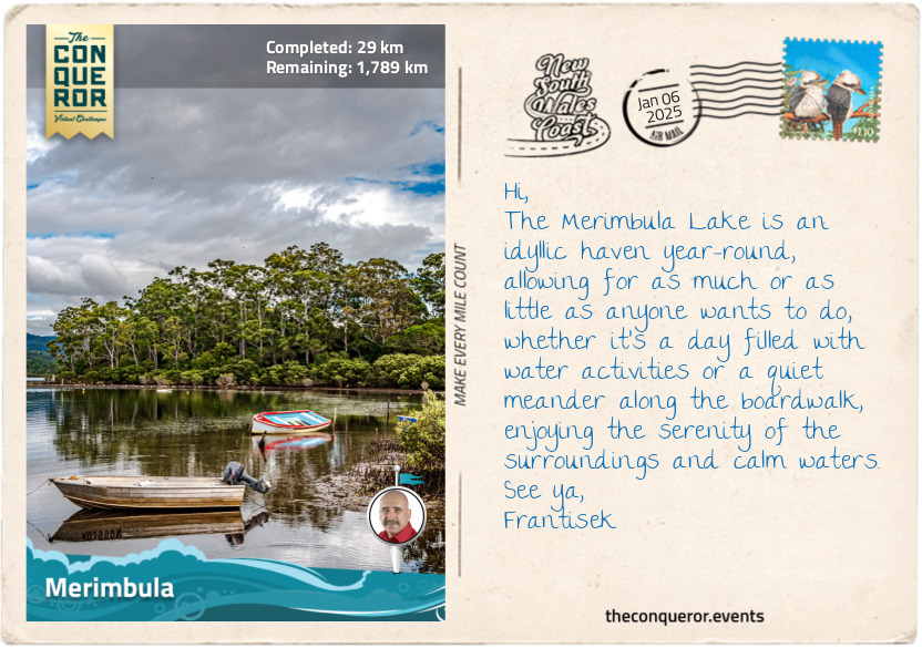
km od začátku : 0029
Merimbula
I left the tranquil coastal town of Eden and headed north toward Merimbula, eager to explore whatever I encountered.
My first stop was at Pambula Lake to take an oyster farming tour because I had heard that the Sapphire Coast is where the best oysters can be found. Some say they are the best in the world, and there’s nothing like having the renowned Sydney Rock oyster straight from the lake. Of course, I had to earn my oyster by learning to shuck it safely, wiggling the knife between the shells until it popped and then gently loosening the oyster from the shell. A squeeze of lemon amplifies the flavour, which is easy to carry when out on a lake. However, if I were in a restaurant, I’d be asking for Oysters Kilpatrick because I love the flavour of tomato sauce (ketchup) mixed with Worcestershire Sauce drizzled on the oysters, topped with bacon bits and baked in the oven. Hmm, I can practically taste it already.
After the lake, I passed through the historic town of Pambula, where the nearby Panboola Wetlands are brimming with birdlife. But before the wetlands existed, the area was home to the Thaua people, who thrived on the abundance of seafood from the Pambula River and rich wetland vegetation. The Thaua were deeply connected to the land through their cultural practices and spiritual beliefs. With the arrival of European settlers in the 1830s, the land was developed until the mid-1990s when a local resident purchased a parcel of land to establish a waterbird sanctuary. Further purchases over succeeding years helped develop the current Panboola Wetlands, where a wide range of birds, such as royal spoonbills and purple swamphen, call it home, and birdwatching and bird photography are a favourite pastime. Bird sculptures are dotted throughout the reserve, and winding paths offer cycling and bushwalking opportunities alongside mangroves, swamp marshes, grassy plains and a freshwater billabong.
Merimbula is a holiday hotspot during the summer months, as families on road trips descend on the town for their vacation. Arriving during a quieter time, I wasted no time immersing myself in the many watersport activities on Merimbula Lake. I challenged myself on a stand-up paddleboard, requiring a significant amount of core strength, followed by a kayak paddle and finished with a refreshing swim.
Once back on dry land, I meandered around the lake’s edge on a boardwalk, passing mangrove forests, eucalyptus trees, and nearby oyster estuaries. It was an easy 2mi (3.4km) return walk, ending my day at Mitchie’s Jetty. I savoured a delicious serving of fish and chips as I watched the sun dip below the horizon. It was a moment of sheer delight, satisfied with my day of exploration.
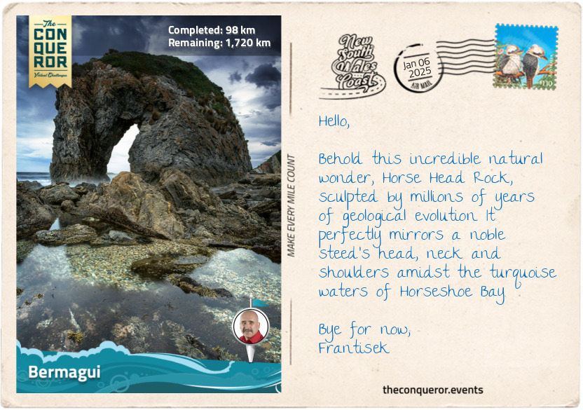
km od začátku : 0098
Bermagui
Leaving the sunset behind in Merimbula, I started my morning on the road again, excited about today’s adventure. I traveled through Bournda National Park, a wonderful park featuring the large saltwater Wallagoot Lake. The traditional owners of the land are the Dhurga and Yuin people, who lived off the land for thousands of years and quarried to make tools. The name ‘Bournda’ means ‘place of tea tree and kangaroos’, evident in the tea-tree-stained lake and ample kangaroos roaming the park. The park also features Bondi Lake, a freshwater lake close to the ocean, and Bournda Lagoon, a half-freshwater and half-saltwater swimming hole that occasionally opens to the ocean. Right next to the lagoon is access to Wallagoot Beach, which leads directly to the lake. In between all this are numerous hiking tracks.
My next stop was Tathra, a small seaside resort home to the last coastal steamer wharf in NSW. Built in the 1860s, the wharf was the last departure point for the iron steamer Bega, a reliable vessel that for 25 years plied the south coast shipping lanes from Eden to Sydney. Bega found its fateful end when it departed Tathra in April 1908 heading for the Commonwealth Bank, laden with cargo, livestock and gold coins, and succumbed to instability, possibly due to incorrect packing, although this was never determined with certainty. Shortly after its departure, the vessel began listing, taking on water at the bow, which slowly entered the deck spaces below. Unable to rebalance, the captain ordered everyone onto lifeboats. Sadly, an elderly passenger died after suffering a heart attack during the commotion. Staying afloat in boats and rafts overnight, the remaining 61 passengers made it to shore more than 12 hours later. The wreck was discovered in 2004, 76 metres below water, north of the town. Bega is now a protected wreck under the Historic Shipwrecks Act, and diving to the site requires a permit.
Continuing my journey, I passed through Mimosa Rocks National Park, which is significant to the Yuin people. The park got its name from the paddle steamer Mimosa that ran aground at its northern end in 1863. The rocks in this area have a fascinating, craggy, castle-like appearance, shaped by the forces of folding, fracturing, and new rock formations. It's said that catching the sunrise at Bunga Head transforms these red lichen-covered rocks into a stunning sight against the backdrop of the pink morning hues.
The park is close to the Ulladulla to Merimbula Important Bird Area, where swift parrots rely on the forest’s spotted gums and flowering eucalypts for food. At 10in (25cm) long, the swift parrot is primarily green with a turquoise crown and red patches above and below the beak. Breeding in Tasmania during the summer, the species migrates across the Tasman Sea yearly to the Australian mainland in search of food. Voted Bird of the Year in 2023, these critically endangered birds are found only in southeastern Australia.
As I entered Bermagui, I headed straight to Blue Pool, another ocean-fed rock pool. It is one of 100 along the NSW coast, and I’m sure I’ll experience many more along my travels. I climbed down the cliff to find an Olympic-sized swimming hole, which was expanded to its current size in the early 1930s. Diving in for a refreshing swim, I dipped my head underwater to find the pool floor teeming with marine life, such as anemones, sea snails and crabs.
After a splash in the pool and some underwater exploration, I dried off and wrapped up my day at two nearby ancient rock formations. The Horse Head Rock, which, no matter the angle viewed, clearly resembled a horse, and the Camel Rock, aptly named after the camel hump-shaped feature. At 500 million years of age and created by underwater avalanches, they are some of NSW's most ancient rock structures.
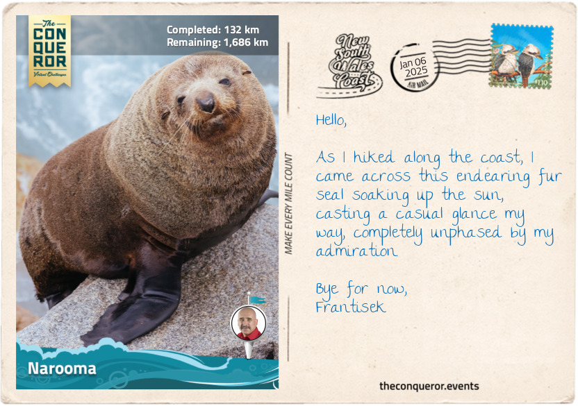
km od začátku : 0132
Narooma
Narooma was a delightful coastal town surrounded by the ocean, lakes and rivers. As I strolled along Wagonga Beach, shaped like a graceful fan, I was mesmerised by the twinkling, azure waters flowing between the breakwaters into the ocean.
Venturing to the opposite side of the beach, I walked to the hilltop lookout, letting the soft breeze brush my face and ruffle my hair as I breathed in the warm, salty air. At the bottom of the lookout was a rock formation naturally carved in what seemed like the shape of Australia, which, unsurprisingly, was called Australia Rock. But it was the lively inhabitants of Seal Rocks that truly stole my heart as I watched the local seals bask in the warm sunlight, playfully frolic in the water, and engage in friendly sparring, each vying for their spot to laze upon the sun-drenched rocks.
Eager to explore the waterways of Narooma, I hopped on a boat ride to enjoy the tranquility of Wagonga Inlet and the native greenery lining the shores. As the boat glided across the inlet, I imagined casting a line into the water. Reeling in a nice catch would have made for a terrific barbie, as they say in Oz (BBQ for most folks), with a squeeze of lemon and a Mediterranean marinade of garlic, paprika, cumin, tomatoes, onion, and capers. Hmmm, finger-licking good.
Instead, binoculars in hand, I scanned the skies and the horizon, hoping to catch a glimpse of herons or ibises, and I was rewarded with an osprey. Have you ever seen them swoop above the water to catch their prey? From heights as high as 100ft (30m), they pluck the fish from the water with their curved claws, then cleverly carry them headfirst to minimise wind resistance.
However, the highlight of my journey was a short side trip to Montague Island, where hundreds of fur seals frolicked among the island's granite rocks. Eager to swim with them, I donned my snorkeling gear and jumped in the crystal-clear waters surrounding the island. To my delight, the playful seals were not shy at all. They came in droves, curious to investigate me, a strange creature in their midst, with arms as flippers and legs as fins. It was a truly magical experience, made even more special by the wonderfully sunny day that bathed the underwater world in bright, clear light.
Eventually, as the day drew to a close, I reluctantly bid farewell to the seals and Narooma. With my heart filled with cherished memories, I continued up the coast toward Moruya.
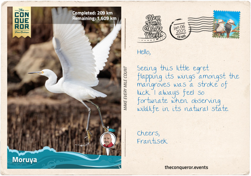
km od začátku : 0209
Moruya
A name like One Tree Point Lookout must raise anyone’s curiousity, including mine. I was delighted to discover this lovely spot in Tuross Head, overlooking the ocean flanked by pristine beaches with a single tree at the end centre of it. It’s a great place to picnic under the shade of the tree while whale watching or dolphin spotting.
The waterways here are a true paradise for watersport enthusiasts. Tuross Head is on a headland between Tuross Lake to the south and Coila Lake to the north. As Tuross River meanders into Tuross Lake and toward the ocean, it develops a system of channels and backwaters that become the perfect playground for kayakers and anglers.
I arrived in Moruya, situated on the banks of the Moruya River. It is a quiet town steeped in history, especially surrounding Granite Quarry, which was highly regarded for the quality of the granite. In the early 20th century, around 250 stonemasons from Australia, Scotland and Italy moved to Moruya, where they quarried over 173,000 blocks of granite to dress the pylons and piers of the iconic Sydney Harbour Bridge. The quarry closed in 1932 after 7 years in operation.
Today, Moruya is known for its weekly farmers market, where local producers offer fresh and locally grown and harvested goods. After buying some fresh veggies for my cheese, I took a gentle paddle on the river to observe birds frolicking. My highlight was the Australian pelican stretching its incredible wings. Primarily white, the pelican has black wings with a wingspan of up to 10ft (3m). It’s also known to have the longest bill of any bird in the world, with the longest on record measuring 20in (50cm). After a few cormorants, black swans (a native of Western Australia) in flight and a sunken sand barge, I wound up my day and headed for the local bakery, where I’m told that the lemon-filled doughnuts are a must-have.
The next destination is the very popular Batemans Bay.
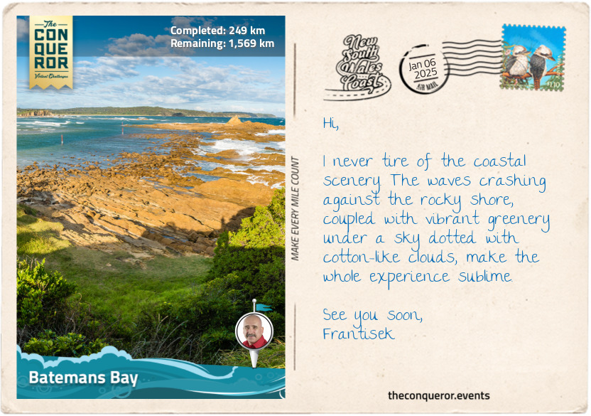
km od začátku : 0249
Batemans Bay
Located on the Eurobodalla Coast, Batemans Bay is the largest town in the region and a popular beach destination, particularly for travellers from Canberra, the capital, owing to its proximity. The town lies within Walbunja Country, traditionally owned by the Walbunja people.
The bay’s name was given by explorer James Cook while on his first expedition in the late 18th century when he was charting and naming landmarks as he saw them. It is unclear what prompted this particular name and whether it commemorated anyone he knew. During colonisation, NSW was separated into 19 counties, of which Moruya was the official southernmost point. Settlers could not obtain land outside these boundaries, mostly because of the wilderness and unknown dangers. However, it didn’t take long before squatters crossed these boundaries to graze their large numbers of livestock.
These days, Batemans Bay is home to the Sculpture for Clyde Festival, an annual exhibition of large-scale sculptures, from which the winning artworks are permanently installed on the Clyde River as part of the Sculpture Walk trail. The best way to explore it was to take a leisurely ride and stop at the ones that intrigued me the most. My favourite was Tides by Joel Adler because the sculpture was made from steel that was once part of the historic Batemans Bay Bridge. The artist used two main pieces of the bridge's structure as the base of the sculpture, keeping it mostly unchanged and maintaining some of its historical features. Another clever design was Buoyansea by Jesse Graham, who used a buoy as the base of the artwork and attached tentacles to it, now resembling a 6ft (1.8m) tall upside-side octopus.
I continued my leisurely ride until I reached Caseys Beach in Batehaven to dip in the beautifully clear waters and snorkel. As I explored the rocky reefs and swam among the seaweed beds, I was treated to a few species of fish, such as the red morwong with its large fleshy lips, the large-tailed bluish-grey luderick, and bream, which, if cooked, has a nice meaty, rich flavour without the strong fishy taste. I reveled at my encounters while I was hoping, although to no avail, also to encounter lobsters or gropers.
Having built up a healthy appetite, I sourced a restaurant in the marina with gorgeous water views. I feasted on fresh seafood, starting with Sydney Rock Oysters from Narooma topped with wakame seaweed and a good squeeze of lime, followed by a fisherman’s basket with delicious crumbed calamari and prawn cutlets, beer-battered fish, hot, crispy chips (fries) and tartare sauce for dipping.
My next stop is Pebbly Beach to look for the water-loving kangaroos.
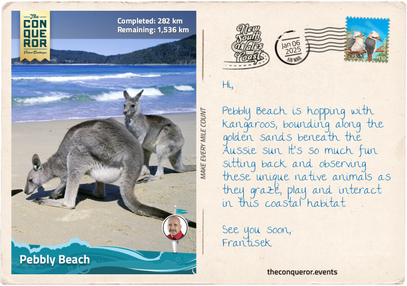
km od začátku : 0282
Pebbly Beach
Aside from being a picturesque spot on the coast, a very good reason to visit Pebbly Beach was to enjoy the beach-loving eastern grey kangaroos. Lounging about and grazing on the nearby grassy area, the kangaroos weren’t particularly fussed by the presence of humans, probably because they are accustomed to human visitors on this sheltered beach within the Murramarang National Park.
Eastern grey kangaroos are the second largest and heaviest marsupials native to Australia. They are usually found in the eastern third of the country, from the northernmost point of Queensland down to a few parts of Tasmania. One fascinating fact about these mammals is that they are very good swimmers, hence very comfortable hanging around Pebbly Beach. They will take to water to evade predators and then attempt to lure them in. If they succeed, the predator swiftly becomes the prey because the kangaroo will hold its head underwater until it drowns. The strong muscular body, hind legs and powerful tail are not to be trifled with, even when they seem docile and tolerant of people. Interaction in the wild is best done at a distance, but if an opportunity arises in a safe environment to touch their soft coat, know that it is a wonderful experience only surpassed by seeing a joey pop out from the mum’s pouch to check out the surroundings before tucking itself away and out of view.
Murramarang National Park stretches along the coast for 27mi (44km) and is one of the rare places where spotted gums, endemic trees to eastern Australia, grow all the way down to the ocean. Spotted gums are a small group of eucalypts, and it is a fascinating study as their smooth, mottled bark peels away in patches. Beneath the bark is a creamy white to grey surface. Run your hands over the smooth trunk next time you get a chance. Because the bark grows back at different rates, the trunk gets a colourful spotted pattern that can create a beautiful abstract image when photographed.
“Old Blotchy” is a well-known tree to locals near Temeil because it is supposedly the oldest surviving spotted gum, estimated at 400 years old. Having been around so long, its girth measures 36ft (11m), is 193ft (59m) high and, as such, made it into the National Register of Big Trees. While its crown is a fair way up the trunk, it is interesting that some of its limbs have grafted together, creating fascinating twists and knots along its branches, a phenomenon known as limb inosculation.
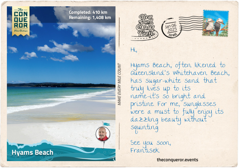
km od začátku : 0410
Hyams Beach
After admiring the sheer size of ‘Old Botchy’ and feeling somewhat small-sized in comparison, I made a beeline for Booderee National Park in Jervis Bay, which has a unique status as a territory on its own.
Jervis Bay has a governance structure separate from New South Wales and is strategically important as a deep-water port and naval base. The Australian Navy's HMAS Creswell, located near Jervis Bay Village, serves as a training facility and plays a vital role in the country's defense capabilities.
Within its territory and at the heart of Booderee lies its botanical jewel, the Booderee Botanic Gardens, the only Aboriginal-owned botanic garden in Australia. The site was originally a farm owned by piano manufacturer Octavius Beale, aimed at growing timber for piano frames, but the plantation failed. In the mid-20th century, the Australian National Botanic Gardens developed it as a botanic garden until 1995, when it became independent, and the local Koori community became its owners. The gardens are spread over 80 hectares and focused on the Aboriginal use of plants for bush food and medicine.
The park's name means 'bay of plenty' in the Dhurga language, and it is home to more than 450 species of native plants, including beauties like Eucalyptus summer red, a flowering gum tree with gorgeous pinkish-red flowers that are rich in nectar, thereby attracting bees and nectar-loving birds like New Holland honeyeater. Another interesting-looking plant is the Kangaroo tail, a grass tree with a tall, dark, spear-like central trunk covered in tiny, densely packed white flowers that produce sweet nectar. Indigenous Australians soaked the flower in water to make a sweet drink, and the resin exuded from the flower’s spide was used as an adhesive to make tools and as lacquer for furniture.
Aside from the village and the territory’s defence role, Jervis Bay is also an oceanic bay that is incredibly beautiful with its white sands and turquoise waters. Just a stone's throw away from Booderee, back in NSW, lies Hyams Beach, a spot of paradise renowned for its pristine white sand.
I took a short walk behind the beach, on a trail through coastal forest and sand dunes, to do a little more birdwatching. I kept my eyes peeled for the colourful crimson rosellas and the eastern spinebills, which were a little harder to find since they were only 6in (15cm) long. Once finished, I returned to the village via the beach and enjoyed listening to the squeakiness of the sand beneath my feet.
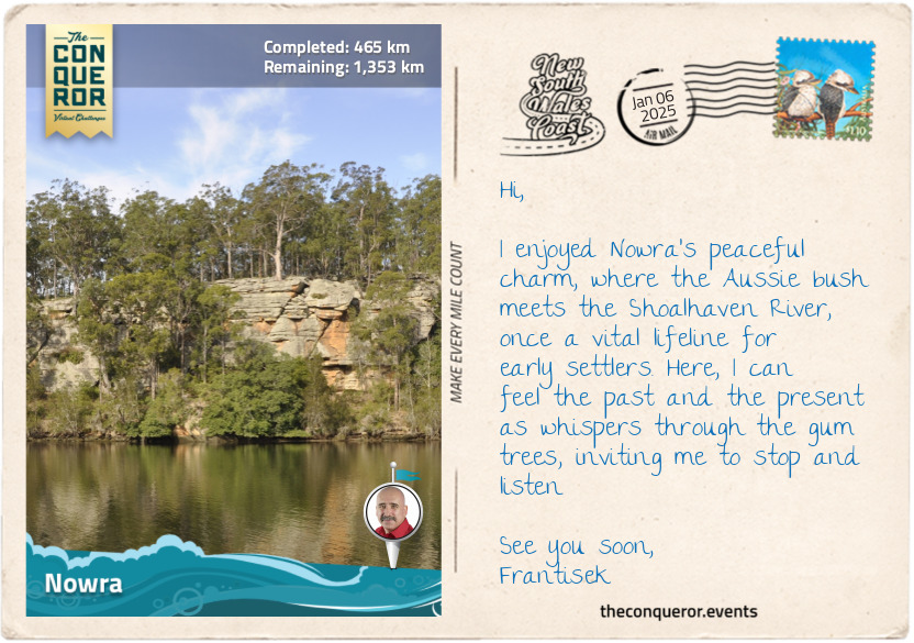
km od začátku : 0465
Nowra
Leaving the coastal area, I followed the Shoalhaven River inland to Nowra, the regional hub for the Shoalhaven district. Nowra was settled by Europeans in 1857, with dairy farming and timber as the main industries. Prior to settlement, Nowra was inhabited by the Wodi-Wodi tribe of the Yuin nation, to whom the town’s name meant black cockatoo.
There are several renowned historical figures in and around Nowra, beginning with Mary Reibey, who appears on Australia’s $20 note. Originally born Molly Haydock, Mary was convicted for stealing a horse in England when she was 13 and shipped to Australia in 1792 to serve as a nursemaid. She married at 17 and built a successful enterprise across various industries with her husband. Mary applied for a land grant in the early 1800s in Burrier, west of Nowra, where her descendants continue to live. Highly respected for her charitable works, Mary’s property in Macquarie Place, Sydney, was the founding location for the Bank of NSW.
On the northern banks of the Shoalhaven River stands the Bundanon homestead, a double-storey 19th-century sandstone house, once the home of famous artist Arthur Boyd. Purchased in the 1970s and expanded to include a home studio, Boyd painted many Shoalhaven landscapes, capturing the region’s essence. His most significant work is the Great Hall Tapestry in Parliament House, Canberra. Measuring 65ft (20m) long by 30ft (9m) tall, the work features a forest of towering eucalyptus trees from Boyd’s home and pays homage to Australia’s distinctive bush landscape.
Adjoining Bundanon are several other properties, including Eearie Park, once occupied by equally famous artist and Boyd’s brother-in-law, Sir Sidney Nolan, known for his series of 27 paintings depicting bushranger and outlaw Ned Kelly. Another one of his significant works is the 65ft (20m) long mural of the 1854 Eureka Stockade, a miners’ uprising against oppressive mining licences and authority and the struggle for rights and reforms during colonial Australia. A very important event in the country’s history, the painting style was influenced by indigenous Australians’ sandpainting technique using a finger-and-thumb stroke. The artwork hangs in the Reserve Bank of Australia’s Melbourne office.
The last famous figure from the area is a Thoroughbred racehorse named Archer. One of the year's biggest events is the Melbourne Cup, where the city itself comes to a standstill as people flock to Flemington Racecourse not just for the race itself but also for the vibrant atmosphere, fashion, socialising, and celebrations accompanying this iconic event. Anyway, Archer was a reddish-brown stallion who arrived in 1860 at Nowra to be trained by Etienne de Mestre. A year later, Archer entered the inaugural 2mi (3km) Melbourne Cup. Neither Archer nor Etienne, as the trainer, was favoured at the races until Archer took first place, winning the very first Melbourne Cup. He won it once again in 1862. Archer has had 8 major wins in his racing career and, in 2017, was inaugurated in the Australian Racing Hall of Fame, while Etienne was added in 2002.
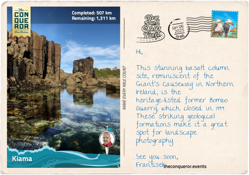
km od začátku : 0507
Kiama
Entering the Illawarra region, I headed to Kiama to check out its two blowholes. Unsurprisingly, the word Kiama is derived from the Aboriginal word ‘kiarama’, meaning ‘place where the sea makes a noise’, which refers to the blowholes.
Before European settlement, the land was occupied by the Wodi Wodi people. Evidence of midden shells, an accumulation of discarded shells, is found near Bass Point, indicating indigenous settlement from more than 17,000 years ago. Once the Europeans arrived in the 1800s, the area was initially used for wheat farming because of the nutrient-rich volcanic soil and abundance of rain. However, it was unsuccessful, and the community switched to dairy farming. The Kiama Pioneer Butter Factory was the first Australian factory to successfully send butter to Great Britain for consumption instead of to make soap. The factory was also the first to use cream separators to ensure consistent fat content and efficient dairy production.
By the early 20th century, the town was booming, quarrying basalt for road paving and railway ballast and developing a harbour for steamships to transport blue metal stone to Sydney for construction. A highlight of this booming era can be seen through the row of wooden terraces along Collins Street. The weatherboard houses, featuring gabled iron roofs, small-paned windows and simple verandahs, were built in the late 1870s as quarry workers’ cottages. Among them were properties that served as an inn and the town’s post office. Following the Depression Era and World War 2, the quarries closed, and the houses fell into disrepair, being threatened with destruction. Fortunately, a local company saw their potential and saved the properties. They were restored and converted into shops, although a few are used as private homes, that continue to grace the street today. In the 1980s, they were protected by being added to the National Trust of Australia register.
Leaving history behind, I walked past the Kiama Lighthouse and down to a lookout platform where the largest blowhole in the world was putting on a show, spewing water as high as 98ft (30m) up in the air from an 8ft (2.5m) opening. Next, I followed the coastal trail to yet another rock pool, where I took the opportunity to relax and take a refreshing dip.
km od začátku : 0555
Wollongong
The further north I headed, the more I realised how much closer I was getting to Sydney and its urban expanse. Only 50mi (80km) south of Sydney, I arrived in Wollongong, the state’s third-largest city and Australia’s tenth-largest. Nestled between the rugged Illawarra Escarpment and the Pacific Ocean, Wollongong was first occupied by the Dharawal people. The name "Wollongong" is derived from an Aboriginal word meaning "sound of the sea" or "ground near water”.
George Bass, an explorer and surgeon, and Matthew Flinders, a navigator and cartographer, both with the British Royal Navy, were the first people to explore the southeastern coast of Australia, more specifically, their 1796 expedition navigating and charting parts of the coastline around present-day Wollongong. Their insight into the Illawarra region helped with its development and opened up the area for eventual colonisation.
Coal mining and steel industry accelerated the city’s development in the late 19th and early 20th centuries. Throughout the 1900s, the city's economy continued to evolve in the healthcare, tourism and education sectors. Most notable was the establishment of the University of Wollongong in 1951, which grew into a well-regarded educational and research institution in information technology, engineering and environmental sciences.
One of the major community highlights in Wollongong is the annual Illawarra Folk Festival held at the Bulli Showground each January. Launched in 1985 as an opportunity to celebrate folk music and dance, the festival has grown to a four-day extravaganza, attracting thousands of attendees to join in the community spirit, attend workshops, and interact with artists while enjoying an international lineup of a wide range of folk music genres. Close to 100 artists put on a show, be it singing, poetry readings, yarn spinning (‘yarn’ is Aussie slang for telling tales), indigenous performances and even circus gigs.
A little southwest of Wollongong in the suburb of Berkeley is Fo Guang Sha Nan Tien Temple, the largest Buddhist temple in the Southern Hemisphere. Set amidst a sprawling landscape, the temple complex features the Nan Tien Institute, an accredited educational centre focused on Buddhist studies, meditation and retreat lodgings, a beautiful 8-storey pagoda with curved eaves, and a pond densely filled with blooming lotuses. The centrepiece of Nan Tien Temple is its magnificent main shrine hall, adorned with intricate traditional Chinese architectural elements, ornate decorations, and thousands of small Buddhist statues on the walls.
As I usually enjoy finishing my day’s journey near the ocean, I wandered to Wollongong Head, from where I could explore a few more landmarks, including two lighthouses, the only ones on Australia’s east coast to be so close to each other, the heritage-listed harbour precinct, and three 68-pounder guns, now defunct, from the former military Flagstaff Hill Fort.
km od začátku : 0583
Sea Cliff Bridge
I always marvel at the engineering feat of building any kind of bridge, including its design, functionality, and the complexity of connecting two landmasses. Structures like the Navajo Bridge in the Grand Canyon, 476ft (145m) above the Colorado River, or what seems like a rickety suspension bridge when crossing Hillary Bridge in Nepal on the way to Everest Base Camp, but find that it is sturdy with dazzling views over Dudh Koshi River, or the mind-boggling 22mi (35.7km) long Hangzhou Bay Bridge in China built to shorten the highway route between two cities, never cease to amaze me.
Then there are the architectural beauties around the world like the UNESCO-listed cantilever Firth Bridge in Scotland, carrying 200 trains per day, the famous suspension Golden Gate Bridge in San Francisco that’s featured in more movies than any other bridge in the world, or the cable-stayed pedestrian Helix Bridge in Singapore inspired by the double helix of DNA.
The commonality of all these bridges is the need to cross some form of waterway. However, there are instances where a bridge must navigate around a cliff face while maintaining a safe distance to avoid falling rocks. The Sea Cliff Bridge between the small coastal towns of Clifton and Coalcliff is one such example.
The section between Clifton and Coalcliff was originally serviced by the Lawrence Hargrave Drive, a scenic road regularly prone to rock falls, erosion and mudslides, especially after high rainfall. When a large embankment slip caused the road's closure in 2003, restricting access between towns and large centres like Wollongong, the local community strongly protested and an alternate plan was developed.
Building the bridge was a complex task. Engineers conducted detailed geological studies to deal with falling rocks. They also needed to protect the coastal environment, ensuring marine and land habitats were not harmed. Specific design methods were chosen so the bridge could withstand strong winds and saltwater conditions. Furthermore, the steep and rough terrain made construction difficult, requiring special techniques and equipment.
The result was a 2185ft (665m) long curving bridge around the contour of the cliff face, 135ft (41m) at its highest point. It opened in 2005 with two lanes, shoulders on either side and a pedestrian walkway. The bridge’s lifespan is estimated at 100 years.
Experiencing this engineering marvel on foot was a must. I strolled across the bridge, taking my time, absorbing the vastness of the Pacific Ocean to one side and the dramatically rising cliff face on the other. I almost felt suspended between the ocean and the cliffs. Add a sunny day to this, and the experience was pure bliss.
km od začátku : 0615
Royal National Park
Shortly after crossing the Sea Cliff Bridge, I arrived at the southern end of the Royal National Park. Inaugurated in 1879, it is Australia’s first national park and the world’s second oldest after Yellowstone in the United States. Originally known only as National Park, in 1955, it was renamed after Queen Elizabeth II passed by in a train on her Australian tour.
I started with the Coastal Track, excited to explore the rugged cliffs and native bushland. My first destination was the Figure Eight Pools at the base of the cliffs, which required quite a bit of backtracking to get to it but was worth the effort. As the name suggests, the pools, carved out of the relentless pounding of the waves, were indeed in the shape of the number 8. The water was crystal clear. Tempted, I stepped in for a refreshing dip.
I carried on, sometimes above the cliffs, sometimes at sea level on a beach, until I reached Eagle Rock, a fabulous rock formation jutting out into thin air, which, when seen from a certain angle, indeed resembled an eagle’s head. Nearby, the Curracurrong Falls plunged 328ft (100m) into the ocean below.
The track followed close enough to the cliff’s edge, giving me the most incredible panoramic views of the ocean and the shrub-covered landscape. As I marvelled at the sights before me, I stumbled upon Wattamolla Falls, cascading into the emerald-coloured water below. A viewing platform at the top gave me a perfect vantage point to admire its beauty, but I was unable to resist the allure of the falls. I descended to the base, where I indulged in a ‘waterfall shower’, letting the cascading water wash over me in a moment of utter joy.
At Marley, I turned inland for a hike on the Marley Track, a rugged and narrow trail through heathland. It was a solitary and tranquil experience, allowing me to immerse myself fully in the natural surroundings. Along the way, I kept my eyes peeled, hoping to come across the Gymea lily, a magnificent Australian native plant known for its spectacular red flowers and unique appearance.
From Marley Track, I connected with the Winifred Falls Track, which led me through dense forestry of eucalyptus trees and down a steep descent to the pools at the base of the falls. Winifred Falls, though not particularly tall, was quite attractive as the water gently tumbled over an overhanging slab of rock. While resting, I was delighted to spot a sulphur-crested cockatoo. These striking birds, native to Australia, are known for their bright white plumage and distinctive yellow crest, which they raise when alarmed or excited. They are highly intelligent and social birds, often seen in noisy flocks. It was a treat to observe it in its natural habitat.
From here, I followed the trail a little further until I reached the suburban outskirts of Sydney, heading toward Botany Bay.
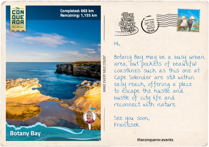
km od začátku : 0663
Botany Bay
Botany Bay (Kamay in Dharawal, the indigenous name) is steeped in the history of Australia’s colonisation days. It is a tale of two eras, where the untouched natural beauty first witnessed by Captain James Cook in 1770 starkly contrasts with today's bustling urban landscape. To appreciate Botany Bay’s evolution from an untamed landscape to an industrial and residential hub, I need to step back in time before I fast forward to the present day.
Let’s take a look at Botany Bay in 1770. Imagine standing on the deck of the HMS Endeavour as it approached the pristine shores of Botany Bay in April 1770. Captain James Cook and his crew were the first Europeans to set foot on the land. They were greeted by a landscape of unspoiled beaches, dense forests, and a cacophony of bird calls. Cook initially named it "Stingray Harbour" due to the abundance of stingrays. It was later renamed "Botanist Bay" and then settled on Botany Bay after the unique plant life catalogued by the ship’s botanists, Joseph Banks (the flower Banksia was named after him) and Daniel Solander.
When Joseph Banks returned to Britain, he became interested in colonisation. He recommended Botany Bay as a suitable site for a penal colony. The First Fleet of 11 ships arrived in January 1788, filled with more than 700 convicts. When Governor Arthur Phillip arrived on his ship HMS Supply, he swiftly concluded that the land was unsuitable due to insufficient fresh water, being too swampy, water too shallow to anchor ships and trees too hard to cut down. The fleet relocated further north in Port Jackson. A year later, Captain John Hunter, who would later succeed Phillip as governor, found Botany Bay suitable and began the area's settlement.
Now, let’s fast forward to the present day, where Sydney Airport’s runways extend into the bay. The skyline is dominated by the towering cranes and container ships of Port Botany, one of Australia’s largest and busiest ports. The untouched shores are long gone, though the sandy beaches are still present, albeit dotted with pathways and recreational facilities.
The dense forests that once lined the bay have largely given way to urban development. Patches of green remain in the form of protected parks and reserves, such as Botany Bay National Park, preserving some of the nature that Cook saw more than 250 years ago. The birds that flitted in the eucalyptus forests are still around, perhaps not as many or as diverse. However, the unmistakable screeching sound of the cockatoos or glimpses of vibrant parrots can still be experienced, having adapted to the urban environment.
Throughout Botany Bay’s history, the Dharawal people have been the Traditional Owners of the land, having lived here for thousands of years. Today, the Dharawal people continue to contribute to the identity and care of Botany Bay, ensuring their legacy continues and their traditions and stories are preserved.
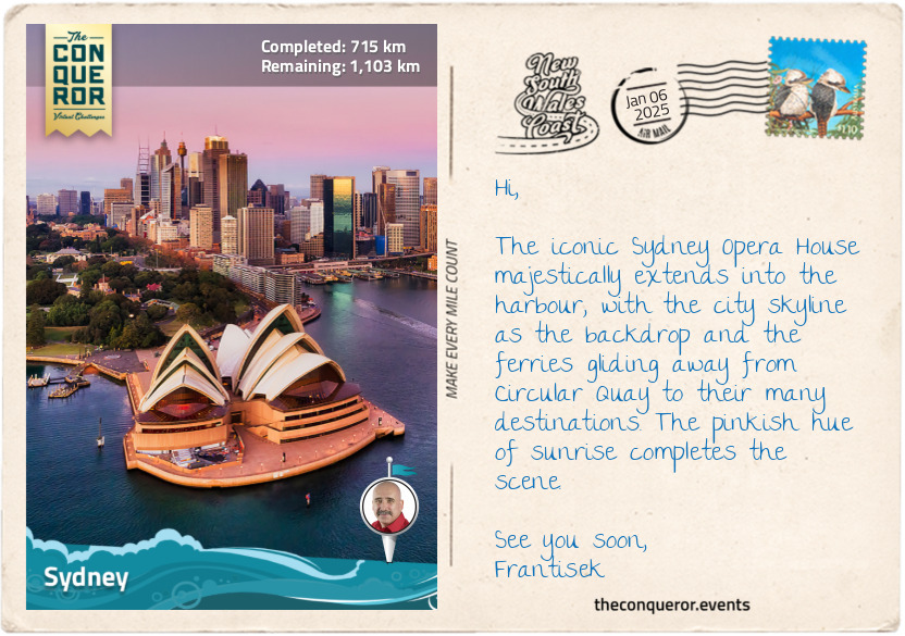
km od začátku : 0715
Sydney
There is no greater cosmopolitan location on the NSW Coast journey than the state’s capital, Sydney. As the largest and most iconic Australian city, it is widely known for two of its most famous landmarks, the Sydney Opera House and Sydney Harbour Bridge.
Sydney is a complex landscape, given its extensive waterways and varied topography. It is a sprawling urban area with the Pacific Ocean to its east, national parks to its north and south and stretching west all the way to the Blue Mountains. The Paramatta River cuts through the landscape as a major tributary of Sydney Harbour (also known as Port Jackson). The natural harbour is one of the largest and most picturesque in the world.
Bridges and tunnels connect various parts of the city for vehicular transportation, while water taxis and a network of ferries connect commuters from their suburban homes to downtown. Catching one of the commuter ferries from Circular Quay is a great and economical way to explore Sydney and visit attractions like Taronga Zoo or its prettier suburbs, like Manly or Watson Bay.
With so much water surrounding the city, it is expected that it will have an endless supply of gorgeous beaches, from the famous Bondi Beach with its vibrant beachfront scene to Manly Beach, known for its laid-back atmosphere, Coogee Beach, popular with families and Palm Beach, where the long-running TV show “Home and Away” is filmed.
There are so many points of interest in a very contained space that it would require an independent journey to Sydney alone to cover its extensive history from early colonisation to the financial and commercial hub it is today. But a roundup of some highlights would include exploring The Rocks, Sydney's oldest neighbourhood steeped in colonial history, marvelling at the architectural wonder of the Sydney Opera House, and for the courageous, climbing Sydney Harbour Bridge to take in the views from the top. My favourite activity is a wander around Darling Harbour to visit the elegant Chinese Gardens and check out the historic vessels at the Maritime Museum, particularly the tall ship James Craig.
The city’s business centre juxtaposes historic buildings and modern skyscrapers. The Queen Victoria Building is a stunning example of Victorian architecture, housing boutique shops and cafes, contrasted by the sleek, glassy facades of the commercial buildings, upscale restaurants and luxury boutiques in the Barangaroo precinct.
Much as I wished to continue exploring Sydney, the rest of the coast awaited, so I pushed on to my next destination, Ku-ring-gai Chase National Park.
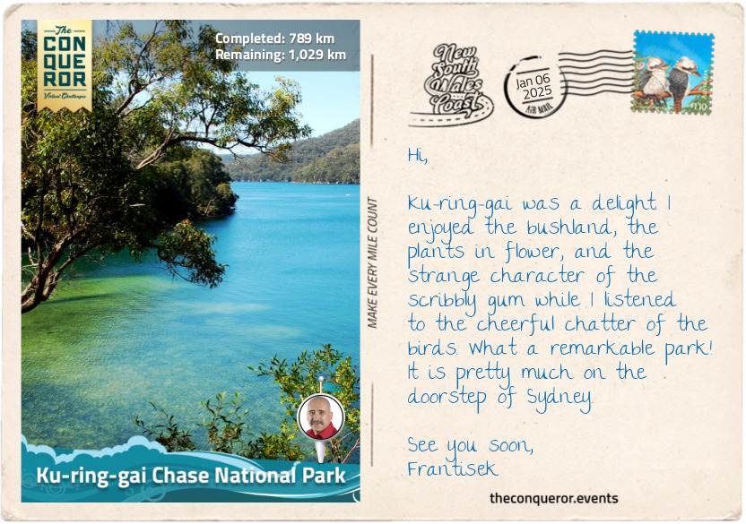
km od začátku : 0789
Ku-ring-gai Chase National Park
While not completely out of Sydney, I am, however, on its outskirts, visiting the third oldest Australian national park. Established in 1894, Ku-ring-gai Chase National Park is beautifully located south of the Hawkesbury River. The park is a wonderful display of untouched bushland, sheltered coves, and sparkling blue water views.
Ku-ring-gai’s plant life is quite diverse, with more than 1000 species recorded. It features low, shrubby heathland, eucalypt trees such as Sydney peppermint and red bloodwood, whose sap was used in traditional medicine to heal open wounds, burns and sores. The small area of rainforest includes the dense, glossy-leaved Lilly Pilly, an evergreen tree with pink summer flowers and edible winter fruit. The fruit varies from tart to sweet, and its high acid content makes it a perfect candidate for homemade jams or preserves.
A quirky eucalypt tree found in the park is the scribbly gum, so-called because of the scribbles found on its smooth trunk made by moth larvae. The moth grub tunnels between the old and new bark, and as the old bark sheds, the new marks appear. The trunk of the tree was often used by Aboriginal people to make coolamons (vessels) or, in Wiradjuri, known as guliman. The coolamons were vessels used to carry water or collect bush tucker, like fruit and nuts. Cuts were typically made on the south side to minimise stress on the tree, as evidenced by the scars on the tree. The tree's usefulness extends further by providing a home in its hollows and nectar from its flowers to possums, flying foxes, owls and parrots.
There is no shortage of wildlife in the park, but many are shy, nocturnal creatures like possums, gliders, bandicoots and swamp wallabies. Then there’s the common bent-wing bat that managed to colonise itself over the last 15,000 years from southern Europe to Asia, Africa and all the way south to Australia. More than 100 species of butterflies inhabit the park, with beauties like the Delias nigrina (common Jezebel) with white and black-tipped topside and a black, yellow and red underside.
The park is on the traditional lands of the Guringai Nation, from which the name is taken. A very important place is the Red Hands Cave at the park's northern tip. It provides physical evidence of their ancestors through a red handprint on the rock, engravings in the soft sandstone on the ground by the Garigal people of the Gurangai Nation, and a spiritual connection to their past.
Ku-rang-gai was vast, with many tracks through the bush, some leading to secluded beaches or expansive views of the central coast. From the highest point on the Willunga Track, the outline of Sydney and the suburb of Chatswood was visible to the south.
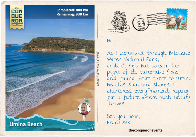
km od začátku : 0880
Umina Beach
Soon after leaving Ku-ring-gai National Park, I arrived at the Peats Ferry Bridge. Opened in 1945, it connected Sydney to the Central Coast until 1973, when the adjacent Hawkesbury River Bridge replaced it as part of the Pacific Motorway (M1). The bridges span the Hawkesbury River, a 75mi (120km) long tributary that, together with the Nepean River, nearly encircles Sydney’s metro region. The Hawkesbury River is a water lover’s haven with deep gorges and lush, forested banks – allowing anything from boating, fishing, and kayaking.
Not far from the bridge is the Brisbane Water National Park (est. 1959), containing several rare and endangered flora. The Grevillea shiressii is a vulnerable plant species with clusters of flowers that start green, turn blue-grey and then become a translucent cream. It is endemic to NSW, found only in the park’s surrounding area. Several other vulnerable plants exist, such as Camfield’s stringybark, Somersby mintbush with pale mauve flowers and Thick-leaf Star-hair. One flower that was thought to be extinct, the Donkey Orchid, so-named because of its ear-like petals, has reappeared.
In addition to its flora, the park is also a sanctuary for rare and endangered fauna, such as the nocturnal squirrel glider that likes the hollows of Acacia trees and Banksia shrubs; the spotted-tail quoll, the second-largest carnivorous marsupial in the world, after the Tasmania devil; and the cuddly-looking, fluffy-eared koala that is typically found snoozing in a eucalyptus tree or chewing on its leaves.
One of the park's highlights is the Kariong Brook Falls. Off the main track, the waterfall is hidden in dense bushland, but once there, it is a perfect, secluded spot to swim, soak in the atmosphere, and watch it cascade over the cliffside.
Continuing my journey, I passed by Pearl Beach, a quaint coastal village and hiked up to Mount Ettalong Lookout for panoramic views of Broken Bay, Lion Island and my constant companion, the Pacific Ocean stretching before me. I stopped at a picnic table beneath the towering Sydney Red Gums for a snack and captured a few photos for my collection.
As the afternoon sun began to dip, I reached Umina Beach, an ideal coastal town with a long and wide stretch of unspoiled beaches. Umina is known for its excellent surfing conditions, and I watched, seated on the beach, as the surfers effortlessly rode the waves or diligently waited for the next one.
I finished the day at the nearby ferry terminal as I waited to catch a ferry ride across Broken Bay to Wagstaffe on the Bouddi Peninsula.
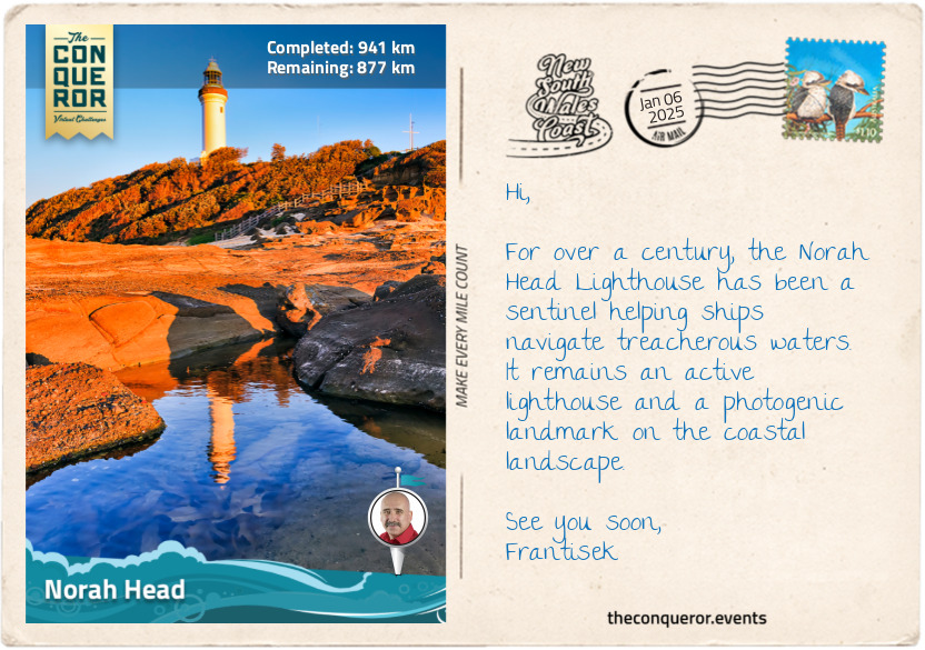
km od začátku : 0941
Norah Head
From Wagstaffe, I set off towards Norah Head with my first stop at Bouddi National Park, tackling the 5mi (8km) trail from Putty Beach to Macmasters Beach. It was an incredible, rugged track, just like the coastline, with a nice lookout at Gerrin Point. The sea was wild as it smashed against the coastline, showing its powerful force. The trail descended onto the beach at Maitland Bay, named after SS Maitland, a paddle steamer that wrecked offshore in 1898. The park’s boundary extends about 984ft (300m) into the Tasman Sea and is frequented by whales, dolphins, and seals.
Keeping an eye on the sky, I was hoping to see an osprey or sea eagle as I ventured on northbound until I reached The Entrance, a small town where Tuggerah Lake meets the Pacific Ocean through a narrow tidal channel. Pelican feeding is a major attraction, a tradition that started in the late 20th century, and so is fishing, with catches including whiting, bream and flathead.
Next, I circled around Tuggerah Lakes, a wetland system consisting of three interconnected lakes, with Tuggerah Lake being the largest. Interestingly, while all three lakes are quite large, with a combined perimeter of 65mi (105km), none exceed 6.5ft (2m) in depth, making them quite shallow. Because of the shallow water, it has extensive beds of seagrass attracting waterbirds like sharp-tailed sandpipers, chestnut teals and black swans.
I finished my day’s wanderings at Norah Head, a sleepy coastal village and headland home to the historic 1903 Reflections Norah Head Lighthouse. During World War II, several naval battles occurred near here, resulting in the sinking of the Nimbin in 1940 and the fishing trawler Millimumul in 1941. When the SS Iron Chieftain was sunk by a submarine in 1942 near Manly, NSW, the surviving crew floated on one of the life rafts until they were rescued and reached shore at The Entrance a day later. I found myself at Soldiers Beach, listening to the rhythm of the waves, as I ended another perfect day.
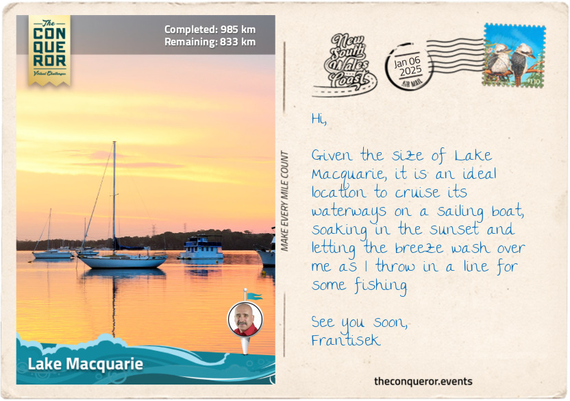
km od začátku : 0985
Lake Macquarie
About 6mi (10km) north of Norah Head lies the beginning of the largest coastal saltwater lake in the Southern Hemisphere. With a shoreline stretching about 108mi (174km), Lake Macquarie is part of a larger catchment area that includes rivers and creeks flowing into it. The lake contains several islands, including Pulbah Island, designated a nature reserve and home to goannas. The lake was formed during the last Ice Age when the area was a river valley carved by the flow of a river. As the Ice Age ended and the glaciers melted, sea levels rose, causing the ocean to flood the river valley and transform it into a coastal lake.
As I travelled along a narrow strip of land between the lake and the sea, I arrived at Swansea and the entrance to Lake Macquarie via the narrow Swansea Channel. The area surrounding Lake Macquarie was originally inhabited by the Awabakal people, a strong and determined clan who practiced fire-stick farming (controlled burning) that helped them with hunting and navigating through dense shrubland.
To the east of Swansea is Reids Mistake Head, and east of that is Moon Island. The story of how the headland got its name goes back to 1800 when Captain William Reid was sent to Hunter River, further up north, to obtain a cargo of coal. Reid sailed to Moon Island, thinking it was Nobby’s Head at the mouth of the Hunter River. He loaded his ship with coal and returned to Sydney. It was upon his return that Reid discovered his mistake, having not sailed far enough north and had instead reached another river, the entrance to Lake Macquarie, which happened to be another source of coal.
This area became known as Reid’s Mistake, a name applied to the lake’s entrance and eventually to the whole lake. It wasn’t until 1826 that it was renamed Lake Macquarie, after Governor Lachlan Macquarie, a Scottish officer recognised for his efforts of leading NSW from being a penal colony to a free settlement. And so, Reid’s Mistake remains the official name of the southern headland.
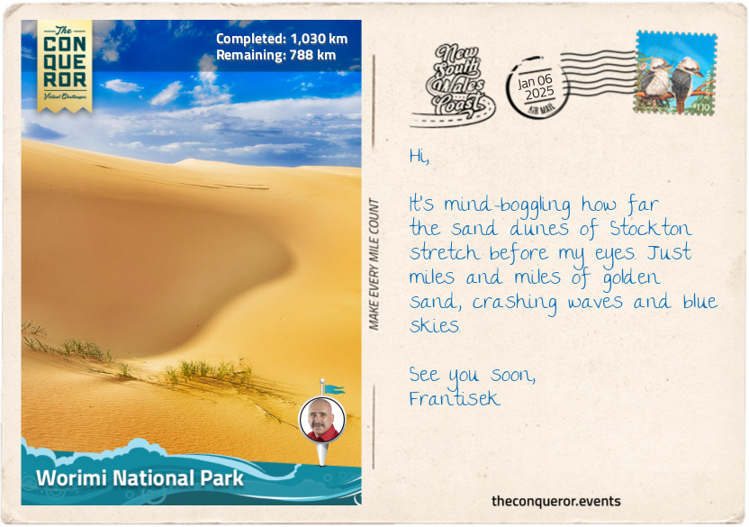
km od začátku : 1030
Worimi National Park
Had Captain Reid sailed up a little further, he would have come across Nobby’s Head. On the other hand, maybe just as well he didn’t because in the same year at Broken Bay a gang of 15 convicts seized the sloop Norfolk and sailed northwards, wrecking it at the entrance to Hunter River. They then seized another boat in nearby Newcastle. They carried on in their attempt to escape, but nine of them were eventually captured. The peninsula near the Norfolk wreck was subsequently named Pirate Point after the convicts’ piratical act. The area seemed prone to piracy as a further seven ships were illegally seized from Newcastle in the first half of the 1800s.
Pirate Point carries a dual name, where the Traditional Owners, the Worimi people, know it as Burrabihngarn. The dual naming convention of geographical features and cultural sites illustrates the NSW Government’s support and recognition of the Aboriginal cultural heritage.
Hopping on a ferry, I sailed across the Hunter River into Stockton, a suburb of Newcastle, to venture down the break wall where the remnant of Adolphe, which sunk in 1904, is still visible, probably because it’s actually resting atop SS Wendouree, wrecked in 1898, SS Lindus in 1899 and somewhere further below is the steamer Colonist wrecked in 1894.
Returning to shore, I walked along Stockton Beach, where, at one time, the 700ft (200m) Norwegian bulk carrier MV Sygna ran aground in 1974 after a heavy storm with swells 56ft (17m) high battered the port entrance. Fortunately, all 30 crew were rescued. When salvage operations commenced, the back unfortunately split in two. While the bow was towed away, the stern settled deeply into the sand and, over decades, slowly decayed while visible from the beach. In 2016, the structure finally collapsed and sunk into the ocean, with only a small section above the waterline.
From the beach, I continued along the shore until I reached the Stockton Bight Sand Dunes within the Worimi National Park. It stretches an incredible 20mi (32km) parallel to the park and contains a forest of blackbutt, smooth-barked apple gums and paperbark. The sand dunes are the largest moving coastal dunes in the Southern Hemisphere. This is one place for serious quad biking or 4WD adventuring while tossing in a sandboarding ride or two. For an extra experience, there’s a visit to Tin City, built as a squatter’s village during the 1920s Depression Era. Made up of a bunch of small tin shacks half buried by the shifting sands, the shacks have a post-apocalyptic feel about it, almost like a scene out of a Mad Max movie.
And now, onto Hawks Nest to check out some dolphins.
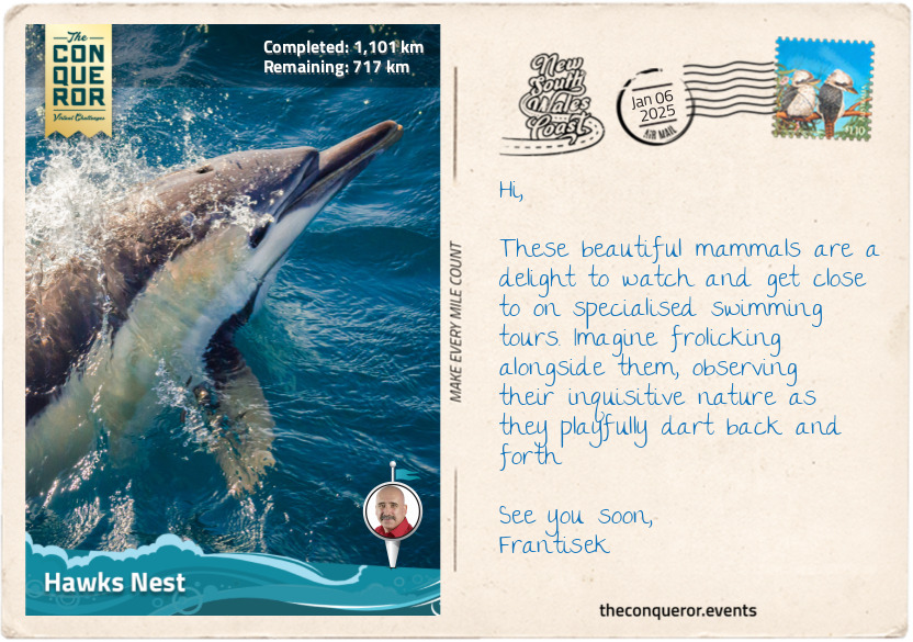
km od začátku : 1101
Hawks Nest
I swung inland after Stockton to circle around Port Stephens Bay, travelling through several small towns. Karuah is supposedly known for its fresh local oysters, but I didn’t stop to find out even if I would have been partial to a serving of Oysters Kilpatrick topped with crispy bacon bits and Worcestershire sauce.
When I passed through Tea Gardens, all I could think of was sitting outside at a café on a balmy afternoon with a pot of tea and a lamington, an Aussie favourite with various stories of its origins. While there is no conclusive evidence of how it came into existence, one thing is certain: the recipe for the famous lamington was discovered in a 1900 issue of the Queensland Country Life newspaper, making it more than 100 years old and most likely named after the then Governor of Queensland, Lord Lamington. How the town got its name is also a mystery. Some suggest it was after an attempt to grow tea in the 1820s, albeit unsuccessfully, or because of the tea trees along the Myall River near the town.
I arrived in Hawks Nest on the northern shores of Port Stephens Bay, which has a long and colourful story. The bay resulted from a submerged estuary of the Karuah and Myall Rivers. It was initially occupied by the Worimi people, who lived along its shores. Early explorers were attracted to the bay’s clear waters. When Captain James Cook sailed by in 1770 on the Endeavour, he named the bay after his friend Philip Stephens, the Secretary of the Admiralty. The HMS Salamander was part of the Third Fleet, transporting convicts to Sydney, and the first to enter the bay in 1791. Then, in 1795, HMS Providence arrived. The captain was surprised to find five convicts living with the Worimi people, who escaped from the Sydney area but got wrecked in the bay. By the early 1800s, the area was a haven for escaped convicts, and a garrison was established at what is now known as Soldiers Point.
These days, the Port Stephens region is a holiday getaway. Its greatest draw is the resident pod of 150+ bottlenose dolphins, hence the bay’s claim as the “Dolphin Capital of Australia. These magnificent animals are super-intelligent with a hearty appetite, eating up to 22lbs (10kg) of fish per day. They are also ‘conscious’ breathers, unlike humans, who breathe automatically, needing to surface every few minutes to breathe. When asleep, only half of their brain is at rest while the other half is awake to manage breathing and staying alert.
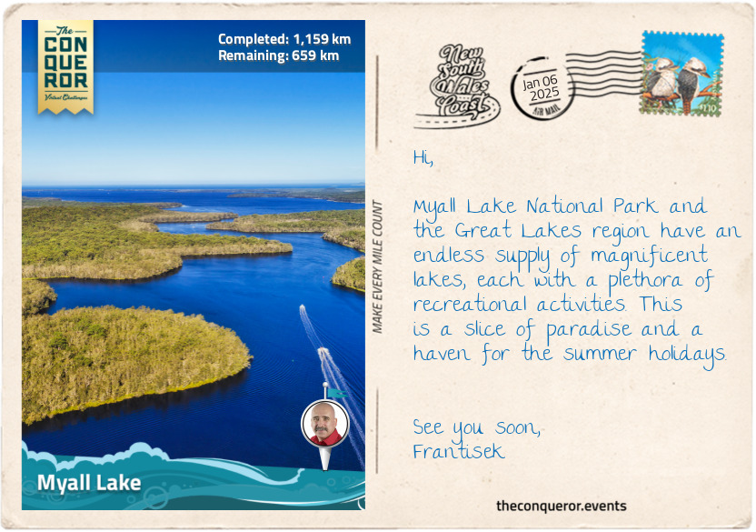
km od začátku : 1159
Myall Lake
As I wound along the winding coastal road, I veered inland again, arriving at Bombah Point, the gateway to Myall Lakes National Park. I could smell the now-familiar scent of eucalyptus and looked forward to exploring a series of lakes within the park and extending further into the Great Lakes region.
Within the park are a series of interconnected freshwater lakes – Bombah Broadwater, Boolambayte Lake, and Myall Lake. As the lakes are connected, this was a fabulous opportunity to explore them on a small boat, meandering from one to the other. When I reached Myall Lake, the largest of the three, I found the water to be tannin-coloured, a result of decomposed plant material from the surrounding wetlands. Despite its tea-like colour, I was compelled to hop in for a refreshing dip. The water was calm and crisp on my skin.
The shore was lined with native shrubs and trees, such as the paperbark trees with their distinctive peeling bark, thriving in wetland areas, and the Casuarina trees, also known as she-oaks, with their needle-like foliage and sturdy trunks, which help prevent erosion by stabilising the soil. A favourite flowering shrub is the Banksia because of its hardy cone-like flowering, appearing in varying shades from brown and red to orange and gold.
Myall Lake is also part of the Great Lakes region due to its proximity to Smith Lake, separated by a narrow piece of land, and Wallis Lake, the largest of the three. With so many waterways, it’s not surprising that fishing is a significant pastime in the area. A line can be thrown in from the beach, a lake or a river and may be lucky enough to catch bream, whiting, Australian salmon or mullet. While waiting for the fish to hook, sit back, relax, and look out for the birds occupying the wetlands. One example is the brolga, a huge bird from the crane family with a wingspan of up to 7.5ft (2.2m). They are easily recognised by the band of red skin atop their small head. They are also known for their unusual ritual dance when searching for a mate. Cultures like China have stylised these moves to incorporate them into their kung fu martial arts (think of the crane kick in the 1984 Karate Kid movie). Closer to home, the Aboriginal people have incorporated it into their own dance rituals. Sydney-based author Rod Clement was inspired to illustrate and write the children’s book Olga the Brolga, telling the story of a keen bird just wanting to dance.
The best place to finish my exploration was in the twin towns of Forster and Tuncurry at the end of the Great Lakes. Looking for a place to eat, I settled on another Aussie favourite, the chicken parmigiana. If you haven’t had one, it’s a must-try. It’s a chicken schnitzel topped with tomato sauce and melted cheese and served with a good dose of hot chips.
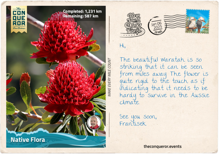
km od začátku : 1231
Native Flora
Australia has a very harsh and unforgiving climate. Just consider the vast expanse of desert outback to the lush coastal regions. For plants to survive in these environments, they need to be tough and adaptable, and over thousands of years, they have found a way to evolve and thrive. The result is a unique and diverse range of flora, of which I will cover three well-known species.
The first one is the Waratah, a striking native plant endemic to and, since 1962, the floral emblem of NSW. The plant features large, vibrant red flower heads made up of many small individual flowers densely packed together, measuring about 4in (10cm) in diameter. Growing up to 13 feet (4m) high, the Waratah thrives in moist, well-drained soils of forests, woodlands, and heathlands, particularly in regions with higher rainfall, such as the Blue Mountains and Sydney. Waratahs provide essential habitat and food to wildlife, attracting nectar-feeding birds like honeyeaters. However, this gorgeous plant doesn’t do well in a competitive environment with dense undergrowth. They do much better in dappled sunlight, preferably beneath eucalypt trees and with plenty of open space.
One of the strangest-looking plants and one that warrants a closer inspection is the Kangaroo Paw. Originally native to Western Australia, it is now found all over Australia and even in the Singaporean Botanical Gardens. The flower on this plant has a paw-like tubular shape. It comes in various colours, ranging from deep crimson to scarlet, pale lemon to golden or soft peach to intense tangerine. Less prevalent are the green tones, often tinged with yellow or red.
Quintessentially Australian and the national flower, the Wattle, when in bloom, is a beautiful splash of bright yellow fuzzy flowers bursting into colour each spring and lasting for several weeks. Besides being an important Australian symbol, the plant is believed to help improve soil by absorbing nitrogen from the air and releasing it as nutrients through its roots. The plant was also used as bush tucker by grinding the wattleseed into flour for damper, but these days, it can be found in a range of foods like muffins, teas or coffee substitutes.
Other interesting native plants are Billy buttons, with bright yellow globe-shaped flowers growing on long stems and the Bottlebrush, named for its cylindrical flower spikes resembling a bottlebrush in shades of red, mauves, yellow and green.
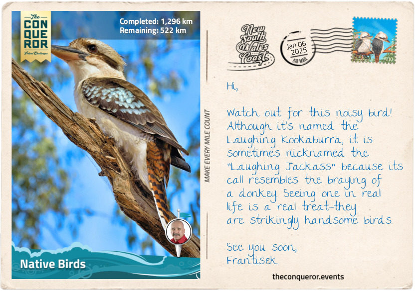
km od začátku : 1296
Native Birds
State emblems, such as the Waratah as the floral emblem for NSW, encourage regional pride and identity while raising awareness about native species and conservation. They serve as representations of a state’s unique characteristics. As such, NSW has three distinct animal emblems: the kookaburra, the platypus and the eastern blue groper.
The laughing kookaburra is the state’s bird emblem. It is one of ten kingfishers in Australia and the largest in the world. This iconic Aussie bird is known for its distinctive, laughter-like call, often heard at dawn and dusk. They play an important role in Aboriginal folklore, symbolising joy and the voice of the forest. The kookaburra is recognised by its sturdy body, and the brown and white plumage helps it blend into the environment. They live in eucalypt forests but are adapted to urban areas. Although not necessarily welcomed in the suburbs, given their fiendish laughter, they can wake any person from a deep slumber, hence their “bushman’s clock” nickname.
The platypus has to be one of the strangest-looking animals on the planet. This duck-billed, otter-footed, beaver-tailed mammal seems to have an identity crisis. Its uniqueness also extends to being one of two mammals that lays eggs – the echidna is the other. A nocturnal animal, the platypus is an agile swimmer that eats nearly its own weight in food a day and is a little dangerous if provoked. The male has a spur on its hind legs that can deliver a painful venom. Although not lethal to humans, it does cause severe pain and swelling. Usually, though, they are shy and avoid human interaction.
NSW was the first to have a fish as a state emblem, selecting the eastern blue groper. The fish is native to the coastal waters of eastern Australia. It was once an endangered species due to overfishing, but legislative changes and protection of the species allowed it to recover, and it is currently classified as near-threatened. The groper has a robust body, large scales, and powerful jaws used to feed on crustaceans, mollusks, and other hard-shelled invertebrates. They are born females until they reach 20in (50cm) when they transition to males. Adult males are easily recognised by their cobalt blue colour, while females and juveniles are typically golden to greenish-brown. Extremely territorial, they inhabit rocky reefs, often seen around kelp beds and underwater caves. Friendly and curious, gropers are popular with divers and snorkelers.
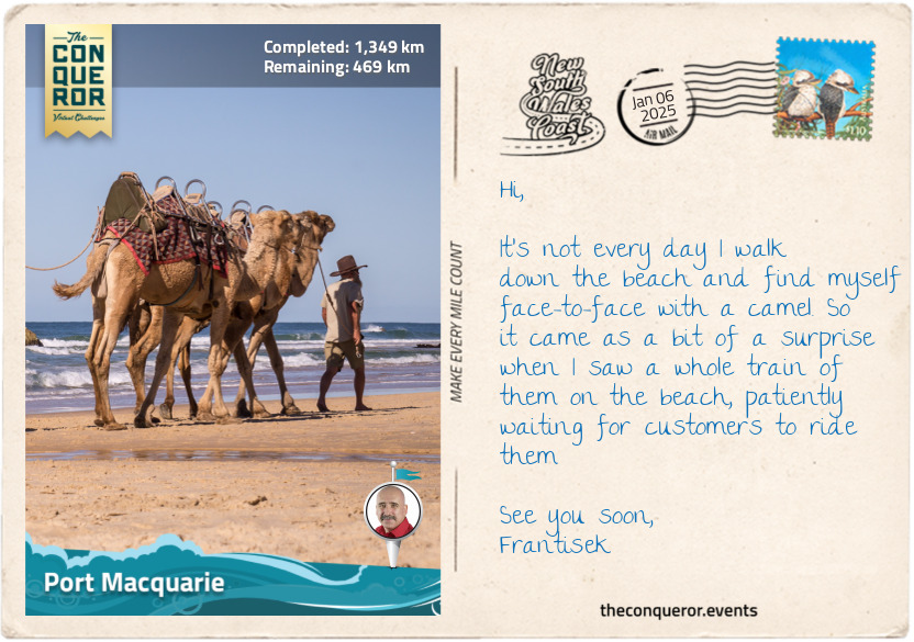
km od začátku : 1349
Port Macquarie
Beautifully located on Hastings River’s south side, Port Macquarie, a once sleepy haven, is now a popular holiday getaway. I can’t blame it given its extensive beaches, each connecting to the next. I figured the best way to experience it was by taking a leisurely stroll along the entire length of the city’s coastline.
But before I could set foot on the sandy shores, my attention was caught by a group of camels led by their handlers. Approaching them for a closer look, I couldn’t help but notice the nonchalant air about them. One of them, a towering creature with a sandy-coloured coat, crouched on all fours carrying a somewhat bored expression, its lips moving rhythmically, chewing on a mouthful of dry grass before spitting out a wad of cud with remarkable accuracy, all the while batting those long eyelashes. As I passed the caravan of camels, their presence seemed almost at odds against the backdrop of the Australian landscape. Yet, I recalled they were introduced to Australia in the 1840s and played an important role in exploring the continent's vast interior. When they were no longer needed for transportation, the camels were released into the wild, and more than a million feral camels occupied the Northern Territory, wreaking havoc on native vegetation.
As I contemplated the conflict presented by the camels with the Aussie landscape, I continued my journey following the sandy expanse of Lighthouse Beach until I reached the historic Tacking Point Lighthouse. Before its construction in 1879, the area had very few lighthouses, and shipwrecks were a common sight. One of the earliest was the 1823 wreck of the schooner Black Jack, privately owned but used by the colonial government when it ran aground due to pilot error. The owner petitioned for compensation and received the schooner Isabella, which unfortunately was seized by convicts in Port Macquarie, who promptly escaped.
I wound around the lighthouse trail through dense coastal scrub and fragrant eucalyptus forests. Along the way, I encountered a wooden boardwalk in the Sea Acres Rainforest, where the path was elevated 23ft (7m) above the forest floor, and enjoyed the bird’s eye view of the canopy. The rainforest was an important resource for the Birpai people, who used the python tree, the second hardest wood in the world, to make weapons and forage for bush food. With each step, I watched for signs of wildlife, hoping to glimpse the elusive goannas that prowled among the underbrush. But the promise of encountering the scarlet robin, with its vibrant red breast and striking black and white plumage, truly piqued my interest.
Pressing onward, I passed Nobby's Beach and Flynns Beach, where novice surfers braved the waves. Then, I took the steep path down to the isolated and pebbly Rocky Beach before finishing at Town Beach, located next to the city centre.
As dusk descended on the town, I grabbed a bag of piping hot fish and chips, with their favourite accompaniments: potato cake and dim sim. I savoured these simple pleasures as I watched the last vestiges of daylight fade into the night.
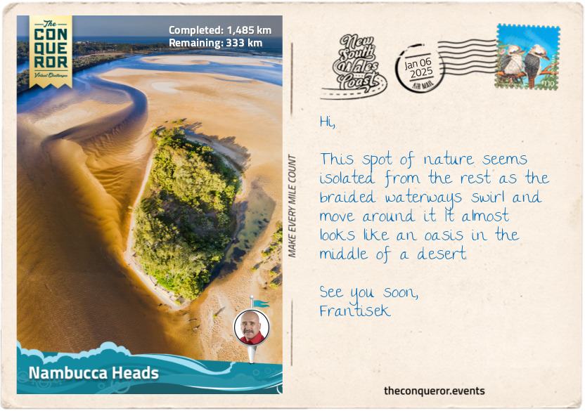
km od začátku : 1485
Nambucca Heads
Long before the Europeans arrived, the small coastal town of Nambucca Heads was the proud homeland of the Gumbaynggirr people. At least a thousand strong, the Gumbaynggirr spoke a common language, passed down through generations, and celebrated initiations that marked the transition from youth to adulthood. Their stories echoed across the valleys and hills.
Yet, loyalty ran deeper than mere tradition. Each clan was fiercely loyal to its own “jagun” (homeland). The Bagabaga lived near the Nambucca River, the Baanbay thrived atop the high plateaus of the Great Dividing Ranges, while the Wiigulga people flourished further north on the Clarence River. Each clan guarded its sacred paths and passed on their dreaming stories only to those who belonged or were kin to each place. The women, strong and resilient, married outside their own clans but within the Gumbaynggirr tribe. Through these unions, the land itself became a living tapestry, binding the clans together through stories and traditions.
The Nambucca Heads Surf Club is one of the oldest in Australia, but it is much more famously known for establishing the Nippers program, a junior lifesaving program for ages 5-13. Australia is surrounded by rugged coastlines, strong rips and surf, and this program helps kids learn how to read surf conditions, how to escape rips, and beach safety while participating in a variety of fun activities that build the necessary skill sets. The program, launched in 1961, was a roaring success that spread out to all the surf clubs around the country, and more than 60,000 children participate every summer. The Coogee Surf Club (near Sydney) has the biggest turnout, with more than 1000 children hitting the sand and surfing every Sunday morning.
There are three viewing platforms around the headland, all with spectacular views of the ocean and a number of waterfront walks. The Lions Riverfront Walk was particularly interesting, as it led to the “Graffiti Gallery”, where the breakwater wall made up of a series of large boulders has been painted with artworks by local artists. This third-of-a-mile (500m) stretch of art features poems, professional and amateur paintings, and great pieces of graffiti. It makes walking the path a visual delight.
Another incredible piece of art is the mosaic wall that wraps around a corner street stretching 196ft (60m). Mosaic artist Guy Crosley scoured the local area for unique pieces of pottery, tiles, china and any other interesting pieces that could be used on the project. He engaged volunteers to help with the project, which took four years to complete. The sculpture features marine animals, mythical creatures, waves and a great octopus gobbling everything up in its path.
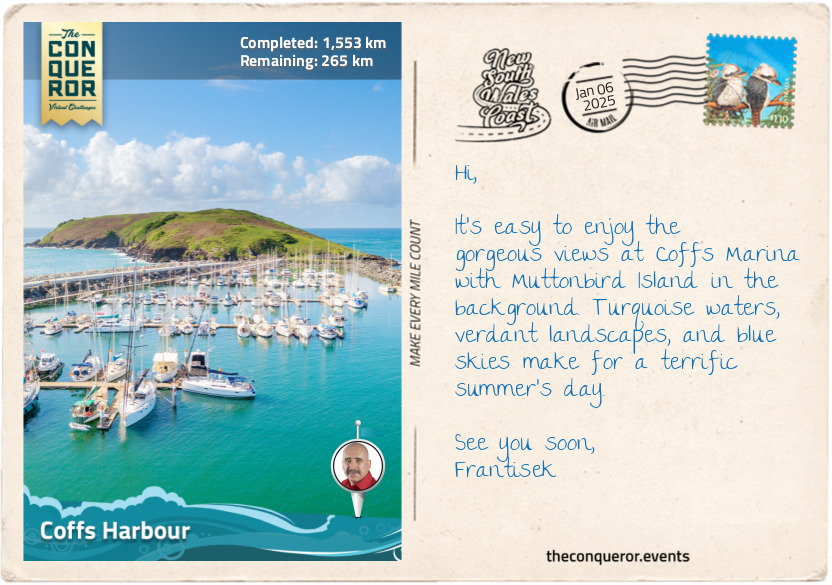
km od začátku : 1553
Coffs Harbour
One of Australia’s quirks is its extensive list of big things. Ever heard of the Big Pineapple, the Big Prawn or Big Ned Kelly? At least 230 big or giant things are scattered around the country, enticing travellers to visit and take pics in front of them. Tourist trap? Possibly, but many of them have become beloved icons. Of course, Coffs Harbour is no different, given its well-known landmark, the Big Banana. Part of an amusement park set within a banana plantation, the Big Banana measures 49ft (15m) in length. It was built in 1964 and is one of Australia’s first Big Things. So important are the Big Things in the country’s culture that in 2007, Australia Post issued a series of Big Things postage stamps that included the Big Banana.
South of Coffs Harbour is the town of Sawtell, which runs the hottest food festival each July. Its focus is the Chilli Festival, where food vendors cook up a storm of spicy dishes. Are you game to join in on the chilli chicken wing eating competition? Sizzling and spicy. May need the fire hose to put out the fire. Maybe dial it down with a chili dog topped with onion, sauerkraut, mustard, pickles, cheese and a bit of hot sauce, or a lot.
Coffs, as it’s known locally, is the largest urban centre on NSW’s north coast, easily accessible by car or air from major cities. It has a beautiful, sheltered harbour with extensive walkways along the south break wall and the northern marina walkway that leads onto Muttonbird Island Nature Reserve. The island is a breeding ground for wedge-tailed shearwaters (aka. muttonbirds). Each year, the birds migrate to the Phillippines and then return to the same burrow in pairs and take responsibility for raising the chick.
Between the two walkways is the historic Coffs Harbour Jetty. It was once a timber wharf where ships moved timber from the hinterland. A nice walk along the 984ft (300m) long jetty offers great views of the surrounding harbour and nearby landscape.
Encircling the city are many national parks, each with its own wildlife and plant life. For instance, Ulidarra National Park, northwest of Coffs, is the place to see masked owls, wompoo fruit doves or the infamous dingo, preferably from a distance. South of Coffs is Bongil Bongil National Park, a migratory refuge where more than 160 bird species have been recorded. It is also home to the largest koala population in the state. Another example is the Cascade National Park, a hilly rainforest park popular with mountain bikers and hikers.
Coffs is wonderfully located as a base to explore the extensive verdant hinterland.
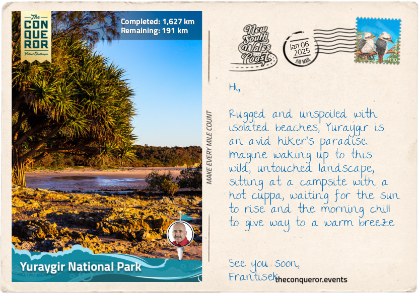
km od začátku : 1627
Yuraygir National Park
Except for a few camping spots and tiny beach villages, Yuraygir National Park protects the longest stretch of undeveloped coastline and untouched bushland in NSW. At 65,000 hectares and a 40mi (65km) coastline, Yuraygir is a merger of two previous national parks, making it the largest coastal park in NSW.
The coastline is dotted with pale sandy beaches, interspersed with rocky headlands, sand ridges, and cliffs, and divided by river estuaries. Further inland, the landscape features lakes, bogs, and swamps formed by sea level changes over millions of years. Notably, the lakes of Minnie Water and Hiawatha are perched freshwater lakes surrounded by massive dunes.
For long-distance hikers, bushwalking the length of the coast through a series of trails, beaches and rock platforms would be the highlight. It takes about 4-5 days to thru-hike, starting in Red Rock and ending in Angourie. However, extra time must be added when the sea is rough, as some beaches may be unpassable even at low tide.
The landscape is a mix of coastal rainforest, dry eucalypt forest with blackbutt and red bloodwood, and wetlands with swamp mahogany, swamp oak and melaleuca with yellow flowers similar in shape to bottlebrush.
Wildlife is abundant, mostly smaller animals, but at dawn or dusk, there’s a chance to see eastern grey kangaroos or red-necked wallabies. Reptiles like the spiky eastern bearded dragon, lace monitor, and skinks scurry around on the ground. Birdwatchers will appreciate catching a glimpse of the red-tailed black-cockatoo—a large, beautiful parrot with distinctive red panels on the male’s tail and stripey orange-yellow markings on the female. Their raucous call has been likened to a "rusty windmill".
A declining and isolated population of coastal emus, numbering fewer than 60, inhabits the low-lying heathland and scrub within the park. These emus are genetically distinct from other emus due to their centuries-long isolation. Unfortunately, their limited genetic variation poses challenges for adapting to ongoing environmental changes. However, while they are still around, these 6.5ft (2m) tall emus are hard to miss and a pleasure to see across the landscape. They are flightless birds and the second largest in the world after the ostrich. They live in pairs, and the male rears the young until they are 2 years old. Don’t try and race these birds. They may not fly but can run up to 31mi/h (50km/h). In some urban areas, they’d get speeding tickets at this rate.
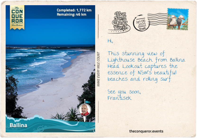
km od začátku : 1772
Ballina
“The Best Catch in Ballina is the Big Prawn”
Remember when I was in Coffs Harbour and mentioned Australia’s passion for big things? Now, I’m in Ballina, facing the Big Prawn directly across the street from Bunnings Warehouse, one of Australia’s largest hardware stores. If you visit on a Sunday, many Bunnings stores host a sausage sizzle, with funds raised going back into the community—a tasty way to fundraise while accumulating steps as you wander around the huge warehouse.
Bunnings went a step further in helping the community when it purchased the site where the Big Prawn stood. This concrete and fiberglass landmark was built in 1989 without a tail atop a service station by Hungarian brothers who constructed service stations around the NSW region, figuring that adding big things as features would draw visitors' attention. They also constructed the Big Merino in Goulburn and the Big Oyster in Taree.
The brothers hired art student James Martin to design the Big Prawn. Martin studied prawns in detail and scaled his final plan to 30,000 times larger than a real prawn. When it first opened, the prawn had an internal staircase allowing visitors to climb inside its head and view the surroundings through its perspex eyes.
While Australia has a thing for big things, the Big Prawn was also built to commemorate the local prawn industry, as Ballina is where the method of netting prawns was pioneered. When the service station closed in 2010, the local council agreed to demolish the prawn. However, locals opposed the demolition vehemently, and this is where Bunnings stepped in, buying the site. They removed the prawn, refurbished it, added a tail, and propped it up on a steel frame, ensuring it continued to be listed as one of Australia's Big Things.
Ballina is located on the north bank of Richmond River and serves as the gateway to Byron Bay, where my journey will end. The traditional owners are the Bundjalung people, who have occupied the area for over 6000 years. European settlers arrived in 1828 aboard the HMS Rainbow when Captain Henry Rous explored Richmond River as far as Broadwater, about 15mi (25km) southwest of Ballina. The next round of settlers were cedar-cutting parties who travelled up from Clarence River, arriving onboard the Sally. They would soon be joined by other parties trekking overland.
In 1928, Sir Charles Kingsford Smith, an Australian aviation pioneer, crossed the Ballina coast when he piloted the first transpacific flight. In 1973, the Las Balsas Expedition, consisting of three rafts made from balsa trees, left Ecuador to sail 8,600mi (13,850km) across the Pacific Ocean to Australia. Blown off course from their original destination in Queensland, the rafts reached Ballina. Two were towed into port, while the third was too waterlogged and cut loose. After 178 days at sea, the 12-man crew stepped safely onto terra firma. One of the rafts is displayed in Ballina’s Maritime Museum.
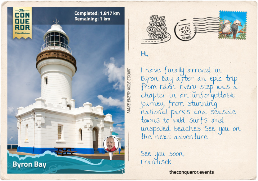
km od začátku : 1817
Byron Bay
Recognised as the traditional lands of the Arakwal, Minjungbal and Widjabul people, who have lived here for 22,000 years, Captain James Cook anchored in Cape Byron, naming it after Vice-Admiral John Byron, known for his attempt to circumnavigate the world in the 18th century. Incidentally, John Byron is the grandfather of Lord Byron, the author of the famous poem Don Juan.
Byron Bay's early days were like many other settlements, with timber as the main industry, followed by farming, fishing, whaling, and a brief stint in gold mining. However, it was the 1960s that truly marked a turning point for the town, as longboard surfers discovered the exhilarating waves around the cape, putting Byron Bay on the map.
During this time, hippies and those seeking alternative lifestyles flocked to the area, drawn by its natural beauty and laid-back atmosphere. This era defined Byron Bay as a haven for free spirits and creatives. Yet, as the 1980s approached, development gained momentum, attracting affluent travelers and shifting the town's character toward luxury accommodations and upscale amenities.
It's hard to believe that this town, with its population of just 5000 permanent residents, hosts over 2 million visitors annually. But as I explore the town and head up to Cape Byron Lighthouse (c. 1901), I understand why people from all walks of life are drawn to this coastal haven.
Certainly, the sweeping views from the lighthouse are absolutely breathtaking. I accessed several vantage points via a well-paved track. I walked through the rainforest of Bangalow palms and ancient burrawangs (cycad), then down to Wategos Beach to watch the surfers before heading to the most easterly point of the Australian mainland.
Back at the lighthouse, I took a moment to appreciate the structure and its role as a navigational landmark along the NSW coast. It provided safe passage to marine vessels as they plied the waters, trading up and down the coast. I eased into a weathered bench, the sun warming my face, and reflected on how far I had come since I began my journey in Eden. My travels led me through a tapestry of national parks, endless stretches of beaches and charming coastal towns. With each step, I catalogued a long list of native flora and fauna, illustrating the wonderfully rich land and the diversity of its inhabitants.
As I take out my packed lunch of none other than an Aussie classic, the Vegemite sandwich, and pour a cuppa from a flask, I plug in my earphones to capture the last essence of Australian culture through another classic, the 1981 Men at Work song Down Under.
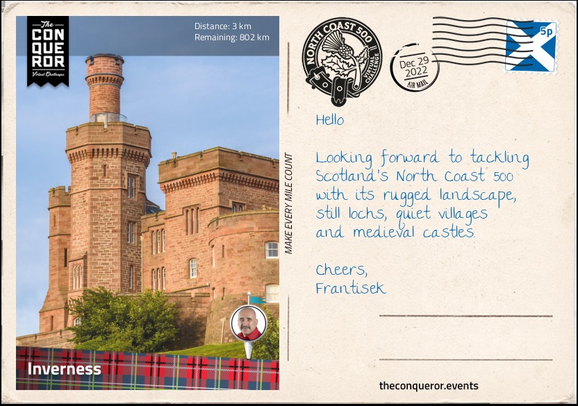
km od začátku : 0003
Inverness
The northwest corner of mainland Scotland is a landscape of wild and rugged coastline, scattered sandy beaches and quaint little hamlets and villages. The northeast coastline has a fine collection of impressive castles such as Dunrobin Castle and Castle of Mey along with castle ruins and towers that fires up the imagination of medieval times.
The North Coast 500 (NC500) is a circular route travelling through the counties of Inverness-shire, Ross and Cromarty, Sutherland and Caithness. The route was launched in 2015 in an effort to connect the remote coastal villages and showcase the Highlands' expansive moors, deep lochs and craggy peaks.
The route begins in Inverness at Inverness Castle. The city is widely regarded as the capital of the Highlands and is generally the starting base for exploring the region. Each year in September, bagpipe players convene for a solo competition and the chance to win the Gold Medal, a prestigious award that qualifies the winner to participate in other restricted competitions.
Inverness Castle was built in 1835 on a previous 11th century castle site. Designed by three architects with each one focusing on different sections, the castle was built out of red sandstone in a castellated style. It sits on a cliff overlooking River Ness with views of Ness Bridge and Inverness Cathedral.
Outside the Castle's main entrance stands the statue of Flora Macdonald, who is known to have helped Bonnie Prince Charlie escape Scotland in 1746 after he lost the Battle of Culloden. She helped him with passage on a boat to the Isle of Skye by dressing him as a maid named Betty Burke. Although she was captured and imprisoned for her involvement, Flora was released a year later. She emigrated to North Carolina, however, she lost her estate and possessions during the American Revolutionary War when her husband took up arms supporting the British army, forcing her to return to Scotland, where she lived out the rest of her life.
The River Ness runs through the centre of Inverness and spills into Beauly Firth (an inlet). At 6mi (10km) long its origin is Loch Ness (lake) which is located further south of Inverness. At 23mi (37km) long and 755ft (230m) at its deepest point, Loch Ness is famous for its mythical creature the Loch Ness Monster endearingly known as Nessie.
Legend has it that Nessie was first sighted by St Columba in the 6th century. By the 1870s new sightings were reported describing Nessie either as a salamander lookalike or resembling a plesiosaur. When unusual photos appeared in the 1930s along with further sightings, the story of Nessie took a real hold and perpetuated throughout the decades till today. Mythical or not we have to give Nessie credit for her incredibly long lifeline. At nearly 1,500 years old, her agility in appearing and swiftly disappearing must be commended. With plenty of room to swim in the loch, it looks like Nessie enjoys the game of hide and seek as no one has been able to capture her or even get a clear photo of her.
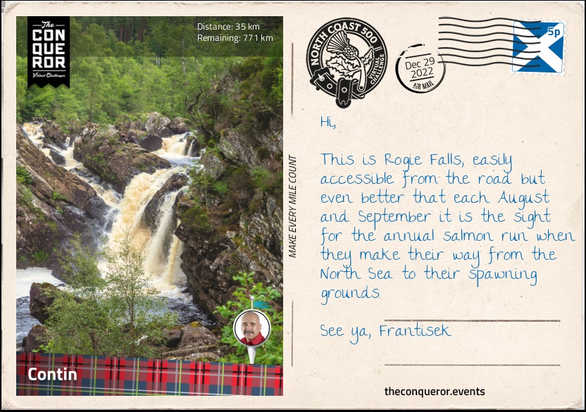
km od začátku : 0035
Contin
Just outside of Inverness is the Achnagairn Castle. Built around 1812, the castle was the setting for parts of the Outlander TV series. An elegant whitewash three storey building with French windows, the castle is more of a mansion with two bell-shaped towers overlooking a formal garden. A ballroom was added in 1912. The then-owners' daughter was turning 21 and had nowhere to celebrate her birthday. The parents built her the ballroom clad in wood panels and sandstone bricks with vaulted ceilings, chandeliers and a massive fireplace. During WWII the ballroom served as a hospital filled with beds. Sadly over the latter decades of the 20th century the building fell into disrepair until it was rescued, restored to its former glory and converted into a boutique luxury hotel.
On the way to Contin I passed through the towns of Beauly and Muir of Ord. Beauly's name was derived from Mary, Queen of Scots exclamation "Ç'est un beau lieu" meaning it's a beautiful place when she visited the area in 1564. Located on the bend of Beauly River is the Beauly Priory where Queen Mary made her observation from. The priory was built in the 13th century and existed for the next 300 years until the Reformation brought it to an end and the priory was abandoned. Only the walls remain with the roof having long gone but the grounds continue to maintain tombstones from the 1400s along with mature trees and an ancient elm tree.
Less than 3mi (5km) north of Beauly is Muir of Ord, a small village that once was known as Tarradale. It is the birthplace of geologist Roderick Murchison (b.1792) who established the Silurian System by grouping together a series of geologic formations from a time period between 443-419 million years ago.
Just northwest of the village is the Glen Ord Distillery which prior to becoming a legal establishment in 1838 was an illegal whiskey distillery. The operations grew quickly and as such so did the population in the village giving the economy a boost. Within 50 years the distillery was producing 80,000 gallons (303,000L) per year with production exported as far afield as Singapore and South Africa. Although the distillery has changed hands several times it continues to operate today producing single malts such as The Singleton.
Contin is a tiny village of around 670 residents located near Black Water River. Just north of the village, off the main road, is a short hike through woodland to Rogie Falls that plummets 30ft (9m) into Black Water River. It is a hillside cascade flowing over several layers of large boulders that is best viewed from the nearby suspension bridge.
I finished the day with a quick side trip to the spa town of Strathpeffer. When the spring waters were discovered to have healing properties back in the 1800s, local landowners transformed this once sleepy village into a highly coveted spa resort. Several Victorian properties cropped up in quick succession opening their doors to wealthy visitors seeking fresh air, restorative springs and a round of golf. After WWI the resort town went into decline until recent times when a local association went about restoring various important buildings and re-igniting the village as a spa resort.
One of the town's highlights is the ornate railway station. Closed in 1946, by the mid-1950s it was in a terrible state with the tracks long gone and the surrounding vegetation scraggly and overgrown. Restored to its former glory in the early 1990s, the station is now home to the Highland Museum of Childhood, a café and gift stores. This is a good place to take a load off and indulge in a pot of tea and scones, jam and cream.
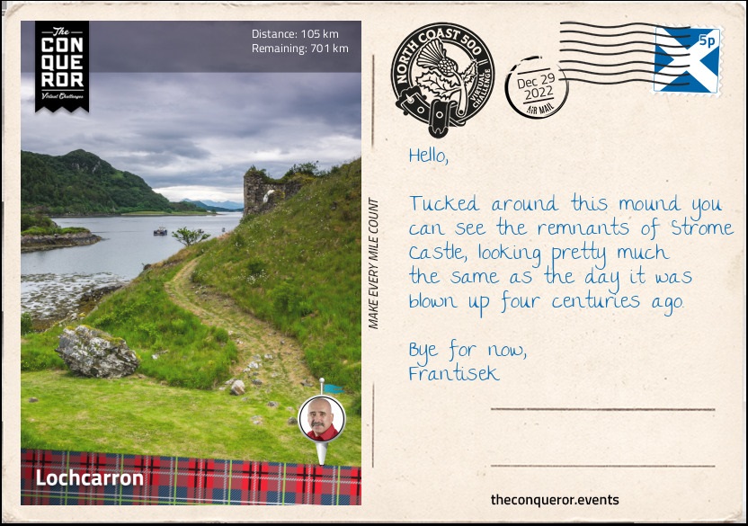
km od začátku : 0105
Lochcarron
Travelling passed fishing lochs, reservoirs and small villages I arrived at the road junction of Achnasheen that was built by Thomas Telford. A civil engineer, architect and stonemason, Thomas was an exceptional designer. His reputation was of such standing that he was nicknamed "The Colossus of Roads" having been responsible for the design and construction of numerous roads throughout the UK and more importantly for connecting many Highland districts that were previously inaccessible.
Starting as a stonemason in 1771 when he was just 14 years old, over the next 63 years his infrastructure projects included over 1,000 bridges, several canals including the Göta Canal in Sweden and the Caledonian Canal in the Highlands, harbours and numerous churches. Thomas was also an accomplished writer having contributed to the Edinburgh Encyclopaedia and publishing poetry before his rise to fame as an engineer.
Having left an impressive list of completed works throughout the UK and serving as the first President of the Institution of Civil Engineers, Thomas' legacy is annually recognised via the Telford Medal, a prize awarded each year to authors who have produced exceptional written works that benefit the civil engineering and construction industry.
Having paused for a moment at the junction to absorb the works of Telford, I swung southwest travelling alongside several lochs into Lochcarron. Prior to 1813, it was known as Janetown, a tiny village that tripled in size when a major road coming from Inverness opened up. The village is located alongside Loch Carron, a sea lake that provides excellent opportunities for diving and underwater photography. One of the highlights for a photographer is the seabed of flame shell, a species of small saltwater clam with bright orange tentacles protruding from the edges. Fish such as 15-spined stickleback, named as such due to its 14-17 spikes in front of its dorsal fin, and small-spotted catshark can also be found in the lake.
As a castle enthusiast, I took a sidetrip to the ruins of Strome Castle. Built in the 1400s up on a rocky bluff, the castle was strategically important as it guarded the Strome Narrows at the mouth of Loch Carron. In the hands of the Macdonalds of Glengarry a century later, the castle was often fought over with the neighbouring clan, the Mackenzies. One night in 1602, water was drawn from the well and accidentally deposited in the barrel containing the stock of gunpowder instead of the water barrel, rendering the castle defenceless. Receiving news of this error, the Mackenzies besieged the castle. Negotiations ensued and the Mackenzies agree to provide safe passage to the Macdonalds. Once the Macdonalds left, the Mackenzies blew up the castle. Although very little remains today of the castle the visit is worth it for the views overlooking the lake, the narrows and the deeply rich and green landscape.
This section completes the southern part of the NC500. From Lochcarron I'll be winding my up the west coast all the way to Durness.
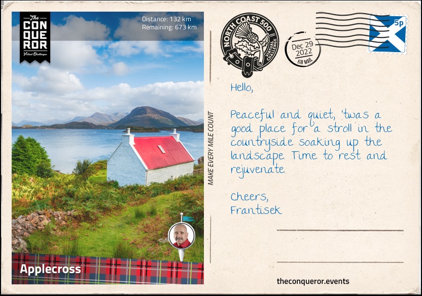
km od začátku : 0132
Applecross
Reaching Tornapress, I took a left turn onto Bealach na Bà, a mountain pass that crosses the Applecross Peninsula. Aside from being incredibly narrow, barely one lane wide, with several hairpin bends the pass very quickly gains elevation. Starting at sea level, the road crossed Russel Burn and tracked along the side of a munro known as Sgurr a' Chaorachain for a total of 5mi (8km) reaching the top at 2053ft (626m). The gradient on this stretch was nearly 20% making it the steepest ascent on any road in the UK.
The mountain pass was built in 1822 and until the late 20th century it was the only way to access the communities on the peninsula. As its Scottish Gaelic name suggests, Bealach na Bà translates as Pass of the Cattle because the pass was initially used as a drovers' road to take cattle and sheep to the markets in Inverness.
At its highest point was a lookout with views of the Inner Sound and Loch Carron to the south and the mountain peak of Beinn Bhàn to the north. A dirt trail led to the peak of Sgurr a' Chaorachain to the right or Beinn Bhàn to the left via a longer trail along the ridge.
From the top the track gradually descends through expanses of moorland all the way into Applecross. A small settlement consisting of a row of houses along the shore it is more commonly referred to as Shore Street or The Street instead of Applecross. Apparently Applecross is not one village but a collection of settlements along the Applecross Bay. Although the other settlements have their own name this row of houses doesn't seem to and it's perhaps why it is called Applecross when looking it up on maps. Quite confusing for sure.
Visible across the bay is the long and narrow Isle of Raasay and to the north of Applecross where I planned to park my weary legs was the Applecross Walled Garden. The walled garden was once part of Applecross House, a picturesque white mansion that was built in the 17th century. Changing hands several times over the centuries the garden was abandoned and fell into disrepair. Roll in the 21st century and the garden changed hands once again when it was lovingly restored to its former glory. Evolving over the years the garden now has a café with fresh produce grown on site.
Taking a seat outside overlooking the flowerbeds I settled down for a homemade egg pasta topped with aubergine, peppers, red onion, cherry tomatoes and fresh basil all picked from their veggie patch. As I like to try anything locally made the recently established Applecross Craft Brewery (Est 2016) seemed a perfect choice to quench my thirst. With a selection of three different ales - pale, dark or red – I opted for the pale ale, thinking it'd complement my pasta the best. As they say in Scottish Gaelic "Sláinte Mhath" (pronounced Slangevar) meaning cheers.
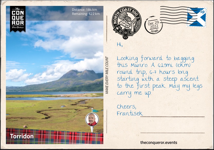
km od začátku : 0184
Torridon
Leaving Applecross, for the next 13mi (21km) I travelled along the coast of the peninsula northward bound. Wide open spaces were a constant on this narrow winding road with mountains visible in the distance, the Inner Sound to my left and the Isle of Rona beyond it.
Reaching the settlement of Fearnmore at the northern tip of the peninsula my journey commenced a southeast bound direction passing several small villages alongside Loch Torridon which joined with Loch Shieldaig that joined with Upper Loch Torridon before arriving into the village of Torridon.
Torridon is a great base for any climbing, hiking, mountaineering or wildlife spotting. It is surrounded by mountains and hills with plentiful trails to climb to the top and take in the splendid views in any direction. There are three main ridge climbing mountains: Liathach, Beinn Eighe and Beinn Alligin.
Of the three the easiest to traverse is Beinne Alligin and one I chose to tackle. Located a short distance from the village the mountain has two peaks known as Sgùrr Mhòr and Tom na Gruagaich. Both peaks are over 3,000ft (914m) giving them the status of a Munro, which is a Scottish classification for peaks of aforementioned height that must appear on the Scottish Mountaineering Club official list (there are 282 Munros on the list).
A circular route, the trail starts at the Beinne Alligin carpark near the bridge over the river Abhain Coire Mhic Nobuil. Starting on the west side of the river, the trail heads northwest and soon I reached a deer fence with a stile, a set of steps kind of like a ladder, used to cross the fence. Stepping over I continued up the moor on a somewhat rocky path barely a foot wide until I reached the corrie, a term used in Scotland, that is essentially a round hollow in a hillside (aka a cirque). Stopping for a break I admired the steep and rugged cliff face and turned to look down the trail and the view of Upper Loch Torridon in the distance.
Winding my up the corrie, I arrived at a plateau and shortly after at the first peak, Tom na Gruagaich with views of the loch and the Isle of Skye to the south and the ridgewalk to the north. Descending slightly on a steep and rocky path across a saddle and then back up, I started a steep climb to Sgùrr Mhòr, the second peak. Just before reaching it I came across a deep but narrow gash in the cliff face on the southeast side plunging down the mountain. It's really just a gully but I imagine it like a deep scar. At this point I could either proceed across the Horns of Alligin by scrambling or return the same way I came.
Never to back down on a challenge, I chose to do the scrambling. Descending the ridge I came across the first of the three Horns. Winding my way up over it with a bit of scrambling, the next one was pretty straightforward over the top but the third one I had to get off the ridge and skirt around the horn on a ‘near impossible to find' extremely narrow path before getting back on the ridge. This is one place where surefootedness was paramount, as a slide down the side of the mountain was not advised.
Having made it this far, I began my descent. Whilst the trail was well marked the descent itself was extremely steep and required plenty of care. I continued until I reached a small footbridge crossing a stream and carried on to a series of waterfalls. The stream joined Abhainn Coire Mhic Nobuil river right where I crossed another footbridge and followed the river on the east bank all the way back to the carpark.
Entering a wooded area beyond the carpark I followed the river to the rear of Torridon Estate, a 19th century property that once was used as a holiday lodge but today serves as a luxury hotel. A good place to rest, I poured over their fine sample of food and decided on a hearty feast starting with potted pork, crackling and spiced apple, followed by an aubergine burger with smoked cheese, parmesan and basil and wrapping it up with sticky toffee pudding and vanilla ice cream. I may need to roll out of here.
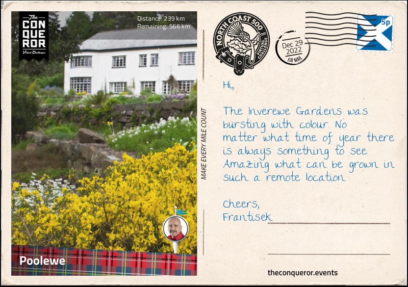
km od začátku : 0239
Poolewe
The road from Torridon to Kinlochewe may be narrow but the vista of mountains on either side is striking. Ambling beside a stream, we part way and rejoin many a times till the stream spills into Loch Clair and then flows out the opposite end as a river all the way to Kinlochewe where we go our own separate ways.
Kinlochewe sits in a valley at the head of the very large Loch Maree and serves as a junction between Torridon and Ullapool where I will be heading further up north. Just slightly to the north of the village is a war memorial for remembering soldiers from World War 1 & 2 particularly two sergeants from the Seaforth Highlanders Regiment who received the Distinguished Conduct Medal, the second highest military decoration at the time behind the Victoria Cross. The medal was awarded for their bravery and gallantry in the field.
Swinging left I headed towards Loch Maree and followed alongside it for its full 13mi (22km) length. At 2.5mi (4km) wide, Loch Maree is the fourth largest freshwater lake in Scotland. The lake consists of five large wooded islands and a staggering 60 smaller ones. The largest is Eilean Sùbhainn located near the top end complete with its own lake in the centre. What's peculiar though is that northeast of Sùbhainn is a very small densely wooded island, known as Isle Maree, and in the centre of it was a cluster of a dozen or so tombstones. I wondered at its story, who were the people buried here? Well perhaps the most intriguing story is of the Viking prince and his princess who took their own lives following a misunderstanding.
Legend says that the prince left his new bride on the island for a long expedition at sea. It was agreed that should he return and all is well he'd raise a white flag from his barge or if otherwise, a black flag would be shown. The princess would leave her home on a barge as well to greet him on the loch and do the same thing. The idea was to reduce the last moments of suspense on whether all is well or not. As time passed despair overtook the princess, that slowly turned to jealousy and mistrust of her husband's love for her. So she devised a plan to test him. Upon his return whilst still on his barge, she raised the black flag on her own barge and pretended to be dead. Seeing the black flag, he went into a rage that put fear into his men. When he reached the barge and saw his eternally sleeping bride, he was so stricken with grief that he plunged his dirk into his chest and died. The princess realising her folly and wracked with remorse pulled the dirk from his chest and plunged it into her own. The bodies of the lovestruck pair were buried on the island with their graves bearing two medieval crosses on top that are still there today. A very Romeo and Juliet type of tragedy but it is a common lore that is regularly told in the nearby village of Gairloch.
Passing through Gairloch, I travelled onwards to Poolewe aiming for the lovely Inverewe Gardens. It was created in 1862 from extremely barren land by Osgood Mackenzie. The estate was bought for him by his mother and a lodge was built on the property. Unfortunately it burnt down in 1914 and a replacement lodge was built in 1939. By 1952 Osgood's daughter handed the property into the care of the National Trust of Scotland who have been managing the 50 acre estate since. The gardens have a collection of over 2,500 exotic plants but none are as spectacular as the rhododendrons that are in flower all year long.
The village of Poolewe is located between mountains and the sea. It has the shortest river in Scotland, all of 1mi (1.6km) long which runs through the village connecting Loch Maree to Loch Ewe. On the shore of Loch Ewe is the Poolewe Hotel. Built in 1570 it was originally a coach inn and it seemed like a great place to rest and enjoy a meal of pan fried Scottish salmon with broccoli & garlic sauce, sauteed potatoes and cauliflower.
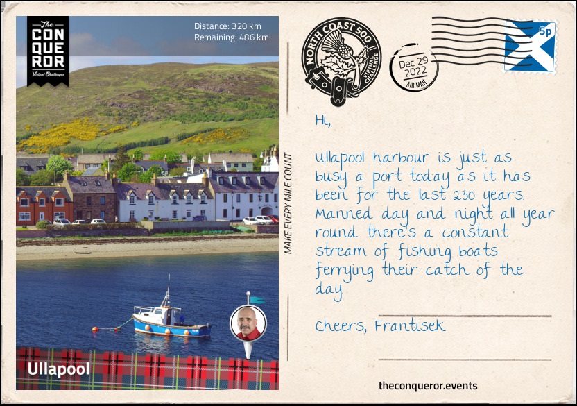
km od začátku : 0320
Ullapool
As I headed towards the village of Garve, I nearly missed the waterfall tucked between trees on the side of the road. Curious about where it was coming from a five minute walk further took me to a faint rocky path that led up towards the river and onto a series of falls known as Ardessie Falls. From up here I enjoyed gorgeous views across Little Loch Broom and An Teallach, a mountain to the east of the falls.
An Teallach is a complex mountain with ten peaks over 3,000ft (914m). Whilst they could all be classified as Munros only the highest peak, Bidean a' Ghlas Thuill at 3,484ft (1,062m) carried that honour until 1981 when it's nearby Sgùrr Fiona summit was added to the list.
Reaching Garve, I took a hike up to the Sgùrr Fiona and experienced the most splendid panorama of mountainous landscape with Loch na Sealga below and the winding course of two rivers joining together that poured into the lake.
My next stop was the Corrieshalloch National Nature Reserve to visit the Falls of Measach, a 157ft (45m) tall waterfall that crashed into the Droma River below and coursed its way through a narrow gorge all the way into Loch Broom. Following a woodland trail, I arrived at a suspension bridge where the waterfall tumbled over several layers before plunging into the river. Crossing the bridge, I walked a little further up to another platform where I could enjoy the tree-lined gorge, the waterfall in the distance and the suspension bridge above it. Travelling north-westerly again, I reached Loch Broom the sister lake to Little Loch Broom. The two lochs are parallel to each other and divided by a peninsula which contains the mountains of Beinn Ghobhlach and Beinn nam Ban. To the east of Loch Broom is the village of Ullapool.
With a population of 1,500 residents, Ullapool is the largest settlement in the region and serves as an important port for fishing, yachting and ferry transport. The village was founded in 1788 and designed by Thomas Telford expanding the then existing hamlet of 20 households. The village is surrounded by mountains and Ullapool River runs through it.
On the shore of Loch Broom near the port, I found an inn where I took an outside seat to enjoy the lake and surrounding mountains whilst I had dinner. From the menu I chose a cider battered haddock with skin-on fries, peas and homemade tartare sauce and finished off with a steamed pudding with vanilla ice cream. I cleaned my palate with a crisp glass of viognier and finished the evening with a hot cuppa of Scottish Blend tea.
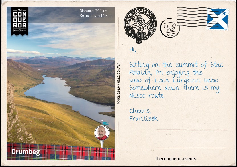
km od začátku : 0391
Drumbeg
Bearing north then northwest, I arrived at Stac Pollaidh and its dramatic rocky crest and the adjacent Loch Lurgainn. At only 2008ft (612m), Stac Pollaidh is a popular hiking destination. It has a circular route with a separate path to the northeast for the final ascent to the summit ridge. Whilst this last stretch is a steep climb it is still easily accessible. However, the true summit lies on the western side of the ridge which requires a high level of scrambling experience and a good head for heights due to the several rocky towers that must be climbed to reach the top.
As the Stac stands alone in a relatively flat landscape the views offered are breathtaking. To the north are Inverolly forest, Loch Sionasgaig and the neighbouring peaks of Suilven and Cùl Mὸr, whilst to the south is Loch Lurgainn at the base of the mountain and the Summer Isles in the distance.
The interesting formation of the rocky stacks atop a smooth-sided mountain is a result of weathering during the Ice Age. Known as a nunatak, the summit ridge protruded above the ice sheet giving its rugged head, whilst below as the ice melted and flowed, it smoothed the sides of the mountain.
Carrying on via the usual single track road, I had Loch Lurgainn as a companion until a small land formation separated it from my next companion Loch Bad a' Ghaill. At Badnagyle I took a right turn and weaved my way into Achmelvich. This settlement via a somewhat difficult single track road, off the main tourist road is worthy of a visit for its Blue Flag beach (awarded to beaches with pristine water) that also carries the Marine Conservation Society status for its marine protection area.
Another curious feature is Europe's smallest castle locally known as the Hermit's Castle. It was built by an architect in the 1950s when according to lore he got fed up with the world and wanted to get away from it all. He spent six months building this concrete 3.8mi² (10m²) "castle" that barely stands about 8ft (2.4m) tall by bringing all the material by sea. It's questionable whether he obtained permission to erect the structure but it seemed that after spending only one weekend in it, he got up and left, abandoning it to the wild of the western highlands. Vandalised in the 1970s when its windows and door were destroyed, the little castle is now sometimes used for shelter, called a bothy in Scotland and provides much amusement to visitors whilst overlooking the Minch (a strait).
Now anyone who likes a good rock formation would be in awe of the 197ft (60m) tall sea stack known as the Old Man of Stoer. Accessed from the Stoer Lighthouse this lonely stack dates back well over 550million years. It is popular with rock climbers due to its height and varying levels of difficulty. I think of it as a long-lost cousin of the 12 Apostles on the Great Ocean Road, Australia.
Just past the village of Clashnessie is a big sandy beach in the bay of Clashnessie to while away the day, however, I was much more interested in the short walk upstream to see the 49ft (15m) tall waterfall. Tucked in-between the hills the fall coming from the a small lake above flowed over the rocky wall creating a curtain like appearance, landing on the rocks below and flowing its way into Clashnessie Bay.
Wrapping my day, I made my way into Drumbeg, a small village with a mere population of 100. Before settling in for the night I wondered up to the Drumbeg Viewpoint for the lovely views across Eddrachillis Bay to the north, Loch Drumbeg to the south and Quinag mountain range to the east.
The Eddrachillis Bay is the site of one of the earliest known shipwrecks in Scotland. Following an archaeological survey it is believed that the wreck which consists of three iron cannons, a Delft tile (Danish tile) and remnants of a wooden hull, is of a mid-17th century trading vessel from northern Europe. This medieval wreck however, is not the only one resting on the seabed of the bay. The ex-liner Bermuda had the misfortune of catching fire not once but twice at which point it was beyond repair. Whilst undertow to the scrapyard both tow ropes snapped washing the ship onto rocks. Re-attaching the ropes and moving off the rocks the ropes parted again. This time the ship washed further inshore making it impossible to refloat. She has been left there since 1930 and today serves an occasional diving site.
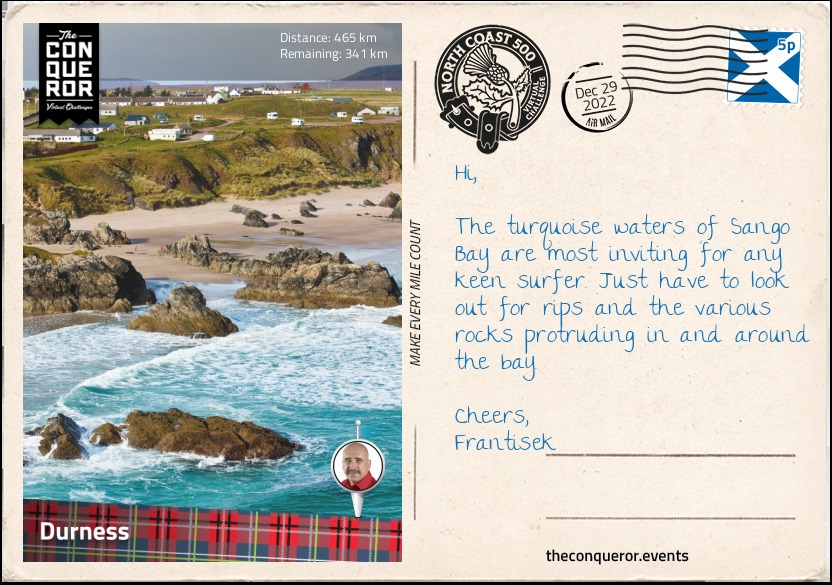
km od začátku : 0465
Durness
Gosh some of these single track sections are so narrow they could barely be called laneways. With rocky hills to one side and lochs on the other, it makes for some very difficult navigation. It eventually reaches moorland and whilst the track is no wider, the sense of space and views of the lochs and seas in the distance are magnificent.
Taking an east to southeast direction, I arrived at a junction where I took a left turn and passed through Newton, Unapool and over Kylesku Bridge that crossed the Loch Cairnbawn (a sea inlet of Eddrachillis Bay) to the west which splits into two lochs to the east; Loch Gleann Dubh bearing east and Loch Glencoul bearing southeast which then runs into Loch Beag.
Making a stop in the village of Kylesku, I took a boat-trip to Loch Beag so I could see Eas a' Chual Aluinn, the highest waterfall in the UK. At 658ft (200m) the waterfall has a sheer vertical drop into the glen below. For the adventuring hiker, the waterfall is accessible through boggy ground via a 6mi (10km) in and out route. It crosses several rivers and over steep, rocky and rough terrain to reach the top of the waterfall.
Completing the final stage of the westside of NC500, I travelled through Scourie known for its rocky bay and seaside cemetery, then from Laxford Bridge the route moved inland all the way into Durness.
Durness is the most northwesterly village in Scotland and marks the start of the northern route of the NC500. Here I explored Sango Bay with its golden sand and turquoise water surrounded by rocky cliffs. A short distance away was Smoo Cave that was formed by both the sea and a river.
Smoo Cave was at the end of a very narrow and steep-sided inlet that I accessed via a set of stairs from the west side of the cave. At the bottom I crossed the stream via a wooden bridge and followed the path to the first chamber which measured 200ft (61m) long, 130ft (40m) wide and 50ft (15m) high. This section of the cave was carved by the sea gushing through the inlet.
To the west of the first chamber, is the second chamber which was carved by the freshwater river Allt Smoo. Here I could hear the roaring sound of a waterfall, a result of the river dropping through a sinkhole. The sinkhole can also be viewed from above where a small bridge was placed over the river. A trail to the east of the cave leads alongside the inlet at the top giving a spectacular view of the sheer cliff face of the inlet and the sea coursing through it.
Ready for a hearty meal and a good rest, I pulled up at the local pub and worked my way through a lamb shank with mashed potatoes and veggies. Finished off with an apple pie, a hot cuppa and a wee dram of Scapa whisky with its spicy undertones from the Orkney Islands located north of mainland Scotland.
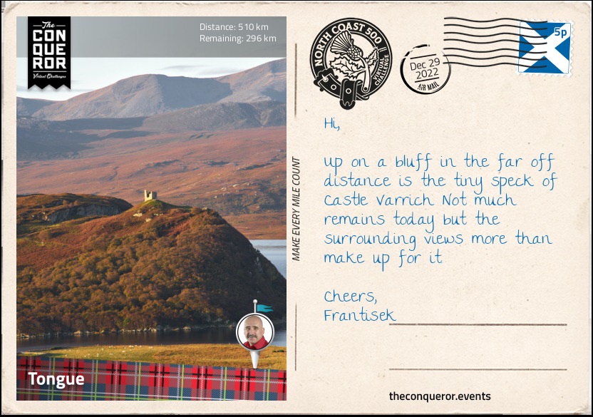
km od začátku : 0510
Tongue
Leaving Durness, I was swayed in making a quick stop at Ceannabeinne Beach just a few miles east of the village. The nearly white sand, clear azure water, flanked by rocky cliffs and a grassy landscape made for a dreamy day at the beach until I dipped my toe in the frigid Atlantic Ocean and thought otherwise of it.
Instead I turned south and travelled west of Loch Eriboll, then made a U-turn and travelled northwards on the east side of the lake till I reached Ar Neakie Lime Kilns. A short hike along a narrow sandy spit leads to a rocky promontory and a defunct lime kiln quarry. The kilns were once used to produce lime for farming which were loaded onto ships and transported to be sold.
Another historical feature at Loch Eriboll was the surrender of 33 German U-boats in May 1945 that helped end the Battle of the Atlantic. Remotely located with deep anchorage, Loch Eriboll was a perfect place for surrender as it limited the chance of resistance by the U-boat commanders. The U-boats were immediately disarmed and eventually relocated where the crews were arrested and the U-boats scuttled.
Bearing east, I crossed the Kyle of Tongue Bridge and into the coastal village of Tongue. A pretty village lined with stone buildings, Tongue's claim to fame was in 1746 when the ship Hazard filled with gold coins hid in the Kyle of Tongue to evade the Royal Navy frigate, HMS Sheerness. The gold was meant to fund Bonnie Prince Charlie's rebellion. Before capture the crew threw the gold into the lake. When the Prince heard of this he sent an army of 1,500 men to obtain the gold but were defeated enroute. To some degree it is thought that if the men had instead been at the Battle of Culloden near Inverness the outcome of the battle may have ended in favour of the Prince.
To the west of the village, high up on a bluff is Castle Varrich, the ruins of a small tower that was once the seat of the powerful Clan Mackay. Possibly built in the 14th century on the site of an Old Norse fort, the ruins have recently had a spiral staircase installed in the centre of the tower with a viewing platform at the top. From the top I can see the Kyle of Tongue and the mountains, Ben Loyal to the south and Ben Hope to the southwest.
Just north of the village is the House of Tongue, the chief seat of the Clan Mackay when they moved from Castle Varrich. The current house was built in 1678 by the Mackays after the previous house was burnt by Cromwell's army 22 years earlier. However, in order to pay off debts the house and most of the Mackay estate was sold to the Sutherland family and today it is the Scottish home of the Countess of Sutherland.
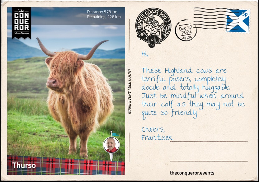
km od začátku : 0578
Thurso
Heading towards Thurso, I made a small detour at Melvich to visit a farm where I could have a close encounter with the completely adorable Highland cows. These shaggy cows with their long coats and long horns originated in the Highlands. They are known for their hardiness and ability to withstand the harsh conditions of northern Scotland. Their woolly hair is double coated with an oily outer hair (the shaggy part) that covers a downy undercoat. They can forage up steep mountain areas by grazing and eating plants that other cattle avoid and they can dig through snow with their horns to find buried plants. Bulls can weigh up to 1,800 pounds (800kg) and the females up to 1,100 pounds (500kg). They have a docile disposition unless they are protecting their young and are highly photogenic. With their ruffled, shaggy look, fringe over their eyes for protection these "Heilan coos" in Scots or "Bò Ghàidhealach" in Gaelic are a much loved Scottish icon.
About 5mi (8km) before Thurso, at the end of a dirt track near a working farm are the remains of Brims Castle. An L-shaped, 3-storey tower house, it was the property of the Sinclair Clan since the 17th century and occupied until the 1970s when the building's roof collapsed and the property was abandoned. A ghostly story of a ‘White Lady' is told to be of a woman who was disposed of by her lover by hiding her body inside the castle. On a lighter note though, Prince Charles is credited for being the artist of a watercolour painting entitled Caithness (which is the region the castle is in) that was displayed at an online art show. A long term resident of Thurso recognised the building in the painting as one of Brims Castle.
Thurso is the northernmost town in mainland Britain and it is located near Thurso Bay. Looking out north to the sea, I could make out the silhouette of the island of Hoy, one of the Orkney Islands and to the north east I could see the cliffs of Dunnet Head. The bay itself is open to the Atlantic swells making the area an attractive spot for surfing. Thurso is host to the annual Scottish National Surfing Championships and has also hosted two World Championships for Kayak Surfing. The bay and the sandy beaches makes Thurso a fabulous place for any water sport enthusiast.
Thurso is also home to one of the oldest churches in the country, Old Peter's Church. It dates back to the 1100s and was altered and expanded many times over the next 700 years. In 1832 the church was abandoned and since then the roof has collapsed leaving the interior open to the elements. Surrounded by a wall the church and small graveyard was a quiet place for contemplation and peaceful meandering.
A short distance from the town centre bearing northeast are the ruins of the 19th century Thurso Castle. Originally a 12th century Viking stronghold, the castle was obtained by the powerful Sinclair clan and during the mid-17th century the castle was largely rebuilt. Disputes ensued with the Campbell Clan, another powerful family, and the castle was attacked and badly damaged. Eventually the dispute was settled and the castle repaired. By the mid-19th century the castle went through further changes until it was fully demolished and rebuilt into a Gothic style mansion. Unfortunately the castle caught fire and sometime in the early 1950s the roof was removed. A section of it is still habitable and it continues to be the home of the Sinclair family.
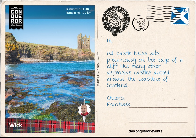
km od začátku : 0633
Wick
Satisfied with my "Heilan coos" encounter, my journey took me to the Castle & Gardens of Mey previously known as Barrogill Castle. Originally built in the 16th century by the Sinclairs, ownership passed out of the family to a Scottish zoologist, Frederick G Heathcote. He inherited the castle on the condition that he would legally change his name to Sinclair. The castle was sold to a Captain in 1929 and then sold again to the Queen Mother in 1952.
The story told was that the castle was in a tragic state and pretty close to demolition when the Queen Mother saw it. The owner at the time desperately wanted to get rid of the castle and just wanted to give it away, however, the Queen Mother wouldn't agree to that and they settled on the purchase price of 100 pounds.
Restoring the property was a significant project as this was the first time that electricity, water and bathrooms were installed. Many of its 19th century additions were removed, the original name of Mey was reinstated and most of the works were supplied by local townspeople.
The Queen Mother visited the castle every year as part of her summer holidays. She would picnic on the beach each afternoon and collect shells which she would bring back to the castle and place in a bowl at the front door. The castle is now in the care of a Trust, helmed by Prince Charles and it is open to the public except for when the Prince and the Duchess are in residence.
Lying on Great Britain's northeastern tip is the village of John o'Groats and it may be mistaken as the northernmost point but that credit goes to Dunnet Head not far from Thurso. The village is famous for its long distance route across the length of Britain - named Land's End to John o'Groats - with the other end being at the southwest corner in Penzance. It is also known for its long-distance walking route called John o'Groats Trail which begins in Inverness and travels north along shorelines, cliff tops and back lanes. The iconic signpost found near the local hotel marks the Journey's End and a great place to wrap your arms around when a strong wind blows through the wide open space.
This marks the end of the northern portion of NC500. Now I start the east coast portion of the route travelling south towards Wick. A few stops were needed along the way to see several coastline castles. Best do a quick roundup as I'm sure each has a long and distinguished piece of history.
Freswick Castle was built by the Sinclairs in the 16th century on the site of an old Viking settlement. As typical with many castles various alterations took place through the following centuries and the castle remained in the family until the 20th century when it entered a period of decline. Located on the shores of Freswick Bay, the castle was purchased in the 2000s to serve as a family home. Following extensive renovations the property was opened for overnight stays.
A mere 1.3mi (2km) away are the ruins of Bucholie Castle. Located on a promontory that is accessed by a very narrow isthmus with sheer drops on either side, the site originally had a fortress called Lambaborg that was built around 1140 by the notorious Viking pirate and robber, Sweyn Asliefson. Castle ownership moved to the Mowat family around the 13th century and remained in the family until 1661 when it was abandoned and fell into disrepair. Not much is left of the castle but for a daring adventurer crossing the isthmus and then climbing up to the entrance to explore the remains on the promontory would be quite the experience.
Standing on sheer cliffs overlooking Sinclair Bay is the partially ruined Old Keiss Castle. Initially built as a square tower house with towers on diagonal corners, the castle had four floors, an attic, a vaulted basement and tall chimneystacks. Built around the turn of the 17th century by the Sinclairs it seems the castle fell into ruins within a century and instead of repairing it the family moved and built the nearby Keiss House. Sadly a portion of the old castle collapsed when the cliff below it fell. What remains of it seems to be on borrowed time.
Making my way into Wick I went out and explored the last two castles that were both within very close proximity to the town. To the north of the town located on a rocky promontory is Castle Sinclair Girnigoe. It was a 15th century five storey building with a walled courtyard, a gatehouse and drawbridge (now replaced by a footbridge) to cross the ditch that cuts off the promontory. The size of the original castle was significant and at one point it was thought to be two separate castles near each other, one called Sinclair and the other Girnigoe. This assumption was a result of another drawbridge that was located between two main buildings and a dry moat that separated them. Those who visited just simply assumed they were two castles. However, following archaeological studies it was concluded that it was indeed just one castle. It is not clear what happened to the castle in the end but an archaeological survey is ongoing and perhaps one day the puzzle will be solved.
South of Wick is the very ruinous state of Castle Wick. Very little is left of it but it is one of the oldest structures in Scotland having been built in 1160 at the height of Norse power. Sitting on a narrow promontory the castle was a single tall tower or keep and the surrounding grounds would have had several buildings to accommodate servants, workshops, stables, kitchen and what was necessary to manage the needs of the lord and his family. Whilst not much remains a meander gives way to expansive views across Wick Bay and the North Sea and somewhere in the distance is the coastline of Norway.
Scotland is renowned for its vast collection of castles. Somewhere upward of 2,000 castles existed. Of course many have perished by now. Primarily built for defense against invasion the castles were built in strategic locations. However, their ability to remain a stronghold was decimated when gunpowder was invented and their defensive capability diminished. With time and changing needs their original designs as fortified castles gave way to luxurious mansions of which many continue to exist today and are inhabited by the descendants of their original clan owners.
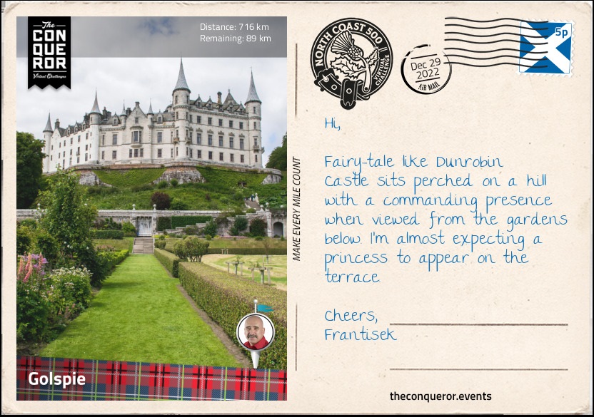
km od začátku : 0716
Golspie
Always curious about unusual locations, I just had to check out Whaligoe Haven and its narrow, steep set of steps. Surrounded by 250ft (76m) cliffs on three sides, the haven was used as a fishing station. Entry to the harbour was quite treacherous with ships having to moor against rocks whilst fishing boats had to be pulled out using a winch. The local residents had no choice but use the haven as there were no alternative nearby options.
Access to the harbour was via a steep descent of some 300+ steps (there seems to be some debate as to precisely how many) in a zig-zag formation. It was built around the mid-18th century for a total of eight pounds. The steps are made of stone and whilst in excellent condition they can be hazardous on wet days, particularly since the seaward side of the steps only has a low stone wall and quite a sheer drop. A good head for heights and surefootedness is certainly necessary. The hillside of the steps is quite pretty, densely filled with wildflowers amongst grassy patches and rockface. At the bottom are remnants of a hand powered winch that was used to haul up the fishing boats and the ruins of a salt store that was used to cure the fish. Whilst usage of the harbour declined over time until it ceased altogether in the 1960s the steps themselves continue to be maintained by local volunteers.
From the shores of Dunbeath Harbour I could see across the bay the striking Dunbeath Castle. Built in the 13th century and expanded on, the white castle stands out amongst its green grassy surroundings and rocky shores. It is a private residence where only the gardens are available to explore. A very long driveway leads to the residence as it passes two walled gardens, each with their own theme. The upper garden, is located on a bank and was designed for serenity and peace as one meanders past its various pools and swaying grasses. The lower garden is brimming with colour and floral displays in perfectly executed garden beds filled with roses, dahlias, lupins, hostas and geraniums to name a few.
Across the river from the village of Helmsdale is The Emigrants monument in memory of the Scottish people who left the shores of Scotland in search of a better life following the Highland Clearances (c1750-1880) when large numbers of Highlanders were displaced from their lands. The statue is of a family consisting of a kilted man looking ahead into an unknown future, a boy looking up at him for reassurance and a woman holding a baby facing the opposite way towards a home they were forced to leave. The inscription on the monument evokes a lot of emotion for those times and it reads:
"The Emigrants commemorates the people of the Highlands and Islands of Scotland who, in the face of great adversity, sought freedom, hope and justice beyond these shores. They and their descendants went forth and explored continents, built great countries and cities and gave their enterprise and culture to the world. This is their legacy. Their voices will echo forever through the empty straths and glens of their homeland."
Just before reaching my next destination, the village of Golspie, I took another detour to visit the last castle on my journey, the fairytale-like Dunrobin Castle. Located high on a rocky spur it is the largest castle in northern Highlands. Whilst its history is a difficult one due to their extensive involvement in the Highland clearances, I chose to appreciate the castle and its gardens from an architectural point of view. The entrance to the castle wasn't particularly impressive until I walked around the side of it to the rear and found myself on a large upper terrace. Here I admired the grand chateau-like structure with its conical spires overlooking the formal gardens below and views of Moray Firth beyond. The castle has been in the same family for nearly 700 years and it has a whopping 180 rooms. Decorated with period pieces, there was lots to see inside from painted friezes, wood panelling, armoury display and in the old summer-house at the rear of the garden was the museum exhibiting the family's collection of artefacts from their travels.
Golspie is a seaside village located on the North Sea coast. It is overshadowed by nearby Ben Bhraggie, a hill right behind the village. The hill is 1302ft (397m) tall and right at the top is a 100ft (30m) tall monument of the first Duke of Sutherland. The monument was erected in 1837 and is visible from far and wide perched up on the hill. The village has a long sandy beach which seemed like a good place to pause and enjoy the sea views.
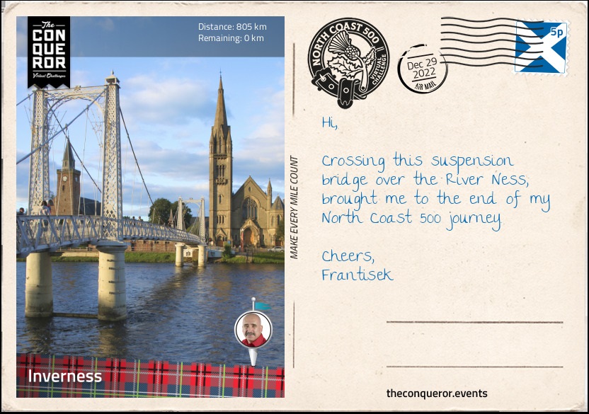
km od začátku : 0805
Inverness
Continuing south I crossed the Dornoch Firth Bridge into the village of Morangie where the Glenmorangie Distillery has been producing its single malt whisky since 1843. The distillery has its own water source, the Tarlogie Springs, and the tallest stills in Scotland. The copper stills at 26ft (8m) with "necks as tall as a giraffe" are used for distilling the spirit and it is said that it is meant to create "more space for taste and aroma". Well they must be doing something right as they produce around 10 million bottles per year of which 60% are sold within the UK alone.
At the Ardullie roundabout shortly before the town of Dingwall, I took a left turn onto Cromarty Bridge and crossed Cromarty Firth. The mile long bridge was built in 1979 significantly shortening the route from the north into Inverness and bypassing major towns such as Dingwall, Muir of Ord and Beauly.
The Cromarty Firth is an arm of the Moray Firth. Several oil rigs occupy space at the entrance to the firth and facilities for cruise ships, oil processing and bulk cargo handling can be found along the firth.
The firth is also designated a Special Protection Area for wildlife conservation where dolphins, porpoises and seals live and minke whales migrate to seasonally. Larger marine animals such humpback whales and common dolphins may visit at times.
Once across the bridge, I took a winding southeast direction across the Black Isle peninsula through several small villages until I reached North Kessock where I crossed yet another bridge across Beauly Firth.
Kessock Bridge is 3,456ft (1,056m) long and since the firth beneath it is navigable the bridge is raised high over sea level. It has four towers with cables running from the top to the deck supporting the bridge. The cables have a fan-like appearance making it visually appealing over Inverness' skyline, especially when the bridge is lit at night.
I finished my journey near Ness Bridge on the opposite side of the river from where I began having completed 500mi (805km) around the north-western Highlands. The North Coast 500 was a combination of hair raising experiences on single track roads, splendid panoramic views, castles rich in history and numerous lochs, sheer cliffs, mountains and pristine beaches.
km od začátku : 0013
12 Grimmauld Place
12 Grimmauld Place is invisible to Muggles, with only a select few wizards and witches knowing about its existence. This is the ancestral home of the Black Family which now serves as the headquarters for the Order of the Phoenix. Though not particularly welcoming, the mysterious and dusty house is a safe haven for Harry as many of the people he loves gather here.
km od začátku : 0019
Ministry of Magic
At the heart of London and kept away from Muggle eyes lies the Ministry of Magic. This governing body is tasked with issuing and keeping magical law as well as liaising with the Muggle minister. The Ministry is comprised of seven departments, amongst which the Department of Mysteries is the most enigmatic.
km od začátku : 0024
Courtroom Ten
Located on level 10, this is one of the courtrooms in use at the Ministry of Magic. This grand room is built of hardwood and stone, with high dark benches, as if designed expressly to intimidate defendants.
km od začátku : 0048
The Hog's Head
Found in Hogsmeade, this inn is the less reputable counterpart of the Three Broomsticks Inn. Decorated with a fearsome hog head and copious amounts of dust, this less frequented place is perfect for a secret gathering.
km od začátku : 0058
Room of Requirement
In need of a place to hide yourself or an object? Looking for a place to practice or a long-forgotten artifact? You might be in luck and find the entrance to the Room of Requirement. This secret room does not appear on any map of Hogwarts, not even the Marauder’s Map! Its entrance is made visible only to those that truly need it.
km od začátku : 0114
The Veil
Deep down in the Department of Mysteries lies a great stone arch with a gossamer-like veil from top to bottom. One cannot pass through and remain in this world, for the ones who are behind the veil are no longer alive. Little else is known about this mysterious structure.
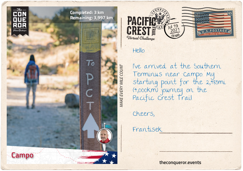
km od začátku : 0003
Campo
The Pacific Crest Trail (PCT) is located on the westside of the United States. The PCT is part of America’s National Trails System that connects 88,610mi (142,600km) of scenic, historic and recreational trails. The PCT in the west and the Appalachian Trail in the east were the first to become part of the National Scenic Trails. Joined by the Continental Divide Trail, together they form the Triple Crown of Hiking in the US.
The PCT commences in Campo on the border of United States and Mexico and travels north through California, Oregon and Washington states terminating in Manning Provincial Park in the province of British Columbia, Canada.
The trail passes through 25 national forests and 7 national parks with the highest elevation at 13,153ft (4,009m). Almost two-thirds of the trail will be spent in California. The midpoint is near Butt Mountain to the west and the town of Chester to the east.
A thru-hike on the PCT takes approximately five months which is pretty much the entire snow-free season, averaging 15mi (24km) per day, give or take and not taking rest days into consideration. Starting any earlier or later increases the risk of encountering snow conditions which could prove deadly or needing to quit the thru-hike.
To begin this journey, I arrived in Campo, a small community of approximately 2,700 residents. Campo was once a military town during WW2 and home to the “Buffalo Soldiers” who were an all-black regiment established by Congress in 1866. Many of the Buffalo Soldiers served as the first national park rangers in California’s Sierra Nevada. The oldest serving Buffalo Soldier was Mark Matthews, who joined the 10th Cavalry Regiment at age 15 in 1909 and lived to 111 years of age, passing away in 2005.
Campo is home to the Pacific Southwest Railway Museum showcasing a collection of locomotives and railroad cars, retired railroad signals demonstrating how they work and a railway library containing the second largest collection of railroad history in California.
One and a half miles (2.4km) south of Campo is the Southern Terminus monument. The monument together with its northern twin was originally erected in 1988 to commemorate the National Trail System Act’s 20th Anniversary. In January 2016 the rotted five fir pillars were replaced with new ones designating the beginning of the PCT. Here, with the border wall as a demarcation of the two countries, on a dusty desert trail I start my trek northward bound.
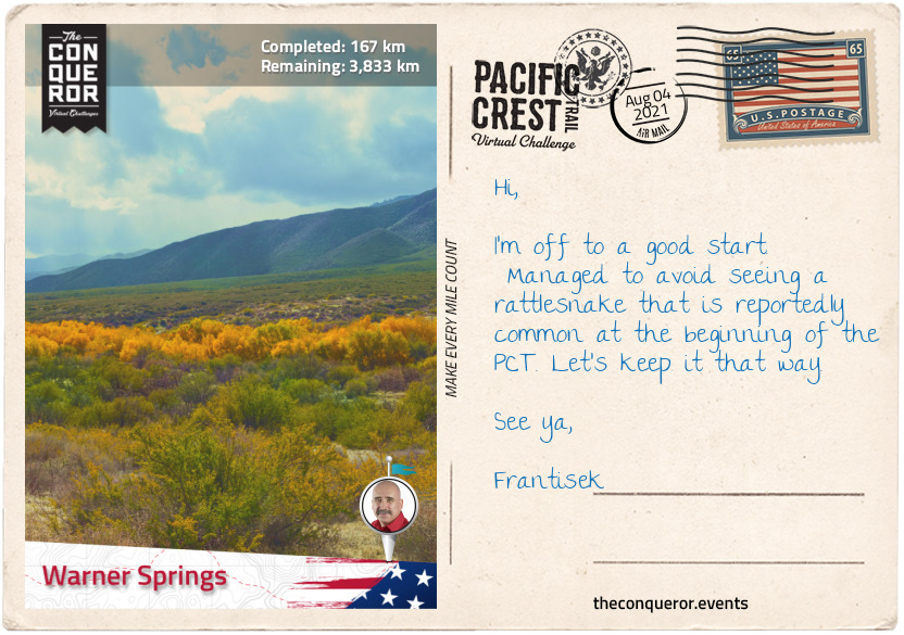
km od začátku : 0167
Warner Springs
Leaving Campo, the trail passes through Lake Morena County Park, a lakeside camping site known for its fishing, picnicking, hiking and boating. Located southwest of Laguna Mountains the park is a combination of desert, coastal and mountain habitat. Bobcats, bald eagles and waterfowls can be seen within the park’s thick and dense shrubs.
The trail swings beneath Interstate 8 at Boulder Oaks and snakes its way through to the rim of Mount Laguna. A small town of 57 residents, Mount Laguna sits at 5,777 ft (1,761 m) within a forest of Jeffrey pines (Pinus jeffreyi), which are large coniferous evergreen trees that grow between 82-131ft (25-40m) tall. The trees were named after 19th century Scottish botanist John Jeffrey, who discovered this species of tree in 1852. With a general store in town this is a perfect place for restocking supplies.
Skirting around Monument and Garnet Peaks the trail occasionally travels along county highway S1 until it veers right around the base of Granite Mountain and meets up with county highway S2. Highway S2 is known as the Great Southern Overland Stage Route because it follows the former route of the Southern Emigrant Trail, an immigration route into California from the eastern United States during the gold rush era in the mid-1800s.
Crossing highway 78 in the San Felipe valley, the trail winds its way through the San Felipe hills all the way to Warner Springs. About 3mi (5km) before reaching town, to the right of the PCT is the natural formation known as Eagle Rock. Made of a collection of giant boulders, this formation takes the shape of an eagle with its wings spread as if ready to take flight. It stands majestically on a hill surrounded by a expanse of grassland and mountains in the distance.
Leaving Eagle Rock, the grassland trail eventually merges into a thicket of shrubs followed by groves of old oak trees before it reaches a town at Hwy 79.
Warner Springs was originally occupied by the Cupeno people, a Native American tribe. When the Spanish missionaries arrived they founded a small community in 1818. St Francis of Assisi chapel was established in 1830 which continues to exist today and still conducts service.
Near Warner Springs is the historical landmark Warner Ranch House. Built in 1849 it served as a way station for the emigrants on the Southern Emigrant Trail between 1849 and 1861. It was owned by American citizen John Trumbull Warner who was a fur trader from Connecticut. He became a Mexican citizen in 1844 and changed his name to Juan Jose Warner. Shortly after he obtained rights to Rancho San Jose del Valle where he established a successful cattle ranch. Most of his workforce was made up of the Cupeno people who were living in a nearby village.
Juan Jose lost his land and ownership transferred to John G Downey in 1880 who began legal proceedings to have the Cupeno people evicted from the ranch. The Cupeno lost the case and in 1903 were relocated to Pala Indian Reservation.
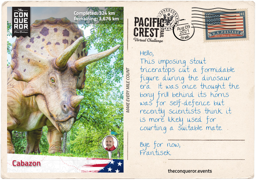
km od začátku : 0324
Cabazon
Crossing Hwy 79 from Warner Springs, the trail winds and climbs passing east of Coombs Peak with a short quarter mile (400m) hike to the summit from the PCT. Marked by frequent cairns (heap of stones) along the way, the hike is a challenge largely due to loose rocks and steepness. However, views of Salton Sea to the east, Lake Henshaw to the southwest, San Jacinto and San Gorgonio mountains to the north make it a worthwhile side trip.
The trail continues crossing a couple of small dirt roads before reaching Hwy 74 with Cahuilla Reservation to the west and the Santa Rosa Reservation to the east. Both reservations are home to the Native American people of the Cahuilla Nation. The town of Anza in the Cahuilla Reservation was named after Juan Bautista de Anza, a Spanish officer who led an expedition into California in the late 18th century.
Crossing Hwy 74 the trail ascends onto the ridge of the San Jacinto Mountain Range. Through a series of switchbacks the trail passes Pine Mountain Ridge to the east. The ridge is made up of thick layers of sandstone that are particularly hard and resistant to weathering. Its ecoregion is split into chaparral (thick shrubs/dwarf trees) on the lower slopes and thick pine forest and incense cedars (a type of conifer) on the upper slopes.
Staying atop San Jacinto’s ridge the trek continues through the woodlands of the San Bernardino National Forest passing several peaks to the west at over 7,000ft (2,100m) such as Palm Peak View, Spitler Peak, Apache Peak and Antsell Rock before reaching Tahquitz Peak at nearly 8,800ft (2,680m). The trail then dips slightly trekking through Saddle Junction swinging westward to Strawberry Junction and entering Mount San Jacinto State Park. The trail passes several 10,000+ft (3,048m) peaks to the east with San Jacinto Peak being the highest at 10,834ft (3,293m). For sea level dwellers it would not be unusual to experience altitude mountain sickness.
One of the highlights of the State Park is the Palm Springs Aerial Tramway. Opened in 1963 it is the largest rotating aerial tramway in the world. Ascending from Coachella Valley to San Jacinto Peak the tramway takes 12.5 minutes to reach the top. It passes a sheer mountain face, travelling through five life zones. The trip starts in the desert and ends in an alpine forest.
Coming upon Fuller Ridge the trail starts its descent through some very tight switchbacks into Snow Creek, a small village in a valley. A little further along is Interstate 10 (I-10) and swinging west is the town of Cabazon.
Cabazon is a small town of about 2500 residents but what it is really known for is its dinosaur roadside attractions. Two enormous steel-and-concrete dinosaurs are seen from I-10. One is a 150ft (46m) long Brontosaurus and the other a 65ft (20m) tall T-rex. Built by sculptor Claude Bell in 1964, its original purpose was to attract customers to his nearby restaurant. Today it’s a museum with 50 robotic dinosaurs, a dinosaur dig and fossil panning.
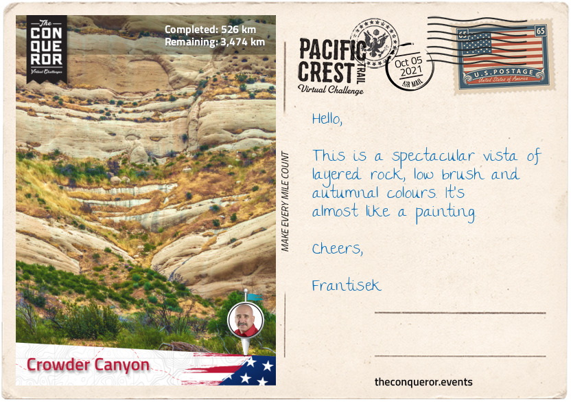
km od začátku : 0526
Crowder Canyon
Back in the woodlands the trail crosses the Whitewater Canyon, home to bighorn sheep, deer and bears. The nearby Whitewater Preserve is 2,851 acres and the Conservancy Association proactively engages in the conservation and preservation of the area, restoring wilderness, purchasing land to retire grazing cattle and removing neglected buildings and non-native diseased trees. One of their great success stories is transforming the Whiteware River from “black water cattle wallows into crystal clear waters”.
Travelling north on a single track through a narrow pass the trail hooks left towards the city of Big Bear Lake. Located on the banks of Big Bear Lake and surrounded by San Bernardino National Forest, the city is known for its ski resorts and recreational lake. At 7mi (11km) long and 1mi (1.6km) wide, the lake is popular with anglers due to the abundance of fish.
Hollywood film producers used the location for the films Gone with the Wind, Daniel Boone and Paint Your Wagon (1969) musical with legends Lee Marvin and Clint Eastwood.
Jordan Romero, a native of Big Bear Lake, is known for his summit of Mt Everest at the tender age of 13 (2010) and completing all 7 Summits by the time he was 15.
The trail passes Delamar Mountain and winds its way until it crosses a fishing spot on Deep Creek. Swinging right, the trail travels north along the creek to Aztec Falls, a crisp swimming hole with a short cascade feeding the pool.
For the next 15mi (24km) Deep Creek remained a constant companion first to the east and then crossing to the west of the PCT, never too far if I needed access to water. However, there’s nothing like taking a load off to bask in natural hot springs at Deep Creek Hot Springs just off the PCT. Great way to rejuvenate and soothe the weary body and battered soles.
Deep Creek and I parted ways when I turned left to travel to Silverwood Lake, a large reservoir built in 1971 as part of the Cedar Springs Dam construction. The construction inundated the town of Cedar Springs and as such all its residents had to be relocated.
After another 15mi (24km), I arrived at Crowder Canyon next to Interstate 15. In the early-mid 19th century the canyon served as a trade route connecting Santa Fe, New Mexico to Los Angeles and Southern California. It was an arduous 700mi (1,100km) route. Following in the footsteps of these early traders, I crossed beneath the Interstate leaving San Bernardino National Forest behind and entered the Angeles National Forest.
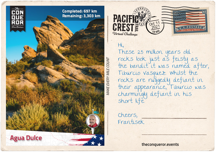
km od začátku : 0697
Agua Dulce
The Angeles National Forest was established in 1908 and it was the first National Forest established in California. It is located within the San Gabriel Mountains to the east and Sierra Pelona Mountains to the northwest. About 100mi (160km) of my trail travels through the forest from east to west.
Just north of the densely populated Greater Los Angeles, this 700,176 acres forest offers five wilderness areas that are federally protected under the Wilderness Act. The Act describes wilderness as "an area where the earth and community of life are untrammelled by man, where man himself is a visitor who does not remain" and "an area of undeveloped Federal land retaining its primeval character and influence, without permanent improvements or human habitation, which is protected and managed so as to preserve its natural conditions."
Hollywood film producers used the location for the films Gone with the Wind, Daniel Boone and Paint Your Wagon (1969) musical with legends Lee Marvin and Clint Eastwood.
The forest is home to several wild animals such as black bears, cougars, bighorn sheep, coyotes and rattlesnakes.
The landscape is primarily chapparal shrub with oak woodlands along with trees such as coulter pine, California walnut and big cone Douglas-fir. About 4% is old-growth (primary forest) with a collection of Jeffrey pine, mixed conifer, ponderosa pine, white fir and lodgepole pine.
The San Gabriel Mountain Range lies between Los Angeles Basin and the Mojave desert with the San Andreas Fault as its northern border. It consists of 20 mountains/peaks ranging from the smallest, Echo Mountain (3,210ft/980m) to the tallest Mt San Antonio (10,064ft/3068m).
Some notable mountains are:
● Mt Baden-Powell named after the founder of the World Scouting Movement, Robert Baden-Powell. The PCT passes within a quarter mile (400m) of the summit;
● Mount Burnham named after military scout Frederick Russell Burnham who taught scoutcraft to Robert Baden-Powell;
● South Mount Hawkins was named after Nellie Hawkins, a famous waitress of the Squirrel Inn (no longer exists). The fire lookout tower, the only all-wooden tower in Southern California, stood here for 67 years until a forest fire destroyed it in 2002.
● Mount Disappointment unfortunately got its name when USGS surveyors thought it was the highest peak in the immediate area to then disappointingly discover that San Gabriel Peak half a mile (800m) away was taller. It was also the site for Nike missiles between 1955-1965.
To the right of the PCT is the Mountain High Ski Resort West, East and North. The west resort was originally known as Blue Ridge and it is one of the oldest ski resorts in the country starting operations in 1937. The east resort was opened in 1948 and a ski ticket in the 1960s was $1.50. The north resort often lacks in snow so it is primarily used as a ski school, tubing and for snow play.
The trail descends onto Soledad Canyon Road and crosses the Santa Clara River. This 83mi (134km) long river starts in Gleason Canyon flowing north before winding west through Soledad Canyon and continues until it empties into the Pacific Ocean.
Finishing the last 10mi (16km) I arrive in Agua Dulce, a small town with a population of about 3,300 residents. It is located in the Sierra Pelona Valley with the Vasquez Rocks within it. The Rocks are known for their unique formation, a result of sedimentary layering and seismic uplift. It is a very popular filming location and historically known as the hideout for the famous bandit, Tiburcio Vasquez.
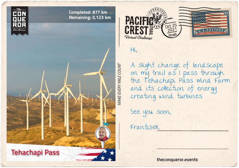
km od začátku : 0877
Tehachapi Pass
Heading north from Agua Dulce the trail enters the brushy landscape of Sierra Pelona, a mountain ridge that borders the San Andreas fault to the north and lies within the Angeles National Forest. Divided from San Gabriel Mountains by the wide Soledad Canyon, Sierra Pelona is flanked by Santa Clarita valley to the south and Antelope Valley and Mojave Desert to the north beyond the Fault. It has a Mediterranean climate and it is covered in chaparral shrubs, yucca, short grasses and scrub oak trees.
Swinging west the trail passes by several rural towns such as Green Valley, Lake Hughes, Three Points and Neenach. Three Points lies southwest of Antelope Valley which encompasses the western tip of the Mojave Desert. The valley has a desert ecosystem and is home to a wide range of plants notably the California Juniper, Joshua tree, creosote bush, the small evergreen California Scrub Oak and the wildflower California poppy.
Common species found in the valley are squirrels, mule deer, rattlesnakes, hawks, mountain quail and Stellar’s jay, a charming bird with a black head and upper body and blue on the bottom half, closely related to the Blue Jay.
Interestingly the valley was named after a species called pronghorn because they looked like antelopes which they are not. They are however colloquially referred to as American antelope. Pre-19th century the pronghorn grazed in the valley in large numbers until they were hunted for their fur by settlers and eventually migrated to Central Valley.
After 56mi (90km) in the woodlands of Sierra Pelona, the trail heads north once again for a hot and dry hike across the San Andreas Fault Zone and western arm of the Mojave Desert. The San Andreas Fault is the sliding boundary between two tectonic plates. The Pacific Plate to the west moving northwards and the North American Plate to the east moving southwards. It runs for approximately 750mi (1,200km). The Vasquez Rocks in Agua Dulce are evidence of the San Andreas fault at work. The most striking and noticeable section of the fault line lies in the Carrizo Plain, a long treeless plain where the fault presents itself like a deeply cut and raised scar.
Passing by several wind farms the trail climbs to Tehachapi Pass, a mountain pass that crosses the Tehachapi Mountains and marks the boundary with the Sierra Nevada range. Before American settlement in the 19th century the pass was a trade route for the Kitanemuk people who lived in the Tehachapi Mountains and the Antelope Valley.
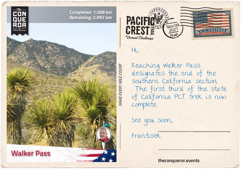
km od začátku : 1008
Walker Pass
Crossing State Route 58 via an overpass, the trail enters the Sierra Nevada range. This 400mi (640km) long and 70mi (110km) wide mountain range stretches from the Tehachapi Pass in the south to Fredonyer Pass in the north. It is home to 3 National Parks, 10 National Forests, 27 protected Wilderness Areas, the largest tree in the world by volume, largest alpine lake in North America and the highest peak in the contiguous United States.
The name “Sierra Nevada” which translates as Snowy Mountains was a term originally given in 1542 describing a less familiar mountain range in the interior. However, when Pedro Font, a Franciscan missionary and diarist, saw the ranges he applied the name on his 1776 Mar del Sur map and it stuck. As an expert at navigational equipment, Pedro joined Juan Bautista de Anza on a trek to Alta California. Maintaining a diary he kept a detailed account of Anza’s expedition to establish a Spanish base on the North American west coast. His diary can be found at the John Carter Brown Library, Rhode Island.
This section of the PCT from Tehachapi Pass to Walker Pass treks through the southern part of the Sequoia National Forest. Named after the giant sequoia tree, the “forest protects the largest concentration of giant sequoias on the planet” and various environments from semi-arid canyons to granite peaks. Originally established in 1893 by President Benjamin Harrison it was known as the Sierra Forest Reserve and it was the largest reserve with over 4 million acres. When President Theodore Roosevelt added land by Presidential Proclamation the Reserve was encompassed within the National Forest.
The National Forest has 38 distinct groves of giant sequoias including different species of pine and fir trees and six wilderness areas of which Kiavah Wilderness is on this section of the PCT.
Kiavah Wilderness is within the Scodie Mountains, a low mountain range which rises out of the Mojave Desert. The 88,290 acre wilderness was created in 1994 as part of the California Desert Protection Act and it is only one of two protected areas that support the pinyon-juniper woodland in California. Joshua trees, canyon oak, Mormon tea, sagebrush are some of the plants found here with a wildflower display during the spring period. The “Walker Pass milkvetch” is a rare wildflower endemic to the area. It was discovered in 1982 when a new section of the PCT was constructed. Some 17mi (27km) of the PCT runs through the wilderness. The plant is so rare that there’s very little information about it. There are less than ten populations of this plant found and all within the same county.
This section of the trail ends at Walker Pass which is designated a National Historic Landmark. It was named after John Rutherford Walker, a 19th century mountain man and scout, who after learning of the pass from Native Americans charted a route and mapped it. Nine years later he returned and led an immigrant wagon train through the pass.

km od začátku : 1180
Crabtree Meadows
Continuing through the Sequoia National Forest the trail meanders around the side of Morris Peak, gains a little more elevation skirting Mt Jenkins to the west and passes through the western side of Owens Peak Wilderness. At its centre is Owen Peak the highest point (8,452ft / 2,576m) in the southern Sierra Nevada Mountains.
Owens Peak was named after explorer Richard Owens by John C Fremont, another explorer who was also a military officer and politician. Fremont undertook five expeditions into the western United States during the 1840s and Owens accompanied him on his third expedition in 1845. Fremont held Owens in high regard and as such also named a valley, river and lake after him. During the Mexican-American War from 1846-1848, Owens served as Captain in Fremont’s California Battalion.
From Owen Peak the trail winds significantly laterally gaining and losing altitude until Sawtooth Peak when it swings northwest and crosses Chimney Creek, into Chimney Creek Campground, past Chimney Peak Wilderness to the west and Chimney Peak to the east. I can’t help but think that’s a lot of Chimneys.
Traversing relatively dry terrain, the trail reaches the South Fork Kern River near Kennedy Meadows. This 95mi (153km) river is a tributary of the Kern River and the southernmost river on the western slope of Sierra Nevada. The lower part of the river was once inhabited by Native Americans, however, when gold was discovered in the area in the mid-1850s and permanent settlement was built, conflict ensued until the US Army established a military post and controlled the area.
Crossing the South Fork Kern River on Kennedy Meadows Bridge, the route begins an ascent of 3,300ft (1,000m) to Cottonwood Pass alternating between large meadows and conifer forests, crossing the river once again just before reaching Deer Island. Of course it’s not actually an island, it’s a peak surrounded by vast plains and Cow Canyon.
The Olancha Peak is a fascinating mountaintop. When viewed from certain angles the ridge gives the impression of a human profile. Depends how one perceives the view it could be the face of a man and hence referred to as “Indianhead” or the figure of a woman lying on her back referred to as “the Sleeping Maiden”.
Passing through Golden Trout Wilderness, Mulkey Pass and Trail Pass, then skirting around Trail Peak the trail arrives at Cottonwood Pass at an elevation of 11,200ft (3,413m). Slightly to the northwest of Cottonwood Pass is the scenic Chicken Spring Lake nestled in a cirque. To the south the lake is covered in rocky meadows and foxtail pines whilst to the north and east sheer granite cliffs rise above its shores.
The last 14mi (23km) meanders at the same altitude with subtle undulations to Crabtree Meadows. This lush green meadow with a creek running through it is surrounded by a dense forest of pine trees with views of Mount Whitney’s west face just beyond.
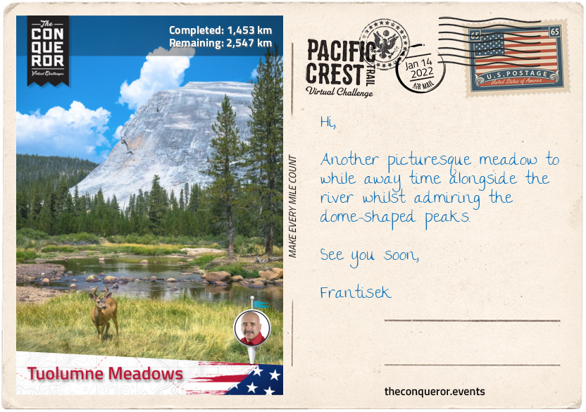
km od začátku : 1453
Tuolumne Meadows
A short hike from Crabtree Meadows is the John Muir Trail. The trail with its southern terminus at the summit of Mt Whitney descends the western slopes and joins the PCT. Mt Whitney is the tallest mountain in contiguous United States with an elevation of 14,505ft (4,421m). It was named after Josiah Dwight Whitney, an American geologist whose extensive experience made him the foremost authority of his day in economic geology.
The mountain is partially dome-shaped with jagged ridges flanking the sides. Its west slope is in Sequoia National Park whilst its east slope is in Inyo National Forest. With its alpine climate very few plants grow near the summit except for the colourful sky pilot, a perennial plant that grows 4-16in (10-41cm) with blue or pink flowers and the cushion plant that grows low to the ground.
On Whitney’s summit is the Smithsonian Institution Shelter, a stone hut built in 1909 after a hiker was struck by lightning whilst having lunch.
The John Muir Trail joins the PCT for the next 169mi (272km) travelling over eight named passes that exceed 11,000ft (3,352m) and a collection of 17 named lakes. Forester Pass at 13,153ft (4,009m) is the highest point on the PCT and it sits on the boundary between Sequoia National Park and Kings Canyon National Park. The lakes up in the High Sierra, are a result of glaciers creating basins that filled with water. There are thousands of lakes and pool ponds in this region. The trail crosses several creeks and around several unnamed lakes.
No roads travel through the boundaries of the Sequoia National Park making it accessible only by foot or horseback riding. About 84% of the park is designated as wilderness making it home to an abundance of wildlife such as bobcats, foxes, mule deer and rattlesnakes and a rich landscape of various pine trees including Pinus Lambertiana, the tallest pine tree with the longest cones of any conifer tree.
One of the major highlights in the park is the giant sequoia tree known as General Sherman for being among the tallest, widest and one of the oldest trees on Earth. It stands at 286ft (86m) with a circumference of 113ft (34m) and estimated to be between 1800-2700 years old. The tree was named after American Civil War general William Tecumseh Sherman.
The Kings Canyon National Park was originally named General Grant National Park when it was established in 1890 and it was renamed in 1940. The General Grant sequoia tree, the second tallest sequoia tree, sits within this park and stands at 268ft (87m) with a circumference of 107ft (82m) and estimated to be around 1,650 years old. Named after the 18th US President, Ulysses S. Grant, in 1926 the tree was designated as the "Nation's Christmas Tree".
The two parks are managed together as Sequoia and Kings Canyon National Parks and in 1976 it joined the UNESCO Biosphere Reserve list.
North of King Canyon National Park is the Sierra National Forest followed by Yosemite National Park. The Sierra National Forest was established in 1893 and at the time the largest national forest with an area covering six million acres. By 1908 it had been broken up to make a series of other forests or parks. The John Muir Wilderness sits within this forest and the PCT travels through it.
Yosemite National Park is home to Devil Postpile National Monument, a basalt rock formation and Rainbow Falls, a 101ft (31m) high waterfall both within easy reach of the PCT. Yosemite was listed a UNESCO site in 1984 and it is 94% designated wilderness. It is one of the most famous parks known for its “granite cliffs, waterfalls, clear streams, giant sequoia groves, lakes, mountains, meadows, glaciers, and biological diversity”.
This section of the trek finishes at Tuolumne Meadows in Yosemite alongside Tuolumne River and at the junction of Tioga Pass Road, the highest paved through road in California’s State Route System. During the Gold Rush era the pass served as a pack trail for prospectors circa 1849 and by 1875 it was a wagon road extending to Yosemite Valley.
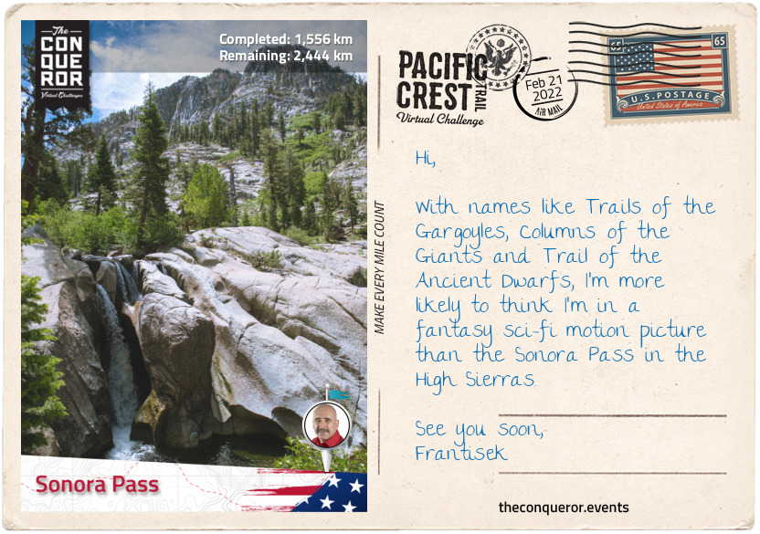
km od začátku : 1556
Sonora Pass
Leaving Tuolumne Meadow the trail reaches the confluence of Cold Canyon, Conness Creek and the Tuolumne River. Crossing a bridge over the river, the trail heads north before swinging west wading across Return Creek.
As it winds its way around past several peaks and waterways, of particular visual interest was the deeply snaking Matterhorn Creek as it flowed and carved its way through the landscape. Parting ways with the creek the trail then crossed the rather barren Benson Pass and onto Smedberg Lake to the right and Volunteer Peak to the left. Although Volunteer Peak isn’t high, famous or difficult to climb it is widely regarded for its stunning views.
Three miles (4.8km) further the trail crosses Piute Creek which less than half a mile (700m) away to the left of the PCT empties into Lake Benson. With a broad, sandy beach the lake sits at an elevation of 7,578ft (2,310m) with Piute Mountain rising above the lake to the northwest.
Arriving at Wilma Lake the trail meets with Falls Creek, a 24mi (39km) tributary of Tuolumne River. Northbound the creek becomes a constant companion for the next 8mi (13km), at times meandering away into the landscape before reappearing alongside the trail, until it veers off to its source on the east side of Dorothy Lake and the PCT to the west of the lake.
The trail passes through Dorothy Lake Pass, then sidles along the second half of Lake Harriet and onto Kennedy Canyon Trail Junction where views of wildflowers in bloom contrast with the surrounding granitic and volcanic mountains. The trail moves through the canyon like an arc and exits into Stanislaus National Forest and the Emigrant Wilderness.
Stanislaus Forest was established in 1897 and is one of the oldest national forests. Within its 898,000 acres the park has 78 lakes, 811mi (1,032km) of rivers and streams and 1,100mi (1,770km) of trails. A landscape of Lodgepole pine, Jeffrey pine and White Fir, the forest contains about 15% of old growth otherwise known as primary forest that has attained great age without human interference or disturbance.
The final stage of this section takes the PCT past Leavitt Peak and nearby Leavitt Lake, Leavitt Creek and Leavitt Meadow. The namesake is for Hiram Leavitt who in 1863 established a hostel near Sonora Pass for travellers passing through.
The Sonora Pass at 9,624ft (2,933m) is the second highest highway pass in the Sierra Nevada connecting the Sonora and Bridgeport communities. Back in the 1860s when gold and silver was discovered both towns on either side of the pass pushed to have a road built for easier transportation and trade. By 1865 a road was established and in use. Today the road over the pass is quite steep, narrow and winding making the traverse unsuitable for vehicles that are wide, heavy or long. During the winter period due to snow accumulation the pass is closed to traffic.
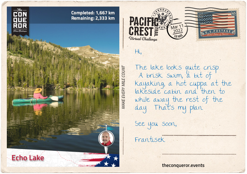
km od začátku : 1667
Echo Like
Heading northwest from Sonora Pass the trail rounds Sonora Peak and treks alongside East Fork Carson River in a valley till it commences an ascent and passes several peaks to Wolf Creek Pass and the nearby Asa Lake, a spring-fed lake located amongst woods and meadows.
Moving in and out of woodlands, the trail passes between Tryon Peak and Highland Peak with Noble Lake at the base next to the PCT and on to Ebbetts Pass.
Elevated at 8,736ft (2,663m), Ebbetts Pass is a high mountain pass and one of two passes that is traversed by State Route 4. Registered as a California Historical Landmark, the pass was named after John Ebbetts, a fur trader turned guide for California Gold Rush prospectors circa 1851. He thought the pass would be a viable place for a transcontinental railway but upon later examination he deemed it unsuitable. Although he wanted to return and survey the area further he unfortunately died in a steamer explosion three years later.
Just north of the Pass a little off the PCT is a lookout with views of the Kinney Reservoir below. With a little uphill hike, the trail then descends with Ebbett’s volcanic peak to the left followed by Sherrold Lake right next to the PCT. Another mile further (1.6km) are the Lower and Upper Kinney Lakes and together with the Reservoir are known to be popular fishing spots for brook, rainbow and trout.
Interestingly the 1864 Silver Mountain Mining District map has the two lakes marked as Silver Lakes. Sometime in the 1890s, Silver Creek was dammed to create the current Kinney Lakes and the reservoir, utilising it for irrigation purposes in Carson Valley. The dam for the lower lake was completed in 1926, and the upper lake in 1990. Several other reservoirs were built by 1912 to serve the agriculturists in the area.
Rounding Raymond Peak, the trail moves up and down gaining and losing about 400ft (120m) of elevation until I reached Wet Meadows Reservoir and realised how spoilt for choice I am on this section with a multitude of lakes on either side of the trail. There’s the Reservoir, Summit Lake, Lilypad and a Tamarack Lake to the left and Upper Sunset Lake (which joins with Lower Sunset Lake) plus two unnamed lakes to the right.
The trail climbs up the southside of Nipple Peak to 9,000ft (2,743m) and travels along the ridge with spectacular views of the Blue Lakes, Twin Lake and Meadow Lake below and the peaks of Markleeville and Jeff Davis to the northeast and east.
The two mile (3.2km) hike along the ridge is in the open on desolate landscape with no shade to escape to until it descends slightly near the headwaters of West Fork Carson River and there’s a short reprieve through chapparal woodland.
Crossing Forestdale Divide the trail meanders down into a valley, climbs across the Elephants Back mountain, past Frog Lake, through Mokelumne Wilderness and into Carson Pass. The Elephants Back is a volcanic rubble that is easily recognisable from Carson Pass and although it is overshadowed by its neighbours Round Top and The Sisters, it provides great views over Carson Pass and the Mokelumne Wilderness.
From Carson Pass the trail treks through Dixon Valley, past Showers Lake, through woodland and gently descending to 7,600ft (2,300m) straight into Echo Lake. The small community of Echo Lake is near the glacial lake of the same name. This 2mi (3.2km) long lake is divided into Upper and Lower lake and sits within the Eldorado National Forest.
Established in 1910, the Eldorado forest ranges from 1,000ft (300m) in the foothills to over 10,000ft (3,000m) along the Sierra crest. The forest is broken up with many steep canyons with plateaus at the base between them. Desolation Wilderness and Mokelumne Wilderness can be found within its boundaries. Most of the forest is made up of chapparal, oak woodlands, pine trees, fir trees and old-growth.
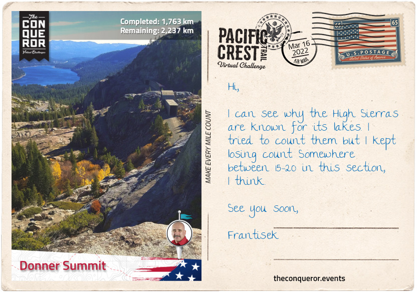
km od začátku : 1763
Donner Summit
Departing Echo Lakes, I travelled 24mi (38km) with a plethora of lakes as constant visual delights. Between Ralston Peak and Keiths Dome, beside each other in the basin are a tamarack lake and Ralston Lake. Both Ralston Peak and the Lake were named after William Chapman Ralston, who founded the Bank of California in 1864 making it the first commercial bank in western US and the second richest bank in the nation.
The path then followed the mountaintop through some snow with Lake Margery to the right and Lake of the Woods to the left, through Desolation Valley, passed Cracked Crag peak and the very large Lake Aloha, a backcountry reservoir within the Desolation Wilderness area. The lake was created in 1875 by damming Pyramid Creek as a year-round water source for grazing cattle.
Turning right from Lake Aloha, the trail descends to Heather Lake, then southside of nearby Susie Lake. As I skirted around Susie, I almost missed the fact that Susie is the source of a stream that culminates in a waterfall plunging down the mountain over several tiers flowing into Grass Lake below. Only the brink of the waterfall is visible from the PCT as the best view is from Grass Lake.
Halfway along the right side of Susie Lake, the trail turns left and winds its way through the landscape to Gilmore Lake. Ascending the western slope a third of the way down from the ridge, the trail hugs the side of the mountain to the right with a steep escarpment to the left with spectacular views of Half Moon Lake below flanked by Jack’s and Dick’s Peaks.
Crossing Dicks Pass at 9,200ft (2,800m) the trail descends to Dick’s Lake which is pressed against Dick’s Peak on the opposite side of Half Moon Lake. A third of a mile away (480m) from Dick’s Lake is Fontanillis Lake and just a little further along are the Velma Lakes. The PCT passes the Middle Velma Lake with Upper and Lower Velma Lakes just beyond. All these lakes are popular fishing spots for anglers who come up from Tahoe.
From here the trail descends to 7,600ft (2,300m) between Middle Mountain and Phipps Peak for a fairly straight northbound trek to Lost Corner Mountain to the east followed by Richardson Lake with Sourdough Hill opposite the lake. A short hike up Sourdough Hill is a must with expansive views of Lake Tahoe.
Back in the woods I forged onto Barker Pass, climbed a few switchbacks and followed the ridge line for about 2.4mi (3.9km) to Ward Peak. In the winter, a keen skier has a varied terrain to choose from at Alpine Meadows or Squaw Valley Ski Resorts which are to the east of the PCT.
Alternatively just off Interstate 80 at Donner Summit where this section of the PCT ends, are Sugar Bowl or Boreal Mountain Ski Resorts. Leading up to I-80 were another three picturesque lakes nestled amongst the rocky mountain and scattered woodland: Lake Angela, Flora Lake and Azalea Lake.
These resorts along with a few others off the PCT are part of the Lake Tahoe area within Tahoe National Forest, famous for winter sports, summer activities and surrounding scenery. A large portion of its economy is reliant on the winter season and ski resorts.
Lake Tahoe itself is an extraordinary ancient lake at least two million years old. It is the second deepest lake in the US with a depth of 1,645ft (501m). The lake is 22mi (35km) long, 12mi (19km) wide and has a shoreline of 72mi (116km). The California-Nevada state line runs right through the lake.
Naming the lake was quite the story. It’s first known name was Lake Bonpland but it never took. It was changed to Mountain Lake and then Fremont’s Lake which also didn’t stick. Fallen Leaf Lake (there is one now such named lake just south of Lake Tahoe) and Lake Bigler were both names given by the same person. Eventually in 1862 it was named Tahoe but it also didn’t seem to be favoured so it swung like a pendulum between Tahoe and Bigler until 1945 when it was affirmed by the California State Legislature as the official name – Lake Tahoe.
Donner Summit is the end of the central California section. This completes two-thirds of the PCT in the state of California.
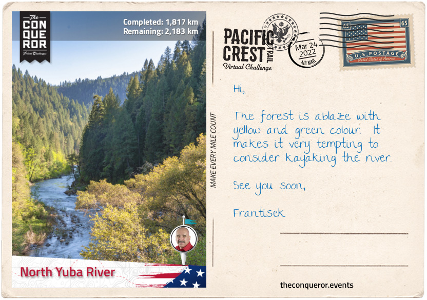
km od začátku : 1817
North Yuba River
Taking the underpass beneath I-80 the trail swings left past West Lakes and commences its northwest direction through thick woodland, over a crest and down, skirting Round Valley at the base of Basin Peak to the north and Castle Peak to the south. The two peaks are nicely connected via a trail atop the ridgeline at 9,000ft (2,743m) with views of the PCT and Round Valley below to the left and Frog Lake and Prosser Reservoir to the right.
After the valley the trail moves through several switchbacks within woodland, across North Creek via a bridge, up the mountain slope, descending to ford White Cross Creek, through Bear Valley and past the eastside of Jackson Meadows Reservoir.
The Reservoir is a result of damming Middle Yuba River in 1965 in order to control flooding and irrigation water storage. The dam is 195ft (59m) tall and 1,530ft (466m) long and it is part of the Yuba-Bear Hydroelectric Project.
At an elevation of 6,100ft (1,859m) the Reservoir has nine camping grounds of which Little Lasier Meadow is reserved for campers with horses and Jackson Point for boat-in campers.
Travelling through a densely wooded ravine alongside Milton Creek, the trail gently descends as it nears North Yuba River near Sierra City to 4,600ft (1,400m). Just beneath the bridge that crosses the river is Loves Falls, a small waterfall filled with rocks and boulders. North Yuba River is 61mi (98km) long and it is the main tributary of the Yuba River. As it drains westward through Sierra Nevada and the Sacramento Valley, the river takes a sharp southern turn and flows through New Bullards Bar Reservoir and into Middle Yuba River and finally forming the Yuba River.
The nearby Sierra City is located in the canyon of North Yuba River with a population of 220 residents. Originally settled in 1850 by Philo A. Haven and Joseph Zumwalt, three years later the settlement was completely destroyed by an avalanche. As gold mines were being developed in the area, Sierra City was rebuilt. In 1869, a gold nugget weighing 106 pounds (48kg) was discovered at the Sierra Buttes Mine, now known as the “Monumental Nugget”.
Towering over the town are the Sierra Buttes Peaks, a cluster of sheer rock peaks at 8,587ft (2,617m) with views of Mount Lassen and Mount Shasta in the Cascade Range.
This section of the trail is entirely within Tahoe National Forest located northwest of Lake Tahoe. Established in 1905 it has a total area 871,495 acres. The forest contains hundreds of lakes, reservoirs, river canyons, hiking trails and the Granite Chief Wilderness, and it provides water supply to several nearby towns including Reno and Sparks in Nevada.
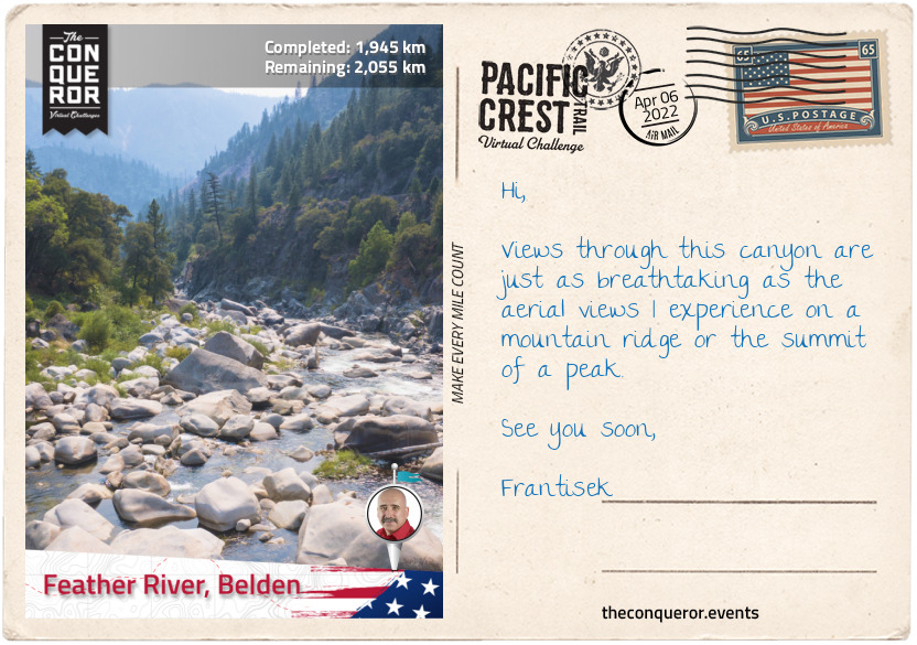
km od začátku : 1945
Feather River, Belden
A mile (1.6km) after crossing North Yuba River, the trail, through a series of tight switchbacks, sharply gains 1,400ft (426m) and continues to climb as it rounds the flanks of Sierra Buttes Peaks some 2,000ft (610m) above the town of Sierra City.
Travelling along the ridgeline, I’m taken by the vast views especially the large Gold Lake flanked by Deer Lake and Long Lake to the east of the trail and a little further along the lovely peaks of Mount Elwell and Mount Washington.
As I reach McRae Ridge (elevation 7,200ft/2,194m), I leave Tahoe National Forest behind and enter Plumas National Forest. The forest was established in 1905 by President Theodore Roosevelt. Within its boundaries is Bucks Lake Wilderness. Named after a primary watershed, Rio de las Plumas (translating as Feather River), the forest has a land area of 1,146,000 acres of which 127,000 acres are old-growth, mostly mixed conifers. Due to extensive logging during the gold rush era into modern times much of the original timberland has disappeared.
Descending into a valley to 6,000ft (1,829m) the trail skirts around the foot of Beartrap Mountain, then around the two closely located Mounts Stafford and Etna, across Bunker Hill Ridge to swing around Pilot Peak and then continue with a long, gradual descent to Grass Valley Bald Mountain and Little Grass Valley Reservoir below. The reservoir, accessed via Bald Mountain trail, is an artificial lake created when the dam was completed in 1961. Used as a recreational area the lake is 2mi (3.2km) long, one mile (1.6km) wide and 65ft (20m) deep. It’s shoreline is 14.5mi (23.3km).
Travelling through woodland across a ridgeline the trail further descends to 3,000ft (914m) alongside Onion Valley Creek where the trail crosses Middle Fork Feather River via a bridge. A major river, Middle Fork is nearly 100mi (160km) long of which just over three-quarters are designated National Wild and Scenic River. A remote and rugged landscape with huge boulders, cliffs and waterfalls it is seldom visited due to the difficulty of navigating the terrain and river.
Back in the forest the trail travels up and down, across Bear Creek and onwards to Bucks Lake and Bucks Lake Wilderness. Encompassing 21,000 acres the Wilderness was established in 1984. Filled with conifers, oaks and red firs, the Wilderness is littered with lakes to the east and small meadows to the west. It’s elevation is from 2,000ft (610m) in the Feather River Canyon to 7,017ft (2,139m) at Spanish Peak. The lake is a result of damming Bucks Creek in 1928.
Passing Spanish Peaks on the right the trail travels along a steep escarpment with views of Silver Lake below, onto Mount Pleasant, then Three Lakes to the left before a long and gradual descent to 2,400ft (731m) at Feather River near Belden.
At its main stem Feather River is 73mi (117km) long and is a major tributary of the Sacramento River. Starting at Lake Oroville the River is joined by its four branches: South, Middle, North and West Branch Feather Rivers. During the 19th century the river and its forks were a centre for gold mining. Today it provides water to the state and hydroelectricity generation.
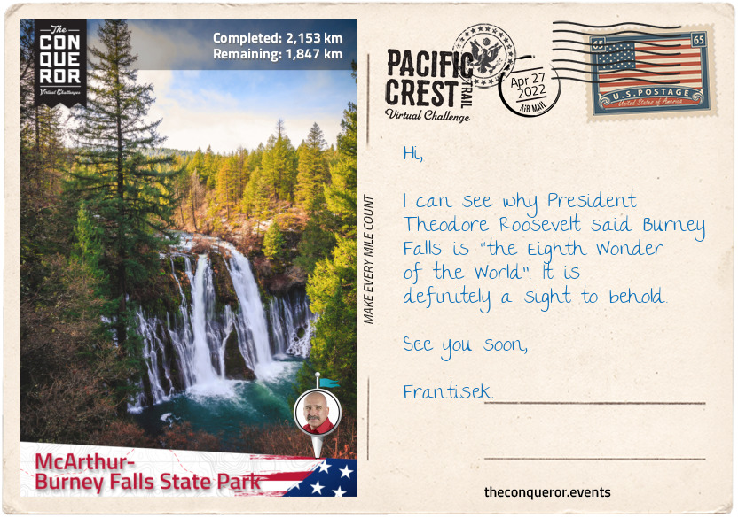
km od začátku : 2153
McArthur-Burney Falls State Park
Trailing along the mountain slope alongside Chips Creek, I have now entered Lassen National Forest. Named after pioneer, Peter Lassen, the forest was formed in 1905. A wide variety of animals are found in the forest including, black bear, coyote, cougar, chipmunk, woodpecker, salamander and wolves. The forest surrounds Lassen Volcanic National Park which includes the active volcano, Lassen Peak.
Whilst not near the trail it’s worth noting that Lassen Peak is where the Cascade Range starts, leaving Sierra Nevada behind. Lassen Peak rose 27,000 years ago out of a now-collapsed Mount Tehama. It has an elevation of 10,457ft (3187m) and its lava dome shape is the largest one on earth. Lassen last exploded in 1915 destroying nearby areas and spreading volcanic ash 280mi (450km) away. The National Park was created to protect the affected areas, to observe and study it and inhibit anyone from settling too close. The Peak is monitored by California Volcano Observatory.
At Humboldt Peak, the trails arcs to the right across Carter Creek Saddle, over the ridge near Butt Mountain on the left with views of Ruffa Ridge to the right.
Weaving through the woodland the trail descends to 4,400ft (1,341m) over Soldier Creek and ten miles (16km) later over North Fork Feather River, one of the Feather River branches. The trail remains wooded till I reach Little Willow Lake with Sifford Mountain and Kelly Mountain on either side of the lake.
A short hike off the PCT is Willow Lake a rare and special botanical environment. The shore is filled with a type of moss that has no soil so it becomes more like a wet meadow called a fen. The moss is known as sphagnum and it supports unusual plants such as American Scheuchzeria, a perennial plant with greenish-yellow flowers that once was thought to have been extinct until it was discovered at Willow Lake in 1988. Carnivorous plants such as English sundew and roundleaf sundew busily feast on trapped flies whilst Douglas spiraea and other herbs provide colour to the fen with their blooming flowers. Due to its fascinating environment, Willow Lake was designated a Botanical Special Interest Area.
Back on the PCT less than a mile (1.6km) northeast from Little Willow Lake is the Terminal Geyser spewing bubbling water from beneath. Another mile further on the PCT is Boiling Springs Lake an interesting geothermal feature. The milky froth surface of the lake is a result of an underground heat source producing hydrochloric acid and sulphurous fumes that are combined with water. Along the shore of the lake are boiling mud pots.
Hiking through Warner Valley and crossing King’s Creek the trail travels between Swan Lake on the right and Upper and Lower Twin Lakes on the left, around the base of Fairfield Peak, Prospect Peak, circling Badger Mountain and then up a steep slope using long switchbacks. Trekking along the edge of the slope, the trail descends into Plum Valley before ascending on the opposite side following the contour of the mountain, around a canyon and onwards till it finally descends again near Cinder Flats State Wildlife area, a woodland for bald eagles and deer nesting habitat, birdwatching and wildlife viewing.
Having reached Baum Lake, now was the final push to end this section. A slight off-route jaunt to see Lake Britton Bridge that featured in the 1986 Stand By Me movie and finishing up at Burney Falls in the McArthur-Burney Falls State Park. The park is the second oldest state park in California. The falls, 129ft (39m) high, are located on Burney Creek at the entrance of the park. It was named after Samuel Burney a pioneer settler from the 1850s. The descendants of the McArthur family who arrived in late 19th century saved the waterfall from development by buying the property and gifting it to the state in the 1920s. In 1954 it was designated a National Natural Landmark.
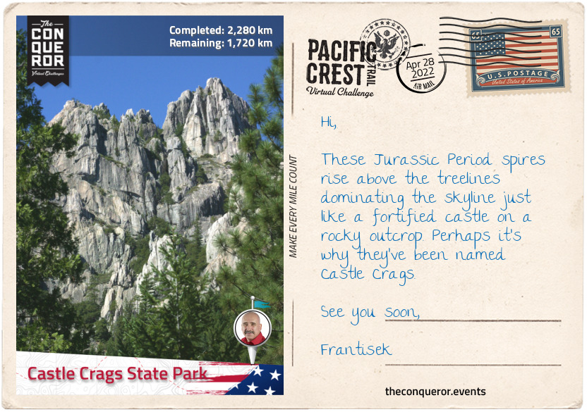
km od začátku : 2280
Castle Crags State Park
Having entered the Cascade Range, before I take off on my hike, let me give you an insight into this extensive mountain range. Running from north-south, the range is 700mi (1,100km) long and 80mi (130km) wide. It starts in British Columbia, Canada extending through Washington, Oregon and Northern California. With its highest peak in Washington State, the range is also home to several volcanic mountains. The Cascades are part of the Pacific Ocean’s “Ring of Fire” which are volcanoes and earthquakes that occur around the rim of the Pacific Ocean. The last two eruptions on contiguous US were in the early 20th century; Lassen Peak had its largest eruption in 1915 and Mount St Helens in 1980.
Crossing the dam at Lake Britton the trail begins to follow the contour of the mountains over DeLucci Ridge, along Rock Creek to JNM Falls to the left and shortly after Rock Creek Falls to the right. Gently ascending to 4,800ft (1,463m) the trail starts to climb further up to 5,400ft (1,645m) after crossing Peavine Creek.
The trail moves between forest and large open meadows around the edges of the mountains up to Mushroom Rock and just below Grizzly Peak offering stunning views of the valleys below between these two peaks. From Grizzly Peak the trail descends into a valley travelling alongside Deer Creek for about 5mi (8km) then crosses Butcher Knife Creek, past Doodlebug Gulch and then across McCloud River via a bridge.
McCloud River is a 77mi (124km) river named after hunter and trapper Alexander Roderick McLeod who once explored the area in 1830 and the river’s spelling was initially McLeod River. However, eventually the river’s name spelling changed partly to honour Ross McCloud an early pioneer settler of the mid 1850s who was instrumental in the improvement of roads and rail in the area.
The trail continues up and down through the thick woodland of Shasta-Trinity National Forest. Originally two separate forests, both established in 1905, they were merged in 1954 and their names combined. The forest encompasses 2,210,485 acres and within its boundaries it has five Wilderness designated areas, hundreds of mountain lakes including Shasta Lake, Mount Shasta (elevation of 14,179ft/4,322m) and a total of 6,278mi (10,103km) of streams and rivers.
Shasta Lake is the largest man-made lake in California and is a result of damming Sacramento River by Shasta Dam. The building of the dam started in 1937, providing much needed jobs at the time given the Great Depression era. Construction finished in 1945 a good 26 months ahead of schedule. It is 602ft (183m) high making it the 8th tallest dam in the US but at the time of completion it was the second tallest dam after Hoover and considered an engineering marvel. During WW2 the dam played a vital role by providing electricity to California factories as manufacturing efforts were redirected towards the war effort and California became a major ship and aircraft builder.
Reaching the slopes of Girard Ridge it was worth climbing up to Girard Lookout at 4,809ft (1,466m). Built in 1931 and used by the Forest Service untill 1981, the lookout is now a great place to get spectacular views of Sacramento River Canyon below, Mount Shasta to the north and Castle Crags to the west.
Another 10mi (16km) and the trail descended to 2,200ft (670m) across Sacramento River and into Castle Crags State Park. Sacramento River is a principal river in Northern California and the largest in California. It flows in a north-south direction for 400mi (640km), rising in the Klamath Mountains and flowing into San Francisco Bay. The river was named in 1808 by Spanish explorer Gabriel Moraga and when gold was discovered the river had an influx of people arriving to mine for gold. When gold mining ceased the settlers turned to farming and ranching in the area. By the 20th century large dams were built to impound the river and provide water to Central and Southern California. This changed the river’s original state greatly reducing the fish that inhabited the river.
Within the Castle Crags State Park are the grey spires of Castle Crag, dramatic rock formations from the Jurassic Period that rise up to 7,200ft (2,194m) at the summit of the highest crag. The formations were sacred to the Native Americans and the area an important source of clean water and food. However as the gold rush emerged, miners were filling the river with mud damaging the salmon run and killing the wild game for food thereby reducing the natural source of food for the Indian people. Conflict arose between the Indians and the immigrants giving way to the 1855 Battle of Castle Crags.
Following excessive mining and lumber operations land was purchased in 1933 to protect the area and a further parcel was purchased by the State ten years later which was the beginning of the State Park. Bordering the park is the Castle Crags Wilderness, an area of mixed conifers and 300 species of wildflowers, including Castle Crags Bellflower which only blooms here.
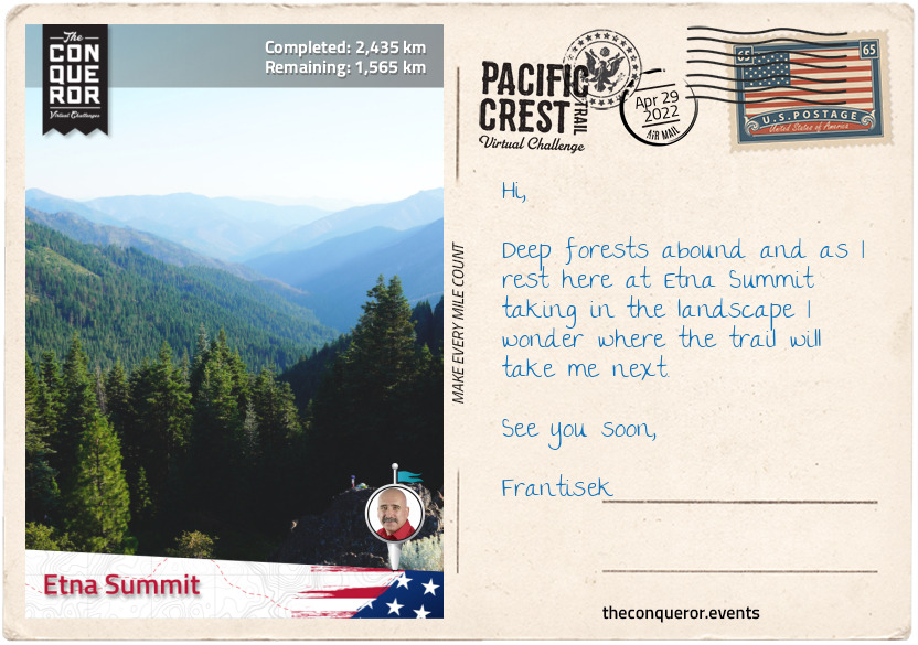
km od začátku : 2435
Etna Summit
Having climbed to 5,000ft (1,524m) and traversed most of Castle Crags Wilderness the trail wound its way around the mountain slopes and climbed further up to Devil’s Pocket. Heading west just below the ridgeline the trail was above a wide valley with views of Echo Lake at the base of Boulder Peak on the opposite side of the valley.
The trail takes a northerly direction past White Ridge and between Porcupine Lake to the left and Toad Lake to the right reaching an elevation of 7,400ft (2,255m). Traversing another slope, over a crest and past Deadfall Lakes, it then circles around the interior slope of a mountain with the peak of South China Mountain to the northwest.
Zig-zagging around and over to Bull Lake and the southside of Cory Peak, I continued to Kangaroo Lake which is located within the Klamath National Forest. Nestled amongst trees this 21 acre lake is known for its fishing of brook trout, a freshwater fish member of the salmon family.
Established in 1905, Klamath National Forest encompasses 1,737,774 acres of forest with a combination of pines, firs, cypress, cedar and old growth. There are four wilderness designated areas within its boundaries.
The historic church building, Sawyers Bar Catholic Church was built within the forest in 1855 by Father Florian Schwenninger and the first Mass was held in 1857. Graves dating as early as 1850 can be found on the churches grounds. The church was added to the National Register of Historic Places.
The trail winds southwest to Scott Mountain, around the southside of Eagle Peak then swinging north again to Russian Peak that sits within the Russian Wilderness Area at an elevation of 8,196ft (2,498m).
Russian Wilderness consists of 12,000 acres and it protects Russian Mountain, over twenty named lakes and the watershed of Scott River and North Fork Salmon River. Connecting to Trinity Alps Wilderness to the south and Marble Mountain Wilderness to the north, the Russian provides an important corridor for migrating wildlife.
From Russian Peak the trail continues north past Paynes Lake, across a rocky slope with Smith Lake below and descending to 6,000ft (1,829m) at Etna Summit where this section ends.
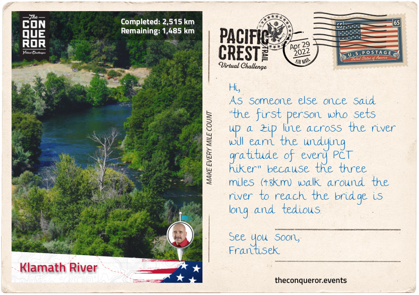
km od začátku : 2515
Klamath River
The next 15mi (24km) were quite uneventful travelling either on the ridgeline or just below until I arrived atop a crest with views of Cliff Lake in the large valley below and Campbell Lake beyond. Another 5mi (8km) along I come across Sky High Valley below with three lakes near each other: Upper and Lower Sky High Lakes and Frying Pan Lake. Looking north from up here I can see the striking white rocks of Marble Mountain above the treelines.
As the PCT reaches the junction with Marble Mountain Trail it veers to the right and descends into Little Marble Valley and then over white rocky terrain that is an extension of the mountain cliffs above. Marble Mountain sits within the Marble Mountain Wilderness. Besides the usual mix of oak, fir, pines and hemlock, at 225,114 acres the wilderness has a whopping 89 lakes. Wildlife such as bears and deer are plentiful. The PCT crosses the entire wilderness for 32mi (51km).
Marble Mountain is located in the heart of the Klamath Mountains and its bright white cliffs made of glacially polished granite are a sight to behold. Although the highest peak is the nearby Black Marble Mountain at 7,429ft (2,264m) what makes Marble Mountain’s peak interesting is its “long, curving, escarpment with numerous points along the rim”. It is broken into two segments separated by Marble Gap near the centre. To the east the mountain has a gradual slope which is where the PCT traverses it across Marble Valley, however, on the western side are sheer cliffs with Rainy Creek and Elk Creek at the base.
After Marble Mountain the trail passes Paradise Lake with Kings Castle Peak behind it then across Big Ridge, down into Cliff Valley and alongside Grider Creek till Klamath River where the trail skirts around the river bend and terminates this section in Seiad Valley at an elevation of 1,388ft (423m).
Flowing for 257mi (414km), the Klamath River travels through Oregon, Northern California and then empties in the Pacific Ocean. It is the second largest river in California by discharge. It begins in the high desert, flows through the Cascades and Klamath Mountains before reaching the sea. Inhabited by Native Americans for 7000 years, the river’s fish migration of salmon, steelhead and trout were their source of food. With the Europeans arriving the 1820s the Indians were, within a few decades, forced into reservations. Soon after the gold rush began and with the influx of miners the river became polluted. Steamboats operated in the upper basin untill the railroads arrived at which point it the area turned agricultural and dams were built to provide irrigation and hydroelectricity. Today the river is a recreational area and continues to provide water for agriculture.
Seiad Valley is a small community of 350 residents and only a mere 15mi (24km) south of the Oregon border. I will be taking a load off at the historic Wildwood Tavern and Lodge. Opened in 1929 as a one-story building and bar, it was sold, bought and remodelled many times across the decades except for the 24ft (7.3m) bar that has been lovingly preserved for the last 90 years. Today it continues to serve passing travellers.
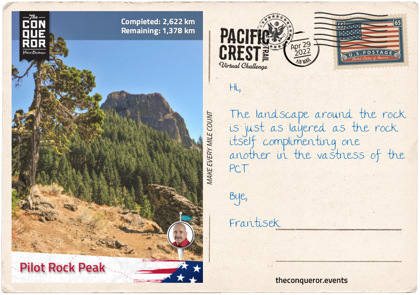
km od začátku : 2622
Pilot Rock Peak
The climb out of Seiad Valley was challenging to say the least with a 3mi (4.8km) steep ascent of 2,000ft (610m) and it continues climbing although a little gentler towards Kangaroo Mountain at 5,800ft (1767m) before descending down its southern flank and traversing at the foot of the mountain.
The trail takes a north-easterly direction past Lily Pad Lake to White Mountain Peak. At 14,252ft (4,344m) the peak is the third highest peak in California and one of two peaks over 14,000ft that is not in the Sierra Nevada. The University of California has three research stations on White Mountain at different altitudes in order to study the effects of altitude in physiology.
A few miles further I skirted around the southside of Condrey Mountain and then to the California-Oregon border. The border crossing was a point of celebration as it indicated completion of the PCT in California and two-thirds of the entire hike. Oregon should be a breeze in comparison.
Trekking through woodland to Observation Gap the terrain changed to a dry and barren landscape open to the elements. It continued like this through Jackson and Wrangle Gaps then a few scattered woods to Siskiyou Gap before reaching Siskiyou Peak where a quick amble up to the peak afforded spectacular views of Mount McLoughlin, Ashland, Shasta and Eddy.
Three miles (4.8km) away is Mount Ashland. At 7,536ft (2,297m) it is the highest peak in the Siskiyou Mountains and it’s named after the city of Ashland. During winter it turns into a ski resort with 200 acres of skiing trails, however, during summer it has a lengthy wildflower season with a variety of blossoms.
The next stretch of the hike winds through forest to the base of Pilot Rock, a 25.6 million year old volcanic plug that protrudes some 570ft (170m) above the treeline and is distinguishable as far as 40mi (64km) away. It is one of the older formations in the Cascades and it is a protected area by the Cascade-Siskiyou National Monument. When Pilot Rock’s magma broke through the earth’s crust it solidified beneath the surface creating the plug. The columnar jointing (layers of rock) that was created when the magma cooled are now tilted 20 degrees due east, a result of Siskiyou Mountains gradual uplift, giving the peak a unique appearance along the PCT.
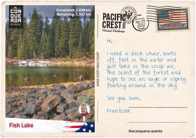
km od začátku : 2698
Fish Lake
The Cascade-Siskiyou National Monument is a forest reserve encompassing 114,000 acres established in 2000 by President Bill Clinton’s presidential proclamation and further expanded by President Barack Obama in 2017. It’s located at the junction of the Cascade Range and Siskiyou Mountains.
The Monument has a diverse ecosystem and it’s the first one in the US to be put aside for the preservation of biodiversity. It has a catalogue of at least 200 known bird species including the threatened Northern Spotted Owl and its water resource is critical to the salmon in the Klamath River. Flora such as Green’s Mariposa Lily and the critically endangered Gentner’s Fritillary are both endemic to the area. The much more widely distributed Blue Elderberry shrub can also be found here and its flower blossoms can be used to make tea whilst its fruit can be eaten.
As the trail winds its way past Keene Creek Reservoir and Little Hyatt Reservoir, I came across the 8 square miles (21 square km) catchment of Hyatt Reservoir. Dammed in 1923 the lake supports large population of fish and each year it is stocked with 250,000 young rainbow trout. With a shoreline of 7.5mi (12.1km) and a maximum depth of 38ft (12m), the lake is a recreational area with camping facilities and various activities including boating, fishing and wildlife watching.
Less than 3mi (4.8km) further is the even bigger Howard Prairie Lake with its 79 square mile (205 square km) catchment. Created in 1958 it is another recreational area with large numbers of trout and bass for anglers alongside hiking and cycling around the lake. Whilst surrounded by fir and pine the lake also consists of three islands: Buck, Doe, and Fawn.
I trekked through dense forest for another 15mi (24km) until I reached the southside of Brown Mountain. Skirting around the western foot of the mountain over solidified lava with sparse trees, the trail in this section finishes at Hwy 140 and the nearby Fish Lake.
Brown Mountain is a cinder cone at 7,344 feet (2,238 m) above sea level. Although the mountain seems reasonably young in age, it has been dated to 12-60 thousand years old. The solidified lava across the western slope that the PCT crosses is a result of an eruption 2000 years ago. It spewed enough lava to create a depth of over 250ft (75m). Whilst the base is covered in old growth forests, the summit is devoid of vegetation giving the visitor views of Mt McLoughlin to the north, Fish Lake to the northwest and Lake of the Woods to the east.
Fish Lake was initially a small natural lake until the Fish Lake Dam was built in 1898 to supply water to Rogue Valley. In early 1900s it was decided to connect the lake to Fourmile Lake for added water storage which is located diagonally across from Fish Lake with Mt McLoughlin in the middle of it. Constructing a canal in 1915, the two lakes were connected by bringing water from Fourmile Lake to Fish Lake. Today Fish Lake is a recreational area for trout fishing, boating and swimming.
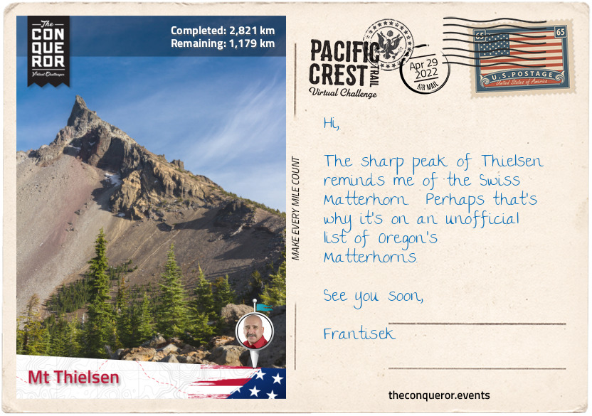
km od začátku : 2821
Mt Thielsen
Highway 140 runs between Brown Mountain and Mt McLoughlin with Fish Lake to the west of the two mountains. Crossing the highway, the trail climbs around the east flank of Mt McLoughlin and enters the Sky Lakes Wilderness area. At 9,493ft (2,893m) this dormant steep-sided volcanic mountain overshadows its neighbouring Brown Mountain. The mountain was named after John McLoughlin, a trader with the Hudson Bay Company who later ran a general store that was known as the last stop on the Oregon Trail.
To the north-east of McLoughlin is Fourmile Lake which is connected to Fish Lake via a canal. With a surface area of 483 acres and a depth of 170ft (52m), the lake is substantially larger than its neighbouring Fish Lake. The connecting canal allows excess water to be drained into Fish Lake for extra storage. Fourmile Lake sits within the Fremont-Winema National Forest. The forest is a merger of Fremont and Winema forests with a combined area of 2.25m acres.
Fremont National Forest was founded in 1908 with nearly 45% of its 1.2 million acres being old growth. There are two former uranium mines and a mining company within the forest which under federal law has been cleaned-up and restored. The forest was named after John C Fremont, an explorer, military officer and politician. Although controversy surrounded John Fremont’s army and political careers, as an explorer he was largely recognised as the man who opened the American west to immigrants and pioneers through detailed narrations of his expeditions, published maps and botanical records. He was often referred to as The Pathfinder. An enormous amount of places, organisations and plants are named after him.
Winema National Forest was founded in 1961 and of its 1.04 million acres, 68% of it is old growth. More than half of the forest was formerly an Indian Reservation of the Klamath people. When more than three-quarters of them voted to withdraw from the tribe, the US government purchased about 635,000 acres from the tribe and incorporated it along with three other national forests to form Winema National Forest.
The Sky Lakes Wilderness is one of four Wilderness areas within the Fremont-Winema National Forest. The Wilderness encompasses 116,300 acres and it has a staggering 200 pools of water of which a number of them are classed the “most chemically pure water known of all lakes in the world”. Two main basins within the Wilderness are: Sky Lakes Basin to the east of the PCT, below Luther Mountain and Seven Lakes Basin further along on the PCT to the west near Devil’s Peak. Sky Lakes is enriched with 14 lakes within its basin including the two larger ones, Marguerette and Trapper Lakes. Whereas the Seven Lakes has the extremely pristine Alta Lake that is so long and thin it could easily be mistaken for a river and Cliff Lake sitting directly below two peaks. A few of the Seven Lakes are visible from the summit of Devil’s Peak.
Although the trail takes a wide berth around Crater Lake it is worth noting that this amazing circular lake is visible from space. With a depth of 1,949ft (594m) it is the deepest lake in the United States. The lake is a result of Mount Mazama collapsing 7,700 years ago and forming a 2,148ft (655m) deep caldera. The lake is recognised for its deep blue colour and water clarity. The lake has two islands: Wizard Island and Phantom Ship.
The trail swings past Red Cone Peak, Grouse Hill Peak, the edge of Pumice Desert and ends at Mount Thielsen, a 290,000 year old extinct volcano. The steep slopes and horn-like peak of Mount Thielsen are a result of glaciers eroding its structure which during winter months become black diamond (advanced) skiing trails. When explorer Jon Hurlburt saw the mountain, he named it after Hans Thielsen, an engineer who was prominently involved in the construction of the California-Oregon Railroad.
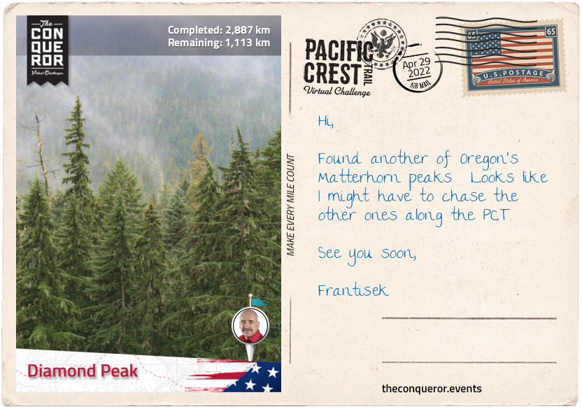
km od začátku : 2887
Diamond Peak
Departing from the western flank of Mount Thielsen, the trail navigated north at above 7,000ft (2,134m), through Mount Thielsen Wilderness, down and over Windigo Pass and back up onto a ridge where I could enjoy views of Windigo Lakes below.
A few miles later the trail wound around the west side of Cowhorn Mountain. At 7,591ft (2,314m) the upper portion of the mountain was completely exposed and the hike to the summit a little challenging given the loose scree and scrambling needed to get to the top. However, the effort was worth it for the surrounding views and especially of Crescent Lake. Shaped like a crescent, hence the name, the lake has a surface area of 4,547 acres and a shore length of 12.4mi (20km). It is a natural lake with a dam located within Deschutes National Forest.
Continuing along the ridge through woodland and descending to 5,600ft (1,707m), the trail skirted the west end of Summit Lake for about a 1.5mi (2.4km), past several tarns to the base of Diamond Peak. Gradually climbing the trail ended on the eastern flank of the peak.
Diamond Peak is a 100,000 year old volcano that last erupted about 11,000 years ago. It has an elevation of 8,748ft (2,666m) with steep slopes and “andesitic volcanic cone that contains pyroclastic materials at its core”. Glaciers have eroded its slopes creating several cirques which are amphitheatre-like valleys. The mountain is located in the Diamond Peak Wilderness within the Deschutes and Willamette National Forests. It is surrounded by a coniferous forest.
Diamond Peak Wilderness has an area of 52,611 acres ranging from an elevation of 4,790-8,748ft (1,460-2,666m) of which Diamond Peak is the highest point. Three other peaks over 7,000ft (2,100m) are within the Wilderness: Mount Yoran, Lakeview Mountain and an unnamed peak. The vegetation is a combination of pine, firs and hemlock trees along with flowers such as mimulus, lupine, heather and Indian paintbrush. The forest is home to deer, elk, bears, foxes and squirrels, whilst ravens and woodpecker crows may be found in the sky with bufflehead and goldeneye ducks nesting near lakes.
Willamette National Forest was founded in 1933 when two forests were combined. Within its boundaries, the forest contains 8 wildernesses, 7 major peaks and several National Wild and Scenic Rivers. One-fifth of its area is designated as wilderness. The forest was at the centre of the controversy between the logging industry and environmentalists who worked at saving the endangered northern spotted owl. The resolution was to restrict logging in areas that could be spotted owl habitats.
Deschutes National Forest was established in 1908 from parts of three other forests and it contains 5 wildernesses, six National Wild and Scenic Rivers, a conservation area and recreation area. Of its 1.596 million acres about 20% is old growth and it has over 250 known caves.
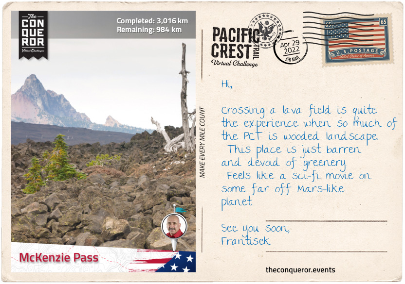
km od začátku : 3016
McKenzie Pass
Skirting the eastern slope of Diamond Peak at around 7,200ft (2,194m) the trail descended and passed Odell Lake near Willamette Pass.
Odell Lake is a natural lake without a dam that fills a basin carved by a glacier. It has a surface area of 3,582 acres and shoreline of 13mi (21km). The lake was named after William H. Odell who was a surveyor general in Oregon. Various fish such as trout, salmon and whitefish can be found in the lake. The most significant catch was in 1984 when a trout weighing 40lb (18kg) was caught.
Although not visible from the PCT the nearby Waldo Lake is known for its exceptionally clear water which on a clear day can be seen to a depth of 120ft (36m). The lake was named after John B. Waldo, a judge who helped push preservation of the Cascades which eventually became a national forest in 1893. North of the lake is the Waldo Lake Wilderness.
Travelling through woodland, the trail emerges regularly at various lakes butting the PCT such as: Desane, S Lake, Mac, Horseshoe and Cliff Lakes, then through a meadow beside Ledge Lake. There’s an even longer list of lakes on either side of the PCT just out of view.
The trail then cuts through another meadow that from the air it looks like a ring-donut, with a circular collection of trees in the middle of the nearly round meadow.
Entering the Three Sisters Wilderness, the trail skirts around the west side of the Three Sisters, which are three closely spaced volcanic peaks named South, Middle & North Sisters, each over 10,000ft (3,000m) high. The peaks are the 3rd, 4th and 5th highest in Oregon and are prone to frequent snowfall and wild temperature variations between seasons.
Whilst North and Middle Sisters haven’t erupted in 14,000 years and are unlikely to ever again, South Sister’s last eruption was 2000 years ago and believed to very likely erupt again in the future. A tectonic uplift discovered in 2000 has increased monitoring of the peak.
Several glaciers can be found on the mountains but the beauty amongst all this is the highest lake in Oregon, known as Teardrop Pool, which can be found on South Sister’s summit crater.
At the far end of North sister is the basalt covered Opie Dilldock Pass with a short, steep and angled climb to it. Descending slightly the trail forged on and skirted the foot of Yapoah Crater, a small cinder cone whose name translates as “isolated hill”. The hill is so barren, with the exception of a few specks of trees, that it almost looks polished with its fine basalt rock. It’s worthy of a climb to the top to see inside the smooth crater and take in the view of several prominent peaks.
Back on the trail, I finish this section at McKenzie Pass traversing solidified lava. Nearby is the Dee Wright Observatory, an open shelter structure made out of lava stones. The observatory is located in the middle of a lava flow and the viewing windows were designed to showcase and identify different peaks in the Cascades.
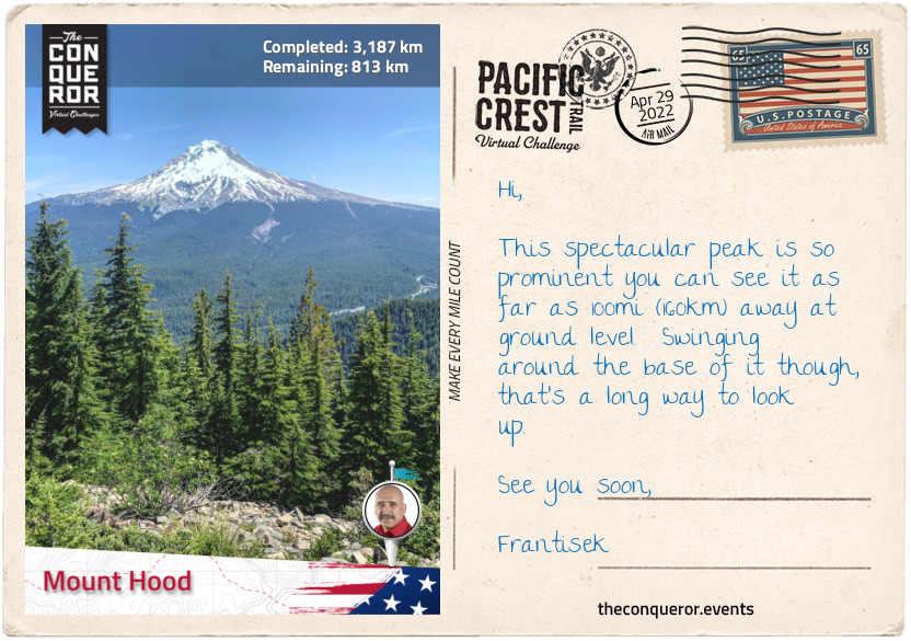
km od začátku : 3187
Mount Hood
A good 5mi (8km) was spent trekking over an old lava flow with its barren and grey terrain to the base of Mount Washington (7,795ft/2,376m). Another of Oregon’s Matterhorns due to its jagged peak, Mt Washington is a deeply eroded volcano that last erupted more than 250,000 years ago. The surrounding area is designated a wilderness but given the mountain’s extremely barren landscape it has very little wildlife and vegetation is mostly pine and shrubs. In 1926 a group of six boys were the first to scale the mountain to the summit.
Not far from the PCT is the very interesting flat-topped Hayrick Butte. Viewed from the sky the Butte takes on a near-perfect shape of a love heart. As a tuya, a type of subglacial volcano, Hayrick’s plateau of nearly half-a-mile (800m) across sits atop 700ft (210m) vertical walls. The north facing slope of Hayrick is rich in forestry, however, it seems to thin out towards the southern end of it with sparse trees and mostly meadows and shrubs in between. Although not as popular as the nearby Hoodoo Ski Resort, Hayrick’s summit offers views of the nearby Big Lake, Mount Washington, Mount Jefferson, Black Butte and its neighbour Hoodoo Butte.
Crossing Santiam Pass, the trail leads to Three Fingered Jack, a shield volcano that’s about 200,000 years old. At 7,844ft (2,391m) high, the mountain is inactive and highly eroded. It’s another peak within Oregon’s Matterhorn unofficial list. Skirting around its western slopes the trail climbs onto the north face with views of Canyon Creek Meadows to the east.
The trek from Three Fingered Jack covers a large section of open and barren terrain passing Wasco Lake, through Minto Pass, around Coyote Lake and to the base of Mount Jefferson and back into woodland.
The trail travels around the entire west side of Mount Jefferson which is about 10mi (16km) from the southside of the mountain to the northside. At 10,502ft (3,201m) high, Mt Jefferson is the second tallest mountain in Oregon. With incredibly rugged surrounds the mountain is difficult to access and hence highly regarded for mountaineering and backpacking excursions. The forest is a mix of fir, hemlock, pine and cedar trees. Formed about 730,000 years ago, the glacial erosion on the mountain seems to have carved a slice out of the western flank creating steep ridges and deep ravines in between.
Named after the 3rd President Thomas Jefferson (also famous author of the Declaration of Independence), the mountain is located in Warm Springs Indian Reservation to the east and Mount Jefferson Wilderness to the west. The Wilderness consists of 111,177 acres and a collection of over 150 lakes. A good 40mi (64km) of the PCT travels through the wilderness.
Trekking over a ridge at the north end of the mountain, the trail travels along the entire west side of Olallie Lake, a recreational lake and into Mount Hood National Forest, ending this section of the hike at Mount Hood.
Mount Hood National Forest was first established under a different name in 1892 and changed to its current name in 1924. It has 8 designated wildernesses and of its 1.07 million acres, 32% are classed as old growth forest. The forest is one of the busiest in the US with a whopping 4 million visitors per year. Within its borders is Oregon’s tallest and most popular peak, Mount Hood at 11,249ft (3,429m).
Mount Hood is a dormant volcano with 12 named glaciers and 4,600 acres of skiable terrain. The mountain is estimated to be about 500,000 years old and its last major eruption was around 1865. First sighted in 1792, the name was bestowed by Lt William Broughton, a British naval officer, and named after Samuel Hood, a British Admiral at the Battle of the Chesapeake. Two US naval ships have been named after Mount Hood despite the namesake being of an enemy commander. First one was an ammunition ship in 1944 that was destroyed when its explosive cargo ignited and the second was another ammunition ship in 1971 that was decommissioned 28 years later.
A man-made feature just as significant at Mount Hood is the Timberline Lodge, a 70 room hotel located on the southern face only a few hundred feet from the PCT. Built during the Great Depression between 1936-38 the building was dedicated in 1937 by the 32nd President Franklin D. Roosevelt. What makes this building important is the handiwork of hundreds of artisans from stonemasons, blacksmiths and wood carvers to weavers. The interior of the building speaks volumes of the craftsmanship as wood carved animals adorn the stairwell, the drapes and carpets are handwoven, carved panels, mosaic murals, hand built furniture, wrought-iron gates, fire screens made of tyre-chains and a six-sided stone chimney stack 90ft (27m) high and 14ft (4m) in diameter. In 1977 the Lodge was designated a National Historic Landmark.
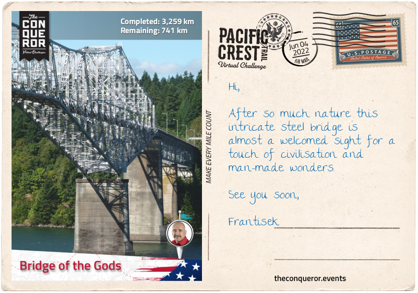
km od začátku : 3259
Bridge of the Gods
Traversing the southwest flank of Mount Hood, the trail dips down into Little Zig-Zag Canyon and back up, then 2mi (3.2km) further it fords Zig-Zag River between Zig-Zag Falls to the right and Middle Zig-Zag Falls to the left.
Zig-zagging away from Mount Hood through woodland atop a ridge, the trail wraps around Wahtum Lake. A recreational destination the lake is located in a cirque at 3,727ft (1,136m) and it is the deepest lake in Mount Hood’s National Forest at 184ft (56m).
The trail ascended towards the west end of Chinidere Mountain, but a detour off the PCT to the summit offered 360 degrees uninterrupted views of Mount Hook, Wahtum Lake below, the Columbia Gorge area and from as far as Mount Jefferson to the south to Mount Rainier in Washington State to the north.
Rejoining the PCT, the trail stayed on the ridge for the next 6mi (9.6km) before gradually descending out of the mountain area and into the city of Cascade Locks, alongside the Columbia River. With a population of 1,144 residents, Cascade Locks is the largest city directly on the PCT.
The city was named after a set of locks (canals) built in 1896 to help steamboats on the Columbia River to bypass the Cascade Rapids. It operated for 42 years when Bonneville Lock and Dam replaced it 4mi (6km) downstream. In 1938 the locks were submerged.
Columbia River is 1,243mi (2,000km) long and it is the largest river in the Pacific Northwest. The river starts in Canada’s Rocky Mountains flowing northwest before making a sharp turn to flow south through Washington state and then west for the last 309mi (497km) forming the boundary between Washington and Oregon states. The river empties in the Pacific Ocean, over the Columbia Bar, a shifting sandbar that makes navigating the mouth of the river extremely dangerous and is often referred to as the “Graveyard of Ships” due to the hundreds of nearby shipwrecks.
Crossing the Columbia River is via a steel truss, cantilever bridge named, Bridge of the Gods. When the bridge first opened in 1926 it was 1,127ft (344m) long, however, after the construction of the Bonneville Dam, the bridge needed to be raised 44ft (13m) and extended to the current length of 1,858ft (566m).
The bridge was named after a geologic feature of the same name which was a natural landslide that occurred sometime early in the first millennia (scientists have not been able to agree on an exact year). Named the Bonneville Slide, large amounts of debris from Table Mountain and Greenleaf Peak, both located on the northwest side of the river, tumbled into the river creating a natural dam and blocking Columbia River. The dam was about 200ft (61m) high and 3.5mi (5.6km) long. With the river impounded it created a lake so large that it drowned a forest for about 35mi (56km). Eventually the river broke through the dam and washed most of it away.
Standing on the bridge I dare not look down as the roadbed is not asphalt but an open metal grate with views of the mighty Columbia River rushing below. The bridge is also barely two-lanes wide with no sidewalk for pedestrians. Hikers cross at their own risk and pay a toll for the privilege. However, here in the middle of the bridge I am at the lowest elevation point on the PCT. A mere 170ft (50m) above sea level. Crossing the remainder of the bridge I farewell Oregon and welcome Washington.
A sidenote - many hikers take the alternate Eagle Creek Trail from the PCT for the last 14mi (22km) into Cascade Locks for all the waterfalls this route offers. The trail is squeezed between narrow canyons and on one occasion it even travels behind a waterfall. A total of ten waterfalls are accessible via this route including the spectacular Punch Bowl Falls which plunges 35ft (11m) into a large bowl that resembles a punchbowl, hence the name.
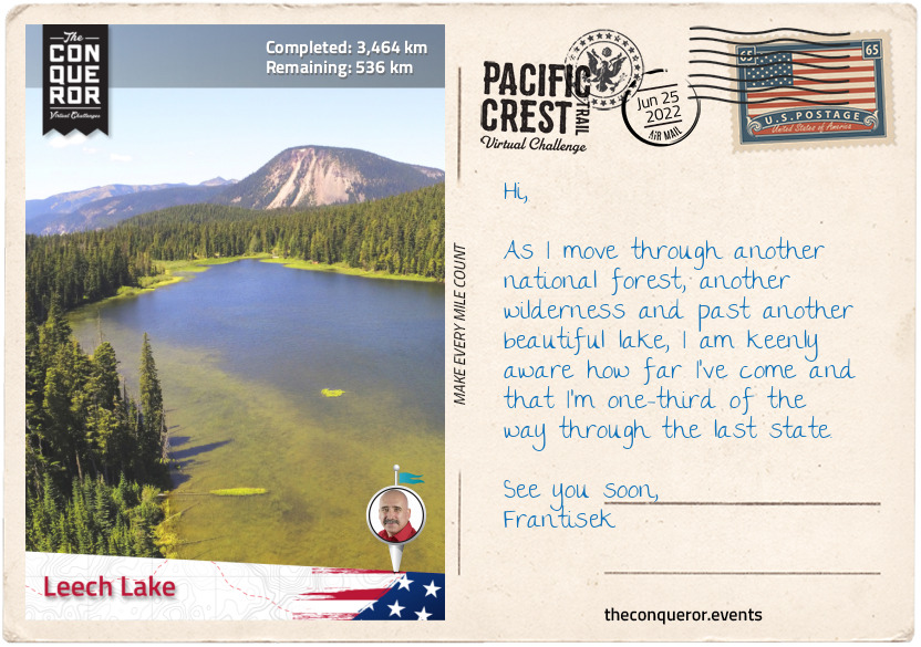
km od začátku : 3464
Leech Lake
Washington state starts with a plethora of lakes just across the Bridge of Gods. As the trail turns west, the PCT passes Ice House Lake and whilst no other lake is visible there is a fair collection beyond the woods next to each other with Wauna Lake as the largest, neighboured by Black, Evergreen and Fern Lakes.
The trail travels through woodland untill it circles around Gillette Lake and the west flank of Table Mountain which together with nearby Greenleaf Peak are responsible for shearing off their south face and damming Columbia River 600-800 years ago.
This section of the trail is entirely within the Gifford Pinchot National Forest. One of the oldest forests in the United States. It runs from Columbia River at the Washington-Oregon border to Mount Rainier National Park in the north. It encompasses 1,312,000 acres consisting of several wildernesses, numerous major rivers, lakes and various peaks. The forest was named after Gifford Pinchot, a forester and politician who was friends with Theodore Roosevelt and together convinced Congress to establish the US Forest Service.
The PCT travels through four wildernesses, of which three are connected to each other and all within this particular section. Indian Heaven is the first one which encompasses 20,782 acres of forested plateau and about 150 small lakes. The second one is Mount Adams Wilderness which is home to the west side of Mount Adams and its peak (the east side is part of the Yakama Nation territory). The third wilderness is Goat Rocks at the north end of this section across both Gifford-Pinchot forest and Okanagan–Wenatchee National Forest.
Mount Adams is 12,276ft (3,743m) tall and it is the highest peak in the Gifford-Pinchot forest and second highest peak in the state. It is a very large, broad mountain with a diameter base of 18mi (29km). Although it’s a volcanic mountain and its last eruption was 920AD, today it is still considered active. It has 12 named glaciers of which Adams Glacier is the second largest in the Cascades. It is a climber’s paradise with 25 different routes ranging in level of difficulty. The easiest non-technical route is from the south, whereas the north and west are a game changer with their steep headwalls, where crampons and ice axes are generally required. However, the relatively flat summit affords amazing panoramic views of at least nine other volcanic peaks, including St Helens, Jefferson, Rainier, Hood, Three Sisters and Baker. The mountain was named after 2nd President John Adams, one of the founding fathers of the United States, a leader of the American Revolution and contributor in the drafting of the Declaration of Independence. The PCT traverses the western flank of the mountain.
Trekking onto Goat Rocks Wilderness, the trail travels up and down along the western slopes of Goat Rocks, an extinct volcano which features several rugged peaks such as Gilbert, Ives, Old Snowy, Tieton, Johnson, Bear Creek and Hogback. It was named after the numerous goats that are found in the area. Various mineral resources can be found on Goat Rocks, such as coal, copper and lead.
Whilst each peak is moderately tall, the highest is Gilbert Peak at 8,202ft (2,500m). Gilbert Peak has two glaciers: Meade Glacier to the south and Conrad Glacier to the east. McCall Glacier is located to the east between Ives Peak and Snowy Mountain. The trail then crosses Packwood Glacier, northwest of Snowy Mountain, up onto a ridge until it descends northeast into woodland through Tieton Pass. Another ascent up the southwest slope of Hogback Mountain and over to traverse most of the barren, east flank of the mountain, back into the woods and down to Leech Lake.
Located at the summit of White Pass, within Wenatchee National Forest, Leech Lake is a fly-fishing-only lake. It has 1.5mi (2.4km) loop trail around the lake which is accessible year round either for hiking or snowshoeing.
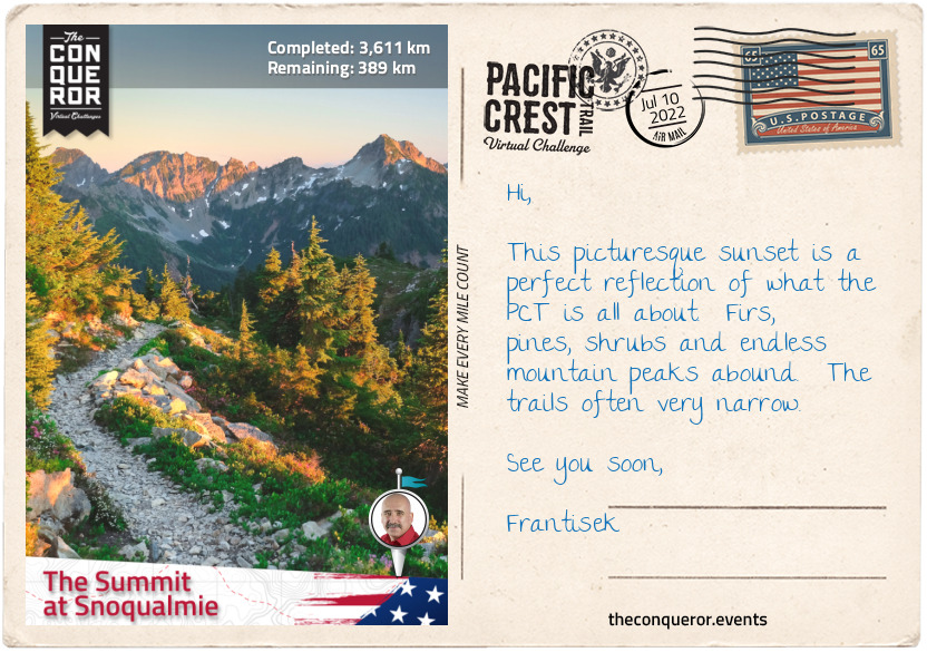
km od začátku : 3611
The Summit at Snoqualmie
Heading north in Wenatchee National Forest the trail passes several lakes and through a broad valley with Fryingpan Mountain to the left. The Wenatchee Forest has six wilderness areas of which three are traversed by the PCT being: William O. Douglas, Henry M. Jackson and Goat Rocks which was in the previous section.
Crossing Bumping River near Fish Lake, the trail starts a steep 250m ascent through several switchbacks passing Buck Lake to the right, Crag Lake further up to the left with Crag Mountain peak on the opposite side. For several miles the trail weaves between Mount Rainier National Park and Wenatchee National Forest. It passes the nearby Anderson Lake then the PCT crosses a stream that connects the large Dewey Lake on the right to a small unnamed lake on the left.
Climbing up over a crest the trail skirts the foot of Naches Peak to the east, then alongside Hwy 410 before veering off and climbing past Sheep Lake and over Sourdough Gap. Trekking on the side of a ridge the trail reaches Brown Gap within the Mt Baker-Snoqualmie National Forest and the Norse Peak Wilderness. The Gap is the midpoint of a mountain range shaped like a horseshoe. The trail heads right past Pickhandle and Crown Points, with views of Crystal Mountain Ski Resort on the opposite side. The carved ski trails are prominent as they weave down the mountain funnelling at the bottom near the ski lifts.
Mt Baker National Forest was established in 1907 and Snoqualmie National Forest in 1908. They were combined as one in 1974. Together they encompass 1,724,229 acres and nearly half is designated wilderness with a total of 10 separate wilderness areas. Almost 42% of the overall forest is old-growth. The forest is home to the largest number of glaciers outside of Alaska. As at 1998 count there were a total of 287 glaciers within the forest. Due to warming conditions many glaciers have disappeared prior to this count consequently warming rivers and reducing their flow. This in turn affects fish species that rely on this ecosystem.
Travelling through Norse Peak Wilderness, the trail flanks east of Norse Peak through Green Pass and across the ridge of Blowout Mountain. From here the trail commences a long and steady descent from 5,698ft (1,737m) passing Snowshoe Butte, Mirror Lake, Silver Peak and ending at The Summit at Snoqualmie at 3,200ft (975m).
Snowqualmie is a ski resort with a skiable area of 1,994 acres. The resort has 62 runs of various levels across 4 different areas. Of its 62 runs more than half are advanced or expert ski runs and its longest run is 1.2mi (1.9km) long. The PCT runs along the west side of the Summit, whereas most of the ski runs are on the east side. Only the last half a mile (800m) of the trail is traversed beneath the ski lifts and over the ski runs.
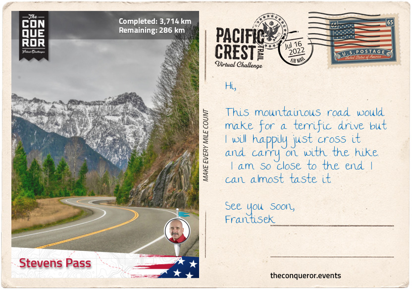
km od začátku : 3714
Stevens Pass
Taking the underpass beneath the I-90, the next 7mi (11km) was an upward climb to the ridge gaining 2,600ft (792m) to Kendall Katwalk. I circled the ridge with Alaska Lake below, crossed over a crest to circle another ridge with Joe Lake below to the right and Edds Lake to the left.
The trail traverses the southern and eastern flank of Huckleberry Mountain with its sharp peak (6,320ft/1,930m) and treks over a crest to traverse the southwest flank of Chikawee Mountain (7,000ft/2,100m) and its neighbour Four Brothers (6,489ft/1,978m).
The three peaks are within the Alpine Lakes Wilderness. Encompassing 394,000 acres the wilderness is home to woodland consisting of firs, cedar, pine and hemlock to expansive meadows and more than 700 lakes that dot the glacier carved terrain the PCT travels through.
Crossing a crest the trail descends into a wide valley before starting an upward climb on tight switchbacks and continues zig-zagging until it goes down again, gaining and losing about 2,297ft (700m) then a straight stretch to Waptus Lake. Trekking the full length of the lake, the trail swings left into a canyon alongside Spinola Creek which empties into nearby Deep Lake, then up a handful of switchbacks to Cathedral Pass and the east side of Cathedral Rock.
Traversing a valley the trail passed the full length of Daisy Lake and its north-westerly neighbour Deception Lake. I wound my way up the west side of Surprise Mountain (6,330ft/1,930m) to its north face and then back down northeast passing Glacier Lake, then crossing the terrain diagonally to climb back over another crest and traverse the flank of a mountain slope with Trap Lake below.
Moving north-easterly, the trail passes next to several more lakes such as Hope, Mig and Josephine Lakes and straight through Stevens Pass Ski Area crossing the saddle between Cowboy Mountain (5,845ft/1,782m) to the left and Big Chief Mountain (5,600ft/1,600m) to the right.
Stevens Pass has 1,125 acres of skiable terrain that includes 37 ski runs. The area around it is prone to avalanches and it bears the mark of the worst avalanche in US history. In 1910, the small community of Wellington experienced nine consecutive days of severed blizzard, with snow of up to a foot (30cm) falling every hour and on the worst day 11ft (3.4m). Two trains were trapped in the depot, one of them a passenger train with all the passengers and crew staying aboard. Due to lightning strike, a slab of snow broke loose that was 10ft (3m) high, half-mile (800m) long and quarter-mile (400m) wide and tumbled toward town. With a recent fire ravaging the slopes the avalanche had complete freefall with nothing standing in its way. It hit the trains in the depot and tossed the trains 150ft (45m) downhill into the valley. A total of 96 people died in the wreckage and 23 survived. The town was renamed to Tye to remove the stigma of the previous name. When the Cascade Tunnel finished construction in 1929 the town was eventually abandoned.

km od začátku : 3893
Rainy Pass
About 2.8mi (4.5km) from Stevens Pass, the trail circles Lake Valhalla and rising steeply above this glacial lake to the east is the rugged peak of Lichtenberg Mountain (5,844ft/1,781m). The west side of Lichtenberg is a much gentler slope with Lichtenwasser Lake at the base.
Trekking over Union Gap the trail descends into a valley to Janus Lake. This body of water is only 40ft (12m) deep at its centre and it sits at the base of Jove Peak (6,007ft/1,839m). The lake was named after the two-faced Roman God because it was thought that the lake drained west as shown on maps but it actually drained east. The peak was named after Jupiter, Jove for short, the Roman God of sky and thunder. Both the peak and the lake were named by Albert Hales Sylvester, associating it to the nearby features that were also named after Roman Gods, ie Minotaur & Theseus Lake and Labyrinth Mountain.
Albert himself was a fascinating character. As a pioneer surveyor, explorer and forest supervisor in the later 19th century, Albert was largely responsible for naming more than 1,000 features in Washington state. Together with Gifford Pinchot they recognised that naming features and producing detailed maps was an important task in order to protect forests from wildfires. Through the naming process it made it easier to provide the correct location of fires to the firefighters. With so many features unnamed, Albert took it upon himself to explore, map and name the natural features. He was often the first to climb these peaks as part of his surveying work.
The trail continues over a crest and follows along on a ridge through Wenatchee Pass to Pear Lake and Fortune Mountain (7,382ft/2,250m) behind it. The peak was named after Fortune Creek which is where Queen of the Hills gold mine and Ruby Mine were located.
The trail then traverses the east slope of Skykomish Peak (6,368ft/1,941m) located within the Henry M. Jackson Wilderness. The volcanic ash found on Skykomish is a result of the nearby volcanic Glacier Peak. Creating fertile soil the slopes of Skykomish are filled with wildflowers and meadows.
The wilderness itself consists of 103,297 acres and it is “rich in mining history with several acres of patented mining claims within its borders.” There are 30 lakes within the wilderness with the most striking being Blanca Lake due to its turquoise green color, a result of silt-filled melt water. With a combination of tall forest and broad meadow, the wilderness has a mix of cedar, firs, spruce, hemlock and at higher elevations, alpine meadows.
Tucked in a cirque along the PCT is Lake Sally Ann looking mighty inviting for a dip. Pushing on though the trail reached Kodak Peak through its southside, along its eastern ridge and then traversing its eastern flank through Indian Pass. As the name suggests Kodak Peak offers wonderful views of the surrounding area, particularly the dominating Glacier Peak to the northeast and some of the smaller ones such as, White Mountain to the north and Johnson Mountain to the west.
Trekking between White Mountain, Portal Peak and White Chuck Cinder Cone, all in close proximity, the trail descends 2,296ft (700m) into a densely forested valley at the base of Glacier Peak within the Glacier Peak Wilderness. The peak at 10,525ft (3,207m) is one of five stratovolcanoes and fourth tallest peak within the state. Formed a million years ago, Glacier Peak is one of the most active volcanoes having explosively erupted at least five times in the last 3,000 years. There are 11 significant glaciers on the peak.
Circling the north side of the peak, then on the flanks of Vista Ridge, the trail crosses Suiattle River. Sometime in 2003 a flood washed away the original bridge leaving the PCT without any safe crossing. It wasn’t until 2011 that a new bridge was installed. Until then a large tree trunk that fell across the river was used as a makeshift bridge. Crossing it standing up was dangerous with no railings to rely on, so straddling the trunk and scooching across was the favoured method.
The trail follows the river for 4mi (6.5km) and then turns left to wind its way on the slopes of Plummer Mountain and its neighbour Sitting Bull Mountain. Descending into a valley and alongside South Fork Agnes Creek the trail is flanked by the rising peaks of Needle Peak, Saddle Bow Mountain and Agnes Mountain. The creek joins Agnes Creek in the aptly named Agnes Gorge where the trail follows alongside it to the base of McGregor Mountain where it forks off. Agness Creek travels right joining Stehekin River. Taking the left fork along the continuation of Stehekin River, the trail carries on until it turns right alongside Bridge Creek, past Rainy Lake and terminates at Rainy Pass, a mountain pass on State Route 20.
Although not on the PCT an interesting feature east of McGregor Mountain is Lake Chelan. This incredibly narrow and very long lake looks like a very wide river when seen from a satellite. It has a shoreline of 109mi (175km), length of 50mi (81km) and a depth of 1,486ft (4539m). It’s total water volume is a staggering 15,800,000 acre feet.
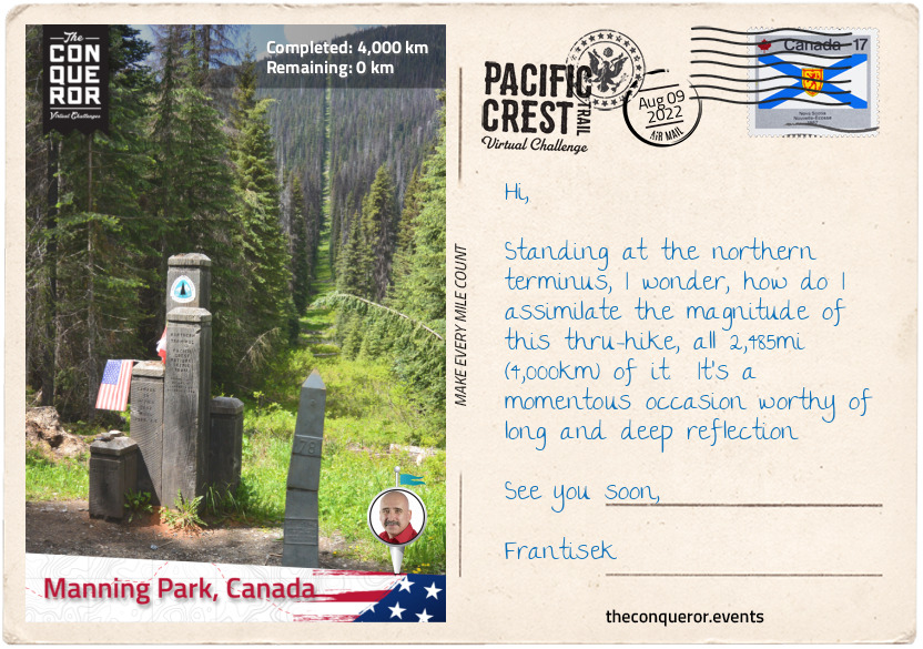
km od začátku : 4000
Manning Park, Canada
From Rainy Pass, I crossed the road and entered the valley along Porcupine Creek and Porcupine Peak to my left. Climbing a few switchbacks, the trail traversed the south end of Tower Mountain, a non-volcanic mountain with prominent jagged peaks, then over a crest and down into a valley beside Methow River for the next 5mi (8km).
Turning left at Azurite Peak, the trail ascended and traversed the south slope of Tatie Peak. I left the PCT for a quick scramble to the summit for a complete view of the North Cascades. Back on the PCT, I followed the trail across the flank of Slate Peak, then down to the foot of Tamarack Peak and up the east slope of Devil’s Backbone.
After descending into Holman Pass, I ascended again weaving between Holman Peak, Powder Mountain and Three Fools Peak towards Lakeview Ridge and reaching the ridge of Devil’s Stairway (6,800ft/2,073m). Circling along the ridge, I was enjoying the near perfect circular Hopkins Lake below. Once I trekked through Hopkins Pass, the trail descended to 6,000ft (1,829m) and traversed the western slope of Blizzard Peak, then further descending to 5,200ft (1,585m) as it passed the west side of Mt Winthrop for the next 3mi (4.8km) to the Canadian border.
Entering the province of British Columbia, I travelled through the valley to Windy Joe Mountain and completed the final stretch by crossing Similkameen River and ending this most extraordinary journey in Manning Park at an elevation of 3,937ft (1,200m).
It would have been impossible to capture all the peaks, passes, gaps and lakes throughout these writings but it does raise the curiousity that is perhaps best illustrated in a statistical roundup:
- 3 States
- 5 National Monuments
- 30 Sections
- 7 National Parks
- 25 National Forests
- 48 Wilderness Areas
- 57 Mountain Passes
- 19 Major Canyons
- 1,000 lakes and tarns
- Lowest elevation: 170ft/50m – Bridge of Gods
- Highest elevation: 13,153ft/4,009m – Forester Pass
Clinton Clarke, the “Father of the PCT”, was an avid hiker and great visionary when in 1932 he proposed the idea of creating a wilderness trail from Mexico to Canada, along the crest of the Pacific Coast mountains for the preservation and protection of its wilderness from human interference. It would take 61 years before the Pacific Crest Trail was officially completed. As he beautifully encapsulated the meaning of the PCT in these words, he left a masterpiece to be enjoyed for generations to come.
“In few regions of the world … are found such a varied and priceless collection of the sculptured masterpieces of Nature as adorn, strung like pearls, the mountain ranges of Washington, Oregon and California. The Pacific Crest Trail is the cord that binds this necklace.”
- Clinton C. Clarke, Pacific Crest Trailway Compilation, 1945
km od začátku : 0023
The Leaky Cauldron
The Leaky Cauldron is the oldest inn and pub in London, as well as a passage from the Muggle world to the wizarding one. The cozy ground floor serves food and drink, as well as offering passage to the Diagon Alley. The seemingly infinite corridor on the upper floor is lined with doors leading to shabby but warm rooms ready for any witch, wizard or magical creature in need of a bed.
km od začátku : 0035
The Hogwarts Express
At every start of term, this scarlet train shuttles Hogwarts students from Platform 9 ¾ to Hogsmeade Train Station. A trip on the Hogwarts Express is a rite of passage for every first-year student and a place where older students meet their school friends after being separated for the summer holiday.
km od začátku : 0064
Hogwarts Quidditch Pitch
Quidditch is a serious business at Hogwarts. The School has its own pitch for its inter-house games, as well as trials and practice matches. The oval-shaped grounds are flanked by stands for spectators and 16 tall towers which offer a better view of the players while in flight. For every match, the pitch is decorated in the colours of the opposing team.
km od začátku : 0079
Hogsmeade
Hogsmeade is the only non-Muggle settlement in Britain and serves as a home for many witches and wizards. For special days and with signed releases from their guardians, Hogwarts students fill the village's quaint streets, taking in all that Hogsmeade has to offer: Honeydukes sweets, Butterbeer, and plenty of shopping.
km od začátku : 0093
Hagrid’s Hut
This stone hut on the edge of the Forbidden Forest is Hagrid’s home. The austere exterior shelters a cosy, warm, and busy interior. The one big room and its kitchen are shared with Fang and often more than one other magical creature, such as a baby dragon! The hut’s door is always open for any student looking for help or advice.
km od začátku : 0101
Shrieking Shack
“The most haunted dwelling in all of Britain” is avoided even by the most adventurous students. The desolate cabin stands on top of a hill outside Hogsmeade and is connected to Hogwarts’ grounds through a secret passage under the Whomping Willow.
km od začátku : 0126
Clock Tower Courtyard
As the name suggests, this small but pleasant courtyard is found next to the Clock Tower. The ancient-looking arches surrounding it are partially covered with vegetation, giving it the feel of a secret garden. In the centre sits a beautifully decorated fountain, flanked by 4 eagles and a pear tree.
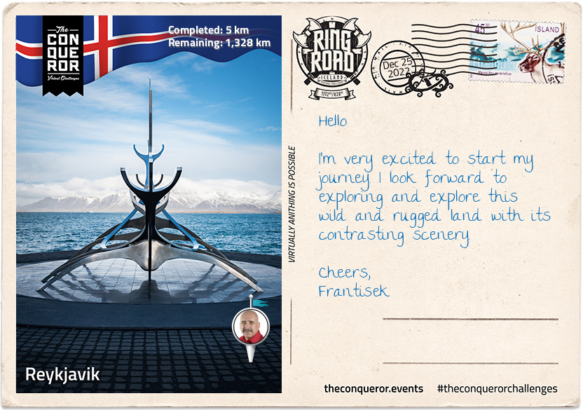
km od začátku : 0005
Reykjavik
It's been a great first day. When I arrived in Iceland at Keflavik International Airport, instead of going straight to Reykjavik, it was recommended that I take a side trip to the geothermal spa named Blue Lagoon. It is located in a lava field and the water is supplied by the nearby geothermal power plant. This man-made lagoon has a milky blue colour which is largely due to the high content of silica (a chemical compound containing oxygen and silicon). The lagoon is also high in algae and salt. Bathers with psoriasis have found it beneficial to their skin to bathe in the lagoon.
Having spent a couple of hours in the lagoon, a great way to rejuvenate from my flight, I headed into Reykjavik for some exploration. Reykjavik is the capital city of Iceland and the world's most northernmost capital. The first settlement was in 874AD and the city itself was founded in 1785 as a trading town which steadily grew and expanded to become the national centre it is today.
I headed to Grandi Harbor as several points of interest are located there and started with a visit at the Whales of Iceland, a wonderful museum exhibiting 23 man-made life size models of various whales. I was particularly taken by the 25m (82ft) long blue whale model. It's a tactile experience as each hand-painted model is designed to be soft and squishy and accessible to visitors.
Nearby is the Maritime Museum exhibiting Iceland's maritime history including displays of 100-year old fishing boats. What makes this visit interesting is the decommissioned Coast Guard and rescue vessel Óðinn moored near the museum providing visitors an opportunity to see and learn about its custom design and special duties patrolling Iceland's territorial fishing grounds. During its service (1960-2006) the vessel towed 200 ships to safety, rescued stranded crews and twice saved the lives of crews from sinking ships.
At the north-east edge of Grandi is a small dome shaped hill with an encircling path to the top. This art installation with a fish drying shed on top is a lovely contemplative spot with a terrific view of the harbour and the glistening honeycomb design of the Harpa Concert Hall.
As I made my way along the shore, I came across the Sun Voyager, a stainless steel sculpture designed by Jón Gunnar as a commemoration of the city's 200th anniversary. Often mistaken as a Viking ship, the artist describes the work as "...a dream boat, an ode to the sun. It symbolizes the promise of undiscovered territory, a dream of hope, progress and freedom."
With that in mind, I forge ahead and commence my 1,332km (828mi) round-the-island journey on Route 1 better known as Ring Road.
Take care and I'll write again soon.
See ya,
Frantisek
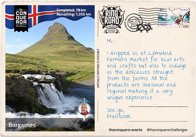
km od začátku : 0078
Borgarnes
The Ring Road can be enjoyed in any direction, so I decided to go north and arrived in Borgarnes. It was fun travelling beneath Hvalfjörður fjord through the Hvalfjörður tunnel to get here. This 5.8km (3.8mi) long tunnel connects Reykjavik to the western and northern parts of Iceland. Apparently it reduces the travel by 45km (28mi). I also crossed Iceland's second longest bridge at 521m (1700ft) known as Borgarfjarðarbrú just before entering town.
Borgarnes is the gateway to Snaefellsnes Peninsula and the National Park within it holds Snaefellsjökull, a cone-shaped 700,000 year old glacier-capped stratovolcano that is often referred to as the “crown jewel of the peninsula" and it's the famous setting for Jules Vernes' novel Journey to the Centre of the Earth.
North of the Peninsula is the most photographed Kirkjufell Mountain. At 463m (1519ft) high the mountain beckons hikers to its summit for a breathtaking view but it's only suitable to hikers who don't suffer vertigo and are fit enough to take on the treacherous climb near the top. For movie buffs, Kirkjufell features in Games of Thrones (Season 6 & 7).
Nearby Borgarnes are several waterfalls, each with their own characteristics, such as Glymur, Glanni, Hraunfossar and Barnafossar Waterfalls. Glymur, accessed via a rugged trail, is the second tallest in Iceland with a cascade of 198m (649ft) falling into a canyon. Glanni sits near an ancient lava field but it is also said to be the home of elves and trolls. Hraunfossar and Barnafassor are near each other and both stream out of Hallmundarhraun, a lava plain created by volcanic eruptions on Langjökull, the second largest ice cap in Iceland.
There are four national forests within the region with a mix of birch woods and native conifers, however, some of the tallest and oldest birch trees can be found in Borgarnes. Anyone familiar with Iceland, will probably know that it is quite a treeless landscape largely a result of deforestation during Viking settlement, sheep contributing to soil erosion which couldn't support trees and lastly volcanic eruptions covering areas that previously were fertile areas. Fortunately reforestation projects have been underway for the better part of the century including incentives offered to farmers who can obtain a grant if they create a section of woodland on their land.
Bye for now,
Frantisek
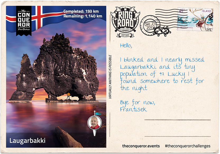
km od začátku : 0193
Laugarbakki
Laugarbakki may be small but they were forward thinking when they converted an old school into a hotel with modern Nordic designs. With all necessary amenities on the premises, I settled in for a few days and explored the surrounding area.
My first stop was the nearby Folk Museum which houses Ófeigur, the 19th century ship that refined oil from the sharks it caught and sent it to Europe to use in their streetlamps well before the age of electricity. Built in 1875, the preserved vessel is the last of its kind in Iceland. Imagine 10 men hauling this vessel into freezing icy waters in the middle of winter in search for the Greenlandic sharks which they fished for meat and liver oil. The meat was cured and fermented to create Iceland's national dish Hákarl which is still made today. The Museum also exhibits rural living at the turn of the 20th century, displaying living arrangements, cooking during these times, criminal cases and women's history.
In need of some lore, I was curious about the gorge Kolugljufur that legend says was dug out by a troll called Kola. Living in a nearby cave Kola hunted and cooked salmon from the river Víðidalsá which cascades into this narrow but deep canyon forming the Kolufossar waterfalls. The lore ends with Kola eternally resting amongst her treasures on a nearby hill.
On my way to Vatnsnes Peninsula I took a small detour to see the Borgarvirki volcanic plug. Made of basalt strata in a columnar shape, it stands 177m (580ft) above sea level. Although a natural phenomenon, evidence of walls, stairs and other additions indicate that it was once used as a fortress. The Icelandic Sagas (circa 9th-11th century) mention that Borgarvirki was used for military purposes.
To add to my volcanic mood, I did a quick stop in Blönduós to have a look at the church on the hill that was built to resemble a volcanic crater. Made of concrete it has a strong and striking look showcasing Iceland's modern architectural designs that is ever-present throughout the island and particularly through their churches.
Having made it on Vatnsnes Peninsula, I was particularly interested in seeing the Hvítserkur rock formation that some refer to as an elephant shape and others as a rhino. I think it looks more like a triceratops drinking water. A little more lore, it is said that the rock formation is really a troll frozen in the light of day. This 15m (49ft) tall basalt rock protrudes from Húnaflói Bay and is the nesting ground for various birds. The three large holes may have been carved by cascading sea water but its foundations have become brittle and it has since been reinforced with concrete to protect it.
I finished my day with a picnic watching the seals lazing on the rocks and the pups playfully frolicking in the water.
Regards,
Frantisek
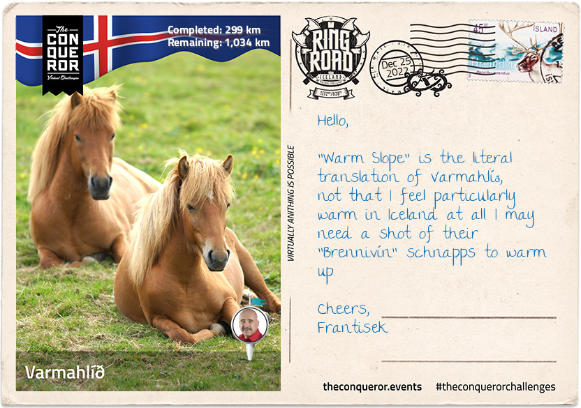
km od začátku : 0299
Varmahlíð
Travelling through Vatnsskarð mountain pass on the way to Varmahlíð, I came across Stephan G. Stephansson's monument. Stephan was a renown Icelandic poet and farmer from the region who suffered from insomnia. As such he would write all night after finishing his farming work. A self-educated man, he only wrote in Icelandic even though he emigrated when he was 19 years old to Wisconsin, USA and later to Alberta, Canada. He returned to Iceland for the first time 45 years later when he was 64 years old and although none of his poetry has survived only his letters, he is highly regarded and considered "as one of Iceland's foremost men of letters".
The village of Varmahlíð is home to 140 residents. Small it may be but it is not to be underestimated. Living on the slope of a hill, the village is in the centre of the most prosperous agricultural region, rich in geo-thermal water and contains a number of greenhouses that grow tropical and sub-tropical fruit and vegetables.
The village is home to Iceland's most famous men's choir, Karlakórinn Heimir. Originally founded in 1927 it travels the world singing. In its 93 years, the choir has only had three conductors of which the second conductor held his position for 40 years.
The region's main industry is the Icelandic horse. A pure breed described as small almost pony-like, yet sturdy and hardy horse. Native to Iceland they have few diseases and due to Iceland's strict no horse-import policy they are not vaccinated against potential diseases. Although Icelandic horses are exported, once they leave the country they cannot return. Unique to these horses are their gaits. Known for their sure-footedness and ability to cross rough terrain the horses have an additional two gaits. Although difficult to articulate have a look at this link that describes their special gaits and history on how they arrived during the Viking Age in the 9th-10th centuries. https://en.wikipedia.org/wiki/Icelandic_horse
Just north of Varmahlíð is the Glaumbær Farm and Museum, exhibiting 18th-19th centuries rural living in turf-roofed farmhouses. Turf was used as building material which first appeared over 1,000 years ago when the Vikings arrived. As timber was sparse and slow to regrow, the Vikings used turf to lay over a timber structure to form walls and a thick roof. The turf was sturdy and easily available providing insulation from the cold climate. However, due to its biodegradability and erosion from the harsh climate the turf needed to be replaced every 20 years.
Of course no daily trip is complete without a stop at a waterfall. Only 7km (4mi) from Varmahlíð, is Reykjafoss waterfall which is a result of Huseyjarkvisl river cascading 20m (69ft) over two wide steps into the river below and flowing onwards to the Atlantic Ocean. The Huseyjarkvisl river is one of the top sea trout rivers. Large fish are caught each year with one of the biggest measuring 96cm (3ft) and weighing as much as 6kg (13lb). Catch and release practices were introduced in 2000 which is one of the reasons for such large fish and the double digit catches.
Bye,
Frantisek
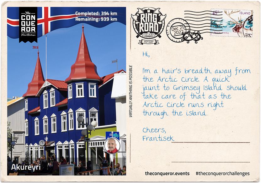
km od začátku : 0394
Akureyri
I've arrived in Akureyri, the largest town outside the heavily populated south-west corner of Iceland. Nicknamed the capital of North Iceland, Akureyri was originally settled in the 9th century by Norse Viking Helgi Eyvindarson. Danish merchants used it as a trading port during the 17th century but always returned to Denmark during the winter. Permanent settlement began in the 18th century largely due to the ice-free nature of the port and rich agricultural conditions in the region.
During WWII, Allied units were based in town and the Norwegian-British squadron had an airbase here. The squadron flew Northrop N-3PB bombers and Catalina flying boats to protect convoys between US, UK and Murmansk in Russia from German submarine attacks.
Akureyri has a strong folk culture and it is home to Vefarinn, the folk dancing group. Each year the town hosts several festivals such as: Vaka Folk Arts Festival with performances from folk musicians and dancing groups like Vefarinn; and, the Medieval Festival held at Gásir, a trading post from the Middle Ages where a medieval market is held annually and visitors can experience the culture and occupations of the Middle Ages.
Eight main museums can be found in this small northern town. Anything from aviation, art, industrial history, folk art, literature to 20th century toys, motorcycles and general regional history. There's no shortage of history and exhibitions. Just consider the 28 full-sized aircrafts in the aviation museum or the motorcycle collection that tells its 100-year history since the first motorbike arrived on the island. The toy museum may be nostalgic but the building itself was once owned by the Independent Order of Good Templars (a sector of the Freemasons).
For a round of golf, the Akureyri Golf Club holds the title of the most northerly golf course in the world. Established in 1935 it is the second oldest club in Iceland. The Arctic Open is held here during the summer as a four-day championship event. Given the proximity to the Arctic Circle, I think a round of golf under the midnight sun is in order.
Cheers,
Frantisek
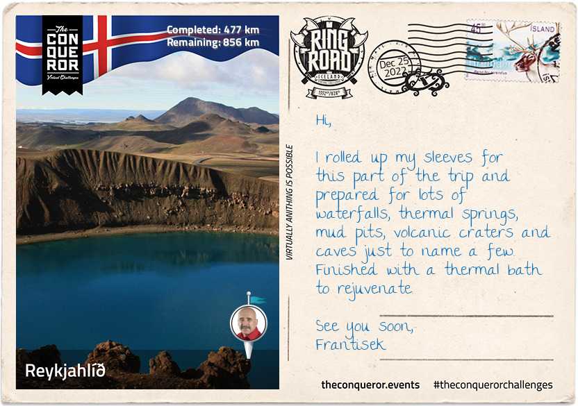
km od začátku : 0477
Reykjahlíð
When I arrived in Reykjahlíð I rolled out my map and pinned everything I wanted to see in this area that didn't include the two waterfalls I had to see halfway between Akureyri and Reykjahlíð. There is no end to the breathtaking scenery in this country. So grab a cuppa and let me regale you with my exploits.
On my way to Reykjahlíð, I took a very short detour at Fossholl to checkout Goðafoss. It is a 30m (98ft) wide curved waterfall with a 12m (39ft) drop. Legend says that a lawmaker, who was also a pagan priest, meditated for one day and night and decided in favour of Christianity. When he returned home, he threw his Norse god idols into the nearby waterfall which is now known as Goðafoss, "the waterfall of the gods". The story is illustrated in the window of Akureyri's main church. A further 500m (1,640ft) below Goðafoss is the smaller Geitafoss at about half the width and height which is thought to be swallowed up when the depth of the river increases within the gorge due to floods.
When the volcano Krafla erupted 300 years ago, the townspeople of Reykjahlíð fortunately survived as they huddled in the church up on higher ground where the lava flow stopped. The town itself was completely destroyed. Thankfully today I can use it as a place to visit the nearby natural wonders.
I started with the Myvatn volcanic lake. With its high level of biological activity it provides a habitat for waterbirds such as ducks (15-16 species of duck). The lake began 2300 years ago when a basaltic lava erupted. South of the lake are pseudocraters (aka rootless cones) which look like volcanic craters but are actually formed by steam explosions when flowing lava crosses a wet surface like a lake.
There are many hot springs in the area with contradictory advice if swimmable or not but the following two are worth exploring. Stóragjá for instance is an ancient subterranean cave filled with naturally heated thermal springs. It is a bit of an adventure climbing down a very narrow ravine before clambering into the cave using ropes followed by carved steps. The beautiful blue colour of the water is very inviting but the dangerous algae and lack of filtration makes the spring unsafe for bathers.
The more popular Grjótagjá Cave rose to fame after its appearance in an episode of Game of Thrones. It used to be a popular bathing location until the mid-70s when following an eruption the water temperature rose beyond 50°C (122°F). Due to the liquid rock a mile beneath the surface the temperature remains high making swimming unsafe.
Once I surfaced from the subterranean caves, I took a hike onto Hverfjall Crater. Described as a tephra cone or tuff ring volcano, it is one of the largest of its kind in the world due to its 1km (0.6mi) diameter. The 396m (1300ft) walk up a steep path and around the crater's rim provides a great view of the Myvatn region and nearby lava fields.
The Myvatn Nature Baths is beckoning me for a leisurely steam bath in its alkaline lagoon but first one final stop at Hverir to see the boiling mud pits and steaming fumaroles that emit sulphuric gases. The pits are surrounded by colourful sulphur crystals which unfortunately give off a strong egg-like smell. The area's high acidity levels inhibits vegetation from growing.
It's time for my geo-thermal soak.
Cheerio,
Frantisek
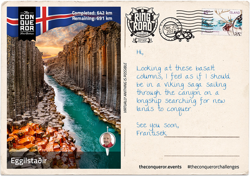
km od začátku : 0642
Eggilstaðir
Along the second longest river on the island, known as Jökulsá á Fjöllum, are three substantial waterfalls; Selfoss, Dettifoss and Hafragilsfoss in close proximity. This glacial river is 206km (128mi) long and flows into the Greenland Sea. Its source is Vatnajökull, the largest ice cap in Iceland that covers 8% of the country.
The most spectacular of the waterfalls is Dettifoss. Incredibly powerful with its 44m (144ft) drop and 100m (330ft) width it is also deafeningly loud. The waterfall can be seen from both the west and east banks and on a good day a rainbow may be seen from the west bank. Selfoss, much smaller, is only a kilometer away upstream. Although it doesn't have the same volume or power and is only 10m (32ft) tall, Selfoss is much wider than Dettifoss and best seen from the east bank since most of the water flows from the west. Hafragilfoss is downstream of Dettifoss and just as powerful with its single 27m (89ft) drop.
My next stop was the Jökuldalur Valley, known for its forceful glacial river and basalt column canyon. The river used to roar its way from the Highlands, cutting through the valley which for many centuries due to its force and high level made crossing it inaccessible and very dangerous. However, in 2009 the river's source was diverted by a hydroelectric plant and created the Hálslón reservoir. From the reservoir the river flows with the same force for 60km (37mi) in underground tunnels to drive the hydroelectric turbines of the power plant.
What's left of the original river course is now fed from surrounding mountains, creeks and small rivers. No longer a glacial river carrying 120 tonnes of sand, mud and dirt, it is now a clear, blue river flowing to its final destination. The greatly reduced water level has exposed the basalt columns that makes up Stuðlagil Canyon. These hexagonal columns are a result of basaltic lava slowly cooling over time and as the columns shrink in volume they crack creating these symmetrical columnar patterns. The canyon is also home to pink-footed geese during nesting season when they lay their eggs along the gorge. A little further down is Stuðlafoss, a waterfall that cascades down moss-covered basalt columns. The shorter columns at the bottom stack in front of each other resembling an ancient throne.
When you think of Iceland, it probably conjures images of ice caps, glaciers, barren land, volcanoes but not of trees or forests. So it's hard to imagine that once, Iceland was heavily forested when the climate was warmer and the glaciers were smaller. Then the Vikings came and since trees were their main source of building materials for housing and boats and smelting metal, the forests diminished over time. Native trees were mainly birch with some rowan, willow and aspen trees. At the turn of the 20th century reforestation projects and woodland planting schemes commenced and have been ongoing ever since. Near Eggilstaðir is Iceland's largest forest, Hallormstðaskógar, covering 740 hectares. The forest has 40km (24mi) of hiking trails and a tree museum consisting of 70 species of trees. The most delightful part was being able to collect edible mushrooms and pick raspberries and redcurrants. When I ran out of water I was able to refill my bottle directly from the stream as it's clean and drinkable.
See you soon,
Frantisek
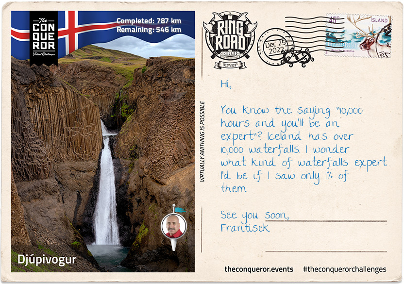
km od začátku : 0787
Djúpigovur
Having reached east of Iceland, my journey took me through a jagged coastline of fjords. Although Egilsstaðir is the largest town in this region, Djúpigovur is the oldest municipality by receiving its trading license in 1589. Located on a peninsula between two fjords, the town is home to the oldest commercial building in the country known as Langabúð (early 19thC). Today the building is a café, heritage museum and has an exhibition on local sculptor, Ríkarður Jónsson who in 1918 won a competition to create a new coat of arms for Iceland.
Not far from town is an outdoor art installation called, The Eggs of Merry Bay. Along the bay are 34 large replica eggs that are meant to be a tribute to the native birds of Iceland. Each egg, set atop a concrete slab, "depicts the shape, patterns and colours of the individual bird egg it represents". With the exception of one, the eggs are all close in size. The larger singled out egg, was the sculpture honouring the red-throated diver which is the official bird of Djúpigovur.
Classified as a "Cittaslow" town, Djúpigovur is the first and only one in Iceland. Cittaslow is a cultural trend towards slow movement. Founded in 1999 Italy, Cittaslow's aim is to improve the quality of life in towns by slowing down the pace, promote healthier lifestyles, environmental protection, cultural diversity and resist cultural standardisation. Djúpigovur is one of 192 Cittaslow towns around the world.
The nearby Papey Island was settled by two monks who might have fled Norse attacks on the mainland and founded a hermitage. The island's name is Celtic, meaning "Friar's Island". It has the oldest wooden church in the country. Uninhabited since 1948 when the last resident left, it is a great place to see puffins, guillemots, other birds and seals.
"Climbingslopewaterfalls" is the literal translation to Klifbrekkufossar, a waterfall that looks like a series of waterfalls one above the other falling from a 90m (295ft) height but Klifbrekkufossar is a singular waterfall that lands on a series of ledges before winding itself down the river. Being spring-fed the river is not contaminated by dirt, like glacial rivers, thereby making the water clear and clean giving the waterfall a sense of purity.
See you soon,
Frantisek
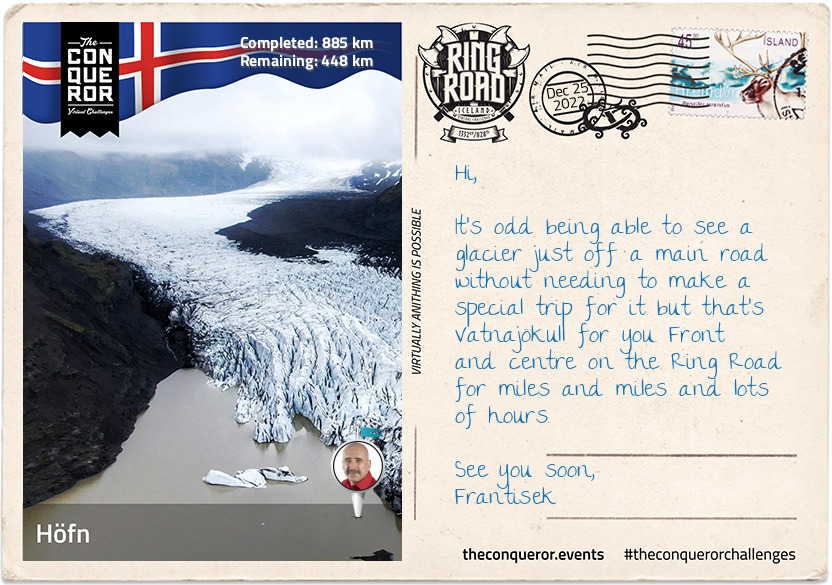
km od začátku : 0885
Höfn
I chose Höfn, a town slightly south of the Ring Road, because I wanted to visit Vatnajökull National Park. What I didn't expect was a thriving community with excellent modern services, a strong fishing and agricultural industry and rapid growth in tourism.
Historically speaking Höfn is a relatively new town unlike the others I've travelled through that can trace back their history for centuries. It has a harbour surrounded by sea on three sides that is usually difficult to navigate due to shifting patterns of shoals. Regular dredging is needed to remove excess sand from the harbour so ships may safely moor.
Across Skarðsfjörður Bay is Stokksness Peninsula and the dramatic Vestrahorn mountain. At the tip of the peninsula is a radar station used by Iceland's Air Defence System to monitor their airspace. Vestrahorn is a 454m (1,489ft) tall scree mountain largely made up of subvolcanic rock. The scree formation is a result of water flowing into rock walls and freezing due to temperature fluctuations. The frozen water then splits and splinters the bedrock which then tumbles to the base of the steep slope accumulating as loose rock.
Between the peninsula and the mountain is a beach with black sand and green tufts of grass sprouting from it. The beach got very dark at night making it a great spot to see the Northern Lights. The black sand is a result of volcanic activity. It is formed by rapid cooling of lava when in contact with the sea. The lava then shatters and breaks down into small particles until it looks like sand. Unlike normal sand that is hardier and more resistant to weathering, black sand continues to break down. A by-product of this breakdown is that shores become deep very quickly making waves behave differently to what we may be typically accustomed to elsewhere. Common advice I hear is to keep a substantial distance of at least 30m (100ft) from the shore in case a rogue wave that is much larger and reaches much further up the shore sneaks up on the unsuspecting visitor.
Finally let me tell you about Vatnajökull, Europe's largest glacier. Covering an area of 8,100 square km (3,127sq mi) in some areas the thickness of the ice cap is anywhere from 400 to 1100m (1,312-3,280ft). Beneath the ice is a landscape of valleys, canyons and gorges. Highly active volcanoes also hide beneath with Grímsvötn being the most active. Its last eruption in 2011, caused multiple earthquakes and an ash cloud rising to 20km (12mi). Vatnajökull has 30 glacier tongues which are huge sections of the glacier falling from the top of the ice cap, down a long slope, at a very slow pace and as it reaches the bottom the glacier tongue starts breaking and forming deep cracks with enormously loud noise eventually ending in a lake or the ocean.
See you soon,
Frantisek
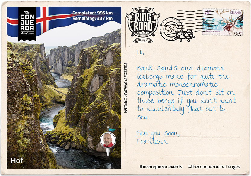
km od začátku : 0996
Hof
On the way to Hof, Iceland the Ring Road crosses over the famous Jökulsárlón glacial lake. It is the deepest lake in Iceland at 284m (932ft) and as a result of glacial melting it has grown fourfold since the 1970s. As icebergs calve from the glacier's edge they start floating towards the sea. Waves polish the icebergs and float them onto the black sands of Breiðamerkusandur, a glacial outwash plain. It is nicknamed Diamond Beach, because the polished ice on the black sands look like diamonds glistening in the sun. Due to floating icebergs in the lagoon the bridge is reinforced with a row of stone boulders that prevents the icebergs from hitting the pillars and stops the foundations from eroding.
When I arrived in "Hof, Iceland" I was very curious about why the name Iceland is tagged on the end of Hof. It's the only village in Iceland that seems to carry the name like this. I couldn't find an answer but what I did discover is how new this village is. Hof, Iceland was nothing more than a collection of farms until 2017 when increased tourism created a shortage of housing in the region. The local government wasted no time and commenced building new streets and housing around the already existing primary school.
The village's church has been there since 1884 and it was the last turf church ever built in Iceland and the only one that continues to be a practising parish. Looking at the church from the rear it looks as if it's sinking but it's actually partially buried in the ground in order to use the earth as natural insulation.
The village is in the foothills of Ӧræfajökull glacier which covers the largest active volcano that last erupted in 1727. At 2,110m (6,955ft) the volcano is the highest peak in Iceland. The volcano has phreatic eruptions which happens when magma heats ground water. The magma's extreme temperature causes "near-instantaneous evaporation of water resulting in an explosion of steam, water, ash, rock and volcanic bombs" which then deposit in the surrounding areas. The volcano's 1362 eruption destroyed everything in the region and deposited 10km³ (2.4mi³) of volcanic material. It took 40 years to resettle the area. Unsurprisingly the region's name was changed to Ӧræfi, meaning "wasteland".
North of Hof, Iceland is Svartifoss a slender 20m (66ft) high waterfall. The beauty of this waterfall is the geometric rock face being a 3D wall of hexagonal basalt column. These columnar joint formations are often an inspiration for Icelandic architecture such as the main church in Reykjavik.
Fjaðrárgljúfur is an ancient, massive river canyon with steep walls up to 100m (330ft) high and water winding its way through the canyon for at least 2km (1.2mi). Its origins date back two million years when the pressure of flowing water from glaciers cut through the bedrock creating these deep channels with steep valley walls. Sadly the canyon's environment was threatened due to the influx of visitors and the authorities closed access to the canyon.
See you soon,
Frantisek
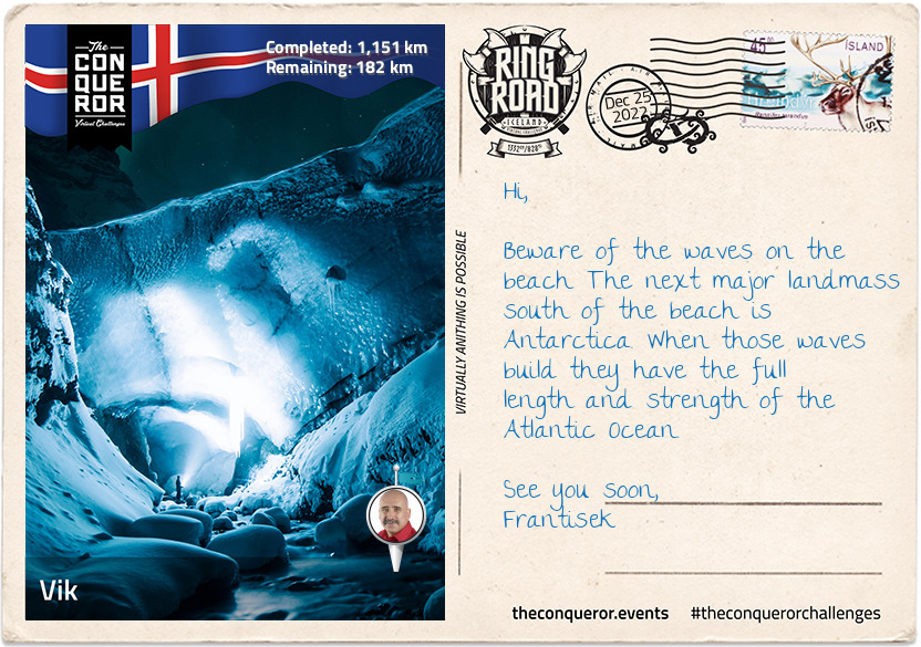
km od začátku : 1151
Vik
In the shadow of Mýrdalsjökull glacier sits the tiny seaside village of Vik. It only has 300 inhabitants but it is not short of services for the locals and tourists. Vik has much to offer and most of it all within walking distance.
Starting in town, Vik is rich in maritime history but quite surprisingly has never had a harbour, largely due to strong waves and shallow shores making it too difficult for ships to navigate without stranding. However, the nearby museum centres around Skaftfellingur, a trading ship that serviced the south coast for 20 years (1918-1939). Renown for saving a crew in 1942 from a German submarine, the ship was salvaged in its entirety in 2001 and made available to see in the museum.
Up on the hill is the famously photographed Vikurkirkja Church. With its white walls and red rooftop, the church is a safe haven should the highly active volcano, Katla, erupt. Katla is covered by Mýrdalsjökull's ice cap and it erupts every 40-80 years (16 eruptions have been recorded to date). Although the last eruption was in 1918, scientists predict that an eruption may occur soon. Should that happen, the concern is that it would cause a flash flood big enough to annihilate the whole town, hence making the church the safest place to be.
If having an active volcano beneath a substantial glacier isn't impressive enough then imagine an ice cave beneath the volcano. It is referred to as Katla's Ice Cave Dome. With crampons on, I climbed a few steps on ladders to the entrance of the cave where I was greeted by a narrow snake-like ice tunnel before entering the dome. The opening that formed in the ceiling made me feel like I was standing in a cathedral. In 2018 a secondary cave was discovered inside this one when a new opening was found. I'm told that ice caves are an ever-changing phenomenon making each visit different from the last.
Black sand beaches permeate through southern Iceland or anywhere with volcanic activity since the sand, as I mentioned in my letter from Höfn, is cooled lava shattered into small particles. However, the black sand beach of Reynisfjara, a short walking distance from town, is the most famous. It provides access to Reynisdrangar, two basalt sea stacks that are all that's left of a cliff (just like the 12 Apostles on Great Ocean Road, Australia). In folklore the stacks are said to be two trolls who unsuccessfully tried to drag a three-masted ship to land and when daylight hit they became needles of rock.
See you soon,
Frantisek
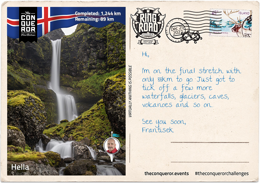
km od začátku : 1244
Hella
Hella is another reasonably new community and a great base to slow down, rejuvenate and visit the surrounding area. It started in 1927 with a store being built near the bridge that crosses the Ytri-Rangá River. A decade later the store was bought by a co-op society and moved into other businesses and by the 1950s it was a flourishing little town that continued to grow and develop bringing more services such as schools, community centre, sports centre and an administrative building. Today the town's economy is dependent on service and tourism.
A short easy hike away from the bridge, I came across Ægissiðufoss waterfall. Nothing like what I've seen throughout Iceland so far, a tall, menacing, powerful falls, but it is wide and cascades over a couple of layers into Ytri-Rangá River that flows onwards into the Atlantic. The river itself is popular for salmon fishing and a great foreground for photographic composition with Mount Hekla in the background.
Hekla is a very busy volcanic mountain. At a height of 1,491m (4,892ft) it has erupted more than 20 times in the past 1,100 years and during the Middle Ages it was called "Gateway to Hell". Due to its frequent eruptions, the tephra layers that covered about 10% of the land are now used to date other volcanoes in the country.
Hiking is a popular pass time on Hekla especially since the path leads up to the summit. The first ascent was in 1750 completed by two students. Although the path is marked up to the halfway point the rest of it is on a broad ridge walk with half of that on snow. The hike passes three craters along with some steaming sulphur.
Hekla also has a pastry named after it. It's an upside-down cinnamon roll with icing sugar drizzled over the top to look like the snow-topped volcano. Much as I'd like to have one the nearest bakery for this specialty is Boston, Massachusetts.
See you soon,
Frantisek
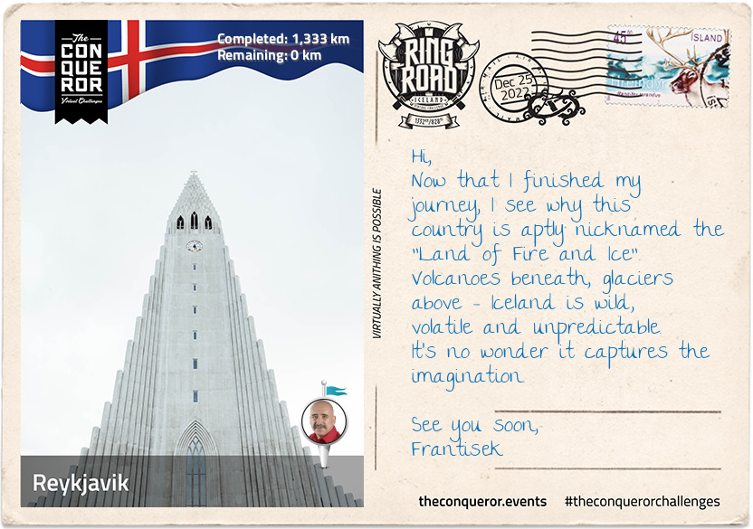
km od začátku : 1333
Reykjavik
I have completed my 1,332km (828mi) journey around the Ring Road of Iceland finishing at the Árbæjarsafn Open Air Musuem, a historical museum about Reykjavik. The museum was born as a result of concerns that the city's historical legacy is disappearing. Built in 1954 the museum provides an insight into the lives and work of the people pre-20th century through displays of various types of buildings and cultural artefacts.
Any art or architecture enthusiast would revel in the exploration of The Einar Jónsson Museum. The first art museum in Iceland, it was the pipe dream of Iceland's first sculptor Einar Jónsson. Einar gifted all his works to the country on the proviso that a museum was built for them. Although the gift was initially rejected, following fundraising between Parliament and private contributors the art museum came into existence in 1916. The building, designed by Einar, is as much a sculpture as all the works it holds within its walls. The nearby sculpture garden is keeper of 26 bronze casts of his works. Einar worked with clay and plaster and in order to protect them the museum actively turns the sculptures into bronze casts. I also found many of Einar's works just meandering around the city.
No Reykjavik visit is complete without seeing Hallgrímskirkja, a parish church and national sanctuary 41 years in the making. At 74m (244ft) high, it is the largest church and one of the tallest structures in Iceland. It is an architectural feast with a façade reminiscent of the basalt column rock formations found throughout the island.
Outside the church is the statue of explorer Leif Erikson, which was a gift from the United States commemorating the 1000th anniversary of Iceland's parliament. Leif was a Norse explorer from Iceland and considered to be the first person to reach the North American continent around 1000AD.
Now if I had the time I'd swing by the Golden Circle for a few days to see the Thingvellir National Park which is also a UNESCO site. Thingvellir is a rift valley where the North American and European continental plates separated. The nearby Thingvallavatn, is the largest natural lake in Iceland and reaches depths of 114m (374ft). On the northern shore of the lake is Silfra, a fissure filled with incredibly clear blue water. A perfect site for scuba diving and snorkelling. One of the diving sites is 100m (328ft) long with clear visibility from end to end.
However, I must end the journey here and as I travel homewards, I'll happily reflect on the natural and beautiful wonders I've experienced on this trip.
See you soon,
Frantisek
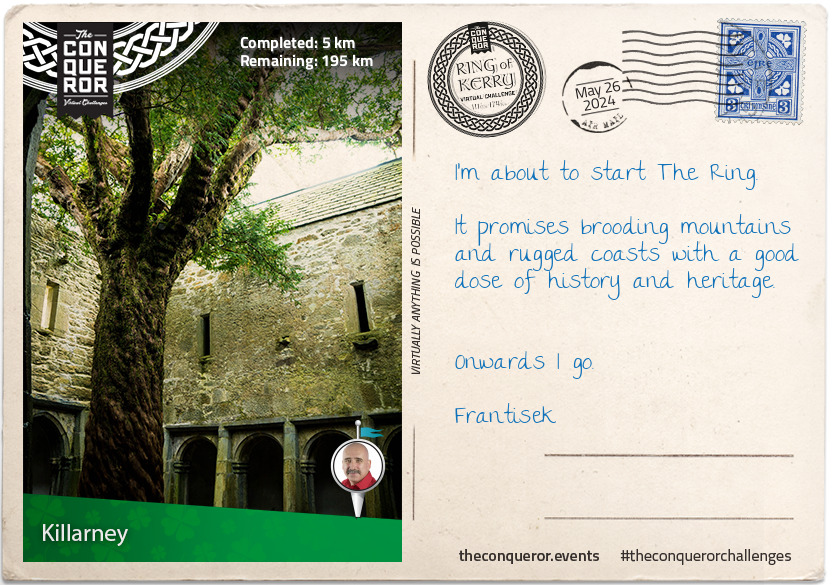
km od začátku : 0005
Killarney
In the southwest corner of Ireland, on the Iveragh Peninsula, is the 200km circular route known as the Ring of Kerry. Following the contour of the land, the route is a panoramic feast of mountains and lakes, passing through rural seaside villages.
Your journey begins in Killarney, a popular destination due to its many wonderful attractions. Here you can indulge in hiking, horse and carriage rides, explore medieval abbeys or castles, absorb the mountaintop views overlooking lakes, watch waterfalls cascade and if you're lucky see red deer roaming through the oak woodland.
The town is located on the edge of Killarney National Park which is Ireland's first park. Established in 1932, the park was previously known as Bourn Vincent Memorial Park (named after the benefactors) and gained National Park status and protection in the 1970s when concerns over its preservation was threatened. At 103km² the park's major objectives are conservation and ecosystem protection and as such has obtained the UNESCO Biosphere Reserve status in 1981.
Within the park you will find the grand 65 room Muckross House overlooking Muckross Lake. Designed by Scottish architect, William Burns, and built mid-19th century, this Tudor style house is furnished in period style illustrating the elegant lifestyles of landowners at the time. The house changed hands several times until 1932 when the last owners, the Bourn-Vincent family, donated the property in its entirety to the Irish state. Today the House is open to the public hosting tours, events and spinning and weaving demonstrations. The House's research library is home to the Centre for Collection, Storage and Preservation of documentary material relating to Kerry.
A short walk away from the House sits the 15th century Muckross Abbey, a Franciscan Friary whose monks were driven out in the 1650s by Cromwell's forces during the Wars of the Three Kingdoms. Although damaged and rebuilt many times, the ruins of the abbey are in reasonable shape and well preserved. A vaulted cloister surrounds a square courtyard which within its centre holds a 550-year-old yew tree.
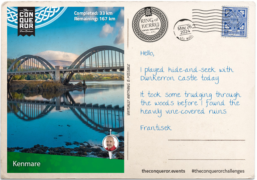
km od začátku : 0033
Kenmare
Seen as the gateway to the Ring of Kerry and Beara Peninsula, Kenmare is a coastal town nestled amongst mountains and situated on the estuary of Kenmare Bay.
Established in the late 1700s, archaeological studies date the area back to the Bronze Age. The nearby Stone Circle comprising of 15 stones laid out in an egg-shape indicates a presence of 3000 years. Perfectly aligned with the sun, it is thought to be used as an agricultural calendar.
The town developers gave Kenmare a unique triangular shape with the three main streets connecting to each other. Kenmare is also the recipient of the first suspension bridge in Ireland. Built in 1841, due to heavy traffic and mounting ongoing problems the bridge was replaced 90 years later with the current iconic wrought iron and concrete bridge.
Suffering greatly during the Irish famine of the mid-19th century, upon the request of a local priest, seven nuns arrived to open a school believing the best way to improve the residents' future was through education. A convent building was erected by 1862 which continues to exist as a place of education with a secondary school moving in 2001.
To develop a source of income girls were taught lacemaking and embroidery, whilst boys were taught woodworking and leather work. Over time Kenmare Lace became internationally renowned for its craftsmanship and intricate design. It continues to be an important part of Kenmare today.
For the outdoorsy person, Kenmare is host to a number of activities such as beach horseriding, archery, diving, golf, deep sea angling and water sports. Nicknamed as the "Walking Mecca of Ireland", Kenmare offers a combination of town heritage walks or for something more strenuous several routes of different grades can be experienced in the nearby mountains. Even the competitive athlete will find local running and cycling races or the annual Little Bo Peep triathlon.
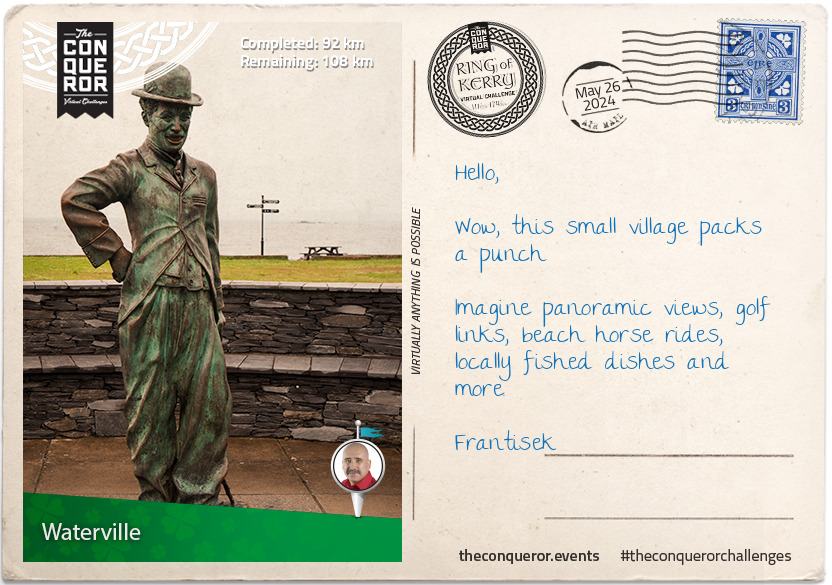
km od začátku : 0092
Waterville
Between Ballinskelligs Bay and Lough Currane (lake) on a narrow isthmus lies the coastal village of Waterville. Flanked by two championship 18-hole golf courses, one to the north and the other to the south, this small town of 496 residents is a bundle of surprises.
Waterville began as a village in the 1800s and although it remains a small village, you will never be short of something outdoorsy to do. There's a plethora of walking and cycling routes with both easy and difficult levels. The Equestrian Centre conducts pony camps, horsemanship courses and beach rides. The Sea Synergy is a marine awareness and activity centre, with their main objective to educate about marine life and ocean conservation. Operated by marine biologist and ecologists, the organisation runs educational adventure tours and summer camps for kids and teens.
A walk on the promenade will bring you to a statue of Charlie Chaplin who enjoyed Waterville so much that for a decade he returned every year for holidays with his family. Obtaining permission from the Charlie Chaplin estate, Waterville hosts the annual Charlie Chaplin Comedy Film Festival.
When the first transatlantic cable was installed in 1858 between Newfoundland Canada and Valentia Island near Waterville it didn't come without its problems. Working for a mere three weeks due to weak cables, it took five further attempts across nine years to eventually succeed in maintaining a lasting connection. The Atlantic Telegraph Co. had a monopoly over the industry and as a result the Commercial Cable Company from New York was established to break the monopoly and reduce prices by successfully installing cables in 1884 from Waterville to Nova Scotia. This brought a hive of activity into the village and the need for more housing to accommodate company personnel who settled in the area. Waterville became the European hub for the Company and at its peak was the largest cable station in the world.
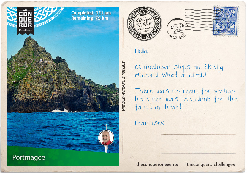
km od začátku : 0121
Portmagee
As you make your way towards Portmagee, you'll be veering off the Ring of Kerry onto a small country road called the Skellig Ring. An extension of the Ring of Kerry, this quiet coastal route with the ever-present Atlantic Ocean to the left, takes you through small villages and mountains of the Iveragh Peninsula.
Along the way make a pitstop in the village of Ballinskelligs and walk in the footsteps of the Skellig Monks along the foreshore to the 12th century abbey. The abbey became the land base for the monks who came from Skellig Michael island. From the Abbey a short walk away is McCarthy Mór Tower, thought to be a 16th century tower house on a small isthmus that once belonged to the McCarthy's, chieftains in Cork and Kerry at that time.
As you continue on lookout for the 1000ft high Kerry Cliffs with uninterrupted views of Puffin Island, an uninhabited island home to numerous seabirds and puffins; Skellig Islands, two uninhabited islands of which the bigger one known as Skellig Michael, is the site of a 6th century Christian monastery; and the wild Atlantic waves crashing against the cliff-face.
Arriving in Portmagee, the first stop for any chocolate enthusiast must be at the Skellig Chocolate Factory, Ireland's only open-plan chocolate factory. Handmade onsite in an open-plan design, visitors are able to interact directly with the chocolatiers whilst tasting samples.
From here, take a boat trip to Skellig Michael and climb the 618 medieval steps to the top. Rising to fame as the island sanctuary to Luke Skywalker in 2015’s Star Wars: The Force Awakens, Skellig Michael has a long history. A twin-pinnacle crag, it came into existence some 360+ million years ago. Originally part of a mountain range and connected to a continental landmass, it became separated with rising water levels. Around the 6th century an Augustinian monastery was built for monks who appreciated the island's isolation and available rock for construction. Continuously occupied until the 12th century, it is estimated that only 12 monks and an abbot lived on the island at any one time. The island was eventually abandoned as a result of several factors such as colder and stormier climate, ongoing Viking raids and changing structure of the Irish Church. Skellig Michael entered the UNESCO World Heritage List in 1996.
Valentia Island is linked to Portmagee by a bridge. Valentia is better known for its first successful and commercially viable transatlantic telegraph cable. Connecting to Newfoundland, Canada the trans-Atlantic undersea cable opened up a faster and more reliable form of communication between Europe and North America. Prior to the telegraph cable, communication was undertaken via ship. Depending on weather, particularly during severe winter storms, communication by ship would take several weeks to reach their destination. With the telegraph cable installed, messages were received and responded to on the same day. The transatlantic cables in Valentia remained in operation for one hundred years when the owners, Western Union, terminated cable operations in 1966.
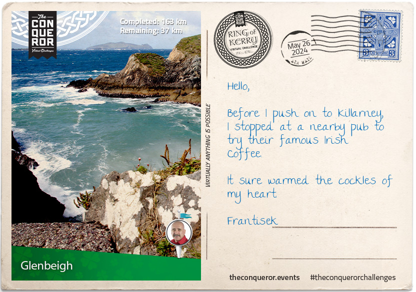
km od začátku : 0163
Glenbeigh
Glenbeigh is a small civil parish nestled amongst the hills with rivers Caragh and Behy flowing on either side of it into Castlemaine Harbour.
With a mere population of 308, you may think it a small sleepy town but Glenbeigh is a popular tourist destination. Besides being on the Ring of Kerry it is home to the pristine Blue Flag award Rossbeigh Beach. A long sandy beach which annually hosts a Horse Racing Festival, Rossbeigh has fallen victim to high tides, wild storms and consequently sand erosion. In 2008 the beach had lost 1200 feet of sand dunes. It is estimated that since 2008 a further 10-15 million tonnes of sand has been lost raising concerns that without pro-active action the beach will eventually disappear.
Rossbeigh Tower, located at the end of Rossbeigh Beach was the beacon for safe navigation into Castlemaine Harbour for 150 years. Following heavy storms off the Atlantic Ocean it gave way and collapsed in 2011. After five years of campaigning, including salvaged parts of the original tower, a replica was built in the town centre as a way to preserve the history and heritage of the tower.
This wasn't the end of surprises for the Glenbeigh residents. In early January 2014, Cyclone Christina left a trail of damage on the coasts of Ireland but on Rossbeigh Beach it fully unearthed a partially submerged 19th century schooner that has been buried for a hundred years. The schooner named, The Sunbeam, was built in 1860 England and was on a voyage shipping flour when it shipwrecked in 1903, fortunately with no loss of life.
In a field near Glenbeigh parish, stands the ruins of Wynn's Castle, an 18th century castellated mansion. The exorbitant cost of building the castle was funded by rental income earned from the estate. The higher the costs went, the higher the rental increases. Tenants who were no longer able to meet their rental expenses were unfortunately evicted by the owner who himself eventually became insolvent and left Glenbeigh. During WWI, the castle was used as a training centre for reservists of the British Military Command and by 1921, the castle was burnt to the ground by Irish Republican forces and was never rebuilt.
Before you leave Glenbeigh to make your final trek back to Killarney, stop in at one of the local pubs for a traditional Irish Stew and a pint of Guinness. Finish with an Irish Coffee, the coffee and whiskey combination that was created by Chef Joe Sheridan in 1943 at Foynes Port near Limerick.
Joe Sheridan's recipe for a true Irish Coffee:
Cream - Rich as an Irish Brogue
Coffee - Strong as a Friendly Hand
Sugar - Sweet as the tongue of a Rogue
Whiskey - Smooth as the Wit of the Land
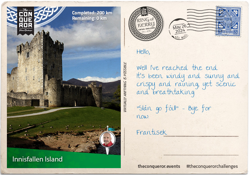
km od začátku : 0200
Innisfallen Island
Congratulations, you have completed Ireland's well known scenic route the Ring of Kerry. Before you leave spend a little more time in Killarney by visiting the historical site of the 15th century Ross Castle.
Overlooking the third largest lake in Ireland, called Lough Leane, the castle was built by the local ruling clan, O'Donoghues Mór. Ross Castle was one of the last castles in Ireland to surrender to Cromwell's forces. Up until the 17th century the castle was surrounded by a curtain wall with towers in each corner. A portion of the curtain wall was torn down to make way for expansion whilst in use as a barracks. Today the castle is open to visitors, retaining the tower house, part of the curtain wall and two towers.
From the castle take a boat ride on the lake to Innisfallen Island, the home to the ruins Innisfallen Abbey. Founded in 640 AD by St Finian, the patron saint of the area, it was occupied for nearly a thousand years. Nothing remains from that early settlement. The current ruins are a late 12th century Augustinian Priory. Over a few hundred years the resident monks wrote the famed Annals of Innisfallen, a chronicle of Ireland's medieval history. In the late 16th century during Queen Elizabeth I's reign, the monks were dispossessed of their abbey.
An excerpt from Thomas Moore's poem entitled Sweet Innisfallen (c1870) describes it best:
Sweet Innisfallen, fare thee well,
May calm and sunshine long be thine!
How fair thou art let other tell,
To feel how fair shall long be mine.
Sweet Innisfallen, long shall dwell
In memory's dream that sunny smile,
Which o'er thee on that evening fell,
When first I saw thy fairy isle...
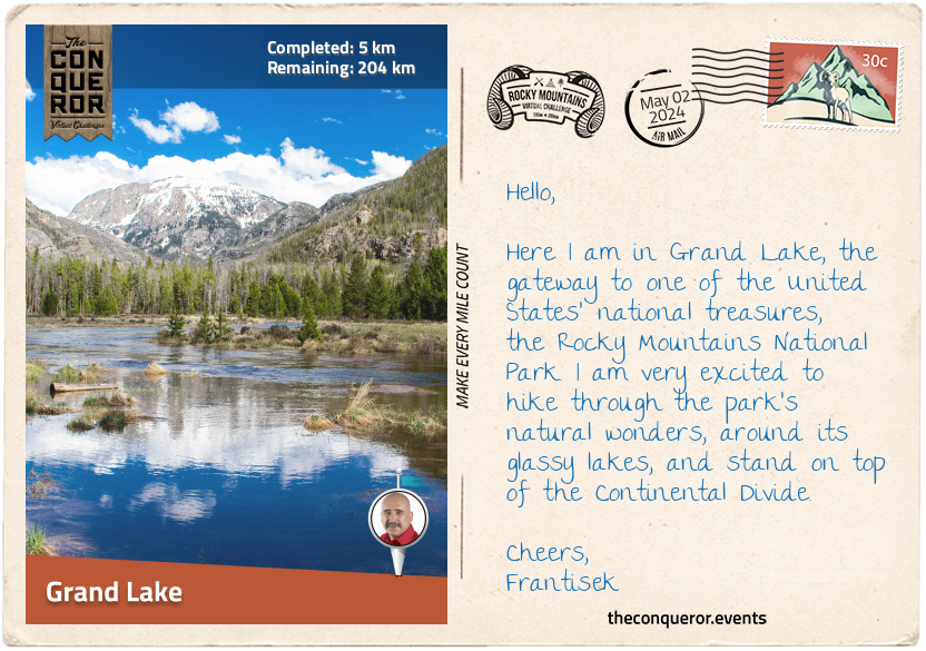
km od začátku : 0005
Grand Lake
The Rocky Mountains is the most extensive mountain range on the North American continent, stretching 3,000 mi (4,800 km) from the northernmost of Canada to New Mexico, United States. Cresting the range is a series of spectacular national parks, including the Rocky Mountains National Park (RMNP).
Located within the state of Colorado, United States, the RMNP sits high on the Continental Divide containing an area of 415 mi2 (1,074 km2) across four ecosystems: montane, sub-alpine, alpine tundra, and riparian. Within its boundaries, more than 60 granite peaks over 12,000 ft (3,600m) rise into the sky, and over 150 lakes glisten down in the valleys and up in cirques.
Throughout the park, the wildlife and flora are in abundance. Elk and moose graze in wide-open meadows, pika and marmots scurry around, either filling their food stores or crashing a picnic party, and the symbol of RMNP, the bighorn sheep, may be watching from craggy cliffs. The park's tree species are magnificently diverse, from conifers, pines, and firs to willows, cottonwoods, and red river birch. In the spring and summer, low to the ground is a kaleidoscope of blossoming wildflowers, like the magenta Parry Primrose; Colorado's state flower, the Blue Columbine; or the striking scarlet Indian Paintbrush. It is no surprise that UNESCO designated the park a World Biosphere Reserve.
There is so much that could be written about this park that I would end up with an essay. So instead, I will start with my journey from one of the park's major gateways in the town of Grand Lake. Located in the southwest corner of RMNP, the town sits nicely on the north bank of Grand Lake with a great view of Shadow Mountain on the opposite side.
The first people to inhabit the area were the Native Americans thousands of years ago, including the Ute and Arapaho tribes. Many legends and superstitions abound around the lake, giving the site a mystical feel. One story tells of a time when an enemy tribe attacked the Ute tribe. Corralling the women and children onto a raft, they were pushed into the lake. Unfortunately, heavy winds and treacherous weather upturned the raft, and all aboard drowned. Now, when a mist descends upon the lake, the ghostly forms of those who perished appear, and their cries can be heard beneath the icy waters.
According to another legend, a supernatural buffalo roams the area, traveling to and from a specific hole in the ice, leaving extra large hoofprints every time the lake freezes. The Arapaho believe that the buffalo rose from the lake's depths like a spirit, earning the lake's moniker "Spirit Lake".
When settlers arrived in the early 1800s, they weren't concerned about the superstitious stories. They settled the region, built hunting lodges, and established an early form of local tourism. Later in the century, miners arrived, hoping to find gold or silver. Tourism returned to Grand Lake in the early 20th century, and the area has been a popular destination since.
Since Grand Lake is located on the west side of the RMNP and, farther away from major cities, it is less frequented than Estes Park in the east, so it is a quieter and more peaceful place.
I'll be heading north through valleys and meadows, over mountains, and around lakes. I look forward to breathing in the pine-scented air, feeling the breeze on my face, and spotting a few animals from afar. Let's go!
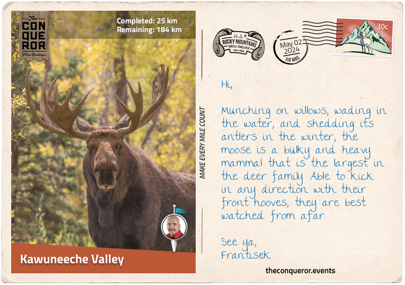
km od začátku : 0025
Kawuneeche Valley
Having left Grand Lake, I passed the Grand Lake Cemetery. Dating back to 1875, it is the only active cemetery in a U.S. national park. The local historical society maintains a detailed record of those buried there, including the inseparable Harbison Sisters.
The sisters were early homesteaders, having moved into the area in 1896. Purchasing adjoining lots and building individual cabins, they set up a dairy ranch and supplied milk to local folk. When the park was established in 1915, the sisters refused to sell their ranch to the National Park Service (NPS). They lived there until 1938, when the property was incorporated into the park. Choosing to tend to the land and care for each other, the sisters never married. Contracting pneumonia, both sisters died only days apart, remaining devoted to one another forever.
I took the Tonahutu Creek Trail walking through a lodgepole pine forest to Big Meadows, a beautiful large meadow filled with wildflowers, tall grasses, and the Tonahatu Creek meandering through it. About halfway up on the trail's edge were two cabin ruins that used to belong to Sam Stone, a 19th century hay harvester and seller. One day he met a woman who convinced him to search for gold and abandoned his cabins, never returning.
Connecting with Timber Lake Trail, I continued through the forest until it opened to a long meadow at the southern end of Jackstraw Mountain. Skirting the mountain, I descended into the verdant Kawuneeche Valley, bordered by the many peaks of the Never Summer Mountains and the Colorado River passing through it.
I only had one mission here, and that was to spot moose in the area. The largest and heaviest species from the deer family, moose love to munch on the willows that are in abundance in the area, as well as aquatic plants and grasses. They are capable swimmers and can be seen wading around in the lakes. As fascinating as they are, moose tend to be unpredictable around humans. Since they can kick with their front hooves in any direction, they are best observed from afar.
I'll wander up to the Beaver Creek Picnic Area, settle down for lunch, and keep my eye out for these hefty mammals.

km od začátku : 0064
North Fork Big Thompson River
Good fortune was upon me with a great viewing of a handful of moose grazing in the valley. Packing up my gear, I pushed on north towards Lulu City. This former mining town came into existence when Joe Shipler discovered silver in the area in 1879. The town sprung up quickly, but it didn't last. Unfortunately, the silver was of low grade, and transportation costs were exorbitant. The town declined swiftly, and by 1885, it was abandoned except for Joe Shipler. He continued to live there for the next 30 years. When he left, his cabins and his nearby silver mine became part of the national park. The cabins were not maintained and are now in a state of decay, but I could imagine Joe stepping out his cabin door with a hot cup of coffee in hand, looking out onto Hart Ridge, flanking peaks, and the Colorado River. It was a sight to behold and understandable why he may have chosen to live there most of his life.
Passing by Long Draw Reservoir, a dam built in the 1920s that's great for fishing cutthroat trout, I connected to the Mummy Pass Trail and navigated the northern boundary of the national park. Through forest and long meadows, I stopped to take in the scenery at Mummy Pass, a cross between barren terrain, clumps of shrubs, and timberline. I skirted the southern flank of Fall Mountain, working my way down into a valley and then climbing back up to Storm Peaks Trail. The aspen trees here were beautiful with their bright green leaves and narrow silvery trunks. In autumn, the aspens turn to a brilliant yellow-gold colour before turning orange and striking red.
As I crossed the Stormy Peaks Pass, I started downhill to the junction of North Fork Trail. I set up camp at Lost Falls Campground and took a little wander along the North Fork Big Thompson River, quite a lengthy name. The walk was pleasant as I meandered beside the river through lovely woods on a gently climbing trail. After a mile or so, I returned to my camp, made myself something to eat, a hot cuppa, and sat back to enjoy the peaceful surroundings.

km od začátku : 0089
Estes Park
I began my day early, heading out on the North Fork Trail and hiking through dense forest. When I reached the junction with North Boundary Trail, I turned right and crossed the North Fork Big Thompson River. The trail steadily climbed around the side of a hill, and I peacefully forged onwards, travelling up and then down, crossing creeks and valleys, lost in my thoughts.
North Boundary Trail ended at Cow Creek, where the historical McGraw Ranch stands. Built in 1884, the ranch was used to raise cattle, then later converted into a guest ranch. When the National Park purchased the property, it initially planned to demolish it and let the land return to its natural state. However, the ranch was saved, fully restored, and repurposed into a research and learning centre. Although not open to the public, the ranch now houses researchers who spend weeks or months studying various aspects of the park's landscape and wildlife.
Swinging west, I followed Cow Creek Trail to Gem Creek Trail, then hiked south into Estes Park. The town is the very popular and very busy eastern gateway to the National Park. Estes Park was named after adventurer and miner Joel Estes. He was the first settler in the area, having moved into it with his family. Unfortunately, he found the place unsuitable for farming and left after only six years.
One of Estes Park's most important early 20th century residents was Enos Mills, endearingly referred to as the "Father of the Rocky Mountains National Park". In 1889, Enos had a chance meeting with naturalist John Muir, "Father of the National Parks", who advocated for the preservation of America's wilderness. Enos was a prolific writer capturing his adventures on paper, and John told him he could use his stories to educate others about the importance of nature. From then on, Enos dedicated his life to conservation activism, writing books and articles, and running lectures. He became the driving force behind the creation of the RMNP and never let up on it, even when the area was designated a forest reserve instead of a national park. He pressed on by writing thousands of letters. In 1915, President Woodrow Wilson officially created the RMNP, making it the tenth U.S. national park. Enos continued to live in Estes Park, writing and lecturing until his death.
In
the centre of town is Lake Estes, a reservoir popular with anglers fishing for trout or water sport enthusiasts looking to kayak, paddleboard, or boat. I decided to stroll around the paved trail that skirted the lake and hoped to see elk or black bears, which are said to be common visitors to the lake's shores. Looking up at the sky, I hoped to see bald eagles. These fascinating birds of prey with their white head, yellow beak, and dark brown plumage have been the United States' national emblem since 1782, and the Native Americans revered them for their strength, seeing them as a symbol of courage, wisdom, and leadership.
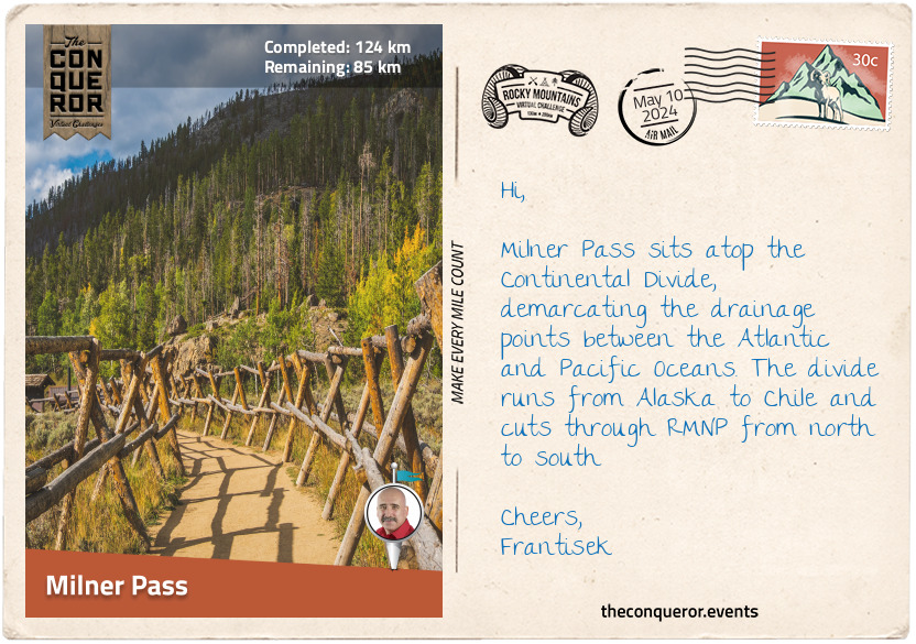
km od začátku : 0124
Milner Pass
Heading west on Fall River Road, I passed the very rocky Castle Mountain with its castle-like peaks. An isolated mountain, I took a short side trip to hike up to the top. Although there was no specific trail, I crossed many dirt roads and used them to navigate to the top. From the summit, I had fabulous views over Estes Park and the lake. But I did not stay long, as mountain lions were known to hover around this rocky area.
Walking back to my route, I passed several lodgings that I could only imagine being fully booked at the height of the season. When I reached the base of Bighorn Mountain, the road forked, and I veered onto Endovalley Road. The Sheep Lakes here are known to be a grazing site for bighorn sheep. They descend from the Mummy range during late spring to early summer to nourish themselves with nutrients not found at a higher elevation.
A short distance later, I took another short side trip to the very pretty Horseshoe Falls. Not particularly tall, I still enjoyed the rushing sound of the water as I watched it tumble over several boulders into the creek below.
Less than 2mi (3.2km) later, I came across Chasm Falls plunging through a narrow granite gap. As I rested, taking in the scent of the ponderosa pines, I watched a couple of American dippers frolicking in the river. These small, stocky, dark grey birds are so-called because of their bobbing and dipping movements. I watched them dive underwater and walk along the bottom, foraging for food. They tend to be found around fast-moving streams, like here at Chasm Falls.
Chasm Falls is located off the Old Fall River Road (aka 'The Old Road'), a narrow seasonal, one-way, gravel road. About 9mi (14.45km) long, the road was opened in 1920, and it was the first car road that led into the high country of RMNP, reaching an elevation of 11,700ft (3,566m). Without guard rails and at dizzying heights, 'The Old Road' follows a series of tight switchbacks, climbing from Endovalley to spectacular views and ending at the Alpine Visitor Centre. Keeping my eyes peeled, I spotted elk grazing in Willow Park, although I was still hoping to spot a cheeky little marmot.
At the visitor centre, I connected with Trail Ridge Road, the highest continuous road in the United States. The road boasts an elevation of 12,183ft (3,713m) and incredible panoramic views of mountain ranges hundreds of miles away. Wildlife can often be sighted, and in some areas, walls of snow survive throughout the year.
My objective on this road was to reach Milner Pass so I could stand on top of the Continental Divide, the drainage divide that separates the Pacific Ocean's watershed from the Atlantic Ocean's. This invisible divide traverses America from the Baring Sea, Alaska, to the Strait of Magellan, Chile.
The Pass was right next to Poudre Lake, an ideal place to stop for lunch and a rest before I turned off onto Ute Trail.
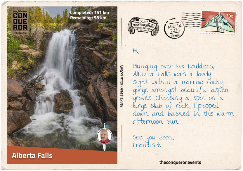
km od začátku : 0151
Alberta Falls
From Milner Pass, I began the Continental Divide traverse through the park. After a short stint on Ute Trail, I entered the backcountry through rugged terrain and no defined route. I hiked up to the ridge of the Front Range, with my first target to reach the summit of Mount Ida. The hike was above the treelines on a barren and rocky landscape with very steep sections. Down below in the valley were the remote Azure Lake and Inkwell Lake. I contemplated climbing down to the lakes, but the elevation drop of nearly 1000ft (300m) with lots of scrambling was a great deterrent. So, I just enjoyed it from the top.
I hiked along the ridgeline, descending to the glassy Haynach Lakes. Following the trail through the forest, I began another ascent at Tonahutu Creek Trail. I continued to Flattop Mountain, where my Divide traverse ended as it continued south while I turned left. As I gazed north of Hallett Peak, I glimpsed a small cirque glacier known as Tyndall Glacier. It was named after John Tyndall, an Irish scientist and alpine mountaineer. John was known as the first person to ascend Switzerland's Weisshorn Peak in the Alps. He also identified "carbon dioxide as a heat-trapping greenhouse gas".
Taking the Flattop Mountain Trail, I traversed a barren landscape, passing gnarled krummholz, aspen trees, and boulders. I ended up at Bear Lake. The region here is another significant entry point from the east, with many trails to tackle in all directions to explore splendid glacial lakes and picturesque forests. The quickest one to do, though, was the half-mile (1km) loop trail around Bear Lake, tucked within a treeline of spruce, aspen, and lodgepole pine.
Eager to see another waterfall, I connected to Glacier Gorge Trail, where the hike through the woods was easy and reasonably flat. The trail was well-maintained, and as the sun streamed through the trees, I walked beside Glacier Creek, listening to its burbling flow. I veered off the main trail through a narrow gorge arriving shortly after at Alberta Falls. Noisy and thundering, the cascade, set amongst aspen trees, plunged over massive boulders into Glacier Creek.
Alberta Falls was named after Abner Sprague's wife. Abner was one of the original settlers in the Estes Park area. In the late 1800s, Abner built a guest lodge and several other properties in the immediate area. From the mid-20th century, the National Park Service began purchasing all commercial developments within RMNP, including the Sprague properties, demolishing them, and returning most of the park to its original state.
Abner Sprague was a keen outdoorsman who loved Estes Valley. He was instrumental in developing the national park. Once the national park was signed into law, Abner went down in history as the first person to pay an entrance fee.
Taking a break to rehydrate and snack, I watched a blue-tailed Steller's Jay jumping on the ground, flitting from branch to branch without a care in the world.
km od začátku : 0163
Longs Peak
Leaving Alberta Falls and swinging past the East Glacier Knob, I took on the toughest climb of this whole journey to Longs Peak. At 14,259ft (4,346m), the peak is the tallest one in the park and the 16th highest Fourteener in the Rocky Mountain range. Needless to say, the hike was rigorous as I climbed 4,465ft (1,361m) in elevation.
On the first stretch of North Longs Peak Trail, I tackled a series of switchbacks and then skirted the base of Half Mountain to Boulder Brook. The well-maintained and quiet trail was lined with bristlecone pine and subalpine fir. The hike was moderate but nothing overly tricky yet.
After a few more switchbacks, I was above the treeline, where the landscape was grassy and rocky. I climbed up the side of Battle Mountain to a junction at Granite Pass and stopped at a small wooden sign giving directions to different trails.
Taking the Keyhole Route, I continued climbing. The maintained trails disappeared, and I climbed into a vast valley of rocks, stepping on them one after the other. Keeping my head up to take in the views proved difficult as rocks of all shapes and sizes threatened to turn my ankle any minute.
The further up I went, the tougher it got, and then came the Keyhole. Massive boulders strewn together in a jumble formed my trail ahead. As I scrambled up, my heart palpitating from the effort, I wondered if I should continue. This was only my halfway point, and the climb got very real. The Keyhole was a long ridge extending from Longs Peak's north with a rock notch at the top. Crossing through the gap felt like entering another realm, but when looking in either direction, it was all rocks and formidable granite peaks.
A good dose of gusty wind hit me as I stepped through the Keyhole. It swiped at my face and body as the wind dared me to quit while trying to knock me off my feet. Seeing a conical building just below, I armed myself with will and stubbornness and climbed down to seek shelter and respite. A plaque on the wall acknowledged Agnes Vaille, who in 1925 was the first woman to ascend the East Face of Longs Peak. Sadly, she died of exposure when she slipped and fell on her descent. Her father always wondered if a shelter may have saved her and, in her honour, built the structure I took cover in.
The next phase of my hike was The Ledges, where I had to navigate a long series of slabbed rock ledges. Although the trail was flat, the heart-stopping drop to the west kept me focused and moving forwards, often using all four limbs to navigate this area.
Having reached The Trough, a short scree-filled gully, I definitely questioned my sensibilities. This trail was not for the faint of heart. I almost didn't dare to look at the views but was pleased to catch a glimpse of a few lakes far in the distance. More scrambling ensued as I climbed 1,000ft (300m) through The Trough, watching out for loose rocks.
And just when I thought it couldn't get any scarier, I reached The Narrows, a stretch of rock barely 3ft (1m) wide hugging a wall 1000ft (300m) high to one side and a clear drop to the other. Slowly inching across it, I stuck closely to the wall, so the wind wouldn't blow me off while also being mindful of where I stepped on the uneven sections.
Once past The Narrows, I was on The Homestretch, a 300ft (90m) climb across steep rock slabs with limited handholds. Again I had to be slow and careful with my movements so I would not slip, and finally, I reached the top. To my surprise, the summit of Longs Peak was flat and as large as a football field. The views were spectacular, with Storm Peak to the northwest, Mount Meeker to the southeast, and Chasm Lake and Peacock Pool below the east face.
I basked in my accomplishment here and remembered the extraordinary people who successfully climbed the peak. The Father of RMNP, Enos Mills, summited it 340 times but was outdone a few decades later by Jim Detterline, whose summit statistics exceeded 420 and more than 1,000 rescues in the area. William Butler celebrated his 85th birthday on top of Longs Peak, making him the oldest person to summit the peak. Lisa Foster summited it 193 times as of December 2022 and is the only female to hold such a great number of ascents.
km od začátku : 0196
Lake Verna
Filled with satisfaction after my successful summit of Longs Peak and a good night's rest in my tent, I packed up early in the morning and headed down the mountain. Although the descent was still rocky, it was welcomed. Small clumps of yellow flowers dotted the landscape. When I reached Chasm Junction, I looked back at the park's second-highest peak, Mount Meeker, the smooth east face of Longs Peak called The Diamond and Chasm Lake in the valley below.
I walked through an expansive landscape dotted with rocks and low-lying shrubbery. Crossing Alpine Brook, I entered the woods and peacefully hiked amongst the trees for the next 3mi (5km). From there, I connected to South St Vain Avenue, where I came across St Catherine of Siena Chapel. Also known as the Chapel on the Rock, this pretty church rose like a castle from a large rock. It took twenty years to build it, finally opening in 1936, and while it suffered damage a few times because of natural disasters, today, it is a lovely elaborate stone building with detailed stained-glass windows. In 1999, it was designated a historic site by the local county.
I proceeded south for a couple of miles, then veered west, passing Copeland Lake, a popular location for fishing brook trout. I jumped off the trail for a quick hike to Copeland Falls and then back into the aspens-filled woods. I reached the trail's end at Thunder Lake, ringed by pine trees and the peaks of Pilot Mountain and Tanima Peak.
After the lake, I hiked off the beaten path to the Lake of Many Winds, where I scrambled up to Boulder-Grand Pass. From here, I had wonderful views of the verdant valley below, the lakes I passed by, and all the way to Longs Peak and Mount Meeker. Absorbing the panorama, I took a moment to marvel at the beauty of nature.
From the Pass, I descended 1300ft (400m) to hike East Inlet Trail beside the boulder-filled shoreline of Fourth Lake. The trail was opened in 1913 to access the five lakes east of Grand Lake. The first half of the trail was developed and improved upon many times over the decades, but the second half was left untended. Since I came from the opposite direction, I joined the part of the trail that was not maintained and found I had to climb over many downed trees. While the first three lakes were given names, Fourth Lake and Fifth Lake, which was further behind me, seemed to have missed out on their own unique names.
From Fourth Lake, I walked past Spirit Lake, and a short distance later, I reached Lake Verna. Long and narrow with a sandy shore, Lake Verna was the largest of the East Inlet Lakes. The craggy peaks of Mount Craig and Andrews Peak rose above the surrounding treelines on either side of the lake.
I pulled up at the Lake Verna Campsite and set up for the night. Topping up my water at a nearby stream, I settled down to make a meal and contemplate my upcoming finish.
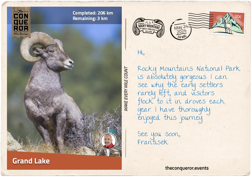
km od začátku : 0206
Grand Lake
It was great to return to a well-maintained trail at Lake Verna. The hike to the last of the five lakes, Lone Pine Lake, was a mere mile away. There were several camping spots here, making the location quite popular with hikers.
I zig-zagged in and out of the woods and steadily walked downhill alongside East Inlet. The landscape was verdant, and the nearby mountains were covered in lodgepole pine, spruce, and other tree species.
The inlet snaked beside the trail most of the way and into Grand Lake. Two miles (3.2km) before the end of my journey, I took a short side trip to check out Adams Falls, the last waterfall on this route. Named after Jay E. Adams, an early settler in the late 1800s, the waterfall plunged 55ft (17m) down a series of steps through a narrow rock gorge. I had great views from a platform made with locally sourced rocks and an even better view when I climbed down a little further.
Back on the trail, I forged on and completed my journey in the town of Grand Lake. The lake of the same name is the deepest and largest natural lake in Colorado. This cobalt beauty is popular with water sport enthusiasts and families frolicking on its shores. On the lake's west end is a channel that connects it with Shadow Mountain Lake, a high-elevation reservoir.
As I mentioned at the beginning, Grand Lake is the quiet gateway to the national park, and after my adventures hiking up and down mountains, around lakes, through forests, and along rivers, it was an ideal place to finish and take time to rest and recover.
Pondering my favourite places, I realised that as hair-raising as the climb to Longs Peak was, the challenge to get up there had left its mark. Add to that the views from 14,000+ ft (4300m), and I couldn't ask for more. Other highlights were standing on top of the Continental Divide, the views of the three lakes from the summit of Mt Ida, and the beautiful aspen groves with their silvery bark.
Farewell for now, until the next time.
km od začátku : 0111
East Emnet
Aragorn, Legolas and Gimli descend the hills onto the rolling grass covered plains that lie at the Eastern border of Rohan.
Here, they encounter Éomer who was banished by Théoden King and is now leading a band of Rohirrim still loyal to The Mark. He bestows grim news on Aragorn: the Orcs they have been chasing were slaughtered and no trace of the Hobbits has been found.
km od začátku : 0367
Borders of Fangorn
Following the traces left behind by Merry and Pippin, the company reaches the northern border of Rohan. Here the crooked and tangled bunches of root and twig creep towards the rolling plains.
The ancient thick darkness of Fangorn looms over the three companions who must venture farther in to find the Hobbits.
km od začátku : 0385
Fangorn Forest
This ancient and deep forest is the last known home of Ents in Middle-earth™. Here, the very air is pregnant with “memories and anger”. The Elf-awakened trees are speaking to each other.
Aragon™, Legolas and Gimli tread carefully, following strange tracks, while a powerful presence approaches…
km od začátku : 0596
Edoras
Standing tall and proud atop a hill is Edoras, capital of Rohan and seat of Théoden King. Its gold tarnished, Rohan’s heart is enveloped in darkness as prince Théodred has passed and Saruman has clouded the king’s mind.
Aragorn, Legolas, Gimli and Gandalf ride up to Meduseld to speak with Théoden and tell him of the war that’s brewing at his border.
km od začátku : 0644
Plains of Rohan Camp
On the long stretch of the journey from Edoras to Helm’s Deep, the Eorlingas slow down and camp for some hot food and respite.
Speaking to Aragorn, Éowyn learns that he is one of the Dúnedain, blessed with long life.
km od začátku : 0715
Helm's Deep
Named after a king of old, this gorge into the White Mountains nestles the fortress Hornburg at its mouth. Trusting in its history of never being breached, Théoden has led his people behind the stone walls and strong gates.
Wounded, but not defeated, Aragorn approaches the mighty stronghold with dark tidings: ten thousand Orcs march upon them.
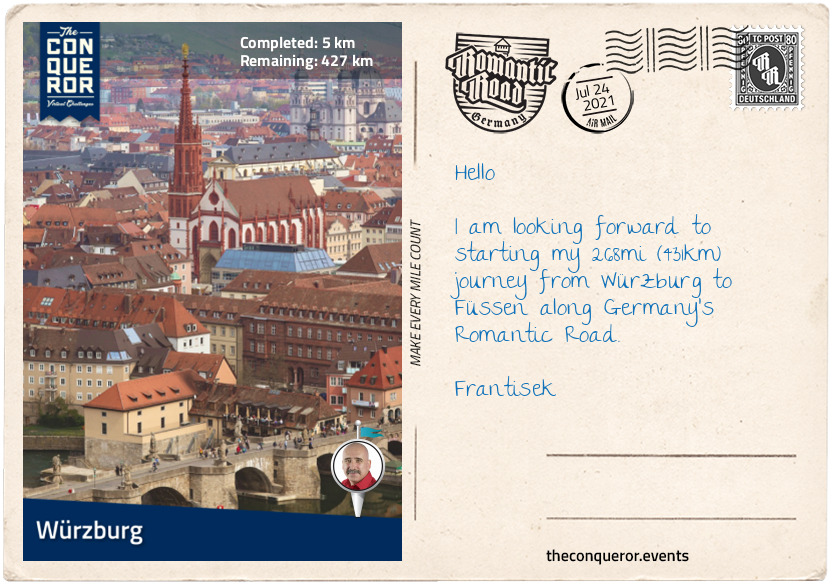
km od začátku : 0005
Würzburg
Germany’s most scenic route begins on the River Main and ends in the foothills of the Alps. Winding its way through medieval villages and Bavarian towns the route endearingly called “Romantic Road” evokes images of castles, half-timbered homes, cobblestoned alleys, warm and hearty culinary delights, art, culture and a long history.
Travelling through 29 towns, the journey begins in the city of Würzburg. With a population of 130,000 residents, the city spans the banks of the River Main, showcasing lavish baroque and rococo architecture. The highlight of the city is the majestic Residenz Palace. Built between 1720 and 1744 and designated a UNESCO site in 1981, this Baroque style palace was the home of Prince-Bishop Philipp Franz Von Schönborn. Inside the palace is a grand and elegant staircase featuring an expansive 18th century ceiling frescoe depicting the four known continents of the time: Europe, Asia, Africa and America. Measuring 59 x 98ft (18 x 30m), the frescoe is one of the largest in the world.
Up on a hill dominating the city is the 13th century Marienberg Fortress. First settled in the late Bronze Age, the fortress served as a home for the prince-bishops for nearly 500 years. The fortress saw action in wars many times during the 18th and 19th century and by the 1900s it was abandoned and fell into disrepair. In 1945 it was heavily destroyed by fire due to British bombing. Reconstruction began in the 1950s and completed in the 1990s. Today it holds two museums, St Mary’s Church (Marienkirche) dating from 706AD, a 328ft (100m) deep cistern and a 130ft (40m) high keep.
Below the fortress is the Old Bridge across River Main. Built between 1473-1543AD, the bridge replaced an earlier Romanesque bridge from the 12th century. During the 18th century 12 statues of prominent figures were added to the bridge, including the statue of Charlemagne who is credited for uniting western and central Europe during the Early Middle Ages. The statues made of stone stand 15ft (4.5m) high on a stone base.
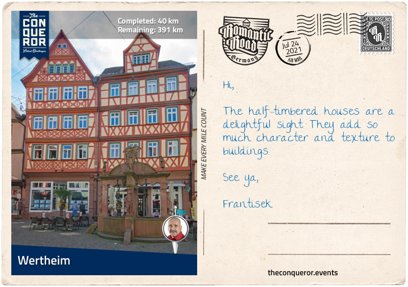
km od začátku : 0040
Wertheim
On the confluence of rivers Main and Tauber lies the town of Wertheim. Founded between the 7th-8th century, Wertheim has a population of 23,000 residents. The town’s landmark is Wertheim Castle and its medieval town centre.
Wertheim Castle sits on the crest of a hill above the valleys of the Main and Tauber rivers. Built in the 12th century for the von Staufen family and expanded several times over the next 500 years, the castle is one of the largest stone castles in south Germany. Damaged extensively in the 1600s during the Thirty Years War (a conflict mainly in Germany and Central Europe), the castle fell into further ruin over the centuries with walls and towers collapsing as late as the 1950s. The town took ownership of the castle in 1995 and its grounds are now used for various events and concerts.
Adjacent to River Tauber is the 12th century Spitzer Turm (Pointed Tower), a round tower originally built as a watchtower. The bottom half of the tower is built out of house stones, whilst the top half is octagonal in shape, plastered with sandstone cornice and a pointy roof. It stands 120ft (36.5m) high and is only accessible via a ladder as the entrance is 32ft (10m) off the ground. At some point it also served as a prison for drunkards and “quarrelsome women”.
In a half-timbered building from 1577, is the Glasmuseum (Glass Museum) exhibiting glass works from antiquity to modern times. Founded in 1976, the museum showcases “3500 years of glass production and glass application”, everything from drinking glasses to lab glass. Ancient glass items from Egypt, the Roman Empire and the Orient are displayed alongside replica historical glasses from the Middle Ages. A paperweight collection of 800 items presents its history from 1840 to today and a collection of 3000 oriental, Roman and Venetian glass beads from 1000BC to the Middle Ages was bequeathed to the museum by Thea E. Haevernick, an archaeologist primarily focused on prehistoric glass finds.
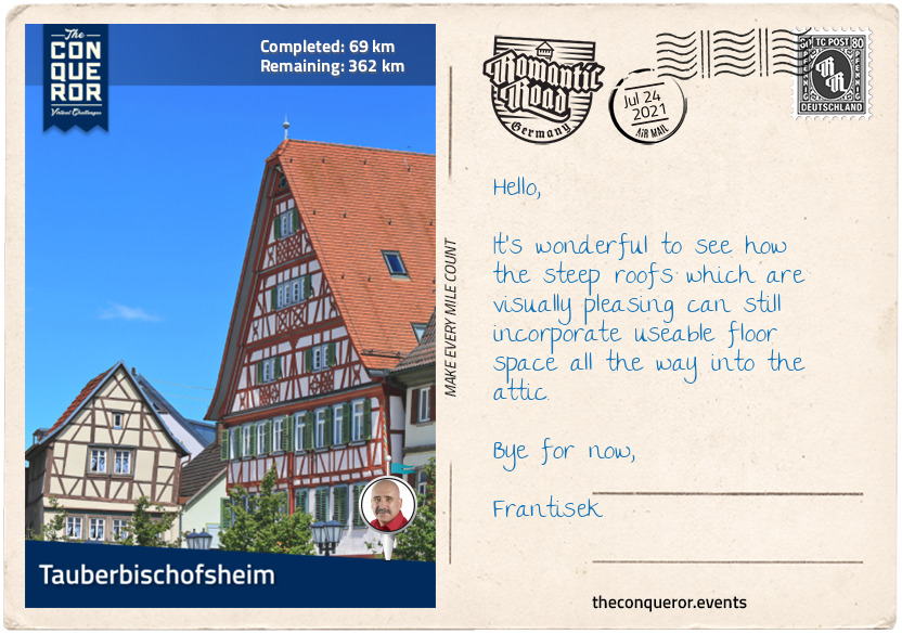
km od začátku : 0069
Tauberbischofsheim
Anyone for fencing? The fencing club in the town of Tauberbischofsheim is one of the most successful fencing clubs in the world and earns regular podium placers in international sporting events. Founded in 1954 as a fencing division of TSV 1863 Tauberbischofsheim e.V. (a sports association) by 1967 the fencing division left to establish its own club and training camp. As at 2016, the team has won 380+ medals in the Olympics, World Championships and European Championships. At the German National Championships the team accumulated a staggering 655 medals.
Tauberbischofsheim is located within the state of Baden-Württemberg on the Tauber River and it is the capital city of the Main-Tauber district. Based on prehistoric finds, the area was settled around 3,000BC, however, the first mention of the town was in 836AD and known as Bischofsheim (Bishop’s Place). Since other towns carried the same name in 1850 Tauber (the name of the river) was added to give its current name.
Landmark buildings such as Chapel of S. Peter, Kurmainz Castle and Türmersturm Tower were built in the 12th and 13th centuries and at one time the entire town was surrounded by a defensive wall. Half-timbered houses and the gothic revival town hall encircle the central plaza (marktplatz).
For the beer enthusiasts, the nearby suburb Distelhausen, houses the family-owned Distelhäuser brewery with specialty in Pils, wheat beer, fruit brandies, regional cider and apple juice.
Baden cuisine with its bohemian style has many influences from Alsace, France and Switzerland such as Baeckeoffe (a meat and potato casserole dish) and Sauerkraut (fermented raw cabbage with a sour flavour). For the sweet tooth there’s always Kirschenmichel (kind of a bread pudding) or the widely known Black Forest Cake.
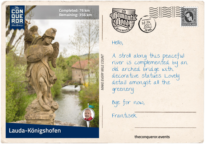
km od začátku : 0076
Lauda-Königshofen
Lauda and Königshofen are two neighbouring towns known for their hillside vineyards on either side of the Tauber Valley. The diversity of grapes in the area produce a wide variety of red and white wines. Depending on your palate, in the white wine range there’s the Bacchus with its strong bouquet, the Gewürtztraminer that may be anywhere from sweet to dry or Silvaner with its full-bodied pear flavour. If red is more to your liking how about a black Riesling with its ruby red color and velvety aroma but not too strong a flavour; or maybe a more modern grape, the Acolon. Created in 1971, the Acolon has a terrific, intense colour but the grape was only officially recognised thirty years later. Now well established it is a complimentary wine to a meat based dish or a platter of hard cheese.
Lauda-Königshofen is not a tourist destination, just more of an overnight stopover unless of course you want to sample the various vineyards in the area. However, when the Königshöfer Messe, a folk festival, comes to town, the area attracts more than 150,000 visitors. This 10 days festival has been running for over 500 years offering music, culinary specialties, a running race with various categories, amusement park and trade fair.
Half-timbered houses, museums, historical stone bridges or a stroll along the Tauber river may be a more preferred option for a quieter experience. Several churches date back to 18th century, whilst many of the half-timbered houses date back to as early as the 16th century.
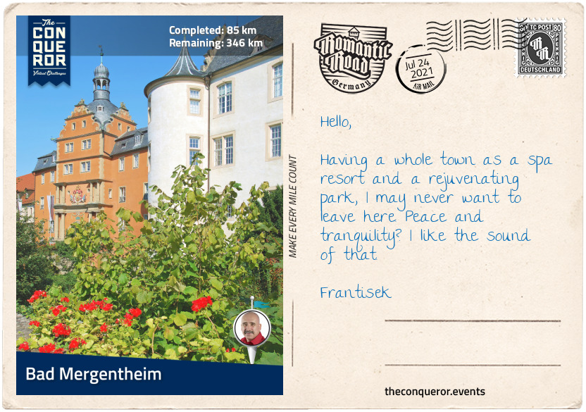
km od začátku : 0085
Bad Mergentheim
Welcome to spa town. Officially recognised as a spa town since 1926, Bad Mergentheim is a one stop-shop for relaxation and rejuvenation. As one of the largest health resorts in the state of Baden-Württemberg, the town receives more than 100,000 visitors each year.
The stunning Spa Park is an outdoor oasis of peace and tranquility amongst greenery, exotic and native trees, and beds of vibrant floral displays. You can listen to the sounds of tweeting birds or observe the perfectly choreographed dancing water move to a piece of music at the fountains. Even better to see it at night when the coloured lights are on adding another layer to the routine. Small waterfalls, a granite arched bridge and exotic plants make up the Japanese garden offering calmness and balance or a colourful feast of blooming roses can be experienced in the Rose Garden with its collection of 30 different varieties.
During the Middle Ages, Bad Mergentheim was headquarters to the Teutonic Order. Their purpose was to help Christians on the pilgrimage to the Holy Land and to build hospitals. Referred to as Teutonic Knights, the military order was made up of both volunteers and mercenaries. Mergentheim Palace is the town’s landmark building and was the home base of the Teutonic Order until 1809. Built in the 12th century it was expanded several times for the next 800 years. Dominated by the palace church, the interior is a work of art featuring elaborate ceiling frescoes, whilst the crypt below the church is the burial site of the order’s grand masters. Today the palace is a museum exhibiting the Order’s history. The royal accommodation in the palace showcases the elaborate Baroque and Rococo styles of the 17th and 18th centuries.
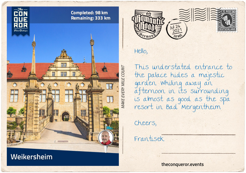
km od začátku : 0098
Weikersheim
Weikersheim is a small town of 7,358 residents but it is the Renaissance Palace and its Versailles style gardens that it is known for.
Weikersheim Palace was once the medieval seat of the princely House of Hohenlohe. Originally built in the 12th century, by the late 16th century it was rebuilt into a Renaissance Palace with the exception of the tall tower which was left as a symbol of its history. One of the most remarkable rooms is the ornate Mirror Cabinet. The walls in the room are covered with deep red wallpaper and decorated with gold trimmings, small mirrors and brackets to display the collection of porcelain, silver and precious stones figurines, and faience (tin-glazed pottery) from Ansbach, Germany.
The even more significant room is the 17th century Knight’s Hall. At 131ft (40m) in length, the entire wooden ceiling was attached to the roof structure without needing to use supports. Within each wooden frame is a painting of a hunting scene. The walls are decorated with stucco sculptures, large animal figures and grand master paintings. Entry is via a portal and directly opposite the room is the striking 30ft (9m) fireplace embellished with reliefs and figurines and the 15ft (4.5m) chandelier. With only minor additions in the 18th century, most of the hall is in its original state.
The outside gardens are a feast of symmetry and regularity. Designed as a continuation of the castle, the garden path is bordered by colourful flowers, sandstone sculptures of ancient gods and a large pool at the end. Box hedges surround floral beds, a central fountain has a statue of Hercules holding a dragon with its head tilted up spitting jets of water from its mouth and the orangery with its two wings, large arched windows and large stone figures on the roof is a greenhouse for palm trees, citrus plants and other exotic plants. What is also unique to the palace garden is the collection of 14 stone dwarfs from the 18th century decorating its balustrade. Once a decorative feature in palace gardens, most have not been preserved or maintained making this collection very rare.
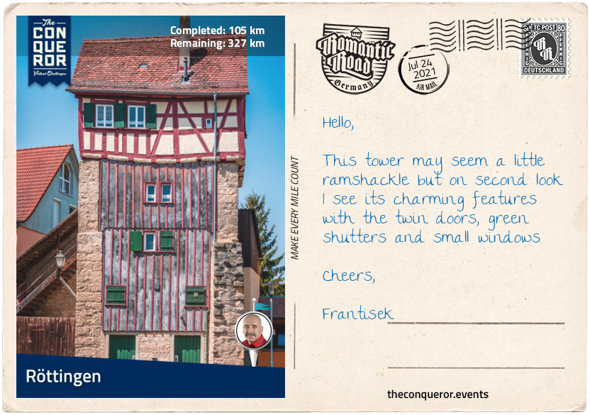
km od začátku : 0105
Röttingen
First mentioned as Rutingen in 1103AD, the small town of Röttingen is known for its Franconian Festival that has been held every year for the last 30 years at Brattenstein Castle. The open-air theatre features musicals, operettas, theatre and bands.
Sometime after 1336AD, the town constructed its fortification wall around the town and over the next 300 years added 14 towers. Seven towers have survived of which four are rectangular and three are round. The twin towers in the southwest corner of town are the most imposing. Four storeys high, each with its own façade they are connected via a covered battlement. The Jakobsturm Tower is the oldest defensive structure in town. It was converted into holiday apartments and has since won several awards for the preservation of historic buildings. The last rectangular tower is best seen in autumn when foliage on the hanging vines turn a brilliant red colour. The circular towers with few light openings, are made of stone with conical shaped roofs. Only the twin towers and Jakobsturm are inhabited towers.
Röttingen is also known as the city of sundials. Scattered along a 1.2mi (2km) circular route are 25 different types of sundials. The idea came from Kurt Fuchslocher, a master locksmith who loved sundials and their simple mechanics. He set about creating and building all the sundials in various styles and were added to Röttingen’s landscape in 1984.
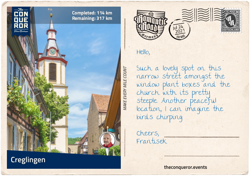
km od začátku : 0114
Creglingen
Set amongst the hills is the pretty little town of Creglingen and its population of 4,700 residents. Its main attraction is the 14th century Church of our Lord. In 1384, a piece of undamaged communion wafer (bread) was found in a peasant’s field. Believing that the wafer was the cause of miracles the local Lords built a chapel shortly after. Several altars were ordered for the inside but the centrepiece is the 36ft (11m) tall altar of the Virgin Mary. Carved out of wood in early 1500 by gothic-sculptor Tilman Riemenschneider, the altar is a fine and intricate design of figures made from linden trees with the altar wings made of pine trees. During the Reformation period, the altar wings were closed instead of destroyed and remained that way for the next 300 years indirectly providing the best form of preservation throughout the centuries.
Any seamstress or sewing enthusiast will appreciate the very useful accessory, the thimble. Its history spans more than 30,000 years when bones were discovered in Moscow. These bones were used by mammoth hunters to sew beadwork onto leather. Difficult to manufacture, the thimble became a collector’s item for the upper class. In 1982 Creglingen opened the Thimble Museum housing over 3,000 thimbles from around the world. The collection includes thimbles made of mammoth bone, bronze, brass, porcelain, gold and embroidery to name a few. Their design could be anything from plain and utilitarian to jewel-encrusted with detailed miniature sculptures. Modern day thimbles come in a wide variety of themes and designs.
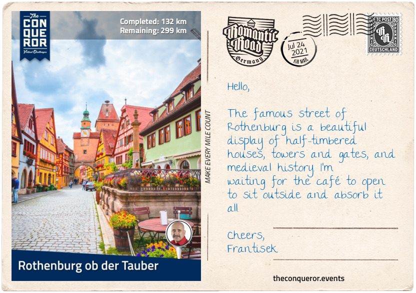
km od začátku : 0132
Rothenburg ob der Tauber
This beautifully preserved town is one of only three cities in Germany that has completely intact city walls, dating back to 1070AD. A walk around the wall is approximately 1.8mi (3km) long although in some sections there are houses backing onto the wall obstructing complete access for the full walk.
Highly regarded as an ideal German community during WWII, Rothenburg was at risk at being destroyed by the Allies when 16 planes bombed the town destroying 306 buildings, 2,000ft (600m) of wall and killed 37 people. John McCloy was the US Assistant Secretary of War at the time and understood the importance and history of the town. To spare Rothenburg from complete destruction, he ordered six men on a three-hours mission to enter the town and request its surrender. The local military commanded, Major Thömmes, agreed to the terms thereby saving the town and its history from complete artillery destruction. In 1948, McCloy was made an honorary citizen of Rothenburg. After the war, Rothenburg went about rebuilding its town restoring many of the landmark buildings to their original state. An outpouring of international financial support helped Rothenburg rebuild itself to its former glory.
Germany is very well known for its town squares, Christmas markets with big Christmas trees and stalls selling Christmas decorations, and delicatessens selling the stollen (a sweet bread with dried fruit, nuts and spices, coated with icing sugar) that typically runs for the month of December. However, Rothenburg goes a step further with a Christmas Museum that is open year round. It began as an idea by Harald Wolfhart who wanted to create a museum that could showcase historical Christmas decorations from different parts of Germany. He began a private collection that he built over nearly two decades and by the year 2000 he launched the first permanent exhibition. The collection includes a wide variety of decorations from as far back as the 19th century including postcards, nutcrackers, baubles, the Christmas pyramids from the Erzgebirge region and tree stands, made of various materials such as glass, cotton wool, pewter and leonic wires. Besides devoting their time to the exhibitions, the museum team is also charged with collecting, preserving, researching and capturing the customs and traditions of Christmas that have been handed down by generations to ensure their survival for future generations.
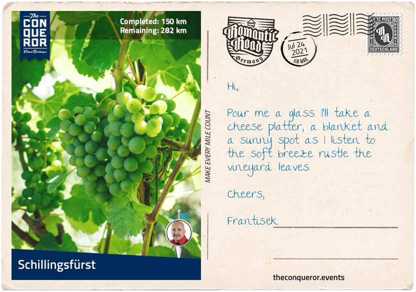
km od začátku : 0150
Schillingsfürst
Nestled amongst Frankenhöhe Nature Park is the small town of Schillingsfürst and its population of just under 3,000 residents. The 425mi² (1,100 km²) nature park is a mix of forests, streams, vineyards and protected areas. Because of its geographical location, the park is one of the sunniest spots in Germany.
The town’s landmark site is Schillingsfürst’s Castle located on a mountain spur of the nature park. The castle has been through several rebuilds through the centuries having been destroyed in 1316, 1525 and 1632. The current castle with its Baroque architecture was built by Prince Karl Albrecht in 1753 and it took 40 years to complete. The castle ownership moved to Prince Chlodwig Karl Viktor in the 1800s and has remained in the family since.
This U-shaped castle is three storeys high with a large courtyard leading to an arched bridge crossing a double moat system. The castle’s entrance is via a stuccoed staircase with the ceiling and walls filled with allegory reliefs. The intricate staircase balustrade leads to the first floor hallway that is filled with hunting trophies and rifles. The west wing holds the family’s ancestral portrait gallery from the 19th century along with a collection of uniforms, medals and items exhibiting political activities.
The ladies’ salon is dusky pink with more stucco art on the ceiling, whilst the men’s salon is red with large mirrors in gilded frames hanging on the walls. The dining room has a massive artwork on its ceiling showing a biblical scene from the Old Testament, whilst the study which is the smallest of all rooms contained medallions, musical instruments and putti (aka cherubs) along with a delicate Venetian glass chandelier. What is striking throughout the castle is the flooring. In its original condition since 1730, the floor in various rooms is made of precious woods and inlaid with various intricate patterns or scenes that include lions, dogs, plants and carriages.
During WWII the castle narrowly escaped destruction by US tanks. A warning shot was fired and it hit the north part of the castle. The damage was visible until its restoration in the late 1990s. Credit for saving the castle goes to Princess Aglaie and Red Cross sister Johanna Lößlein who hung white tablecloths out the windows and surrendered the castle.
Today the castle is kept as a museum along with the Falconry Museum, Franz Liszt Museum (music composer) and Foreign Legionnaire Museum that are found within its grounds.
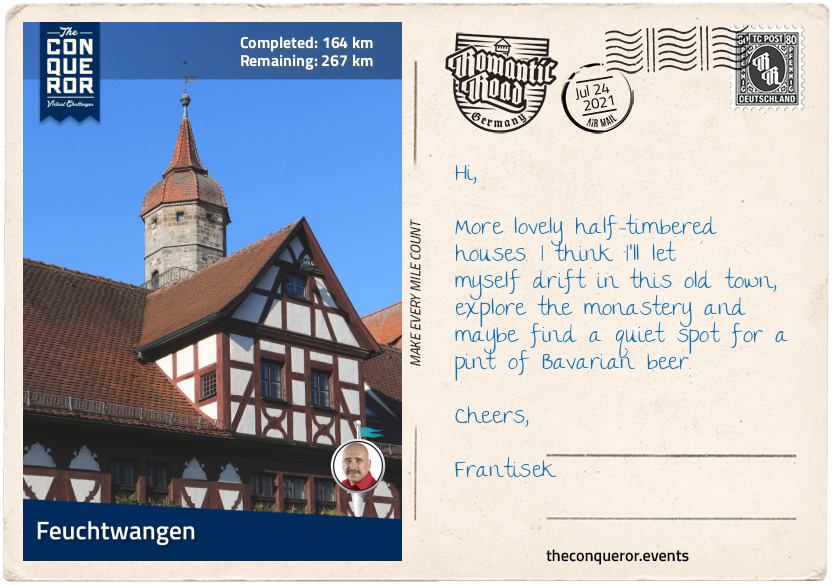
km od začátku : 0164
Feuchtwangen
The town of Feuchtwangen can trace its roots back to a Benedictine monastery in 819AD. In 2019 it celebrated its 1200th anniversary. Feuchtwangen has had a haphazard and disruptive history. Establishing itself as an official town in the late 1100s, Feuchtwangen became a self-ruling city within the Holy Roman Empire in the mid-1200s and became wealthy as a result of its location on travel routes. This status was short-lived as 130 years later the town’s ownership was transferred and its self-governance withdrawn.
In the late 1300s the town was destroyed and subsequently a city wall was built with three gates and 14 towers. The town blossomed once again until the early 1500s. Prosperity and peace was curtailed with the onset of the Peasants War in 1525, followed by Protestant Reformation in 1533 when the Benedictine monastery, a vital piece of the town’s history was confiscated. More hardship came with the Thirty Years War in the early 1600s including plundering the town by military forces and a few years later the Swedish and Imperial forces came and took what was left of it.
Move into the late 1700s and the town was ceded to Prussia, then conquered by the French before final handover to Bavaria in 1806. Thankfully by the 19th century it started seeing some stability and peace. Fortunately during WWII the town was left intact even though the neighbouring towns were completely destroyed. By the mid-1900s the town began flourishing as people who were either expelled or fled from the previously occupied German countries began arriving and settling in.
Fast forward to 2000 and Feuchtwangen became home to the second largest casino in Bavaria. With a floor space of 4,800m², the casino’s ultramodern bluish architecture is in stark contrast to the town’s historical architecture.
The neatly laid out centre of town is beautifully adorned with brightly painted buildings, some with very steeply pitched roofs that run across three storeys, interspersed with half-timbered houses and a central fountain. Most of the original town wall was demolished in the 19th century to make way for progress. Only one of the original three gates remains standing and has been preserved.
The Romanesque cloisters of the Benedictine monastery become the setting for Cloister Plays. Each year since 1948, the cloister is the backdrop to outdoor theatre productions.
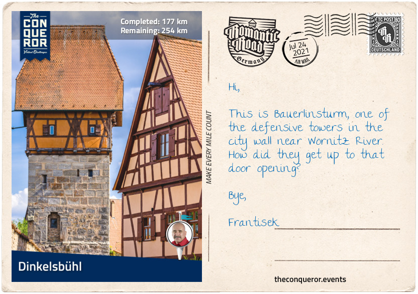
km od začátku : 0177
Dinkelsbühl
Being spared from destruction during WWII, Dinkelsbühl remains one of the best preserved medieval towns in Germany. The town is surrounded by a complete fortified wall with 16 towers and four fully preserved tower gates.
Located near the cardinal points of the wall are the four gates: Rothenburg in the north, Nördlinger to the south, Wörnitz to the east and Segringer to the west. Each tower was built in the late 1300s with its own unique design. Unfortunately Segringer Gate collapsed in 1648 after the Swedish invasion and was rebuilt in a Baroque style seven years later. Inside the gate there is a staircase that leads to the city moat. The stone-built Nördlinger Gate has a stepped gable topped with half-shells and it is adjacent to the fortress-like 14th century mill. The mill comes with its own moat, battlements and loopholes (slits in walls, typically used for shooting arrows). The oldest of the four is Wörnitz Gate. Built out of stone the top half is painted in an orange colour with renaissance gable and a bell tower. The last tower is Rothenburg Gate. With a fortified gateway complete with pitch holes (same purpose as loopholes), Rothenburg was a strong and defensive gate. The second floor of the gate used to have prison rooms and a torture chamber.
Inside the town wall is the 15th century Gothic hall church with a 13th century tower portal leading to an interior of 22 pillars supporting a vaulted roof. The Neo-Gothic high altar with a shrine circa 1490 is flanked by highly decorated side altars dating from the early 1500s. On display is a tablet from 1520 depicting the ten commandments and a walk up the tower presents the visitor with a view over the town.
The Old Town Hall built in 1361 served as a town hall for nearly 500 years. In 2007 it was renovated and converted into a museum showcasing the town’s history across 800 years. Beneath in the vaulted cellar is the dark history of the witchcraft persecutions that swept Europe beginning in 1428 and lasting for the next 300 years. The exhibition presents the circumstances that led to these events in Germany and the cases and court proceedings that occurred within Dinkelsbühl and neighbouring towns.
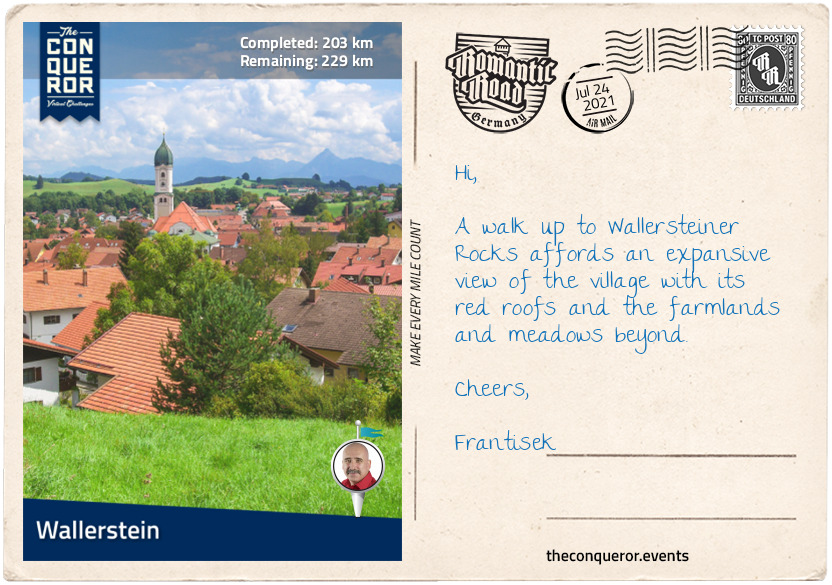
km od začátku : 0203
Wallerstein
Wallerstein came into existence in 1238 when it was initially known as Steinheim. Originally owned by Emperor Barbarossa, ownership was transferred to the House of Oettingen in 1250. The Oettingens developed and brought prosperity to the town until they lost their independence in 1806 and the town was enveloped into Bavaria.
Wallerstein is a small town which together with its neighbouring villages totals a mere 3,400 residents. However, Wallerstein has a notable inhabitant, William Von Moll Berczy born in town in 1744 and passed in 1813 in New York City. William was regarded as the founder of the city of Toronto, Canada. He was originally named Johann Albrecht Ulrich Moll but changed his name when he married. In 1792, he sailed to America and although he settled in Philadelphia, he eventually set up a business in York, Upper Canada which today is known as Toronto. William helped build homes in York and also the nearby town of Markham.
William was an accomplished painter and one of the significant stories told are by the Hudson Bay Company (HBC) and its rival North West Company (NWC), both Canadian companies. Back in 1805, NWC commissioned William to paint a portrait of Admiral Nelson, who at that time was regarded as the greatest British naval officer, to bolster the spirits of the company’s fur traders. However, Nelson died at the Battle of Trafalgar in the same year and with an outpouring of sympathy in Quebec, Canada, the company decided to commission a complementary painting depicting the Battle of Trafalgar. Basing his paintings on previously produced artworks by other master painters, William went big. He wanted his paintings to be on a large scale and ended up using canvases measuring 7x4ft (2.1x1.2m). The completed paintings hung in the office of NWC until its merger with its nemesis HBC when they were transferred to HBC’s corporate office and added to their corporate art collection.
However, this story does come with a bit of mystery. The paintings were never signed and the painter, being William, was unidentified. Whilst the paintings were handed down and had significant historical importance it was on the basis that the artist was at the time anonymous. So begins the unravelling of the mystery or as a 1948 article called it “The Riddle of the Paintings”.
The search for the original artist began in the 1900s when a senior staff member wrote an article in a magazine asking if any old HBC officers knew anything about the artist. Unsuccessful, the paintings moved around, became neglected until once again curiosity raised the question in 1948 to no avail. Suggestions were made that the paintings may have been by artist Dulongpre, however, that was also debunked when the style of leaves and flowers on the canvas were eventually matched to another family portrait that was known to be painted by William. It was not until 1991, when a piece of correspondence dated 1807 written to William was discovered. The letter said: “…the large and monumental picture of Lord Nelson was to be completed in three weeks. I congratulate you on this.” And with this a century old mystery was finally solved.
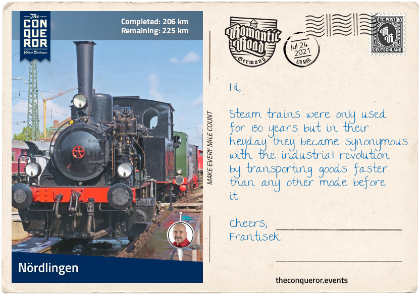
km od začátku : 0206
Nördlingen
This is a town that is as old as time or at the very least the location certainly is. The town itself was built in a crater which was a result of a meteorite striking at 43,496mi/h (70,000km/h) about 15 million years ago. The diameter of the crater is 15mi (25km) wide and the town sits within its depression.
A climb to the top of St George’s Cathedral clock tower presents an aerial view of the town, the crater and the fully preserved town wall. The 15th century Cathedral was built out of rock known as suevite. This type of rock is typically formed during an impact event such as the asteroid crashing. The clock tower is 300ft (90m) tall and affectionately named “Daniel” by the locals.
Inside a 16th century barn is the Rieskrater Museum. Opened in 1990, the museum focuses on meteors and their collision with Earth. Part of its collection is a moon rock on loan from NASA that was obtained by the crew from Apollo 16. The rock was in exchange for using the Nördlingen crater to train the Apollo 14 astronauts for the 1971 mission.
In the old locomotive sheds of Nördlingen Station is the Bavarian Railway Museum and home to more than 100 railway vehicles. From the mid-1800s Nördlingen was on a major railway route that ran south-north for approximately 352mi (566km). Nördlingen’s depot was built in 1851 and was used by steam locomotives until 1966 when they were replaced by diesel locomotives and rail buses. In 1985 the depot was adapted to a museum and amongst other rail vehicles it houses the No 3673 Pacific locomotive of the Bavarian State Railways. Built in 1918, the Pacific design had a new wheel layout known as 4-6-2, meaning four small wheels followed by six large wheels and ending with two small wheels again. The Pacific became an important design in Europe in the early 20th century for express passenger work and it dominated throughout Western Europe until the mid-20th century when it was replaced by diesel and electric locomotives.
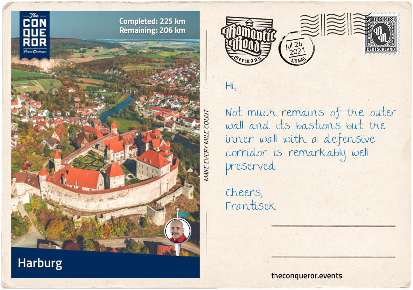
km od začátku : 0225
Harburg
The small medieval village of Harburg is located in the Bavarian region of Swabia. It has a population of 5,500 residents and it sits between the banks of Wörnitz River and the castle hill with Harburg Castle rising above it. Its origins date back to the 12th century when it was owned by the Hohenstaufen family, a noble dynasty that rose to rule the Holy Roman Empire during the Middle Ages (1138-1254).
It was at the same time that the first mention of Harburg Castle was documented when 13 years old Hohenstaufen Heinrich, son of King Conrad III, sent a letter from the castle to his aunt about an upcoming battle. The castle remained in the family until 1299 when ownership transferred to the Oettingen family who over the next two centuries expanded the castle into the fortress that exists today.
The castle is a complex of buildings within a fortified wall complete with bastions, battlements, drawbridge, prison tower, private residence, central water well and several other buildings. Having been expanded over a long period of time, various architectural styles showcase buildings from Romanesque (10thC), Gothic (12thC), Renaissance (15thC) and Baroque (17thC) periods. The central water well was once 417ft (127m) deep and reached the groundwater in the valley. Its construction was very complex and expensive indicating the importance of the castle. Due to a road tunnel the well was reduced by nearly two-thirds of its original size.
Throughout its history the castle has seen many sieges, battles and wars but fortunately it has never been destroyed or seriously damaged as many other German castles were particularly during WWII. Owned by the Prince Oettingen-Wallerstein Cultural Foundation, the castle remains as one of the most well preserved castles of the Middle Ages.
For a culinary experience, Swabian cuisine would delight those who enjoy simple and rustic flavours. Swabian home cooking is centred around egg noodles, potato and flour dumplings, soups, stews, crepes, bread pudding, a wide variety of breads and baked goods.
One of the interesting dishes with a story is the Gaisburger Marsch (March to Gaisburg). The dish is a stew made of cubed ox meat, potato and egg pasta in deeply flavoured beef broth. It is topped with fried onions. According to legend back in the 19th century the stew was served to soldiers in Gaisburg (a district in Stuttgart) and it became so popular that soldiers stationed further away would march to Gaisburg for a serve, hence the name.
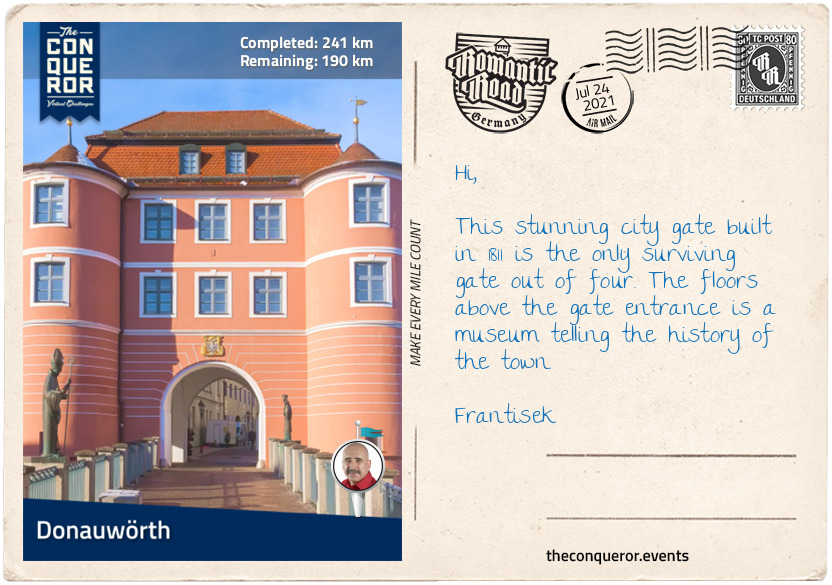
km od začátku : 0241
Donauwörth
At the confluence of Wörnitz and the Danube Rivers sits the town of Donauwörth. It began as a fishing settlement around the 10th century. The old town is located on an island surrounded by Wörnitz River and connected to the rest of the city by a wooden bridge via the oldest surviving town gate known as the Riedertor. Right through the centre of the old town runs Reichstrasse, a street lined with colourful houses built over multiple levels that were once homes to the nobility.
Over the millennia Donauwörth was caught in many significant wars beginning with the Thirty Years’ Wars (1618-1648) when during the war the town was attacked by Gustavus Adolphus, King of Sweden in 1632 and then captured in 1634 by Ferdinand III, Archduke of Austria.
Less than a century later, the Battle of Donauwörth took place in 1704 during the War of the Spanish Succession (1702-1713). When the British troops marched into town and surprised the French whilst crossing the Danube at Donauwörth a heavy battle ensued. The French retreated and in their haste to escape thousands of soldiers drowned crossing the treacherous Danube River.
The second Battle of Donauwörth took place in 1805 when French forces as part of Napoleon’s Ulm Campaign battled and beat the Austrian forces and were able to cross the Danube to continue with their campaign.
The biggest damage to Donauwörth was the extensive bombing in 1945 when it obliterated three-quarters of the town. The town was rebuilt and carefully restored continuing to maintain its medieval charm.
Located in a historic building is the Käthe Kruse Doll Museum. Containing a collection of over 130 dolls dating from 1912, the museum showcases the history of the famous dolls, its creator, the company and the process it takes to make each individual doll.
In 1905 Käthe Kruse’ young daughter requested a doll for Christmas but the doll needed to be huggable and to look more like a baby. Unable to find a suitable doll in the shops, Käthe Kruse set about to create one. The first doll was somewhat rudimentary but her daughter loved it. Sadly it fell apart. Käthe Kruse decided to develop her doll making skills so she could create one for each of her children.
With time her reputation grew and in 1910 she was asked to exhibit her handmade doll collection in a department store. They became an instant success because her dolls with their baby-like features were much more relatable to children than the existing dolls on the market that looked like little adults. Her first large order of 150 dolls was received in 1911 for shipment to New York. Realising she could no longer make dolls at home, Käthe Kruse opened a factory and began manufacturing. What set these dolls apart from the mass produced variety was that each doll was individually handmade giving them their own unique characteristics and high-end quality. More than a century later the Käthe Kruse dolls continue to bring joy to young children and continue to be individually made.
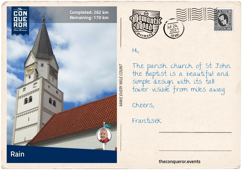
km od začátku : 0262
Rain
Rain is a small town of 8,800 residents located near the River Lech. It was founded in the mid-13th century for strategic purposes. Protecting Bavaria from the northwest, Rain was also a collection point for customs from those crossing the bridge over the river.
The Battle of Rain took place in 1632 during the Thirty Years’ War. The battle was between the Swedish Protestant army and the Catholic League (a Holy Roman Empire coalition) commanded by the Count of Tilly. During the battle Tilly and his second in command were severely injured, leaving the army leaderless. The army withdrew and shortly after Tilly died from his wound. A monument commemorating Tilly was erected in 1914 in front of the Town Hall.
The town centre is a combination of 17th and 18th century patrician houses and located at the north edge of the old town is Castle Rain. Built between 1392-1421, the castle originally had three wings within a fortified wall with bastions to the north and east and surrounded by a moat. Access to the castle was via a drawbridge to the south. By 1960 one of the wings was demolished and the moat filled. After WWII it was used as temporary living quarters for displaced families and a school from 1972. Following extensive renovations in 2008, the castle is now used as a cultural hall.
Rain has quite the musical background having been the birthplace of Michael Raucheisen (1889-1984), a pianist and song accompanist, and the Lachner brothers of which all four became renowned musicians in the 19th century. A museum showcasing the history of the Lachner Brothers exists in Rain.
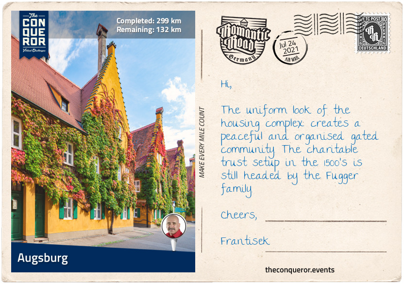
km od začátku : 0299
Augsburg
Augsburg is one of the oldest cities in Germany, it is the third biggest city in Bavaria with a population of 300,000 residents (885,000 if you include the metro area) and a university town. Founded in 15BC by the Romans, it was named August Vindelicorum after Emperor Augustus. The city was home to the noble families Fugger and Welser who controlled European banking in the 16th century. The Water Management System of Augsburg became a UNESCO site in 2019.
Augsburg has the oldest social housing complex in the world. It was founded in 1513 by Jakob Fugger who also established a charitable trust to provide ongoing funding for its upkeep. Located in a walled enclave the housing complex was established to help house needy citizens. The complex is still in use today under the same conditions as 500 years ago. Aside from three daily prayers, the tenant paid and still pays equivalent to 0.88 euros and must hold a part-time job in the community. To be eligible a person had to be Catholic, live in Augsburg for two years and become poor without debt. The wall gates are still locked at 10pm as they were in the past. Each apartment has an elaborately shaped doorbell that dates back to when streetlights didn’t yet exist. Residents were able to feel the handle in the dark in order to identify their door.
Inside a Renaissance style building that once served as a hospital is the Augsburg Puppet Theatre. The theatre was founded by Walter and Rose Oehmichen and their two daughters in 1943 in a small setup which was destroyed a year later after a bomb attack on the town during WWII. Fortunately only the stage was destroyed, as the puppets were taken home following a performance in a separate location which saved them. After the war the family found space at the hospital building and opened up with the performance of Puss in Boots. The puppets were initially hand carved by Walter and later were taken over by his daughter, Hannelore who continued carving the dolls until she passed in 2003. The puppet theatre was handed down from generation to generation and has remained in the family since its inception. In 2001 a museum was opened to showcase its most famous marionettes.
The centre of the city has widely varied architecture such as: the Gothic onion-domed Basilica of Saint Ulrich and Afra which in 1777 held a Mozart organ concert (Augsburg was the birthplace of Mozart’s father); the Renaissance Town Hall with its Golden Hall, an ornately decorated room recognised for its wood coffered ceiling and rich gold decorations on its furnishing; and the Fuggerhaüser a complex of houses that once served as the seat of the Fugger family, a wealthy banking dynasty.
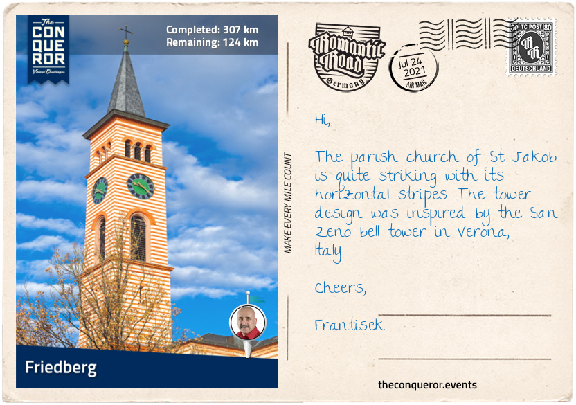
km od začátku : 0307
Friedberg
Only 5mi (8km) from Augsburg is the town of Friedberg. It was founded in the mid-13th century by the Bavarian Duke Ludwig II to protect the salt route and the borders against the powerful neighbouring Augsburgers who at the time wanted their territory across the River Lech.
Ludwig commenced building Castle Friedberg and a defensive wall much to the dismay of the Augsburgers who in turn burnt the city. Friedberg and the castle suffered destruction and were rebuilt many times over the centuries largely due to its strategic location and ongoing conflict between Swabia, Bavaria and Augsburg.
When fire devastated the castle once again in the mid-1500’s, the new design came in a simple Renaissance style and for a brief period it was occupied by Duchess Christina of Lorraine. During this time Friedberg was the centre of court life in Bavaria, experiencing prosperity and peace until the plague arrived in 1599 and ravaged the town.
Following damage during the Thirty Years’ Wars in the 17th century the castle was repaired once again. No longer used as a residence, the castle became an administrative seat for various organisations. It survived WWII without damage and eventually was converted into a museum in the 1980s. In 2018, after three years of intensive restoration efforts the museum was reopened to the public.
Today the castle is an elegant white building with a red pitched roof. It is accessed via a footbridge through a portal beneath the tower gate into an arcaded courtyard. The interior has been fully gutted and uniformly redesigned to better reflect the museum’s displays such as: the town’s history; collection of Friedberger watches capturing its 16th-19th century history, when the town was the centre of watchmaking; and faience manufacture from its short-lived 18th century era, when a ceramic glazing factory existed in town for only a few years, making Friedberger faiences extremely rare.
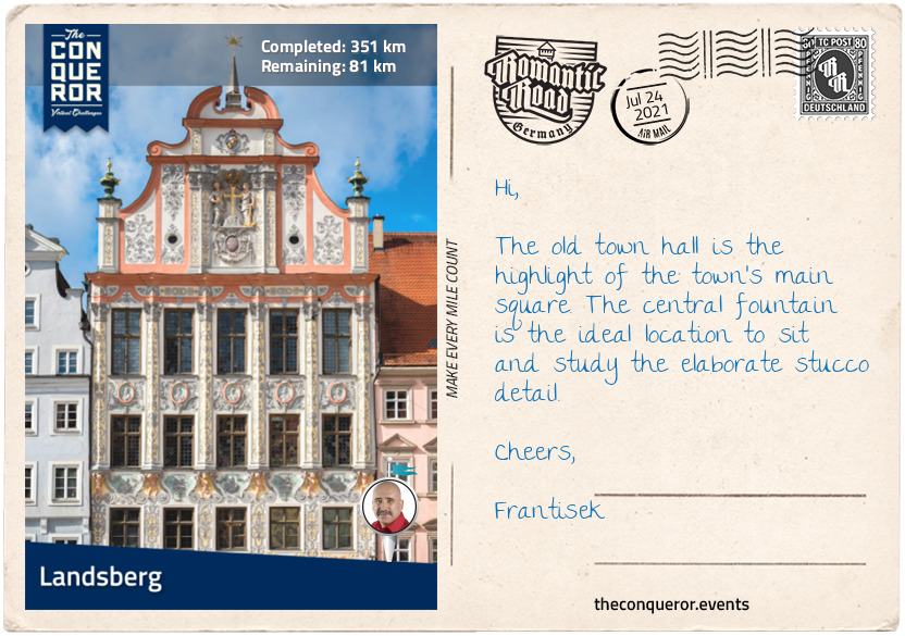
km od začátku : 0351
Landsberg
The picturesque town of Landsberg located on the River Lech was once a major salt route in the middle ages. In the same fashion as Friedberg it collected salt duties as a source of income and later added river taxes.
Across the river tucked away amongst trees and bushes is a medieval fairytale tower called The Mutterturm (Mother Tower). It was built by Bavarian artist Hubert von Herkomer in honour of his mother and served as his art studio in the late 1800’s. Built out of solid tuff stone, the grey tower is accented by its conical green and yellow roof, whilst the interior displays his father’s skills at wood carving through the tower’s furniture and fittings, whilst his uncle wove the fabrics. The tower is a museum now exhibiting some of Herkomer’s artworks.
The town is a collection of pastel coloured buildings but the most impressive is the ornately decorated old town hall. Built in the 1700’s the building is three storeys high with a richly detailed stucco façade. The windows increase in size with each floor indicating the importance of the rooms behind them. The first two floors display significant paintings by Herkomer whilst the third floor is a ballroom with frescoes depicting the town’s history.
To the southeast of town is the beautiful Bayertor Tower. It was built in 1425 as a way to impress arriving travellers. Standing at 118ft (36m) tall the tower provides stunning views of the old town and Lech valley. The exterior wall is richly decorated with a Gothic crucifixion painting and three coat of arms beneath it, each one representing the three individuals who financed the project.
North of the old town is the Landsberg Shoe Museum exhibiting traditional shoes covering eight centuries. The museum was opened in 1995 when the owner of the Schuhhaus Pflanz, a family run shoe business that can trace its history to 1625, decided to display shoes that he’s been collecting for more than 40 years. The collection includes silver wedding shoes from Afghanistan, pointed shoes from the Orient, Chinese lotus shoes for women who practiced foot binding, along with shoes worn by tennis player Steffi Graf, Empress Sisi of Austria and King Ludwig II of Bavaria. The museum also has the most unique shoehorn collection which has won an entry in the Guinness Book of Records as the largest collection in the world.
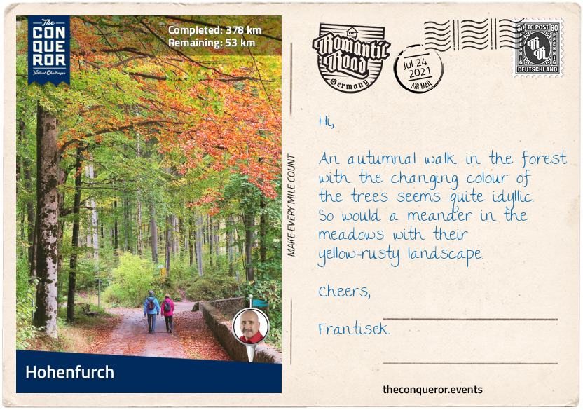
km od začátku : 0378
Hohenfurch
On the banks of Schönach River sits the rural village of Hohenfurch and its 1500 residents. The village is surrounded by expansive meadows and forests and it is a holiday destination for those who enjoy a variety of activities such as hiking, cycling, horse riding and cross-country skiing to name a few.
South of the village on a hill is the charming Gothic Chapel of St Ursula. Built around 1520 the chapel was dedicated to St Ursula, the patron saint of raftsmen. Until the early 20th century rafting was a common profession in Germany where tree trunks or logs were tied together and transported across waterways to various places such as glass factories, lumber yards or shipyards. From March to November raftsmen were separated from their families as they took logs down the Lech River to the Danube and onto the Black Sea. When they returned to their families they gave thanks in prayer to St Ursula for their safe return. The second half of the year the rafters worked in the woods producing B. Wieden which were twisted branches converted into ropes that were used to tie the logs together.
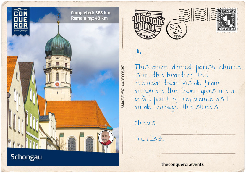
km od začátku : 0383
Schongau
Located along the River Lech is the new town of Schongau. Although it is over 700 years old, the original Schongau used to be a few miles to the northeast of the current town. Sometime in the 13th century a large number of residents moved from the old Schongau and established a new settlement. When they left they took the town’s name with them.
Schongau was a prosperous trading route and commercial centre until America was discovered and the trading route relocated. The town fell into poverty and decay until post WWII when middle class refugees settled in the area and turned the tide for the town’s economy.
Surrounded by a well-preserved city wall, Schongau maintains a medieval feel through its buildings and parishes. One of the highlights is the Schongau City Museum exhibiting the city’s history along with a rare collection of coins. The original museum began in 1891 and prospered for several years until the advent of WWI when it was forced to close. Throughout the 20th century the museum opened and closed several times due to wars, looting and financial difficulties, but each time it reopened it focused on the story it wanted to represent, restoring its collections and actively acquiring new ones. In 2004 after yet another closure the Historical Association of Schongau took over the management of the museum.
The coin collection is a result of Schongau’s history with minting currency. In 1331, Emperor Ludwig the Bavarian gave Schongau the right to mint. During that time several other towns minted coins and they were either royal or episcopal issues. The coins from Schongau were classified as royal issues of which a collection is exhibited in the museum, along with a history of how money developed from its early beginnings to the present day.
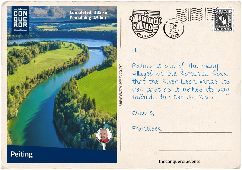
km od začátku : 0386
Peiting
A mere 1.5mi (3km) southeast of Schongau, across the River Lech is the town of Peiting. First mention of the town was in 1055AD when a castle was built on the Schlossberg (castle hill). It is one of the oldest settlements in the area.
After WWII around 1,500 refugees found their home in Peiting. To remember those who perished a memorial chapel was built and inaugurated in 1987. It is the town’s hope that the memorial will remind future generations of their history and “help to build bridges of understanding from person to person, from community to community, from people to people”.
Just outside of town in a small hamlet called Kreut, a Roman estate called Villa Rustica, from the early 2nd century, was discovered. Following excavations it was deduced that the first owner of the Villa might have been a Roman soldier, who after leaving the Roman army with citizenship and land would have built himself a country house. The property would have had a residential home, several farm buildings and a bathhouse. Heating in the home was installed on the floors and walls and the house was designed with a central courtyard. To date only the bathhouse has been fully excavated, however, remains of wall paintings, glass windows and clay tableware give an indication of the high standard of living enjoyed by the owners.
Outside of the excavation site is a Roman kitchen with 75 different types of plants grown. These plants were introduced to the area by the Romans providing a kitchen garden that included vegetable plants, herbs and medicinal plants, cereals and legumes, trees and bushes and vines. Display boards around the kitchen garden indicate how the various plants were used during the Roman era.
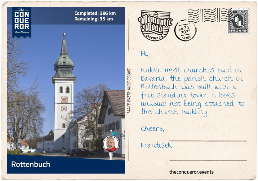
km od začátku : 0396
Rottenbuch
Rottenbuch is a small village with a mere 1800 residents but its history is deeply tied to the former 11th century Augustinian monastery. When the clergy was donated property, income and land by the Duke of Bavaria in 1073, they went about building a monastery followed by a church and providing rental properties to craftsmen and employees in their service.
For several hundred years the community thrived until the Middle Ages when the monastery suffered financial hardship due to weak leadership. Although saved by Emperor Ludwig the Bavarian from financial ruin, ongoing riots and fires broke out within the monastery and the church until the tower eventually collapsed.
New leadership ensued, the tower was rebuilt and a new lease of life breathed into Rottenbuch. By the end of the 16th century it was one of the largest Bavarian monasteries. Once again fires raged through the monastery during the Thirty Years’ War followed by the plague, followed by looting during the War of the Spanish Succession.
However, nothing prepared the Rottenbuchers for what was yet to come. In 1803 the monastery was closed due to secularisation that was sweeping Bavaria. The buildings, chapels and its noteworthy library were either demolished or auctioned off and all of a sudden a 730 years history since the foundation of the monastery came to an end.
The ramifications of secularisation were felt not only by the clergy but also the members of the community. Those providing services to the monastery suddenly found themselves unemployed, without social security, medical care or education. It took the community years before they could obtain ownership of their farms and those who could not make an income eventually had to move away.
Rolling into the 20th century and the community was impacted once again through the two world wars and the losses they endured. After WWII refugees found a home in Rottenbuch. Construction flourished with new housing and better infrastructure was developed and expanded. By the 1990s the town centre and monastery complex began renovations to make way for a town hall, school and various other facilities.
Today, Rottenbuch is part of the monastery circuit where visitors travel to see monasteries and churches in the surrounding villages.
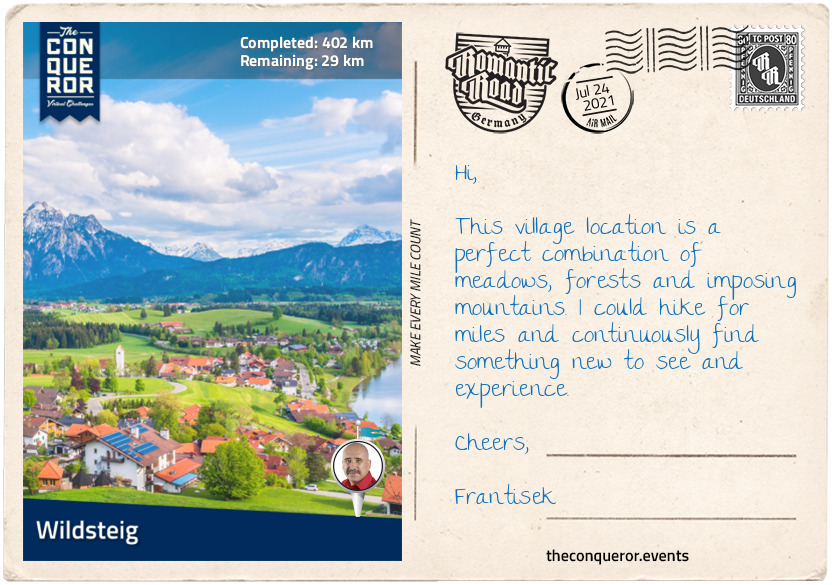
km od začátku : 0402
Wildsteig
In the foothills of the Alps sits the village of Wildsteig. This quiet community of 1370 residents is surrounded by the Ammergau and Allgäu mountains making it a great location for hiking, Nordic walking or cross-country skiing.
In the centre of the village is the parish church of St Jakob. The white building with yellow trim, red pitched roof and a green onion dome sits perched up on a hill getting a bird’s eye view of the meadows and pastures below. Where the outside may seem simple in its design, the interior is an elaborate display of baroque architecture, rich stucco and brightly coloured ceiling frescoes. Outside below the church is a replica of the Lourdes Grotto with cave-like walkways. It was built in 1908 out of limestone from the nearby Ammer Gorge.
Wildsteig may be small but it still knows how to serve a good hearty meal. Dishes such as Parsley Pancake Soup are quite intriguing. It is essentially a clear broth with a rolled up and sliced pancake (others may refer to them as crepes) topped with freshly chopped parsley. For the main course you can never go wrong with a schnitzel, a thinly pounded meat dipped in egg, lightly breadcrumbed and deep fried accompanied with split potatoes. Wrapping up the meal with an oven baked apple strudel with ice cream and cream would be a great way to clean up the palate.
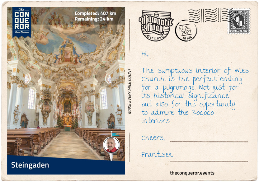
km od začátku : 0407
Steingaden
The former monastery village of Steingaden has a long history tied to Steingaden Abbey. A 12th century monastery, it was originally built in a Romanesque style. Sadly the monastery suffered throughout the centuries when it was looted and burnt during the Peasants’ War in 1525 then nearly fully destroyed during the Thirty Years’ Wars. Rebuilt in a Baroque style in the 17th century the monastery came to an end as part of the secularisation in 1803. With the exception of the cloisters and the abbey church the rest of the buildings were auctioned off and demolished.
The abbey church survived by converting it into a parish church. The magnificent interior of the church is decorated in a rich Rococo style with highly detailed stuccos on the walls and large colourful frescoes on the ceiling. On the north wall of the church is a genealogical painting of the Welf family of which Welf VI was Duke of Bavaria and founder of the monastery. A monument of Welf VI is located in front of the abbey church. The memorial depicts Welf VI on his knees holding a replica of the church’s twin towers in his hand. Both Welf VI and his son were buried here in an elaborate tomb which was destroyed in the 16th century leaving behind only a carved sandstone panel dating back to the 1200’s and considered one of the “oldest surviving heralding representation in Germany”.
Less than 3mi (5km) southeast of the abbey is the UNESCO World Heritage listed Wies Church. An oval Rococo church from the 1740s, Wies Church is a pilgrimage site on the monastery circuit. It is said that in 1738 during prayers, tears were seen on an old wooden statue of “Scourged Saviour”. As news spread more and more people arrived to pray to the statue. In order to accommodate the large numbers of visitors a new building was needed. Local architects, the Zimmermann brothers, were hired to build the new church. Popular throughout Europe for their work, their style was a mix of gilt, stucco and art. The church fortunately escaped destruction during secularisation when the state authority requested that the church be spared and continue to be a pilgrimage site.
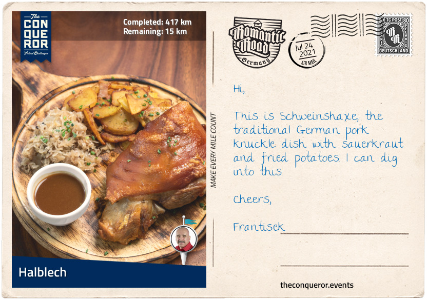
km od začátku : 0417
Halblech
On the banks of Halblech River is the small village of Halblech and its 3500 residents. Described as Bavaria’s largest nature reserve, Halblech is a holiday destination year round offering activities such as hiking, cycling, skiing and cross country skiing.
Halblech is located on the edge of the Alps, at the foot of the Ammer Mountains. An 18x18mi (30x30km) mountain range, the Ammer has low summits with the tallest being the “Daniel” at 7,680ft (2,340m), making it an ideal location for day trip hikes or walks.
Near the village are several lakes of which Forggensee is the largest. Forggensee is a manmade lake and the fifth largest in Bavaria at 5.7mi² (15km²). The River Lech runs through it. Forggensee was created in 1954 when the river was dammed to manage water flow from snow melts in the spring. The lake is used for recreational purposes such as sailing, boating and fishing.
For an aerial experience, the double chairlift floating at 1142m above sea level provides views of the valley and a multitude of nearby lakes. The chairlift terminates at a rustic mountain hut café where a hearty Bavarian meal can be enjoyed whilst watching the paragliders taking off.
Bavarian cuisine was developed in the 19th century for wealthy households and further refined for the royal court. Meat, boiled dumplings and potatoes are staple dishes with Brotzeit, a savoury snack consisting of bread, ham, boiled egg, butter, cheese and condiments, being a Bavarian specialty usually eaten between breakfast and lunch. A popular meat dish is Schweinshaxe which is roasted ham hock served with fried potatoes and sauerkraut. Bayerische crème (Bavarian cream) is a milk dessert thickened with eggs, gelatin and whipped cream served with raspberry or apricot puree.
Bavarian cuisine is closely connected to Austrian cuisine especially from Tyrol or Salzburg. Apfelstrudel (apple strudel) is a popular dessert in Bavaria but it originates from Austria. Many of these influences arise from the time of the Austrian-Hungarian Empire particularly through the two major dynasties, the Wittelsbach of Bavaria and Habsburg of Austria. A small side fun fact is that Empress Elisabeth of Austria, affectionately known as Sisi, was a Bavarian royal from the House of Wittelsbach. She married Emperor Franz Joseph I of Austria who was a royal from the Habsburg family. One might imagine that a royal banquet in this household would be a real culinary delight.
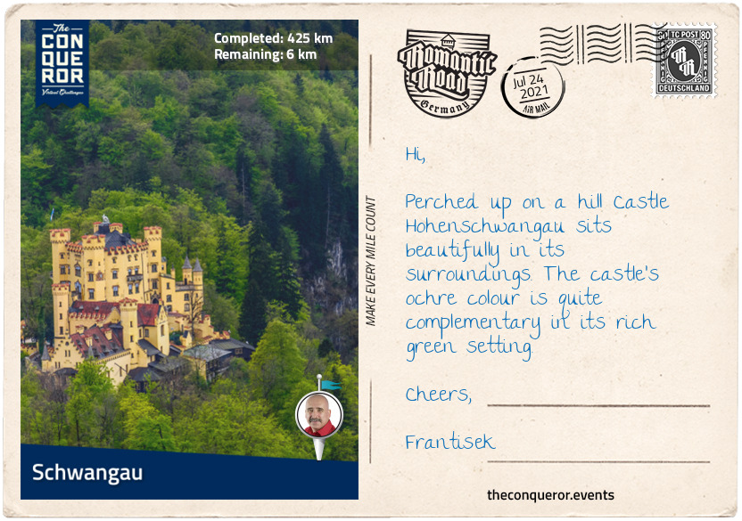
km od začátku : 0425
Schwangau
Surrounded by lakes and a mountainous backdrop, Schwangau is the second last town on the Romantic Road. Due to its proximity to the famous Neuschwanstein Castle and its neighbouring Hohenschwangau Castle, Schwangau is referred to as the “village of royal castles”.
With its year round activities and health spa, Schwangau is a holiday resort but it is also a pilgrimage destination to St Coloman Church. The 17th century Baroque church was dedicated to Saint Coloman, an Irish pilgrim who in 1012 stopped in Schwangau on his way to the Holy Land. When suspected of espionage during a time of conflict among Austria, Moravia and Bohemia, Coloman was tortured and hanged. The local people venerated Coloman for his ability to withstand the torture and out of remorse and due to various miracles that occurred around his grave, he was made a saint and patron of livestock.
In honour of St Coloman each year in October a festival is held where a procession of 200 riders on highly decorated horses parade from town hall to the church for service and the horses are blessed. The procession then goes around the church to the market square to celebrate, eat, drink and enjoy the views of the castles.
The current Hohenschwangau Castle came about by chance. When King Maximilian II of Bavaria stumbled across an old fortress called Schwanstein whilst out on a hike, he immediately fell in love with its scenic location. Young and enthusiastic, he went against his father’s wishes to move to a different castle and bought the dilapidated property. In 1833 he went about converting the original building from the Middle Ages into a residential palace. It was the summer residence for his family including his son, Ludwig II, who would later, further up the hill, build Neuschwanstein Castle.
The palace was used for 80 years by the king, queen, Ludwig and Ludwig’s uncle, Luitpold, as the last resident. When Luitpold died in 1912, the castle was opened a year later as a museum. The castle survived both World Wars due to its strategically unimportant location. The state government recognised the rightful ownership of the castle and it was returned to the family who continue to use it as a summer residence along with being open to the public and receiving 300,000 visitors per year.
The castle’s ochre coloured façade and four tower cubed palace dominates the landscape. The top of the arched entrance is decorated with two life-size sculptures of knights holding a shield and a lance, flanking either side of a gothic style window topped with a coat of arms. There are over 90 murals inside depicting the history of Bavaria. Each room has its own specific theme, telling its own story. Neo-Gothic frescoes abound. The largest room which takes the full width of the castle is the banquet hall named “Hall of Heroes”. The walls are decorated with paintings telling the story of an old Norse chivalric saga centred around a hero called Dietrich von Bern.
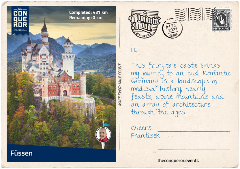
km od začátku : 0431
Füssen
Before arriving in Füssen, a slight detour leads up to King Ludwig II’s fairy tale and most famous Castle Neuschwanstein. Inspired by the likes of Disneyland’s Sleeping Beauty Castle, the flyover in the 1968 family movie Chitty Chitty Bang Bang and numerous images, postcards and castle calendars, Neuschwanstein became a symbol of romance and fairytale dreams.
Ludwig II became king at the young age of 18 when his father suddenly died in 1864. An eccentric daydreamer, Ludwig preferred art, theatre and seclusion over governing, public appearances and social functions. Although much loved by the citizens of Bavaria, he was disliked by the nobility for his neglectful approach to the kingdom’s affairs.
When Prussia conquered Bavaria, Ludwig lost the kingdom and the rights that went with it. Bavaria became annexed to Prussia. Despondent at this turn of events, Ludwig retreated further from his responsibilities and he sought refuge in his own dreamworld from which Neuschwanstein was born.
Pouring his energy into creating a retreat where he could retire from public life, Ludwig began construction on the castle in 1869 after inheriting considerable funds following his grandfather’s death. Ludwig was very keen on a Middle Ages design that reflected the old German Knight’s castles. He harboured complete control over the architectural plans, requesting to approve every single draft along the way. Built out of standard bricks and encased in rock, the castle façade was dressed in white limestone. In the upper courtyard a painting of Saint George and the Dragon can be seen on the exterior wall of the rectangular tower. The gatehouse with its red brick façade was the first to be completed and furnished allowing Ludwig to move in and continue supervising the construction.
Ludwig never saw the castle finished as he died under unusual circumstances. It is theorised that instead of drowning as initially reported he may have been murdered by his enemies. At the time of his death the rectangular tower was still under construction. Had the castle been finished it would have had 200 plus interior rooms as opposed to the 15 that were finished. The total floor space the castle occupies is 65,000sq ft (6,000sqm) over three levels. Seven weeks after his death the castle was opened to the public. Today the castle sees 1.5 million visitors per year and during peak season as many as 6,000 people per day. The town of Füssen is where this journey ends. Located less than a mile (1km) from the Austrian border, Füssen is known for violin manufacturing. It is the highest lying town in Bavaria sitting right on the edge of the Alps over the River Lech.
Up on a hill overlooking the town is Hohes Schloss (High Castle) a fortified castle that was once the summer residence of the prince-bishops of Augsburg who were also Lords of Füssen. Today it houses an art gallery exhibiting works from the late Gothic and Baroque periods. Spectacular rural views can be seen from the top of the clock tower.
Below the castle is the 9th century former Benedictine Monastery of St Mang which was dissolved as part of secularisation in 1803. The Abbot was told to vacate the premises and the library shipped out on rafts. The abbey was gifted to Füssen 35 years later and today it is a museum displaying the history of the abbey, the town and manufacture of violins and lutes. Beneath the monastery church is the Crypt of Saint Magnus, the patron saint of Füssen and founder of the abbey. In the crypt is Bavaria’s oldest surviving fresco dated 980AD.
Another Bavarian feast is the best way to wrap up this journey. Starting with a clear soup with liver dumplings, followed by Schupfnudel, a fried potato noodle with vegetables topped with sour cream and finished with a tantalising Bavarian dessert, the Prinzregententorte, a chocolate covered thin layer cake filled with chocolate buttercream.
Cleansing the palate with a Bavarian beer is ideal but it may take a while to choose a brand. With 647 brew houses in Bavaria you are spoilt for choice. Perhaps narrowing it down to the six brands that are permitted to be used during Oktoberfest (beer festival) can help with the selection: Augustiner, Hacker-Pschorr, Hofbräu, Löwenbräu, Paulaner, and Spaten. Each beer has to be produced according to the Bavarian Beer Purity Law introduced in 1516 which stipulates that the only ingredients that may be used are barley, hops, yeast and water. Well I say, cheers to that!!
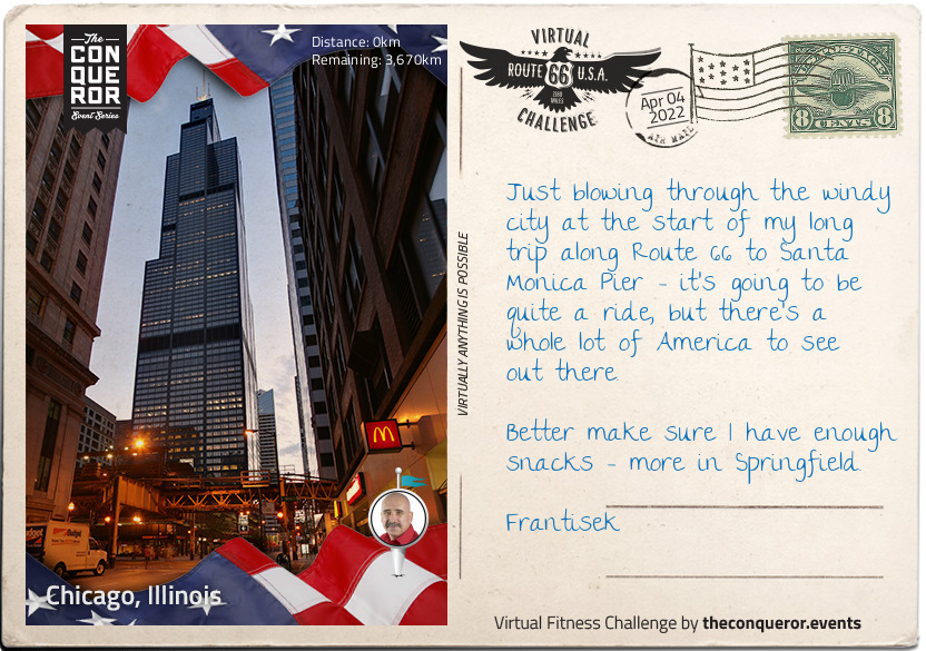
km od začátku : 0000
Chicago, Illinois
Welcome to Chicago, Illinois Frantisek, the third largest city in the United States of America, and a trading post since the late 17th century. The first permanent resident was a free Haitian man, Jean Baptiste Point du Sable - little is known of him before he first appears in Chicago in the 1770s, but he was certainly resident there from 1790 and is known as the founder of the city. By the time Mark Twain said "she outgrows [a man's] prophecies faster than he can make them" in 1883, Chicago had gone from trading post on the river to thriving town.
When the Willis Tower - formerly known as the Sears Tower - was completed in 1973, it was the tallest building in the world, and remained so for 25 years. Although still impressive, the tower is only the second tallest in the States, and has slumped to 14th in the world. It gets its original name from Sears Roebuck, who at the time of construction required a staggering 3,000,000 square feet of office space for its employees.
After 40 years, Sears' naming rights bizarrely expired, and in March 2009, Willis Group Holdings not only leased part of the building but obtained naming rights too. Potentially, the name could change again in 2024, when rights become available again, although the Chicago Tribune notes that "we're stubborn about such things", and that the current name hasn't yet stuck in the mind of locals, let alone the world.
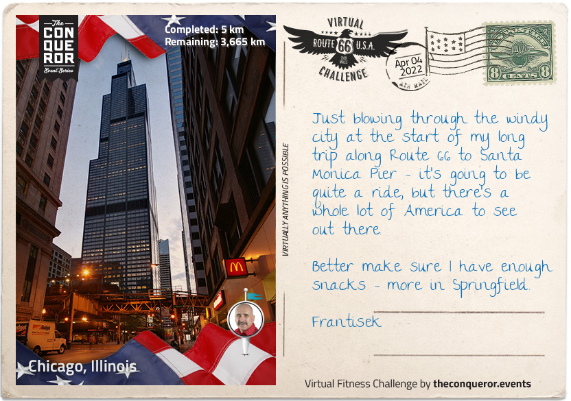
km od začátku : 0005
Chicago, Illinois
Welcome to Chicago, Illinois Frantisek, the third largest city in the United States of America, and a trading post since the late 17th century. The first permanent resident was a free Haitian man, Jean Baptiste Point du Sable - little is known of him before he first appears in Chicago in the 1770s, but he was certainly resident there from 1790 and is known as the founder of the city. By the time Mark Twain said "she outgrows [a man's] prophecies faster than he can make them" in 1883, Chicago had gone from trading post on the river to thriving town.
When the Willis Tower - formerly known as the Sears Tower - was completed in 1973, it was the tallest building in the world, and remained so for 25 years. Although still impressive, the tower is only the second tallest in the States, and has slumped to 14th in the world. It gets its original name from Sears Roebuck, who at the time of construction required a staggering 3,000,000 square feet of office space for its employees.
After 40 years, Sears' naming rights bizarrely expired, and in March 2009, Willis Group Holdings not only leased part of the building but obtained naming rights too. Potentially, the name could change again in 2024, when rights become available again, although the Chicago Tribune notes that "we're stubborn about such things", and that the current name hasn't yet stuck in the mind of locals, let alone the world.
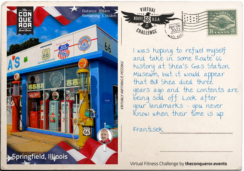
km od začátku : 0306
Springfield, Illinois
You've made it to Springfield, Frantisek, capital of Illinois and sixth most populated town in the state. Like Chicago, Springfield's early history is intertwined with the fortunes of travelling fur trappers and traders. By the time a young Abraham Lincoln moved here in 1837, Springfield was an established town.
Lincoln met his wife, Mary, in Springfield, and practised law there for 24 years, also taking a healthy interest in politics - a good pursuit for a future president. He was elected to office in November 1860, although was singularly unpopular in slave states; in fact, he only won two of 996 counties in the South that year.
A two-term president, Lincoln can also be credited with founding Thanksgiving as a national holiday in America. Before, it had been a small holiday in New England, but he fixed it as the final Thursday in November; something we can be certain retail employers don't thank him for today, with Black Friday falling the following day.
Although buried in Springfield, Lincoln is perhaps best known for being murdered in a theatre. John Wilkes Booth, his assassin, was a well-known actor and a vocal racist; Lincoln promoting equal voting rights for freed slaves didn't go down well, and when watching Our American Cousin in Ford's Theatre in April 1865, he was shot in the back of the head at point blank range. African-Americans, whose rights Lincoln championed, openly wept at their president's death.
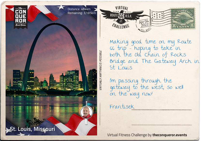
km od začátku : 0484
St. Louis, Missouri
Historic St. Louis was founded over 250 years ago, Frantisek, and before the French fur trappers and traders that settled there arrived, it was a centre of Native American Mississippian culture. Evidence of a sophisticated society dating back at least a thousand years before the city was established as a French territory was all around, including earthworks, a complex social structure, and advanced farming techniques.
European exploration of the area first took place in the late 17th century, and the early French settlers grew wealthy from the fur trade, relying on slave labour to provide the workforce. By 1821, Missouri was a state in its own right, with St. Louis serving as the state capital until 1826, when Jefferson City was decided upon as being more central.
St. Louis is also well-known for two spectacular landmarks; the Chain of Rocks Bridge, with its strange 30 degree turn halfway across, prompted by the water safety advice of boatmen who frequented that stretch of the Mississippi. Out of general use since 1968, the bridge is now a monument to early 20th century construction.
Discussions for a structure in St. Louis to commemorate the first settlers and pioneers were mooted as early as 1933, with Eero Saarinens's designs in place for the Gateway Arch itself by 1947. Plagued by delay, funding issues, and red tape, preparation of the ground didn't begin until 1959, and construction proper didn't start until 1963. It's also one of the few major world monuments where no construction workers died during building, despite an actuarial firm's estimate of an unlucky 13 potential deaths.
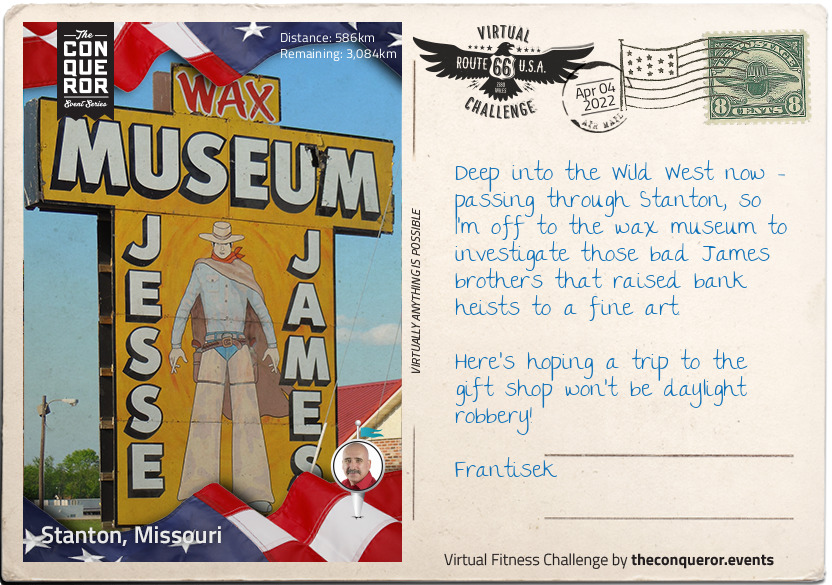
km od začátku : 0586
Stanton, Missouri
At first glance, Stanton might not appear to have much to recommend it to someone taking in the sights and landmarks of historic Route 66, but this small, unincorporated community is up there with every other example of not judging a book by its cover. It has even apparently shrunk since Rittenhouse's 1946 Guidebook to Highway 66 - then it had a garage, a gas station, a café, a shop, and a few cabins. Now, the only business open year round is the gas station, although the famed Jesse James Wax Museum does a good trade in the Summer, when it is open daily, and at the weekends in Spring and Autumn. Like the town, it pretty much closes down in Winter.
Stanton is, however, close to the famous Meramec Caverns, where the James gang holed up to avoid arrest. The caves are natural limestone, formed more than 400 million years ago, and have been used variously for shelter by Indian tribes, to collect saltpetre for the production of gunpowder in the 18th century, and even as a venue for ballroom dances in the 1890s - the same area of the caves can still be rented today for private special events.
The wax museum is devoted to all things Jesse James - including photographs of the outlaw, plus several personal items and vintage firearms. You will also hear the legend of what was possibly the greatest feat of James' criminal career; officially, he was gunned down by Bob Ford, a member of his own gang, in 1882, but legend has him escaping and dying at the grand old age of 101 in Texas in 1951. It would make a fitting end to the tale of the modern-day Robin Hood, but family questioning and recent DNA evidence have sadly debunked this.
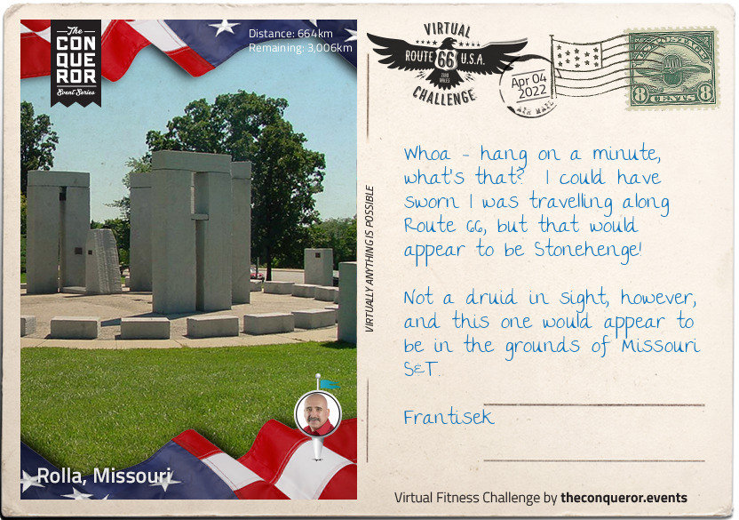
km od začátku : 0664
Rolla, Missouri
For a relatively small place, Rolla produces a lot of professional sports men and women, and also an impressive crop of politicians. Although incomes are a little below the national average, the surrounding area and amenities help rate the town higher than it might otherwise sit for quality of life.
In terms of its history, it's a relatively short one - the first house within the current Rolla city limits was built in 1844 by one John Webber. The following year, the railway came to town - or at least the reconnaissance mission did - led by James Abert, the first professor of Civil Engineering at the Missouri School of Mines, which later became Missouri S&T. The official town founder, however, was Edmund Ward Bishop, a construction contractor who was tasked with the job of building that branch of the Southwest Railroad.
There are two entertaining stories about the name; both might be true, or at least contain a grain of truth. In the 1860s, Rolla and neighbouring Dillon were in competition to be the county seat. Rolla won, but part of Dillon's consolation prize was to choose the name of the new city, which they did - after a particularly useless hunting dog. The official version is that it is a phonetic corruption of Raleigh in the emerging North Carolina accent, the origin of many of the settlers.
The modern Stonehenge reconstruction in the grounds of Missouri S&T is a must-see; partial, and a scale model it might be, not to mention erected with the use of modern equipment, but it underlines rather than detracts from the fact that the original prehistoric monument was an incredible feat of engineering.
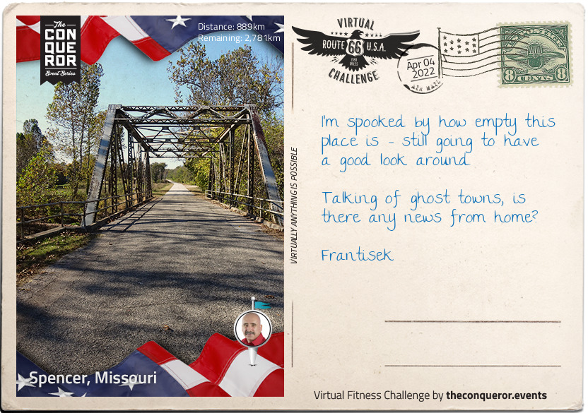
km od začátku : 0889
Spencer, Missouri
Congratulations on making it to Spencer, Missouri Frantisek, an actual real-life ghost town. Although Spencer was never much more than a wide place in the road, it did actually have not just people but a post office in the late 1870s. The local population were nearly all connected with agriculture, and Spencer gained both a church and a general store to cater to them.
However, less than forty years later, the road became unusable, and the town more or less emptied - at least for a while. By the late 1920s, when Route 66 was constructed to pass through the derelict buildings, the town reopened for business, with two shops - one grocery, one dry goods, a barber, a garage, and a Tydol station. The second death of Spencer occurred when Route 66 was bypassed by I-44 and until recently, the whole town was a row of vacant premises left over from the still rather quiet heyday of the 1920s.
In recent years, the site has been purchased by the Ryan family - bought from the Caseys, who first owned the land the 'town' was built on in 1925. The gas station has been restored, and although non-operational, is full of authentic memorabilia of the period it was first constructed, including a vintage police car parked in front. Spencer never required or got its own police station, but it's a nice touch.
Just to prove that vandals really will trash anything, the restored (but closed) barber shop was damaged in 2015, including the theft of its nostalgic red and white pole. They may have caused a few thousand pounds worth of damage, but Spencer will carry on - a lovingly-restored, slightly creepy non-town along historic Route 66.
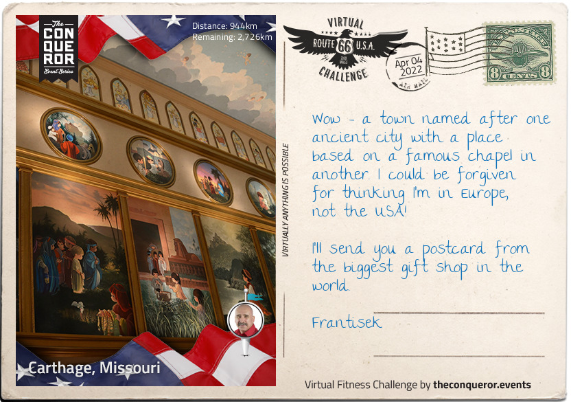
km od začátku : 0944
Carthage, Missouri
Carthage, Missouri is, in many ways, as fascinating as its ancient namesake. Birthplace of senators, suffragists and sportspeople, it's also the birthplace of perhaps the most famous female outlaw of the wild west, Belle Starr, who died in 1889. The wonderfully-named Myra Maybelle Shirley Reed Starr (known to her family as May) was from a reasonably well-to-do family, and even received a private classical education at the higher end of what a girl might expect in the 19th century. Her father, however, had been the black sheep of his own family (who were even more well-to-do) and something of that rebel streak obviously passed down to Belle, who fell in with the notorious James brothers, Frank and Jesse - she had, in fact, known them since childhood, and they grew up together.
Belle's personal style fed the later legend; she was a crack shot, and rode dressed in black velvet and a plumed hat, carrying two holstered pistols on her hips. Having buried her first husband, Jim Reed, Belle married Sam Starr, a Cherokee man and famed bootlegger and horse thief.
Belle Starr's legend extends to her death, two days short of her 41st birthday - shot multiple times, it's unsure whether it was a simple ambush, a lover's tiff, or conspiracy between her third husband (Sam Starr had been killed a few years earlier) and her children. Her daughter, Pearl, became something of a legend in her own right - a Bordello queen, operating several properties until the end of the First World War.
Modern day Carthage boasts the Precious Moments Park and Chapel, inspired by the Sistine Chapel in Rome. The mural artworks throughout the Chapel depict Bible stories, both Old and New Testament, and cover nearly 5000 square feet. The Chapel and Park also boasts the world's largest gift shop - a must for lovers of kitsch memorabilia.
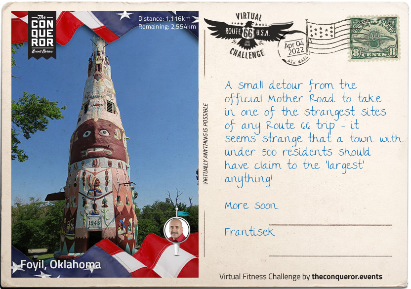
km od začátku : 1116
Foyil, Oklahoma
Foyil, Oklahoma is tiny, Frantisek, absolutely tiny. In the 2000 census, there were only 68 families, 97 households, and 234 people in the town. However, over the next decade, the population grew by almost 50%, reaching a booming 344 - the largest population that Foyil has had since its first US census in 1920.
The area used to be part of the Cherokee Nation, but like much of the rest of the American Midwest, the railway brought a small and thriving settlement of rail worker, and in 1890, a postmaster, Alfred Foyil. The town was built on his farmland, and with the addition of a general store (also owned by Foyil), a chemist, and a furniture shop by 1898, then a bank in 1905, Foyil might have been small (at around 150 residents), but it was perfectly formed. In 1911, it was home to - amongst others - two doctors, two blacksmiths, a lawyer, nine teachers, and even its own newspaper.
Route 66, helped the small town survive, but like many other small communities, boom and recession affected the size of the population. However, in 1937, Foyil started to garner fame as the home of a rather strange and wonderful piece of folk art - the world's largest totem pole. Nathan Edward Galloway's concrete construction wasn't finished until 1948, and although it was hailed as a wonderful monument to the former Native American history of the area, Galloway later stated it was just to give him "something to do" in retirement.
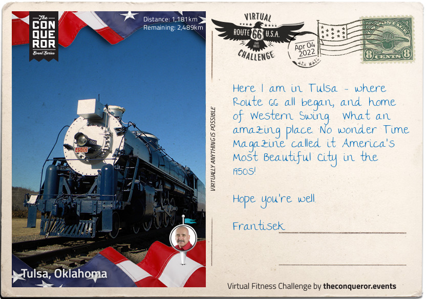
km od začátku : 1181
Tulsa, Oklahoma
Welcome to Tulsa, Oklahoma Frantisek, the very birthplace of Route 66, and home of the one and only Route 66 Village. It takes its name from the name for 'old town' - Tallasi - in the language of the Lochapoka and Creek tribes who officially settled here in 1836, and who were part of the so-called 'Five Civilised Tribes'. Descendants of the Mississippian culture societies, they were largely farming and agricultural communities, and appropriated many aspects of the colonising and displacing pioneers - although the absorption wasn't always peaceful, or welcome.
Oklahoma still wasn't a state by the time of the American Civil War, but that didn't stop Tulsa both seeing its fair share of skirmishes, and later on some of the more notorious outlaws of the Wild West, not least the Wild Bunch, and the Dalton Gang. In the 20th century, oil protected Tulsa from the worst of the Great Depression, and the city's Greenwood neighbourhood was the home of what was termed 'Black Wall Street' - a highly successful and wealthy black community. Horrifying race riots - sparked by an alleged assault on a white 17 year old girl - in 1921 led to the shameful massacre of hundreds of black residents; the neighbourhood was razed to the ground in the space of just a few hours. Those who survived and chose to stay rebuilt Greenwood, and it thrived. The massacre itself was rarely mentioned in history books or classrooms, and not at all in the press.
When Cyrus Avery, a local businessman, had the idea for a Chicago to Los Angeles road in 1925, little did he know that Route 66 would become world-famous. The Route 66 Village in Tulsa is a must-see transportation museum, complete with rail cars and other memorabilia from the early days of the town.
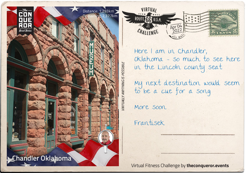
km od začátku : 1293
Chandler, Oklahoma
Welcome to Chandler, Oklahoma Frantisek, county seat of Lincoln, and home to many Route 66 attractions. It didn't have the smoothest of starts, however; due to be 'opened' on 22nd September 1891 as part of a land run - literally a first-come, first-served rush to previous restricted territory, usually previous Native American settlements - Chandler was already 'settled' insofar as there was already a post office and several other official buildings. However, the site survey wasn't in place, so Chandler had its own separate, exclusive run six days later.
The Chandler courthouse seems to have had a run of bad luck too - torn down by a tornado in 1897 (17 town residents died), a stone courthouse eventually replaced it, but this was burned down in December 1967, and rebuilt again. Third time lucky for the courthouse, it's still standing today.
Despite oil discoveries in the surrounding area, Chandler has surprisingly never become a boom town. Additionally, the population has always been relatively small - less than 3000 inhabitants.
The Lincoln County Historical Society and Museum of Pioneer History is full of thought-provoking information about the area, not to mention photographs and mementos of families dating back to before the land rush of 1891. Records of business, people and the general history of the whole county is on display, dating as far back as the Spanish American War in 1898.
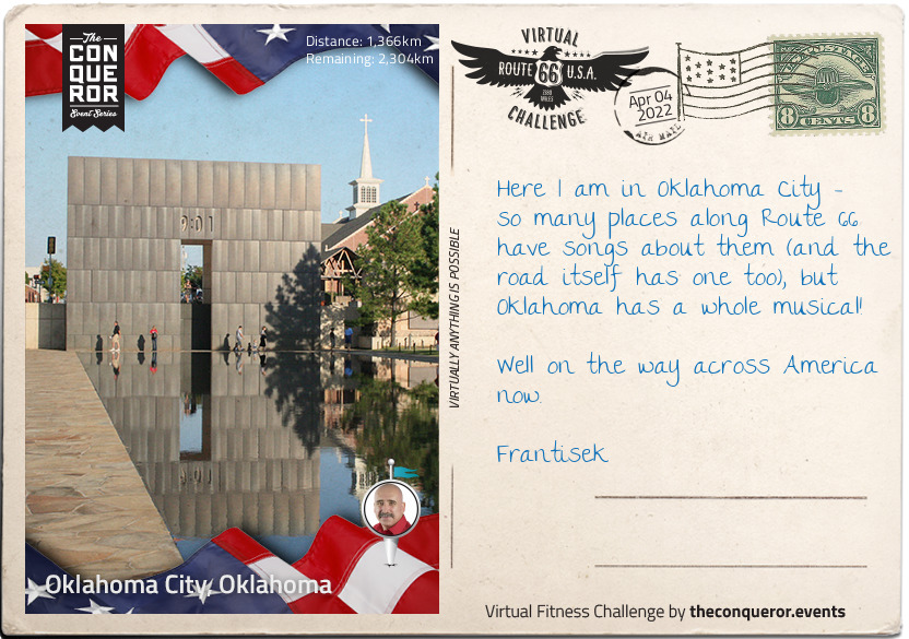
km od začátku : 1366
Oklahoma City, Oklahoma
Oklahoma City was founded in the Land Run of 22nd April 1889, and within a few hours of its official foundation, already had a population of over 10,000 people. Within a decade, the population had doubled, and by the time it was admitted to the Union in 1907, was streets ahead of Guthrie - the territory capital - both as a population centre and a successful industrial and commercial hub.
Oklahoma enjoyed a rich and prosperous reputation, largely due to oil, and also as a centre of federal government. In April 1995, however, the Murrah Building was subjected to the deadliest act of domestic terrorism in American history, and the worst act of terrorism on American soil until September 11th 2001. 168 people died, and over 600 were injured.
Gulf War veteran Timothy McVeigh detonated a truck bomb in front of the building as revenge for the government handling of the Waco siege, which killed 76 people exactly two years earlier. McVeigh was a decorated soldier, and shocked by his orders to execute Iraqi prisoners who were surrendering. On his return from the Gulf, he appears to have become completely disillusioned by government, and even wrote a letter to a local newspaper containing the line "do we have to shed blood to reform the current system?"
By 1995, he was completely radicalised, and turned to violent terrorism. His 168 victims at the Murrah Building included 19 children in a second-floor daycare centre; something which he said would have given him cause to choose another target had he known (although it is widely thought that he did know, and didn't care). McVeigh was convicted, and was executed by lethal injection at 7.14am on 11th June 2001.
Rescue and recovery operations went on at the site for over a week until the ruined building was demolished a month later, and on the fifth anniversary of the bombing in April 2000, the Oklahoma City National Memorial was formally dedicated, commemorating all those affected by the atrocity, including rescuers and family members.
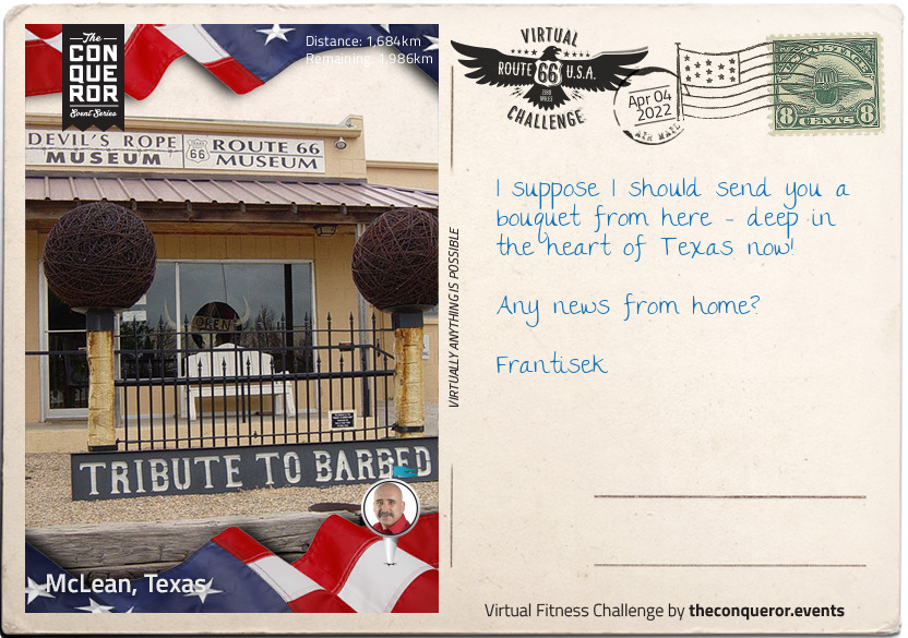
km od začátku : 1684
McLean, Texas
You could be forgiven, Frantisek, for thinking that McLean's day has been and gone. Alfred Rowe, an Englishman who perished on the Titanic in 1912, gave land for a cattle loading stop and town in the area in 1901, and that community grew very rapidly. Three years later, it not only had a newspaper, but a bank, three general stores, wagon yards and stables, and a wood yard. Tourism arrived with Route 66 in 1927, and by 1940, there were six churches and some 59 businesses, not to mention around 1,500 people living there - a number that trebled when a prisoner of war camp was built close to the town in 1945 to house 3000 German prisoners.
It has shrunk somewhat since then, with fewer than 900 people currently living there. It is, however, home to one of the strangest museums on earth - a museum entirely dedicated to barbed wire. Fencing wire in itself might not seem particularly fascinating, but although several patents were issued between 1853 and 1868, only one of them had projections, or 'barbs' - what we recognise as barbed wire was developed by Joseph F. Glidden in 1874, now known as the Father of Barbed Wire. Today, there are more than 2000 types.
The Museum itself was opened in 1991, and took over the premises of a disused bra factory - thankfully those underwires are barb-free. Dedicated to not just the history of barbed wire but to ranching and fencing, the exhibits also include location-relevant artifacts from McLean's Route 66 history.
There's also a gift shop with a different. Whereas other museums sell tea towels and tote bags alongside books and postcards, the Devil's Rope Museum sells, you guessed it, different kinds of barbed wire as a memento of your visit.
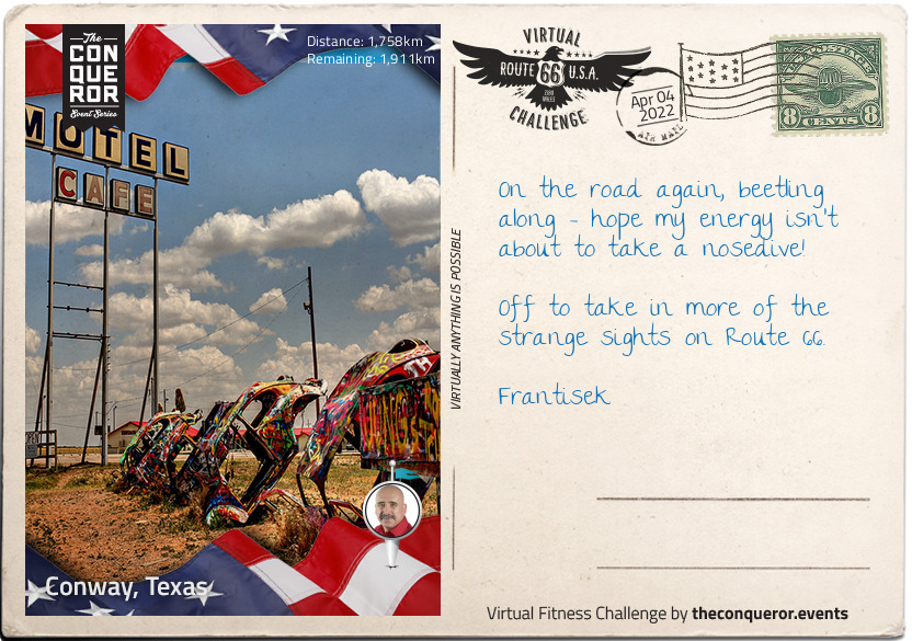
km od začátku : 1758
Conway, Texas
If you're not looking for it, Frantisek, you might miss Conway, what with it only having a population of 20 at the time of the census in 2000. However, it's real panhandle territory, and was more densely populated some 10000 years ago by hunter-gatherers, as evidenced by the stone tools they left behind.
Prior to any European discovery and invasion, those early Native Americans hunted on foot - the Spanish introduced European horses in the 15th century, and were soon completely outstripped in terms of horsemanship. The native population here - as elsewhere along Route 66 - was confined to reservations, and the territory was up for a succession of land runs.
Before Conway was Conway, it had a school, a post office, and a railway. In 1905, it acquired a name, and an increased population - in 1939, there were 125 residents, in spite of hard financial times across the country. However, decline began in the late 1960s; the post office and railway closed, and the I-40 bypassed the town, leading to a population today that you can literally count on your fingers and toes.
That late 1960s decline, however, gave Conway - and Route 66 - one of the strangest sights along the route; burying five Volkswagen Beetles nose-down in the dirt. No-one 'owns' the site as such now, and visitors are encouraged to bring spray paint to leave their own mark behind.
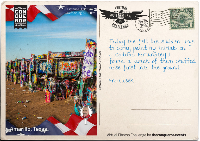
km od začátku : 1819
Amarillo, Texas
By the time the 19th century ended, Amarillo was a cow-town, and not just any cow-town; it was one of the biggest and busiest cattle-points in the world. However, it wasn't cattle that made the town's fortunes. Gas and oil reserves led to the Federal Bureau of Mines operating the Amarillo Helium Plant from 1929, and it remained the only producer of helium for commercial purposes in the world for many years.
Amarillo isn't just famous for producing gas - it also makes its cowboys tough. Thomas Everett Blasingame was born on 12th February 1898 in Ellis County, and decided as a small child that he would work on a ranch when he grew up - he started riding at the age of six. In 1918, he headed to the Texas Panhandle, and began work, not stopping for 73 years; he was still putting in full days on the job at the age of 91. In fact, Tom Blasingame almost died in the saddle; two days after Christmas in 1989, he got off his horse, laid on the grass, folded his arms over his chest, and died - he inspired writer Linda M. Hasselstrom to write her moving poem, 'Death of the Last Cowhand', and with Blasingame, an era ended.
One of Amarillo's other great legends is the Cadillac Ranch, twin to the Bug Ranch in Conway (or rather, the other way around!). Myth has it that an eccentric Amarillo millionaire would bury his cars nose down on his land when he got a new one, but it's actually a great deal more planned than that. The millionaire in question was an eccentric, but he was also something of a visionary; representing the 'golden age' of American motoring, they were junk yard purchases, costing around $200 each.

km od začátku : 1987
Tucumcari, New Mexico
As with many of the other towns and cities we've reached so far, the real founder of Tucumcari, New Mexico was the Chicago, Rock Island and Pacific Railroad, which built a construction camp in what is now the town in 1901. Initially called Ragtown, the camp's reputation for lawlessness quickly earned it the popular name of Six Shooter Siding, with the official name - Douglas - hardly used at all. By 1908, the settlement had settled a little, and with that, took its second and permanent official name; Tucumcari, after a nearby mountain. Although it's not known where the mountain got its name from, it's very similar to the Comanche word for 'ambush'.
The town might be 'run down' according to tourist reviews, but the Dinosaur Museum is something of a hit. Opened to the public in 2000, the Mesalands Community College Dinosaur Museum has around 14,000 visitors each year, from all over the world. The exhibits are a mixture of fossil findings, bronze skeletons, and replica dinosaurs and other animals, with the bronzes made onsite in the College foundry.
Concentrating on the Mesozoic Period - the 'Age of Dinosaurs' - the museum prides itself on its children's activity area, and that most of the exhibits are touchable. Pride of place - and sadly not touchable - is given to the Torvosaurus skeleton, a relative of the Tyrannosaurus Rex. This rare skeleton presented the small museum with a first; they were the only museum in the world which had one on display.
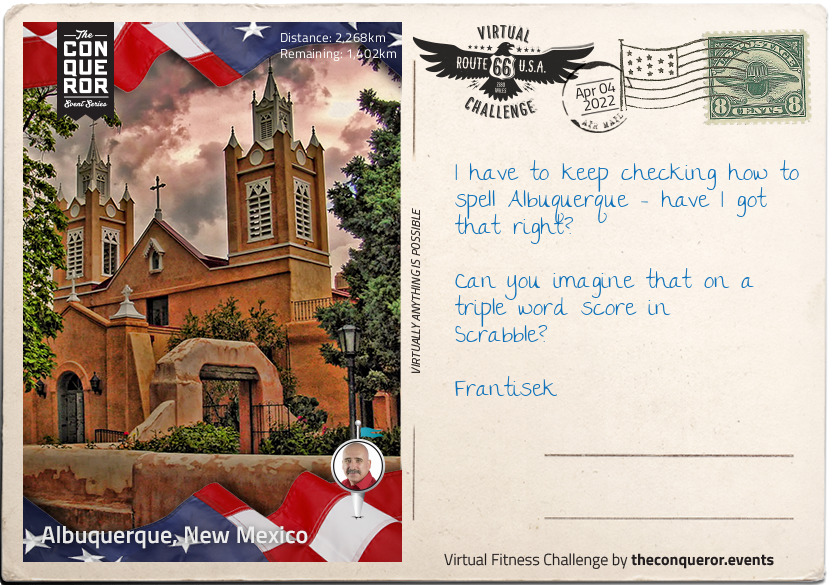
km od začátku : 2268
Albuquerque, New Mexico
The origins of Albuquerque's strange name are as fascinating as its history. You could be forgiven for thinking that it's a Native American place name, or a word that describes some feature of the surrounding landscape. However, it was named after Francisco, Duke of Alburquerque - in one surviving portrait, he had incredible moustache. Alburquerque (with the extra 'r') is close to the Portuguese border in Spain, and was a Moorish colony in the 8th century.
Looking into the meaning of the name, it becomes clear that Latin and Arabic have some similarities - the Latin source would appear to come from albus quercus (white oak), and the Arabic from Abu al-Qurq (father of the oak). The border town in Spain was - and still is - a major player in the Spanish cork industry, with coats of arms depicting a white cork oak.
Albuquerque Old Town doesn't look a great deal different today to when it was built in the 18th century. The town was founded in 1706, and the San Felipe de Neri Church, dating from 1793, is the oldest building in the city. The buildings have a particularly Spanish/Arabic flavour, with flat roofs and covered porches. The Old Town area is still home for many of the descendants of the town founders.
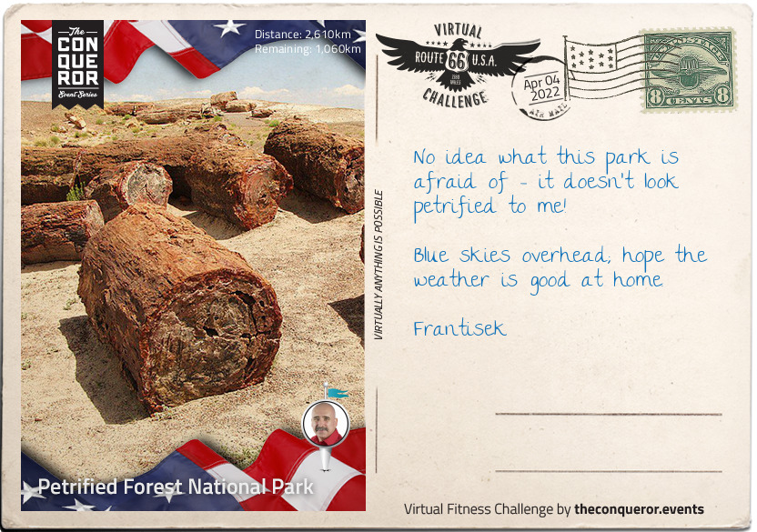
km od začátku : 2610
Petrified Forest National Park
Welcome to the Petrified Forest National Park, Arizona, Frantisek, 230 square miles of desert and Badlands. There's so much to see here over such a wide area that it's probably a trip in its own right. The park has over three-quarters of a million visitors every year, with a good few hiking and backpacking over the course of a few days.
The part itself was declared a national monument in 1906, and Route 66 goes right through it, guaranteeing that casual sightseeing can be done from the comfort of an air-conditioned car! Made a national park in 1962, it's not just notable for the landscape; around 400 species of plants can be found across the park, and in addition to other animals, birdwatchers will be keen to spot over 200 separate species, some migratory, some permanent residents.
But onto the petrified bit - the park is particularly noted for its fossils, not least the fallen trees that give it its name, and which grew during the late Triassic Period, some 225 million years ago. Animal fossils include giant phytosaurs (an extinct group of semi-aquatic reptiles), and a probable sister evolutionary group of the branch from which both birds and crocodiles descend, and also early dinosaurs.
Human habitation came somewhat later, with evidence of tribal groups dating back around 8000 years, and farming culture from around 2000 years ago.
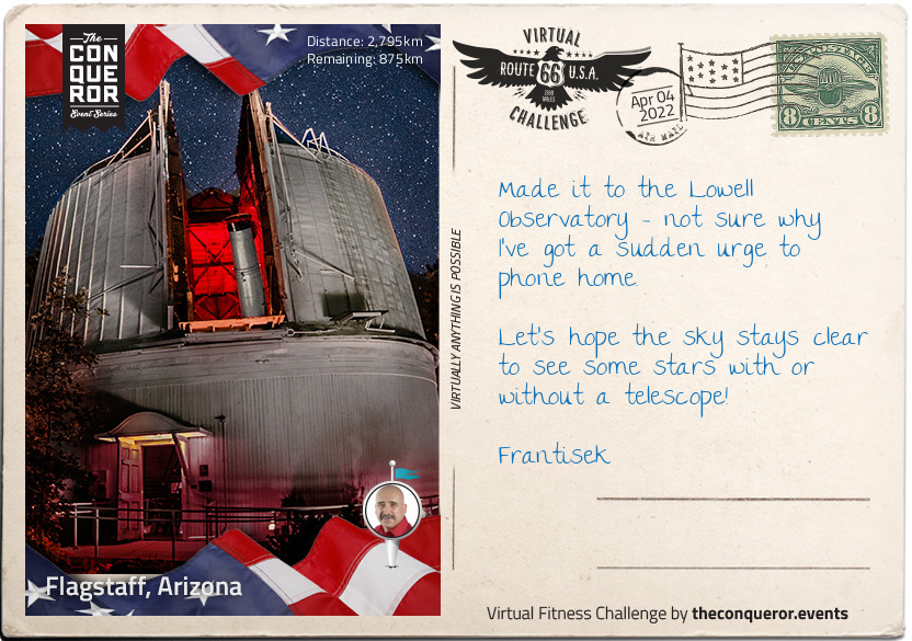
km od začátku : 2795
Flagstaff, Arizona
Flagstaff, Arizona and the Lowell Observatory are a perfect match - as the scout for an observatory site stated in the 1890s when tasked with looking for a suitable place "other things being equal, the higher we can get, the better".
Established in 1894, Frantisek the Lowell Observatory is one of the oldest in the United States, and worthy of being designated one of "The World's 100 Most Important Places" by TIME magazine in 2011. The Observatory's major claim to fame is for the discovery of Pluto by Clyde Tombaugh in 1930.
Tombaugh had an unusual path to astronomy; part of a farming family, his college plans had to be put aside when a storm ruined the farm's crops. He started to build his own telescopes at the age of 20, in 1926, testing them by digging himself caves to keep the air temperature constant - this also doubled neatly for family use as a cellar and emergency shelter. He sent his detailed drawings of Jupiter and Mars to the Lowell Observatory, who decided to offer him a job in 1929. The young researcher was given the job of looking for Planet X - predicted by research by Percival Lowell and William Pickering - and conclusively proved on 18th February 1930.
Tombaugh was also keenly-interested in the possibility of UFOs. In the mid-1950s, he went on record as saying there had been three objects over the past seven years for which he could find no scientific explanation, and thought that other reputable sources were being "unscientific" in refusing to believe the possibility that aliens might exist.
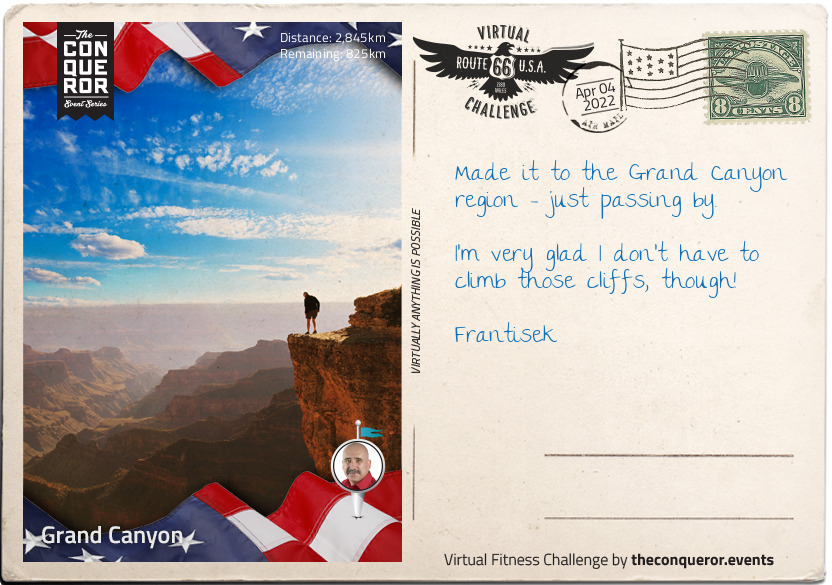
km od začátku : 2845
Grand Canyon
The site of the Grand Canyon is so overwhelming that it is no surprise that the Pueblo Native American population used to view it as a holy site, and to make pilgrimages there. The valley itself displays around two billion years of geology in the exposed rock walls of the canyon, with the site itself thought to have its origins around 17 million years ago, although there are several credible scientific arguments that it is anything between six and 70 million years old.
In terms of human occupation, there is some debate as to when a distinct group with their own culture emerged, but there is considerable evidence to suggest that the ancient Puebloan people referred to as the Anasazi ('Ancient Ones' in Navajo) who lived there around 3200 years ago are the ancestors of today's modern Pueblo-identifying population.
By the time the Europeans arrived in the mid 16th century, there was a complex society of many different tribes, co-existing and frequently intermarrying. The Spanish didn't have it easy in 1540 - it's likely that their Hopi guides could have found them an easy route to the canyon floor, but the apparent difficulty meant that no European bothered with the canyon again for over 200 years.
The Grand Canyon is a US National Monument, and has Theodore Roosevelt - a conservationist as well as President - to thank for it. After a 1903 visit, he established a game preserve, and also eradicated natural predators. Land claim holders, mining prospectors, and other opponents tried to get his best efforts blocked, but the Grand Canyon was eventually established as the 17th US National Park by Woodrow Wilson in 1919.
It doesn't get any easier for conservationists; recent concerns include the leaching of uranium into the water supply should mining recommence in the area - it has been suspended since 2009. The case rumbles on through the courts.
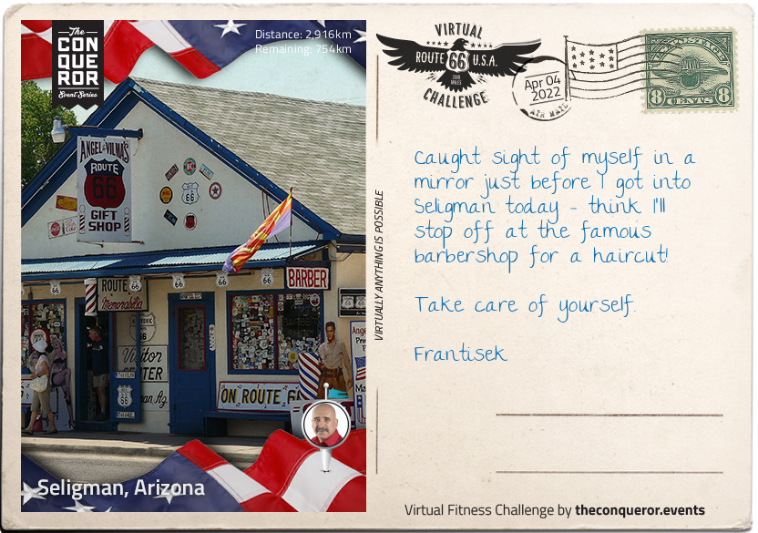
km od začátku : 2916
Seligman, Arizona
You are doing an amazing job, Frantisek - here we are at Seligman, Arizona home to fewer than 500 people, and popular stopping point for Route 66 travellers. This area was historically the home of the Yuman-speaking Havasupai Native American people, who have been settled in the area for almost a thousand years. Formerly surviving through agriculture and hunter-gatherer culture, tourism is their modern day main source of revenue as Supai, their major city in the Havasupai Reservation, has around 20000 visitors a year, despite having the reputation as being one of the most remote cities in the United States, ultimately reachable only by hike, horse, or helicopter.
It is often said that Seligman wouldn't exist without Route 66, and Route 66 wouldn't exist without Seligman, or at least, famous resident Angel Delgadillo. Of an age with the route itself - he was born in 1927 when the roads that formed Route 66 were first being connected up - Angel followed the family trade, and became a barber just like his father, Angel Delgadillo Sr. In 1972, Angel moved his barber shop from its previous location so that he could take advantage of the slightly adjusted route of Route 66, which now went through Seligman - everything went with him; his father's 1926 barber chair, and three pool tables. With close to 10000 cars passing through every day, trade was brisk for Angel and the rest of Seligman's businesses.
Until 1978. On September 22nd, the cars disappeared. The new Interstate 40 had opened two miles to the south, and as Angel puts it "the world forgot about us". Angel and his brother discovered that the only signage which even mentioned Seligman was 16 miles away, and campaigned for another four more useful mentions, but it still wasn't enough.
Not to be beaten, Angel tapped into the one thing that most Route 66 travellers are interested in - nostalgia. Seligman took the bait, and is now known as "The Birthplace of Historic Route 66".
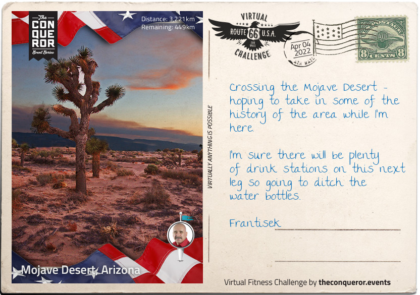
km od začátku : 3221
Mojave Desert, Arizona
For over a hundred years, the name Mojave (and its alternate spelling, Mohave) has been used to describe 'the people who live along the water' - the Native American tribe who lived there, and whose descendants still live there.
The driest desert in the United States, the Mojave boundaries are marked by Joshua trees, which are only native to this area, and also by other desert areas, and both the San Gabriel and San Bernardino mountain ranges; both of this are on fault lines, notably the San Andreas fault.
Desert implies a certain lack of population, but the Mojave has urbanised areas, notably Las Vegas, with a population of over two million, and the 29th most populated city in the United States. Founded as a city in 1905, it didn't take long for Las Vegas to acquire its first casinos, and a prime place to live if you needed a quickie divorce. The 1950s also brought nuclear testing, with residents and visitors able to watch the mushroom clouds - and experience the fallout - from testing in the Nevada Desert some 65 miles away.
Known for shopping, gambling, and nightlife, Las Vegas bills itself as 'The Entertainment Capital of the World'. However, before Tom Jones and Elvis headlined at The International, nomadic tribes left their mark on the area around 10000 years ago.
Not so long to go now Frantisek - the end is in sight!
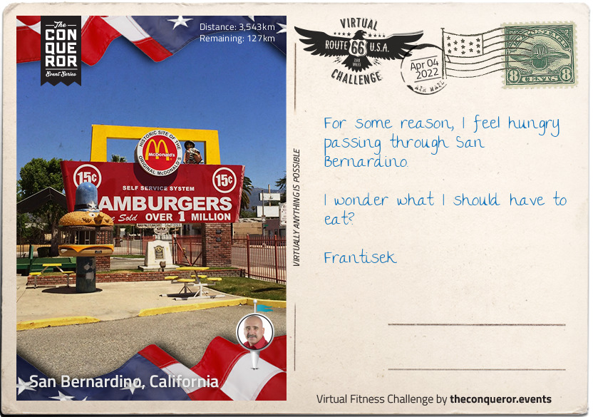
km od začátku : 3543
San Bernardino, California
Home of California State University, San Bernardino is home to many cultural and artistic sites. And also to the McDonald's Museum.
One of the oldest cities in California, San Bernardino was settled in 1810, but didn't really establish itself for another 40 years when it became an important trading hub. It continued to be a busy and thriving community, including the establishment of Norton Air Force Base in the Second World War. And also a restaurant called McDonald's.
You can't get away from mentioning McDonald's when talking about San Bernardino, as the two have become inextricably linked in each other's histories. Dick and Mac McDonald were brothers and fast food pioneers; their first stab at success had been a hot dog stand in Pasadena in 1937 (not a hamburger in sight), but when the opportunity came to open a restaurant in San Bernardino in 1940, they closed the hot dog stand and jumped at the chance. It's no longer a McDonald's, but it does now serve as the company museum.
McDonald's was a hit. So much so that within 13 years, they began franchising their restaurant - or at least the system; franchising the entire concept, including the famous golden arches, came later. The brothers were still thinking small in terms of global domination, however, and it wasn't until partnering with Ray Kroc, who turned their ideas into what became the McDonald's Corporation - he purchased the company from the brothers for $2.7 million in 1961.
In 1984, the 50 billionth McDonald's hamburger was served - to Dick McDonald, the first cook behind any McDonald's grill.
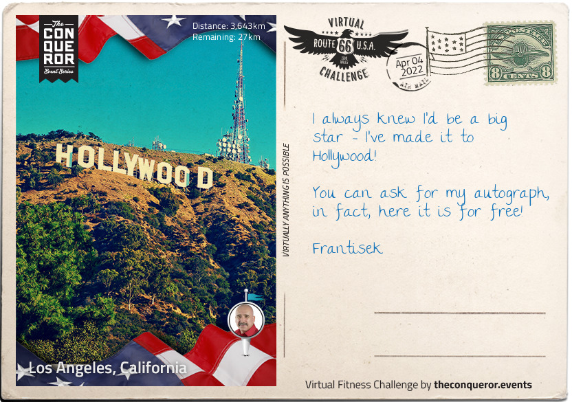
km od začátku : 3643
Los Angeles, California
Your last stop before your last stop, Frantisek - you've made it almost all the way across Route 66!
Los Angeles, California is the second largest urban area in the U.S. It extends more than 40mi from the mountains to the sea.
The Spanish explorer Gaspar de Portolá visited the site in 1769. On Sept. 4, 1781, the Mexican provincial governor, Filipe de Neve, founded "El Pueblo de Nuestra Señora la Reina de Los Angeles," meaning "The Village of Our Lady, the Queen of the Angels." The pueblo became the capital of the Mexican province, Alta California, and it was the last place to surrender to the United States at the time of the American occupation in 1847. By the Treaty of Guadalupe Hidalgo in 1848, Mexico ceded California to the United States, and Los Angeles was incorporated as a city in 1850.
Los Angeles is a major hub of shipping, manufacturing, industry, and finance, and is world-renowned in the entertainment and communications fields
In the Santa Monica mountains is perhaps the most famous American monument this side of the Empire State Building and the Statue of Liberty - the Hollywood Sign. Erected in 1923 as a real estate advertisement - then left behind - it eventually became synonymous with the blossoming film industry, and a symbol of aspiration to budding hopefuls. It was also connected with tragedy - Peg Entwistle was a Welsh-born actress whose stage career in her adopted America drew considerable acclaim; she even drew a 17 year old Bette Davis to tell her mother "I want to be exactly like Peg Entwistle". Nobody knows precisely what caused Peg to jump to her death from the H of the sign - her career was going well, and her final jobs were a film with Myrna Loy and Irene Dunn, and a play opposite Humphrey Bogart - but on 18th September 1932, her body was found in a ravine below the sign. She was only 24 years old.
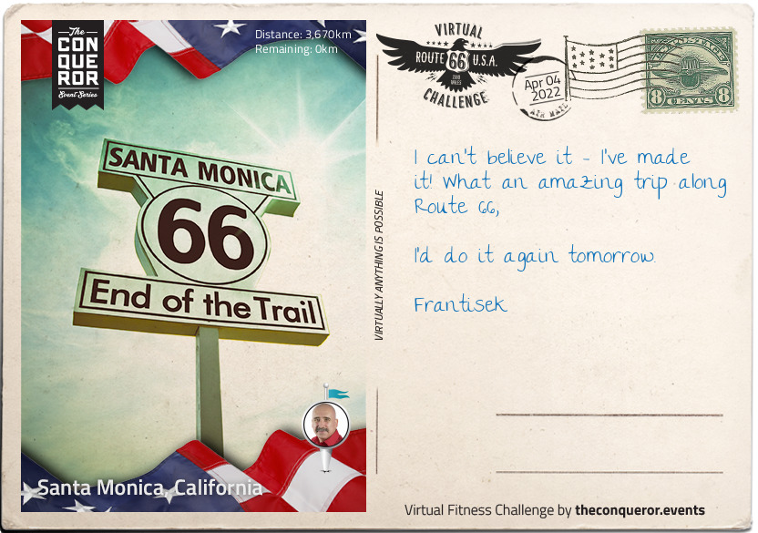
km od začátku : 3670
Santa Monica, California
Congratulations Frantisek, you're here at Santa Monica Pier, and officially at the end of Route 66.
The pier is actually two piers, both over a hundred years old, which originally had separate owners. The narrower Municipal Pier had a less appealing function, which was to carry sewage beyond the breakers. The Pleasure Pier, built seven years later in 1916 originally housed a theatre, and is now the site of the carousel - built in 1922, the carousel was restored in 1990 and placed inside the former theatre building.
The first heyday of the pier was during the 1920s, but like much else during the Great Depression, spending on non-essentials suffered greatly, and the pier was mainly used as a ferry port with many of the amusements sold off. The 1940s brought country music star Spade Cooley's television show, broadcast from the pier ballroom, and during the 1950s, the ballroom served as a roller skating rink.
Storms, recessions, strange redevelopment ideas, and other peaks and troughs of the popularity of pier-style entertainment have all beset Santa Monica Pier since it was built, but still it stands - a feature of television and film, and the official end of Route 66; it's a long way back to Sears Tower!
From the team and My Virtual Mission - Congratulations, you've done it!
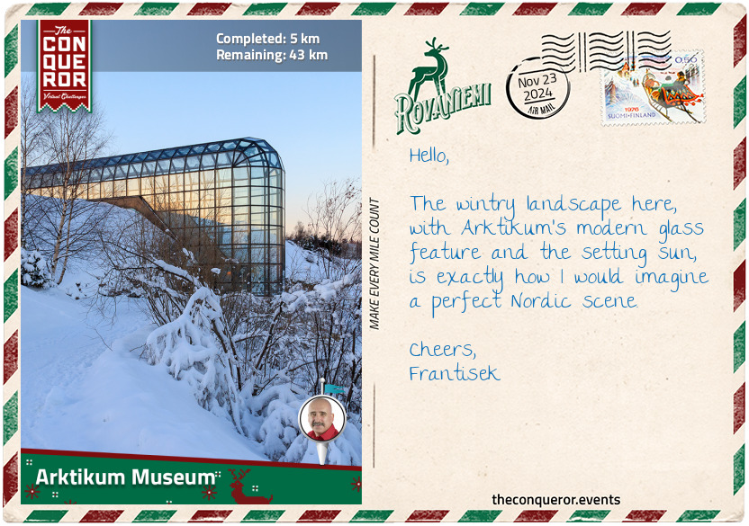
km od začátku : 0005
Artikum Museum
When I think of Rovaniemi, Santa Claus's hometown naturally comes to mind. However, there's much more to this small city. As the capital of Finnish Lapland, Rovaniemi serves as a gateway to the Arctic's expansive wilderness, where endless forests, lakes, and snow-covered fells are perfect for rugged exploration under the midnight sun.
Before World War II, Rovaniemi was a remote market town and trading hub. It had a small population and was surrounded by vast boreal forests, also known as taiga. These forests, typical of the Arctic region, are made up of conifers and patches of birch and aspen in areas with more sunlight, where wildlife like reindeer, moose, wolves, and brown bears make their home. During this time, the settlement relied on fur trading, fishing, and timber floating. While isolated, Rovaniemi was at the confluence of the Kemijoki and Ounasjoki rivers, making it an important stop for those traveling into northern Finland.
As World War II neared its end, Rovaniemi was razed. With the vision of Finnish architect Alvar Aalto, the city was rebuilt with an interesting town plan. Understanding the reindeer's importance to Lapland's culture and livelihood, he designed the city in the shape of a reindeer's head and the main roads resembling the antlers, giving rise to the nickname "Antler City". While not every detail was implemented, the city's layout still reflects his vision, and a simple observation on Google Maps reveals the resemblance, especially with the roads branching out like antlers leading into the Arctic landscape.
One of Rovaniemi's most striking buildings is the Arktikum Museum and Science Centre. Located next to the highway, the museum is hard to miss with its long glass corridor stretching toward the Ounasjoki River. This corridor resembles a 'northern frozen finger' pointing toward the Arctic, symbolising a connection to the northern, frozen landscapes. Its glass design mirrors the Arctic environment, allowing natural light to fill the space with its transparent structure, especially during the dark winters. Inside, the museum offers exhibitions on life in the harsh conditions of the Arctic, with displays on wildlife, the northern lights, and climate change.
The museum also highlights the Sámi culture, the indigenous people of the Arctic region. Known for their nomadic lifestyle, they rely on reindeer herding for food and clothing, moving with the seasons to ensure their herds have the best grazing. Their deep connection with the land is evident in their traditional lifestyles, knowledge of sustainable land use, and spiritual beliefs intertwined with nature. For the Sámi, the land is not just a place to live but a source of identity and life, with their cultural practices and rituals reflecting their respect for the Arctic environment.
A well-known traditional meal of the Sámi people is poronkäristys, a reindeer stew. The meat is sliced thinly, fried in fat, and spiced with pepper and salt, usually served with lingonberries and mashed potatoes. It is an important and hearty dish in the northern region because the meat is rich in protein and essential nutrients, crucial for sustaining energy in the harsh Arctic climate.
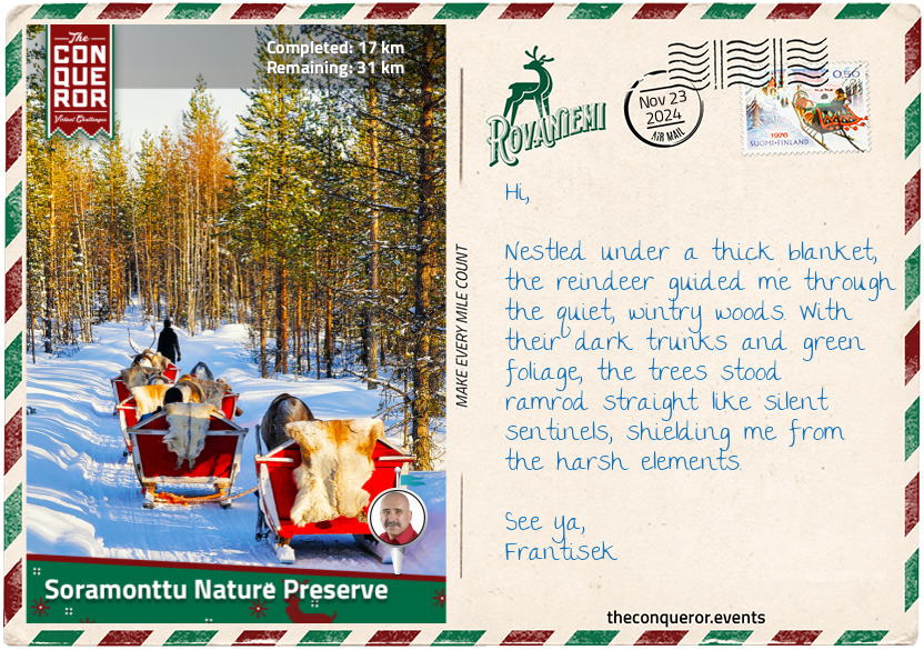
km od začátku : 0017
Soramonttu Nature Preserve
Leaving the Arktikum, I set off on a fantastic snowmobile journey on the Ounasjoki. As one of the longest rivers in Finnish Lapland, the Ounasjoki stretches about 186mi (300km) and is the largest tributary of Finland's longest river, the Kemijoki.
Finland is well known for its fishing opportunities, boasting a staggering 188,000 lakes and countless rivers and streams. Ounasjoki is one of the best spots for cold-water fishing, particularly salmon, trout, pike and perch. In winter, however, ice fishing takes centre stage. As the river freezes, anglers drill a hole through the thick ice, drop a line into the cold, clear water, and then patiently wait for a bite.
Riding a snowmobile on the frozen river covered in snow is a thrilling experience. The vast expanse of whiteness stretches for miles, bordered by snow-clad forests and the occasional house. It's hard to tell where the river ends and the land begins, but the sight is breathtaking against the clear blue sky. Rugged up in warm winter gear, I can still feel the chill as I rev the engine, the snowmobile gliding effortlessly across the thick ice, leaving crisp patterns in the snow. As I speed along the frozen expanse, the cold wind rushes past, biting at my cheeks and filling my lungs with crisp Arctic air. The frosty mist rises around me, enhancing the thrill of feeling both the machine's power and the quiet stillness of the frozen world.
After an adrenaline-filled ride along the frozen river, I headed into the forest for a more peaceful adventure. The Soramonttu Nature Preserve was my next stop. In summer, Soramonttu is a sandy pit used for motocross sports, its terrain offering a challenging environment for riders. But in winter, the motorbikes are stored away, and the area transforms into a haven for snowmobiling, cross-country skiing, and snowshoeing.
I, however, chose to swap the roar of the snowmobile for the gentle rhythm of a reindeer sleigh ride through the dense forest. The soft crunch of hooves on snow was the only sound, adding to the magical atmosphere as I glided deeper into the woods.
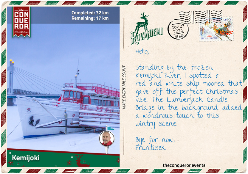
km od začátku : 0032
Kemijoki
Finishing my peaceful sleigh ride, I headed back into the city, navigating through suburban streets past quaint wooden cottages, eventually reaching downtown Rovaniemi.
As I arrived, I was greeted by a mix of modern and traditional architecture. The work of architect Alvar Aalto is particularly notable here, including the Rovaniemi City Hall, which was completed posthumously by his wife, as well as the city library, and Lappia House, the city's conference centre. These buildings feature a minimalistic style with organic yet angular shapes, such as those of Lappia House, using materials that resonate with the natural environment and complement the region's rugged landscape.
Another interesting spot is Lordi Square, named after the Eurovision-winning metal band. Lordi, hailing from Rovaniemi, made history in 2006 by winning the Eurovision Song Contest with their song "Hard Rock Hallelujah". Formed in 1992, Lordi is known for their hard rock and heavy metal music, complete with pyrotechnics and horror elements. What really sets them apart is their incredible stage look, featuring monster costumes, elaborate makeup, and towering platform shoes. Naming the square after them is a nod to their big win, local pride, and their impact on Finnish culture.
Leaving Lordi Square, I crossed the Ounaskoski Bridge over the Kemijoki. This two-storey bridge was originally built in 1934 but destroyed during WW2. The new bridge, opened in 1951, supports railway traffic on the top section, while the lower one is for cars and pedestrians.
Looking north from the bridge, I could see the Lumberjack Candle Bridge. This cable-stayed landmark opened in 1989 and won a Civil Engineering Prize for its innovative design. Inspired by the Finnish 'lumberjack candle'—a traditional outdoor fire made by sawing dry pine logs into four parts and lighting them—the bridge features red lights atop its pillars that resemble burning candles.
As I admired the bridge, my gaze naturally turned towards the Kemijoki or Kemi River. As Finland's longest river, the Kemijoki flows south for 340mi (550km), emptying in the Gulf of Bothnia. The river has been impacted by hydroelectric dams, starting with the Isohaara power plant built in 1949 and followed by 20 others, depleting the once-abundant salmon stocks. Despite efforts to release young salmon into the river, the numbers have not yet recovered. However, projects like the fishway at Isohaara give hope that salmon migration could improve.
After a day exploring in the cold, I decided to warm up with a bowl of lohikeitto, a creamy salmon soup that was both comforting and delicious. To finish the meal, I treated myself to a slice of raparperipiirakka, a delightful rhubarb pie that added a sweet note to the end of a satisfying day.
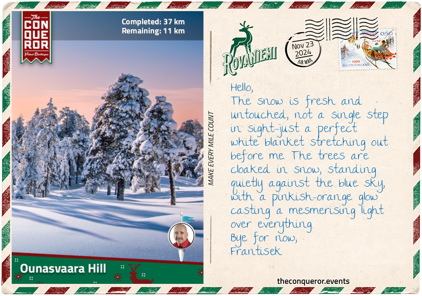
km od začátku : 0037
Ounasvaara Hill
Ounasvaara, a notable hill a short distance from downtown Rovaniemi, is pretty much a winter paradise when the snow starts falling. While summer has its own charm with hiking and biking, winter turns this hill into a skiing and snowboarding haven.
As I strapped on my skis and hit the slopes, I couldn't help but think about the local legends—Olympic skier Tanja Poutiainen and World Champion snowboarder Antti Autti. Both grew up in Rovaniemi and trained right here, shaping their incredible careers. It's pretty cool to know I'm gliding down the same snow that played a part in their success.
Standing still on the summit, I admired the snowy landscape below, the snow-covered Kemi River shimmering in the crisp, sunlit air. The scene was invigorating. I pushed off, feeling the exhilarating rush of freedom as I sped downhill. The wind whipped through my hair as I effortlessly took each turn. The only sound was the gentle swish of my skis gliding through the snow. It felt like a dance, almost like a waltz—smooth and graceful, with a seamless shift from one leg to the next. My knees were slightly bent, quads and hamstrings engaged to help maintain balance. There were no thoughts or worries, just the controlled speed and the pure thrill of the ride.
With ten ski runs to choose from, the longest one stretches about a third of a mile (600m). Given that it's a hill rather than a mountain, I didn't expect the runs to be particularly long. However, they still offered opportunities to practice speed and carving techniques. I could feel the difference as I pushed harder. As I leaned into tighter turns, I felt my skis digging into the snow more deeply, making each turn sharper and more precise. My body had to adjust, lowering my centre of gravity to stay balanced. With each turn, my legs and core worked hard to keep me steady and in control, making handling the speed and the curves easier. The exhilaration of skiing became more playful as I navigated small moguls. These little snow bumps required quick reflexes and sharp skills.
Wrapping up the day on the slopes, I stopped at a restaurant at the bottom of the hill to warm up with a hot cup of stone-ground, organic chocolate drink. I could taste the slightly gritty texture from the stone-grinding process, a method that keeps the cacao's intense flavour. Every sip was pure heaven—deep, rich, and creamy.
While savoring my hot chocolate, I contemplated another day on Ounasvaara, but this time, I'd rent a fatbike—an off-road bike with oversized tyres made for riding on soft, unstable terrain like snow. I imagined hitting the snowy singletracks on the hilltop, ready for a new kind of adventure.
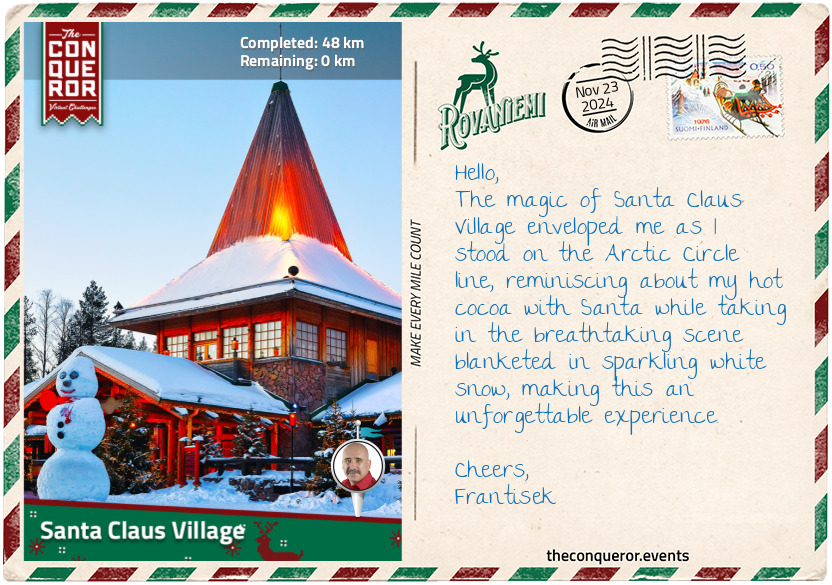
km od začátku : 0048
Santa Claus Village
Ounasvaara was a wonderful, active playground, but my final destination was the famous Santa Claus Village. The village exudes a rustic charm with its Nordic log cabin style, featuring exposed wooden beams, stonework, and steeply pitched roofs. The village began with a unique connection to Eleanor Roosevelt, the former First Lady of the United States.
In 1950, while on a goodwill mission, Eleanor Roosevelt visited Rovaniemi, drawing attention to this remote corner of Finland. During this visit, a small log cabin was built in her honour. Known as the "Eleanor Roosevelt Cabin", it marked the start of a magical transformation.
Legend has it that Santa, intrigued by the growing allure of the village, took notice. As word of Eleanor's visit and the quaint log cabin spread, the magical whispers reached Santa's ears. According to folklore, Santa visited the village one winter night, guided by the twinkling lights of the cabin and the warm glow of the village's first Christmas decorations. Seeing the pristine Arctic beauty, Santa decided it was the perfect place to call home. The cabin became a symbol of his presence, and Santa Claus Village grew around it, blending tradition with myth.
Caught up in the festive excitement, I headed to the Santa Claus Main Post Office, where more than half a million letters from over 200 countries arrive each year. With their exceptional speed and abilities, the Postal Elves have read over 20 million wishes, becoming true keepers of holiday magic. I wrote postcards to family and friends, and the elves stamped each one with a special Arctic Circle postmark before dropping them into a red postbox. This box, a magical vault, holds the letters until they are sent out for Christmas.
Next, I visited Santa's office. The cozy log cabin, adorned with twinkling lights and festive decor, was just as I had imagined. Inside, Santa greeted me with a warm smile and a twinkle in his eye. We took a photo together to commemorate the moment, exchanged pleasantries and holiday wishes, and enjoyed a cozy cup of hot cocoa.
Returning to the village centre, where the Arctic Circle runs through it, was the perfect end to my Rovaniemi journey. This boundary marks the northernmost point where the sun does not set during the summer or rise during the winter. The painted white line is marked with festive columns, and, like a child, I stepped back and forth, experiencing the chill of the Arctic air and the warmth of the holiday cheer all at once. I felt as if I was stepping between the known world and the wondrous realm of Santa Claus.
Farewell for now, and see you on the next adventure.
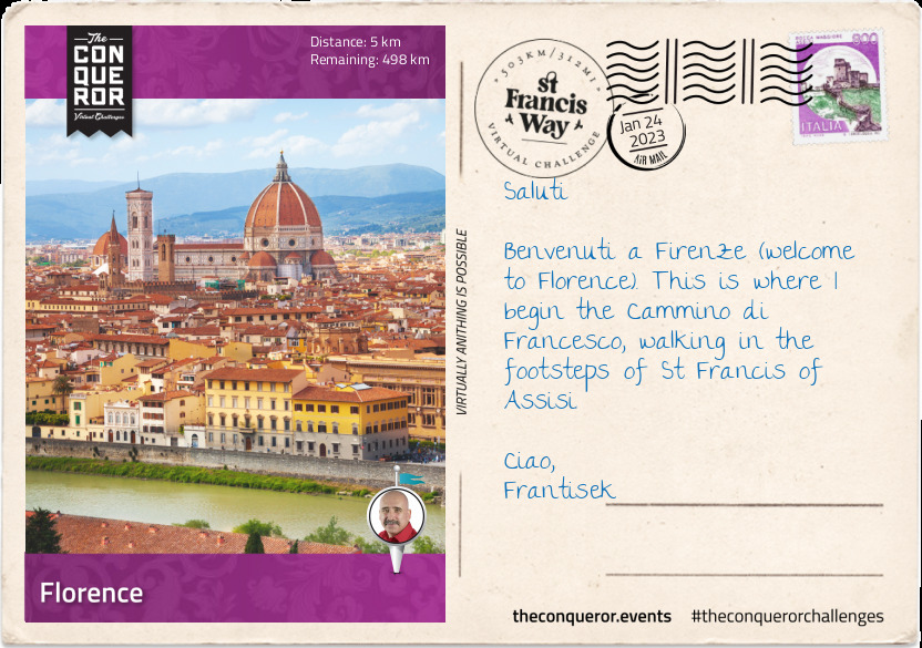
km od začátku : 0005
Florence
The romantic city of Florence is a visual feast of Renaissance architecture, art and monuments. Famous historical figures from the Renaissance era (14th-17thC) such as Da Vinci, Michelangelo, Galileo and Donatello, emerged from Florence producing and leaving an incredible body of work that continues to move and inspire people today. Museums, galleries, cafes and restaurants are in every nook and cranny. And then, there's the food; gloriously filling, tastebud dazzling, tantalisingly aromatic. Every corner is an architectural experience from Corinthian columns, grand domes and endless arches to interiors adorned with richly-detailed frescoes and motifs.
Filled with 2,000+ years of history, Florence began as a settlement in 59BC, established by Julius Caesar, the Roman Emperor for his veteran soldiers. It quickly became a commercial centre and a major crossroad between Bologna and Rome. Florence is currently the capital city of Tuscany with the highest population density in the region. In 1982 it was added to the UNESCO World Heritage list.
The most iconic building is the cathedral Santa Maria del Fiore, otherwise known as the Duomo. Built between 1296-1436 in a Gothic style it towers over the city with its terracotta-tile dome visible from all of the nearby hilltops. The Piazzale Michelangelo across the river from the cathedral provides a magnificent view of the city of Florence and the Duomo.
A stroll alongside the River Arno leads to the very popular Ponte Vecchio, translated as "Old Bridge". The bridge is a medieval arched bridge built in 1345 and at one time housed shops run by butchers, tanners and farmers. Now it is tenanted primarily by jewellers, art dealers and souvenir sellers. During WWII, at the behest of German officer, Gerhard Wolf, the bridge was spared destruction unlike the neighbouring bridges which were detonated in order to buy more time for the German retreat. Wolf was once a student in Florence and had a special affinity towards the bridge. The Florentine's made him an honorary citizen in 1955 and placed a plaque on the bridge in his honour in 2007.
Some notable artworks that can be found in Florence are Michelangelo's sculpture of "David", a marble sculpture completed early 16thC; Leonardo da Vinci's oil and tempera painting "Anunciation" dating late 15thC; and Boticelli's tempera painting "The Birth of Venus" dating late 15thC. There is no shortage of paintings, sculptures, fountains or architecture to immerse oneself in but when rest is needed head for the nearest coffee bar and ask for a café macchiato. Italians traditionally stand at a bar to have their shot of coffee instead of sitting at a table before pressing on with their day.
The Way of St Francis pilgrimage begins at the Basilica di Santa Croce, a 13thC Franciscan church located in the Piazza Santa Croce. The church is the burial site for Galileo (astronomer), Machiavelli (politician and diplomat) and Rossini (composer) and many other notable Italians. Dante was originally buried here but was later moved. His tomb, however, remains on site. A memorial plaque for Da Vinci (polymath) and memorial monument for Florence Nightingale (pioneer of modern nursing) can also be found here. Outside the church is a monument to classical writer, Dante Alighieri, built in 1865 by Enrico Pazzi.
The pilgrimage trail is 312mi (550km) long and inspired by the life of St Francis of Assisi. Taking an ancient Roman route from Florence to Rome via Assisi, the trail finishes at Basilica di San Pietro in the Vatican City. The route travels past ancient ruins, through medieval villages, crossing mountain passes and valleys, making this pilgrimage perfect for nature lovers, history buffs and outdoor enthusiasts.
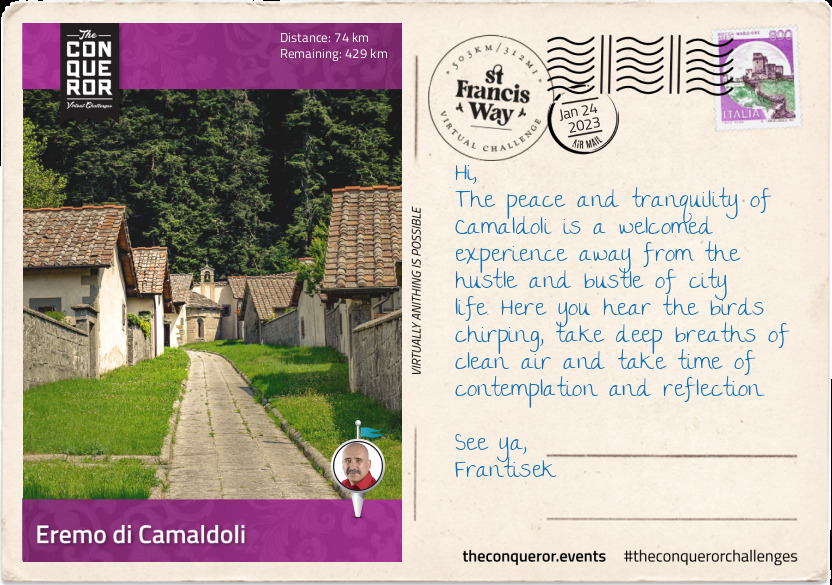
km od začátku : 0074
Eremo di Camaldoli
Leaving Florence through the San Gallo Gate, the trail veered east over gentle hills, past the small hamlet of Compiobbi, along the river bank of Arno River to Pontassieve. This ancient walled commune was originally named Castel Sant'Angelo later changing it to be named after the 16thC bridge over the Sieve River. Pontassieve suffered severely during WWII, as the Allies heavily bombed the village, destroying it almost entirely. The current appearance is largely a result of post-war reconstruction, although it continues to maintain a medieval look in the city centre.
From Pontassieve I climbed through Chianti vineyards up to the village of Diacceto. The Chianti recipe was first created in the middle of the 19thC by Baron Bettino Ricasoli when he combined Sangiovese grapes with Canaiolo and Malvasia bianca grapes. Historically the wine was closely associated with a squat bottle enclosed in a straw basket but has since shifted to regular bottling.
Heading into the mountains, I hiked uphill through the small villages of Ferrano and Consuma, reaching the first mountain pass called Passo Della Consuma at an elevation of 3,445ft (1,050m). I weaved my way around the mountain at this altitude until I reached the village of Campolombardo where I began my descent into the pretty village of Stia (1,476ft/450m). In the 19thC woolen fabric was produced in Stia to clothe monks and nuns in the area at first and later the wealthy families of Tuscany. The largest wool mill was built in 1838 and employed 500+ people. The factory produced 2.3 million feet (700,000m) of cloth per year until it ceased production in the 1990s. In 2010 it was opened as a museum of wool production.
I took this opportunity to have lunch at a local restaurant indulging my senses with crepes filled with melted pecorino and leeks as an appetizer followed by spaghetti alla chittara topped with scallops and zucchini and washing it down with a glass of chianti.
Refreshed and a full belly, I gently began my ascent to Sacro Eremo Di Camaldoli (3,937ft/1,200m), a monastery and hermitage surrounded by dense fir forests in the heart of the Camaldoli National Park.
Camaldoli is a community of Benedictine monks that was founded by San Romualdo, a 10thC nobleman turned monk. San Romualdo was born into aristocracy and lived an indulgent life until he witnessed his father kill a relative over property. Devastated he did 40 days of penance and continuing to struggling with the situation decided to become a monk and live in seclusion spending the next ten years studying monasticism. With his new found knowledge he spent the next 30 years travelling through Italy building monasteries and hermitages such as the Camaldoli.
The Camaldoli is made of two houses, the Sacred Hermitage and the Monastery. They "represent two fundamental dimensions of the monastic experience, solitude and communion". Where the hermitage is a place of solitude, silence, prayer and work; the monastery is a place of fraternal life and community. The monastery welcomes visitors to share in their faith through hospitality. The monastery also has a guesthouse called Foresteria which is open for cultural and spiritual retreats and events.
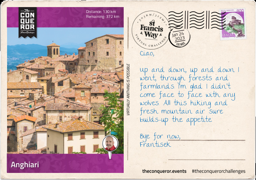
km od začátku : 0130
Anghiari
The trail continues weaving through mountains and forests passing a few isolated buildings to the mountain village of Badia Prataglia. The village is located within the Foreste Casentinesi, a national park that stretches out over 37,000 hectares. It has more than 600km of trail paths and 20 mountain biking routes. The area can also be explored on horseback, whilst in the winter it is open for cross-country skiing. In the village is a mid-19thC arboretum that was originally established for Leopold II, Grand Duke of Tuscany. The arboretum has a museum that also includes the Duke's former villa.
Skirting around the small village of Rimbocchi (1,640ft/500m), I am back in the woods admiring the tall trees, densely packed as I gently climb up to La Verna (3,937ft/1,200m) to visit the Franciscan sanctuary where St Francis is said to have received the stigmata in 1224. The sanctuary is home to several churches, chapels and a monastery. The site was taken under papal protection in 1260. The main church took over a century to complete from 1348 to 1459. The monastery was partially destroyed in the 15thC, suffering desecration during the war of this time and it took three centuries to be fully restored. The friars suffered further in 1810 and 1866 when they were expelled from the monastery as part of suppressing religious orders.
The sanctuary is nestled within a spruce-beech forest with specimens as tall as 160ft (50m) and some with diameters up to 5.9ft (180cm). The forest floor teems with wildlife such as deer, boar and wolf, whilst above one can find eagles, owls and peregrine falcons.
Leaving the sanctuary, I descended through fields and farmlands to Caprese Michelangelo (1,969ft/600m), a small commune where Michelangelo, a Renaissance era painter, sculptor and architect was born in 1475. Michelangelo was baptised in the village's church, St John de Baptist and a museum in his honour has been established inside a fortress. The aim of the museum is to document his body of works with plaster casts. The collection also includes sculptures and paintings donated by artists of the 19th and 20th centuries.
The terrain steadies a little with gentle undulations until I reached Anghiari, a sprawled out, hilltop town overlooking the Tiber Valley. The town centre, however, is a fortified collection of stone buildings and labyrinth-like narrow streets. In this compact location are a handful of museums including the Battle of Anghiari Museum. The battle was a 1440 event between the Republic of Florence and Duchy of Milan. The battle, comprising of thousands of foot soldiers and knights took only one day and according to Machiavelli it resulted in only one death of an unfortunate knight who fell off his horse and drowned in a swamp. The battle ended with the Florentines winning and securing their domination over central Italy. Leonardo da Vinci depicted a painting of the battle which has since been lost. Fortunately copies existed inspiring Paul Rubens to sketch a replica of the original.
The terrace in the town centre with its fortified wall was a perfect place to indulge in some Tuscan food, overlooking the landscape and residential homes. My starter was bruschetta which was a slice of Tuscan bread generously rubbed with garlic, lavishly drizzled with green olive oil and lightly sprinkled with salt (at home I might have chopped up some tomatoes and added it to the mix). This was followed by a hearty slow-cooked stew called "spezattino" and finished it with a scrumptious sugar-coated, fried doughnut known as "bomboloni". No meal experience is ever complete without a café macchiato.
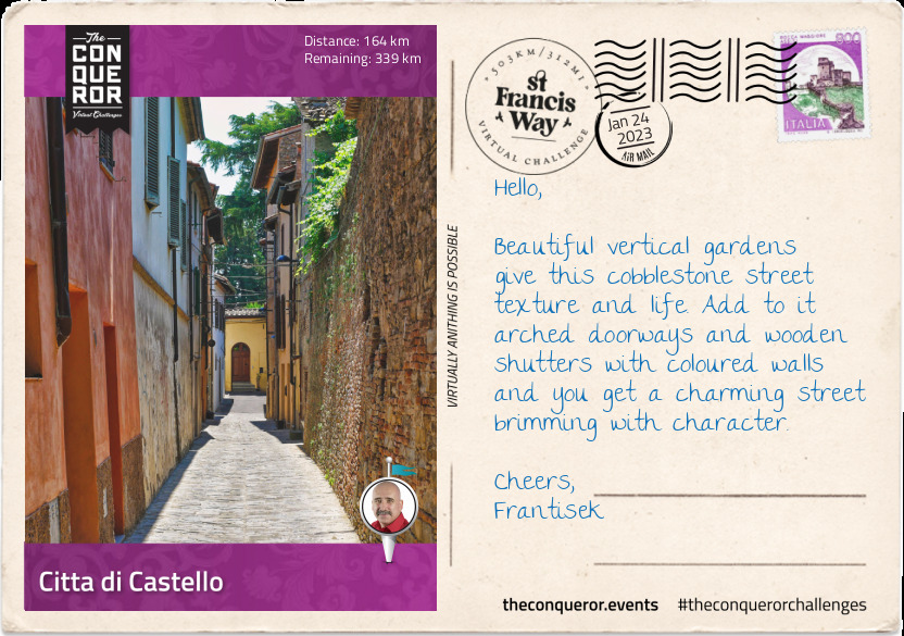
km od začátku : 0164
Citta di Castello
Descending into the Tiber Valley under a sunny blue sky, I made my way through the town of Santa Fiora and across flat countryside to Fighille. Arriving in the hamlet of Fighille, I left behind the region of Tuscany and entered Umbria. Fighille was the centre for ceramics for many centuries due to its high quality clay deposits.
Continuing on, my trail led past meadows and agricultural farms. I was keeping an eye out for their famous fruit, the tomato. There is nothing more tasty than an Italian grown, ripe tomato, picked straight off the vine. Full of flavour in its ripe red colour, the tomato is a very important part of the Italian cuisine. Do you ever wonder why they are so deeply flavoured? It's simply because they are locally grown and allowed to ripen on the vine as opposed to other parts of the world where they are picked whilst still green in order to facilitate distribution. That has me thinking of a caprese salad, deliciously layered tomato and Italian mozzarella cheese topped with fresh sweet basil and seasoned with salt and olive oil.
Anyway, I hiked up into the medieval village of Citerna. Located at the top of a flat-topped hill and built on a motte with a fortified wall around the centre, the village was a recipient of the "Borghi più Belli d'Italia" (most beautiful village in Italy) award. Much of its beauty is steeped in the stone buildings, the city gates and medieval arcaded passageway along with the uninterrupted views of the meadows and woodlands below.
What goes up must go down and so down the hill I went again, winding around a country road, hiking around the edges of the mountains in the Tiber Valley into Citta di Castello, the largest town in Umbria. Located on the slopes of the Appenine Mountains near the Tiber River, the town was founded by an ancient Umbri circa 3rdC BC. It serves as the main economic centre in the region.
Housed in a Renaissance palace that was converted into a gallery is a vast collection of paintings and arts and considered as one of the main public art galleries in Italy. The gallery documents works from 13th to 20th centuries with a particular focus on the Renaissance period and Raphael's early works. The two facades of the "Standard of the Holiest Trinity" hanging in the gallery are considered as Raphael's first work.
One of the oldest paintings is a gilded 13thC panel with the enthroned Madonna and Child made by an anonymous painter of medieval art. Since he was never identified, he was named Master of Citta di Castello.
The palace itself was built mid-16thC as a wedding gift. Facing the garden the palace was famous throughout Europe for its collection of exotic plants. In 1907 the palace was acquired by a local artist who restored it and donated it five years later to the city to house the Municipal Art Gallery.
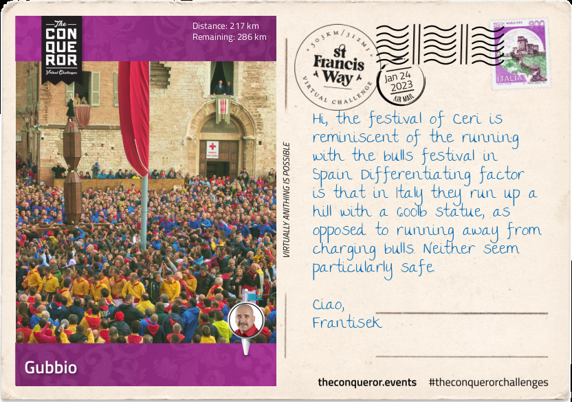
km od začátku : 0217
Gubbio
Further up from the hamlet of Baucca, I turned off the main road and headed into the hills on a small winding country road, travelling in and out of woodland, over open spaces through Pietralunga, down into a valley and straight into the medieval city of Gubbio.
Gubbio's origins are ancient as far back as the Stone Age. It was conquered in 2ndC BC by the Romans and at the time the city was named Iguvium. Around 20BC the Roman's built an amphitheatre with large blocks of limestone. Although now in ruins it remains the second-largest amphitheatre surviving in the world. There's enough of its original structure to imagine what it might have once looked like.
What brought Gubbio to prominence was the 1000 knights that joined the First Crusade into the Holy Land. It is said they were the first to penetrate the Church of the Holy Sepulchre in Jerusalem when the city was seized in 1099. A powerful city, Gubbio spent the following centuries in various wars with surrounding neighbours until it was rolled into the Kingdom of Italy in 1860.
Around the 15thC, a tin-glazed pottery industry known as maiolica emerged giving rise to Giorgio Andreoli, a renown and important potter of the Renaissance period. Giorgio became a citizen of Gubbio and became famous for inventing lusterware, metallic glaze that gave an iridescent effect, using red and gold. He was assisted by his brothers, Salimbene and Giovanni and upon his death the work was continued by his son Vicenzo.
To reach the Sant'Ubaldo Basilica on top of Mount Ingino, I had to take a cable car that is, if you could call it that. The contraption was a cross between a bucket and a topless bird cage. There was only space for two people, standing up with the railings at chest level. At 2,953ft (900m) above ground level, I was thankful it was only a short 6 minutes ride.
The Basilica is set atop a plateau with views across the entire valley and the Apennine Mountains beyond. It houses the body of 12thC Bishop Ubaldo Baldassini, patron saint of Gubbio, in a glass sarcophagus that is kept atop the main altar on a marble plinth. There is an adjacent convent and both were built in the early 1500s. Once richly decorated in Baroque style, much of it was destroyed after the bombings of WWII. Choosing to hike back down, I followed a zig-zag trail through forestry straight into town.
This trail is used each year on May 15th, St Ubaldo Day, for a running event called Corsa dei Ceri (the Ceri is a heraldic emblem on Umbria's coat of arms). The race consists of three teams each dressed in yellow, blue or black tops with white pants and red belts and neckbands. Each team represents one of three saints: St Ubald, St George or St Anthony the Great. The race requires the teams to run up the mountain to the basilica carrying a statue of their saint, mounted on a wooden octagonal prism. The statue measures 13ft (4m) tall and weighing 617lb (280kg).
Legend has it that around 1220, St Francis of Assisi was living in Gubbio where a fierce wolf appeared, terrorising the humans by attacking their livestock at first and later moving onto humans. Apparently no weapon was able to destroy it and those who tried were devoured by the wolf. With the city under siege, St Francis took leave to meet the wolf. As soon as the wolf saw him, it charged with its jaws wide open. St Francis making the sign of the Cross, demanded the wolf stop attacking at which point the wolf ceased his attack and docilely trotted up to St Francis laying at his feet, putting its head in St Francis' hands. A pact was made between St Francis and the wolf, that if it was fed by the people of Gubbio, it would cease any further attacks. The wolf lived for a further two years in peace. St Francis gave it an appropriate burial and later built the Church of St Francis of the Peace on the site. Apparently in 1872, when the church was being renovated, a skeleton of a wolf was found buried under a slab. It was reburied back inside.
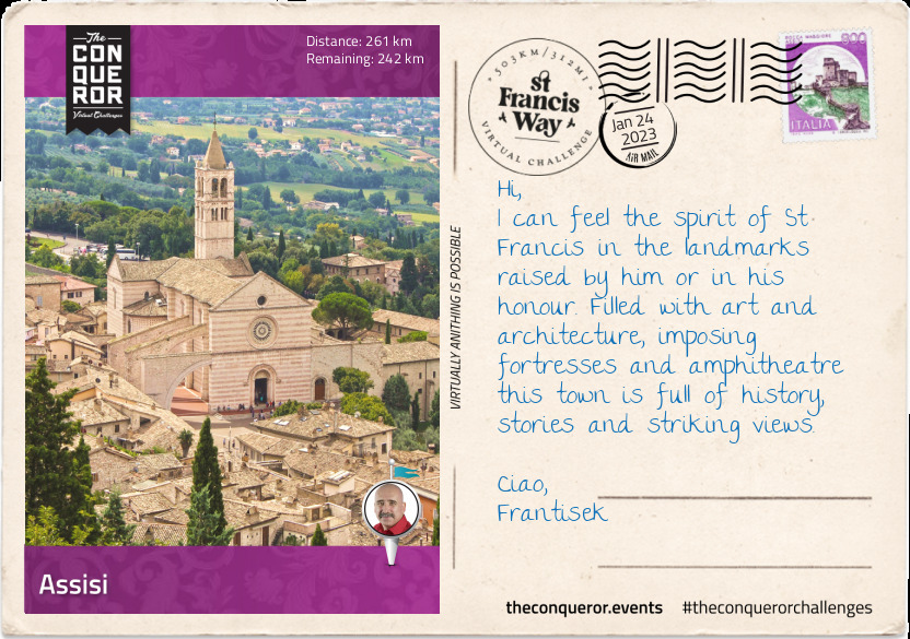
km od začátku : 0261
Assisi
Travelling across more mountainous terrain, I passed through the small villages of Mengara and Bellugello then had a quick stop in Barcaccia to see the ancient farmhouse St Francis used to rest in. Gently descending amid olive trees and vineyards, I crossed the stone bridge of Tescio River at the foot of Mount Subasio. A steep narrow road brought me to the entrance of Assisi via the San Giacomo Gate and to the St Francis Basilica.
Assisi is a town in Umbria, flanked by Mount Subasio to its west. It is the birthplace of St Francis and Latin poet Propertius (c.50BC). There are two castles and a number of churches that together were designated UNESCO sites in 2000 under the title of "Franciscan Structures of Assisi".
The main church is the Basilica of Saint Francis. A Roman Catholic church it is an important place for Christian pilgrims. Built into the side of a hill, construction began in 1228 and consists of a crypt where the saint was interred and two churches: the Upper Church and the Lower Church. Designed in a combined Romanesque and Gothic style, both churches are decorated with frescoes by painters of the late medieval period. A free-standing bell tower stands to the left of the church.
Besides the basilica is the Friary of St Francis. It was built with pink and white stone from Mount Subasio and has 53 Romanesque arches. Overlooking the valley below, the friary looks like a formidable fortress. Although it was occupied since 1220, the construction took a couple of centuries to complete and you can see the mix of Romanesque and Gothic styles within its walls. Today the friary is a library and art museum.
St Francis is the patron saint of Italy and the founder of the Franciscan order. He is one of the most popular Catholic saints in history. Born in 1181 to a wealthy family, he was initially named Giovanni. This changed when his father, who on business in France, at the time of his birth started calling him Francesco. It stuck and he was renamed. Coincidentally he also had great aptitude for learning French. Francis lived an indulgent life enjoying fine clothes and spending lavishly.
Sometime in 1202 he joined a military expedition and was captured, spending a year as a prisoner and falling ill. This experience forced him to re-evaluate his life and began his spiritual journey. Over the coming years he nursed lepers, begged for stones to repair churches, began preaching repentance and peace, established a set of rules to live by and requested papal approval for his order.
In 1219 as part of the Fifth Crusade, Francis set out for the Holy Land and Egypt to try and convert the Muslim sultan. According to Father Cusato, a specialist in the medieval Franciscan order, the two met "under the sultan's tent and discussed interfaith conflict, war and the search for peace" and seems to have been a transformative experience. Because of this encounter the Franciscan order has had an ongoing presence in the Holy Land to this day.
Upon his return from the Holy Land he continued to refine the rules of his order and established more discipline as requested by the Pope. In 1224 he received the stigmata, marks of Christ's wounds and two years later due to ill health he passed away. Francis was canonised in 1228 and his remains are interred in the Basilica of Saint Francis.
Looming over the town from the hill is Rocca Maggiore, an 800 years old fortress with imposing bastions and battlements. In front of the castle is a piazza with spectacular views of the Spoleto Valley and the town of Assisi. With a natural defensive position above the town, records indicated that fortifications have existed on this site well before the Romans. The earliest structure on this site was a German feudal castle erected in late 12thC, however, following an uprising by the people of Assisi the castle was destroyed. Two centuries later, Cardinal Albornoz rebuilt the castle using the outer walls and some of the fortifications of the ruined castle. Another century later, a twelve sided tower and the curtain wall was added connecting the castle to the town. The castle has been recently renovated functioning as an art and exhibition centre and is open to visitors.
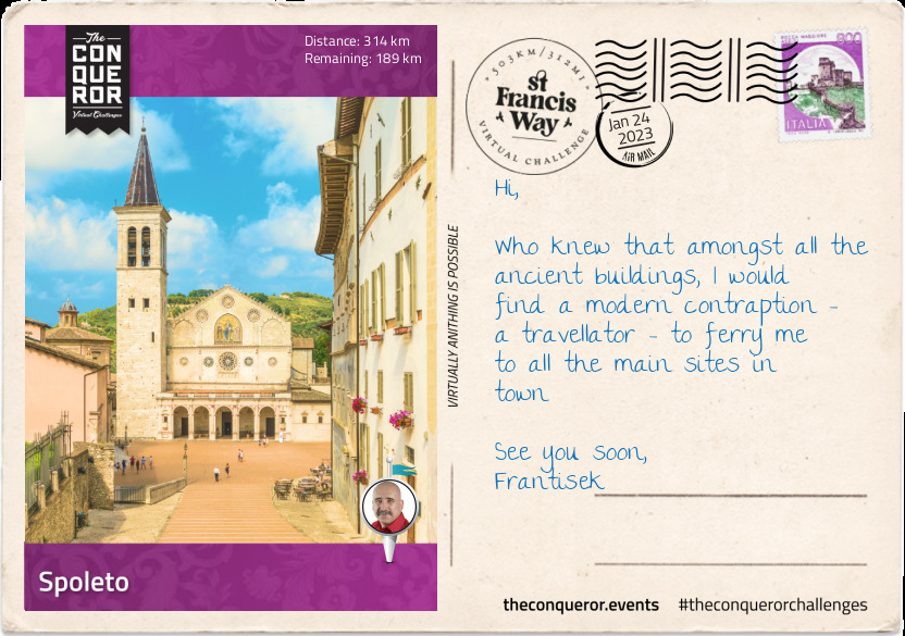
km od začátku : 0314
Spoleto
With Mount Subasio everpresent to my left, I arrived at the medieval town of Spello. Beautifully located on a ridge at the southern end of Subasio, the ancient section, wrapped in a fortifying wall, overlooks the valley below and the expanded residential and commercial area of Spello. Each year the festival Infiorate includes the creation of sixty flower carpets for the Corpus Domini feast. These elaborate works of floral art serve as a pathway for the Corpus Domini procession.
Descending into a flat bottom valley, I hiked along country roads to Foligno. The town is an important railway junction in Umbria. The train station, opened in 1866, has been expanded and rebuilt many times either due to earthquakes or bombing raids. During WWII, the town was heavily bombed and destroyed including the railway station. Rebuilding the town is what gives it its current modern feel. There are very little medieval monuments left and no Ancient Roman footprints are left bar the street plan of the centre.
My next stop was the ancient town of Trevi. Located on the lower flank of Mount Serano, the town center sits atop a flat section of a hill whilst the residential area, densely packed, is built on the slope to the west giving uninterrupted views of Umbria as far as 30mi (50km) away. The Museo della Civiltà dell'Ulivo (Olive Museum) tells the history of olive oil making through illustrations showing the process of extracting olive oil, explaining different olive varieties cultivated in Umbria and displays of old equipment used in producing the olive oil. Trevi is well known for the production of extra virgin olive oil and its techniques are not much different than those used by the Etruscan people 2,500 years ago. The cooler hills of Trevi produce smaller olives providing a more concentrated flavour than those from warmer climates.
At the foothills of the Appenine Mountain range, is the ancient city of Spoleto. It has a long history of civil wars and foreign conquests with the likes of Hannibal, Frederick Barbarossa and Napoleon Bonaparte each wanting a piece of it. Razed to the ground by Barbarossa in 1125, then rebuilt, its borders were continuously shifting ownership until 1860 when troops fighting for the unification of Italy reclaimed the city from Bonaparte and enveloped it into the Kingdom of Italy.
Spoleto is rich with ancient and medieval landmarks such as the 13thC aqueduct Ponte delle Torri, a 774ft (236m) long and 262ft (80m) high bridge across a steep ravine connecting Spoleto to the little borough of Monteluco. Made of local limestone the bridge is supported by ten arches and nine piers.
On the north-west end of the bridge up on a hill is the fortified castle, Rocca Albornoziana. It was built in the 14thC by Spanish Cardinal Albornoz - also responsible for rebuilding Rocca Maggiore in Assisi - at the request of the Pope who wanted to re-affirm his authority in the area. The rectangular castle with six towers features two courtyards which were used by the troops in one and administrators and governors in the other. In 1816 the castle was turned into a jailhouse and the many frescoes that adorned the walls were lost. The jail ceased operation in 1982 and a grand renovation project was underway to restore the castle to its original layout and as much of the frescoes as possible. In 2007 it was reopened as a museum.
The Roman amphitheatre built around the middle of the 1stC BC on a large artificial terrace continues to be used today much the same as it was 2,000 years ago. It has the typical semi-circular plan with a diameter of about 230ft (70cm) and features an orchestra pit with seats arranged around it in tiers. Divided into three horizontal sections dictated the seating arrangements. Closest to the pit was for the community's elite, the middle section for the general public and the furthest section for women and children. Once decorated with marble sculptures and reliefs, most of it was destroyed to make way for the Sant'Agata monastery and church in the Middle Ages. Recent findings of two busts are believed to represent Augustus, the first emperor of Rome and Julius Caesar, his adoptive father.
Basilica of San Salvatore, is a church built between 4th-5thC and it is an example of early Christian architecture. It is part of a UNESCO listed group of seven historic buildings constructed by the Germanic tribe of the Lombards referred to as 'Longobards, Places of Power (568-774AD)".
Cathedral of S. Maria Assunta is a Romanesque cathedral built late 12thC on the site of a previous church, after Barbarossa's troops destroyed the town. A manuscript letter by St Francis of Assisi is within its possessions.
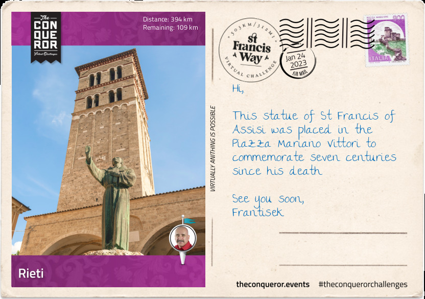
km od začátku : 0394
Rieti
The day started with an uphill climb to the tiny borough of Monteluco, population 27. Located on a limestone mountain at an elevation of 2,559ft (780m), is the Sacred Wood of Monteluco, a forest of evergreen oaks. Within the forest is a 13th Franciscan convent which St Francis lived in for a short period of time in 1218 and is said to have visited often.
Walking across the woods, then through lush forests I reached the other side of the mountain. Descending I came across the ancient abandoned village of Sensati, most of it taken over by vegetation, then down to Ceselli. From Ceselli I hiked through a narrow valley passing several small villages like Macenano and Precetto, then across the River Nera to Ferentillo. Here the valley opened up to a small plane where I followed the river course to Arrone and onwards to Marmore Falls.
The Marmore Falls is a man-made waterfall created by the Romans around 271BC. Its purpose was to divert stagnant waters that fed the wetland in the Rieti Valley as a way to mitigate perceived health risks. It is a three-tier waterfall at 541ft (165m) tall with the longest drop at 279ft (85m) and the tallest in Europe and second tallest in the world.
Leaving the region of Umbria behind, I entered the region of Lazio. I climbed up to Labro (2,067ft/630m), a perfectly preserved village with a castle overlooking Lake Piediluco and travelled through the Reatini mountain range. Continuing the climb I made it to the little chapel of Saint Francis (3,609ft/1100m) and the famous beech-tree that legend says sheltered St Francis during a storm. At 26ft (8m) tall and circumference of 13ft (4m) it has a weeping shape (unlike other beech trees) almost as if embracing Francis to shelter him. Its gnarled and twisting branches seemed to give it a fairytale-like shape. Pilgrims on the Way of St Francis leave offerings at the base of the tree.
Descending again across meadows and woods along the flanks of Mount Rosato, I took a rest at the Sanctuary of Poggio Bustone. Historians of Francis' life indicate that it was here he had a vision where his past sins were forgiven and he prophesised that his mission of peace would begin at this Sanctuary.
The final descent took me into the ancient town of Rieti. Thought to be founded at the beginning of the Iron Age, around 9th-8thC BC, the town was originally occupied by Umbri (Italic people of ancient Umbria), then Aborigines (oldest inhabitants of central Italy) and later by Sabines (central Apennines). The town sits to the south-east of a large plane that once used to be a large lake. It was drained by the ancient Romans leaving only two small lakes behind.
The beautifully preserved town centre has two main piazzas that holds many historical monuments. However, it is the small Piazza San Rufo that holds a unique interest in that it is considered to be the geographic centre of Italy. It is marked by a low circular monument with a map of Italy on top. Besides the monument is the small Church of San Rufo. On its exterior wall is a plaque inscribed in 19 languages "Centre of Italy". Whilst the church on the outside is somewhat plain, the interior is richly decorated in Baroque-style.
Beside a modern bridge, protruding from Velino River was the sunken remains of an old Roman bridge built in 3rdC BC that connected to Via Salaria (Salaria Street) an ancient salt trade route. The bridge was the only crossing of the river and hence was regularly restored and fortified over the centuries. Unfortunately large deforestation in the late 1800s caused the Velino River to swell and flood the area threatening its stability. By the 1920s, engineers planned to dismantle and reuse its components but it proved costly and was demolished. It was replaced by a cement bridge in 1939 which shortly after was bombed by German forces. The current bridge was built in the 1950s.
Just over half a mile away from the bridge on Via Salaria is a tunnel entrance to what is known as "Rieti Underground" where remains of a Roman viaduct can be explored. It was built to transport goods beneath Via Salaria because it was prone to flooding when the river overflowed.
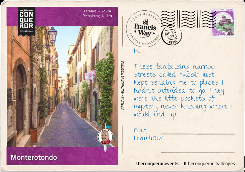
km od začátku : 0462
Monterotondo
Heading south into a narrow valley I passed Fonte Cottorella, known for its ancient springs of curative waters then; Monteleone Sabino with the ruins of an ancient Sabine town; Montelibretti and its 17thC palace of the noble Barberini family; and Grotta Marozza that has a 10thC ruined fortification and finally arriving in Monterotondo.
Monterotondo is a town on the outskirts of Rome. Historically it was strategic point for the defence of Rome. In the 12thC the town was sold by the noble Capocci family to the Orsini family. A noble family, the Orsinis were highly influential during medieval Italy. Across centuries several members of the Orsini family rose to prominent political and religious positions including 3 popes, 34 cardinals and many military captains.
In 1432 the town was seized from the Orsini's by Niccolo Fortebraccio, a condottiero, a captain in command of mercenary companies during the Middle Ages and multinational armies during the early modern period. The Orsini's set fire to the town 50 years later. In 1634 the town was acquired and restored by the Barberini family.
The Orsini-Barberini Castle that stands today is a 17thC palace built on top of a pre-existing castle originally owned by Orsini. The upper floors of the palace has four rooms with richly detailed frescoes from the 16thC. The rooms were originally built to host Pope Leo X and later became the private apartments of Pope Urban VIII. One of the rooms painted between 1535-1555 illustrates the life of Adonis. The smaller room has a series of frescoes that run in a continuous frieze. Called "Room of the Hunt" the artwork depicts views of Monterotondo and hunting scenes in the hills of Sabina. The third room has a coffered ceiling (a section of the normal ceiling that is recessed or raised by a series of grids) with landscape frescoes. The final room leads to a gallery with vaulted ceiling with frescoes representing Time, Hours and Fame, and reflect the use of Monterotondo Palace as a residence for the pursuit of pleasure.
In 1943 Italy unconditionally surrendered to the Allies. Germany wanting to secure Rome for themselves forced the Italian Army to setup in Orsini Castle. Hearing that the Italians were not going to surrender, the Germans decided to airdrop a battalion of 800 paratroopers with the aim to capture General Mario Roatta. Jumping over the landing zone a battle ensued until the Germans found themselves under heavy crossfire with the Italian military to their left and a group of armed civilians to their right. The fighting continued and the Germans kept advancing towards the castle. The battle ended when the Italians surrendered. Ironically General Roatta and other high ranking officials had already left the castle several days before the battle.
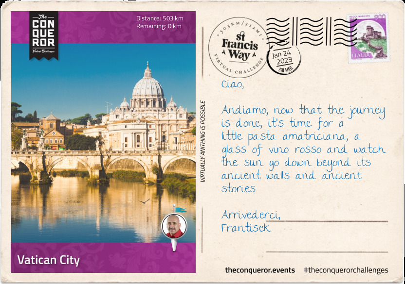
km od začátku : 0503
Vatican City
I knew I was on the home stretch when I entered the Marcigliana Nature Reserve, a 4,000 hectare reserve but what I'd really like to tell you about are all the treasures of this city, well at least the highlights.
As I made my way down the principal street Via Nomentana, I devised a plan to capture as many of the major landmarks that Rome is known for starting with Trevi Fountain.
Tucked away in a small piazza stands the grand Fountain of Trevi. Designed by Italian architect Nicola Salvi, it is the largest fountain in the city and it stands at 86ft (26m) high and 161ft (49m) wide. Work began in 1732 and took 30 years to complete. Salvi died halfway through the works. Giuseppe Pannini was then hired to finish the construction. Palazzo Poli forms the backdrop of the fountain with its double-storey height Corinthian columns. At the forefront is a large scheme of rock and water spilling into the pool. In the centre is Oceanus, the god of fresh-water, in a shell chariot flanked by two Tritons, fish-tailed sea-daemones, taming hippocamps (sea-horses). To the left of Oceanus is Abundance, goddess of prosperity, spilling water from her urn and Salubrity, the shepherdess, holding a cup from which a snake drinks.
I winged my way straight to the 2,000 years old amphitheatre, the Colosseum. Built between 72-80AD, it opened with 100 games sponsored by the Emperor Titus. The theatre could hold up to 80,000 people and averaged an audience of 65,000. Used for gladiatorial contests and mock sea battles, the Colosseum has a simple design. It is oval with high outer walls and inside are sloping tiers of seats that lead to the arena in the centre at ground level. Sand was used in the arena to give gladiators good footing but also to absorb the bloodshed. The original plan was for three levels, with each level had 80 arches (total 240 arches). Titus added a fourth level to increase capacity. Corinthian columns were added inside and out, although the outside ones were for show only. Another decorative feature on the outer wall was the 160 painted statues of emperors and gods. Each statue was different and stood 15ft (4.6m) tall inside an arch on the second and third levels. In 1349 a devastating earthquake ripped through Rome knocking down the south side of the outer wall. A major renovation was undertaken between 1992-2000 and further renovations were done throughout the last decade.
In another tiny piazza is the Pantheon, a former Roman temple that was built by Emperor Hadrian circa early 2ndC. It is a cylindrical building with a large portico holding up a pediment with eight Corinthian columns at the front and two sets of four behind the front line. Exceptionally preserved it has been used as a church since the 7thC. The circular interior is covered by a dome with an oculus as its apex. Circles and squares are the theme within its interior. The checkboard floor pattern contrasts with the dome's concentric rings of square sunken panels (5 rings of 28 panels). The door and the oculus are the only source of light in the interior. The light from the oculus moves around the space as the day wears on.
I crossed the Tiber River via the Ponte Sant'Angelo, an ancient Roman bridge built by Emperor Hadrian in 134AD. The bridge has five arches with the parapet walls adorned with ten angel statues, each holding an instrument of the Passion. The sculptures made of marble were the vision of Gian Lorenzo Bernini an Italian sculptor. When Pope Clement IX saw the statues he thought they were too beautiful to be displayed on the bridge and requested they be replaced with copies. The originals were placed in the church of Sant'Andrea delle Fratte in Rome.
The bridge leads to the magnificent Castel Sant'Angelo, a towering cylindrical castle also built by Emperor Hadrian in early 2ndC. It was initially commissioned as a mausoleum for Hadrian but it has since been used as a castle and fortress by the popes. Around 400AD the castle was turned into a military fortress which caused many decorations to be lost. By 14thC the popes started converting the fortress back to a castle connecting it to St Peter's Basilica with a covered fortified corridor. For a period the castle was also used as a prison and executions occurred in the small inner courtyard. Decommissioned in 1901, the castle is now a museum.
Bearing west of the castle, I took my final steps into the courtyard of St Peter's Basilica. Located within the Vatican City the Basilica sits at the west end of St Peter's square. Covering an area of 2.3 hectares, the Basilica has a capacity to hold more than 60,000 people making it the largest church in the world.
The Basilica is believed to be the burial place of Saint Peter, who was one of the twelve apostles of Jesus and the first Bishop of Rome. Although there's no conclusive evidence of this, a tomb containing bones thought to be his was discovered under the church in the mid-20thC.
St Peter's is well renowned for its Renaissance architecture largely due to the vision and design of four principal architects: Michelangelo, Bernini, Bramante and Maderno. Construction began in 1506 and took 120 years to complete. An earlier Basilica stood on this site built around the 4thC by Emperor Constantine. The central dome towers at 48ft (137m) making the church the second tallest building in Rome. An internal circular staircase of 491 steps leads up to the top of the dome with expansive views of Rome.
In the piazza the Basilica is enclosed by 284 colonnades four rows deep each 39ft (12m) high, creating an elliptical shape that at its widest point measures 1,049ft long and 787ft wide (L320m x W240m). Above the colonnades are 140 statues, 15ft (4.5m) high of saints and martyrs of the church. In the centre of the piazza is an ancient Egyptian obelisk and on either side of it are two white disks. Standing on one of the disks gives the viewer the impression of only a single row of columns instead of four.
Of the 266 deceased popes around 100 of them are buried beneath the Basilica. The Basilica is not a cathedral as it is often believed because it doesn't have a bishop. The pope who is the Bishop of Rome has his bishop's throne at the cathedral of Saint John Lateran. However, he uses St Peter's regularly as his main church because he lives in the Vatican.
The Basilica holds many treasures such as Michelangelo's "Pieta", a sculpture depicting Jesus on the lap of Mary after the crucifixion. It is the only piece he ever signed. The bronze statue of Saint Peter Enthroned has his right foot largely worn due to pilgrims touching and kissing it for centuries. His left foot is still showing his toes as individual digits. Pope John Paull II was the most popular pontiff and he reigned for 27 years. Upon his passing he was entombed within the Basilica. Nine years after his death he was canonised and declared Saint John Paul II.
St Peter's Basilica is a Catholic worshipper's final pilgrimage destination. St Francis' spiritual journey began on his pilgrimage to Rome and just as he went in search for meaning and truth so did all the pilgrims before and after him.
km od začátku : 0006
Run in with the Zombie
Our adventure begins with Mystery Inc. returning from a fishing trip. Fred takes the Mystery Machine through a swamp in the dead of night. They ask a lone stranger standing on the side of the road for directions. As Shaggy rolls down his window, he notices the man’s hunched posture, his green skin, his red eyes, his inability to respond with anything other than ‘uugghhh, guughh’. A zombie! Zoinks!
km od začátku : 0011
A Zombie and a Witch
The gang arrives at the town of Swamp’s End, they notice that it’s deserted. They go to the General Store, run by a man named Zeke. Fred asks what happened to the town and hears from him a spine-chilling tale: a while ago, when Zeke and his partner Zeb were frog hunting in the swamp, they came across a cackling witch conducting a ritual, creating a hulking, brainwashed zombie. Jinkies!
km od začátku : 0037
Hunt for the Witch
Shaggy and Scoob head to Zeb’s cabin. Here, they make a terrible discovery: a doll in the shape of Zeb, stuck with pins. Zoinks! A voodoo Doll! Scooby and Shaggy rush back to the gang and they all make their way to the Witch’s shack. Suddenly, the Witch appears in a puff of smoke. Flourishing her bony witchy fingers, she casts a spell and vanishes, taking Daphne with her.
km od začátku : 0055
The Chase
The footprints lead the gang to a derelict old riverboat. ‘Let’s split up!’ Fred suggests. Shaggy and Scooby go to explore. A terrified Shaggy and Scoob peek into a box, they see a pair of shoes and attached to them ... a zombie! Yikes! A chase ensues; they are pursued this way and that by the dastardly duo of dangers. Meanwhile, Fred and Velma rescue Daphne and set out to find Shaggy and Scooby.
km od začátku : 0061
Uncovering the Conspiracy
Fleeing from the Witch, Velma, Daphne and Fred find Scoob and Shaggy under a blanket in a boat. What luck! It’s an airboat and the gang escapes. Then, another startling discovery. Scooby throws the anchor down, and it catches onto something. The gang looks to see what they’ve found - an armoured truck - filled with money!
km od začátku : 0068
Capturing a Witch
The villains see the money bags in the swamp and rush towards them, cackling: “Money! Money! Money!”. Suddenly, Shaggy and Scooby jump out of the sacks and the monsters give chase. “Duck!” Fred calls, and a tree branch is released, sweeping the Witch, the Zombie and poor Scooby into a cart. The captured villains are tied up, the sheriff arrives and Velma pulls off their masks - it’s Zeb and Zeke!
km od začátku : 0074
Masks Come Off
Velma puts the clues together: the villains created a story about a witch and a zombie to scare people away so they could use a metal-tipped pole to search for a car filled with money that they hijacked. They perfected their illusion with powder bombs to make it look like they could disappear. And they would’ve gotten away with it too if it wasn’t for these meddlin’ kids!
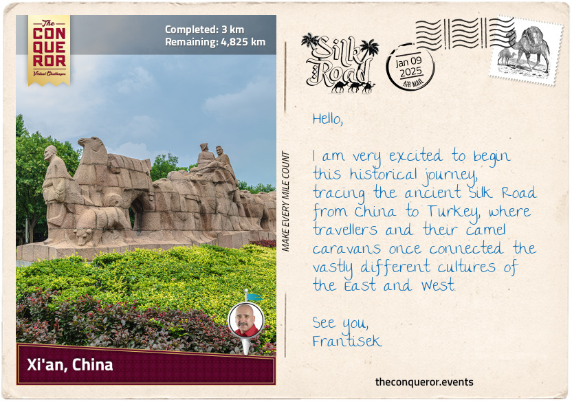
km od začátku : 0003
Xi'an, China
What images come to mind when you hear the phrase "Silk Road"? For me, the Silk Road conjures images of camels laden with goods, crossing endless deserts beneath vast, starry skies. Brave travellers embarked on long journeys to exchange knowledge and ideas, while merchants embraced the dangers, hoping to make their fortunes through trade. Yet, it's fascinating to think that most merchants didn't traverse the entire route from East to West. Instead, goods were traded in stages, passing through many hands, each merchant specialising in a particular segment of the journey. In contrast, explorers like Marco Polo ventured the full length of the Silk Road, driven by curiousity and diplomatic missions, and his accounts brought these new worlds into focus.
The Silk Road was a vast network of paths stretching from China to the Mediterranean and extending south to India. Goods, such as spices, gold, and silk, were traded along the way. But more than that, it was a gateway to stories, cultures, religions and discoveries. Technological advancements and innovations, such as papermaking, printing, and astronomy, spread to new lands along these routes.
Spanning nearly 1,500 years from its beginnings in 130 BCE to its decline in the 16th century, the Silk Road lacked a unified name until the German geographer Ferdinand von Richthofen coined the term in the 19th century. While the name suggests a single route, it refers to a complex web of northern and southern paths, each serving different regions and purposes.
Starting in the ancient city of Chang'an (modern-day Xi'an), this journey will traverse the northern edge of the Taklamakan Desert, crossing rugged mountains, fertile lands, and oases. Along the way, I'll pass through eight modern-day countries that didn't exist in the heyday of the Silk Road, as borders and nations have changed over time. Each mile will bring me closer to my final destination: the ancient city of Antioch (modern-day Antakya), Turkey, near the sun-soaked coast of the Mediterranean.
As the eastern terminus of the Silk Road, Chang'an (modern-day Xi'an) was the imperial capital during the Western Han Dynasty (206 BCE - 9 CE). Several key trade routes passed through the city, making it a natural starting point for the Silk Road. Its strategic location near the Wei River and surrounded by fertile plains provided easy access to Central Asia and efficient transportation of goods.
While the Silk Road is often thought to have begun with the trading of silk, it was actually China's need for hardy horses for military purposes that set it in motion. In search of strong and reliable cavalry horses, the Han Dynasty looked westward to Central Asia, where the famed "Heavenly Horses" were bred. In 130 BCE, Emperor Han Wudi sent the diplomat Zhang Qian on a mission to secure these horses and establish diplomatic ties with Central Asian kingdoms. His journey is considered the starting point of the Silk Road, connecting the East and West. As a key figure in its early development, Zhang Qian's fascinating travels opened the door to centuries of trade and cultural exchange—a story I'll explore further next.
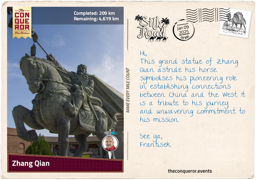
km od začátku : 0029
Zhang Qian
Regarded as one of the most important figures in the history of the Silk Road, Zhang Qian was a diplomat and politician in the service of Emperor Wu. At the time, two powerful empires were emerging: Rome in the West and China in the East. While China was expanding westwards, seeking to establish commercial ties with distant lands, it was regularly raided by nomadic tribes, especially the Xiongnu, who controlled Central Asia.
To deal with this threat, the Chinese decided to strengthen their military by acquiring better horses. At the time, they only had small, pony-like horses unsuitable for carrying soldiers in armour. The "heavenly horses", larger and stronger, were said to come from the distant valleys of Fergana, located beyond the Tianshan Mountains, in what is now Uzbekistan and Kyrgyzstan. These horses were perfect for battle, and the Chinese needed them to defend against raids and improve their military power. This quest would lead to one of the most important journeys in Chinese history.
Around 138 BCE, the emperor sent an expedition to find these "heavenly horses". The envoy, led by Zhang Qian, set off with 100 men, including Ganfu, a captured native Xiongnu. Travelling to the western end of the Great Wall of China, Zhang continued toward the infamous Taklamakan Desert, knowing very well that he would have to pass through Xiongnu territory. It wasn't long before he was caught and spent ten years as a prisoner. During this time, he married a Xiongnu woman and had a child, but he never wavered from his mission, one that no other Chinese dignitary was willing to undertake. By this stage, the emperor had already presumed him dead. As oversight eased, Zhang fled, and instead of returning home, he continued until he reached the court of the Yuezhi in 129 BCE.
Hoping to negotiate an alliance, Zhang remained in Yuezhi for a year. Unable to persuade the chief, he left for China, only to be captured again by the Xiongnu. With civil war breaking out and the death of the shanyu (Xiongnu leader), Zhang seized the opportunity to escape a year later. This time, he returned with his family and the loyal Ganfu, the only other person to make it back to the Han court.
Although his mission was unsuccessful, he returned with valuable information. During his time with the Xiongnu, Zhang gained extensive knowledge of the Central Asian landscape, as well as the customs and politics of the Xiongnu and other nomadic tribes. He confirmed the existence of the "heavenly horses" in Fergana and, more importantly, introduced the idea of trade with the West by sharing stories about distant empires like Persia and India. While trade routes to the West had existed for centuries, Zhang's journey paved the way for the Silk Road, opening up trade between China and the West.
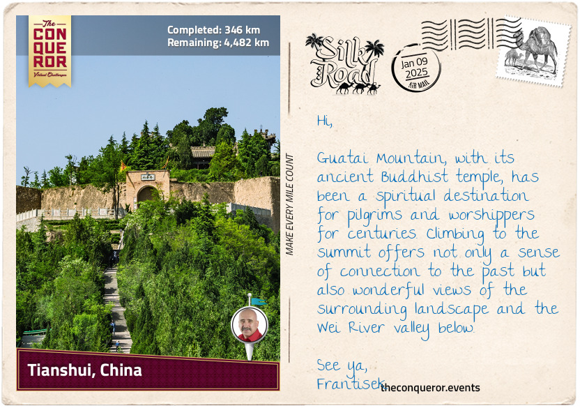
km od začátku : 0346
Tianshui, China
Tianshui's history stretches back over 3,000 years, starting in the early days of the Zhou dynasty, one of the longest-ruling dynasties in Chinese history, lasting more than 790 years (1046–256 BCE). This makes Tianshui one of the oldest settlements in the area.
The Zhou dynasty was known for its philosophy, agriculture, and technological advancements. However, the land was not peaceful. Nomadic invaders, skilled on horseback from the north and west, attacked the region. In addition, internal instability due to political conflict, weak leadership, and the rise of the powerful Qin state led to the dynasty's collapse.
As the Qin state grew stronger during the Warring States period (475–221 BCE), it eventually conquered all other states, paving the way for the Qin dynasty and the ascension of Qin Shi Huang as the first emperor of China, who is credited with unifying the country.
Reclaiming places like Tianshui helped the dynasty expand its lands, as evidenced by the archaeological discoveries of ancient Qin tombs in nearby Fangmatan. Two tombs were excavated in 1986. One contained ancient texts written on bamboo slips and seven maps drawn on pine wood in black ink illustrating the Jialing River systems. The other tomb contained a paper map fragment depicting topographical features such as mountains, waterways, and roads. The highlight of this map is that it was drawn on the oldest existing piece of paper, which is more than 2,000 years old.
When the Qin Dynasty was replaced by the Han Dynasty in 206 BCE, Tianshui became part of a much larger empire, leading to increased trade and exploration. Its location along the Wei River valley, which led to Xi'an, made it a crucial military stronghold and an important stop along the Silk Road for merchants, troops, and officials. Tianshui played a key role in protecting the western approach to the capital and China's central plains, making it a frequent site of conflict. As a central hub, it helped maintain communication and control across the empire, becoming vital to the Han Dynasty's administration and military operations.
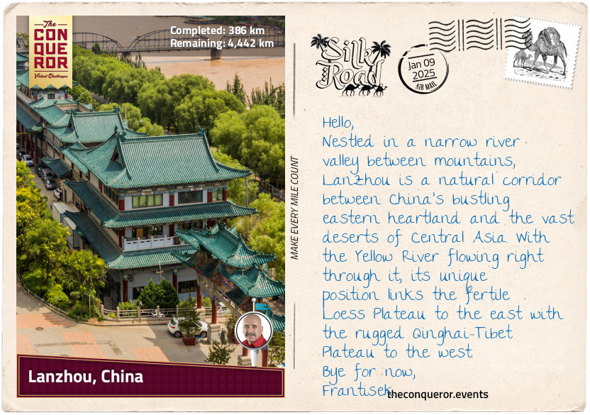
km od začátku : 0386
Lanzhou, China
Lanzhou's history stretches back more than 15,000 years, beginning when people first settled along the upper reaches of the Yellow River. Around 5,000 years ago, the Majiayao Culture emerged, renowned for its intricately coloured pottery. Over time, Lanzhou evolved from a small settlement into a thriving administrative region.
During the Western Han period (206 BCE – 9 CE), the city was known as Jincheng, or "Gold City", because gold was found there. As a critical passage into the heart of China, Lanzhou was an important military and trade outpost. The city's walls and fortifications were strengthened to protect it from nomadic tribes like the Xiongnu, who posed a constant threat. As a key military stronghold, it helped secure the Silk Road routes and control access to China.
This was further strengthened by the strong currents of the Yellow River and the mountainous terrain surrounding the city, creating a natural protective barrier that provided an additional defensive advantage. The river was also the cornerstone of Lanzhou's prosperity. Known as China's "Mother River", the Yellow River (the second longest in China) sustained Lanzhou's communities and farmland, enabling the region to flourish. Its waters fed crops and provided a natural route for transporting goods. For travellers along the Silk Road, Lanzhou was a vital crossing point where merchants from as far away as Persia, India, and Central Asia stopped to trade goods. Silk, ceramics, and paper from China were exchanged for spices, gemstones, and textiles from the West. Among these treasures, tea became one of the most sought-after commodities.
Tea was prized for its delicate flavour and health benefits, making it a favourite among traders and nobles. Tea was often compressed into bricks or cakes to withstand the long journeys. These compact forms preserved its freshness and made it easy to transport.
The tea trade brought together a variety of cultures. For example, in Tibet, brick tea was mixed with yak butter and salt to make po cha, a strong and smoky tea. Its high-fat content provided essential energy and warmth to those travelling in cold mountainous regions. In the Middle East, tea was infused with clove, cinnamon or cardamon, crafting aromatic blends.
In Central Asia, tea was more than just a drink—it became a currency of sorts, often traded for goods or used to create bonds between people from different places. This helped shape the cultures along the Silk Road, fostering deeper connections between distant lands. Tea became more than a commodity; it was a cultural connector that brought people of different backgrounds together, whether for trade, conversation, or ritual.
km od začátku : 0676
Wuwei, China
Wuwei, once known as Liangzhou, was the eastern end of the Hexi Corridor and played an important role in the history of the Silk Road. Settled over 5,000 years ago, the area was initially used as grazing land by the Yuezhi people during the Qin Dynasty. By the Han Dynasty, however, the Xiongnu tribe had taken control. It expelled the Yuezhi people, marking a turbulent time in the Corridor's history.
In 121 BCE, Emperor Wu of Han tasked his 20-year-old nephew, General Huo Qubing, to lead an army against the Xiongnu. He achieved a decisive victory at the Battle of Mobei and helped secure the Hexi Corridor for the Han Dynasty.
The Hexi Corridor itself is a long, narrow band of land stretching about 620mi (1,000km) through western Gansu Province. It is bordered by the imposing Qilian Mountains to the south and the arid expanse of the Tengger Desert to the north, making it an ideal route for connecting central China to the West and offering a safe passage through what would otherwise be tough terrain. Wuwei's location is particularly significant because it sits at the meeting point of three major geographical regions: the high-altitude Qinghai-Tibet Plateau, the fertile but erosion-prone Loess Plateau, and the arid Mongolian-Xinjiang Plateau. This unique convergence of landscapes shaped Wuwei's environment, contributing to its importance as a trade and cultural hub.
The Qilian Mountains were a lifeline for the region. Their snowy peaks not only created a natural protective barrier but also supplied vital water from melting snow, feeding rivers and streams, making farming and settlement possible in an otherwise dry region. Meanwhile, the Tengger Desert bounded the northern part of the corridor. Its harsh, dry conditions meant that travellers were forced to stick to the narrow strip of the Hexi Corridor, where resources were concentrated, and survival was more feasible.
Wuwei's strategic position along the Hexi Corridor made safeguarding the Han Empire's western frontier essential. By controlling this vital region, the Han Dynasty could protect trade routes, monitor military movements, and maintain stability between central China and the nomadic tribes of the West.
km od začátku : 0901
Zhangye, China
Located in the centre of the Hexi Corridor, Zhangye is a city surrounded by the Qilian Mountains to the south, Longshou Mountain to the north, and the Hei River to the west. The terrain is flat, fertile, and lush with forests. It is a land of contrasts where snow-capped mountains, grasslands, and deserts coexist. In the foothills of the Qilian Mountains is the Zhangye National Geopark. Inscribed as a UNESCO site, the park is famous for its strikingly colourful rock formations. The rocks, with their smooth shapes, resemble a layered cake that has been tilted—a result of tectonic shifts. Over time, wind and rain sculpted these formations into towers, pillars, and ravines, each with its own unique colour and pattern.
Zhangye once served as the capital of the Northern Liang Kingdom (4th to 5th centuries), led by the Juqu clan, whose ancestors had served under the Xiongnu tribe. The military commander Juqu Mengxun seized power through political manoeuvres, including tricking Duan Ye, the governor of the region, into killing his rival, Juqu Nancheng, the crown prince. After the assassination, Duan Ye was executed in retaliation. Mengxun declared himself Duke of Zhangye, solidifying his rule over the kingdom.
Juqu Mengxun promoted Buddhism during his time in power, even though the religion had been gradually spreading to China via the Silk Road since the 1st century. Initially, it was influenced by Taoism, but over time, Indian Buddhist texts were translated into Chinese, creating a valuable collection that spread throughout East Asia. Buddhism flourished during the Tang Dynasty (618-907), and its influence shaped art, literature, and culture during this golden period.
Despite some anti-Buddhist persecutions, Buddhism remained significant, and today, it is the largest established religion in China and practiced by more than 30% of its population. In the centre of Zhanghye, The Dafo Temple, built around the 11th century, stands as a testament to this enduring influence. The most famous feature of the temple is the Giant Buddha, one of China's largest reclining Buddha statues. Made of wood and painted in gold leaf, the statue measures 115ft (35m) long and 25ft (7.5m) wide.
In the 15th century, during the Ming Dynasty, Emperor Ying Zhong gifted more than 6,000 scriptures to the monastery. Some were copied onto Prussian blue paper using ink made from gold and silver powder, adding a layer of luxury and making them not only incredibly valuable as artifacts but also highlighting the importance of Buddhist practices and teachings in China.
km od začátku : 1110
Jiuquan, China
Fulu, later known as Suzhou and now called Jiuquan, was founded on the edge of the Gobi Desert in 111 BCE. Nestled within the Hexi Corridor, Jiuquan served as a military outpost and a bustling hub for trade, exploration, and cultural exchange.
The city's name, meaning "Wine Spring", is said to come from a legend during the Han Dynasty when General Huo Qubing's soldiers were rewarded with wine that flowed into a nearby spring after a victorious campaign.
A key aspect of Jiuquan's prominence was its proximity to the Jade Gate (aka Yumen Pass) to the northwest. The pass was an important Silk Road checkpoint that safeguarded merchants and travellers. It was named for the coveted jade transported from Khotan, a region in modern-day Xinjiang renowned for its high-quality nephrite. Prized for its durability, smooth texture, and symbolic associations with purity and immortality, jade was used for tools, ornaments, and ceremonial objects. Its reputation as the finest jade made it a significant trade item on the Silk Road, passing through the Jade Gate on its journey to the heart of the Chinese empire.
Just to the west of the city stands Jiayu Pass, the western terminus of the Great Wall of China, a massive series of fortifications built to protect the empire's northern borders. Stretching over 13,000mi (21,000km), the Great Wall marked the northern boundary between China and the nomadic tribes. It served both as a defensive barrier and a symbol of imperial power. On this western frontier, the Great Wall and the Jade Gate, along with other nearby passes, formed a meeting point where military power and trade came together, ensuring the safety and success of the Silk Road.
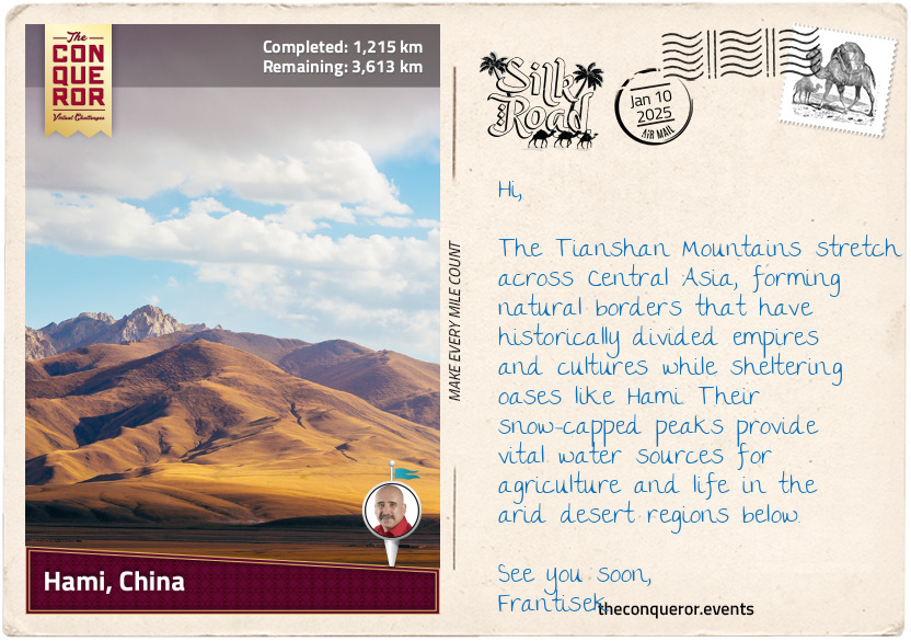
km od začátku : 1215
Hami, China
Hami, known variously as Yizhou, Kumul, and other names throughout its history, lies at the base of the Tianshan Mountains in China's Xinjiang region. Its identity has been shaped by the Han Chinese, Uyghurs (a Turkic ethnic group), and Mongols, who lived, traded, and inevitably battled over this oasis. Its strategic location made it a coveted prize, passed between empires like a ping-pong ball as they struggled to control the Silk Road's vital lifeblood. This crucial trade artery carried goods, stories, and ideas, but Hami is perhaps most legendary for its sweet and iconic melons. Cultivated since the Han Dynasty, a half-dried Hami melon was even discovered in a tomb in nearby Turpan City, dating back at least 1,500 years.
The Tianshan Mountains, with their snow-capped peaks, provide both a formidable barrier and a vital water source. Hami's ingenious farmers tapped into this resource through ancient karez systems—underground irrigation channels that carried water from distant mountains to the melon fields. These systems conserved water and prevented evaporation, essential for agriculture in the arid landscape. Thanks to this ingenuity, the Hami melon, celebrated for its high sugar content, juicy flesh, and aromatic flavour, flourished in this challenging environment.
While fresh Hami melons were difficult to transport over long distances on the Silk Road without spoiling their seeds were likely traded, spreading the fruit's cultivation far and wide—a fact reflected in their availability today in far-flung places such as the USA and Australia.
Several enduring tales highlight the Hami melon's symbolic significance in local culture. One of the most famous, The Emperor's Melon, dates to the Tang Dynasty. According to legend, a Uyghur farmer presented the emperor with a melon during a caravan visit to the capital. So impressed was the emperor by its sweetness that he declared Hami the "Land of Heavenly Melons", leading to the fruit being sent regularly to the imperial court.
Another tale, underscoring the melon's association with life and survival, recounts the story of a merchant caravan stranded in the desert, their water supplies exhausted. On the brink of collapse, they stumbled upon an oasis where locals offered them Hami melons. The melons quenched their thirst and rejuvenated their spirits, enabling them to continue their journey.
Even today, Hami melons are celebrated for their versatility and unique flavour. To honour this ancient fruit, here is a refreshing dessert recipe, perfect for summer:
Hami Melon Sorbet
Ingredients:
2 cups Hami melon, diced
1/4 cup sugar (adjust based on melon sweetness)
1 tablespoon lemon juice
1/2 cup water
Instructions:
Blend the melon, sugar, lemon juice, and water until smooth.
Strain the mixture to remove any pulp.
Chill in the refrigerator for an hour.
Pour into an ice cream maker and churn, or freeze in a shallow dish, stirring every 30 minutes until the texture resembles sorbet.
Serve garnished with mint leaves.
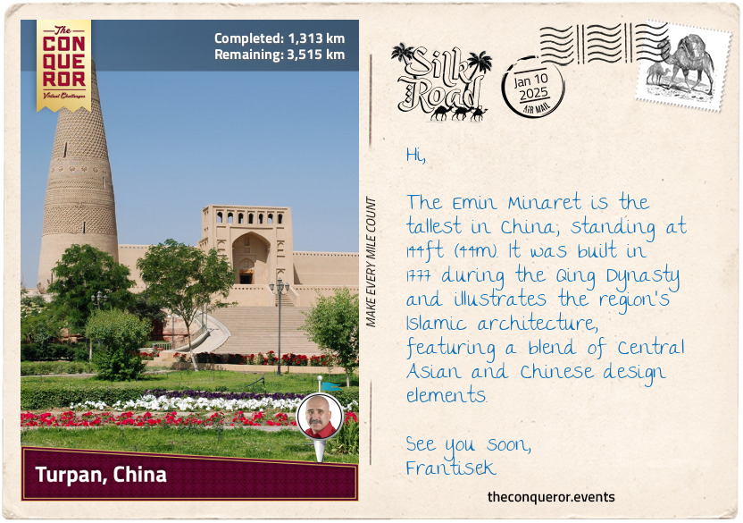
km od začátku : 1313
Turpan, China
Like Hami, Turpan is located in Xinjiang and is one of Central Asia's most ancient and historically significant oases. Its history stretches back thousands of years, with archaeological evidence pointing to early human settlements as far back as the Bronze Age. Artefacts reveal the presence of metallurgy, farming, and trade networks, which laid the foundation for Turpan's later prominence as a commercial hub, further strengthened by its strategic position along the northern route of the Silk Road.
Also, like Hami, Turpan's long-term control alternated between Chinese dynasties, local rulers, and other Central Asian powers, such as the Uyghurs (Turks) and the Xiongnu (nomads). Regardless of the changing powers, however, Turpan flourished and absorbed the cultural, religious, and technological influences left behind by each ruling group, including the innovative underground irrigation system known as the karez. This system, combined with the region's arid climate, supported Turpan's tradition of grape cultivation since the Han Dynasty, especially seedless white grapes, along with red and black grapes harvested in the fall.
As a bustling crossroads, many goods were traded, but silk was one of the most highly sought-after products. First produced in China thousands of years ago, silk is made from the silkworm’s cocoon, which is fed on mulberry leaves. According to Chinese legend, Empress Leizu (circa 27th century BCE) discovered silk by accident. The story goes that while she was sitting under a mulberry tree, a silkworm cocoon fell into her tea. As she tried to retrieve it, the cocoon began to unravel into long, delicate threads. Intrigued by the fine threads, she is said to have figured out how to unwind them carefully and weave them into fabric. Although the details of this story are mythical, the empress is still credited with introducing sericulture, the practice of raising silkworms to produce silk.
Silk became highly valuable due to its lightweight, smooth texture, natural sheen, and vibrant colours. The production process was labour-intensive, and while the fabric had a delicate feel, it was surprisingly strong and durable. Silk was often associated with royalty and nobility, symbolising wealth and status, and its rarity outside of China made it a desirable, exclusive luxury fabric for garments and tapestries.
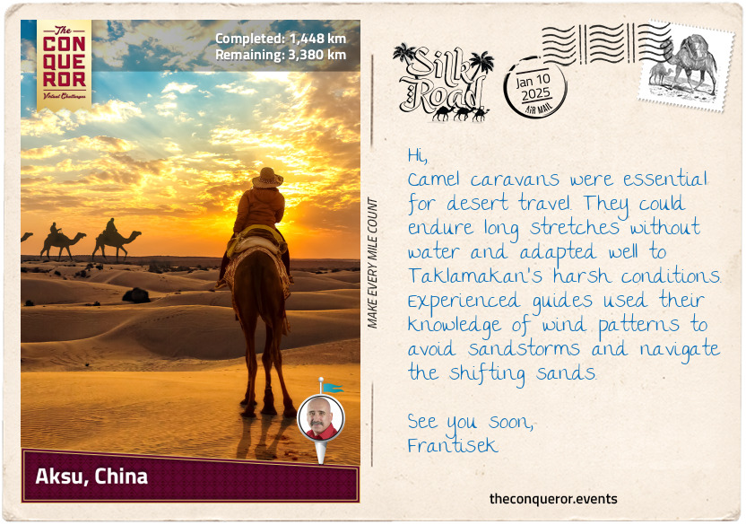
km od začátku : 1448
Aksu, China
Aksu, located at the western edge of Xinjiang, shows a clear blend of Chinese and Central Asian influences. As we move further into the region, where the Uyghur population makes up more than 70% of the residents, a clear shift from Han Chinese culture becomes evident. The Uyghurs, a Turkic ethnic group with deep historical roots in the region, have traditionally inhabited a series of oases scattered across the Taklamakan Desert. These oases were sometimes independent states but, at other times, were controlled by various powers, such as China, the Mongols, and the Tibetans. Over time, the Uyghurs gradually embraced Islam starting in the 10th century, with many of their practices deeply rooted in Islamic traditions. This has shaped a distinct blend of Uyghur culture, marking a cultural transition as we move further west.
The vast Taklamakan Desert forms the southern border of Aksu, bounded by mountains on three sides and the Gobi Desert to the east. Stretching 620mi (1,000km) long and 250mi (400km) wide, with dunes rising to 300ft (91m), it is one of the largest and driest deserts in the world. The climate varies widely, with summer temperatures soaring to 114°F (45.6°C), while winter temperatures can plunge below -4°F (-20°C). The desert receives less than an inch (2.5 cm) of rainfall per year, and over the last 1,000 years, it has expanded by a further 62mi (100km) to the southwest.
While the Taklamakan conjures images of dryness and desolation, China's longest inland river, the Tarim River (821mi/1,321km), flows right through it, providing crucial support to the ecosystem. This includes the 60-million-year-old native poplar forests, which continue to thrive despite the harsh conditions, although for a time, they faced environmental challenges due to human activities and reduced water flow.
Two branches of the ancient Silk Road once skirted the Taklamakan Desert—one to the north and one to the south. Travelling around this unforgiving expanse was incredibly dangerous, as merchants and caravans faced extreme temperatures, relentless sandstorms, and constantly shifting dunes that could erase paths without warning. The scarcity of water increased the risks, making oases essential for survival. Settlements near reliable water sources became crucial waypoints, offering shelter, supplies, and guidance to weary travellers. Local guides were especially valuable with their deep knowledge of the desert's shifting landscape and how to navigate the treacherous terrain.
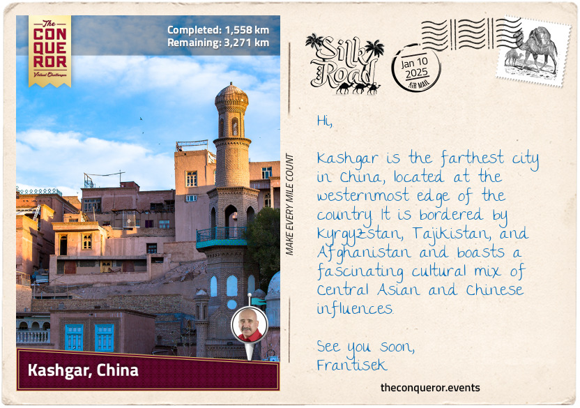
km od začátku : 1558
Kashgar, China
Nestled at the western edge of the Tarim Basin, Kashgar was an isolated yet pivotal oasis town where the Taklamakan Desert met the Pamir Mountains. It was an important stop for caravans travelling to trade with Central Asia, India, Pakistan, and ancient Persia. Because it was at the crossroads of the northern and southern Silk Road routes, Kashgar became a major centre for trading spices, especially those from India, like black pepper, cardamom, and saffron.
India was key in transporting these spices across its subcontinent or along the Indus River, connecting to trade routes that reached Central Asia. Southeast Asia, especially the islands of modern-day Indonesia, also sent spices like cloves, nutmeg, and cinnamon. These spices would travel by sea to India before continuing overland through Persia and other trade centres to Kashgar. The Middle East also helped spread spices, blending goods from the Indian Ocean region with local products like frankincense (a fragrance derived from the Boswellia tree, used in incense, perfumes, and medicine) before sending them to markets across the continent.
Imagine how, in this bustling oasis, mixing flavourful spices with different cooking techniques could create a fusion of dishes, aromas, and delightful tastes, each reflecting the distinct culinary traditions of Chinese, Persian, Indian, or Central Asian cultures. As these spices travelled far and wide, the same basic dish, though prepared in different regions, would vary based on the local ingredients available. These shared meals became wonderful opportunities to exchange cultures through cuisine.
While Kashgar is in the Xinjiang region of China, its food is nothing like traditional Chinese cuisine. Instead, it's shaped by the Uyghur people, the city's dominant cultural group, with dishes influenced by hearty lamb, handmade noodles, spices like cumin and chilli, flatbreads, and sweets such as dried fruits, nougats, and pastries. A meal might begin with comforting bowls of lamb and vegetable soup paired with fresh naan bread, followed by smoky, spicy kebabs. To finish, a simple dessert like zongzi—a Uyghur twist on classic Chinese sticky rice with sweet red dates, topped with yogurt curd and sugar—is complemented by fragrant cups of tea.
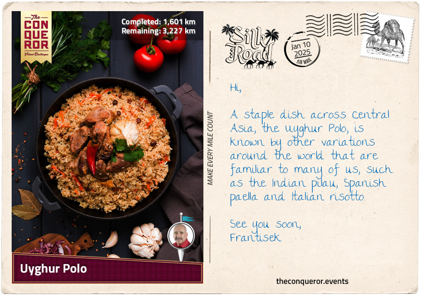
km od začátku : 1601
Uyghur Polo
Polo is a Uyghur-style pilaf made by frying lamb with onions and thinly sliced carrots in oil. Then, rice and water are added and steamed, allowing the rice to soak up all the aromatic juices. Cumin, coriander, and sometimes a hint of cinnamon are added to infuse the meat and rice with rich, savoury flavours. To balance the richness, raisins and dried apricots are often included and the dish is then served with fresh bread and yoghurt.
Notes
Use a heavy-bottomed, deep pan with a lid to help cook the ingredients evenly.
Use lamb shank for its tenderness and juiciness when slowly cooked. Beef and chicken can be used as alternatives if you don't like lamb or kidney beans for a vegetarian option.
INGREDIENTS (Serves 4)
1 lb (500 g) lamb shank – chop into 5-6 chunks
1 lb (500 g) carrots – peel and cut into matchsticks (Julienne-style)
½ cup olive oil
1 large red onion – peel, halve and slice
½ cup raisins (optional)
2 cups rice – rinse until water is clear to remove the starch that makes it stick
2-3 cups water (enough to cover the ingredients in the pan)
1.5 teaspoons salt
½ teaspoon cumin
1 teaspoon sugar
INSTRUCTIONS
Heat the oil on high, add the meat and brown on all sides.
Add onions, cumin, salt, carrots, and sugar. Mix and cook for about 10 minutes.
Add the water, bring it to a boil, then lower to a simmer. Adjust flavour as needed.
Drain the rice and add to the pan. Spread it evenly on top of the liquid (do not mix).
Sprinkle the raisins on top.
Poke a few holes in the rice layer (it simmers easier), then cover.
Cook on low for about 35 minutes (check at the end that it is fully cooked).
Mix all the ingredients. Tear the big chunks of lamb into bite-sized pieces and place them back on the polo.
Video tutorial:
https://youtu.be/a46wspZtOkI - Have fun with the cooking and enjoy your meal.
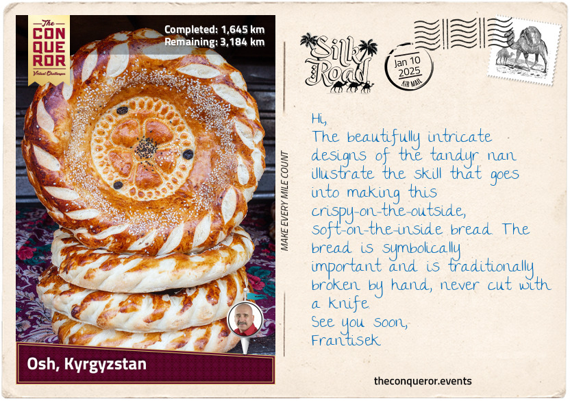
km od začátku : 1645
Osh, Kyrgyzstan
Leaving China behind, I entered Kyrgyzstan, a country in the heart of Central Asia. During the Silk Road era, the land was ruled by Turkic nomads for about seven centuries until the Mongols conquered it in the 13th century. Kyrgyzstan is a completely landlocked country and among the furthest from the nearest ocean. It borders Kazakhstan up north, Uzbekistan to the west, Tajikistan in the south, and China to the east.
The landscape here is wild and dramatic, with the towering Tianshan Mountain in the northeast and the rugged Pamir-Alay Mountain in the south. Nestled between these ranges is the lush and fertile Fergana Valley, a major agricultural hub for centuries, known for its cotton fields. While the mountains have historically isolated Kyrgyzstan, they also made it an ideal route for merchants navigating the Silk Road.
Traveling through Kyrgyzstan inevitably led to Osh, the country's second-largest city with a history of over 3,000 years. One of Osh's most iconic features is its vibrant marketplace, which has been operating almost continuously in the same location for the past 2,000 years. Over the centuries, merchants from all over would gather in the bazaar to exchange goods, with silk, spices, and ceramics heading west while gold, glass, and woolen goods made their way east.
Aside from trading goods, merchants and travellers would stop at bustling markets like the one in Osh to find street food or small eateries. Here, they would find a variety of foods, such as dried fruits, nuts, breads, kebabs, and flatbreads, as well as local delicacies like pilaf, dumplings, and falafel. Lagman, for instance, is a wonderfully hearty Central Asian dish believed to have originated from the Chinese "lo mein", meaning stirred noodles. Over the centuries, it has evolved and been influenced by various cultures, particularly Uyghur cuisine. Lagman consists of hand-pulled noodles in a rich, savoury broth with meat, bell peppers, tomato paste, celery, cabbage, and spices.
In Osh, a delicious accompaniment to the broth is a type of decorated bread known as "tandyr nan", named for how it's baked in a tandoor oven or "lepyoshka". Freshly prepared each day, this bread is typically round, with a soft, fluffy interior and a crisp golden-brown crust. What makes it stand out is the decorative stamp pressed into the top of the dough before baking, often featuring geometric patterns or floral designs. These designs sometimes carry symbolic meanings related to prosperity, fertility, or blessings. They are commonly offered during celebrations like weddings or festivals.
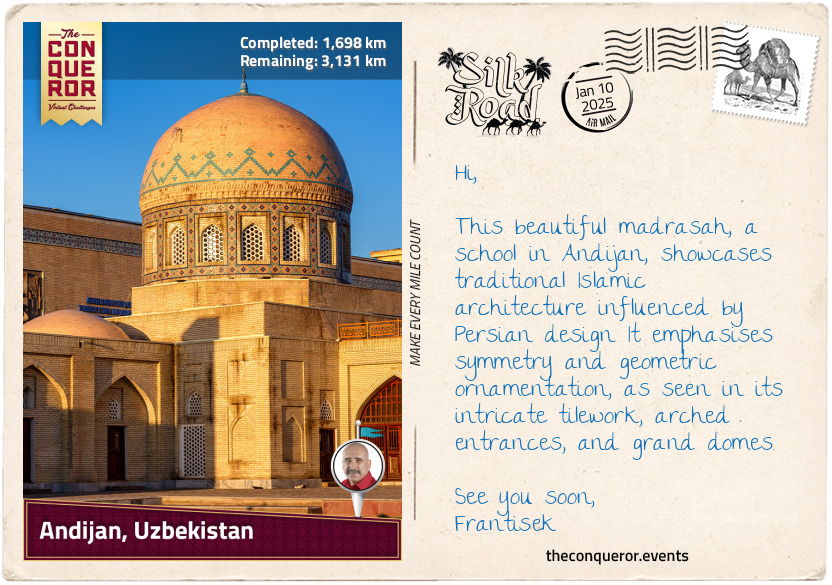
km od začátku : 1698
Andijan, Uzbekistan
Uzbekistan marks the third modern-day country on this journey, where caravans once passed through Andijan, Kokand, Samarkand, and Bukhara along the ancient Silk Road route, leaving behind some of the most incredible Islamic architecture. The country is bordered by Turkmenistan, Kazakhstan, Tajikistan, and Kyrgyzstan, making it one of only two double landlocked countries in the world—meaning it is surrounded entirely by other landlocked nations. The other such country is Liechtenstein in Europe.
Uzbekistan has a varied landscape, with large deserts like the Kyzylkum Desert in the north, the second largest in Central Asia, mountains in the east that are prone to earthquakes, and the fertile Fergana Valley, which is watered by the Syr Darya river.
The city of Andijan sits within the fertile Fergana Valley and has long been historically linked to agriculture. The region is known for cultivating cotton, silk cocoons, grains, and fruit trees such as apricots, peaches, and grapes. Its rich soil and irrigation systems, fed by rivers from surrounding mountains, made it an ideal location for farming. Archaeological evidence shows that Andijan is over 2,500 years old, making it one of the oldest cities in Central Asia.
The region around Andijan was controlled by many powerful empires, beginning with the Persian Empire, which ruled in the early centuries BCE, until Alexander the Great's conquest in the 3rd century BCE and the rise of the Greco-Bactrian Kingdom, when Greek culture spread across Central Asia. Over the centuries, further empires like the Kushans and Sassanids took control until the city became part of the Arab Caliphate during the Islamic conquest in the 8th century. By the 10th century, the Samanid Empire had taken control, and the area was transformed into a centre of Islamic culture.
A notable figure from Andijan is Zahīr ud-Dīn Muhammad Bābur. Born in 1483, toward the end of the overland Silk Road era, Bābur was a descendant of Timur (14th-century founder of the Timurind Empire) on his father's side and Genghis Khan (13th-century founder of the Mongol Empire) on his mother's side. Babur was a statesman, poet, and author renowned for his memoir, the Baburnama, which recounts his exploits as a minor ruler of Fergana who twice attempted to capture Samarkand but failed. Setting his sights further afield, Babur conquered Kabul in present-day Afghanistan and later invaded northwestern India. He founded the Mughal Empire there, which his descendants expanded over 300 years of rule. They became famous for their prolific constructions and the development of Mughal architecture, such as the Taj Mahal in Agra and the Red Fort in Delhi.
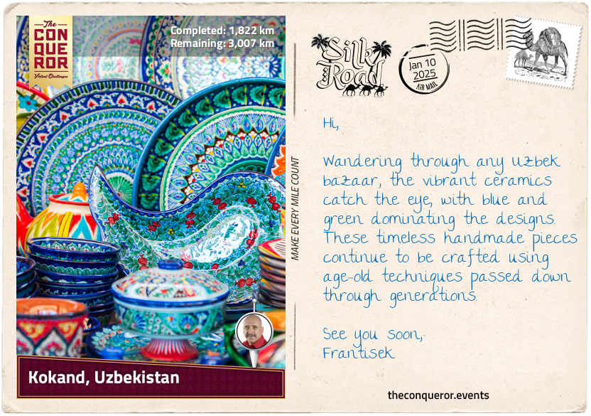
km od začátku : 1822
Kokand, Uzbekistan
Located at the western end of the Fergana Valley, Kokand, along with nearby Margilan and Rishtan, forms a trifecta of artisan cities, each steeped in centuries-old traditions of craftsmanship, often passed down through generations within families. Kokand’s earliest mention, under the ancient name of Khavakand, dates back to the 10th century. The city didn't last long, as the Mongols destroyed it in the 13th century. After rebuilding, it took another 600 years for Kokand to regain its footing, eventually becoming the capital of the Kokand Khanate (kingdom) in the 18th century and thriving under its rule.
Kokand has long been a centre for wood carving, where artisans chisel intricate designs into doors and furniture. The city is also renowned for its ceramics, particularly its decorative tiles in vivid shades of green and blue—two colours that hold significance in Uzbek culture. Green symbolises nature and the flourishing of plants, while blue is associated with the sky and represents peace.
Southeast of Kokand is Rishtan, the pottery capital of the Fergana Valley. Artisans use the region's red clay to create bowls, plates, and tiles, often painting floral and geometric designs with distinctive blue and green glazes. Purple, too, makes an appearance in the pottery, representing the festive spring days and the blossoming of fruit trees.
Further east is Margilan, famous for its silk production. The leaves of mulberry trees feed the silkworms, which produce threads dyed and woven into ikat fabrics. The term ikat originates from the Indonesian word "ikat", meaning "to tie" or "to bind". This refers to tie-dyeing the threads before weaving them, creating intricate patterns in the final textile.
These crafts, which have been developing for over a millennium, have made Kokand, Rishtan, and Margilan the renowned artisanal centres they are today. The vibrant goods crafted in these cities would have drawn attention in the bustling markets of the Silk Road. As the merchants traded and shared these exquisite textiles, ceramics, and wood carvings, the crafts spread far and wide, helping the Fergana Valley solidify its reputation as a centre for artistry and craftsmanship.
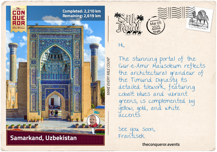
km od začátku : .jpg
Samarkand, Uzbekistan
The legendary city of Samarkand has, for more than two millennia, been a key crossroad for the Silk Road. Sitting on the southern banks of the Zeravshan River in northeastern Uzbekistan, its history traces back to 1,500 BCE. Initially governed by local tribes, the region was later ruled by the Persian Empire until Alexander the Great's conquest.
By the 6th century BCE, Samarkand became home to the Sogdians, ancient Iranians known for their trading skills. It was a melting pot of religions, influenced by Zoroastrianism (Persian faith), Christianity, Buddhism, Hinduism, and Manichaeism (a dualistic religion).
Despite suffering devastation from Genghis Khan's Mongol armies in 1220, Samarkand experienced a remarkable revival in the 14th century under Timur (aka Tamerlane), founder of the Timurid Empire. Timur made Samarkand his capital and turned it into a major cultural and scientific centre.
Many of the city's landmarks are representative of the Timur Dynasty, as they showcase the grandeur and architecture of the era. One of the most iconic examples is the Shah-i-Zinda mausoleum complex, a collection of tombs and mosques dating from the mid-14th to the 16th century. The complex is the final resting place of many of Timur's relatives and Qusam ibn Abbas, a cousin of Muhammad, the founder of Islam. Qusam ibn Abbas is believed to have come to Samarkand to teach Islam and is revered as a martyr, with his tomb serving as a pilgrimage site for Muslims.
Another architectural masterpiece is the Bibi Khanum Mosque, built by Timur to honour his wife. Once one of the grandest mosques in the Islamic world, it was constructed with materials transported by 95 elephants and designed by artisans from Persia and India. The mosque features towering domes, beautifully detailed facades, and extensive use of blue and turquoise tiles. However, the mosque has suffered significant damage due to its hasty constructions and earthquakes over the centuries. Restoration efforts are ongoing to help preserve its stunning tile work.
Perhaps the most historically significant landmark is the Gur-e-Amir Mausoleum, whose name means "Tomb of the King" because it is the burial place of Timur. The mausoleum has an octahedral structure crowned with an azure dome decorated with rosettes and fluting. Its walls are decorated in geometric patterns using blue, white, and terracotta tiles. Inside, the mausoleum is richly embellished with onyx panels, marble stalactite cornices, painted plaster and gilded papier-mâché ornaments. Timur's grave is marked by a solid block of dark green jade, surrounded by the tombstones of his sons, grandsons, and spiritual teacher.
km od začátku : 0005
4 Privet Drive
Little Whinging is a sleepy town with rows of neat, identical houses. This unremarkable place is home to the Dursley family. At number 4 Privet Drive, Vernon and Petunia raise their beloved son Dudley, and their nephew Harry Potter, who has been living here since his parents’ death.
km od začátku : 0011
Hut-on-the-Rock
This cold house perched on a rock in the middle of the sea makes for a very unconventional home. Battered by crashing waves and storms, it does not offer comfort or convenience, but it is remote and completely out of reach of the post.
km od začátku : 0021
Diagon Alley
Although in the heart of London, this magical place is well hidden from Muggles. Any witch or wizard passing through the Leaky Cauldron secret passage will find themselves on Diagon Alley. From wands, robes, owls, and rats to cauldrons, sweets, and even a bank, Diagon Alley has anything and everything anyone might need, especially for a year at Hogwarts.
km od začátku : 0027
Ollivanders
“A wand? Well, you’ll want Ollivanders. T’ain’t no place better!” With thousands of wands packed, stuffed, and stacked on every inch of the shop, Ollivander always has the right wand for the right witch or wizard. The wand always chooses its owner, but Ollivander has an impeccable instinct for picking the right combination of wood, core, and length to present to each of his customers.
km od začátku : 0090
Chessboard Chamber
The Sorcerer’s Stone is held not behind a heavy door or inside a locked chest - if someone desires it, they must overcome a series of obstacles, including the Chessboard Chamber. The immense Wizard’s Chess pieces enchanted by Professor McGonagall to move and play the violent game will stop anyone but the winner from advancing to the next room.
km od začátku : 0108
Great Hall
This multi-functional room is one of the most impressive in the Castle. With warm fires, big bright windows, and a bewitched ceiling, this hall is both welcoming and imposing. Here is where all manner of activities take place - from the Sorting Ceremony to clubs, feasts, and gatherings.
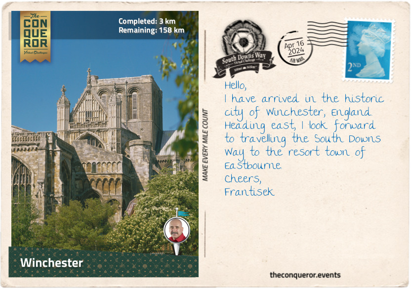
km od začátku : 0003
Winchester
Contained within the South Downs National Park is the 100mi (161km) bridleway known as the South Downs Way (the Way). Accessible to walkers, cyclists, and horse riders, the bridleway was first opened in 1972 and became the fifth national trail in the UK. Initially, it ran for about 80mi (128km) from Buriton to Beachy Head. Fifteen years later, it was extended, starting in Winchester, where the national park’s boundary began, to Eastbourne, stretching across Southern England.
The trail follows the chalk escarpment of the South Downs, with most of the route passing through the open countryside along the top of the ridges. It crosses the counties of Hampshire, West Sussex, and East Sussex. The Way can be tackled in either a westbound or eastbound direction. In a handful of places the bridleway splits for a short distance until it merges back with the footpath. It is waymarked with a white acorn symbol, the UK’s National Trails logo, and colour coordinated with arrows. When the path diverges, the yellow arrow designates the footpath and the blue arrow the bridleway.
Between the hills are expansive verdant valleys with major rivers running through them. The Way climbs up and down these valleys on changing terrain ranging from soft turf to flint paths. Woodland is more prevalent towards Winchester in the west, while wide open spaces and the stunning chalk cliffs on the coast are in the east towards Eastbourne.
I chose to undertake this journey eastbound, preferring to leave the coast and its brilliantly white cliffs for the end. Starting in Winchester, Hampshire, I found the starting point at the Winchester City Mill. With a history dating back 1,000 years, it was a working mill until the early 20th century, when it was converted into a youth hostel. In the early 21st century, the mill underwent extensive restoration turning it back into a working mill and a museum.
Winchester is famous for its magnificent Gothic cathedral, one of the largest of its kind. Built between the 11th and 16th centuries, it is the longest medieval cathedral in the world (558ft / 170m long) with the longest and widest nave. Intricate stained glass windows decorate the cathedral with the most exquisite mosaic design found on the Great West Window. Monarchs and bishops have been buried at Winchester for centuries, but the most well-known burial is one of England’s greatest novelists, Jane Austin. Inside the church is a bust of William Walker, honouring him for saving the church from collapse. When the cathedral’s foundations sprung a leak, William, a deep sea diver, spent six years working underwater, placing concrete bags to stabilise them. For his service, William received the Royal Victoria Order.
Another significant building is the 13th century Great Hall, the only remains of Winchester Castle. The Hall was built by King Henry III, and on its wall hangs King Arthur’s Round Table. The massive tabletop is 18ft (5.5m) in diameter and weighs an enormous 2,600lbs (1,200kg). The current design is from the 16th century and was ordered by King Henry VIII. The table’s edge bears the names of King Arthur’s knights, including Sir Galahad, Sir Lancelot, Sir Gawain, and Sir Percival, to name a few. In the centre is a portrait of King Arthur.
Leaving historical buildings behind, I swung a right turn at The Bishop on the Bridge pub to walk along the banks of the River Itchen and past the Roman wall remains. Heading out of the city, I am on my way to the quaint village of Chilcomb and then toward Butser Hill.
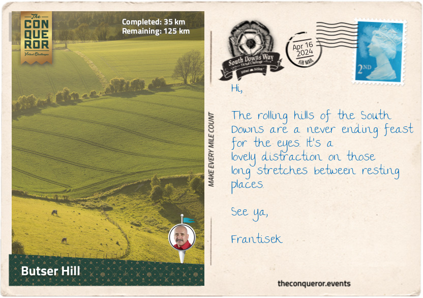
km od začátku : 0035
Butser Hill
After Winchester, the trail entered the countryside, with hedgerows lining its path and large pastures beyond. Outside of Chilcomb, I passed an old barn raised on staddle stones. These traditional mushroom-shaped stones lift granaries or haystacks off the ground to improve circulation and keep the vermin away. I wondered about the contents of this old barn as I strolled by.
Feeling the subtle incline, I meandered through woodland, where vines seemed to take over every tree. Bearing left at a four-way crossing, I cut through a field and crossed a road onto a narrow path. To my left was Cheesefoot Head, a large amphitheater that, during WWII, was used for boxing events. It was also where General Eisenhower addressed the Allied troops before the Battle of Normandy, the largest seaborne invasion in history that led to the liberation of Europe during WWII.
Pressing on through meadows and road crossings, I came to a T-junction where I turned right and walked straight into The Milburys Inn for some pub grub. Replenished, I marched past the site that once was Lomer village, one of many villages that disappeared during the Middle Ages. At Beacon Hill, a National Nature Reserve, I climbed 660ft (201m) to its summit to enjoy views of Meon Valley and as far as the Isle of Wight. Several species of orchids and different types of chalk grassland inhabit the area. Drawn to the flowers are the pretty Chalkhill blue butterflies.
After Beacon Hill, tucked away in a cow paddock, was Exton Beacon, erected in 2012 to commemorate Queen Elizabeth II’s Diamond Jubilee. Less than a mile further, I walked through the pretty little village of Exton, sitting on the west bank of the Meon River. Exton may be small – population 200 – but it has been around since the Anglo-Saxon days back in the 10th century. The Shoe Inn and the 13th century church are the only community buildings in town.
A further 8mi (13km) through the countryside and I arrived at Butser Hill, the original starting point of the Way. At 885ft (270m), Butser Hill is the highest point on the South Downs Way and is home to rare chalk grassland species. A mile further is the Queen Elizabeth Country Park. Designated an Area of Outstanding Natural Beauty (AONB), the park is one of the largest expanses of unbroken forest in the southeast of England. The park’s woodland, mostly beech trees, was planted in the 1930s. The park is twinned with the Queen Elizabeth National Park in Uganda, focusing on cultural exchange, conservation, and supporting local communities.
It’s time for refreshments at the Butser Roundhouse Café. Housed in a replica Iron Age roundhouse, I chose a lemon drizzle cake and a pot of English Breakfast tea. Consulting my map, I got a feel for the next stage of my hike to Amberley.
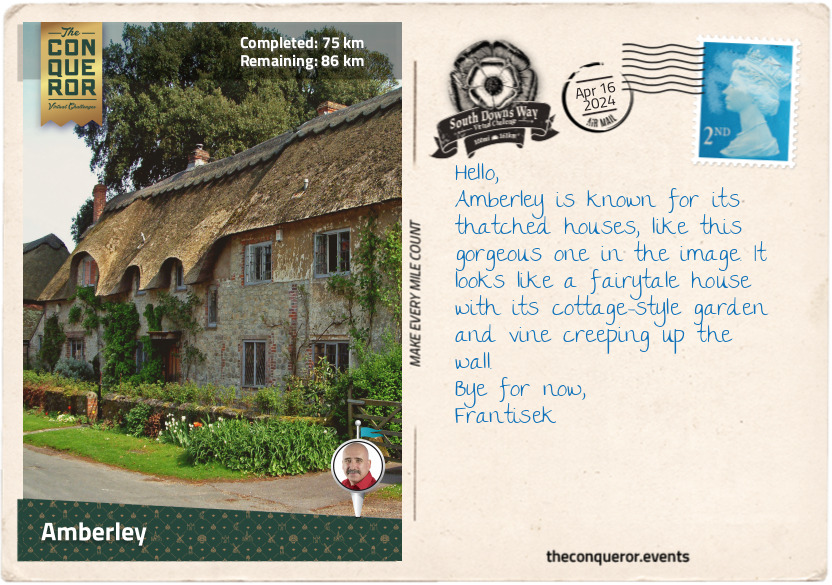
km od začátku : 0075
Amberley
After the beautiful Queen Elizabeth Country Park, I was delighted to walk through more woodland. This time I wandered through Coulters Dean Nature Reserve, where pretty wood anemones, violets, and primrose line the trail’s edges in spring. Half a mile further and I entered the county of West Sussex.
As the trail continued, narrowing once again, in the distance up on Tower Hill was the ruined folly of Uppark House. The house is more than 300 years old and has been remodelled many times over successive generations. As part of its fine interiors and collectible items, the most significant is a large 18th century doll’s house, one of few surviving from that era. Three storeys high, the interiors are intricate, containing silk-covered mahogany chairs, Flemish-style oil paintings, porcelains, and a fully decked-out kitchen. The dolls illustrating the upper class are dressed in fashionable clothes and made of wax, whereas the servants are made of wood and wear simple clothing. The house is in excellent condition, leading curators to believe it was bought as a curiosity and display item instead of for play.
The National Trust’s Harting Down, a large area of ancient chalk downland, was south of the village. A little further was Beacon Hill, developed as an Iron Age fort around 500 BC. It was a fairly steep climb to the top, but the effort was worthwhile for the stunning 360 degree views.
Two miles (3.2km) later, the trail skirted around a series of large Bronze Age burial mounds collectively called the Devil’s Jumps. Thought to be nearly 4,000 years old, they are very well preserved, measuring between 85-112ft (26-34m) in diameter and up to 16ft (4.5m) high. The name, though, is part of folklore. Apparently, the god Thor used to sit on a hill. One day the Devil, seeing the mounds, decided to jump from one to the next to alleviate his boredom. Thor wasn’t happy about it and threw a stone at the Devil, who subsequently fled.
Tucked away in a corner amongst the trees was a small, well-tended memorial for a 25-year-old German pilot called Hauptmann Joseph Oestermann. He was shot down by a British pilot at the start of WWII while two airmen parachuted to safety. Ironically, the British pilot was shot down later in the day over the English Channel. He survived but sustained injuries to his legs.
The walk over Bignor Hill follows an old Roman road. In the village of Bignor, north of the Way, is a prominent 3rd century Roman Villa full of exceptionally well-preserved and highly detailed mosaics.
I passed through the northern end of the Slindon Estate, a National Trust property focused on conserving the 1,400 hectares in its care. One of its major restoration projects was reconnecting the disjointed woodland called Northwood. Much of the ancient timber was cut down and used during WWI, and the land was converted to farmland. Over the last decade, the Trust planted more than 13,000 trees to fill the gaps and help restore the wildlife corridors. It’s regarded as the biggest man-made forest to date.
The trail led me down into the picturesque Arun Valley, where cowslips bloom in spring, carpeting the valley in a sea of yellow. Crossing the Arun River, I arrived in the small village of Amberley, where a 900-year-old castle was converted into a luxurious hotel - a splendid place to finish my day.
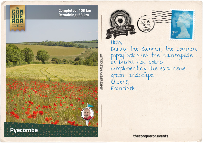
km od začátku : 0108
Peycombe/h2>
Walking uphill from Amberley, I followed the Way up on the ridge to Kithurst Hill, marking the halfway point of my journey. The trail dropped just before I crossed the busy highway and back up the hill to Chanctonbury Ring. A prehistoric hill fort topped with beech trees, Chanctonbury is famous for legendary tales. According to myth, one must walk around the Ring seven times backward on a dark, moonless night to summon the Devil, who will trade a bowl of milk or soup for one’s soul or wish. Spooky stories have been told where “thudding hooves of invisible horses can sometimes be heard,” or a ghostly lady on a white horse can be seen if the Ring is walked around three times. The tales have found their way into modern times, with UFO sightings recorded at the Ring.
As I approached Steyning Bowl, I passed by a memorial to local farmers, Mollie and Walter Langmead, ‘laid to rest on their cherished Downs.’ A bit further was a triangular cluster of trees called the Bramber Beeches. They were planted to commemorate the Sussex branch of the Women’s Institute diamond jubilee in 1979. The Institute is a century-old women only organisation focused on bringing women together and providing educational opportunities. Held in high regard, several British monarchs were members, including Queen Elizabeth II, her mother, grandmother, and daughter (who is a current member).
From here, I walked through the sleepy village of Botolphs, crossed the Adur River, and climbed onto the Fulking escarpment with views of Fulking village. Next was the National Trust’s Devil’s Dyke. This steep v-shaped dry valley was a trendy destination during Victorian times. Various transport ventures used to take visitors to the foot of the hill, including a funicular, a cable car, and a single-track railway. Remnants of all three can still be seen today. Nowadays, the area is popular with hang gliders and paragliders.
Just past the Dyke, I came upon Saddlescombe Farm, another property cared for by the National Trust. Farmed for more than 700 years, Saddlescombe was once in the ownership of the Knights Templar in the 13th century. The farm has several preserved buildings, a blacksmith’s forge, and a donkey wheel used to raise water from the well 50m below. The nearby woodland is home to a 1,000-year-old lime tree and a graffitied beech tree dated 1880, which today holds “the record as the single tallest native British tree in the UK.”
I finished this journey in Pyecombe, a village with two different settlements. The secondary settlement is called Pyecombe Street. The village split after the 1603 plague ravaged London and the surrounding countryside, forcing the villagers to move a quarter of a mile away.
With little else to do, the Plough Inn, serving travellers and locals since the Victorian times, seemed like an excellent place to rest and have a great feed.
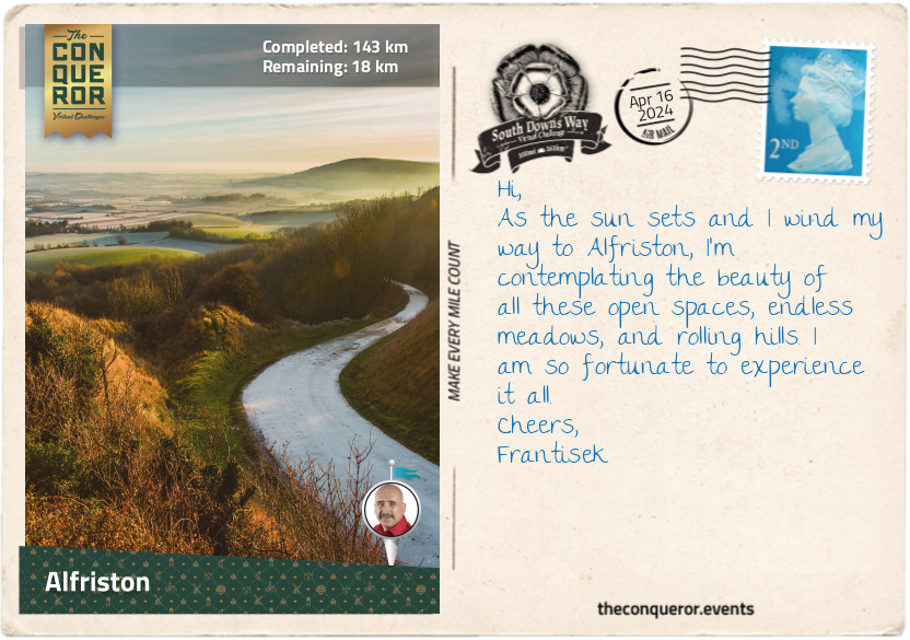
km od začátku : 0143
Alfriston
Having left Pyecombe, I turned right at the golf club and a short way down, facing north, I could make out one of the Clayton Windmills. Both from the 19th century, they are affectionately known as Jack and Jill. Relocated from Brighton, Jill is a working mill with a double-storey roundhouse, whereas Jack is a five-storey tower mill that was converted into a private residence.
I crossed into East Sussex county a mile (1.6km) before Ditchling Beacon. The Beacon is the highest point on the Way in Sussex and is owned by the National Trust. As is the Blackcap Nature Preserve, where I took a sharp right turn and walked through fields and woods to the A27 highway.
Crossing the highway on an overhead bridge, I soon passed beneath a railway via an arched tunnel that opened to a wide grassy valley. Before my 80th mile (129km), I happened upon a wooden fingerpost marking the Meridian Line, demarcating the Western and Eastern Hemispheres. Not far from here is the village of Rodmell, where Monk’s House, a 16th century weatherboard cottage, is known to have been the home of renowned author Virginia Woolf.
Swinging right, I walked through Southease and over River Ouse, one of five rivers in the UK with the same name. The name Ouse is derived from the Celtic word for water, making the literal translation as River Water. The Ouse in Sussex, with all its tributaries, runs over 140mi (225km) long and flows into the English Channel.
The trail traversed Ouse Valley, dotted with farms, woodland, and colourful wildflowers spread across the landscape. North of Firle Beacon is Charleston House, where Vanessa Bell, Virginia Woolf’s sister, resided and worked as a painter. It was here, along with Monk’s House, that the Bloomsbury Group - made up of artists, writers, and intellectuals - gathered to share their progressive thoughts and ideas.
Heading southeast, I arrived in Alfriston village. Its main street had a delightful collection of buildings, with the three local pubs as the most interesting. The oldest building, circa 1358, used to be a butcher’s shop in the 19th century and was owned by Stanton Collins, a legit butcher by day and smuggler by night. His shop was a convoluted maze of 21 rooms, 48 doors, and six staircases to hide the contraband. Smuggling was rife during Stanton’s times, and it was in the shop he and his gang planned a daring raid of a Dutch ship stranded in Cuckmere Bay. Sometime in 1831, Stanton was caught for stealing and promptly shipped off as a convict to Australia. According to records, he served his sentence and returned to England. Eventually, he migrated to New York, USA, where he lived out his remaining days.
Another significant building is the Star Inn. It was built in the 14th century as a religious hostel to accommodate monks and pilgrims on their way to Chichester Cathedral. Two centuries later, it was converted into an inn. Leaning against a wall outside is a red lion figurehead thought to have washed ashore from a wrecked ship and brought to Alfriston by smugglers, which could have been Stanton’s gang.
The third pub, the George Inn, was first licensed in 1397. Its half-timbered façade dates back even further to the mid-1200s. The Inn is known for the network of smugglers’ tunnels leading from the cellars.
Alfriston may be small, but its long history calls for a little more exploration before I move on.
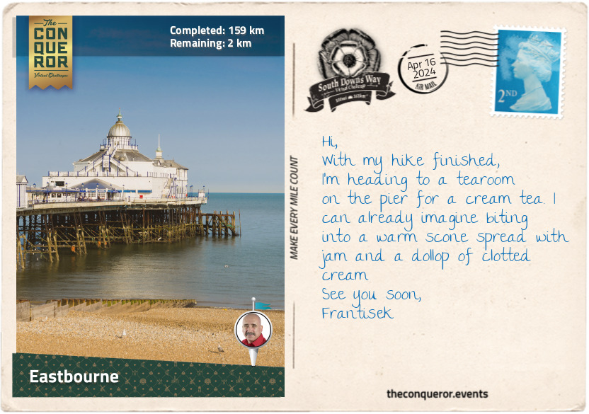
km od začátku : 0159
Eastbourne
I left Alfriston and started the final stage of my journey. I walked for about a mile (1.6km) beside Cuckmere River to the quiet village of Litlington. Pretty cottages and cottage gardens lined the narrow streets. A little out of town up on Hindover Hill was the Litlington White Horse, a chalk horse figure cut into the hillside in 1924. Cared for by the National Trust and regularly maintained with volunteers’ help, the horse measures 93ft (28m) long and 65ft (20m) high. An earlier cut from the 19th century existed on the same site, believed to have been done to commemorate Queen Victoria. The cut was fully covered by the early 1900s due to a lack of maintenance.
Southbound, I veered away from the river onto the clifftop to enjoy the lovely views of Cuckmere Haven. But as I inched towards the clifftop edge, I was met with the most beautiful sight - the chalky sea cliffs that this region is resoundingly known for. Referred to as the Seven Sisters, these series of cliffs on the English Channel coast are sea-eroded sections of the South Downs hills, and the dips in between are remnants of dry valleys. Each crest and dip has been individually named by locals. An eighth cliff is being created as a result of sea erosion.
The English Channel is the busiest shipping channel in the world, with shipwrecks across the centuries in the thousands. However, the most intriguing project I discovered was by the Maritime Archaeology Trust. Since 2019, the Trust has been researching and documenting the shipwrecks from World War I. They have mapped over 1,000 sunken ships off the English Channel coast. Many of them are fragile and extensively deteriorated. The Trust’s aim is to turn attention to these lesser-known wrecks and tell their story before they disappear.
One such story is of the wrecks HMS Nubian and HMS Zulu. Nubian was struck by a torpedo, blowing off its front section, but the rear remained afloat. On the other hand, Zulu had its rear blown off by a mine. Both were towed to the Chatham dockyard, where the two ships were joined together to make an entirely new one. With the names also joined, the new ship was launched as HMS Zubian.
Following the coastline, I climbed to Beachy Head, where the lonely red and white striped lighthouse stood in the shallow water below. The builders and construction materials had to be lowered from the clifftop by cableway to build the lighthouse. Erected in 1902, today, it is a popular visitor location and a terrific subject for keen photographers.
Arriving in Eastbourne, the east end of the South Downs Way, I was pleased to complete my walk in this seaside resort town. The shoreline was a beautiful mix of Victorian hotels, townhouses, and military fort. A 19th century pier was lined with entertainment venues and tea rooms. The pristine beach was a little chilly but a wonderful place to conclude my trip.
Cheerio.
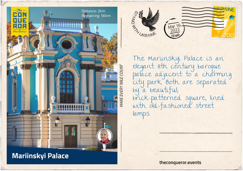
km od začátku : 0002
Mariinskyi Palace
Ukraine is the second-largest country by area in Europe, with its capital city in Kyiv. It is bordered by several countries (Romania, Moldova, Russia, Belarus, Poland, Slovakia and Hungary) and two seas (Black Sea and Sea of Azov).
Settled by Slavs in the 5th-6th centuries AD, today, Ukraine has the second-largest East Slavic ethnic group after Russia. Between its early settlement and now, Ukraine was occupied by various conquerors beginning with Swedish Vikings who, in the 9th century, converted the people to Christianity. Orthodoxy became the most dominant religion, highly influencing Ukrainian customs.
In the 13th century, the Mongols conquered the south and east of the country, leaving the north and west relatively independent. A century later came the Polish and Lithuanians. When serfs ran away from their Polish landlords, they settled in the steppes of Ukraine, forming their own self-governing communities. They became known as the Cossacks, meaning free men, but by the late 18th century they were disbanded and absorbed into Russia.
Fast forward to the 21st century and the Ukrainians experienced a brief independent period in 1918 before the nation was re-absorbed by Russia. After the Cold War and the dissolution of the Soviet Union in 1991, Ukraine regained its independence and has been a developing country since, trading in agriculture and metals, amongst other things.
Ukraine’s biggest export commodity is sunflower seeds. This bright and cheerful yellow flower with a centre packed with seeds that are both edible and used to make oil, is Ukraine’s national flower. Brought from North America by explorers, it was discovered that it grew prolifically in the rich soil of Ukraine and by the 1800s, extensive fields of sunflowers were all over the country. Embroidered on fabrics, painted on walls, furniture and household items in a folk art called petrykivka, the sunflower represents warmth and the power of the sun.
Additionally, this flower’s versatility sees no bounds. In the wake of the 1986 Chernobyl nuclear disaster, scientists planted millions of seeds because they discovered that the sunflower had the ability to rapidly soak up certain radioactive material. Disposing of the flowers is a faster and easier process than removing the soil from the affected area. Then in 1996, to mark the removal of the nuclear arsenals in Ukraine that were inherited at the end of the Cold War, officials from Ukraine, United States and Russia planted sunflowers atop the destroyed nuclear missiles. As such, the flower became a symbol of peace and nuclear disarmament. Today, the sunflower continues to be a symbol of hope and solidarity, a productive agricultural crop, and a cleaner of toxic waste.
The city of Kyiv was founded in the 5th century AD and named after one of the four legendary founders, who were three brothers and a sister: Kyi, Schcheck, Khoryv and Lybid. Home to high tech industries and a centre for education, science and culture, Kyiv is also a treasure trove of historical landmarks and nearly 1,000 churches. Green spaces abound throughout the city, and it is endowed with three UNESCO designations: St Sophia Cathedral, the Monastery of Caves (Pechersk Lavra) and the Collection of Jewish Musical Folklore.
This journey begins at Mariinsky Park, a city park founded in 1847 by Maria Alexandrovna - Empress of Russia, one of the founders of the Russian Red Cross, founder of the first Russian all-female school and famous for aiding her husband, Tsar Alexander II, with ending serfdom. During the 19th century, the park brimmed with busts and sculptures, which have since been removed, however the cast iron fountain installed in 1900 continues to hold a prominent position.
Adjacent to the park is the Mariinsky Palace, which the park is named after. A stunning baroque palace, construction was completed in 1752 with Catherine the Great being the first imperial member to stay in it during her visit in 1787.
The palace burnt down in a fire in the early 19th century and was left empty and abandoned until Tsar Alexander II restored it and renamed it after his wife. By the 1920s it was used as an agricultural school, then a museum and, following serious damage in WWII, it was restored twice more.
Today, the palace is used for official receptions and summits. Outside, it is beautifully painted in a sea foam colour with white and ivory accents. Inside it consists of 55 rooms on the ground floor, used for official purposes and the second floor has 26 richly adorned suites and halls. The walls are decorated with paintings by foreign and Ukrainian artists loaned from galleries in Kyiv, L’viv and Odessa.
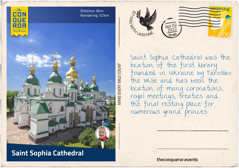
km od začátku : 0006
Saint Sophia Cathedral
Founded in the 11th century, Saint Sophia Cathedral gets its name from Hagia Sophia Cathedral in Istanbul, Turkey. Saint Sophia is the first heritage site in Ukraine to be inscribed on UNESCO’S World Heritage List.
It was founded by Yaroslav the Wise, a Swedish Viking and ruler of the Kyivan Rus federation. Occupying the region, Yaroslav made Kyiv the capital from 882 AD, which it remained until 1240 AD when the Mongols invaded. Yaroslav is often referred to as the Father of Europe whose many offspring wed into European royal houses. His body is entombed in a white sarcophagus within the cathedral.
The cathedral is a magnificent Byzantine structure, with a high central dome representing Christ surrounded by smaller domes representing the apostles. The arched entrance denotes the heavenly gates through which people enter. The white cathedral is topped with green domes and gilt cupolas.
The interior is richly adorned with mosaics made of shiny gold background with blue, grey, and white accents. All the frescoes date back to the cathedral’s constructions. During the 19th century they were restored with oil paints. A 15-year scholarly study of the cathedral’s hidden passages culminated in a body of works, listing more than 7,000 ancient graffiti dating from the 11th-18th century.
Next to the cathedral is a 250ft (76m) tiered bell tower with a pear-shaped dome in gilded bronze. The light blue exterior wall is decorated in detailed stucco ornaments and bas-reliefs.
The cathedral barely escaped destruction in the 1920s when the government at the time planned to use the grounds for the construction of a “Heroes of Perekop” park. It was saved by the intervention of scientists and historians. However, the cathedral was confiscated from the Orthodox Church in 1934 and designated a secular museum with the majority of visitors being tourists.
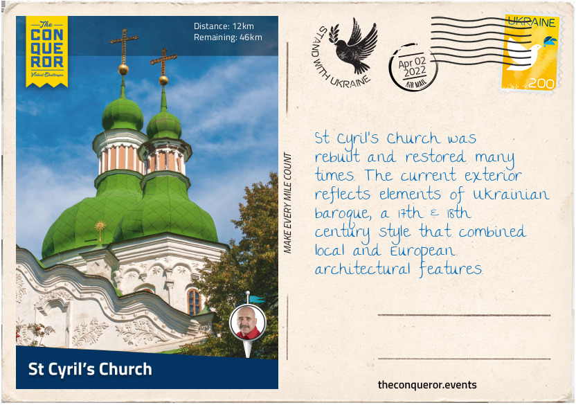
km od začátku : 0012
St Cyril’s Church
Recognisable by its deep green domes and cupolas, St Cyril’s is a medieval monastery containing a 12th century church and architectural elements from the 17th and 19th century. It is located north of the city centre on the edge of Kyrylivsky Hai, a large, wooded park.
The monastery was named after Cyril of Alexandria, who was the Patriarch from 412-444 AD and the church within its grounds was the burial place for the Olgovichi family, the founders of the complex. The monastery was rebuilt following fire damage in 1734 and extra monastic buildings, a belfry, and gate were added. Unfortunately, the belfry was demolished in 1937.
By the late 18th century the monastery was closed and converted into a hospital. A mudflow during the 1960s caused new damage but fortunately most of the church survived in its original form. Inside are enormous 12th century frescoes painted by Mikhail Vrubel, a 19th century Russian artist, and several unknown Ukrainian artists.
Designated a state museum in 1929, the church was saved from destruction at a time when many other sacred monuments were being torn down.
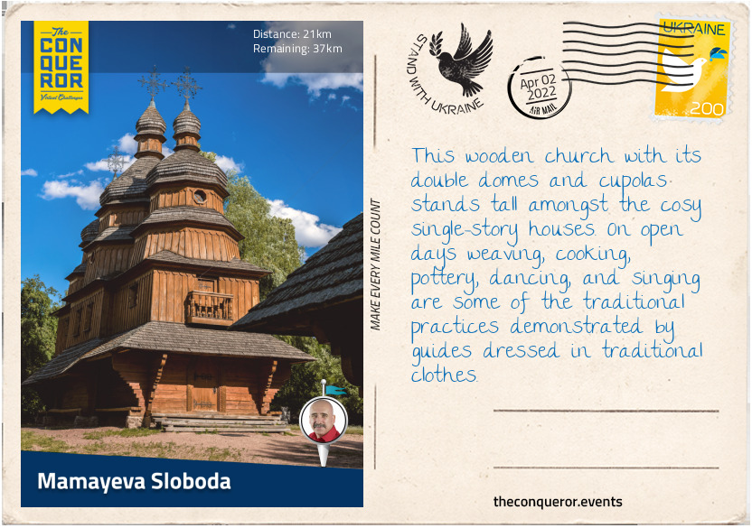
km od začátku : 0021
Mamayeva Sloboda
Tucked in a park amongst high rise residences is the open-air Cossack village known as Mamayeva Sloboda. Made up of wooden houses, a church and other buildings, the village depicts rural life.
The park often hosts dances and festivals and the traditionally dressed guides tell stories of the buildings and the Cossacks’ way of life. Cooks of traditional dishes, weavers and blacksmiths demonstrate their specialty, whilst others may re-enact Cossack fighting techniques.
Rural and folk traditions are an important part of Ukrainian culture. It is a way to carve their own distinctiveness from the many similarities they share with their neighbours. They are evident through their folk costumes, traditional dances and songs, hearty dishes and especially their exquisite embroideries.
Ukraine’s embroidery history is more than 2,000 years old; appearing in folk dress, embroidered shirts known as vyshyvanka, weddings, and other celebrations. Each design, the colour used, and type of stitch applied reflects the region it originated from.
Traditional belief is that a person wearing a vyshyvanka will be protected from all harm. That is because the ornaments embroidered on the shirt are like a coded pattern, where some may bring prosperity and others protection or luck. A disorganised set of patterns may bring distress or change of one’s fate.
The designs are characterised by their region. For instance, flowers and plants prevail in the south and east of Ukraine. They symbolise purity, renewal, and family prosperity. Whereas geometric patterns are reflected in the west of Ukraine symbolising the beauty of nature, fertility, and well-being. Used less often are animal patterns and although not depicted on clothes, they are found on embroidered towels. A wedding towel, for example, may have doves or roosters, facing each other as ornaments.
Celebrated in May, the International Day of Vyshyvanka, is a holiday aiming to preserve “the original folk traditions of creating and wearing ethnic embroidered Ukrainian clothes” and at the same time celebrate the Ukrainian people’s spirit of unity, patriotism, identity, culture, and tradition.
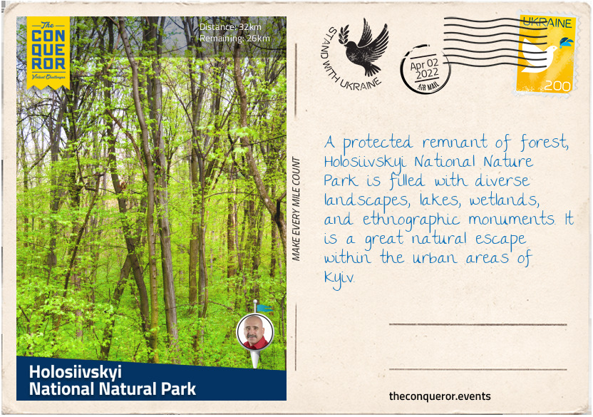
km od začátku : 0032
Holosiivskyi National Nature Park
Green spaces are dotted all over Kyiv, giving its people ample opportunity to escape to nature close to home. Holosiivskyi National Nature Park is one such space located in the hills outside the city centre.
First mentioned in the early 16th century, the park encompasses approximately 11,000 hectares of forest and swamps. With a flora collection of more than 650 species of vascular plants (i.e. ferns), 118 species of moss and 60 species of fungi, the highlight of the park is the age-old oaks scattered throughout with some as much as 500 years old. Delicate flora such as the small pasque flower, Siberian iris and martagon lily bring a dash of colour to the verdant landscape.
Its fauna collection is also quite diverse with 100 species of birds, 44 species of mammals and several species of reptiles, amphibians, and fish. Elks, foxes, hares, and deer make the park their home along with more rare species of snake, otter, stoat (small weasel) and the old-world swallowtail butterfly.
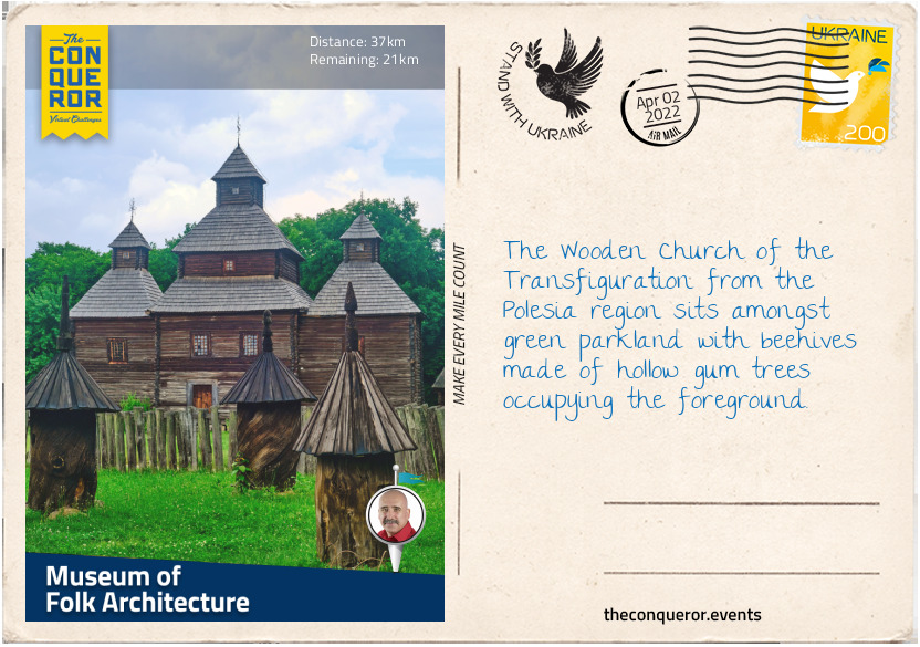
km od začátku : 0037
Museum of Folk Architecture
Pyrohiv is a small village south of Kyiv and home to the open-air Museum of Folk Architecture and Life of Ukraine, the largest outdoor museum in Europe. It was founded in 1969 and holds a collection of more than 300 buildings dating back to the Middle Ages that were sourced from all over Ukraine and rebuilt onsite to illustrate Ukraine’s rural history.
At the centre of the museum are the wooden windmills scattered on the grounds, surrounded by wooden single-story houses and a number of churches. The museum is separated into two sections each representing a specific Ukrainian region. The oldest church, known as Naddnipryanska, was built in 1742.
Over 40,000 vintage household items are held by the museum such as costumes, embroidery, carpets, ceramics, metal crafts, woodwork, glassware, artworks, and musical instruments. Traditionally dressed artisans and volunteers demonstrate the use of daily items and during different folk holidays, the museum conducts theatrical performances and festivals.
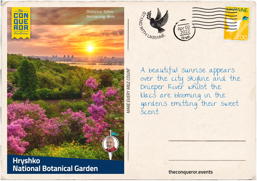
km od začátku : 0050
Hryshko National Botanical Garden
Hryshko National Botanical Garden was established in 1936 and contains 13,000 species of flora from all over the world. It was named after botanist Mykola Hryshko. Within its grounds are the Vydubychi Monastery and Trinity Monastery of St Jonas.
The garden is divided into separate zones, representing flora from different regions such as the Ukrainian Carpathians (mountains), the Plains of Ukraine, the Caucasus (between Black and Caspian Seas), Altai and Western Siberia and Asia. It has more than 350 species of orchids and the greenhouse cares for rare tropical and subtropical plants.
Garden designs may include parterre (an ornamental garden with paths between the beds), decorative succulents, woody plants or flower beds filled with roses, irises, chrysanthemums, tulips, and lilies to name a few.
The tropical and subtropical collection may include bromeliads, azaleas, camellia, cacti, palm, and ornamental deciduous plants.
The highlight of the garden is in May, during the lilac’s blooming season. It has a heady sweet fragrance and blooms in delightful shades of lilac, light purple, and lavender.
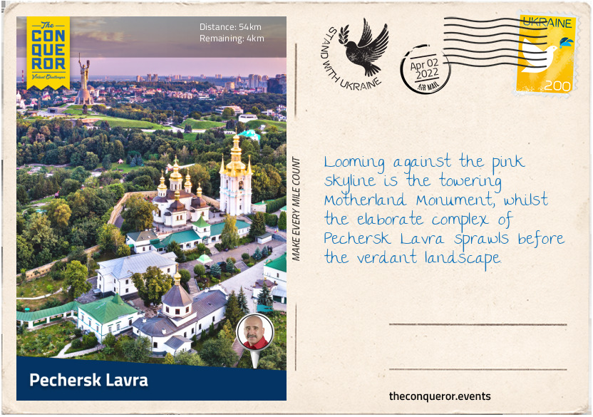
km od začátku : 0054
Pechersk Lavra
Founded in 1051 AD as a cave monastery, Pechersk Lavra is the largest museum in Kyiv. It began with a Christian monk from Mount Athos, Greece, who settled in Kyiv and chose a cave on the current site with views over Dnieper River. As disciples grew, Prince Iziaslav I (oldest son of Yaroslav the Wise), gave the whole site to the monks who then built the monastery.
The complex is a combination of bell towers, churches and cathedrals, cave systems and fortification walls. At 316ft (96m) tall, the Great Lavra Belltower was built between 1731-1745. At the time it was the tallest free-standing belltower in the world. Consisting of four tiers, each tier is surrounded by columns and archways and the top is covered with a gilded dome. The Dormition Church was originally built in the 11th century. Unfortunately, during WWII it was completely destroyed. Having been fully rebuilt and restored in 1995, it is now the main church in the complex.
The museum houses numerous historical relics such as precious metals, rare prints and photographs, chalices, crucifixes, textiles, needlework, and embroidery. The complex’s catacombs contain the remains of Eastern Orthodox saints.
A mile south of the monastery is the incredible stainless steel 203ft (62m) tall statue known as the Motherland Monument, weighing a staggering 560 tonnes. A 52ft (16m) long sword is in the statue’s right hand and a shield in the left. The statue is part of a wider historical complex commemorating the German-Soviet conflict during WWII. At the base of the monument is another significant statue entitled Crossing the Dnieper. The Museum’s Memorial Hall displays the names of more than 11,800 soldiers and workers honouring their service during the war.
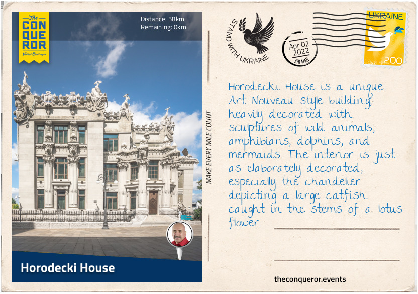
km od začátku : 0058
Horodecki House
Horodecki House, also referred to as the House of Chimaeras, is located directly across from the President’s office and as such is often used as the Presidential residence for official visits and diplomatic ceremonies.
Built in 1901 by Polish architect Wladyslaw Horodecki, the house was originally intended to be an apartment building of which he would use one for his own purposes. Financial troubles, however, forced Wladyslaw to sell the property. It changed hands numerous times, then it was vacated and sat empty until its restoration in the 2000s. It was built entirely out of cement because at the time it was not a popular building material. The usage of cement was intended to draw attention and publicity to the house and the building material. Although the house appears only three storeys high, from the rear all six levels are visible.
The unusual aspect of the house is the use of exotic animals, shipwrecks, and hunting scenes to decorate the outside of the house. There are rhinos, frogs, mermaids, snakes, and dolphins adorning the upper section of the building. This architectural style is known as chimaera (unrelated to the chimaera of mythology). A set of stairs to the right of the house leads to a narrow entry door. Six tall Corinthian columns were added to the front façade with statues of deer set atop it.
Due to the house’s close proximity to the Presidential office, the street separating them has been closed off to vehicular traffic and is now used as a patrolled pedestrian zone.
Kyiv is a vibrant city filled with beautiful architecture, nature parks, monuments and a long history. It has a rich traditional and contemporary art and craft scene, and it is a food lover's heaven.
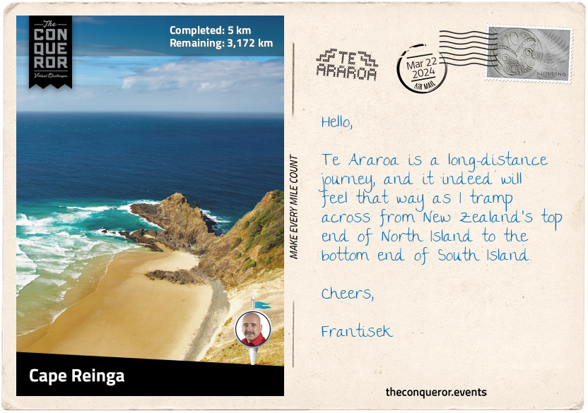
km od začátku : 0005
Cape Reinga
In the beginning, there was a great nothingness, an empty faceless void that the Māori called Te Kore. From this void came Te Pō, the realm of perpetual darkness, where the celestial parents, Ranginui (the sky father) and Papatūānuku (the earth mother), were tightly joined together in an eternal loving embrace. Many sons were born out of this union, living in the darkness between their parents. Yearning for light and a curiosity about what lay beyond their tight confines, the sons decided to separate their parents. One after the other, they tried and failed to break their parents' bond until it came to Tāne, the god of forests and birds. Tāne pushed and pushed with all his might, slowly separating his parents until Ranginui (Rangi) was high enough to become the sky, and Papatūānuku (Papa) remained where she was, becoming the earth.
Brought into the light, Tāne sought a female element to bear his children. Since none existed, he concluded that he must create and mould one from the red earth. As life was breathed into the new form, Hineahuone, the first woman, was born. Together they had several daughters, including Hinetitama, later known as Hine-nui-te-pō (goddess of death). She was an ancestor of Māui, who crushed him to death when he attempted to win immortality for humankind, making him the first man to die.
Māui was a demigod, a cheeky trickster and shapeshifter. Prematurely born, he was cast into the ocean by his mother. Protected by sea fairies, he was returned to shore as a live baby. He was found by his grandfather, Tamanui-ki-te-Rangi, who raised Māui and passed on all his knowledge and incantations. Māui later reunited with his mother and siblings. One day, the siblings refused to take him fishing, so he snuck onto and hid at the bottom of their waka (canoe).
The following day when they were too far from land to return, Māui used his grandmother Muriranga-whenua's jawbone - a gift to him - refashioned into a fishhook to cast into the ocean. Since his brothers wouldn't share any bait with him, he hit himself on the nose and used his blood instead. Soon he had a great bite and struggled to pull the fish. His brothers were unwilling to help, leaving Māui to recite an incantation to keep his line strong. Reeling his catch, Māui hauled a giant fish which today is known as Te-Ika-a-Māui (The Fish of Māui), the North Island of New Zealand.
This is the creation story in Māori mythology, the indigenous people of Aotearoa (New Zealand). The story of New Zealand's South Island diverges between the northern and southern Māori cultures and one that I will tell at a later stage.
Traditional stories fill me with wonder and imagination. As I look at the map of North Island, I see the shape of a stingray emerging. The tail is at Cape Reinga, the island's northern point and the head is at the southern end in Wellington. The fins are the landmasses bulging out on either side. Can you see it?
With excitement and a good dose of nervousness, I embark on a long-distance journey of 1974mi (3177km) through the entire length of New Zealand on the iconic Te Araroa. Beginning in Cape Reinga near the tip of North Island, I will travel south over various landscapes, through towns, and past Māori marae (meeting houses). I look forward to experiencing the contrast between the more populous North Island and the remote wilderness of South Island. Along the way, I hope to capture the stories, history, and spirit of this country and its people.
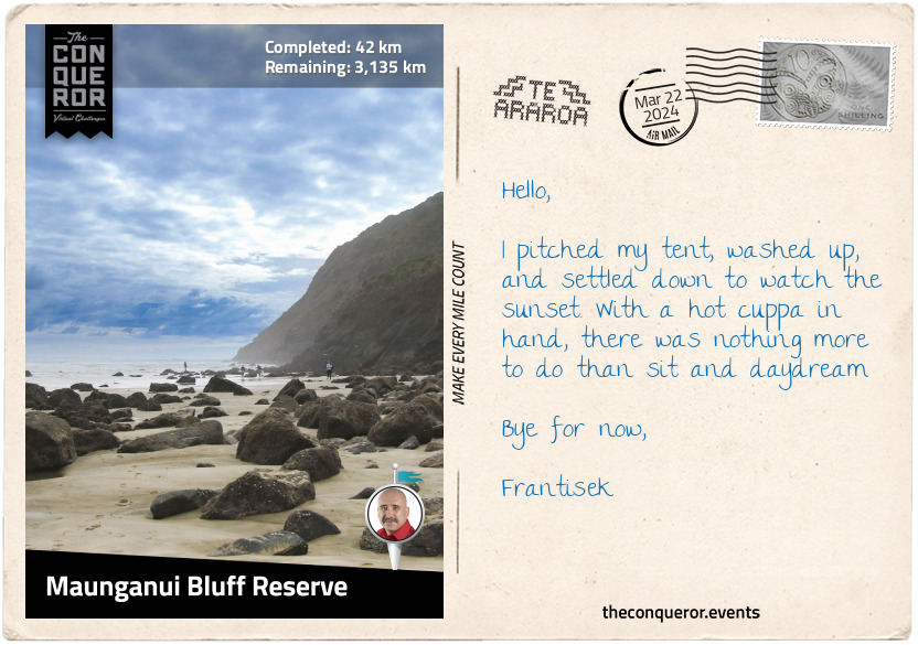
km od začátku : 0042
Maunganui Bluff Reserve
The trail took a right turn near the Cape Reinga car park and travelled the ridgeline along the coast, descending onto Te Werahi Beach. Wide and pristine, the beach led to peach-coloured dunes with views of Cape Maria Van Diemen. The cape was named by Abel Tasman, after the wife of Governor Anthony van Diemen. Tasman was a Dutch explorer who, in 1642, sailed past Van Diemen's Land (now Tasmania) and soon after sighted the west coast of New Zealand. The cape and a group of islands further west, the Three Kings, are the only two locations in New Zealand that retain the original name Tasman gave them.
Continuing by the coast, I strolled onto Twilight Beach, back up a small hill through the bush, followed by a steep stair descent to Ninety Mile Beach and the Giant Sand Dunes. The dunes are 6mi (10km) long and up to 490ft (149m) high. A good fitness level is needed to climb to the top, but a sled ride hurtling down the sand would make it all worthwhile.
I took a break at Maunganui Bluff Reserve. It had a basic camping site and a rocky outcrop called Wakatehāua Island. The coastal vegetation was dominated by Pohutukawa, a tree that blooms with blazing red floral clusters during the summertime.
The Pohutukawa is New Zealand's symbol of Christmas and a sacred tree to the Māori people. At Cape Reinga is a gnarled Pohutukawa where Māori spirits begin their long journey to their ancestral home Hawaiki. Following the World Wars, the trees were planted en masse around Wellington's War Memorial to commemorate the fallen, including the Pacific Island volunteers who fought for New Zealand.
After setting up camp, I took a quick dip in the ocean to wash away the day's grit and sweat, settled into the evening with a hot cuppa, and watched the sun slowly disappear over the horizon.
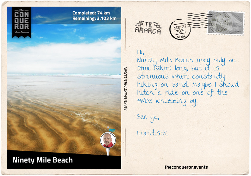
km od začátku : 0074
Ninety Mile Beach
The Ninety Mile Beach is expansive and never-ending, stretching as far as the eyes can see. In the 1930s, it was used as a runway for an airmail service from Australia. Luckily, I didn't need to worry about airplanes coming in for a landing as it's no longer in use. The beach, however, is an official highway with 4WD enthusiasts motoring on it during low tide.
The reason for the name "Ninety Mile" is a puzzling question because the beach stretching from Tiriparepa/Scott Point near Cape Reinga to Ahipara Bay is only 54mi (88km) long. Early European settlers apparently figured that their horses or livestock could travel 30mi (48km) per day and take three days to arrive at their destination. Simple mathematics concluded that the beach was 90mi (145km) long. The settlers didn't consider that travelling on the sand was much slower than travelling on the road.
In Māori, the beach is called Te Oneroa-a-Tōhē, meaning the 'long beach of Tōhē '. The name commemorates Tōhē, an elderly chief of the Ngati Kuri people who lived in Kapowairua (Spirits Bay) near Cape Reinga. One day Tōhē, very old at this stage, decided to take a walk south to see his daughter one final time. Although he died before reaching his daughter, Tōhē named over 100 places along the western coast of the far north of North Island.
Each year at the end of March, the beach hosts the Snapper Surf Casting Competition, where the one-species-of-fish competition makes up the five day event. More than 1000 anglers are drawn to the event, vying for the largest snapper and the enticing prizes. The heaviest snapper thus far weighed 26lbs (12kg). Anyone up for some surf fishing?
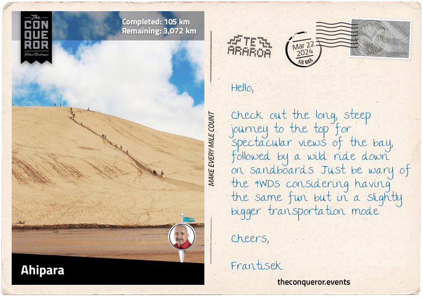
km od začátku : 0105
Ahipara
My trek on Ninety Mile Beach ended in Ahipara, a small community of 1450 residents. It used to be known as Wharo, 'stretched out', because Chief Tōhē ordered a servant to measure the distance between the receding tide and the water level by counting the number of arm spans.
With its unspoiled beach, Ahipara is a popular spot for surfcasting (beach fishing), land yachting (a three-wheeled vehicle powered by sail), and quad biking. But a fun experience was doing the 'Tuatua Twist'. All I had to do was dig my feet in the shallow water during low tide and twist until I felt the tuatua's (clam) edge. These shellfish are delicious when steamed in a mixture of garlic, butter, herbs, chili, and white wine or water. Another option is to make clam fritters mixed with curry powder, diced onions, and tomatoes, then shallow fry and serve with a fresh salad.
Left of the town was Te Kōhanga (Shipwreck Bay), a place appreciated by surfers for its excellent surf breaks. Historically though, the bay is known for its many shipwrecks. One story is of an Australian-built barge called The Favourite that ran aground in 1870. All that is visible of the wreck, usually at low tide, is a wrought-iron crankshaft. Sometime in 2014, it was vandalised and weakened by a local protesting oil drilling prospects. Heavy swells damaged it two years later, causing a safety hazard. Surfers used it as a safety marker for the boiler that lay underwater. To locals, it felt like "an old friend is gone". As such, in 2018, the crankshaft was restored and reinstalled on top of the boiler. The old friend was back, and the surfers had their safety marker.
South of Ahipara is the Herekino Forest, home to rare and threatened species, the North Island brown kiwi and long tailed bat. Herekino is a kauri-podocarp-broadleaved forest, one of three types of indigenous forests that usually occurs in the north of North Island. Pohutukawa, Kohekohe, Puriri, and Karaka are the most common trees. Sadly, the forest is closed due to a disease affecting the kauri trees. Because of it, the route that once went through the forest has been diverted. It now travels via the highway to Kaitaia.
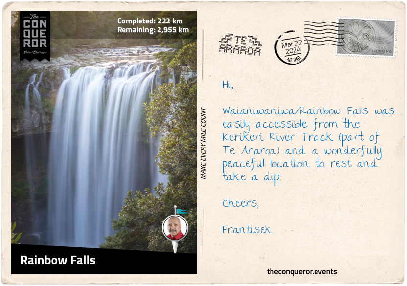
km od začátku : 0222
Rainbow Falls
The 8mi (13km) stretch along the road from Ahipara was somewhat monotonous, with farmland and occasional homesteads dotting the edges of the highway. Yet the sky was clear, the air breezy, and the road was thankfully quiet.
Kaitaia is the last town on State Highway 1 and a major centre in the Far North of New Zealand. Its economy is based on a number of industries: forestry, tourism, avocado farms, dairy farming, and viticulture.
I passed Centennial Park, where a D221 steam tank locomotive was displayed. The locomotive was one of a batch of six built in Glasgow in 1880 and saw a variety of duties with the New Zealand Railway until 1918. It was later sent to Northland (the northern region of North Island), where it was meant to serve on the planned extended line to Kaitaia. The railway line was meant to cut through or around the Maungataniwha Range, but plans were abandoned in the mid-1930s when they were no longer viable. However, State Highway 1 runs through the range and is considered one of the twistiest, hilliest sections of the entire highway.
The locals call the mountain range Mangamuka after the town and river of the same name. The forest within it is home to giant kauri trees that survived the logging era of the early 20th century. As I trekked through the woods, the steep climb had minimal views. Orange triangles marked the trail, a welcome sight, ensuring I remained on the right track. An added challenge to the steepness was the humid air and muddy ground, slowing my pace. Trudging on through Omahuta and Puketi Forests, I finally reached the end and was back around farmland and meadows.
Between the small village of Waipapa and Kerikeri is the lovely waterfall known as Waianiwaniwa (Rainbow Falls) which translates as Waters of the Rainbow. It is a single-drop waterfall that plunges 88ft (27m) into a large swimming hole. The waterfall is surrounded by native bush, making me feel as if I was in a secluded place, all peaceful except for the tumbling sound of the waterfall. This was an ideal place to rest and refresh.
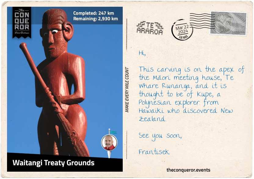
km od začátku : 0247
Waitangi Treaty Grounds
The Kerikeri River Track was on the north side of the river, leading to the low but amazingly wide Wharapoke Falls. I continued around the river's bend to a footbridge and crossed over to visit two of New Zealand's oldest surviving colonial buildings. Kemp House is a timber structure erected in 1822, and for a short period, it was home to Rev John Butler, New Zealand's first clergyman. Near it is the Stone Store, built out of stone and opened in 1836. Both buildings were constructed by pioneering missionaries at Kerikeri Mission Station. The station was a key site during the early period of Māori-European contact that led to the signing of Te Tiriti o Waitangi (Treaty of Waitangi). Aside from being the oldest buildings, both properties boast two of the oldest pear trees. The one at Stone Store was planted in 1819, and the one at Kemp House, which still bears fruit, was planted before 1828 (the exact date isn't known).
I continued my journey through Waitangi Forest, which consists of pine and macrocarpa (Monterey cypress) trees. The route passed commercial forestry until I reached the Te Araroa Cairn, which marked the opening of the first Te Araroa track in 1995. Called the Waitangi-Kerikeri Walk, it connects the two historical settlements. Part of it follows an old Māori trail that was initially linked to the Māori settlement of Okura, which has since vanished.
Taking a short detour to climb to the summit of Mount Bledisloe, I marvelled at the panoramic views of Waitangi, the Bay of Islands, and the Kerikeri Inlet. Descending back onto Te Araroa, I left the forest behind and arrived at the Waitangi Treaty Grounds.
Waitangi Treaty Grounds is a significant location in Aotearoa/New Zealand. On 6 February 1840, Māori chiefs and Captain William Hobson, on behalf of the British Crown, signed New Zealand's founding document – the Treaty of Waitangi. Since 1934, the anniversary of the signing has been commemorated as Waitangi Day.
The Waitangi Treaty Grounds was gifted to the nation in 1932 by the then Governor General, Lord Charles Bledisloe. With beautifully manicured lawns, the grounds include the Treaty House, where the document was signed, and Te Whare Rūnanga, an intricately carved meeting house in traditional Māori form. Facing each other, the two buildings signify the "partnership between Māori and the British Crown" on which the country was founded.
Beneath an open shelter is Ngātokimatawhaorua, the world's largest ceremonial waka (canoe). Built in 1940 to celebrate the centenary of the Treaty's signing, the waka was carved "as a symbolic representation of each iwi (tribe)." The waka is launched every year on Waitangi Day.
The Waitangi Flagstaff flying three official flags is located in the middle of the lawn. The middle flag is New Zealand's national flag (1902-present) with Te Kara the flag of the United Tribes of New Zealand (Te Kara o Te Whakaminenga o Nga Hapu o Nu Tireni) to the north (1834-present), and the British Union flag to the south (1840-1902).
Taking time to absorb the history, I take one last look across the bay and continue with my journey.
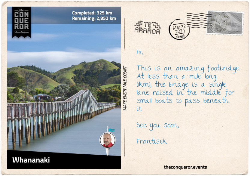
km od začátku : 0325
Whananaki
Crossing the Waitangi Bridge, I took the coastal walkway to Paihia, the main tourist destination when visiting the Bay of Islands. It was here that, in 1832, the first cricket game was mentioned in the diary of Henry Williams. He was the leader of the Church Missionary Society, building the first church in Paihia. He was also the translator of the Waitangi Treaty into the Māori language. His wife Marianne was a pioneering educator in New Zealand, establishing schools for Māori children and adults and teaching the children of the missionary.
The first New Zealand sailing ship, Herald, a 55-ton schooner, was built in Paihia and launched in 1824. Its maiden voyage was to Sydney, Australia. Barely two years later, Herald was wrecked attempting to enter the Hokianga Harbour on the west coast. The ship appeared on a 5 cent New Zealand stamp in 1975, and a memorial stone was placed on the beach in town.
My coastal walk ended at Opua, a small village that is the northernmost port for overseas vessels. Myra Larcombe, a resident of Opua, was one of the first female police officers in the country and the first female police officer in Northland. Myra was also a competitive swimmer and a swim coach. In 1998 at the FINA World Master Championships, she set the 200m butterfly record. She was 71 years old, and her record stood for nine years. As co-founder of a swimming club and later lifetime member, in 2018, Myra was awarded the Queen's Service Medal for services to swimming.
Catching a ferry, I crossed Veronica Channel to Okiato and headed inland. The trail led me through a kauri grove within Russell Forest, through the hamlets of Punaruku and Helena Bay, to Whananaki.
Whananaki North is a small village on the banks of an estuary that separates it from Whananaki South. The highlight of this location is the wooden footbridge. Built in 1947 from local timber, the bridge stretches 1300ft (400m) across the estuary. It is the longest footbridge in the Southern Hemisphere and a great fishing spot. The main reason for its construction was to enable children from Whananaki South to attend school in Whananaki North. Before the bridge, the school teacher would row a boat across the estuary twice daily to ferry the children back and forth.
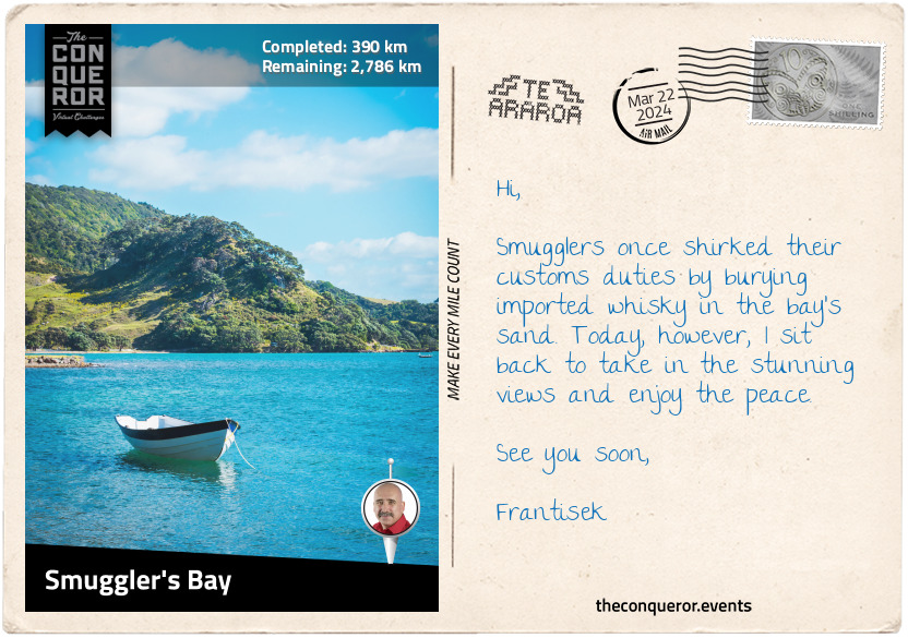
km od začátku : 0390
Smuggler's Bay
Te Araroa zig-zagged around the base of the many hills I passed. At Sandy Bay, I took a right turn and moved away from the coastline. Trekking through forests and farmland, almost in an arc shape, I found myself back on the coast at Ngunguru.
Ngunguru is a small settlement beside a river and a long low sandspit. In 1832, the sandspit was the site of a battle between two tribes, Te Waiariki and Waikato. The Waikato were led by Te Wherowhero, a warrior who later was appointed the first Māori King.
The route works its way south parallel to the coast, going through the small villages of Pataua and Taiharuru and onto Ocean Beach for a seaside meander for the next 4mi (6.5km). I climbed a steep section onto Te Whara Track past a WWII radar station to a scenic lookout at Bream Head. Here, an incredible panoramic view unfolded with several islands in the distance.
Te Whara Track follows the ancient footprints of the Māori chief Manaia. It is believed the ancient trail is at least 700 years old. The track was named after Manaia's wife, who is said to have insulted Puhi-Moana-Ariki, an early ancestor of the Ngapuhi iwi (tribe). Puhi, unhappy, turned her to stone, and the up-thrust rock at the easternmost point of Bream Head is said to be Te Whara standing.
I trekked through stunning coastal forests and descended onto the small beach of Smuggler's Bay, which, as the name suggests, was once used by smugglers to bury whisky in the sand. These days, though, the bay is a beautiful, quiet spot. Enjoying the peace, I took a load off, dipped my toes in the sea, and enjoyed the views over the horizon.
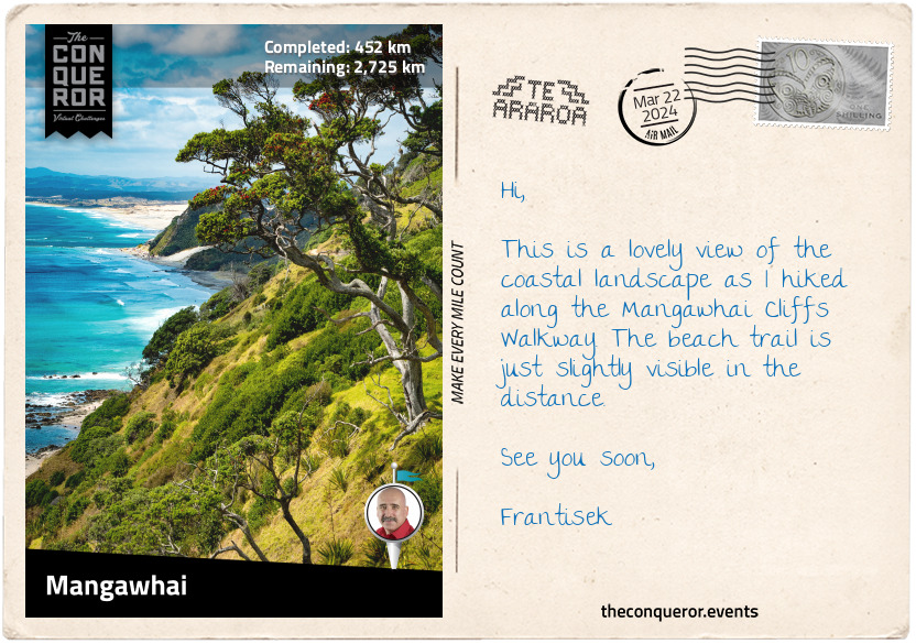
km od začátku : 0452
Mangawhai
Following the coast, I walked to Whangārei Heads, a locality and volcanic promontory. Taking a short side trip, I hiked up to the summit of Mount Manaia for an aerial view of the Whangārei Harbour and Mount Aubrey. Taking a short boat ride, I crossed the bay to Marsden Point, a broad and flat peninsula that makes up the southern part of the harbour entrance.
Heading along Marsden Point Beach at Bream Bay, I veered off at the northern point of Ruakākā Beach into a town of the same name. Ruakākā in Māori means the nesting hole of the kākā, a native parrot that nests in the cavities of hollow trees. The kākā is a large parrot species closely related to the kea, a parrot species found on South Island. Its current conservation status on the North Island is At Risk (Recovering), an encouraging sign since the species was slowly disappearing due to loss of habitat and reduced abundance of food.
Finding myself back in the forest, I hiked up to the crest of Bryndewyn Hill. Although some parts of the trail have been stepped to ease the burden, the trail rose and fell steeply in some sections. The forest is Kānuka regrowth, a tree shrub in the myrtle family and endemic to New Zealand. It has white or pink flowers and is an important food source for geckos. Just like its cousin, the Mānuka tree, the Kānuka is used to produce honey. Its flavour is described as "sweet with a light butterscotch note and a delicate floral finish." All I need is a couple of slices of bread to smear some honey on and gobble it up.
At the trail's end was a kissing gate that led me to more road walking and finally to Mangawhai Cliffs Walkway. The path travels along the clifftop with stunning sea views from Bream Head to Coromandel Peninsula. A section of the trail was on boardwalk, making it easier to walk until I reached the beach and finished this section at Mangawhai Heads.
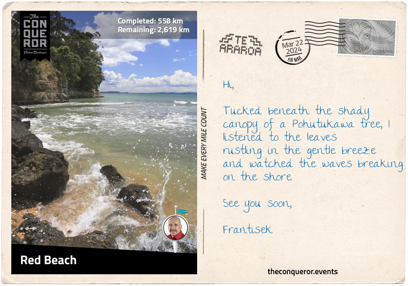
km od začátku : 0558
Red Beach
Having left Northland with Cape Reinga far behind, I entered the Auckland region. Combining beach and inland travels, I trekked through several small towns and took a brief detour up to the Dome Forest Lookout for views of the Mahurangi Peninsula and Hauraki Gulf. On a clear day, Auckland's Sky Tower can be glimpsed.
Exiting the forest, I arrived in the small village of Puhoi, which was settled in 1863 by a group of Bohemian migrants. Obtaining parcels of land from the government, the migrants were unaware that the free land was a densely forested hill and the only way they could farm it was by hacking their way through the bush to clear it. Despondent, disillusioned and without funds, the Bohemians had no alternative options but to work the land. They were fortunate that the local Māori chief Te Hemara Tauhia was an honourable and intelligent man who knew that the Bohemians were on the verge of starvation. Time and again the chief loaded their boats with fresh produce and taught them how to live off the land. In time the migrants’ hard work paid off and the land began to provide its own food. The church was finally completed in 1881 and continues to serve the community. The Puhoi Town Library is one of the smallest libraries in New Zealand. The building is tiny, yet it manages to hold more than 4,000 books.
As the trail wound back to the coast, I passed through Waiwera, which was once famous for its hot water springs. It was reputedly visited by early Māori and later promoted by Robert Graham, a politician who established a health resort here. It has since closed down.
Trekking via the beach, I passed through Orewa, which used to be part of the kauri gum-digging trade a century ago. Today, it is a suburb of Auckland.
A little further was the suburb of Red Beach with a beach of the same name. Sandwiched between the Orewa River and Weiti River, the suburb is a hive of marine activity. Keen paddle boarders, boogie boarders, kayakers, and swimmers can be found enjoying the waterways. The beach is beautifully lined with Pohutukawa trees. While close to Auckland, it's still far enough to escape the city's hustle and bustle. Unsurprisingly, the beach's name originates from the red-coloured sand.
I found myself a shaded spot beneath a Pohutukawa, laid out a beach towel, and whiled away the rest of the day.
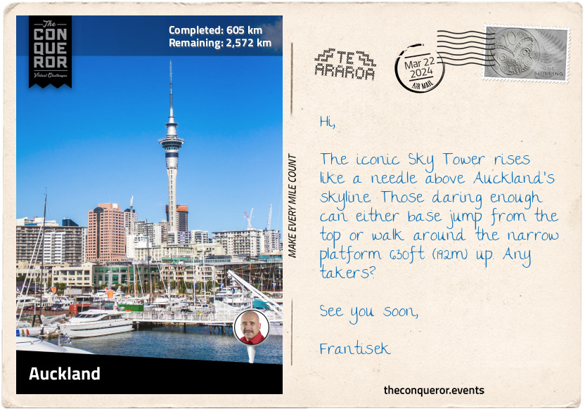
km od začátku : 0605
Auckland
Auckland was the capital city of New Zealand from 1841-1865 and was named after George Eden, 1st Lord of Auckland. The city was first settled by Māori around 1350, with fortified villages built on the volcanic peaks. Before European arrival, the population was about 20,000, but the arrival of firearms caused intertribal warfare with devastating effects. Tribes without weapons sought refuge elsewhere and the population had dwindled by the time the Europeans landed. Following conflict between Māori and Europeans, the capital was moved to Wellington. However, the city continued to grow and expand; today, it is an economic hub and major gateway to the country.
The iconic Sky Tower, a telecommunications and observation tower, is one of many architectural landmarks in the city. The Sky Tower, at 1076ft (328m), is the tallest tower and building in the Southern Hemisphere. Views over Viaduct Harbour and up to 51mi (82km) can be seen from the SkyDeck on the 60th floor. I'll be enjoying dinner on the 52nd floor in the revolving restaurant.
Geographically, Auckland is situated like no other city. Surrounded by various waterways, it is flanked by two large harbours, Waitemata Harbour to the north and Manukau Harbour to the south. To the east is the Hauraki Gulf and to the west is the gateway to the wild West Coast beaches.
Geologically, the city is surrounded by 53 volcanic centres and its hills are covered by rainforests. Auckland sits on a monogenetic volcanic field, meaning the group of volcanoes erupts only once. That holds true except for Rangitoto Island, which has erupted many times, although the last time was around 550 years ago.
With so much water surrounding Auckland, it's no surprise that it is dubbed the "City of Sails" and that sailing is a popular activity. Amazingly there are more than 135,000 registered yachts, with nearly 1 in every 3 households owning a boat. With that in mind, I think I'll head down to Westhaven Marina and see if I can get out for a sail for the day and watch the daredevils bungee jump from Auckland Harbour Bridge.
Lastly, Auckland was the home of Edmund Hillary, who, along with Tenzing Norgay, became the first climbers to summit Mount Everest. Hillary also reached the South and North Poles, making him the first person to do all three expeditions.
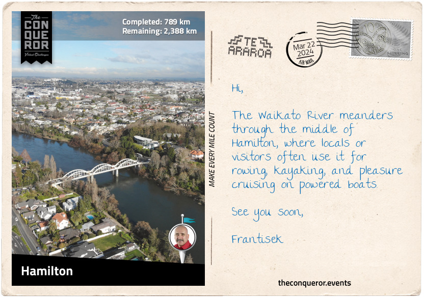
km od začátku : 0789
Hamilton
About 14mi (22km) before Hamilton is the town of Ngāruawāhia, one of the oldest and most historic settlements in the Waikato Region. Near the confluence of the Waikato and Waipa Rivers is the Tūrangawaewae House, the headquarters of the Kingitanga (Māori King Movement), a political institution since the 1850s and the official residence of the Māori King. The building is a blend of European and traditional Māori architecture.
Adjacent to the building is the large steel sculpture, "The Kings' Mask”, created by artist Inia Te Wiata. It features a traditional Māori facial tattoo with sandstone carvings below the neck. A plaque describes the sculpture as a representation of the first two Māori kings – Pōtatau Te Wherowhero and his son Tāwhiao – and pays tribute to their leadership during difficult times and urging peaceful co-existence with the Pakeha (non-Māori).
To put this into context, the Māori did not have a central monarchy like the British. They lived as independent tribes led by a chief. As the European settlers grew in numbers, so did the demand for Māori land. Powerless to negotiate, some Māori from the central north wanted to unite the tribes under one sovereign and began searching for a potential king. Many chiefs were approached but declined the role until the Waikato chief Pōtatau Te Wherowhero reluctantly agreed and was crowned in this very town.
Pōtatau passed away two years later, and his son Tāwhiao inherited the crown. Tāwhiao reigned for 34 years during one of the most turbulent times in Māori history. The crown was passed down to descendants, with Tūheitia Paki as the current king. His mother, Te Atairangikaahu, was the first Māori queen, serving for 40 years, making her the longest reigning Māori monarch.
My next stop was Hamilton, the biggest city in the Waikato region. The Waikato River flows through its centre, which was the site of several Māori villages before European settlers. Land confiscation by the Crown led most villagers to abandon their homes.
Hamilton is a bustling city with a riverside arts and culture precinct that includes the Waikato Museum. Exhibiting regional and international works, the highlight at the museum is the 200-year-old waka (canoe), Te Winika. Carved by Māori from the west coast of the Waikato region, the waka was buried in mudflats in the late 1800s to protect it from the British during the Māori Land Wars. In the 1930s, it was excavated, restored, and later gifted to the museum.
One final location I wanted to visit was Hamilton Gardens, a 54ha public park. At the park's southern end are a series of themed gardens from Italian Renaissance, Tudor, and Chinese Scholar's styles to Ancient Egyptian, Japanese and Indian styles. It also showcases Māori gardening methods at Te Parapara Garden.
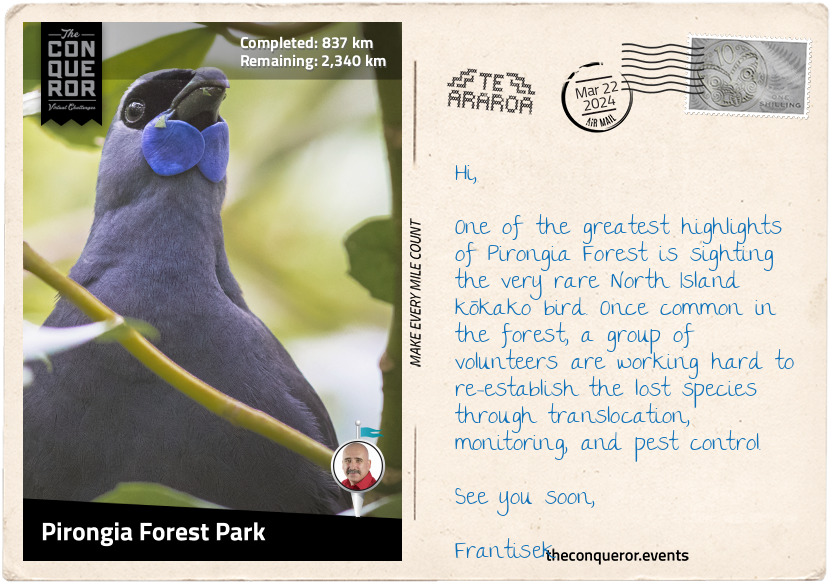
km od začátku : 0837
Pirongia Forest Park
Leaving Hamilton, I trekked southwest to Pirongia Forest Park. The park included three extinct volcanoes: The Cone, which the trail crossed, Mount Pirongia, and Mount Karioi. A densely forested park, the vegetation changed the further up I climbed.
At the bottom were rimu and totara trees, endemic to New Zealand, and ferns in the understory. The rimu is a large evergreen coniferous tree. Māori used it to make canoes, spears, and other tools. The gum was applied to wounds to stop them bleeding. The totara is a podocarp tree species known for its large girth. The Pouakani Tree is the largest living totara. It is over 115ft (35m) tall with a circumference of 157in (4m).
Hardier plants were further up with the likes of kamahi and horopito. Kamahi is an evergreen shrub found in abundance throughout the North Island. It is used as a chest tonic or to make Kamahi honey. Horopito is a woody flowering tree. Its leaves have a pepper-like taste and have been used as a cooking spice. The fresh leaves were chewed to relieve toothaches or to treat external wounds like cuts, bruises, or burns.
Near the summit, the park was filled with mountain flax, coprosmas, and more ferns. The mountain flax is a perennial plant with yellow-greenish flowers favoured by hummingbirds for its nectar. Coprosmas are related to coffee plants, and it is said that coffee can be made from its seed.
About 4mi (6km) off the main trail is the kahikatea tree, known for its grand height of 218ft (66.5m). It is the tallest recorded native tree in New Zealand.
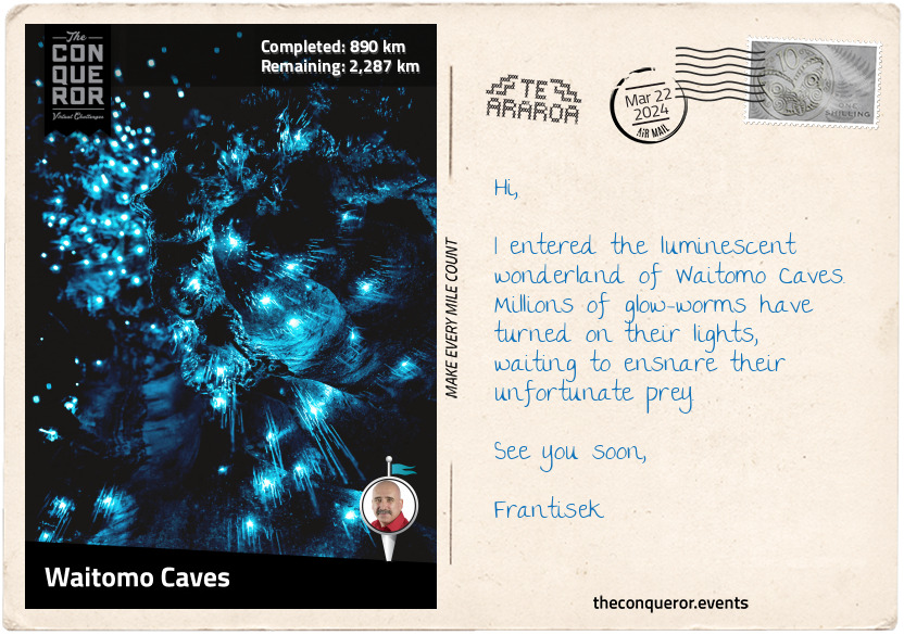
km od začátku : 0890
Waitomo Caves
After plenty of beach walking, forest trekking, and town meandering, it's time for an underground expedition at Waitomo Caves. Known to the local Māori for centuries, the cave system was first explored in 1887 by local chief Tāne Tinorau and English surveyor Fred Mace. They built a raft from flax stems and, with candles, floated into the caves on the underground stream.
Tāne had returned many times, and with his wife, he opened the cave to visitors. In 1906, the government took over the cave's management for the next 80 years when the chief's descendants regained ownership.
Waitomo Caves is a massive cavern system created over the last 30 million years. Throughout the Waitomo region, there are around 300 limestone caves. The Glow-worm Cave is the most popular, covered with millions of carnivorous glow worms, called Arachnocampa Luminosa, that twinkle like fairy lights in the darkness. The light they emit attracts insects on which they feed. When they mature, they turn into flies.
The upper cavern was filled with stalactites and stalagmites. Some joined together, forming a column. They are beautiful natural wonders that take millions of years to develop. Next to it was the Banquet Chamber, which was used as a luncheon spot in the early days of tourism. On the lower level is the tallest chamber, with a high vaulted ceiling known as the Cathedral.
Another worthy cave was the solar-powered Ruakuri Cave, with its dramatic man-made spiral entrance. But what truly piqued my interest was the rafting tour. An adrenaline-filled adventure that started with an abseil down a vertical shaft, ziplined through a glow-worm cave, climbed an underground waterfall and finished on a tube in fast-flowing water.
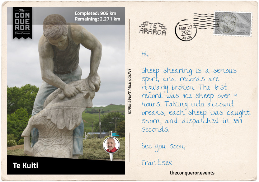
km od začátku : 0906
Te Kuiti
"The Sheep Shearing Capital of the World" is what Te Kuiti is best known for. Although in the 19th century, shearers were not seen in the best light, today, they are revered as "sporting heroes," as illustrated by the town's 20ft (6m) tall statue. Local world champion shearer, David Fagan, has won the Golden Shears title a staggering 16 times and, for services to shearing, has received multiple awards, including the Knight Companion of the New Zealand Order of Merit. Another local champion sheep shearer is Kerri-Jo Te Huia, who in 2012 broke the record by shearing 507 lambs in 8 hours (the previous record was 470).
This small town produced numerous notable people. Iconic artist Diggeress Te Kanawa was a master weaver who applied various weaving techniques to ensure their survival. She contributed extensively throughout her life to the community and abroad. She was recognised for her service with several honours and awards, including the Queen's Service Order and New Zealand Order of Merit.
Colin Meads is widely regarded as the best rugby player in New Zealand. He was named the Player of the Century in 1999 and inducted into several Halls of Fame. He played for the All Blacks national team for 14 years. Rugby writer Lindsay Knight wrote, "As a sporting legend, Meads is New Zealand's equivalent of Australia's Sir Donald Bradman or the United States of America's Babe Ruth." Aside from being an exceptional player, Meads was considered an "uncompromising, loyal, and humble person." He was also awarded the New Zealand Order of Merit and Member of the Order of the British Empire for services to rugby. A statue of Meads was erected in the town, surrounded by boards telling his story.
Many more individuals from Te Kuiti have made their mark in the world, contributing to the community and New Zealand.
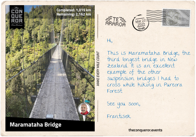
km od začátku : 1015
Maramataha Bridge
The Timber Trail is one of many connecting trails of Te Araroa. Designed as a long-distance cycleway, it winds through the Pureora Forest Park for 52mi (85km). It is a relatively new Te Araroa section that opened in 2013. Local Māori knew this area as Te Pureora-o-Kahu (the life-giving ritual of Kahu), where the ancestress Kahu performed rites to help her recover from illness.
Prior to European settlement, Pureora was a dense virgin forest that became part of the logging industry in the 1940s. Large sections of the forest were felled when thirty years later, environmentalists stepped in demanding protection from further logging. Successful in their protest, the government preserved the remaining forest. Today, it is one of the last intact broadleaf podocarp forests in the world and home to a variety of birds, including the North Island Robin, kererū (native pigeon), and kākā (large parrot).
Trekking through the stunning forest, I marvelled at the tall trees and breathed in their scent and the purity of the air. I reached the highest point on the trail at 3186ft (971m), with great views of Lake Taupo, a crater lake that is also New Zealand's largest lake. One of the main attractions on this trail is crossing eight suspension bridges. Three were more than 328ft (100m) long.
The first suspension bridge was at Bog Inn Bridge, followed shortly after by Orauwaka Bridge. These suspension bridges are amazing engineering constructions. Each one was solidly built with wooden floors reinforced with steel mesh, steel mesh sides, and lots of steel cables acting as supports. Only subtle movements were felt as I crossed while taking in the vastness of the forest and the valley below.
I passed the Piropiro Campsite in a large open field surrounded by forest and continued to Maramataha Bridge. At 463ft (141m) long and 174ft (53m) high, the bridge is the third longest in New Zealand. It is a fabulous single-track non-vehicular bridge with the Maramataha River flowing beneath.
This was an excellent place to rest and take in the sounds and smells of the forest.
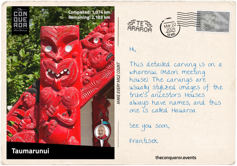
km od začátku : 1074
Taumarunui
I followed the Timber Trail to the Ongarue Tramway. This defunct bush tramway operated between the early to mid-20th century. Crossing a few other suspension bridges, I enjoyed the Ongarue Spiral, a loop on the main tram line going through a tunnel. The loop was meant to ease the trams' grading when travelling through this area. From here, I continued through scrub and private farmland, and the last mile was along a quiet road into Ongarue.
From Ongarue, I waltzed into Taumarunui, a small town on the upper side of the Whanganui River and the Ongarue River to its west. It was once a Māori settlement and a vital canoe route linking with river settlements downstream.
A unique experience in town is the Rail Cart Adventure at Forgotten World. It is an 89mi (142km) tramway journey in an open buggy – imagine golf carts - on rails. The route is from Taumarunui to Stratford, travelling through 24 tunnels and crossing 98 bridges. The longest tunnel is a mile (1.6km) long. Even shorter and more thrilling is a cart ride through 20 tunnels, followed by a helicopter flight over Whanganui National Park and a jet boat ride on the Whanganui River.
For a quieter experience, the nearby family-run lavender farm had a café serving tea and scones. It seemed like an ideal location to sip some tea, admire the purple lavender flowers, and take in their sweet scent.
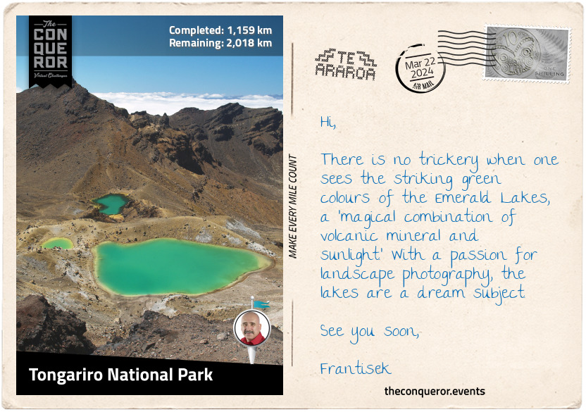
km od začátku : 1159
Tongariro National Park
In the beginning, the priest, Ngātoro-i-rangi sailed from his ancient homeland of Hawaiki on a great ocean-going canoe. When he arrived in Aotearoa (New Zealand) near Matata (Bay of Plenty), he headed inland and southward, reaching Lake Taupō. Climbing the nearest mountain, south of the lake, with his companion Ngāuruhoe, he claimed it as his own and called it Tongariro. Caught in a blizzard, he called to his sisters to send him the sacred fire they brought from Hawaiki. The sisters sent him geothermal fire from the Pacific Ocean through an underground passage, the Taupō Volcanic Zone, and up to Tongariro. It arrived just in time to save him from freezing. However, it was too late for Ngāuruhoe, who remains frozen as the volcanic cone of what is known as Mount Ngāuruhoe, located next to Mount Tongariro.
Ngāti Tūwharetoa is an iwi (tribe) descendant from Ngātoro-i-rangi and the traditional custodian of Mount Tongariro. In 1887, Chief Horonuku Pataatai te Heuheu Tūkino IV extended custodianship of Mount Tongariro, Mount Ngauruhoe, and part of its neighbouring Mount Ruapehu to the people of New Zealand. He believed that sharing guardianship with the British Crown would ensure the preservation of the land, free from development and exploitation.
In 1894, Tongariro National Park was formally established. It was the first national park in New Zealand and the sixth in the world. Dual World Heritage status was conferred on the national park in recognition of its remarkable volcanic landscape and significance to Māori culture.
Entering the park from the north, I passed the Ketetahi Falls and hiked up the east side of Mount Tongariro for a view of the Blue Lake and further along the gorgeous Emerald Lakes. As I descended from the lakes, I found myself in a vast desolate terrain on the Tongariro Alpine Crossing with Mars-like features surrounded by barren hills. The trail led between the peaks of Tongariro and Ngāuruhoe to Whakapapa Village. North of the village is the luxurious Chateau Tongariro and its 9-hole golf, known to have the highest elevation in New Zealand. Anyone for a round of golf?
Southside of the village is the tallest mountain on North Island, Mount Ruapehu, an active stratovolcano that has erupted many times over the last century. At 9177ft (2797m), Ruapehu has three major peaks, a crater lake, and 18 glaciers.
The Lord of the Rings fans would delight in exploring this mountain, walking in the footsteps of Sam and Frodo, as the park was the filming location of several scenes. Mount Ngauruhoe represented Mount Doom. Its symmetrical cone was digitally created because the summit is sacred to Māori culture, and filming was not permitted. Mount Ruapehu was the setting for Emyn Muil, the labyrinth of hills where Sam and Frodo came across Gollum in the Fellowship of the Ring. The Whakapapa Ski Field on the west face of Ruapehu was the location for Sam and Frodo's various mountain trekking scenes. Peter Jackson's vision of Lord Sauron's lair was brought to life with the spectacular volcanic rock formations and rugged, mysterious landscape of Ngauruhoe and Ruapehu.
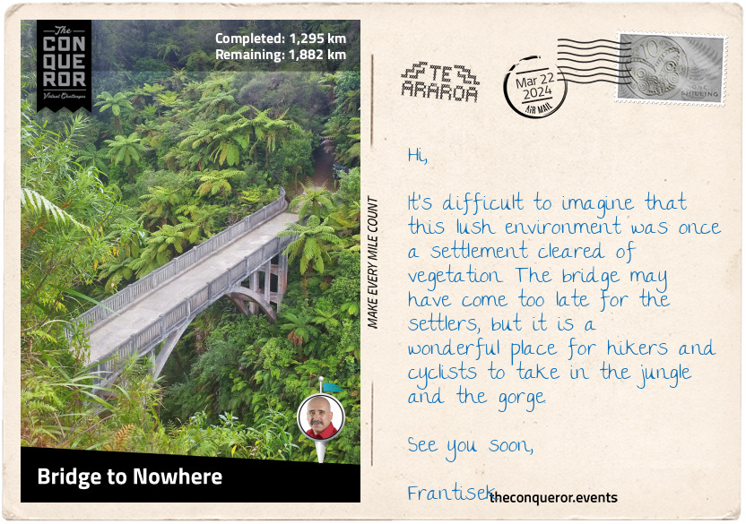
km od začátku : 1295
Bridge to Nowhere
Now, why would a bridge be called the Bridge to Nowhere? Usually, Bridges to Nowhere are incomplete or not connected to a road. But clearly, this one is bound to land on both sides. The simple answer is that it is a remote bridge with no road access. The only way to get to it is either hiking or cycling. Lucky for me, it's part of Te Araroa, and I get to cross it and have a great long view of the lush rainforest and Whanganui River below.
But a little digging indicates that the bridge was actually made for vehicular access. In early 1917, the government opened the Mangapura Valley and allotted land to soldiers returning from World War 1 to help them reintegrate into civilian life. Forty families travelled upriver by boat to discover a dense rainforest crowding the banks. They rolled up their sleeves and cleared 450 hectares of virgin forest. A school was set up, and farming life began. Unfortunately, the soil was not fertile, and the plants failed to grow and thrive.
The government tried to help, aware that access was difficult and the farmers often had to deal with the makeshift bridge being carried away following heavy rains and rockfall. Eventually, a road and a concrete bridge were built in 1936. Unfortunately, this was the height of the Great Depression, and its hard-to-reach location made it impossible. The farmers gave up and abandoned their farms.
A major flood sealed its fate as the government was not prepared to continue spending on road maintenance and officially closed the valley. With time, nature reclaimed the land, and all that remained was the Bridge to Nowhere.
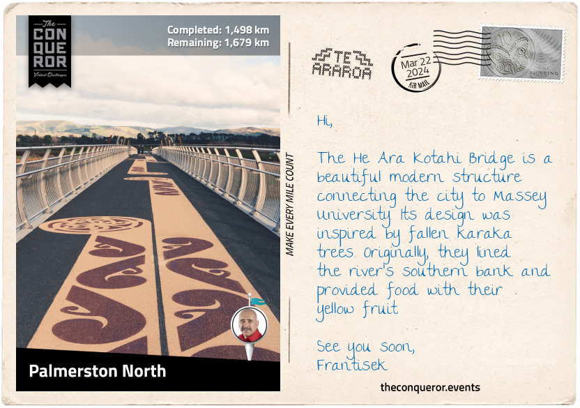
km od začátku : 1498
Palmerston North
Colloquially known as Palmy, the city of Palmerston North was named after Viscount Palmerston, a former British Prime Minister from the 19th century. The suffix North was added later to differentiate it from the town with the same name on the South Island.
The Manawatu River flows on the city's south side. The local council developed a 4.4mi (7km) foot and cycle track and the He Ara Kotahi Bridge to connect it to Massey University. The university is the second largest in New Zealand (excluding international students) and the only one to offer aviation and nanoscience degrees.
One of the main highlights in town is the New Zealand Rugby Museum. Established in 1970, the museum houses a comprehensive collection of rugby memorabilia and rare artifacts. It was founded by keen rugby supporter John Sinclair, who attended Nelson College, where rugby was played for the first time in New Zealand.
After seeing the New Zealand Army rugby team play in the UK at the end of WWII, Sinclair devoted himself to learning everything he could about rugby history. He then pitched the idea of a museum, and Fred Spurdle, President of the Manawatu Rugby Union, offered his assistance. Sinclair threw himself into the project and began collecting rugby objects while Spurdle meticulously documented every single one.
An inaugural display occurred in 1969 with 16 past All Blacks, national rugby team players, and the Governor General in attendance. In 1970, the first exhibition opened on the day rugby turned 100.
Sinclair and Sturdle approached Neil Monro to become the Treasurer. Accepting the job, Neil has been doing it for the last 50 years. Neil's grandfather was Charles Monro, who introduced rugby to New Zealand. Charles organized the first game between Nelson College and the Nelson Football Club. He also coached a Wellington team, played for a Nelson team, and refereed the first game on the North Island. A memorial statue of Charles was erected at the entrance of the museum.
The museum captures the essence and history of this much-loved New Zealand sport. It holds more than 40,000 items, including a 1905 All Blacks jersey, size 20 rugby boots (for real), and a stuffed kiwi that was meant to be gifted to the first team to beat them during the 1924-25 Great Britain tour. They were undefeated, and the kiwi came back home.
Pop quiz: What was the original colour of the All Blacks jersey?
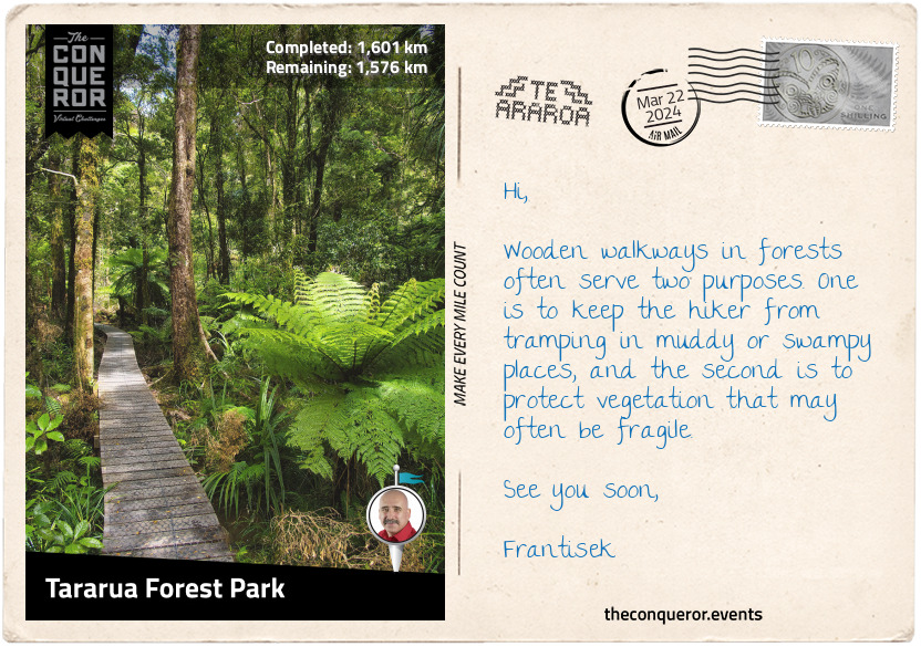
km od začátku : 1601
Tararua Forest Park
Heading southeast from Palmerston North, I arrived at one of the entrances into Tararua Forest Park. A protected area at the southern end of North Island, the park contains nearly three-quarters of the Tararua Range. The mountain has a northeast-southwest direction and stretches for 50mi (80km).
Its three highest peaks are Pukeamoamo/Mitre, Mount Bannister, and Mount Hector, ranging from 5016-5150ft (1529-1570m). As the range's summits are relatively uniform, it indicates that it was once part of an ancient plain that was pushed upward millions of years ago. With time the plain eroded away, leaving behind the mountains known today.
Mount Hector was named after James Hector, a Scottish geologist, naturalist, and surgeon who immigrated to New Zealand and became the chief government scientist. James was a highly accomplished person who founded the Geological Survey of New Zealand. He also advised politicians, managed the Wellington Botanic Gardens, developed the Royal Society of New Zealand, and wrote 45 scientific papers. James received several awards for his contributions, including the Order of the Golden Cross and Knight Commander of St Michael and St George. The Hector Medal and Prize were established in his honour, and it's the leading award for excellence in research.
The range has a very windy and wet climate, dumping as much as 5,000 mm of rain annually on the western slopes. Consequently, the vegetation varies. In the west, it's a combination of conifers, ferns, shrubs, and vines. In contrast, the drier east side is dominated by beech and a more open forest.
With its rugged terrain and challenging climate, the mountain range is wildly popular with trampers (hikers). The Tararua Tramping Club was established in 1919, making it the first of its kind in New Zealand. Up to 150,000 people visit the park each year.
The Tararua range was once the refuge of the now-extinct huia bird. It had the most distinct bill shape, with the female’s being long, thin, and curving downwards, while the male’s was short and stout, like a crow. They had deep-metallic, bluish-black plumage, orange wattles, and a broad white band across the tip of the tail feathers. In Māori culture, the bird was sacred, and its feathers were worn only by people of high status. The birds became extinct following significant deforestation and overhunting.
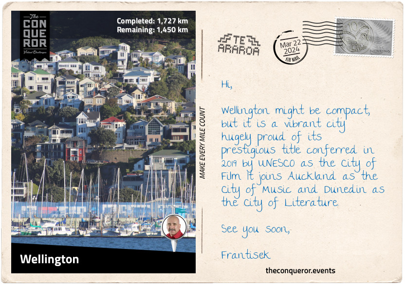
km od začátku : 1727
Wellington
I have finally arrived in New Zealand's capital city, Wellington. It is a compact city, bounded by hills on one side and the harbour on the other. The downtown area sits on reclaimed land, and its buildings rise like a mini-Manhattan. The city is one of the principal seaports serving domestic and international shipping, including cruise ships.
Kupe was a legendary Polynesian explorer and tribal chief from Hawaiki. Legend says he was the first human to discover New Zealand and that he stayed in Wellington's harbour around 925 AD. A statue of Kupe can be found on the waterfront. Whatonga was a later explorer who named the harbour Te Whanganui-a-Tara after his son Tara. Whatonga's descendants inhabited Wellington until 1820, when most of them were forced out by other incoming tribes. In 1839, as part of Edward Wakefield's colonisation plans (see postcard 20), his brother, William Wakefield, arrived to purchase land to sell to European settlers.
Concerned that the South Island, where the goldfields were, would choose to become a separate colony from the British Empire, the then Prime Minister proposed to shift the capital from Auckland to Wellington. Centrally located between the two islands with a good harbour, it proved to be a suitable location. Wellington's city status was raised to capital in 1865.
A challenge to living in Wellington is the frequency of seismic activity. The city rests on the point of two tectonic plates: the Australian Plate to the west and the Pacific Plate to the east. The plate movements have created three fault lines: Ohariu Fault, Wellington Fault, and Wairarapa Fault. The Wellington Fault runs through the city's centre, beginning on the floor of Cook Strait, along the western edge of the harbour, and terminating in Woodville. Because of the number of earthquakes, the city is a "leading centre for studying and researching seismic activity and strengthening techniques in buildings."
Going by several nicknames, two of the most common are "Wellywood" and "The Windy City." Wellywood is a combination of Wellington and Hollywood, referencing Peter Jackson's production company WingNut Films and the special effects and prop company WetaWorkshop. Jackson was the director of The Lord of the Rings trilogy and WetaWorkshop was the movies' set and costume designer. As for The Windy City reference, it is self-explanatory, and it's mainly due to its location on Cook Strait, where the gales blow from the north and the south.
Wellington is known for its coffee scene, having more cafes per capita than New York City. Apparently, the flat white has been perfected here. Ethnically diverse, the city is a melting pot of flavours. Imagine Malaysian rendang, Italian risotto, Korean kimchi, Samoan palusami, or the budding influence of Ethiopian migrants, such as the Doro Wat (a spicy chicken stew).
As a coffee aficionado, I am off to find a strong aromatic cuppa and reflect on my North Island experience. From here, I will board a boat and head across Cook Strait to South Island.
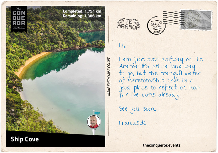
km od začátku : 1791
Ship Cove
Do you remember Māui's story when he reeled in a giant fish, which turned out to be North Island? The next stage of that story says that South Island was Māui's waka (canoe), and Stewart Island was the anchor.
However, on Te Waipounamu/South Island, another story is told by its principal iwi (tribe), the Ngāi Tahu. It relates to the four sons of Raki (sky father), who traveled from the heavens on their waka to meet his second wife, Papa (earth mother). Upon their return, their karakia (incantation) failed, and the waka overturned, becoming the Te Waipounamu (the South Island). Climbing atop the waka, they waited for help that never came and eventually turned to stone, becoming the mountains of the Southern Alps. The highest peak is said to represent the eldest son Aoraki, hence the mountain's name, Aoraki/Mount Cook.
South Island is 32% larger than North Island, yet it contains only a quarter of New Zealand's population. It is a spectacular mountainous island with hundreds of lakes, glaciers, fiords, and national parks. Many are included within the World Heritage site, Te Wāhipounamu - South West New Zealand, which I will cover when I get to Mavora Forest.
The Southern Alps stretch along the length of the South Island, dividing the Canterbury Plains to the east from the rugged coastline of the West Coast. It contains 18 peaks over 9800ft (3000m) and over 3000 glaciers over one hectare.
Eight of the ten largest lakes in New Zealand are in the South Island, with Lake Wakatipu in Queenstown as the largest on the Te Araroa route. The trail passes several other large lakes, including Wānaka, Hāwea, Pukaki, and Tekapo.
Having arrived by boat in Meretoto/Ship Cove, I disembarked on a jetty and walked up the beach to Captain Cook's Monument. The raised monument signifies the day in 1770 that Cook, in the presence of the island's Māori Chief, raised the flag, claiming British sovereignty over South Island.
The cove is surrounded by lush forest, with the taller trees over 200 years old. They were probably growing when Cook was here. He must have loved this place as he spent a lot of time here every time he sailed these waters. In a more practical sense, he probably chose this location because it was accessible to open water, sheltered, and could stock his provisions.
On the eastern shore of the cove is Tōtarunui/Queen Charlotte's Sound. The Sound is home to a pod of Hector's dolphins. Endemic to New Zealand, they are the smallest and rarest dolphins in the world. Hector dolphins have a distinctive black facial marking, a short, stocky body, and a dorsal fin that resembles Mickey Mouse's ear. It was named after Sir James Hector, the 19th century Colonial Museum curator in Wellington (now the national museum). The dolphin is currently listed as an endangered species.
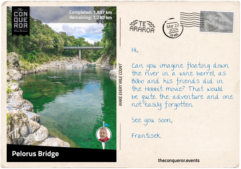
km od začátku : 1897
Pelorus Bridge
Heading southwest on the Queen Charlotte track, I skirted around the hilltops to Punga Cove. I ascended to the ridge on what would be a long and narrow landform with several bays and inlets butting up against it to the south and the Kenepuru Sound to the north.
The narrow track was well-graded, passing through a sub-tropical rainforest of beech, kamahi, and giant rimu trees. Native ferns, including the iconic silver fern, covered the understory. The silver fern is a widely recognised symbol and the country's national plant.
Stylised versions of the silver fern can be found on several sports teams, such as the All Blacks jersey, the tail end of Air New Zealand planes, and the coat of arms. Koru is the spiral shape based on the unfurling of a silver fern frond symbolising "new life, growth, strength, and peace." It is often seen in Māori art, carving, and tattooing. A Māori legend says that the "silver fern once lived in the sea, and the Māori hunters would use the silver underside of the fern leaves to find their way home. When bent at an angle, the leaves of the fern would catch the moonlight and illuminate a path through the forest."
Beautiful views of the bays, inlets, and sound appeared intermittently. At Onahau Bay, the trail began its descent and ended in Anakiwa, a small coastal village. After a brief rest and refreshment, I connected to another trail and continued to Havelock.
Havelock is a small town that "promotes itself as the green shell mussel capital of the world." During the gold rush of the 19th century, Havelock was a thriving town, with the nearby Wakamarina Valley proclaimed a goldfield. As the rush subsided, sawmilling became the town's economic activity, followed by dairy farming. Today, many of the valleys around town are pine plantations.
Pressing on, I passed Canvastown, another town that expanded during the gold rush and contracted when the gold ran out. My next stop was Pelorus Bridge, a small locality with the most important thing – a café.
Once caffeinated, I turned my attention to the glassy green Pelorus River, one of the filming locations for The Hobbit: The Desolation of Smaug. Fans of The Hobbit may remember Bilbo Baggins and the dwarves' exciting wine-barrel getaway from Thranduil's realm. Besides an enormous amount of computer graphics and green-screen shoots plunging down the river, live shoots were also taken on the beautiful Pelorus River with its dramatic rock walls and forest canopies.
While a wine-barrel adventure could be exciting, paddling a kayak down the river may be a more practical option. The trip will surely be more relaxing and less action-packed than Bilbo's adventure.
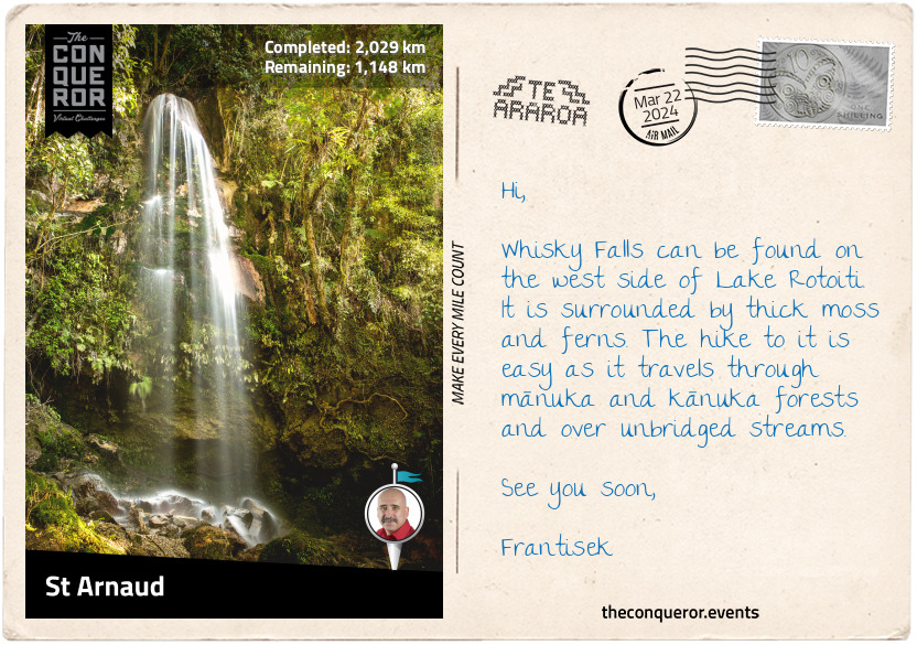
km od začátku : 2029
St Arnaud
Luckily, I managed to stay in the kayak and not tip over into the Te Hoiere/Pelorus River. After an enjoyable paddle on the river, I returned to the trail again and continued my journey.
In Māori, the Pelorus River is called Te Hoiere, named after the first canoe to travel to South Island. Ngati Kuia tells the story of Matua Hautere, one of Kupe's descendants, sailing aboard the waka (canoe) Te Hoiere and reaching Te Waipounamu (South Island). Geographically, Te Hoiere/Pelorus River is the largest river in the northwest Marlborough region flowing eastward 25mi (40km) into Te Hoiere/Pelarus Sound.
Hiking alongside Te Hoiere/Pelorus River, I crossed a swinging suspension bridge and entered Mount Richmond Forest Park, the second largest forest park in New Zealand. The track was easygoing, with a few protruding roots I had to climb over. After a few miles, I took a side track down to the Emerald Pool. The colour was a brilliant deep, transparent green enticing me to take a quick dip.
After another 6mi (10km), the river and I parted ways. I zig-zagged through a big red beech forest to the Rocks Hut Overlook for a stunning 360 degrees panoramic view of the backcountry and the peak of Mount Richmond.
The trail went on through the Forest Park, sometimes on the ridge for several miles, sometimes descending into the forest, then at other times up on rocky summits, until I arrived in St Arnaud.
Previously known as Rotoiti, St Arnaud was a small alpine village on Lake Rotoiti's northern edge, serving hikers, skiers, and a hundred-odd locals. The lake was initially named Lake Arthur after Edward Wakefield's brother, but the name didn't stick and it reverted to its Māori name Rotoiti.
Arthur was a captain in the Royal Navy and later part of the New Zealand Company. His brother Edward tasked him with establishing a new settlement named Nelson. Today, Nelson is the oldest city on South Island and the second oldest in New Zealand. Located on the shores of Tasman Bay, the city thrives in the local art and crafts scene.
Rotoiti Lake borders the Nelson Lakes National Park, which I will be hiking through for the next 65mi (104km).
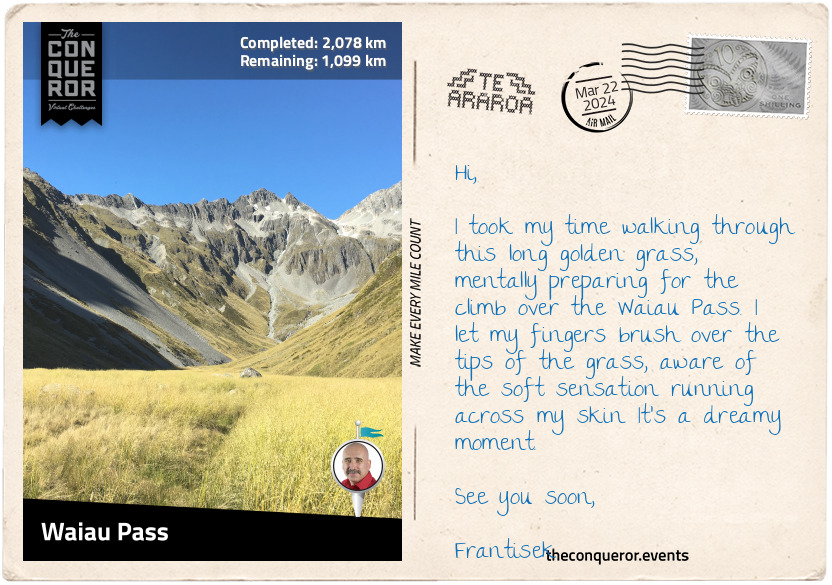
km od začátku : 2078
Waiau Pass
I had a pleasant 6mi (10km) walk beside Lake Rotoiti, part of it on a narrow boardwalk that protects the vegetation. Before long, the trail widened in the forest with occasional sneak peeks of the lake. The trees were beautifully tall and thin, with the blue sky contrasting the green canopies.
Travers River, which feeds into Lake Rotoiti, became my companion as I hiked through the deep Travers Valley. East of the river was Saint Arnaud Range, marking the boundary of Nelson Lakes National Park. The range is covered in beech forest at the lower elevation, while the peaks are snow-capped. West of the river is Travers Range, with Mount Travers as the highest peak at 7670ft (2338m).
At the end of the valley, I had a 980ft (300m) climb up to Travers Saddle and descended into Sabine Valley next to Sabine River. Following the river in a narrower valley, with Franklin Ridge on one side and Mahanga Range on the other, I reached Waiau Pass, the second-highest point on Te Araroa.
The hike up to the pass was strenuous. The track was rough and rocky, with steep descents in some places. Adding to the challenge was climbing up the side of scree slopes in an exposed and windy environment. Yet, the beauty of this track was seeing the stunning sapphire blue Rotopohueroa/Lake Constance surrounded by rocky mountains and jagged cliffs. Lying in a post-glacial basin, the lake is 1.2mi (2km) long and nearly half a mile (700m) wide. At an elevation of 4390ft (1340m), it is the largest alpine lake in NZ.
However, once at the top of the pass, I realised I had the same challenge climbing down. Rocky terrain, more scree, and a desolate mountainous appearance. I knew it would be tough on the knees and had to be careful not to twist an ankle, but I forged on slowly, one step at a time until I reached the bottom and found myself in another valley.
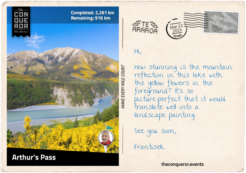
km od začátku : 2261
Arthur's Pass
And so the journey continued through another valley, with Spenser Mountains and St. James Range as my guardians and the Waiau Uwha River as my companion. For a good 15mi (25km), I walked on the St. James Walkway, past St. James Conservation Area. The conservation area was a sheep and cattle station for most of the 20th century. The government purchased the property in 2008 to protect the area from intensive farming and ensure public access.
Near Philosopher's Knob, I swung west to climb over Anne Saddle and arrived at Boyle Village, at the confluence of Boyle and Nina Rivers. Weaving south, I crossed a swing bridge over Boyle River, walked into Hope Valley, and then through the woods. Every now and then, there would be an opening between the trees where I could get a few peeks of Lake Sumner.
The trail entered the Hurunui Valley, where I crossed another swing bridge to the south side of the Hurunui River. After a few stream crossings, I arrived at a three-wire bridge at Cameron Stream that stopped me in my tracks. Imagine my surprise when all I saw was a contraption made of a few steel wires with struts. It was like walking on a slackline with wire handles and was meant to be the safer option than fording the stream. Each time I moved, the line wobbled, threatening to throw me off balance and toss me into the stream below. Each step I took was at a 45-degree angle, kind of duck-like, wedging my heel into the wire, and at each strut, I had to raise my leg high and over it to avoid tripping on the tight V-shape at the base. Historically, these wire bridges, or walkwire as they are called on topographic maps, were a financially economical way to provide a safe crossing over streams or creeks. Many have been replaced, but a few, such as this one, remain.
Getting to Harpers Pass was reasonably straightforward, but once on top, I had a 980ft (300m) descent into Taramakau Valley. I crossed another long swing bridge over the Taramakau River and scrambled over gravel rockslides. The valley then opened out for an easier walk through shrubland. Harper Pass was a heavily used crossing during the early days of the gold rush era (1864).
To the Māori, the pass was an important route across the Southern Alps to obtain pounamu, a hard stone with a jade-like colour that was fashioned into tools, weapons, and jewellery. The pounamu, found only in New Zealand, is highly valued and used for carvings. Considered a sacred stone, it was cherished for its beauty and strength. Chiefs would carry a pounamu weapon as a symbol of their status.
A spread of bright orange lichen called Xanthoria elegans covered rocks beside the river, providing a wonderful contrast to the surrounding greenery. Stepping into Deception Valley, I hiked over Goat Pass and followed the Mingha River to Arthur's Pass Lookout over the Waimakariri River.
Arthur's Pass is the lowest of the three alpine passes that connect the east coast to the west coast by road. It was named after Arthur Dudley Dobson, a surveyor who pioneered the route in 1864. Arthur's Pass was a more direct route than Harper's Pass. Once it was upgraded for coach traffic, Harper's Pass fell into disuse. A memorial dedicated to Doyle was erected further up Hwy 73 past Arthur's Pass village.
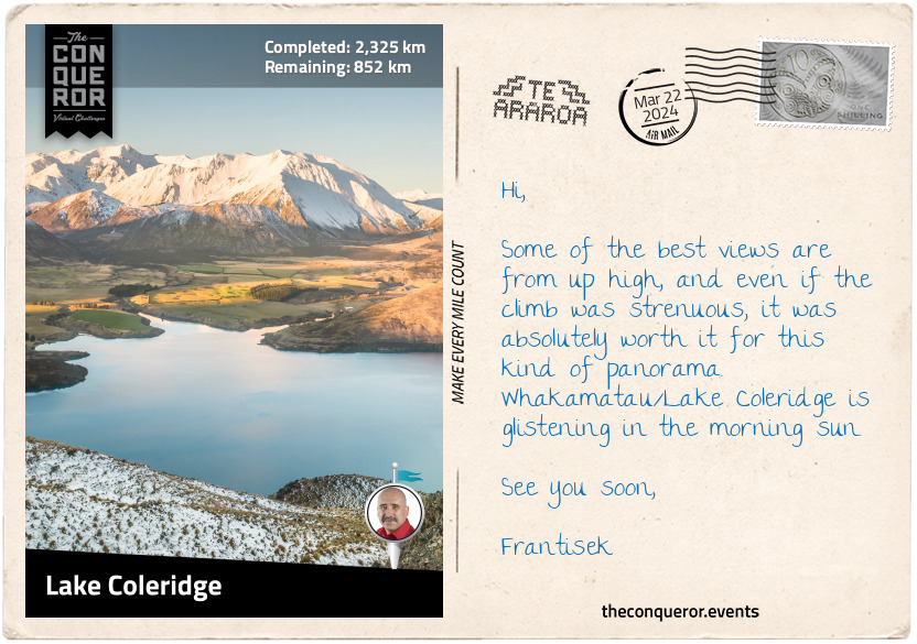
km od začátku : 2325
Lake Coleridge
From Arthur's Pass, I hiked beside Hwy 73 and a railway track (an alternative way to experience the pass) to Cora Lynn Hill. I entered the woods, climbed for a few miles, and exited on the north side of Mount Bruce. The trail skirted around the peak up to Lagoon Saddle, where it descended through more forest hiking alongside Harper River. Up and down I walked through Craigieburn Forest Park.
The trail wasn't too strenuous, leaving me free to enjoy the beech trees and look for the green mistletoe called pikirangi that grows on it. Legend says the pikirangi was the last plant in Tāne's (the god of forests) basket. Looking at it fondly, he decided he did not want it lying on the ground and placed it in the trees close to the sky.
Adjacent to the scree-covered Mount Olympus are a series of rock pinnacles formed millions of years ago when rainwater washed away the exposed soil. With pointed tips, the pinnacles rise from scrubland, seeming alien and unnatural in this environment. For a moment, I drift off into a barren wasteland where only the pinnacles exist, waiting for an extraterrestrial encounter.
Various sci-fi scenes played out in my head as I forged on and arrived at Whakamatu/Lake Coleridge. This long and narrow lake is one of the top 20 largest lakes. It is beautifully surrounded by hills and snow-capped mountains.
The lake was an ideal location for New Zealand's first hydropower plant. After three years of construction, it opened for operation in 1914. A small village sprung up around the power station to house the construction workers. As they moved on, the plant's staff members and their families moved in. Harry Hart was one of the superintendents. He had a keen interest in exotic trees and planted many different species. Harry was curious to learn which ones did well in New Zealand. The collection grew so much that it was classified as an arboretum. Today, it is open to the public as the Hart Arboretum Tree Trail. Some of the more interesting ones are the Western Hemlock with its distinctive droopy branches; the European Silver Fir with its gorgeous cylindrical-shaped cones; and the Mexican White Pine, known to have some of the longest cones.
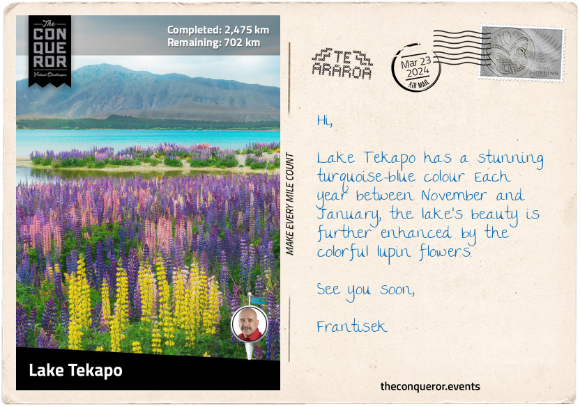
km od začátku : 2475
Lake Tekapo
I have moved into tussock country, home to wide open plains within mountainous regions. The grassy landscape contrasted with the forested areas I experienced further north.
There are two perilous river crossings in this section. The first is over the Rakaia River, one of the largest braided rivers in the country. Rising in the Southern Alps, it travels 93mi (150km) through a wide shingle bed and flows into the Pacific Ocean. As a glacially fed river, its northwest rainfall causes regular floods in spring and summer. So even if the plains are dry, the river level can be high. There's no safe way to cross the river, although some trampers have found ways further upstream. The safer option is to organise a ride and travel via the nearest road.
The second crossing was the Rangitata River from the Potts River tributary. While tricky, it was possible as the water flow was low. Rangitata is another braided river that flows east for 75mi (120km) and empties into the Pacific Ocean. A bit further north of the river is Mount Sunday, the photography location for Edoras, the capital of Rohan in Lord of the Rings.
Continuing on, I climbed up to Crooked Spur, descended a bit, then up again past Royal Hut, named after King Charles's brief helicopter ride. A further 3mi (5km) and I reached Stag Saddle, the highest point on Te Araroa. A small black and yellow sign marked the location. I had the most remarkable sweeping views as far as Aoraki/Mount Cook, New Zealand's tallest mountain.
The remaining miles were a descent to Lake Tekapo and the town on its southern shores. The lake is on the northern edge of Mackenzie Basin, historically known for sheep farming.
A humorous story is told of James Mackenzie, a Scottish immigrant, after which the basin was named, who drove 1,000 head of sheep across this area. The trouble was that none of the sheep were his. He had stolen all of them. James managed to escape his accusers and walk for 100mi (160km) before he was caught by the police. Sentenced to five years of hard labour, James just couldn't handle being in jail. He escaped twice before being placed in irons. Nine months later, he was pardoned when serious flaws in the investigation were discovered. He sailed to Australia shortly after his release and was never heard from again.
Taking a leisurely stroll around town, I stopped by the Sheepdog Memorial, which paid tribute to working dogs. Then I walked to the lake's edge and joined a bunch of kids skimming stones.
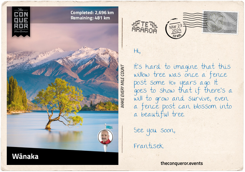
km od začátku : 2696
Wānaka
New Zealand is a country of lakes. There are over 3800 lakes between the two islands, with the majority on the South Island. Carved by glaciers, the lakes are pristine and beautiful, with the bluest colour imaginable.
I was immensely delighted to travel through this section as I passed lake after lake. The first was the milky blue Lake Pukaki, the 7th largest lake. You have to see that colour. I walked down its western side along a trail shared with the Alps to Ocean challenge. Lake Pukaki is part of the Waitaki hydroelectricity. Its southern end used to have an outflow into Lake Benmore but has been dammed.
Near the lake's power station is a wonderful view across the lake all the way to Aoraki/Mount Cook. I could just make out its peak. A bronze statue of a Himalayan Tahr stands on a boulder here. In the early 1900s, a dozen tahrs were introduced in New Zealand, hoping to increase tourism. The population steadily grew; by the 1970s, more than 40,000 tahrs existed. Overgrazing was having a devastating effect on the landscape, and a culling program was introduced, limiting the numbers to 10,000 animals. Today, the Himalayan tahr is listed as a vulnerable species. Outside of their native India and Nepal, New Zealand is the only country with a significant herd.
Heading south, I travelled through the small town of Twizel. It was built in the late 1960s to house construction workers on the Upper Waitaki hydro scheme. In the centre of town are two statues of black stilts, kakī in Māori. They are wading birds found only in New Zealand. Incredibly rare, they are critically endangered, with less than 170 adults surviving in the wild. These black-plumed birds, with long pink legs and a long black beak, breed in the Mackenzie Basin. Twizel has a facility where a captive population of kakī is maintained for breeding. Juvenile birds are then released into the wild. The nearby Lake Ruataniwha is used for watersport activities. It is an artificial lake formed in the late 1970s as part of the hydro scheme.
Next is Lake Ōhau. Māori legend tells the story of Rākaihautū, an early Polynesian explorer who arrived in Nelson, South Island, possibly around the 9th century with his wife and son. Rākaihautū travelled with his wife through Te Wai Pounamu and, with his kō (digging stick), Tūwhakarōria, he dug up many of the South Island's freshwater lakes, including Lake Ōhau.
Lake Ōhau is known for its peacefulness and stargazing. In 2012, a significantly sized area on the eastern shores of the lake was declared Aoraki Mackenzie Dark Sky Reserve. The reserve's unpolluted sky makes it an astrophotographer's dream location.
Lake Hāwea and Lake Wānaka are two parallel lakes running north-south. Lake Hāwea is the 9th largest lake and has had three Royal New Zealand Navy ships named after it, with HMNZS Hāwea still in active service.
Lake Wānaka is the 4th largest lake, with a town on its southern shore. Lake Wānaka is one of the few remaining lakes whose shores have remained unmodified. Many others throughout the country were affected when hydroelectric dams were constructed to manage the electricity shortage after WW2.
A quirky tourist attraction is 'That Wānaka Tree,' a willow tree found sitting in the lake. It's a photogenic tree that is easily accessible to any photographer who wants to capture its gorgeous curves with a fabulous mountainous background.
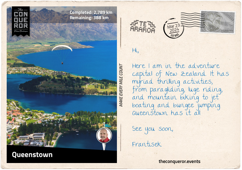
km od začátku : 2789
Queenstown
Queenstown has to be the adventure capital of New Zealand with its year-round high-octane sports. Let me begin with the Kawarau Gorge Suspension Bridge. It was built in 1880 to provide access to the goldfields. A century later, entrepreneur AJ Hackett launched a bungee jumping site at the bridge. Imagine standing on the edge of a platform with a stretchy elastic cord tied around your ankles and then willingly throwing yourself off to free-fall 154ft (47m). A most exhilarating experience.
But let's turn it up a notch and take a relaxing cable car ride to Bob's Peak for a paragliding experience. You wander over to an angled grassy field where a guide lays out a particular type of parachute. He then clips you into a harness and attaches himself to you. Instructions are coming in fast, and while still mentally processing, you're told to start running. Before it all sinks in, you suddenly drift over Queenstown, 2600ft (800m) above sea level. There is no turning back, and all you can do is enjoy the stunning views of Lake Wakatipu, the 3rd largest lake, and its surrounding peaks. But for extra excitement, the guide creates a G-Force experience by adding some speed to the descent with a handful of sharp turns. It can play a little havoc on the stomach.
However, for those who want to keep their feet on the ground, there are several stunning hikes or strolls along the lake's shores. In winter, the town becomes the centre of all snow sports activities.
Movie fans could head out to Deer Park Heights, a working farm, to explore the filming locations for The Lord of the Rings, Wolverine, Disney's The Rescue, and Pete's Dragon. Along the way, you may encounter any number of animals, including red deer, Himalayan tahr, highland cattle, llamas, and alpacas. The farm is 1800ft (550m) above Queenstown, overlooking the town and Lake Wakatipu.
There is definitely lots to do and see. Then there are all the restaurants, more than 100, with an endless supply of delicious choices. How do I even begin to choose?
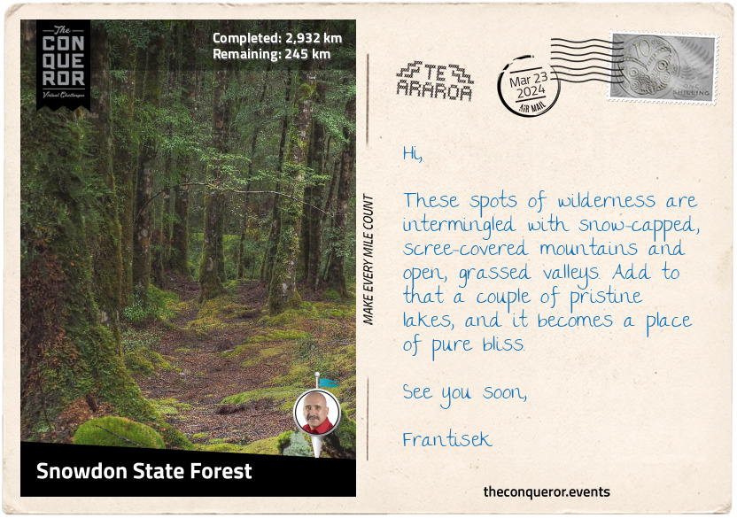
km od začátku : 2932
Snowdon State Forest
Leaving Queenstown behind, I had the most beautiful walk beside the magnificent S-shaped Lake Wakatipu, past Glenorchy, and all the way to Isengard Lookout in Dart Valley. It is hard not to continuously reference The Lord of the Rings. The director, Peter Jackson, knew that the raw beauty of New Zealand was the perfect landscape for his trilogy, and he showcased it every chance he got. Here Dart Valley was the backdrop for the Wizards Vale and the location of the fortress Isengard.
From the lookout, I crossed the single-lane bridge over Dart River and hiked south on the opposite side of Lake Wakatipu. At Elfin Bay, I connected with Greenstone Track, then Lake Rere track, both part of Te Araroa, and continued through large areas of tussock grassland, over Mavora-Greenstone Saddle, and into Mavora Lakes Conservation Park. The park is located within the Snowdon State Forest and is known for its two lakes: North and South Mavora. It is fringed with forest and towered by the Livingstone Mountains to the west and Thomson Mountains to the east.
With its two lakes and beech forestry, the park is part of the Te Wāhipounamu World Heritage Area, a massive 10,000sq mi (26,000sq km) site. In Māori, Te Wāhipounamu means the place of greenstone (pounamu). This incredible site contains iconic national parks such as Aoraki/Mount Cook and Fiordland, active glaciers such as Franz Josef Glacier and Fox Glacier, and numerous peaks, lakes, waterfalls, fiords, and valleys.
A Māori legend tells the story of Hinehukatere, a strong, fearless girl who loved mountaineering. One day she invited her love interest Wawe to join her on a climb. Wawe was less experienced, and trying to keep up with her, he lost his footing and fell to his death, or as told in another story, he was caught in an avalanche. Hinehukatere was heartbroken and cried endless tears that froze to form the Franz Josef Glacier. In Māori, it is called Ka Roimata o Hinehukatere, which means the tears of Hinehukatere.
What makes Te Wāhipounamu so unique is its flora and fauna. As the country's most extensive and least modified area, the vegetation here is in pristine condition. It is considered the best modern representation of the original flora of Gondwana. Many indigenous animals live here, including the Southern Brown Kiwi, Yellow-crowned Parakeet, New Zealand Falcon, and Takahe, found in a few areas in Fiordland.
My favourite bird, though, has to be the kea. It's a large parrot species with olive-green plumage and a brilliant orange colour under its wings. They are intelligent, cheeky, and playful. One humorous story was about a driver who left his vehicle with the window slightly open. A kea squeezed itself in the car, picked up a stack of postcards, and squeezed out. Imagine the driver's surprise when he found a kea with a mouthful of his postcards. Of course, a bit of a tussle ensued until the kea released the goods. Moral of the story? Keep your car windows closed. Watch their playfulness with a hidden camera in a snowball:
https://youtu.be/n9iifaLV15Q
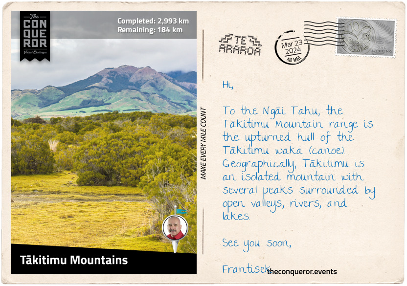
km od začátku : 2993
Tākitimu Mountains
Surrounded by pastures, farmland, and tussock grasslands are the Tākitimu Mountains and the scree-covered Brunel Peaks. Te Araroa travels along its eastern face through beech forest and over river valleys.
Tākitimu Mountains are an important place to the Ngāi Tahu, to whom the mountain represents the upturned hull of the Tākitimu waka (canoe). The Tākitimu was one of seven great migration wakas. It was a large twin-hulled ocean-going canoe. As such only selected chiefs, the holders of its people's histories and knowledge, and sacred relics were permitted to sail.
Tamatea-Arikunui was a high priest who ordered the making of Tākitimu. Construction was closely guarded, and common people were not permitted to enter. Only the craftsmen were allowed under tapu, a concept best described as a spiritual restriction. When the canoe was complete, the tapu was lifted by special rites. Consecration of the canoe followed, seeking blessings from Tangaroa, the god of the sea and sky, for safe passage and Tāne, the god of the forest, whose timber was used to build the waka.
Launching on its voyage, Tākitimu made landfall near Ninety Mile Beach, North Island. Navigating around the North Cape, past Cape Reinga, Tākitimu sailed down the east coast to Tauranga, where Tamatea disembarked and handed the waka to be captained by Tahu.
In search of pounamu, Tahu continued to the South Island by navigating along the west coast to the Arahura River, north of Hokitika. Now, here the story loses its thread, and I'm not quite sure what happened, except that Tahu became the ancestor of the Ngāi Tahu iwi.
According to one legend, Tākitimu, captained by Tamatea, was wrecked in Te Waewae Bay and the hull was "hurled inland by giant waves," becoming the Tākitimu Mountains. And here the confusion lies since Tamatea never travelled beyond the North Island. However, it is entirely possible that the Tamatea and Tākitimu that the legend refers to are actually about the grandson Tamatea-Ure-haea, who built a canoe and named it the same in memory of his grandfather. Tamatea-Ure-haea was an explorer and is said to have circumnavigated the North and South Islands. His journey has him travelling the east coast of South Island, then westward, where he possibly wrecked the waka that became the Tākitimu Mountains. Some say that he built a new waka to complete his journey.
It is impossible not to get drawn into the wonderful world of Māori storytelling. Passed down through generations, the stories touch on many areas of history, culture, and society. They are a blend of myth and truth, and their many heroes often inspire a model of behaviour to strive for and overcome difficult times. My growing familiarity with the many characters I was introduced to through these writings has broadened the way I see Aotearoa/New Zealand. Through the eyes of these legendary figures, every lake, mountain, and valley takes on a new meaning.
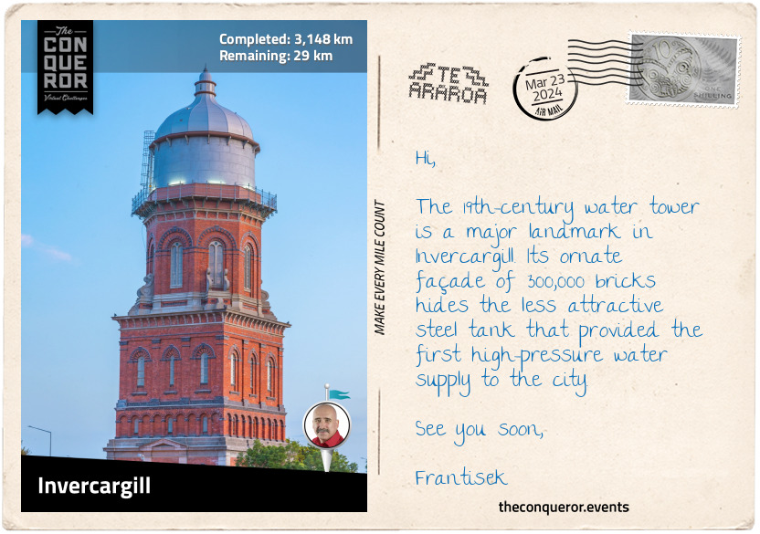
km od začátku : 3148
Invercargill
I hiked right through the middle of Longwood Forest, made up of beech and podocarp trees. The hilltops are large expanses of tussock grasslands. The Round Hill Conservation Area at the south end of the forest is a popular red deer hunting area.
For the next 22mi (35km), I walked on the shores of Colac Bay and Oreti Beach. Foveaux Strait, which includes the two bays, Te Waewae Bay and Toetoes Bay, stretches for 80mi (130km), separating Stewart Island from South Island. The Strait lies within New Zealand's continental shelf and is thought to have been dry land during the Pleistocene era.
Stewart Island is New Zealand's third largest island and, in mythology, is believed to represent Māui's anchor. The island was named after William W. Stewart, a Scottish sealer and the first officer on the ship Pegasus. Stewart charted the southeastern harbour of the island and determined its northern point, confirming that it was indeed an island. The harbour, Port Pegasus, was named after Stewart's ship.
Leaving the beach, I trekked inland and skirted around the edge of Invercargill. Founded in 1856, Invercargill is the southernmost and westernmost city in New Zealand. The almost grid-like city plan and extra wide streets are the foresight of John Turnbull Thomson. He was a 19th-century British civil engineer who was "instrumental in the development of early infrastructure in Singapore and later in New Zealand." Many of Invercargill's streets bear the names of Scottish rivers, i.e., Dee, Tweed, Ness, Ythan, and Clyde, a reflection of Thomson's Northumbrian background.
With just a little further to go, I am nearly at the end. One last final push.
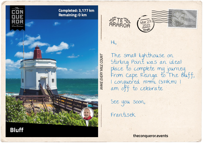
km od začátku : 3177
Bluff
Bluff is one of the oldest European settlements in New Zealand. It was founded in 1823 by James Spencer, who established a trading post to supply visiting ships. The settlement went by many names, including Campbelltown, but the locals insisted on calling it Bluff, and in 1917, the name was officially recognised.
With a natural harbour, Bluff’s history is steeped in whaling, sealing, and shipping. Today, it has a large seaport mainly for commercial ships and fishing boats. Before the town’s entrance is a lovely coastal walk track with views across the harbour and Tikore Island.
Bluff sits on the eastern edge of a peninsula, and at the centre dominating the rest of the area is Bluff Hill, with a lookout on top. The Bluff Maritime Museum tells the story of its heritage. Its biggest attraction is a beautifully restored oyster fishing boat from the early 20th century. Named Monica II, the boat was donated as a permanent display in 1998.
A must do was a walk to Stirling Point, where the famous yellow signpost gives directions to twelve locations worldwide. Nearby was a massive chain sculpture called Te Puka a Maui (Maui’s anchor). It symbolises the Māori belief that Rakiura/Stewart Island is anchored to Te Waka a Maui (Maui’s canoe)/South Island. A similar sculpture on Rakiura/Stewart Island represents the other end of the chain. One could imagine this grand chain disappearing beneath Foveaux Strait, keeping the island spiritually and physically connected to the mainland.
Having reached the tail end of Te Araroa, I am in awe at all the beauty New Zealand has to offer. Between striking landscapes, modern cities, legendary warriors, and sacred places, this long journey opened my mind and heart and awakened my spirit.
Farewell till the next time.
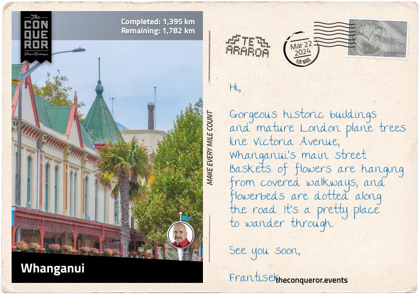
km od začátku : 3195
Whanganui
Edward Gibbon Wakefield was a British diplomatic courier (King's Messenger) in the early 1800s with grand political aspirations. When his wealthy wife died in childbirth, he concocted a plan to kidnap a young socialite and marry her for her wealth in the hope he could enter Parliament. Tying the knot in Scotland, he led her through the countryside and onto France under false pretenses. His wife's uncle and local police were hot on his trail. Wakefield was arrested and imprisoned for three years.
Imprisonment did not deter Wakefield from grand dreams. Soon after his release, he became widely interested in colonial affairs and an early leader of New Zealand's colonisation. Becoming director of the newly founded New Zealand Company, a British charter, Wakefield set the colonisation of New Zealand in motion. The Company's first established settlement was Wellington, followed by Whanganui – both in 1840.
The ancestral home of many Whanganui tribes, the city is located on the western coast of North Island, with the Whanganui River flowing through it. When Wakefield purchased land to settle the area, he named it Petre after Lord Petre, one of the Company's directors. But the settlement was wrought with problems, as the land was haphazardly purchased from the Māori, and new settlers were occupying lands still claimed by the Māori. It would take eight years before some agreements were reached, although undercurrents of tension continue to exist today.
Whanganui has a wonderfully diverse architectural style. Walking through its streets, I appreciated the 1960-built, modernist-style War Memorial Centre. The centre won a gold medal from the New Zealand Institute of Architects and is listed in the top 50 modernist buildings in the southern hemisphere.
The Sargeant Gallery has a robust neo-classical style, while the nearby cinema is beautifully preserved with its original Art Deco lines. At the centre of the main street is the Watt Fountain, built in 1906 as a memorial to the town's first mayor William Hogg Watt. The gorgeous Royal Opera House is the last Victorian theatre in the country. Made from wood and erected in 1899, the theatre seats 890 people and continues to be in use today. In 1999, as part of its centennial celebrations, the building was bestowed with a Royal charter and renamed the Royal Whanganui Opera House.
With plenty more to see, I visited the two large towers – War Memorial and Water Towers - overlooking the town, each with its distinctive architectural style. Another unique landmark is the "Handspan Peace Sculpture", a double-spiral path converging at the centre covered in 4000 clay casts of hands. It was unveiled in 2002 as part of the 20th Anniversary International Day of Peace celebrations.
Whanganui is a beautiful place worthy of a lengthy exploration. Better yet, I may just hop on the Waimarie Paddle Steamer and cruise down the river for a relaxed view of the city.
km od začátku : 0006
Mirrormere
Although Dwarven livelihood and culture is linked to the mountain, their legacy started in this lake. Close to the Eastern Gate, this is where Durin, the first of the Dwarves, looked into the waters and, upon seeing a crown above his head, took it as a sign and founded Khazad-dûm.
With grief burdening their hearts, the members of the Fellowship cross the waters on their way to Lothlórien, where they can be safe from Orcs
km od začátku : 0010
Flet outpost
Also known as a talan, these platforms were built on the branches of Mallorn trees and serve many purposes, from outposts and observation platforms to floors of buildings.
The Fellowship’s fate and path is decided here by their captor, Haldir. The Elf, sensing that Frodo is bringing a great evil into the forest, is reluctant to let them go any further.
km od začátku : 0018
Forest of Lothlórien
Under the protection and spell of Galadriel, this ancient forest is the home of the Silvan Elves. The Lady of the Light also planted here the Mallron trees which can be found at the heart of many Elven structures.
Led by Haldir and his wardens, the companions traverse the forest. Their feeling of safety is only dimmed by a mysterious voice some of them can hear and the feeling that something is amiss.
km od začátku : 0026
Caras Galadhon
Meaning Fortress of Trees, this is the heart of the Silvan Elves’ realm and the house of Galadriel and her husband Celeborn. Surrounded by forest, this is a safe, but hermetic sanctuary.
Upon arrival, the Fellowship is welcomed by the Lady and Lord of Lórien themselves and Frodo realises that the voice whispering to him belongs to Galadriel
km od začátku : 0042
Silverlode Hythe
Located on a strip of land just before the Silverlode river joins Anduin, this small port harbors elegant and light Elvish boats.
From here, the Fellowship embarks on a long journey down the Anduin, ever getting closer to Mordor.
km od začátku : 0048
Anduin
Also known as the Great River, Anduin flows through most of Middle-Earth: from the Misty Mountains into the Great Sea.
While the company rushes downriver, the Uruk-hai Saruman awoke in Isengard are following them closely on the river banks.
km od začátku : 0056
Argonath
These two enormous statues, depicting the great kings of old, used to mark the Northern border of Gondor, Aragorn’s ancestral land. Gondor’s power and size has greatly diminished, the monument now marks the approach of the Rauros falls.
Amazed, the company looks upwards, allowing themselves a moment of awe.
km od začátku : 0072
Nen Hithoel
This is a misty lake on the river Anduin, found just before the Rauros falls. Being once part of Gondor, the banks used to be fortified and held. Now, the stone buildings lie abandoned.
The Fellowship must moor now and decide which way they will approach Mordor.
km od začátku : 0089
Parth Galen
Located on the Eastern side of Nen Hithoel, at the base of Amon Hen hill, this gentle strip of sand offers safe harbour to the exhausted members of the Fellowship.
Here they must decide how to reach Mordor: They may either move straight over land, continue on the river Anduin or make a detour to Minas Tirith.
km od začátku : 0097
Seat of Seeing
Built on top of Amon Hen Hill, this fortification is a great watchtower of old. Once guarding the border of Gondor, now it lays forgotten and has succumbed to nature.
The corruption of the Ring touches all, Boromir is no exception. Running away from him, Frodo reaches the top of the hill. Here, with a heavy heart, Frodo understands that his path is a solitary one.
km od začátku : 0106
Shelving Shore
The Eastern side of Nen Hithoel is dominated by Amon Lhaw hill, upon which another ruined watchtower lies. Before the Hobbits, endless barren hills jut up.
Having followed Frodo, Sam is now by his side and together they must navigate this stone maze and reach the Black Gates of Mordor.
km od začátku : 0111
Emyn Muil
These seemingly impenetrable hills are as confusing as they are vast. Devoid of vegetation or landmarks, they prove to be a barrier for the Hobbit pair who have been wandering in circles for days.
However, there is another lurking in the hills. Sensing that they are not alone, Sam and Frodo trick Gollum into attacking, hoping to capture their strange pursuer.
km od začátku : 0122
Dead Marshes
Gollum leads the Hobbits down a hidden and unused path through this accursed land. The fetid pools of water entomb the spirits of soldiers long past. The Lights, as described by Gollum, entrance their victims and trap them underwater.
Mesmerized by one of them, Frodo is submerged and then saved by none other than Gollum.
km od začátku : 0130
Camp in the Marshes
The Lights are not the only threat in this filthy land. Above their heads a great Fell Beast surveys the skies, perhaps sensing the pull of the Ring.
The travelers must keep their whereabouts secret as they inch closer to Mordor.
km od začátku : 0145
Black Gate
Escaping the Dead Marshes does not give great relief as they are now faced with this disheartening sight. This impenetrable gate was built by the power of the Ring and is now manned by thousands of Orcs and evil creatures, ready to serve their Dark Lord.
Perched upon a hill, the two Hobbits consider their options and head for the open gate, hoping to pass unseen and unharmed.
km od začátku : 0003
The Prancing Pony
This cosy inn is owned by Barliman Butterbur and offers beer and hearty food for weary travellers, whether Hobbit or Man.
Here, the company’s relief fades when they realise that Gandalf has not reached the inn, nor did he leave a message.
km od začátku : 0032
Midgewater Marshes
Deceived at the Prancing Pony, the Nazgûl are still pursuing the company.
Unsure if they can trust the mysterious Strider, but lacking any other options, the Hobbits follow him through this boggy land, making haste to reach Rivendell.
km od začátku : 0052
Amon Sul
Meaning ‘Hill of Wind’, this ring of ruins was once a great watchtower that surveyed the surrounding lowlands.
Strider chooses this ancient hill as a base for their night camp. While the Hobbits rest he scouts the surroundings, sensing that danger is near.
km od začátku : 0092
Stone-trolls
These formations are neither natural nor sculpted, they are, in fact, real trolls turned into stone many years ago by Bilbo and his company.
After being stabbed by a Morgul blade, Frodo is slowly slipping into Shadow; he is in need of Elven medicine. In their rush to Rivendell, hoping to slow the poison, Strider stops here and, through darkness and foliage, they search for the athelas plant.
km od začátku : 0109
Ford of Bruinen
This shallow point on the Bruinen River is used as a crossing point when heading towards the Misty Mountains. Seemingly unthreatening, the waters are controlled by Elrond.
Astride her horse and holding Frodo close, Arwen commands the waters to rise and escapes from the Nazgûl. Although within the boundaries of her own land, Arwen is still pressed for time as Frodo’s strength is diminishing.
km od začátku : 0118
Rivendell
Also named The Last Homely House East of the Sea, this is the house of Elrond and one of the last Elvish dwellings in Middle-Earth. This safe haven is both a place of power and of calm and meditation.
Here, after his recovery, Frodo rejoins his friends and meets some other folk that might just help him finish his journey.
km od začátku : 0134
Hollin Ridge
Heading to the Gap of Rohan, the Fellowship stops at the foot of Caradhras to train and replenish their strength.
km od začátku : 0147
Caradhras Pass
This pass across Caradhras, The Cruel, is infamous for its arduousness and glacial conditions. While attempting to pass, the company is further hindered by Saruman who orders huge boulders to roll down the mountain over them.
km od začátku : 0158
Doors of Durin
Built centuries ago by a rare alliance of dwarves and elves, Durin’s door guards the Western entrance to Moria. Once kept open, now they can only be accessed with a secret password.
The company rests by the water and waits for Gandalf to recall the words that will allow them to step inside.
km od začátku : 0008
Tower of the Hand
Tyrion Lannister is disgraced and out of options. He has been convicted of the murder of King Joffrey. He has been betrayed by the woman he loves. His champion, Oberyn Martell, has been brutally killed. In the Tower of the Hand, he shoots his father and kills the love of his life. Aided by Varys, he is now on his way to Essos.
km od začátku : 0027
Illyrio’s Mansion
Tyrion emerges from his squalid box in Illyrio’s garden. Varys gives him a choice: drink himself to death in Pentos, or travel with him. They will meet someone gentler than Stannis, but more powerful than Tommen. Someone who inspires the fear of the lords and the adoration of the people. A ruler loved by millions, with a powerful army and the right name - the Mother of Dragons, Daenerys Targaryen.
km od začátku : 0053
Volantis
Cloth, spices, wine, slaves, fortunes, death. All these and much more can be found on the meandering and elegant streets of Volantis. Tyrion might not find anything he wishes for here, but someone finds him. The double disgraced Jorah captures and binds Tyrion. He will make a mighty gift for his khaleesi.
km od začátku : 0076
Old Valyria
Tyrion travels bound by Jorah and is kept away from the only thing that makes his life bearable: wine. His captor’s wish to avoid pirates pushes them further into smoke, closer to the ruins of Old Valyria, governed by ghosts and Stone Men. These monsters attack their little boat and, after a miraculous escape, they are washed ashore.
km od začátku : 0093
The Lands of the Long Summer
The name of these lands is most deceiving. Scorched by the Doom of Valyria, they are now barren and dangerous. The only thing that they can still offer is fresh water for pirates bold enough to approach. Such pirates capture Tyrion and Jorah and sell them to slavers - Jorah for his strength and Tyrion as entertainment.
km od začátku : 0105
The Fighting Pits
Imp, regicide, patricide, Hand, murderer, prisoner. Tyrion has been called many things throughout his life. Now, standing in front of Daenerys, he is yet another thing: a gift. After he escapes from the pit, Tyrion is taken to the Great Pyramid.
km od začátku : 0121
Adviser to the Queen
In the Great Pyramid, “two terrible children of two terrible fathers'' converse. By all rights, Daenerys should have Tyrion killed. But she knows that he can provide more than a means of revenge. He has knowledge of Westeros and its Houses, and advice on how to win them over. As her advisor, he is by her side when the Sons of the Harpy ambush Daenerys and her court at the Great Games.
km od začátku : 0129
Slaver's Bay
“We make peace with our enemies, not our friends”. This saying and the chaos on the streets push Tyrion to seek an agreement with the Masters in Daenerys’ absence. It is a dangerous gamble, for he does not trust the Masters and risks turning friends into enemies. A fragile peace settles over Meereen. No more bodies show up on the streets and trade has returned to the markets.
km od začátku : 0140
The Hand of the Qeen
Beside Daenerys, Tyrion will travel to the home they both left behind. As she leads her army against the Usurper and breaks the wheel of violence and oppression, Tyrion will be behind her all the way. And when she is done, when a new dawn will come to Westeros, the Dragon banner will be hung once again on the walls of the Red Keep and Tyrion will serve the realm as Hand of the Queen.
km od začátku : 0008
The Night’s Watch
The Night’s Watch is one of the Seven Kingdom’s most ancient institutions. Its purpose is to man The Wall, the great barrier separating the Seven Kingdoms from the frozen wastelands of the North. No matter their age, status, skill or crime, every man is put to good use here. After the vows are spoken, each man in the Night’s Watch loses his family but gains a whole band of brothers.
km od začátku : 0016
House Stark
House Stark is the paramount House in the North. Ruling from their seat in Winterfell, their House words are: “Winter is Coming”. The Starks are unlike the pampered lords of the South; they know that sooner or later, the earth will frost over, darkness will close in and the Long Night will begin.
km od začátku : 0024
Battle of the Bastards
After the murder of Robb Stark at the Red Wedding, the North passed to House Bolton. Following the mysterious death of Lord Roose Bolton, those lands passed to his newly-named heir, Ramsay. His reign of terror ended when the Knights of the Vale reinforced Jon’s wildling army and Ramsay was fed to his own dogs by Lady Sansa Stark.
km od začátku : 0031
House Mormont
House Mormont are the stalwart lords of Bear Island. They rule over their remote and enchanting domain of waterfalls and deep forests with a firm but fair hand. These days, the House is scattered; the former Lord Jeor heads the Night’s Watch, and his son Jorah is disgraced in exile. Ruling the island has fallen to Lady Lyanna who has proven a capable leader, despite her young age.
km od začátku : 0034
House Frey
The cold, miserly House Frey is one of the richest families in the Seven Kingdoms. The founder of their house capitalised on a narrow crossing of the Trident that links the Riverlands with the North and built a keep in order to collect tolls. Winter came for this House when Arya Stark avenged the massacre of her family at the Red Wedding.
km od začátku : 0056
War of the Five Kings
During his tenure as Hand of the King, Eddard Stark uncovered a conspiracy: Joffrey was not King Robert’s son. Soon, chaos gripped the Seven Kingdoms as the Throne was occupied by a bastard. Robert’s brothers, Stannis and Renly, staked their claim while two other kings rose from the north and west: Robb Stark and Balon Greyjoy.
km od začátku : 0057
House Tully
The Tullys are Lords paramount of the Trident, ruling over the Riverlands. To survive, the family have become master diplomats, maintaining a complex web of inter-marriages and cordial relations. This means that when the inevitable happens and the Great Lords march their armies across the Riverlands, the Tullys and their holdings will remain intact.
km od začátku : 0061
House Greyjoy
House Greyjoy rules over the Iron Islands, a harsh and bleak collection of islands off the west coast of Westeros. From these islands hail the strong and fierce Ironborn. Their motto 'We Do Not Sow' signifies they do not plow the fields or toil in the mines. They will take what is theirs.
km od začátku : 0066
House Lannister
The Lannisters are the richest House in the realm and perhaps the most powerful. Their seat is at Casterly Rock, but the Iron Throne and King's Landing hold more appeal for them. Their words are 'Hear Me Roar,' but they are most known for the saying “A Lannister always pays his debts”.
km od začátku : 0072
House Tyrell
House Tyrell inhabits the bucolic region of the Reach. This lovely land is the breadbasket of the Seven Kingdoms, producing the bulk of the golden grain that feeds the Kingdom. These southern roses seem to thrive even in King’s Landing, as Margaery and Olenna wrap their vines around the court.
km od začátku : 0082
House Baratheon
“Ours is the Fury”. Few houses have such fitting words. The Baratheons that inhabit the Stormlands are risk-takers and warriors. After Robert’s death, the furious black manes of Storm’s End are nowhere to be seen in King’s Landing. Yet it would be unwise to discount their fury, for on the isle of Dragonstone, the grim, implacable younger brother of King Robert is preparing to take the Iron Throne.
km od začátku : 0093
House Martell
The Martells rule over Dorne, a region different to their northern neighbours. Here, ideas surrounding the place of man and woman, trueborn and bastard are as fluid as the cooling waters of Sunspear’s fountains. Their words “Unbowed, Unbent, Unbroken'' reflect their true, unwavering and unconquered spirit.
km od začátku : 0105
The Smallfolk
The smallfolk are the great majority that toil in the fields and fill the armies of the lords of Westeros. Looked down on by the highborn, these people have few rights and fewer prospects. The tides of history throw the common people this way and that. For now, they are the oppressed creature and the specter that haunts every victory the lords of Westeros win.
km od začátku : 0124
House Targaryen
“Fire and blood.” This is what made the Targaryens flee Old Valyria and in turn, this is what they brought to Westeros. For centuries, they ruled the Seven Kingdoms. With their dragons gone, they now find a place in history books, rather than royal halls. Though diminished, their line is not broken, for a young queen is preparing to take dragons across the Narrow Sea once again.
km od začátku : 0019
Bag End
This Evil cannot remain in the Shire, Frodo must leave cosy Bag End and travel to Bree.
There, Gandalf will meet him once more, after he has spoken with the head of his order, Saruman.
km od začátku : 0044
South Farthing
Stretching from Three Farthing Stone in the centre of the Shire all the way down to its southernmost border, this warmer region is renowned for its lush fields and crops.
Frodo and Sam travel cross-country, as advised by Gandalf, in order to reach Bree. Although still in the Shire, this is an important milestone for Sam, being the farthest away from home he’s ever travelled.
km od začátku : 0064
Woody End
As the name might suggest, this region is located on the Eastern edge of Green-Hill and it’s one of the very few forests in the Shire.
Here, Sam and Frodo witness the last journey of the Wood Elves as they head to the Grey Havens, leaving Middle-Earth, never to return.
km od začátku : 0097
Bamfurlong
Located in The Marish, Maggot’s farm is well known amongst Hobbits for its abundant crop fields.
Taking a shortcut through the corn, the Hobbit pair stumbles upon Merry and Pippin, who are helping themselves to the bountiful harvest yet again. Before long, they have to run so as not to be caught by Maggot.
km od začátku : 0105
Bucklebury Ferry
This unmanned ferry on the Brandywine River is one of the main crossing points between the Shire and Buckland.
After a close encounter with a cloaked rider, the raft serves as a literal lifeboat for the Hobbits. Huddled, they float through the night, hoping to reach safety before the pursuer crosses Brandywine Bridge.
km od začátku : 0233
Bree
This unassuming village is located at the meeting of two important roads: The Great East Road and the Old North Road, making it an important stop for travellers.
Bree is one of the only settlements in which Men live alongside Hobbits. Here one can find the Prancing Pony, where travellers can rest and where the four Hobbits are headed, eager to get warm and meet Gandalf.
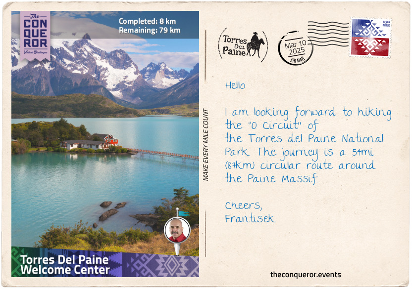
km od začátku : 0008
Torres Del Paine Welcome Center
At the southern end of Chile on the continent of South America is the exquisitely pristine mountainous terrain of Torres del Paine National Park. Established in 1959, the park is filled with tall peaks, ample glaciers, turquoise lakes, rivers, plenty of wildlife and hundreds of species of flora. In 1978 the park was designated a UNESCO Biosphere Reserve.
The name Torres del Paine translates as The Blue Towers, and it refers to the three famed granite towers that the park is named after. Located within the Paine Massif (aka Cordillera del Paine), The Towers are amongst a dozen or so other significant peaks within the mountain formation ranging from 6,560ft (2,000m) to 9,462ft (2,884m) in elevation.
The park and its two major trekking circuits are very popular with hikers. The "W Circuit" is the shorter route that as the name suggests travels in a "W" shape through two of the four valleys and beside Grey Lake close to Grey Glacier.
The "O Circuit" is a hiking trail around the entire massif, past several lakes, rivers and glaciers. The circuit was pioneered in 1976 by John Gardner with two local rangers when they successfully circumnavigated the massif. This is the journey I will be undertaking.
Beginning at the Welcome Center on the southeast corner of the massif, my journey will be heading anticlockwise, hiking north on the east side of the mountain. Following the river to Los Perros Glacier, I climb over John Gardner Pass and cross several suspension bridges. Once beside Grey Glacier, I will keep skirting around the mountain alongside Grey Lake on the westside, then Nordernskjold Lake on the southside and finish back where I started.
I anticipate gusty winds, shifting weather patterns and some tough trekking sections. Whilst I'll be happy to see a herd of guanacos on my travels, any puma sightings would be preferred from a distance.
Time to hit the trail.
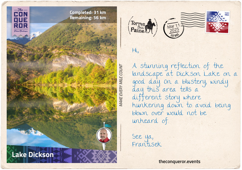
km od začátku : 0031
Lake Dickson
I left the Welcome Center hiking northbound on the east side of the massif. The trail followed parallel to the Paine River on the outskirts of the vast Patagonian Steppe. The environment was harsh with strong winds sweeping across the plains.
Most of the vegetation consists of desert shrubs and tuft grasses but even these are not without interest. Shrubs such as the Mata Verde produce white flowers with antiseptic properties that were once used for medicinal purposes. The Guanaco Bush sprouts with bright red-orange flowers and is one of the first bushes to bloom. Another unique looking plant is the Capachito or otherwise known as Lady's Slipper because the small yellow flower with reddish-brown edges is in the shape of a slipper.
The Steppe is also home to the native guanaco. Roaming on the plains in herds, the guanaco is a camelid and closely related to the llama. Young guanacos called chulengos are capable of walking shortly after birth and able to keep up with the herd right away. This is a necessary adaptation given that in the open plain guanacos have nowhere to hide and pumas are their natural predators.
Ten miles (16km) into my trek I turned the corner of the massif at Paine Lake and entered Dickson Valley. I travelled adjacent to Paine River on a flattish trail with views of Cerro Escudo and Cerro Cabeza Del Indio, both mountains on the northern portion of the massif.
This section of my journey finished at Dickson Lake, the source of Paine River. Interestingly this lake used to be solely within Chile's territory with Dickson Glacier at the head of it. Because the glacier retreated significantly, it opened the way for Dickson Lake to join with newly formed lakes from Argentina's side. Today, it is an international lake with parts of it within both countries.
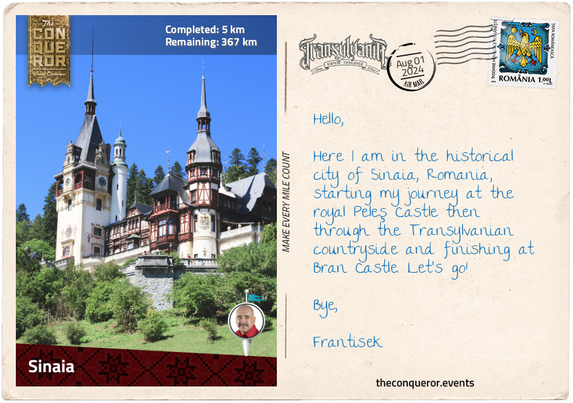
km od začátku : 0005
Sinaia
The “Land Beyond the Forest” lends an air of mystery and adventure. Such is the English translation of the Latin word Transylvania, a magnificent mountainous region in Romania that in modern times has been closely associated with the fictional character Dracula and the legendary warlord Vlad Dracula otherwise known as Vlad the Impaler.
Occupying nearly 42% of Romania’s total surface, the region is hugged by the Carpathian Mountains (“the Carpathians”) to the east and south and the Apuseni Mountains to the west. At the centre is the Transylvanian Plateau made up of a network of valleys, canyons, and small mountain ranges.
Occupied by Dacians, Romans, Huns, Slavs and Bulgars, until just after the end of the first millennium AD Transylvania became part of the Kingdom of Hungary and then the subsequent Austro-Hungarian Empire for the next 900 years. Following the end of WW1 and the dissolution of the Austro-Hungarian Empire in 1918, Transylvania was transferred to Romania.
The region is populated by a mix of Romanians, Hungarians, and German Saxons. This cultural diversity beautifully shows up in the well-preserved Gothic architecture, the Saxon fortified towns, traditional folk costumes, and its finger-licking good food.
I am currently in Sinaia, a mountain resort town that is located in the historic region of Wallachia, south of Transylvania. Wallachia, referred to as Muntenia by Romanians, was a region that was often at war either with the Ottomans to the south or Hungarians to the north. It continued this way until the late-19th century when Wallachia together with Moldavia, a vassal principality in the northeast, joined to become the Kingdom of Romania with King Carol I, a member of a German royal dynasty, as the first monarch to rule.
King Carol commissioned the construction of Peleş Castle, a summer residence in the north of Sinaia on an extant medieval route linking Wallachia with Transylvania. Built at the end of the 19th century the castle has a Neo-Renaissance and Gothic Revival architecture. Completed with more than 170 rooms, it is a beautiful structure of spires, wood panelling, a clock tower and highly detailed frescoes. The grounds are filled with terraced gardens, niches filled with statues, fountains, grand lion statues standing guard and more.
Whilst outside is just stunning, the inside is an absolute visual feast. Spectacular carvings, walnut panelling, themed rooms, gilding on walls and doors, sumptuous velvet seating and curios abound all around. The central atrium was covered with a large stained-glass ceiling allowing natural light to filter through. Medieval weapons adorned the walls where I recognised the curved scimitar swords of the Ottomans, 16th century muskets, battle-axes and various daggers and swords. Everywhere I turned there was something to study or admire.
Filled with all the wonderful art and architecture, I stepped outside and took in the crisp, clean air of the Bucegi Mountains. As the castle proudly sat on a hill surrounded by dense forestry, I imagined this was a quiet getaway for the family from their royal duties.
Taking a stroll, I visited the nearby Pelişor castle the King built at the turn of the 20th century for his nephew, Ferdinand I, heir to the throne, and his wife, Maria. Much smaller in size, the Art Nouveau castle is famous for the Golden Room that is decorated floor to ceiling in golden leaves.
Passing by King Carol’s towering statue at the main entrance, I head out of the estate and towards the city of Braşov.
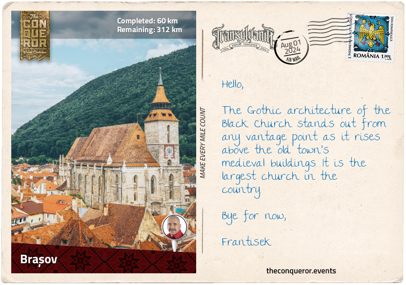
km od začátku : 0060
Braşov
Braşov is the capital city of Braşov County in Transylvania. Developed and expanded throughout the centuries, Braşov has traces of settlement since the Neolithic Age (9500BC). During the 12th century, the King of Hungary invited German Saxons to settle and develop the surrounding area. A century later the Teutonic Knights built fortifications to defend the kingdom’s borders, among these was Kronstadt, the Crown City, today known as Braşov.
Located in the foothills of the Carpathians the old city centre reveals Saxon architecture, partial remains of the old curtain wall, bastions and towers, and restored city gates. At the centre of the old city in a large open square is the old Town Hall, Casa Sfatului, a building that originally began as a watchtower in 1420. Over the succeeding centuries it has been added to, partially destroyed by war and earthquakes, rebuilt, restored, altered and nearly fully demolished twice in the 20th century. This is one building that has withstood the test of time. Given its many changes, the building is a blend of Gothic, Renaissance and Baroque architecture. The tower’s German clock, installed in 1892, continues to accurately tell time.
Nearby, tucked amongst buildings in a court is the 15th century Saxon-built, Gothic-style Black Church, Biserica Neagră. Towering above the old city’s skyline, this imposing church is the heart of the city. The main entrance is richly decorated with heavy carved doors leading inside where two large chalices (c1504) occupy the floor, more than 200 Ottoman carpets – the second largest collection of Ottoman carpets in Europe, mostly from 15th-16th centuries – hang as decoration and two organs, of which one has 4,000 pipes, are played during weekly concerts.
Southeast of the old city is the ethnically Bulgarian and Romanian neighbourhood called Prund-Şchei, Şcheii Braşovului, a village-like town made up of small houses and narrow streets. Prior to the 17th century, the town’s residents were not permitted to own property inside the old city’s walls and access was only allowed through St Catherine’s gate (one of five gates) where they had to pay a toll in order to sell their produce. The ethnic Bulgarians arrived in the late 14th century, most likely to assist in the reconstruction of the Black Church destroyed by the Tatars, a Turkic-speaking ethnic group, a century earlier. They settled in the area and over time adopted the Romanian language and ethnic identity.
In 1583 the First Romanian School located in Prund-Şchei began conducting its first lessons in the Romanian language. Prior to this, education was conducted in Church Slavonic, which used to be the liturgical language of the Romanian Church. As the school was within the Kingdom of Hungary, students from far and wide would come to attend. Their attendance was paid for by the village with the aim that upon return they would then teach and share their education. The school operated for 230 years. Today it is a museum, exhibiting various educational books in both Slavic and Romanian, the first Romanian bible and the first Romanian printing press.
Having worked up an appetite from all my wanderings, I head to the nearest restaurant to try some of the local cuisine. I settled for a Ciorbă de Perişoare for entrée, a clear, slightly sour meatball soup with vegetables chopped up really small and for main I opted for a vegetarian dish of stacked potatoes. This dish in Romanian is called Cartofi Franţuzeşti, meaning French Potatoes, although unsure if it originated in France it consists of layers of sliced potatoes and hard-boiled eggs, topped with sour cream and breadcrumbs, and baked in the oven. There are variations to this dish for the meat lovers by adding ham, sausages, or really tasty salami. Yum!!
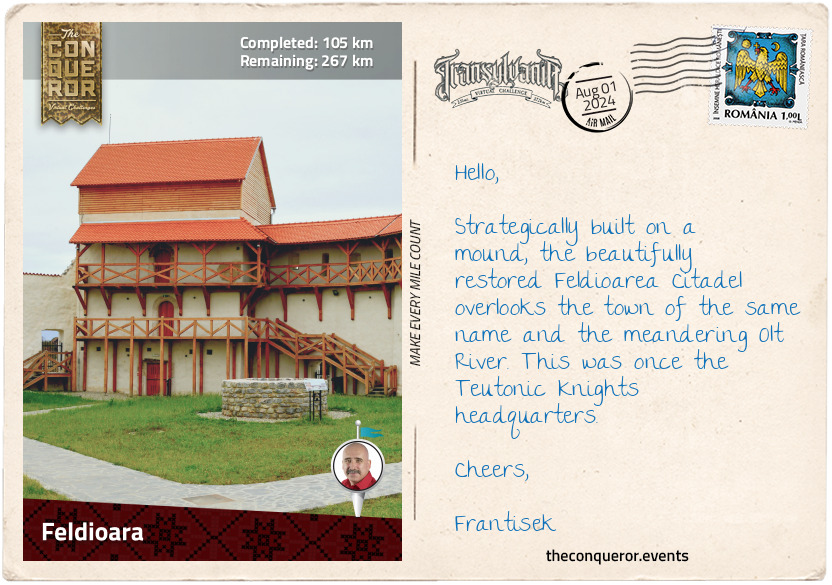
km od začátku : 0105
Feldioara
During the medieval era, fortifications were a typical form of protection against raids and invasions. At a time when conquering and waging war was a way of life, kingdoms would build great walls around their cities. Yet when the Mongols tore their way through the Kingdom of Hungary in the 13th century decimating villages and populations, it was clear that the fortifications in place were insufficient to hold the Mongols at bay.
The Transylvanian Saxons did their best to fight against the Mongols and hold their position but to no avail and subsequently many of the settlements were completely destroyed. Anticipating another invasion, the Saxons proceeded not just to rebuild but to fortify their territories. As such more than 300 villages were fortified. High curtain walls were built around the more important towns, as seen in Braşov, whereas smaller ones were built around the church, adding defensive buildings and storehouses to help the villagers withstand extended sieges.
With time many of these fortified villages fell into ruin and only about half of them continue to exist. Of these, seven of them throughout the region were classified UNESCO sites such as Prejmer’s fortified church just north of Braşov. A little further from Prejmer, I passed the fortified church of Hărman with its 20ft (6m) thick walls. The chapel has an extensive collection of antique knotted carpets and textiles, and the walls are adorned with highly detailed 15th century murals.
Having arrived in Feldioara, I stopped at the former headquarters of the Teutonic Order, a fortress built in 1225 and assumed to be the oldest in the area. Very little is left of the interior, but the curtain wall and its four towers have been fully restored. Strategically located, the fortress offered views over the landscape, the village of Feldioara and the spire of St Mary’s Church.
Wrapping up my meanderings, I pulled up at a local dining spot to indulge in another traditional dish that is usually served during special celebrations called Sarmale, stuffed cabbage rolls. Made of minced pork mixed with caramelised onions and rice, it is then rolled into pickled sauerkraut leaf and pressure cooked with cuts of pork belly. The cabbage rolls are served with a dollop of sour cream on the side. While cabbage rolls have Turkish origins, they are a traditional Romanian dish with regional differences.
km od začátku : 0166
Făgăraş
Făgăraş is a small city located in the foothills of the Făgăraş Mountains. Less than a mile southeast of the city centre lies the geographical centre of Romania. North of the city flowing west is the Olt River, the longest river running exclusively through Romania.
In the city centre, surrounded by a moat is the 14th century Făgăraş Citadel. Built on an earlier fortification made of wood and earth ramparts that was most likely destroyed during the Mongol invasion of 1241, the new citadel was reinforced by doubling the thickness of its walls. A worthy effort since subsequent sieges failed and the citadel was never captured again.
During the 16th and 17th centuries, the citadel served as a princely residence, mainly for the wives of the Transylvanian princes until it was repurposed to serve as a garrison. One such princess was Kata Bethlen who was one of the earliest Hungarians to write memoirs. Married and widowed twice, Kata had a difficult relationship with her in-laws and children and poured her thoughts and emotions into her writing, producing a number of works. As the carer of her late husband’s estate, she was also very involved in the community, encouraging her tenants to develop better farming practices, established nurseries on her lands for improved stock propagation, and employed artisans to work in her papermill and glassworks factory. She taught herself medicine and pharmacology so she could help her community and set up scholarships and schools with particular interest in educating girls.
At the end of WW2, the citadel was once again repurposed as a prison for dissidents of the newly formed communist regime. Restored in the 1970s, it now serves as a museum displaying historical artefacts and travelling exhibitions.
Feeling like a taste of Hungarian cooking, I’m in search of a restaurant that may serve goulash, or gulyás, a soup-stew that dates back to the 9th century when it was eaten by the Hungarian shepherds. Traditionally the stew was slow cooked in a cauldron over an open fire by first browning beef and onion in lard, then adding vegetables and a good dose of potatoes. It was then topped with water and flavoured with sweet or hot paprika and a pinch of caraway. Since paprika was only introduced into Europe around the 16th century, flavouring was completed with plenty of pepper. Fresh baked bread helped to soak up the juices. Now where to find such a place?
km od začátku : 0209
Făgăraş Mountain
One of Romania’s most striking features is the Carpathian Mountains. Dominating over 60% of its territory, the Carpathians arcs from the north of the country to the east, then sharply curve in a south-westerly direction. The birth of the Carpathians was about 100 million years ago when the African and European tectonic plates collided, pushing the rocks upwards.
This 932mi (1,500km) mountain range crosses seven countries and it is the third-longest in Europe. The Carpathians are rich in biodiversity largely due to its remoteness and limited human intervention, allowing plants to thrive and wildlife to roam. Many natural areas in Romania are protected by law through the establishment of national parks and nature reserves.
The Carpathians are divided into three sections, of which the Southern Carpathians, also referred to as the Transylvanian Alps, are part of this journey. Home to brown bears, wolves and lynxes, the Southern Carpathians have the largest area of unfragmented old-growth forests in Europe. It is the second highest mountain range group in the Carpathians with Moldoveanu Peak as its highest followed by Negoiu Peak, both located in the Făgăraş Mountains.
Located in the heart of Romania, the Făgăraş Mountains have an east to west direction with a ridgeline approximately 50mi (80km) long. It contains a great number of peaks (nearly 40 above 7,874ft / 2,400m), glacial valleys, cirque lakes, and moraines. The mountain’s forested areas include deciduous trees, conifers, dwarf pine and juniper. The alpine zone, which is above 6,561ft (2,000m) is mostly grasslands, making it perfect for hiking expeditions with expansive views above the treelines.
With hiking in mind, I veered off the main road near the village of Sâmbăta de Jos in a southwest direction, passing by farmland and other villages until I reached the foothills of the mountains. Ascending along a trail I followed the ridgeline on rocky and wild terrain. Small wildflowers in yellow, white and purple peaked through the ruggedness. After taking in the stunning views, I hiked down to Podragu Lake, a glacial lake in the Podragu Valley.
Enjoying the landscape, I trekked to Fereastra Zmeilor, translated as Kite Window, a small, arched, rock formation with views of the various nearby ridges. The ‘Dragon’s Window’ mountain cabin is nearby to take refuge if needed but I pressed on to the end of the trail and joined with the Transfăgăraşan Road, a dizzying hairpin bending road that cuts through the Făgăraş Mountains from north to south.
Famished, I am in search of food once again and this time I am dreaming of mititei, grilled sausages without their casing. There are variations to this, but my favourite is made of a mix of ground beef and lamb with minced garlic, a little black pepper, cumin, and bicarb soda which gives the sausage a bit of a zing. Rolled into small cylindrical shapes, the sausage is grilled on an open fire and served with mustard or a mixture of finely chopped garlic and water that gives the mititei some extra zing. It may be accompanied by French fries or with fresh bread, but I prefer it on its own because the flavour is so divine, I don’t want any peripheral distractions. As they say in Romanian, poftă bună, have a good appetite.
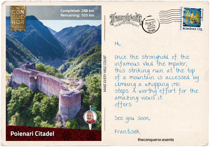
km od začátku : 0268
Poienari Citadel
“The view was magnificent, and from where I stood there was every opportunity of seeing it. The castle is on the very edge of a terrific precipice. A stone falling from the window would fall a thousand feet without touching anything! As far as the eye can reach is a sea of green treetops, with occasionally a deep rift where there is a chasm. Here and there are silver threads where the rivers wind in deep gorges through the forests.” – Bram Stoker’s Dracula
Such an apt description of Poienari Citadel located high atop a mountain west of Transfăgăraşan. It’s as if Bram Stoker had seen it when he described Count Dracula’s lair in his famous 1897 book. But Bram has never been to Transylvania. He has however, spent considerable time writing his book near Slains Castle in Scotland and the description of the octagonal room in the book seems remarkably similar to the floorplan of Slains Castle’s octagonal interior hall.
Construction of the citadel began in the 1300s, possibly by the first rulers of Wallachia and it is thought that only the main tower was built. Abandoned after a few decades and left to decay, it was Vlad Dracula, also known as Vlad III and Vlad the Impaler, who saw it as a strategic spot for a stronghold. As such he set about restoring the fortress and expanding on the tower with walls and bastions. He used the fortress as a second residence with his primary home located in Târgoviște, the capital of Wallachia at the time.
Vlad Dracula was the son of Vlad II the Dragon (Vlad II Dracul) who was a member of the Order of the Dragon, a chivalric order established by the then King of Hungary. The word dragon in archaic Romanian is dracul and Dracula is a Slavonic form meaning ‘son of Dracul’, hence Vlad Dracula.
Vlad Dracula was ruler of Wallachia, reigning over three different occasions. Wallachia was a small country squeezed between two powerhouses, the Kingdom of Hungary to the north and the Ottoman Empire to the south. During his reign, Vlad would regularly switch allegiances for personal gain; fight ferociously; and posthumously acquire the moniker Vlad the Impaler. One story tells of a banquet held by Vlad with hundreds of Wallachian boyars (nobility) who were constantly feuding with one another. When the boyars began challenging his authority, he called on his army to impale them with wooden stakes. A very bloody example that brought stability to Wallachia through fear.
Another story tells of the Ottoman sultan demanding suzerainty which Vlad refused. Vlad retaliated by impaling more than 20,000 Turks. The number seems incredibly high, and it is possible that the story is part true, and part embellished but what does remain a fact is that his reputation grew exponentially, and he continues to be an infamous historical character.
It is assumed that Bram Stoker’s aristocratic, well-dressed, cape-wearing, blood-drinking vampire Dracula was based on the fierce warlord Vlad Dracula. It’d be easy to see why. Both are named Dracula; both were warriors in Transylvania; and both fought the Turks. However, Bram’s notes show copied sections from another book about Wallachia and Moldavia that references several rulers named Dracula who fought the Turks but no mention whatsoever about the name Vlad or The Impaler. He further noted that Dracula means the Devil. What can be surmised from this is that Bram liked the idea of Dracula and its evil and cruel association as a character whilst having no clue about its historical background nor the real people who owned the name. Only a tiny bit of doubt remains based on Van Helsing’s description of Dracula in the book: “He must, indeed, have been that Voivode Dracula who won his name against the Turk, over the great river on the very frontier of Turkey-land."
This connection or lack thereof between the real and fictional Draculas was complex. I am unsure if it was unravelled satisfactorily but I sure was left somewhat hungry. Sitting on a bench at the top of the citadel, I extracted a small lunchbox with a serving of salată de beuf. Translated as beef salad, this is a very popular Romanian dish, often made for easter or other main events. Time consuming to make it is a mix of finely chopped root vegetables, boiled meat, pickled gherkins, peas, and potato folded with homemade egg and mustard-based mayonnaise and accompanied with fresh bread. It was a very hearty dish that powered me up on the next leg of my journey.
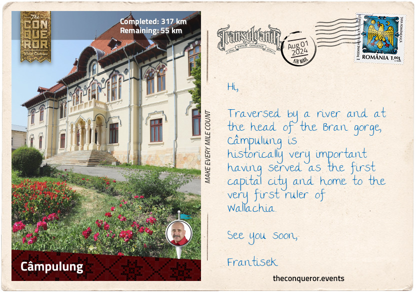
km od začátku : 0317
Câmpulung
Tucked in a valley at the foothills of the Carpathian Mountains is the narrow and elongated municipality of Câmpulung, translated as Long Field. The town is divided by the River Tîrgului with two major roads running parallel on either side of the river.
Câmpulung is one of the oldest Wallachian settlements dating back to 1292. When Basarab I defeated the King of Hungary at the Battle of Posada in 1330, it ended Wallachia’s suzerainty to the Kingdom of Hungary and became the first independent Romanian principality. Basarab I became the founding ruler of Wallachia and established the dynasty House of Basarab of which Vlad the Impaler is a descendent. Basarab set up the first capital city in Câmpulung.
As an interesting sidenote, Basarab’s daughter Theodora married the then Emperor of Bulgaria and after several children and a decade of marriage he divorced her and sent her to a monastery to become a nun. Theodora is the first known nun in Romania’s history and in 2022 she was canonised by the Romanian Orthodox Church.
One of the highlights of the town is the Ethnography and Folklore Museum. Housed in a beautifully restored house, the museum displays a significant collection of folk-art objects, providing an insight into rural living and an appreciation for handmade items from hand carved furniture and wood turned utensils to hand-painted eggs and pottery, handwoven rugs, embroidered cloths, and traditional costumes.
A short stroll south of the Museum is the Negru Vodă Monastery, thought to be built in 1220 by the legendary Radu Negru, Voivode of Wallachia. Radu is supposed to precede Basarab I but some historians think he might have been one and the same person or he might have been Basarab’s father but there is no evidence to suggest either way. The earliest mention of Radu Negru was in the 17th century, lending a lot more mystery than truth to his existence. It is possibly the reason why he is listed as a ‘legendary’ ruler rather than real.
The monastery was rebuilt many times throughout the centuries, having been destroyed at least twice from earthquakes in the 1600s and the 1800s and a fire in the 1930s. Each time the monastery was repaired and restored. The interior of the church is filled with large scale paintings depicting various notable figures including several Wallachian rulers and their spouses. According to inscriptions found in the Court of Argeş (another monastery), both Basarab I and his son Nicolae Alexandru were buried here.
Coming to the end of my day, I’m hankering for a very filling but not too heavy dish and the Romanian stuffed peppers, ardei umpluţi, is what comes to mind. This is a universal dish that can be found in many cuisines, each with its own variation. What I am thinking of is the vegetarian version made of near-perfectly rounded, red bell peppers with their tops chopped off and the seeds cleaned out so it’s nice and hollow. Added to it is a mixture of cooked rice, minced onion, finely chopped carrots, seasoned with parsley, dill and the usual salt and pepper. The stuffed peppers are placed in a tray and a freshly made tomato sauce poured over it then baked. The bread as always is present to soak up the sauce.
A side note about the food. Romanian cuisine is wonderfully diverse and flavoursome. Given its geographical location, the cuisine is influenced by all its neighbours past and present such as the Balkans and Greece to the south, the Turks to the southeast and the former Austria-Hungary to the northwest. What sets it apart from its neighbours is the local flavouring and preparation giving the dishes their distinctive Romanian flavour.
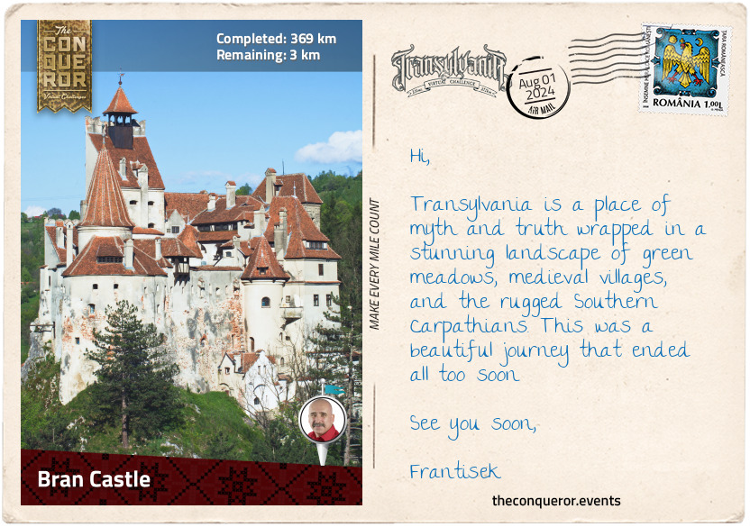
km od začátku : 0369
Bran Castle
The most anticipated part of this journey was arriving at the famous Dracula lair, Bran Castle, on the Transylvanian side of the historical border with Wallachia. Built sometime in the 14th century by the Transylvanian Saxons, the castle was primarily used as a fortress protecting the borders from Ottoman incursions.
There is a belief that Vlad III Dracula was held prisoner by the Hungarians based on written records that he passed through Bran gorge many times on his way to Wallachia’s capital Târgovişte. Other historians completely refute Vlad ever setting foot in the castle most likely due to lack of documentation as evidence thereby breaking the connection between Vlad and Bran Castle.
Of course, the question remains as to how Bran Castle became associated with the vampire’s castle given that Bram has never been to Transylvania. Some suggest that Bram was inspired by an illustration of Bran Castle, referred to as Terzburg (sic) in Charles Boner’s book on Transylvania but Bram’s castle description is so vague that it could have been Poienari Citadel, Slains Castle or any other castle on a precipice with chasms and rivers.
Bran Castle became synonymous with the fictional Dracula sometime in the 1990s when restorations were complete, and the property was added to the tourist circuit. It has a perfect blend of Gothic architecture, sombre appearance and rocky hilltop location for vampire-themed fans coming from far and wide in search of the elusive Count Dracula.
Count Dracula may be a fictional character of Bram’s imagination, but myths of the un-dead referred to as strigoi have been part of Romania’s folklore since the 16th century, beginning with a villager who apparently terrorised his neighbours for years after his death until he was decapitated by the village priest. Strigoi are restless souls who supposedly rise from the grave with the ability to transform into animals and gain vitality from their victims. Unbeknownst to Bram, his creation of Dracula as a blood drinking vampire would become a modern interpretation of the strigoi and Transylvania with all of its beauty and historical villages would become a vampire-themed tourist destination.
On a more realistic note, Bran Castle fell into decay by the late 19th century until it was gifted to Queen Marie of Romania who carefully restored it in the 1920s and made it one of her favourite getaway homes. The castle was confiscated at the end of WW2 when the monarchy was dissolved, and the king (Marie’s grandson) was forced to abdicate and sent into exile. The castle was returned to Marie’s descendants in 2009 and continues to operate as a museum focused on its real history instead of the fictional one.
This brings me to the end of my journey. I wander away from the castle with my head filled with facts and fiction between Vlad and Dracula and I reflect on this beautiful region, its diverse people and wonderfully good food.
Farewell / La revedere
km od začátku : 0008
Saltpans
The Saltpans are neither an important trading point nor a beauty to behold. For Arya Stark, however, it is the place where her life will change forever. She intends to go north to Jon. But, after she shows the iron coin and speaks “Valar Morghulis” to a captain from beyond the Narrow Sea, she is given a cabin onboard. They are heading to Braavos.
km od začátku : 0026
House of Black and White
There are few stranger places across Westeros and Essos than the House of Black and White. Although not much is known, one thing is certain: if one comes here looking for death, one is sure to find it. After endless waiting, Arya is allowed inside. Now, she will need to learn how to lie and deceive in order to become No One and serve the Many-Faced God.
km od začátku : 0048
Market of Braavos
In learning how to become a Faceless Man, Arya comes face to face with the one they call the Waif. Slowly, she learns how to parry her attacks even in darkness. When Arya disobeys Jaqen’s orders, the Waif is sent to kill her. Arya passes this last test and becomes No One. Yet, she has other plans: she is Arya Stark of Winterfell, and she is going home.
km od začátku : 0064
Crossroads Inn
After striking Walder Frey off her list, Arya rests at the Crossroads Inn. She is on her way to her next victim: Cersei Lannister. But a chance meeting changes her plans. Over a delicious meal, Hot Pie tells her that Winterfell is in Stark hands again. Arya can finally go home.
km od začátku : 0089
Fortified Winterfell
Arya is happy to be home, yet Winterfell is unrecognisable. Jon leads the wildling tribes of the true North, Sansa is a confident Lady, the master of a castle. One day, a silver-haired queen from across the Narrow Sea arrives, behind her are legions of Unsullied and a horde of Dothraki. Alongside the Three-Eyed Raven, they have gathered here to stop the Night King and the spread of Darkness.
km od začátku : 0108
Godswood of Winterfell
The attack begins. Arya makes her way towards the Weirwood tree to save Bran from the white walkers. She jumps at The Night King with a dragonglass blade but is caught mid-air. She drops her dagger and catches it in her other hand and, as she plunges it into his chest, he shatters into shards. His army collapses into nothing. The Long Night has passed and on the air is a hint, a dream, of Spring.
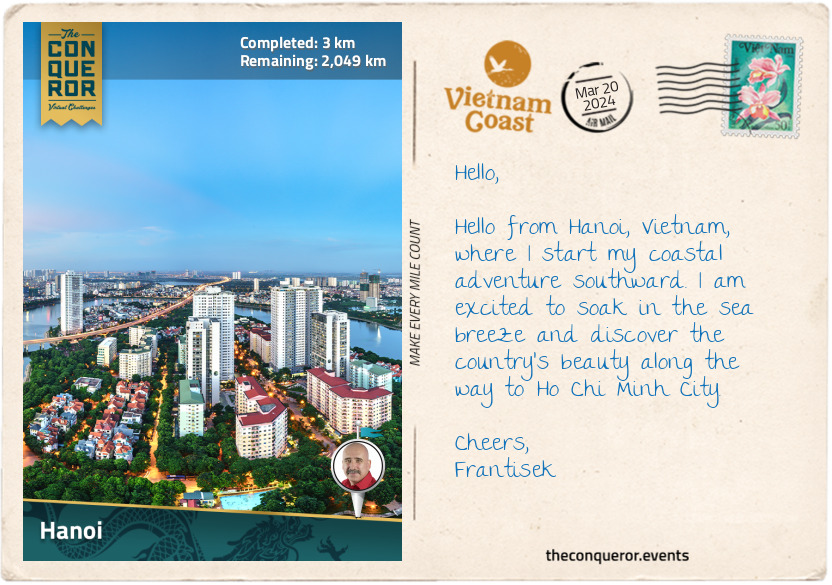
km od začátku : 0003
Hanoi
Vietnam is a long, narrow country in Southeast Asia bordered by Cambodia and Laos to the west, the South China Sea to the east, and China to the north. It is known for its beaches, bustling cities, ancient towns, scrumptious cuisine, and, wouldn’t you know it, for its coffee culture? It has 8 UNESCO Heritage Sites, glistening skyscrapers, French Colonial architecture, citadels and, as expected, many pagodas and temples.
Vietnam is often referred to as the ‘Land of the Ascending Dragon’, and while there are different reasons for the nickname, my favourite explanation is its geographical shape. I took one look at it and could see the top of the country shaped like a dragon head with a slithering body following, almost as if ascending. An alternative meaning is based on a legend and Vietnam’s long-standing association with the dragon. In this mythological story, Vietnamese people were descended from a dragon and a fairy. The dragon brought the fairy to earth to teach the people to cultivate rice and create a civilisation. The dragon is a symbol of power, strength and good fortune, and it is believed to bring prosperity and protection to the people. Given their significance, dragon motifs are often incorporated into art, architecture, folklore, festivals and celebrations.
Travelling the entire length of Vietnam by motorbike is a popular adventure for many tourists. Motorbikes are a common mode of transportation, allowing tourists to experience and blend in with the local culture. It also opens up the opportunity to explore the whole coastline of Vietnam, tackling it from Hanoi in the north to Ho Chi Minh City in the south with side trips to Ha Long Bay or the Mekong Delta.
Hanoi is the oldest capital in Southeast Asia, founded in 1010. Then known as Thang Long, the city was built around the Imperial Citadel, serving as the political and cultural centre of the country. In 2010, it celebrated 1000 years, and to mark the occasion, the Hanoi Ceramic Mosaic Mural was created along the Red River dike system. This incredible 2.5mi (4km) long mosaic was the brainchild of a local journalist who loved the city so much she wanted to commemorate it. Crafted from ceramic tesserae, the mural tells the story of Vietnam’s history by merging modern art with children’s paintings. The collaboration to create this wall brought together over 600 local and international artisans and children. The artwork is colourful and striking, culminating with a stunning ceramic panel of two dragons at Chuong Duong Bridge near the Old Quarter.
Hanoi is the birthplace of water puppetry, a traditional Vietnamese art form that originated in the Red River Delta, with performances held in flooded rice paddies. It has now evolved into a professional stage performance. The brightly coloured puppets are made of lightweight, water-resistant wood like that of a fig tree. They are manipulated by puppeteers who stand in a waist-deep water stage. Using dramatic music from live orchestras and special effects such as fire-breathing dragons, the puppeteers tell stories from a villager's perspective about daily life and Vietnamese folklore.
One of the most revered cultural sites is the Temple of Literature. Dating back to 1070, it was originally built to honour Confucius. It later transformed into Vietnam’s first national university. The Imperial Academy functioned as an educational institution for royals and aristocrats for 700 years until it was relocated to Hue. Throughout its manicured gardens and traditional architecture is a series of stone stelae on the backs of turtles showing the names of candidates who succeeded in their royal exams. The Temple of Literature is a symbol of Vietnam's commitment to education and the pursuit of knowledge.
As I meander through Hanoi’s streets, I head toward the Old Quarter and the fascinating Train Street.
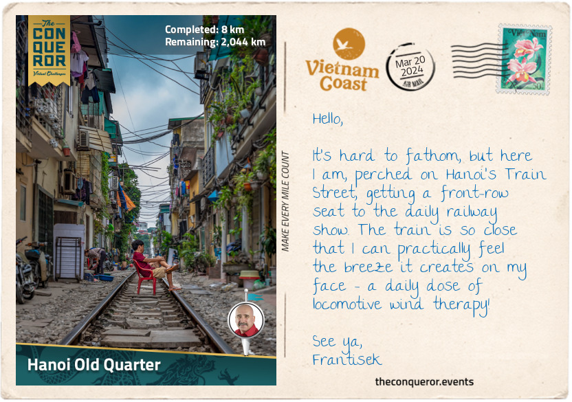
km od začátku : 0008
Hanoi Old Quarter
The Old Quarter is an elaborate web of narrow streets and traditional architecture. It developed during the imperial period of Thang Long (Hanoi’s former name) when the king moved the capital to the area in the 11th century. Artisans and craftsmen began setting up shops to cater to the needs of the palace. As time passed, the Old Quarter developed a guild system, with each street dedicated to a particular trade or craft. It originally consisted of 36 streets, but it expanded over the centuries, and today, it encompasses more than 70 streets.
As I stroll through the cozy alleys, I am in awe of the hundreds of little shops and cafes, bustling with activity, offering specialties such as silk, jewellery, bamboo and traditional medicine. Here, artisans share their skills and craftsmanship in family-run workshops while all around me, I could smell wonderful dishes of steaming noodle soup, grilled meats, and spring rolls.
But the most unique experience is west of the Old Quarter on Train Street, where trains run through three narrow residential streets, just inches away from the buildings on either side. The railway tracks were built during the French colonial period (1887-1954). Over time, houses and shops were constructed beside the tracks. The space between the tracks and the buildings is so narrow that when the train passes, it looks like it's threading its way through the eye of a needle.
Locals living here are used to the situation. Each time a train passes, they move their belongings, sometimes even furniture, indoors. You can imagine what a spectacle this would be to tourists and foreigners. It looks like organised chaos, and as soon as the train passes, everything comes back out. A fun and safe way to experience this is to pull up a seat at one of the cafes, located pretty much on the edge of the tracks and be prepared to be wowed. Word of advice: stay off the tracks and keep your hands to yourself.
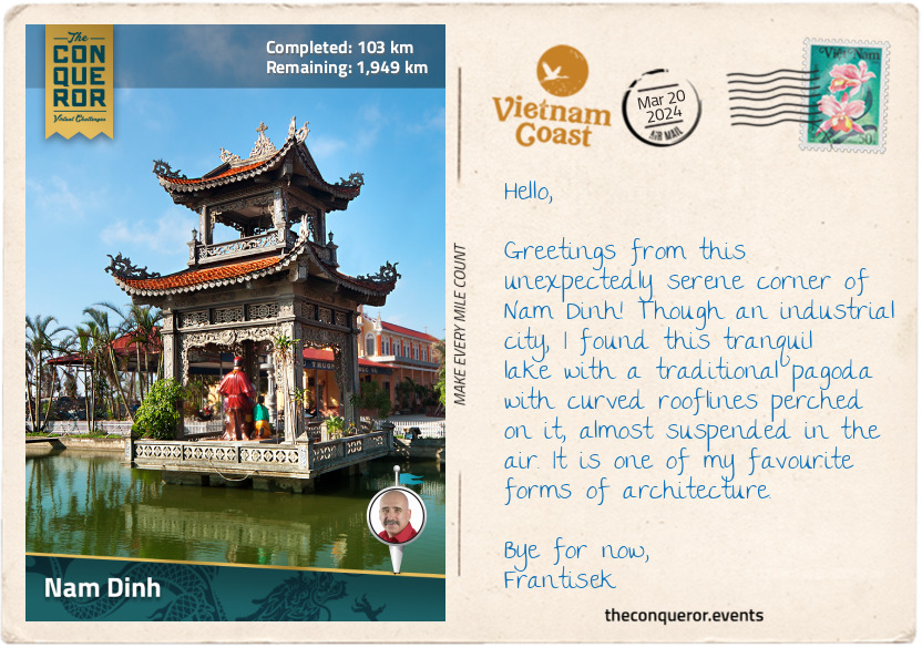
km od začátku : 0103
Nam Dinh
I left Hanoi, heading south alongside the Red River. Known as Song Hong in Vietnamese, it is one of the most significant rivers in Vietnam. Flowing for 714mi (1149km) from the Yunnan Province in China through northern Vietnam, it forms the Red River Delta before emptying into the Gulf of Tonkin. Its English name is derived from the reddish-brown sediment it carries.
Annual flooding and sediment deposits make the Red River Delta one of the most fertile regions in Vietnam and a haven for rice cultivation. It is often nicknamed the “Rice Bowl”, and rightly so, because aside from being a staple food in the Vietnamese diet, Vietnam is one of the world’s largest producers and exporters of rice.
Continuing, I reached Nam Dinh City, the capital of Nam Dinh province, and a textile sector leader. In 1898, French colonists established the Nam Dinh Textile Factory, employing over 18,000 people. It was the largest factory in Indochina. When the textile factory relocated in the 2010s, the site was repurposed into a textile museum displaying large looms, textiles, personal effects of President Ho Chi Minh from his visits and military memorabilia related to the area.
Nam Dinh may have suffered a slump in the industry in the 1990s, partly due to a shortage of workers. However, since the 2000s, the sector has been rising, housing nearly 480 textile companies with over 70,000 workers.
Each August, Nam Dinh holds the Co Trach Festival, honouring the 13th century General Tran Hung Dao, a military strategist who defeated the invading Mongols led by Kublai Khan, the grandson of Genghis Khan. His most famous victory was the Battle of Bach Dang River in 1288, when iron-tipped wooden stakes were planted in the river, immobilising the Mongol fleet as the tide changed. His victories solidified him as a national hero, and he is regarded as one of Vietnam’s greatest military tacticians. Statues commemorating him have been installed in several cities, along with many streets, schools and wards named after him.
The city may not be as well-known internationally, but it can definitely boast as being the birthplace of the iconic Vietnamese dish, pho, a flavourful noodle soup that originated in Nam Dinh. I’ll tell you more about this later. In the meantime, see you in Ninh Binh.
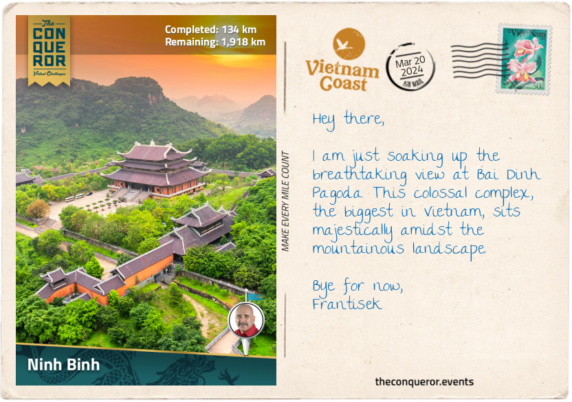
km od začátku : 0134
Ninh Binh
I have arrived in Ninh Binh City, the gateway to and capital of Ninh Binh Province. While the city is not known for historical attractions, it is a terrific base for me to explore the nearby sites. Ninh Binh is often referred to as "Halong Bay on Land" because of the gorgeous karst formations that rise dramatically from the vibrant emerald rice paddies and meandering rivers.
There are some stunning historical locations, such as Hoa Lu, the ancient capital of the 10th-century Dinh Dynasty. Dinh Bo Linh was a military leader who secured Vietnam’s independence from Chinese rule. Declaring himself emperor and founding the Dinh Dynasty, he unified Vietnam and brought stability and prosperity to his people. Although his reign was short-lived, his legacy is commemorated with his tomb on the grounds of Hoa Lu.
The grounds of Hoa Lu are extensive, and although many of the ancient buildings lie in ruins, the serenity of the location, surrounded by karst formations and the meandering Sao Khe River, makes it a worthwhile visit. The Dinh Dynasty was succeeded by the Early Le Dynasty, which was credited for introducing Vietnamese currency. After serving as the capital for 46 years, Hoa Lu was replaced, and the king of the Ly Dynasty relocated the capital to Hanoi.
A few miles northwest of Hoa Lu is Bai Dinh Pagoda, the biggest temple complex in Vietnam and one of the largest in Southeast Asia. Although its history dates back to the 11th century, significant expansion and reconstruction took place in the 21st century, turning it into a Buddhist complex with a mix of traditional and modern architectural features. Containing 500 arhats (enlightened Buddha) statues, the highlights are the 100-ton gold-plated bronze Buddha, the 13-storey stupa (at 328ft/100m, it is the tallest in Asia) and the 1000-year old, moon-shaped Jade Well, which at 98ft (30m) in diameter and 20ft (6m) deep, never dries.
Further afield is Cuc Phuong National Park, the first and one of the largest national parks in Vietnam. Established in 1962, the park is primarily a tropical forest and home to more than 100 species of wildlife and over 300 species of birds. The Endangered Primate Rescue Centre is within the park, focusing on the rescue, rehabilitation, breeding, research, and conservation of endangered primates such as langurs and gibbons.
Since the park is not on my route, I will head south toward Trang An.
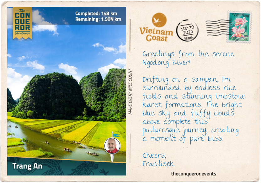
km od začátku : 0148
Trang An
If you’re a fan of the modern version of King Kong and have seen Kong: Skull Island (2017), rewatch it, and if you can identify the limestone peaks and river systems, you’ll notice that some of the stunning filming locations are in Ninh Binh at the Trang An Landscape Complex, a UNESCO World Heritage Site. Trang An is known for its diverse ecosystem, karst peaks, caves, and grottos.
The best way to explore this area is by boat. Sitting in a sampan, a flat-bottomed wooden boat with a wide hull, I am peacefully gliding through the waterways. The river is framed by vibrant green rice fields and forest-green karst peaks jutting from the valley. As I navigate, I can see locals paddling their boats, each wearing the iconic conical hats, providing them shelter from the sun and adding a touch of tradition to the serene scene.
As a side note, when traveling through Asia, particularly in rural areas, one will notice that many villagers, farmers, or fishermen use conical hats as protection from the elements. However, the conical shape and design vary depending on the country. For example, in Vietnam, the hat is known as ‘Non La’, and features a wide, flat brim and a pointed cone shape at the top. It is typically crafted from woven palm leaves or bamboo and secured with a cloth chin strap.
In the highlands of Bhutan, small ornamental conical hats are woven from bamboo strips, resembling basket weaving. They are topped with a pointed spike and adorned with strands of colorful beadwork. The Japanese conical hat, called tokin, has a pointed top and a wide brim, often made from rice straw, with occasional lacquer application for waterproofing.
On the other hand, in Thailand, particularly in Bangkok's Floating Markets, locals wear the Ngob hat, which, while conical in structure, is flat-topped, giving it a unique appearance compared to the typical conical hats.
Continuing my journey, I let the gentle current carry me onward, past a pagoda built in the river, standing like a sentinel. But the most exciting part of this gentle meandering is the cave systems hidden beneath the towering peaks. Son Duong Cave, for instance, is known for its exquisite stalactites shimmering in pure white and emerald green, while Toi Cave is best seen with a torchlight since its interior is dimly lit. Nau Ruou Cave, translated as Cooking Wine Cave, is aptly named since people who lived there used the well found inside to make wine. Because the caves in Trang An are closely located, it’s easy to go cave hopping. Still, the best cave of them all is Dia Linh Cave, as it’s nearly a mile (1500m) long with many twists and turns.
This is a truly beautiful location dressed in a wonderfully diverse palette of green shades, from the lush, emerald-green rice paddies and deep green foliage blanketing the karst formations to the serene waterways with its blend of turquoise and jade. It is just splendid.
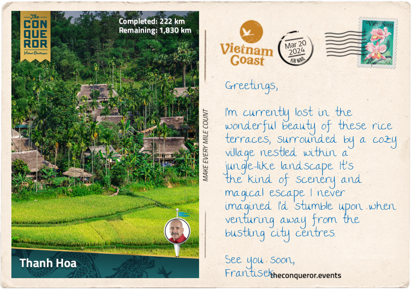
km od začátku : 0222
Thanh Hoa
Thanh Hoa is a large, developing city and the capital of the Thanh Hoa Province. Located on the Ma River, the city is surrounded by mountains and rural countryside.
My first stop was the historic landmark Dragon Eye Cave (Long Quang Cave). More than a natural landscape, the cave is deeply intertwined with the city’s history and the 15th-century reign of Emperor Le Thanh Tong of the Le Dynasty. According to legend, the Ham Rong mountain range, where Dragon Eye Cave is located, symbolises a nine-piece dragon. Lying beside the Ma River, the dragon’s head is identified as the Dragon's Eye, the mountain range is its body, and the tail is at the other end in Dong Son village. The cave, about 328ft (100m) deep, was a place of respite for Emperor Le, where he would inscribe poems into the cave’s ceiling.
During the Chinese Ming Dynasty's occupation of Vietnam in the early 15th century, Le Loi, as he was known, led military campaigns against the invaders with the help of a magical sword. According to folklore, when Le Loi cast a net while fishing on a lake, he suddenly felt a powerful force pulling on his net. When he reeled in his catch, he found a sword entangled in the net. The sword, Heaven's Will, was considered sacred and seen as a sign from the heavens. It was said to have magical properties, emitting a radiant light and bestowing strength and courage to lead a successful resistance upon Le Loi. In 1426, he achieved a victory at the Battle of Dong Quan. After the battle, a golden turtle came to collect the sword and returned it to the dragon master in the lake, never to be seen again.
Carrying on with my exploration, I visited Truc Lam Ham Rong Zen Monastery at the top of the hill near the cave. It is beautifully nestled in a vast pine forest, comprising 12 intricately designed buildings, including the Ancestral Church, bell tower, and drum floor. Surrounded by a peaceful ambiance and views over Ma River, I found the monastery a lovely place to rest and relax.
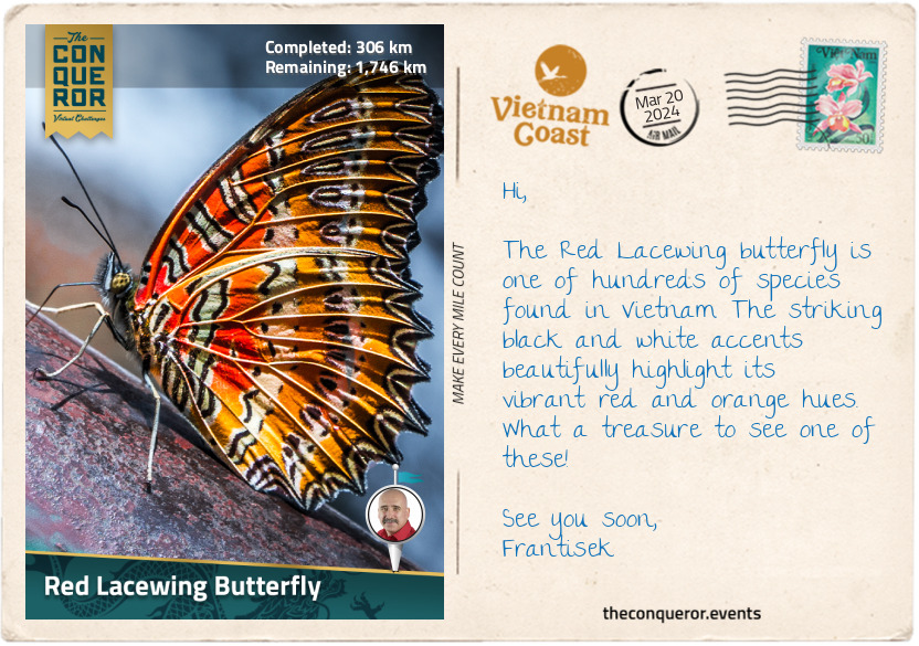
km od začátku : 0306
Red Lacewing Butterfly
Thanks to its rich biodiversity and varied ecosystem, Vietnam is home to more than 400 butterfly species. Although according to a scientific paper by an entomologist, there are more than 1100 species in Vietnam. Regardless of which is true, there is a great number of these sweet and delicate creatures flittering through the air in a myriad of colours.
The scientific term for butterflies is “Rhopalocera”, derived from the Greek words "rhópalon", meaning club, and "kéras", meaning horn, which refers to the club-like antennae that butterflies possess. What distinguishes butterflies from moths (Heterocera suborder) is their daytime behaviour and being relatively colourful, unlike moths' muted and nocturnal habits. Butterflies have beautiful intricate patterns and soar gracefully in flight like pirouetting ballerinas.
Butterflies play many important roles in the ecosystem, most importantly as pollinators of flowering plants, contributing to the production of fruits and seeds. They are also a biodiversity indicator. Changes in butterfly populations can signal shifts in environmental conditions, such as habitat loss, pollution, or climate change. Monitoring butterflies can help scientists assess the well-being of ecosystems. Butterflies are crucial in the food chain as they are both prey for various animals and contributors to the life cycle of their species, as caterpillars - the larval stage of butterflies - use specific host plants for feeding and development. And finally, they are just a sight to behold, adding beauty to our world.
This biodiversity can be experienced in Vietnam at any of its major national parks (N.P.). For instance, with its karst formations and dense forests, Cuc Phuong N.P. provides an ideal habitat, while Bidoup Nui Ba N.P. in the Central Highlands, with its montane forests and grasslands, is home to rare species like Teinopalpus aureus (swallowtail family) or common ones like Troides helena (birdwing family).
Out of the hundreds of species, I wanted to focus on at least one of them. The lacy wing pattern of the Red Lacewing Butterfly (Cethosia biblis) was difficult to pass up. It is known for its striking and vibrant colours, with a layered mix of red, orange and white and delicate black patterns on its wings that give the butterfly its name.
These butterflies are found in different parts of Southeast Asia, including Vietnam, where they like to live in tropical areas with lots of plants. They prefer forests and gardens with their favourite plants, such as passion vines, where their caterpillars can munch on the leaves. The red lacewing uses its bright colours to warn other animals that it might not taste good or be harmful—a trick known as mimicry. Like all butterflies, they go through different stages in their life, starting as eggs, turning into caterpillars, then into pupae (chrysalis), and finally becoming adults.
While Red Lacewings are not in danger of disappearing, unlike the Teinopalpus aureus mentioned above, many other species face problems like losing their homes and environmental damage. Conserving their habitat is important.
Besides being important for nature, butterflies, including the red lacewing, have special meanings in different cultures. They often symbolise transformation, hope and life.
So the next time you see a caterpillar munching away at your plants, think of the butterfly this wiggly, hungry creature is preparing to transform into and the rainbow-like colours it will add to the world around us.
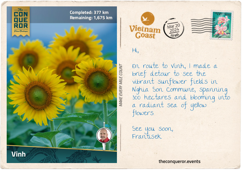
km od začátku : 0377
Vinh
Vinh is a vibrant city in North-Central Vietnam, an important east-west economic corridor connecting Vietnam with Myanmar, Thailand and Laos, and a north-south transportation route connecting Hanoi with Ho Chi Minh City.
Delving into Vinh’s history, the city played a major role in Vietnam’s past. It was originally known as Ke Van but underwent various name changes before settling on Vinh in 1789. During the Tay Son Dynasty (18th-19th century), the city was considered a possible capital of Vietnam and, for a time, as the gateway to the south when Vietnam only occupied the north. When the French colonised Vietnam, the city was developed into an industrial centre with many factories popping up.
Several notable figures were born in Vinh, including Ho Chi Minh, the founding father of modern Vietnam. He served as President for 24 years in the mid-20th century until his death. His childhood home is in a small village in Kim Lien Commune, a short distance from the city. The villagers constructed a 5-room wooden house with a thatched roof to recognise President Ho’s father, the first villager accredited by the Hue royal court for passing his Confucius examinations. Today, the house contains the family's preserved artifacts, including the car used during Ho Chi Minh’s visits, personal items, and a memorial portrait.
The city’s main square is home to the tallest statue of Ho Chi Minh in all of Vietnam. The statue stands at 50ft (18m) and is made of 200 tonnes of copper-coloured granite. It is surrounded by 1600 species of trees from different Vietnamese regions and large planter boxes with bonsai-like trees.
Cua Lo Beach is a short distance northeast of the city and boasts a 6mi (10km) stretch of pristine white sandy beach, turquoise waters, and a backdrop of coconut trees. Nestled not far from the shore are three islands that serve as both quiet getaways and protective barriers against storms and strong ocean winds. The local fishermen deliver their daily catch, making the area a fantastic spot to indulge in fresh seafood, such as shrimps, crabs, and cuttlefish. It is a great way to savour the flavours of the sea right here on the beach.
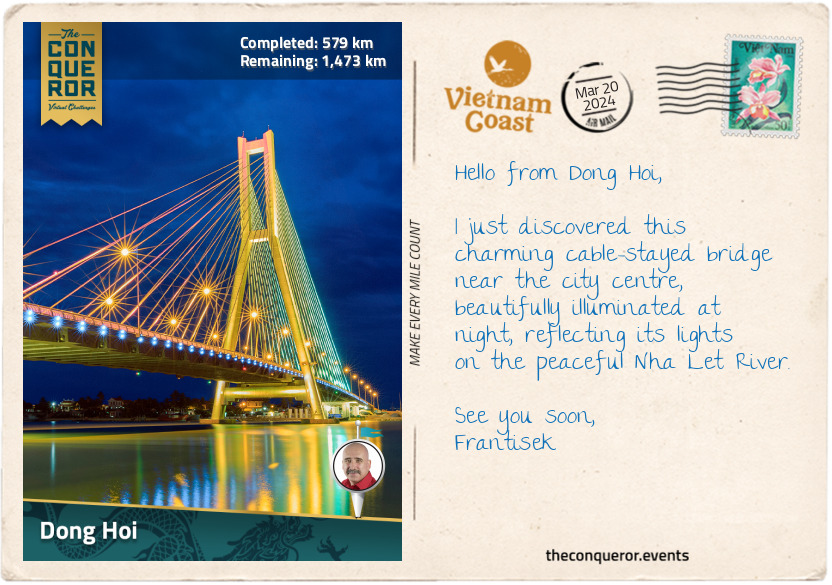
km od začátku : 0579
Dong Hoi
Dong Hoi is a lovely coastal city in the narrowest part of Vietnam, stretching a mere 25mi (40km) from east to west. It is often overlooked as a tourist destination. However, this quiet location offers gorgeous beaches, like the soft white sand of Nhat Le Beach, and crystal-clear waters that are perfect for swimming.
Situated on the west side of the Nhat Le River, Dong Hoi Citadel is a star-shaped fortress constructed in the 19th century by the Nguyen Dynasty. Built with bricks and stone, it served as a defense against foreign invaders and was a military stronghold during colonisation. Like many fortresses around the world, it was surrounded by a moat—a defensive barrier of water to make attacks difficult for invaders. As I walked around the remnants of the citadel, I envisioned the strategic moves that once took place within these weathered walls.
Behind Nhat Le Beach was Bau Tro Lake. This large, oblong-shaped freshwater lake is also an archeological site where Neolithic-era artifacts have been found. Dong Hoi itself can trace its human settlement history back 5,000 years. The lake is surrounded by lush greenery, offering a serene retreat from the city’s hustle and bustle.
Venturing north from the beach and lake, I stumbled upon the Quang Phu Sand Dunes. I couldn't resist grabbing a sandboard and whooshing down the dunes, feeling the wind rush through my hair as I squealed with joy. And when that wasn't thrilling enough, I rented an ATV as the next best thing and had an exhilarating ride through the sandy landscape.
I finished my exploration of Dong Hoi at the night market near Nhat Le River, where the sun was casting a fiery hue of orange, pink and purple as it was dipping over the horizon. The market was bustling with fresh produce for sale, the chatter of people, and local entertainers. I was curious about local food and tried their special snack, Khoai deo. Made from dried sweet potato, it was sweet and chewy. I also tried Banh Beo, a small steamed rice cake topped with minced shrimp, scallions and crispy fried shallots.

km od začátku : 0660
Pho Bo
Oh, the delight of Vietnamese cuisine with signature dishes particular to each region. There’s the:
1. Bun Cha, grilled pork served with vermicelli noodles and dipping sauce in North Vietnam,
2. Ban Khoai, rice flour and turmeric pancake filled with pork, shrimp, bean sprouts and onion in Central Vietnam, or,
3. Can Chua Ca, a sweet and sour catfish soup with veggies and herbs in the Mekong Delta, Southern Vietnam.
Vietnamese dishes burst with savoury, sweet, sour, and rich flavours, often enhanced by aromatic herbs and spices like basil, mint, cilantro (coriander), ginger, garlic, shallots and fennel seeds.
The most iconic Vietnamese dish is Pho Bo, a rice noodle soup featuring beef, herbs, and chili. Its vegetarian counterpart is known as Pho Chay. What makes Pho Bo so special, you might ask? The key lies in its broth, cooked for a long time by simmering beef bones, charred onions, ginger, and spices like star anise and cinnamon. The slow-cooking process results in a broth with a rich and deep flavour. Pho Bo maintains a light and delicate quality, unlike heartier Vietnamese beef recipes. Once the broth is ready, toppings are added. Rice noodles soak up the flavourful broth, providing a satisfying chewiness. Thin cuts of sirloin, brisket, meatballs, and tendons offer complexity and variety. The dish is completed with bean sprouts, basil, spring onion, cilantro, a squeeze of lemon or lime, and chopped chili for added zing.
Just as with any culinary creation, the preparation of Pho Bo varies across different regions and is served any time of the day, particularly for breakfast. The long preparation to achieve the most exquisite flavours is truly a labour of love.
Are you game to try and make it at home? Here’s a recipe that’s kinder on time, has easily accessible ingredients and has plenty of tips and tricks to help you with your cooking journey.
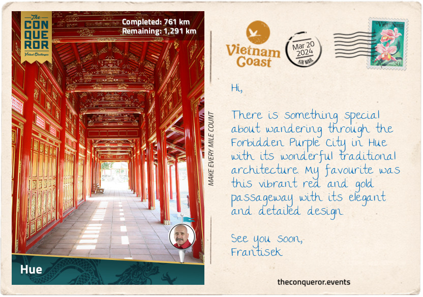
km od začátku : 0761
Hue
I have arrived in Hue, and one of the best ways to explore this ancient city is on a boat ride along the beautiful wide Song Huong (Perfume River). The boat I boarded was decorated with dragon heads, once favoured by the emperors. I gently meandered on the river and enjoyed seeing several of Hue’s landmarks.
The first was the Hue Imperial City and Citadel, a UNESCO World Heritage Site. This complex of palaces, temples, and fortifications was Vietnam's imperial capital from 1802 to 1945 and the seat of the Nguyen Dynasty. The huge fortress with three concentric enclosures and surrounded by a 6mi (10km) moat uniquely blended Chinese and Vietnamese architectural styles. The impressive Ngo Mon Gate is a grand entrance to the citadel made of massive stone slabs upon which the Five Phoenix Watchtower rests. It is so called because when seen from above, it resembles five phoenixes. As a side note, the phoenix, dragon, unicorn and tortoise are the four sacred animals in Vietnamese culture, each representing one of these traits: power, intellect, longevity and nobility. Can you guess which animal is associated with which trait?
Gorgeous red and gold-like colours adorn the watchtower with a green and yellow glazed roof. It is decorated with dragon reliefs, bats and banyan leaves and further embellished with ceramic mosaics of orchids, chrysanthemums and bamboo. The emperor used the pavilion for state occasions.
Within the citadel is the Forbidden Purple City, the emperor’s home where no other man was permitted to enter. Access was given only to the queen, concubines, female servants and eunuchs. In the northeastern Quarter was the emperor’s Royal Library, where he would retreat to read quietly and enjoy the garden and pond.
Heading southwest on the river, I passed by the Thien Mu Pagoda, an iconic symbol of and the oldest temple in Hue. It is a Buddhist temple built on a hill dominated by a seven-storey octagonal tower called Source of Happiness. It offers a great view of the river. Nearby in a pavilion is a huge bronze bell weighing over 4,400lb (2,000kg), which apparently can be heard at least 6mi (10km) away.
You may recall at the beginning, I mentioned the Temple of Literature in Hanoi, which was relocated to Hue when it became the capital city. The emperor built the academy in 1808. Sadly, it was heavily damaged through various wars. However, 32 stone stelae atop turtles' backs are placed inside the central courtyard. The stelae carry the names and towns of individuals who passed the rigorous Imperial Examination.
Rounding a horseshoe bend, I head for the Royal Tombs of the Nguyen emperors.
The Four Sacred Animals and their Symbolism
1. Dragon –power, strength, and good fortune. Represented the emperor and his authority.
2. Phoenix – nobility, rebirth, and regeneration, hence the phrase “like a phoenix rising from the ashes”. Triumphantly coming back from a period of difficulty.
3. Unicorn – harmony, mercy and intelligence. It’s a hybrid creature that is half dragon, half mammal.
4. Turtle – longevity, protection and wisdom. Remember the legend of the golden turtle and the magic sword (see Postcard 6).
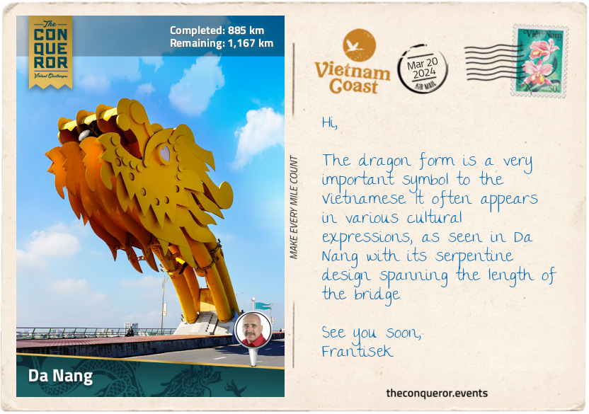
km od začátku : 0885
Da Nang
Da Nang is nearly halfway along Vietnam’s coastline and is the third most important city after Hanoi and Ho Chi Minh City. It is famous for its beautiful beaches and two fascinating bridges admired for their architectural features. Dragon Bridge, aptly named for its dragon shape, spans the Han River for 2,185ft (666m). Illuminated with colourful LED lights at night, the dragon breathes fire and spouts water on weekends and special occasions. The Golden Bridge, west of the city in the Ba Na Hills, is fabulously held aloft by a pair of giant hands emerging from the hillside, giving the illusion that the bridge is being lifted by these colossal hands.
Northeast of the city, on a peninsula, is Son Tra Mountain, also known as Monkey Mountain, named after the red-faced monkeys that used to frequent the area. Accessed via a winding road, a visit to the summit is absolutely worthwhile for the spectacular views of the sea, the city and the surrounding verdant landscape. On the way up, I stopped at the Ling Ung Pagoda to visit the tallest Buddha statue in Vietnam, Lady Buddha Da Nang. She’s a beautiful 220ft (67m) tall, pure white statue with a serene face, holding holy water and wearing a Buddha on her hat. She stands tall on a lotus-shaped platform. Inside the lotus are 17 floors, each with 21 Buddha statues in different shapes, expressions and postures. The statue is so tall and striking that it can be seen from anywhere in the city.
From the base of the Son Tra peninsula begins the 6mi (10km) long My Khe Beach. White sandy beaches, turquoise waters, and palm trees create a peaceful, relaxing atmosphere to soak up the sun and frolic in the gentle waves.
As inviting as it was to stop here, I chose to continue toward Marble Mountains, a cluster of five marble hills riddled with caves and dotted with Buddhist shrines and Hindu grottoes. Each hill is named after one of the five elements – Kim (metal), Thuy (water), Moc (wood), Hoa (fire), and Tho (earth). Only Thuy was open to visitors. It was accessed via steep steps, through dense foliage, dark cave passages and past several cave temples. Once I reached the summit, I had the pleasure of another panoramic view of the city, the beaches and the peninsula.
The next destination is the ancient town of Hoi An.
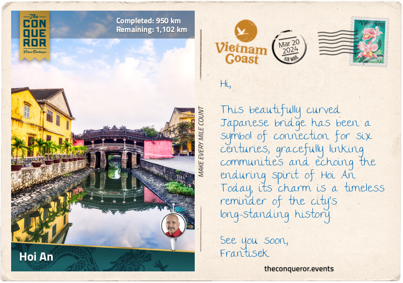
km od začátku : 0950
Hoi An
The ancient town of Hoi An dates back to the 15th century when it was an important trading port later superseded by Da Nang. The Old Quarter, as it’s commonly referred to, has been designated a UNESCO site and is known for its colourful architecture, narrow streets and historic temples. The town may be small in size, but it is big in terms of foot traffic. To alleviate traffic pressure, the local government has blocked vehicles from entering the town.
A pleasant way to experience the town was on a boat, cruising along the Thu Bon River, revealing a series of dark-yellow houses on its northern bank. These well-preserved buildings showcased a wonderful mix of Chinese, Japanese, French, and Vietnamese influences. Delicate wooden carvings and shutters complemented the yellow façade, decked with colourful lanterns.
One block behind the riverbank stands the House of Tan Ky, one of Hoi An's most cherished preserved properties. This architectural gem, blending Vietnamese, Japanese, and Chinese styles, has been in the same family for over 200 years, passing through seven generations. Meticulously preserved, the house is 2-storeys with a traditional yin-yang tile roof (a roofing pattern consisting of square-shaped tiles that are slightly curved and placed in repeated rows of upside down and right side up) and finely carved trusses and columns joined together like a puzzle without the use of nails. The living room was built according to Feng Shui principles, and the five elements (metal, wood, water, fire and earth) around a central courtyard with a skylight for natural light and to regulate the airflow inside. Filled with antiques on the lower floor and open to visitors, the house continues to be occupied by the family residing on the upper floor.
At the west end of the Old Quarter, a tiny river tributary leads to Chua Cau, meaning Pagoda Bridge. It is more commonly referred to as the Japanese Covered Bridge. But to add to the confusion, the bridge’s official name is Lai Vien Kieu. The bridge was constructed in 1593 by the Japanese to connect its community with the Chinese Quarter further east. Trade between the two communities flourished until the mid-17th century when the Tokugawa Shogunate (Japanese military government) closed its borders to international trading, and all its citizens abroad had to return home. A small pagoda was later built in the centre of the bridge with a shrine to Bac De, the God of Weather. During the French occupation (1887-1945), the bridge was flattened to allow motorbikes to cross it. Recognising the bridge's historical value, in the late 1980s, it was restored to its original arched design and made accessible to pedestrians only.
Having worked up an appetite, I aimed for one of the street food vendors for a serving of Hoi An Chicken Rice (Com Ga Hoi An). The dish appeared in Hoi An around the 1950s but is widely known throughout Southeast Asia. It is made of shredded chicken and yellow rice, served with a bowl of hot chicken broth and sweet and sour salad. Sounds delicious and filling.
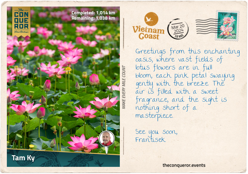
km od začátku : 1014
Tam Ky
I arrived in Tam Ky with a single purpose: to see lotus flowers in full bloom. Every summer, these delicate blossoms transform the rivers and lagoons into a mesmerising sea of pink hues. Thriving in muddy waters, the lotus emerges clean and pristine each morning. It sinks below water each night, only to re-emerge the next day. This daily spectacle may last several weeks before going dormant until the next season.
The Vietnamese hold the lotus in high regard, viewing it as a symbol of purity, strength, and optimism. The flower is deeply embedded in their culture, serving as the national flower and is spiritually valued. It is depicted in Buddhist art with Buddha seated on a lotus, representing the connection between enlightenment, purity and the flower.
The lotus is not just a symbol of beauty. It is also a practical and edible ingredient in Vietnamese cuisine. For instance, the young lotus stems, crisp and tender, are added to salads, stir-fries, and traditional hotpots. The flower is usually dried, and the petals are used to infuse fragrance with a subtle floral aroma into tea. The leaves are also used in tea and are believed to help digestion. The seeds, prized for their nutritional value, are often found in sweet soups and desserts or toasted as a tasty snack.
The lotus is so significant that even modern buildings, such as the Bitexco Financial Tower in Ho Chi Minh City, reflect its influence. Inspired by the national flower, the architect designed the building to resemble a lotus bud, adding a touch of culture to the city's modern skyline.
The best time to see the lotus is early morning, just as they rise from the water. I took advantage of that by hopping into a sampan with a guide to glide between the lotus plants and admire the perfect blossoms while sipping a robust local coffee.
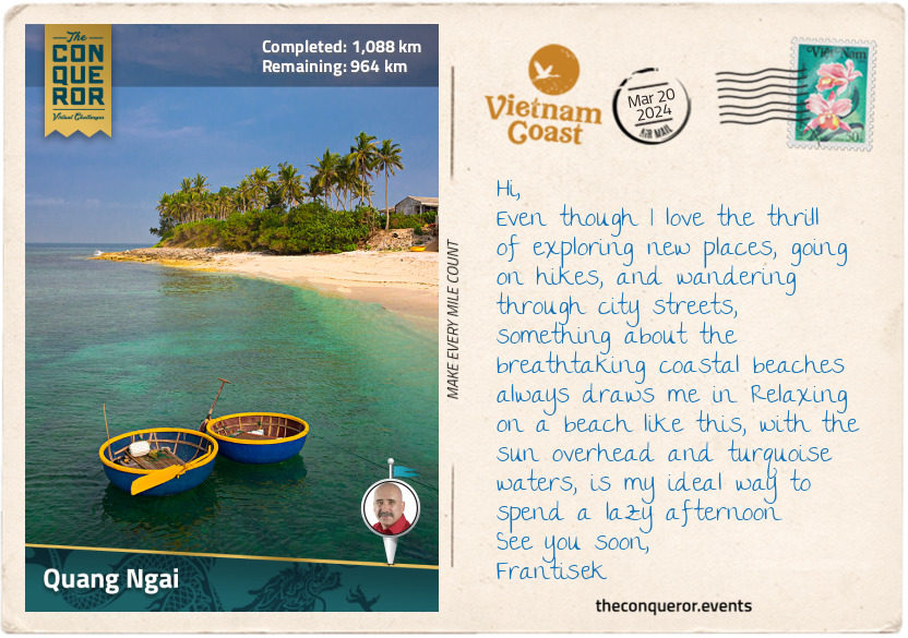
km od začátku : 1088
Quang Ngai
I arrived in Quang Ngai City, the capital of Quang Ngai province. I used the city as my base to explore the region, beginning with a nearby hike up to Thien An Pagoda atop Thien An Mountain.
The pagoda is nestled in Tinh An Dong Commune and stands at 328ft (100m) above sea level amid a dense forest. Constructed in the late 17th century, the pagoda is among the town's oldest sacred sites. Legend tells the story of a time when locals wanting to avoid wild animals only gathered firewood at the base of the mountain until one day, they found a winding path that led to the mountaintop and encountered a Buddhist practitioner who imparted wisdom and compassion to those who crossed his path.
The pagoda’s main gate, adorned with intricate dragon motifs, serves as a guardian entrance. The tombs inside, shaped like lotuses, hold the resting places of monks and abbots. A sacred well, still in its original state, was built on the east side to provide water to worshippers who visited to learn about Buddhism.
The pagoda's iron bell bears a mystical tale. When first cast in a nearby village, the bell was silent. However, one day, while in deep meditation, an abbott was instructed by a spirit to move the bell from the village to the pagoda, when it magically began ringing nice and loud through the region.
A meander around the grounds affords panoramic views across the city and the rest of the region. Near the pagoda is the tomb of Huynh Thuc Khang, affectionately known as “Uncle Huynh”, a revered scholar, Confucian and journalist. Locally born, he excelled in academics, and despite enduring 13 years of exile, he played a key role in the movement for Vietnam’s independence.
Exploring the province's past, I learned about the Sa Huynh Culture, an ancient society that existed more than 3000 years ago. In 1909, several archaeological sites were uncovered in the region, showing evidence of a vast trading network between the Sa Huynh people and places as far as the Philippines, Borneo and Taiwan.
Heading southwest of the city, I explored the Long Wall of Quang Ngai, also known as the Great Wall of Vietnam. At an impressive 79mi (127km), the wall is the longest monument in Southeast Asia, weaving through this province and extending further south to Binh Dinh Province. Construction was said to have taken place in 1819 by the Nguyen Dynasty; however, some scholars have speculated that certain sections may be traced back to the 16th century. Its primary purpose was to set boundary lines between the Vietnamese and H’re people. However, the 115 forts along the wall indicate not only a delineation of the border but also a robust trade relationship, all while steadfastly maintaining security for each side.
From here, my next stop will be Quy Nhon.
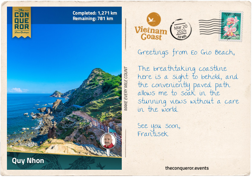
km od začátku : 1271
Quy Nhon
With a coastline of sandy beaches stretching 26mi (42km), there is no shortage of opportunities for sunbathing, beachcombing, and water activities in Quy Nhơn. The extensive shoreline includes popular beaches like Ky Co and Trung Luong, both known for their pristine waters, ideal for swimming and snorkelling.
Even more captivating is the mountainous terrain surrounding these splendid beaches. The lush green hills and rocky outcrops provide a striking backdrop to the coastal scenery, creating a picturesque contrast between land and sea. I strolled along a cliffside path to Eo Gio, a sheltered beach with views of the rugged coastline and a popular destination for sunset watching. Between the sea breeze, crashing waves and the warmth of the sun, the walk was a pleasurable experience.
Next, I headed south to Bai Xep Fishing Village for its less-crowded beaches and a more laid-back experience. As I relaxed on the beach, watching the local fishermen hauling in the day’s catch, the anticipation of my upcoming seafood meal grew. I could already imagine the delicious flavours of a fish ball noodle soup (bun cha ca) or a crispy shrimp pancake (banh xeo tom nhay). With my taste buds tingling, it became clear that it was time to seek out a local eatery and savour some of the local versions of these culinary delights.
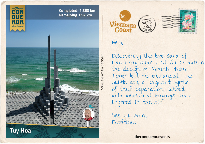
km od začátku : 1360
Tuy Hoa
Tuy Hoa is a beautifully laid out and well-organised coastal city with wide roads, clean sandy beaches and parks lining the shore. Along this shoreline stands the Nghinh Phong Tower, winner of the 2023 Asian Urban Landscape Award, closely resembling the interlocking basalt columns of Ganh Da Dia Beach, located approximately 15mi (25km) north of the city.
The architectural design was inspired by the legendary tale of Lac Long Quan and Au Co, featuring two stone columns measuring 115ft (35m) and 98ft (30m). Their story, one of love, yearning, honour and protection, serves as Vietnam’s creation story. Similar to the Māori creation story which started with Te Pō, the great nothingness, and the Japanese imperial line tracing its origins to a descendant of the sun goddess, Amaterasu, Vietnam's tale unfolds with the legend of the dragon king Lac Long Quan and the fairy princess Au Co.
Lac Long Quan, a brave warrior and the son of a mountain god (the father) and water dragon (the mother), safeguarded fishermen from giant fish monsters. Au Co, on the other hand, was a beautiful fairy from the mountains. Skilled in medicine and kind-hearted, Au Co travelled to heal the sick until she encountered a flying monster. Threatened, she transformed into a crane, catching Lac Long Quan’s attention, who swiftly destroyed the monster by tossing a huge rock. Falling in love, they married, united their kingdoms and lived between the mountains and the sea. Au Co later gave birth to an egg sac, from which 100 children were born, giving rise to the Vietnamese people.
Despite their deep love, Lac Long Quan and Au Co yearned for their respective homes. Unable to stay together, they parted ways, each taking 50 children to raise. The eldest son, King Hung, founded the Hong Bang Dynasty in 2879 BC, becoming Vietnam's ancestral ruler. The tower's structure encapsulates their story, with each column stacked with 50 stone blocks representing their children and the gap symbolising their separation. This gap, only wide enough for two people, creates a unique acoustic effect. As I stand within it, feeling the breeze flow through, I'm reminded of the soft murmur of wind, imagining Lac Long Quan and Au Co whispering longingly to each other.
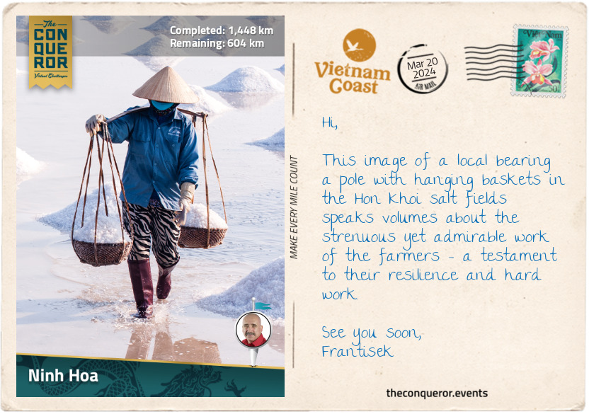
km od začátku : 1448
Ninh Hoa
About 8mi (13km) northeast of Ninh Hoa lies the Hon Khoi salt fields, where local villagers have been harvesting salt for generations. This was an intriguing place to explore and gain insight into the traditional salt production techniques.
Walking through the fields, I noticed the fields were divided into plots, with seawater channeled into these areas. When the seawater evaporates, fine salt crystals are left behind. The harvesting season is from January to June, during which farmers start their work before sunrise, spending up to seven hours each day under the scorching sun tending to the fields. Typically, women take on the role of harvesters, as the men are often engaged in fishing activities.
Salt harvesting follows a careful process. It relies on ideal weather conditions, preferably sunny and dry, to accelerate evaporation. It also involves closely monitoring salt crystal formation and concentration levels to ensure collection at the optimal point.
The actual harvesting is hands-on, using tools such as rakes or wooden implements to gently gather the salt crystals. The collected salt is either piled into small mounds or sent for further processing and refinement. This whole process spans several weeks from start to finish. It requires the expertise of salt farmers, who must determine the right time for harvest to maintain the salt's quality.
While Vietnam produces sufficient salt for its domestic market, local farmers are experiencing challenges from an influx of low-cost imported salt, making it difficult to maintain competitive prices.
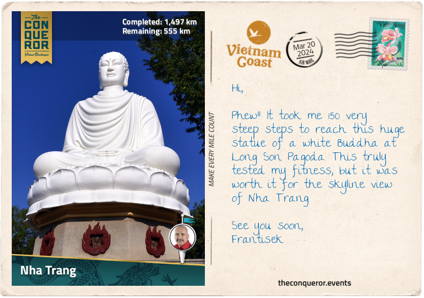
km od začátku : 1497
Nha Trang
Nha Trang is a major fishing port and destination city, owing to its endless miles of stunning beaches framed by a picturesque promenade and swaying palm trees. The bay is a visual treat and a gateway to diving sites and nearby islands, such as the renowned Hon Mun Island. This island, Vietnam’s sole protected marine reserve, is a haven for diving and snorkeling enthusiasts.
While I may not fancy diving, my appreciation for aerial views found fulfillment on the Vinpearl Cable Car. Spanning an impressive 2mi (3.3km) over the sea from Phu Quy Harbour to Hon Tre Island, home to VinWonders amusement park, the cable car offered terrific views of the bay and the city.
Upon reaching VinWonders, the appeal of the amusement park unleashed the child within me. Wild water slide rides had me twirling and swirling, landing in the pools below with a big splash. The park was a delightful mix of architectural styles, from medieval castles to fantasy worlds and tropical paradises. Satisfied with the thrills, I explored the Garden of Five Continents, a botanical oasis showcasing plants from all over the world, including exotic plants and flowers from the South American jungle.
Back in the city, I strolled around Long Son Pagoda, a Buddhist temple set amidst a lush garden, followed by a hike to the summit of Trai Thuy Hill. Partway through the hike, I encountered a reclining Buddha, while at the top was another much larger Buddha seated on a lotus pedestal surrounded by trees and shrubs. I caught glimpses of the city skyline through the greenery.
I ended my day with a visit to the Alexandre Yersin Museum at the Pasteur Institute (his former office). Alexandre Yersin was a Swiss physician and bacteriologist who moved to Vietnam in 1891. He was known for introducing cinchona trees to the country. Native to South America, the tree’s bark was used by indigenous people to treat malaria, and it became an important component in the development of antimalarial medication. However, Yersing was most famous for discovering the bacterium causing bubonic plague. It was named Yersinia pestis in his honour. The museum, housing Yersin’s lab equipment, desk, and books, pays homage to his contributions and the Institute, still in operation, continues to produce vaccines and conduct medical research.
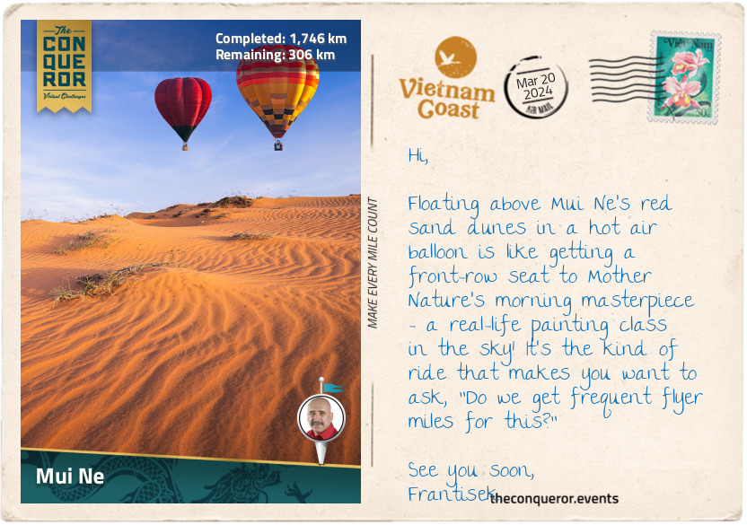
km od začátku : 1746
Mui Ne
Much like the rest of Vietnam's stunning coastline, Mui Ne stands out with its impressive 12mi (20km) stretch of white sand, shaded by palm trees and surrounded by azure waters. It's a busy beach destination, with resorts and restaurants lining almost the entire shore.
But what really caught my interest in Mui Ne was a unique attraction just a bit inland – the vibrant sand dunes. These sand dunes, shaped by the wind and waves, come in two beautiful colors – gold and red. They're scattered all around, so I don’t have to go far to experience them.
The red sand dunes are right off the main road, and climbing up the hill offered a breathtaking view of the coastline and the sea. I could picture the dunes turning a fiery red at sunset. Ready for another sandboarding experience, I shot down the hill on my rented board, reveling in the exhilarating thrill that came with a few tumbles and sandy somersaults for good measure. However, the real exercise began when I had to trudge back up through the ever-shifting sand. With each step, my calves were having their own personal workout session – nature's way of keeping me on my toes, or rather, in the sand!
Next to the red dunes were the golden ones, looking like a vast desert – no need to go all the way to the Sahara when I had this easily accessible version! The best time to catch their golden glow was at sunrise. Since the middle of the day feels like standing on a giant stove, I planned a sunrise visit for the gold dunes and a sunset trip for the red dunes.
To spice up the adventure, cruising over the dunes on a quad bike not only saved me from some uphill struggles but also gave my calves a well-deserved break. And the pièce de résistance? A hot air balloon ride over the dunes because apparently, Mui Ne is the only place in Vietnam that thought, "Why not throw in a hot air balloon ride too?" I couldn't resist topping off the whole sandy escapade with a touch of airborne whimsy!
While these dunes offer loads of fun, they're not just for show – they play a vital role in protecting the coast from storms and erosion while offering a home to different plants and animals.

km od začátku : 1802
Ke Ga Cape
As I reached Ke Ga village, I took a slight detour to Ke Ga Cape, where Vietnam’s oldest and tallest lighthouse stands proudly on a rocky islet a mere 1,640ft (500m) from shore. A prominent local landmark, Ke Ga Lighthouse was constructed in 1899 by the French army to help ships navigate the huge boulders and rocky terrain scattered around this area. It stands tall at 213ft (65m), featuring a distinctive octagonal design carved from granite blocks.
Keen on strolling to the lighthouse, my plans hit a snag when, instead of low tide, the tide had other plans. Rather than attempting a wet walk, I had to turn back, find a nearby boat operator, and decide whether to quickly get there on a motorboat or slowly cruise across a uniquely Vietnamese basketboat.
Never short on wanting adventure, I settled for a laid-back sail in a basketboat. Also known as coracles or thuyen thung in Vietnamese, these boats are unusual traditional watercraft found primarily in the coastal regions of Vietnam. Constructed with bamboo frames and woven with water-resistant materials like bamboo skin, these boats, measuring 4-6ft (1.2-1.8m) in diameter, have a round or oval shape resembling a basket. They are used for fishing in shallow waters or navigating narrow channels.
But why were they made this way? Well, when the French colonists wanted to charge taxes on boats, the fishermen couldn't pay. So, they changed the design to look like baskets instead of boats. This way, they didn't have to pay taxes because the new design didn't match what the tax covered.
Building basketboats demands skilled hands and technical weaving expertise. Maneuvering these boats isn't exactly a piece of cake either, given their conical shape. It requires serious training to handle them effectively. So, when I enthusiastically hopped into the rented basketboat for a ride to the islet, I crossed my fingers and silently hoped for a graceful sway instead of an unintentional somersault into the sea.
Having safely arrived on the islet, I ventured up to the tower, bravely tackling the dizzying 183-step circular stairway to the top. The reward? An incredible view of the South China Sea and the picturesque coastline. The idea of an overnight camp added to my excitement, with the promise of a front-row seat to the sunrise the next morning.
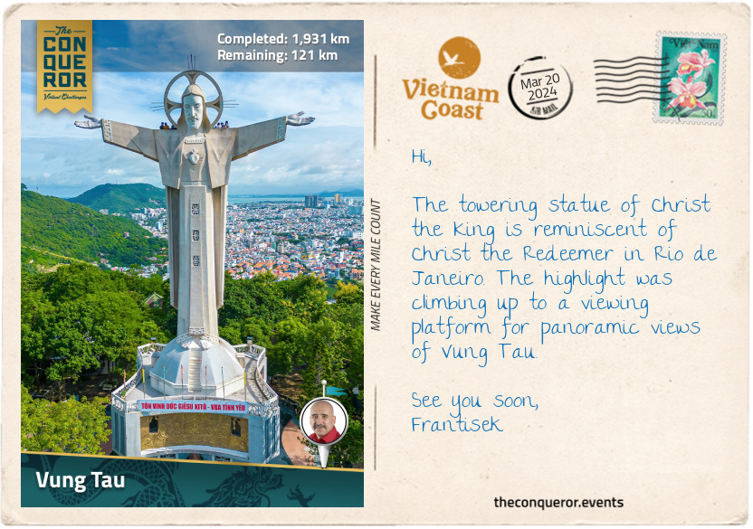
km od začátku : 1931
Vung Tau
As I was nearing the end of my journey, I took the time to explore the coastal gem of Vung Tau, a city perched on a peninsula known for many stunning beaches with names as memorable as Pineapple Beach and Strawberry Beach. Strolling along, I learned that in the 14th and 15th centuries, this very area was a swamp visited by European trading ships, giving birth to the city’s name Vung Tau, which means "anchorage."
Setting foot on Back Beach, a quaint sandy spot with a charming park, I tossed off my shoes, let the sand squeak between my toes, and watched the water gently lapping at the edge. On the flip side of the peninsula and in contrast to Back Beach, lies Front Beach, bustling with activity, a busy thoroughfare, towering hotels, and, for the adventurous, the perfect spot for kitesurfing.
Venturing southward, I discovered Hon Ba, a small rocky island standing 720ft (220m) offshore. Its centrepiece, occupying almost the entire island, is the Mieu Ba temple, a place of worship revered by the locals. To my delight, and unlike Ke Ga Cape, it was low tide. A rocky path emerged, connecting the island to the mainland, which I had the pleasure of walking across to explore the island.
From Hon Ba, my gaze was drawn to the large Christ the King statue atop Small Mountain, visible in the distance. The mountain boasts two peaks, one featuring the iconic statue and the other hosting a lighthouse. Intrigued, I left the island to go and explore the mountain. First, I had to tackle the challenging ascent as I conquered the 850 steps to the summit. But it was worth it for the uninterrupted views of Vung Tau’s skyline and the grand statue. The statue was built in the 1970s by the local Catholic community, and it stands 105ft (32m) high and 60ft (18m) across the outstretched hands. Inside the statue was an additional 133 steps that led me to a viewing platform at the back of the statue’s shoulders, offering a closer look at this impressive monument.
My journey concluded at Nghinh Phong Cape, the tip of the peninsula, where a rugged landscape and a hiking trail awaited. It seemed like an ideal spot for a sunset, where the gentle breeze created a peaceful atmosphere. As the sun set over the horizon, I contemplated the last stretch of my journey to Ho Chi Minh City.
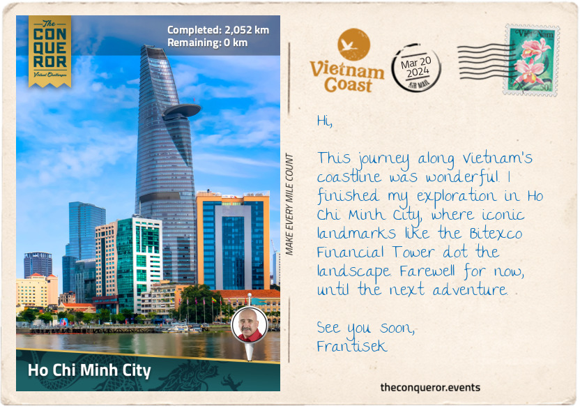
km od začátku : 2052
Ho Chi Minh City
As I reached the final stretch of my journey and entered Ho Chi Minh City, formerly known as Saigon, I found myself in the heart of the metropolis. The Sai Gon River, the city's primary water source and home to the Port of Saigon, gently meandered around the city before merging with the Dong Nai River southeast of downtown. While walking beside the river, I marvelled at the skilled maneuvres of motorcycles navigating the bustling traffic, seamlessly weaving between cars and lanes like seasoned motorbike racers. The city's skyline stretched before me on this sunny day, the sky clear and cloudless.
Passing a major intersection, I caught sight of the Bitexco Financial Tower, previously mentioned in my journey, its architecture inspired by the bud of a lotus flower. Its glamorous and modern design, complete with an observation deck, contrasted with the surrounding colonial-era buildings. Continuing my exploration, I reached the Tran Hung Dao Statue – positioned amidst a semi-circular moat and a park – a tribute to the 13th-century military leader who successfully defended Vietnam against Mongol invasions.
Moving from the statue, I made my way to Duong Nguyen Hue, a 210ft (64m) pedestrian boulevard extending 2,198ft (670m) through the city centre. It is lined with trees, fountains, and public art installations and serves as the city's social hub, frequently hosting large-scale events. Further along the boulevard, I came across the Music Fountain, featuring a stunning pinkish-red lotus glass sculpture as its centrepiece, surrounded by sprinklers. In the evenings, it transforms into a water and light show, occasionally accompanied by music.
My journey concluded at the city hall. French architects constructed it in the early 1900s, bearing a striking resemblance to Paris City Hall. The building, with a central clock tower and turret-like roofs, spans 262ft (80m) in length. A statue of Ho Chi Minh graces the front of the building. After the reunification of Vietnam in the late 20th century, the building became the headquarters of the Ho Chi Minh People’s Committee.
Eager to savour a fresh bowl of pho and crispy spring rolls, I am off to find a local food stall. Then, I’ll take a moment to not only digest the local flavours but also to reflect on my coastline journey from Hanoi to Ho Chi Minh City. See you next time.
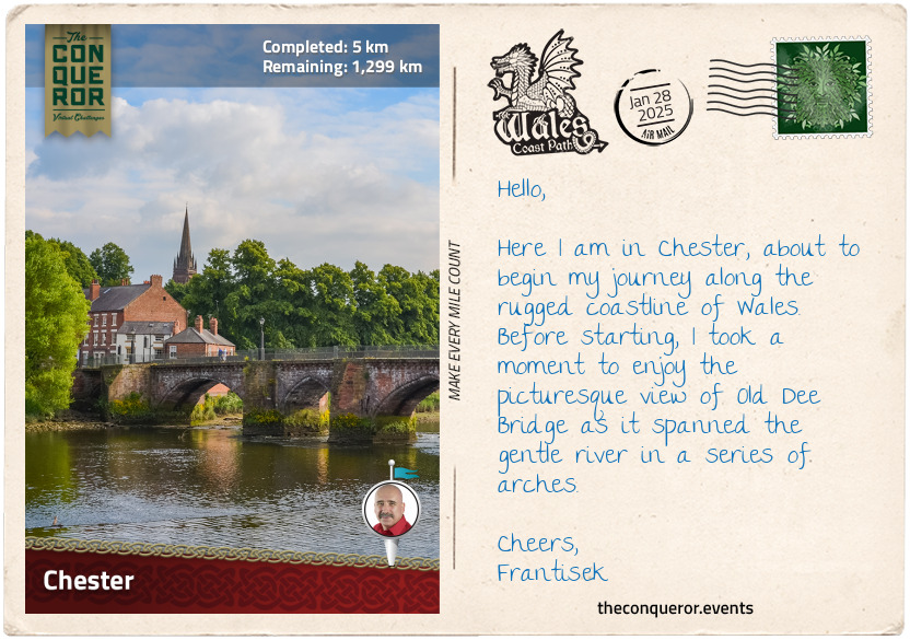
km od začátku : 0005
Chester
I once asked a Welshman how he would describe the Wales Coast Path. He said, "… it's got a dramatic coastline, with jagged cliffs, choppy seas, stacks, caves and large sandy beaches mixed in with rolling hills, dense woodland, isolated farmhouses and ancient churches". Never mind the myriad of medieval castles and quite a few listed as UNESCO sites.
As you might imagine, my interest was piqued, and I wanted to explore, see it with my own eyes, walk the coastline, and enjoy the landscape's wildness while embracing its tranquility.
Wasting no time, I arrived in the historic city of Chester, where the River Dee gracefully meanders through the landscape to find its way to the Irish Sea. Located in England, close to the English-Welsh border, Chester was founded in the first century as a Roman fort named Deva Victrix. Its Roman heritage is still evident in the grid pattern layout and the fabulous and well-preserved city walls, a 2mi (3.2km) circuit around the city centre. Strolling the walkway gave me a lovely elevated view of the city, along with exploring the tower ruins and gates.
A distinctive feature in Chester is the Rows, a medieval-era two-tiered shopping and dining gallery. The architecture is Tudor and Jacobean, easily recognised by the black and white half-timbered facades and ornate carvings. With its long history, Chester has evolved through many architectural periods, from the Gothic grandeur of Chester Cathedral, Georgian townhouses, and Victorian influences to the contemporary buildings dotted amongst them.
A historic landmark near the city centre is Chester Castle, the 11th-century stronghold ordered by William the Conqueror shortly after the Norman Conquest of England in 1066AD. Over time, it saw modifications and expansions, including the construction of a stone keep by King Henry II. The castle played a role in the English Civil War and later evolved into a courthouse and administrative centre.
Since the castle was not accessible to the public, I made my way to the start of my Wales Coast Path journey. I crossed the border into Wales and found myself alongside River Dee, where a marker consisting of two stone pillars launched me into a long-distance journey of 810mi (1303.5km) from Chester to Chepstow. The route is linked by several independent trails running on or close to the coastline. Only very few of them head inland. As a matter of fact, this entire route is the only one in the world that has a continuous waymarked path around its entire coastline.
As I begin to tackle this dramatic coastline, I will remember the Welshman's words and look forward to its many wonders.
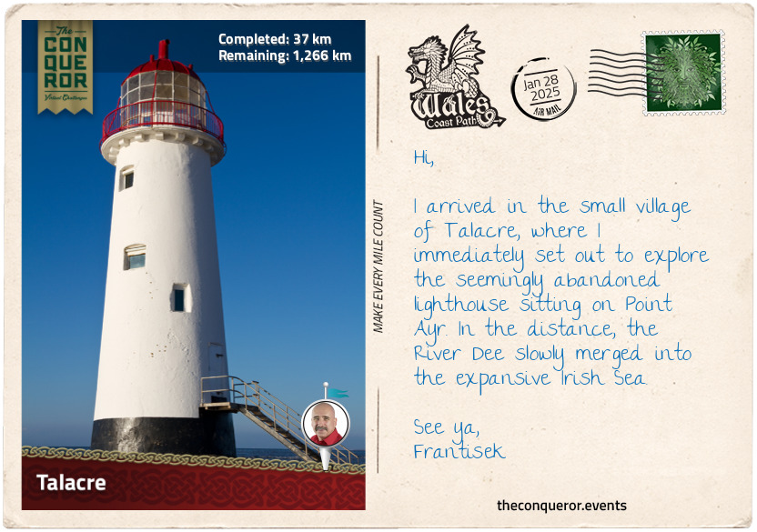
km od začátku : 0037
Talacre
I crossed the River Dee near Queensferry and continued on its southern side until I reached Point Ayr, the northernmost point of Wales. It is located at the mouth of the River Dee, which flows into the Irish Sea. The picturesque beach is part of Talacre, a small village favoured by locals and tourists for its long sandy beaches and extensive sand dunes.
The dunes support a wide variety of plants and animals, and due to their ecological importance, they are designated a Site of Special Scientific Interest (SSSI). Plants such as marram grass and sand sedge help to stabilise the dunes, whereas the sea holly, with its blue-green leaves and silver-blue flowers, and bird's foot trefoil, with clusters of yellow flowers, bring a splash of colour.
The very rare Natterjack toad, with its distinctive yellow stripe down its back, makes this area its home. Extinct in Wales by the 20th century, the toad was reintroduced as a protected species. If I gingerly search within the sand dunes, I may chance upon a skylark nesting, trilling its melodious songs. At the same time, I may spot the odd bird of prey up in the sky, be it a kestrel or a peregrine falcon.
Perhaps the most notable landmark on the beach is the Talacre Lighthouse, also known as the Point of Ayr Lighthouse. This 1776 lighthouse, standing atop the sand dunes, was built to guide ships navigating the coastline. Later, a pile lighthouse was established in its place by the Trinity House, an organisation responsible for overseeing lighthouse operations across Wales, England, the Channel Islands, and Gibraltar. By the end of the 19th century, this replacement, too, gave way to a lightship. Today, Talacre Lighthouse stands in solitude, a somewhat forsaken sentinel, steadfastly gazing over the expanse of the Irish Sea.
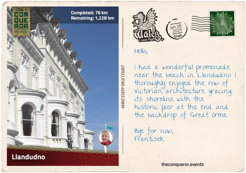
km od začátku : 0076
Llandudno
Llandudno is a delightful coastal town flanked by two sandy beaches and the massive limestone Great Orme headland to its north jutting into the sea. As the largest seaside resort in Wales, it is often referred to as the "Queen of the Welsh Resorts".
The town's architecture evokes its Victorian past when it became a fashionable seaside resort. The beautiful curve of Orme Bay and the incredible Llandudno Promenade, lined with pastel-coloured Victorian-era hotels, guided me to the waterfront, where I took a leisurely stroll along the historic pier, exploring charming shops and amusement arcades. Seated outdoors at the pier's end, I found the perfect spot for a pot of tea. I savoured a cup on a crisp, sunny day, relishing the sea breeze on my face while hearing seagulls squawking above.
A growing interest in health and wellbeing during the Victorian era drew many people to the town's coastal shores, believing that its clean air and clean waters gave it a therapeutic quality. Construction of the North Wales Coast Railway greatly improved accessibility to Llandudno from cities such as Manchester and Liverpool, giving people a much-needed respite from congestion and pollution.
Llandudno's reputation was further elevated when Queen Victoria visited North Wales in 1859. When Elisabeth of Wied, Queen Consort of Romania, left town following a stay of five weeks, she described Wales as "a beautiful haven of peace".
The majestic Great Orme is the main focal point as it towers over the town, commanding attention and inviting any explorers to hike its trails to the summit for a panoramic view of the Irish Sea. For a more leisurely approach, Great Orme Tramway from the town's centre is a fun ride straight up to the summit, or the Llandudno Cable Cars offer an alternative fun aerial trip to the top.
Once on top, the gorgeous views extend across the Irish Sea as far as the eyes can see, encompassing the Little Orme, the craggy headland opposite the bay, and the renowned Snowdonia Mountains.
For a whimsical experience, I searched for the Alice in Wonderland statue trail, consisting of a series of bronze sculptures such as Alice herself, the White Rabbit, the Mad Hatter, the Cheshire Cat, and the Queen of Hearts. The connection between Lewis Carroll's famous novel "Alice in Wonderland" and Llandudno resides with eight-year-old Alice Liddell, who spent her first of many summers in town and inspired the author's tale of curious adventures down the rabbit hole.
Llandudno was a charming place to while away some time, promenading the foreshore, hiking to the summit, and simply taking in the splendid sites.
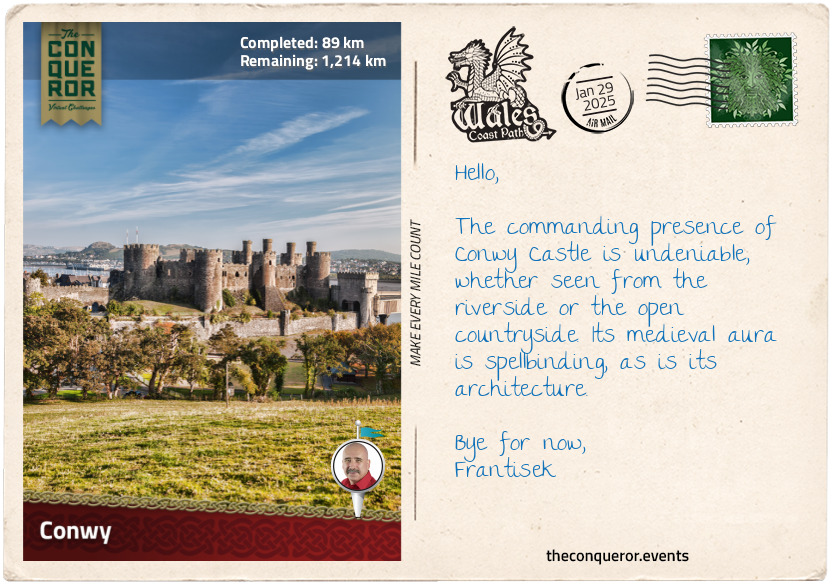
km od začátku : 0089
Conwy
With great anticipation, I crossed the bridge over the River Conwy, where the National Trust's Telford Suspension Bridge is situated parallel. This gothic-style 1800s bridge was designed by the renowned Scottish civil engineer and architect Thomas Telford. He was a pioneer in the early development of infrastructure and transportation systems during the Industrial Revolution, having been at the forefront of many projects such as the Caledonian Canal in Scotland, the Pontcysyllte Aqueduct and Port Penrhyn in Wales while improving and expanding Britain's road network.
The suspension bridge led directly into the formidable medieval fortress, Conwy Castle. Standing guard over the River Conwy and the seaside town of the same name, the castle watched over this important river route that led into the heart of Wales. Built by King Edward I on his quest to conquer the last of the Welsh territories, the Kingdom of Gwynedd, the castle is one of a long chain of fortifications. Edward strategically erected nine castles around Gwynedd, encircling the northwest of Wales and establishing control. This collection of castles earned the nickname "Ring of Iron".
Conwy Castle is an impressive fortress featuring eight huge towers with arrow slits for defense and a thick curtain wall connected to a one-mile (1.6km) town wall that is still remarkably well-preserved. On the upper exterior walls near the battlements are the remains of drop boxes (formally known as machicolations) where stones or other materials would be dropped on attackers. The main gate was via a drawbridge but is now long gone. With its near-oblong shape, the narrow ends of the castle had barbicans added for extra defense. Inside, the Great Hall used by the king for entertainment was supplemented with various other spaces that helped the castle function, from a cellar and kitchen to stables and blacksmith to a royal residence, chapels and, for the unlucky, a prison tower.
An interesting feature of Conwy Castle is the absence of a central keep that usually contained the royal apartments. The reason is a change in layout design focused on defense strategies, where strong walls and layered defenses became a priority after factoring in the rugged terrain, as opposed to a single central stronghold. This allowed for better protection and control of the surrounding area.
As the centuries passed, Conwy was besieged in the 15th century, when Welsh leader Owain Glyndŵr rose against English rule, wanting to reassert Welsh independence. Another two centuries later, the castle was entangled in the English Civil War, where it was held by Royalist forces and besieged by Parliamentarian troops. Following the war, the castle was partially slighted, stripped of its iron and lead, turning it into a ruin. Neglect set in until the 19th century, when restoration efforts were initiated to preserve its history.
Today, the castle maintains its vigil over the river's banks. The medieval setting harmoniously coexists with the presence of roads and railways. In 1986, Conwy Castle and three other "Ring of Iron" castles were designated UNESCO World Heritage Sites.
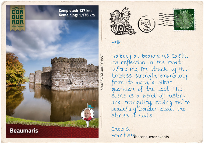
km od začátku : 0127
Beaumaris
Beaumaris is a small, charming town on the island of Anglesey in Wales. It is set at the eastern entrance to the Menai Strait, a tidal waterway that separates the island from the North Wales coastline. Historically, Anglesey, known as Ynys Môn in Welsh, was part of Gwynedd, a medieval Welsh kingdom, and is now a county northwest of mainland Wales.
The town's history traces back to the mid-9th century when Vikings established a presence in Gwynedd through conquest or trade. Initially focused on raids for resources, the Vikings eventually settled more permanently. Gwynedd's access to the sea easily facilitated Viking navigation, while fertile farming soil supported the settlers' needs. At that time, Beaumaris was known as Porth y Wygyr, translating to "Port of the Vikings".
The Norman invasion of Britain in the late 11th century significantly impacted Anglesey. Given Anglesey's strategic location, it became a target for Norman expansion. Castles were constructed along its coastline, creating a network of fortifications to establish authority, safeguard its borders, and protect newly acquired territories.
However, it wasn't until the late 13th century, after the conquest of Wales, that Edward I ordered additional fortifications as part of the "Ring of Iron". Beaumaris Castle was the last of the royal strongholds, planned to be the crowning glory, built with near-perfect symmetry. Partially surrounded by a moat, the castle has a concentric design with dual layers of walls and defenses bordering a central courtyard. This layout protected against attackers and contributed to the castle's strength. However, the castle was never completed, partly due to financial constraints and changing priorities. Beaumaris Castle joins Conwy Castle as the second UNESCO World Heritage Site in the “Ring of Iron”.
The town's story was shaped by the royal charter granted by Edward I, giving civic rights to English and Norman-French residents while limiting the rights of the Welsh. The charter prevented the Welsh from holding government roles, owning property, and engaging in certain trade activities. The town's architecture showcases landmarks like Tudor Rose, the town's oldest timber-framed building dated around 1480, the stylish 15th-century interiors of The Bull's Head Inn, and the distinctive hexagonal design of 19th-century Beaumaris Gaol, intended for more effective inmate supervision.
To complete my exploration of Beaumaris, I strolled down to the beach and onto the pier that once served as a docking point for 19th-century steamships. As I stand at the pier's edge, gazing out to sea, I envisioned the arrival of Viking ships centuries ago—whether for trade, raiding, or settlement—each visit carrying an air of anticipation and uncertainty.
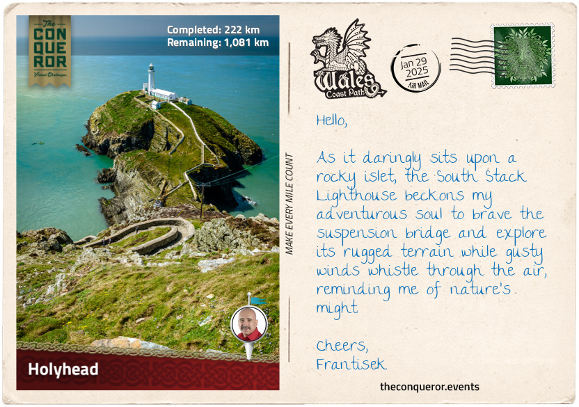
km od začátku : 0222
Holyhead
Heading north from Beaumaris, I followed the Anglesey Coastal Path, part of the larger Wales Coast Path to Holyhead. It is located on Holy Island on the northwestern coast of Anglesey. This small coastal town is positioned directly across from Dublin. Being the shortest and safest route to Ireland across the treacherous Irish Sea, the town has become an important route for transporting goods between Ireland and England. With its straightforward sea crossing, the port has a busy maritime traffic. For context, up until the end of 2020, over 450,000 trucks used the ferry services to cross the sea.
Behind the ferry terminal stands Skinner's Monument, commemorating Captain John M. Skinner. He was an American who lost his arm during the Revolutionary War and an eye when he was a child. When he left the Navy, he moved to Holyhead to work as a captain on mail boats. He was a colourful character, fondly remembered for his kindness and generosity, who would walk around town with his pet raven like a pirate with his parrot. A fearless sea captain, he was remembered for successfully bringing a ship into the harbour while navigating rocks and small islands during rough weather conditions. This was nearly three-quarters of a century before the Holyhead Breakwater was constructed, necessitated to overcome the northerly winds that would prevent ships from safely reaching the harbour. As a side note, the breakwater, at 1.7mi (2.7km), is the longest in the United Kingdom.
His stories of bravery, service and charity are captured in the Holyhead Maritime Museum, where Captain Skinner, dressed in uniform, is immortalised in a life-size model along with his pet raven. On the wall hangs a painting by his friend James Sparrow, capturing his house and local friends.
In the town centre was the 13th-century St. Cybi's Church, dedicated to the patron saint of Holyhead. Founded by St. Cybi in the 6th century, the site housed a clas, a Celtic Church with monastic and educational aspects. The church was built inside a Roman fortification called Caergybi, the Welsh name for Holyland, with three walls and the fourth being the sea. This was a unique feature and one of very few in Europe. The current church, dated to the early 16th century, has a painting inside near the organ depicting the Tudor rose, a symbol of the royal Tudor family who were of partial Welsh descent.
Continuing around the coast, I hiked past Holyland Mountain and came upon South Stack. It was a small rocky island just off the coast accessed via a suspension bridge. The island is largely known for its lighthouse, built in 1809 to guide ships through the hazardous sea. I took the well-paved path up to the lighthouse for a panoramic view. During nesting season, the island is home to various species, including puffins, razorbills, guillemots, and kittiwakes.
I will take some time to explore while enjoying the rugged cliffs, wild sea and coastal scenery. The next stop will be Caernarfon.
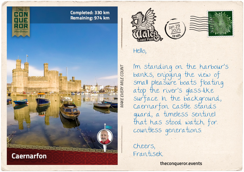
km od začátku : 0330
Caernarfon
Returning to the mainland, across the Menai Strait, I arrived in the royal town of Caernarfon. Rich in natural resources, Caernarfon was occupied by the Celtic Ordovices tribe. When the Romans invaded Britain, they built the fort Segontium to control the Celts. After the Romans' departure three centuries later, Caernarfon joined Gwynedd. William the Conqueror's attempt to invade the town in the 11th century by building a motte-and-bailey castle failed. This was largely due to the rugged terrain and logistical difficulty, further hampered by limited resources and local resistance.
The town remained independent until Edward I's conquest of Wales in the 13th century, when he promptly built Caernarfon Castle as part of his "Ring of Iron" chain of fortifications. While visiting the castle, Edward's wife, Eleanor of Castile, gave birth to an heir, Prince Edward. At age seven, the young Edward was bestowed with the title of Prince of Wales. This tradition continues today, with Prince William as King Charles III's eldest son carrying the title.
Building the castle took nearly fifty years, with the works progressing in stages. Once completed, it was the largest and most formidable fortification in Wales. The castle's layout was driven by the lie of the land, ending up as a figure-eight narrow enclosure. It was dotted with multiple towers along its curtain wall and a drawbridge at the King's Gate, the main entrance from town. A wall encircling and connecting the town to the castle walls was built to extend its defensive structure. In 1284, Caernarfon effectively became the capital of north Wales and the seat of the English government.
Tensions continued between the English and Welsh, with revolts erupting over the following centuries until the accession of the Tudor House to the throne in 1485, who were of Welsh origin. The castle's importance waned as hostilities eased with the Tudor's rule. Consequently, it suffered neglect, with its domestic buildings stripped of valuables and the roofs and timber decaying. Major repairs and conservation efforts began in the 1870s to restore the castle. Caernarfon joins Beaumaris and Conwy as the third property in the "Ring of Iron" to be added to the World Heritage Site register.
The town maintains much of its medieval roots in both layout and preserved sections of the town walls. With a high concentration of Welsh speakers, the culture is actively nurtured and illustrated in its bilingual street signs.
After a leisurely stroll to the waterfront, I took in the lovely view of Anglesey across the strait before gradually departing the town along the waterside to resume my journey.
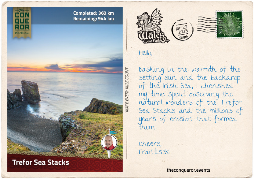
km od začátku : 0360
Trefor Sea Stacks
Leaving Caernarfon behind, I crossed the harbour bridge and set off on a path leading along the coast on a well-paved minor road toward the Trefor Sea Stacks. Menai Strait and the island of Anglesey stretched before me toward the narrow channel of Abermenai. On its south side, situated on the tip of Dinlle Peninsula, is the 18th-century Fort Belan. It is the only British fortress from the American Revolution, purposely built by Thomas Wynn, the region's Member of Parliament who was concerned about attacks on the British coastline. The channel it guarded was a mere 115ft (35m) wide; however, the fort never saw any serious action, and the Wynn family later turned it into private property. Today, it's an accommodation complex where guests must be mindful of the incoming tide as the property gets cut off from the mainland twice daily.
As I continued along the coastal path, I came across St Baglan's church standing alone in a large field, bound by a low stone fence, towering trees to one side and a small time-scarred cemetery. The aged interior illustrated the social life in the 18th century with modest timber pews at the rear and the grander box pews reserved for the wealthy villagers. An oddity among the weathered gravestones was the modern headstone for the 1st Earl of Snowdon, dated 1930-2017. Piquing my curiousity, I was surprised to discover that he was a renowned photographer and filmmaker who campaigned tirelessly for disabled people and was once married to Princess Margaret, Queen Elizabeth II's younger sister.
My path led me to Dinas Dinlle, where I ascended to the hilltop to take in the view that lay ahead. The next stretch of the journey was less than captivating, navigating a narrow road that occasionally grew busy with traffic, which became even more mundane when I turned onto the A499 and followed the cycle path to Clynnog Fawr.
The old pub at Clynnog Fawr has long gone, but I welcomed a brief rest at the café in this small village. The town's main feature was the Eglwys Beuno Sant, a church dedicated to Saint Bueno, who on this site established a Celtic monastery in the early 7th century. Bueno is said to have descended from the Royal Princes of Powys. They were Welsh nobles ruling Powys' central and eastern territories in present-day Wales. The monastery was destroyed by Vikings and then again by the Normans. The current church is a major stopping point for the North Wales Pilgrimage Way, which merges temporarily with the Wales Coastal Path.
My journey finally turned off the A499, and I returned to quiet country roads. Nearing a small gate, I crossed a small wooden bridge and walked near the coast's edge but not too close since there was no fence for protection, and the drop was straight into the ocean. Before long, the Trefor Sea Stacks came into view. Three stacks of different heights and shapes rose above the surprisingly calm, clear water. There was no wind this time, unusual for the coast, allowing me to take the time to admire the volcanic-like jagged piles of rock. Perched atop one of the stacks were a flock of seagulls seemingly resting, perhaps looking out for their next feed.
With these opportunistic feeders, I decided against having my snack. I chose instead to savour a hot cup of tea from my thermos.
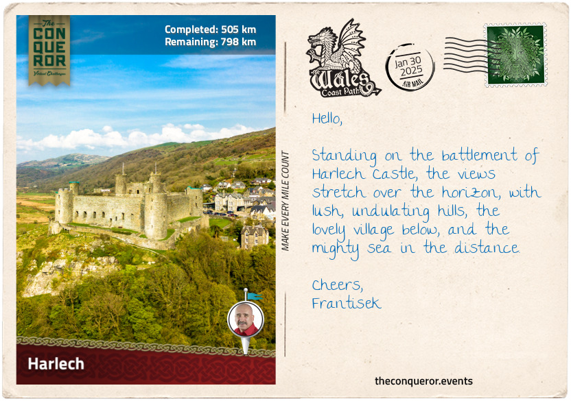
km od začátku : 0505
Harlech
As I arrived in Harlech, I looked forward to exploring the fourth and final castle designated a UNESCO site as part of the "Castles and Town Walls of King Edward in Gwynedd". There in the distance looming over the town from its rocky knoll was Edward's fortress, Harlech Castle. Built around the same time as Conwy and Caernarfon, Harlech's somber greyish stronghold comes with a turbulent past.
Strategically located overlooking the Irish Sea, the castle's curtain wall is still visible in parts as it stretches down the slope to what once used to mark the sea's shoreline. In the medieval days, the Irish Sea was much closer to the castle than today, allowing it access to be resupplied by sea during sieges. However, centuries of sediment deposit and land reclamation altered this coastal area, shifting the shoreline away by half a mile or so (800m).
Harlech Castle played major roles in conflicts such as the English Civil War (1642-1651) mentioned previously and the Wars of the Roses (1455-1487), where two royal houses, the Lancasters and the Yorks, fought for the English throne. The victorious Lancastrians formed an allegiance with the Yorks via marriage. Combining the two houses gave rise to the Tudor dynasty, known for royals such as King Henry VIII and Queen Elizabeth I.
One of the most famous episodes in the castle's history is the Welsh rebellion led by Owain Glyndŵr in the early 1400s. Proclaiming himself Prince of Wales, he laid siege to Harlech Castle and successfully captured it. Owain used the castle as his residence for four years until it was besieged in return, and the castle fell due to a shortage of supplies.
Outside the castle wall, on a small patch of grass, is a bronze sculpture called "Two Kings". The statue of a horse and rider carrying a young boy shows a touching scene from an old Welsh story collection called the Mabinogion. This story is about Bendigeidfran (Bran the Blessed), a giant and king of Britain, and his sister Branwen, who married Matholwch, king of Ireland, as a symbol of peaceful relations between the two countries.
Setting sail from Harlech, the newlyweds returned to Ireland, where their son Gwern was born. Not all was well in the kingdom, and after a few years, things began to unravel. Branwen was expelled from court, sent to the kitchen to work and mistreated. Seeking assistance from her brother Bran, he soon crossed the sea with an army ready to save his sister. Treachery on both sides ensued, and in the process, Gwern was killed. A fierce battle erupted, ending with only seven survivors. Bran died from a poisoned arrow, and Branwen, devastated by her losses, died of grief.
Circling back to the statue, it represents the emotional weight Bran, as the rider, had to bear while carrying the lifeless body of his nephew Gwern. The story is meant to be a reminder of the price of conflict and how important it is to find peace.
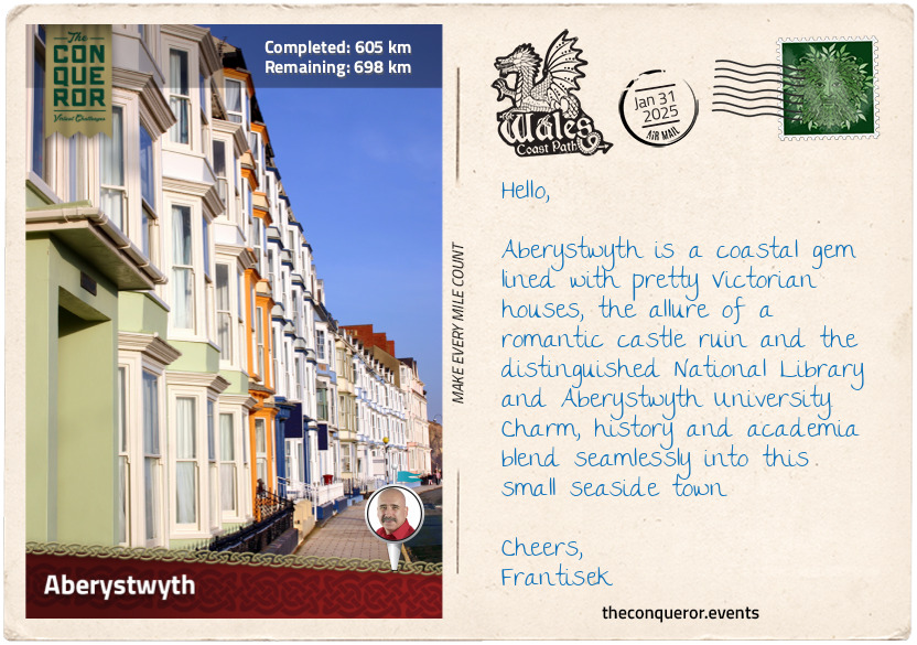
km od začátku : 0605
Aberystwyth
Aberystwyth is a charming seaside town. Located on the shores of Cardigan Bay, its waterfront is lined with Victorian-era townhouses. As I explored the town and took a walk on the beach, I caught sight of the railway track ascending a hill at its northern end. Curious, I ventured toward it to discover it was a historic funicular built in the late 19th century for an easier hilltop journey. I hopped aboard and settled into it, waiting for its slow, rumbling ascent up the hill. A gorgeous view of the town awaited me at the top, with the nearby café tempting with delightful treats and a hot drink.
Returning to town, I strolled to its south side, where the ruins of Aberystwyth Castle stood. As one of the Ring of Iron castles built by Edward I, it was briefly held by Welsh leader Owain Glyndŵr. During Charles I's reign in the 17th century, it became a branch of the Royal Mint, producing silver coins sourced from local mines. Parliamentarian troops razed it during the English Civil War. While strolling the castle walls, I stumbled upon an unexpected treasure—a series of ten mosaics recounting the castle's history, including the remarkable discovery of a well-preserved skeleton in 1988. Its incredible condition perplexed scientists, considering the acidic nature of Welsh soil and its typical degradation of organic matter. The scientists could only hypothesise that the limestone used to build the castle helped preserve the skeleton. Today, it is displayed in the local museum.
However, a peculiar sight on the castle grounds was the arrangement of 13 stones forming a circle. Placed in 1915 during the Welsh National Eisteddfod, these stones represented the country's 13 counties at that time. The Eisteddfod is an annual cultural festival celebrating the Welsh language, literature, music, and the arts through competitions and performances. Gorsedd of Bards is at its centre, a group honouring individuals who have made important contributions to Welsh culture, language, and the arts.
My final stop was at the National Library of Wales, the country's repository for all publications related to the nation and its culture. It is the largest library in Wales, holding more than 6.5 million items. One of its founders, Sir John Williams, preferred the library to be in a more central and Welsh-speaking part of Wales as opposed to Cardiff, where the main institutions are located. Aberystwyth was chosen as the site for the library because it is accessible from anywhere in Wales and has a reputation as a university town with a strong academic atmosphere. The library is a hub for research, education, and preservation of all things Welsh.
My next destination is New Quay, further south of Cardigan Bay.
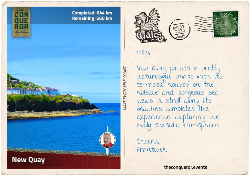
km od začátku : 0644
New Quay
New Quay is a small seaside resort nestled between lush green rolling hills in a sheltered part of Cardigan Bay. The town boasts several long sandy beaches and a natural harbour. It was once home to a thriving fishing fleet. Sometime in the early 1800s, shipbuilding became a new industry, constructing schooners sailing the coastline and larger vessels crossing the ocean. The port operations expanded, providing logistical services for cargo movement, further bolstering the local economy. The town grew with terraced houses springing up along the bay's slopes.
Like many coastal towns during the age of piracy, New Quay was notorious for its smugglers. Ships filled with contraband would moor off the coast, and at night, small boats would row to collect the illegal cargo. Renowned pirates like Bartholomew Roberts (aka Black Bart/Barti Ddu), Henry Morgan and John Evans hailed from Wales. Roberts was perhaps the most successful during the Golden Age of Piracy, capturing over 470 prize ships in a career that spanned only three years. He also created his own pirate code and was among the first to use a Skull and Crossbones flag variant. He died in battle, effectively marking the end of the Golden Age of Piracy.
Henry Morgan was both a pirate and a privateer. The British Crown hired him during the 1600s to take on the Spanish in times of war. Arrested and later acquitted, Morgan was knighted and became Governor of Jamaica, where he spent the rest of his life.
John Evans was a seaman working out of Jamaica. He turned to piracy when he lost his job and had no further prospects. Evans started by raiding wealthy Jamaican houses and then shifted his focus to capture Spanish galleons. Despite his successful plundering career, it was short-lived due to a fatal gunshot wound sustained in a duel.
However, in modern times, New Quay is closely associated with Welsh poet Dylan Thomas. His most famous work is a play called "Under Milk Wood", largely drafted while he lived in town toward the end of World War Two. Thomas was often characterised as a tormented and troubled writer. Those who knew him expressed that his time in New Quay was his most productive period, where he found inspiration in the local surroundings and the community.
To quench his thirst, Thomas preferred the Black Lion pub in town, as noted by the sign outside the building saying it was his "favourite watering hole". This is likely true since he referenced the pub in some of his works. I thought it was an ideal place to stop for lunch and refreshments while enjoying the views across the bay.
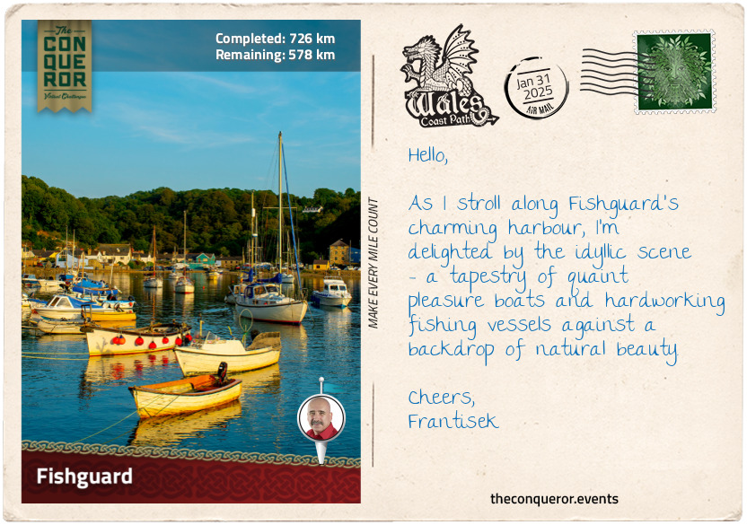
km od začátku : 0726
Fishguard
Heading toward Fishguard, the trail led through an archway into Fishguard Fort. This military site was associated with the Battle of Fishguard when a small French force landed in the bay attempting to invade in 1797. Local militias, armed volunteers, and British Army units defended the area and defeated the French. The story of this invasion was beautifully depicted in the Last Invasion Tapestry, a huge embroidered tapestry initiated as a community project. Over four years, eighty local women worked together to complete the tapestry in time for its bicentenary commemoration in 1997. Measuring an incredible 100ft (30m) long and 21in (53cm) wide, the tapestry’s stitching style resembles the famous Bayeux Tapestry, which chronicles the story of the 1066 Norman Conquest. A total of 178 shades of wool were used to create subtle colour changes illustrating different times of the day and the seasons.
A notable figure during the Battle of Fishguard was Jemima Nicholas (aka Jemima Fawr), a Welsh local who, armed with a pitchfork, captured 12 French soldiers. According to folklore, she led a group of local women armed with household items like pitchforks, scythes, and brooms to confront the soldiers. Rounding them up, the women locked them inside the church until the French troops surrendered shortly afterward. Jemima and her group of women are featured in the Last Invasion Tapestry, and her tombstone in the local cemetery is inscribed with her heroic act.
Fishguard is a coastal town with a strong maritime heritage, where fishing was the primary industry, trading with Ireland and England. Located in a deep valley at the confluence of the River Gwaun and the sea, the town stretches up the valley’s slope and down to the shores of Fishguard Bay. The bay acts as a natural barrier, protecting the town from the fierce waves of the Irish Sea and the prevailing westerly winds.
However, the bay could not shield Fishguard in 1779 when Irish privateer Luke Ryan bombarded the town because it refused to pay a ransom. Ryan was commissioned by the French, who supported the Americans against the British during the Revolutionary War, to command the ship “Black Prince”. He was authorised to target British vessels and disrupt their trade and naval activities. Interestingly, while Ryan's actions may resemble piracy, he operated within the legal rules of privateering during wartime. Whether burning the town was an act of piracy or privateering remains questionable.
It was after Ryan’s attack that the fort was built, which proved valuable when the French arrived nearly two decades later.
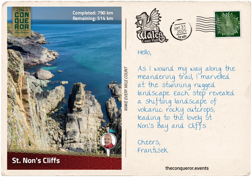
km od začátku : 0790
St. Non’s Cliffs
Having left Fishguard, my hike led me along the Pembrokeshire Coastal Path, a Welsh National Trail that is part of the greater Wales Coast Path. This particular trail wove almost entirely through the Pembrokeshire Coast National Park, Britain's only coastal national park.
I followed the trail markers with the acorn symbol, the UK’s National Trails symbol, leading me along a narrow but well-kept path. The cliffs I passed were of volcanic origin. Some were tall and strong, while others were sharp and sheer. The hills I encountered were a bit challenging, adding some excitement to my hike. The landscape was a mix of rocks and volcanic stones, which in summer turns into a vibrant purple and yellow as the heather and gorse bloom. Parts of the landscape were shared with horses roaming around or cattle claiming their spots while sheep kept watch in the distance.
The trail hugged the coastline, allowing me to admire the cliffs while keeping me safe. It was a fascinating interplay with nature, where the cliffs stood as a constant reminder of the sea's power, shaping the land over millions of years and continuing to do so over many more. With this ongoing shift, the trail must adapt, sometimes changing its original course.
I took a short detour at Strumble Head Lighthouse, a 1908 structure on Ynys Meicel, a small island connected to the mainland via footbridge. The lighthouse is quite elegant with its white cylindrical tower and mint green accents. The view from here toward the mainland was quite spectacular, with pastures and meadows stretching as far as my eyes could see.
The path was peppered with high cliffs and rocky volcanic outcrops like Penberry, Carn Lleithyr, and Carn Llidi. These peaks along St David’s Head, a wild peninsula jutting out into the Irish Sea, were islands when the sea level was higher 70 million years ago. I searched for seals in rocky hideouts and hoped to catch a glimpse of porpoises hunting for fish. They often engaged in playful cat-and-mouse games with gannets, which tend to dive for fish just as porpoises herd the fish to the surface, ready to feast. Gannets, with their yellowish heads, black-tipped wings, and long beaks, are stunning birds closely related to boobies.
As the ocean breeze ruffled my hair, I walked with a spring in my step, feeling the world around me. I absorbed every detail of the coastline. Lost in my thoughts and at one with nature, I eventually arrived at St Non’s Cliffs. Snapping out of my daydream, I noticed the ruins of St Non's Chapel, a medieval chapel dedicated to St Non, the mother of St David, the patron saint of Wales. Nearby, a holy well associated with St Non was believed to have healing properties. The town of St David’s, a short distance north from here, is known as the smallest city in Britain and the final resting place of the patron saint. I have heard it has a beautifully preserved 12th-century cathedral and over 200 listed buildings in an area of merely 18mi² (46km²). I think it warrants taking a slight detour and pausing for refreshments.
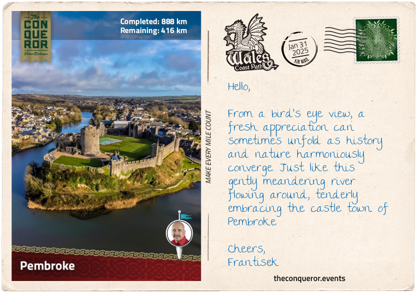
km od začátku : 0888
Pembroke
As I set foot in Pembroke, crossing the Northgate Street Bridge, I was struck by the thoughtful placement of picnic tables on the west side of the bridge, around the statue of King Henry VII, affording a stunning view of Pembroke Castle on the banks of Pembroke River. This medieval fortress, established in 1093 as a Norman motte-and-bailey castle, underwent a transformation under William Marshall. It was gifted to him by Richard the Lionheart, becoming a seat of power for the Earls of Pembroke and the birthplace of King Henry VII, founder of the Tudor dynasty.
William Marshall came from modest beginnings. Despite his noble lineage, William was the fourth son, decreasing his chance for an inheritance and leading him to find his own way. At eight, he was used as a hostage in a truce his father sought with the king. With his father breaching the truce, the king threatened to catapult William over the castle wall. Not wanting to follow through with his threat, the king imprisoned William for a few months. William began knightly training at 12, becoming a prosperous tournament champion with a reputation for chivalry and integrity. Marriage into nobility granted him the title of the 1st Earl of Pembroke.
Faithfully serving five kings in his lifetime, William's last charge was that of nine-year-old Henry III. Swearing an oath to the dying king that Henry would succeed to the throne, William, now 70 and concerned about his age, made a final promise that regardless of circumstances, he would never abandon the would-be king, proceeding to rule as a temporary regent until his death.
Passing peacefully in his sleep at 75, William was inducted into the Knights Templar order. Regarded as the 'Greatest Knight of the Middle Ages', his biography was released shortly after his death – a pioneering work chronicling the life of a regular man in the language spoken by the general public, marking a departure from biographies focused on religious figures written in scholarly languages like Latin.
After William's death, the castle passed on through a line of inheritance for the next 250 years up to 1389, when 17-year-old John Hastings died in a jousting accident without an heir. The castle changed hands many times, and during the Civil War of the 17th century, it was severely damaged. Losing its strategic and military importance, the castle was left neglected and in disrepair until the early 20th century, when efforts were made to restore and preserve it as a historical site.
I strolled down the main street and entered the local inn. Its dark forest-green façade was complemented by its rustic interior with copper pots and pans hanging from wooden beams and around a cozy open fireplace. Exuding a pleasant atmosphere, I poured over its menu. I was intrigued by the 'cockles, grilled bacon and penclawdd laverbread' as a starter. I'm told this mix of seafood (edible mollusks), smoky bacon, and the unusual flavour of laverbread (seaweed) reflect Wales' coastal heritage and traditional cuisine. I would happily follow this with a classic dish, the 'steak and Welsh ale pie'. This hearty dish consists of tender beef steak cooked in a savoury gravy infused with Welsh ale, a shortcrust base, and a flaky puff pastry top. Sounds good to me!!
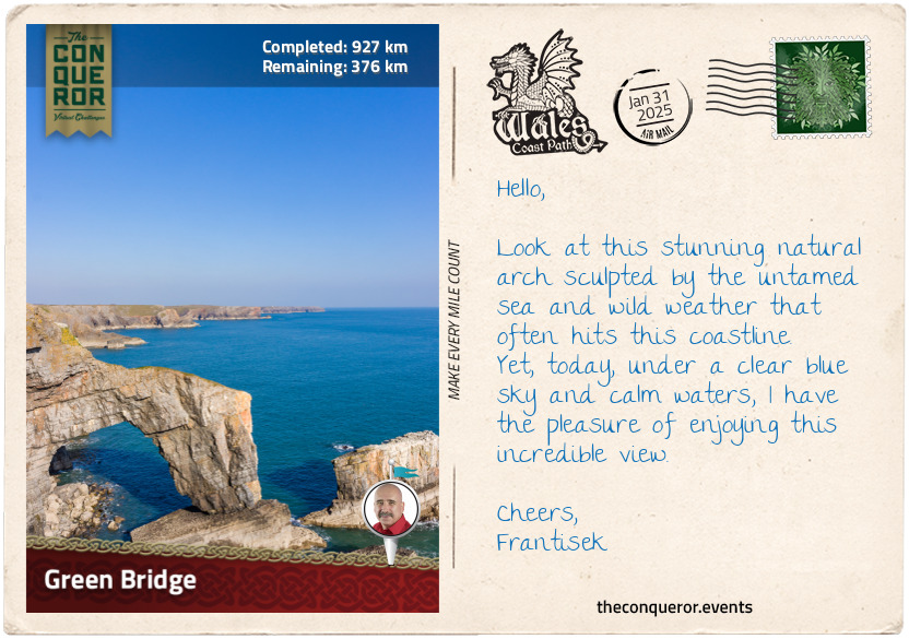
km od začátku : 0927
Green Bridge
It's a brilliant day, with blue skies and a subtle breeze brushing against my skin. I am ready to start my hike from Castlemartin. This village is mainly used as an artillery range for the British Army. Heading east to Warren, I swung south onto a narrow lane, walking past neighbouring houses until I reached a gate and passed through it. The trail seemed to be swallowed by an expanse of unruly vegetation. Thick, overgrown bushes reached out as if attempting to reclaim their territory. It felt like I was walking through a green tunnel obscuring my view of the landscape ahead.
As the grip of the thick vegetation loosened, the path opened up, giving way to expansive meadows, meticulously kept, bordered by clusters of trees far off into the distance. Arriving at a crossroads, I noticed a bilingual sign pointing to the Green Bridge of Wales. Crossing over, I ventured onto a paved pathway that cut a clear route through the countryside. Approaching a car park, I turned onto a wild field with a neatly mowed trail guiding me toward the sea. The trail ended on a viewing platform with picture-perfect views of the Green Bridge.
The Green Bridge is a limestone arch that spans a chasm, connecting the mainland to a towering rock stack. Over millions of years, the sea chipped away at the rock until the power of erosion carved caves and tunnels, forming this fabulous site. From the platform, I watched a brave soul navigating the thin, treacherous path atop the arch.
Not entirely comfortable with heights, I chose to walk past it and check out the stack rocks called Elegug Stacks, a pair of limestone pillars rising from the sea. Elegug is Welsh for guillemot, a noisy chocolate-brown seabird that lends its name to the pillars. Each spring, the tops of the stacks and the ledges below are crammed with guillemots nesting. Of course, the guillemots don't have exclusivity as they are closely joined by razorbills. Both species are descended from the extinct bird called the great auk.
I opted to rest and take in the views for some time while I planned the next part. Later, I will head to The Cauldron, a huge, expansive hollow caused by the relentless force of waves pounding against the coastal cliffs. This powerful action created a natural amphitheatre-like feature. When the sea is wild and the tide is high, I imagine the waves crashing against the rock face, splashing up as if inside a massive blowhole.
After The Cauldron, I will continue to St Govan's Head, the southernmost point of Pembrokeshire. On the way, I will take a slight detour down a steep flight of stairs to St Govan's Chapel. It is a tiny chapel amongst towering cliffs built by a hermit in the 6th century who took refuge there while hiding from pirates. Folk tales are abound in this place, but that will be a story for another day.
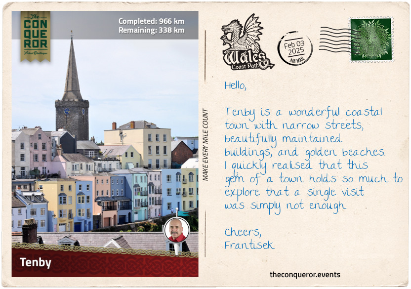
km od začátku : 0966
Tenby
Entering the town of Tenby, I was struck by the imposing St Catherine’s Fort situated on an island just off the mainland with an equally imposing sheer cliff face. Its rectangular design and solid masonry made it look forbidding as if its purpose was not only to protect the harbor but also to deter any potential threat. The fort was built in response to concerns about an amphibious invasion by the French. It was meant to be part of a chain of forts along the Pembrokeshire coast. However, only this fort was ever built, and it appears it never saw any action. The island is easily accessible from the gorgeous sandy beach during low tide.
Next, I hiked up to Castle Hill, where only a small tower of Tenby Castle remained. A manicured lawn surrounded the tower, and a bandstand stood to one side, providing shelter from the scorching sun or high winds. The views from here were fabulous, as the sea enveloped most of the hill. Gazing over the town, I was greeted by a row of pastel-coloured townhouses and a church spire stretching along the shoreline.
Leaving Castle Hill behind, I continued southeast. I followed the road downhill, the back uphill and turned onto Quay Hill, where I stopped to visit the Tudor Merchant’s House. This triple-storey stone house was built in the 15th century when Tenby was a busy commercial port. The merchant occupying the house conducted business on the lower floor, reserving the upper floors for his private residence. As the oldest house in Tenby, it was donated to the National Trust. Following restoration, the house was decorated with period furnishings and opened to the public, providing an experience of life during the Tudor era.
Inside, the main living room was adorned with painted cloths, one depicting medieval Tenby and the other featuring a ship from the Middle Ages. At the rear of the house was the kitchen with a large open fire where food would have been cooked in a cauldron. The kitchen had a table, benches, and a seat carved out from a barrel. Upstairs, in the bedchamber, was a four-poster bed and pew-like bench. The view from the window led directly to the coastline and harbour, a delightful scene to wake up to. All the furniture in the house was beautifully crafted and were locally sourced reproductions.
Tenby is a gorgeous coastal town with great beaches and a mix of medieval, Georgian and Victorian architecture. With its long maritime history, it invites deeper exploration, one that I am sure would fill many pages of writing. For now, I will indulge in a brief stroll before pressing on toward Rhossili Bay.
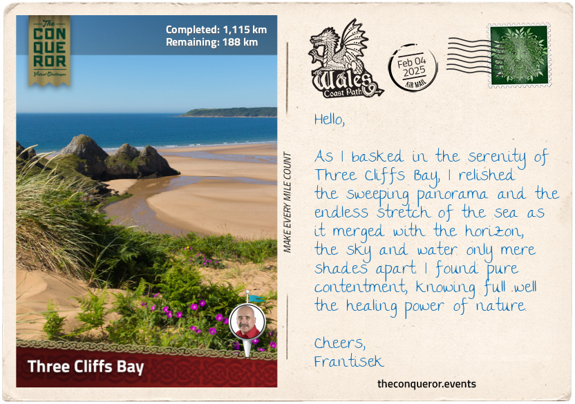
km od začátku : 1115
Three Cliffs Bay
This leg of my journey focused on the Gower Peninsula, a stretch of land that extends southwest into the Bristol Channel. Bordered by the expansive Loughor Estuary to the north and the sweeping Swansea Bay to the east, the peninsula is the UK’s first designated Area of Outstanding Natural Beauty (AONB). This special status recognises exceptional scenic beauty, and I couldn't help but appreciate the significance of this recognition.
The peninsula was a treasure trove of history, with no less than six castles scattered across its terrain. Loughor Castle, erected during the Norman conquest, stands atop a first-century Roman fort, whose remains are located beneath the town. An even older discovery occurred at Paviland Cave, where a 33,000-year-old male fossil was unearthed. Among the peninsula's landmarks are eight standing stones from the Bronze Age, including Arthur's Stone near Cefn Bryn, said to be linked to the legendary King Arthur but more likely a remnant of a Stone Age burial ground.
The trail led me past places like Penclawdd, famous for cockle harvesting, and the ruins of Weobley Castle overlooking the estuary and salt marshes. I then reached the westernmost tip of the peninsula and was greeted by the wild beauty of Rhossili Beach. Three miles (5km) of wild, surf-swept shoreline stretched before me, its golden sands framed by the steep-sided Rosshili Downs.
Venturing inland, I hiked through quaint villages and acres of farmland, eventually arriving in Oxwich, a small village known for Oxwich Castle. Constructed in the 16th century as a private residence, the castle faced disrepair by the 1940s and the threat of demolition before being saved by Cadw, the Welsh organisation devoted to preserving historic structures. Leaving the main road, I descended toward the beach, my gaze fixed on Three Cliffs Bay. The beach's compacted sand made hiking easier as I walked along its edge. The retreating sea, brought about by low tide, kept a fair distance.
Two prominent rock formations, Little Tor and Great Tor, came into view, both popular rock climbing destinations. Despite its small size, Little Tor boasted several climbing routes catering to different skill levels. Great Tor, the larger rock face, projected further into the beach and offered longer, technical routes spanning two levels. Over 40 different routes were available, though those from beach level were tide-dependent.
With the tide on my side, I walked around Great Tor, the sea breeze invigorating my senses. Soon, I found myself at the boundary separating Oxwich Beach from Three Cliffs Bay. A trio of majestic cliffs framed the bay along a pristine beach that regularly receives the sought-after Blue Flag Award.
As I stood there, waves lapping in the distance, I took my hiking boots off, rolled up my pants and bravely marched into the Irish Sea. The chilly water sent tingles down my feet as they adjusted to the cool temperature.
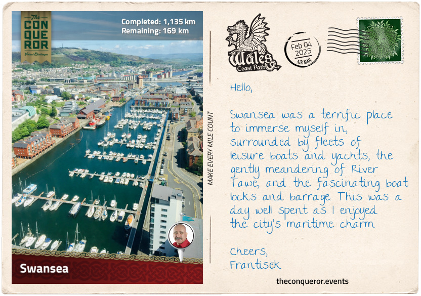
km od začátku : 1135
Swansea
After travelling most of the way through small villages, coastal towns, and seaside resorts, I had a sensory overload upon my arrival in Swansea. As the second-largest Welsh city, Swansea is an important economic hub for various industries, particularly finance, technology, education, and healthcare. The city is also home to the second-highest-ranked educational institution in Wales, Swansea University, where academic studies in engineering and technology, health and medicine, and arts and humanities are offered.
Swansea has a strong literary heritage and is closely tied to the renowned poet Dylan Thomas. Born in a house in the city's western suburbs, Thomas spent 23 years here, writing a significant portion of his published works before moving on.
The River Tawe weaved its way through the city toward the bay, flowing beneath the sleek pedestrian Sail Bridge and, a little further, the truss Trafalgar Bridge, named after the Battle of Trafalgar (c.1801).
The Trafalgar Bridge sits above a barrage constructed in 1992 to accommodate another marina. It features boat locks, spillways, fish passage and generators. The generator currently produces electricity for the National Grid and pumps water back into the river. A main concern at the time of construction was the impact on fish unable to swim upstream and the reduced oxygen in the water. To overcome this, divers installed machines that infused oxygen into the water, effectively improving the water quality. This success story extended to Cardiff, the capital city, which adopted the same measures to clean its water.
The waterfront has three marinas, where leisure crafts await their next maritime adventure. Stylish apartment complexes rise between the waterways, completing the marina development.
Strolling around the marina, I found myself at the National Waterfront Museum. It is an architectural marvel, a fusion of slate and glass that integrated a historic warehouse from the former Swansea Industrial and Maritime Museum. The museum showcases the country’s industrial journey through various exhibits, displaying items such as mining tools, textile machines, transportation relics that include a steam locomotive, and early innovations of communication devices like the telegraph machine. The museum is also a starting point for the European Route of Industrial Heritage, a tourist route focusing on Europe's most important industrial heritage sites.
My final destination was 5 Cwmdonkin Drive, the very birthplace of the renowned Welsh poet Dylan Thomas. As intrigued as I was about Thomas and his works, I was just as keen to delight in an offering of Edwardian-themed afternoon tea, where small bites of baked scones with cream and jam, Welsh cakes, and finger sandwiches graced the table along with hearty brew of Welsh tea served in antique china. Here, I could sit back, relax and envision Thomas crafting his latest pieces of literature, such as the iconic “Do Not Go Gentle into that Good Night”.
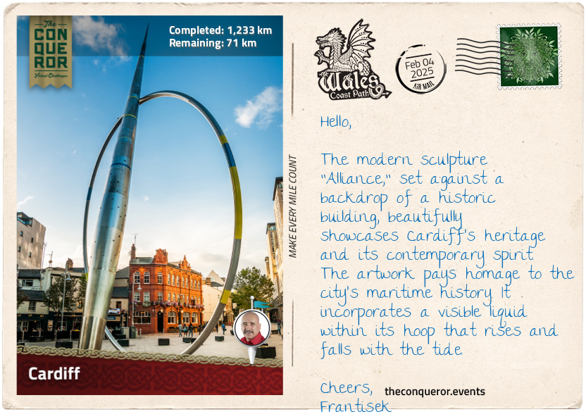
km od začátku : 1233
Cardiff
Vibrancy, modernity, and cosmopolitan flair weaved in with a long and storied history are how I would describe Cardiff, the capital city of Wales. A relatively young capital, Cardiff's official designation was in 1955, providing Wales with a definitive seat of government that was previously absent. The city's prominence came in the 19th century with the rise of the coal industry and its strategic location on the South Wales coast. Cardiff became the prime port for exporting coal. As the industry boomed, so did the city's growth and prosperity, making Cardiff one of the busiest ports in the world.
When Cardiff became a city in 1905, many important national institutions like the National Museum, National War Memorial, and Registry Building set themselves up there. Interestingly, the National Library picked Aberystwyth as its main centre because one of its founders felt Cardiff might not be Welsh enough.
When the coal industry declined, Cardiff pivoted its economy toward the financial sector, education, tourism, and services. The redevelopment of Cardiff Bay in the late 20th century rejuvenated the once-busy port. As I wandered around the waterfront, I contemplated taking a Ferris wheel ride for a scenic view from the top.
The waterfront was bustling with activity, filled with the humdrum chatter of café patrons and children squealing as they played. Amidst this scene, the Pierhead Building, with its vibrant red Victorian façade, is fabulously contrasted with the sleek modern lines of the nearby Millenium Centre, the city's iconic performance venue.
The waterfront is dotted with sculptures such as the Merchant Seaman's Memorial, a large bronze sculpture combining a sleeping head with a ship's hull, the statue of early 20th century Welsh arts performer Ivor Novello, and the Celtic Ring depicting maritime details associated with Cardiff's Docks. Cardiff is full of fascinating sculptures that any art enthusiast would thoroughly enjoy exploring by following the city's street art trail.
Bound north, I walked around the public plaza named after the endearing children's author Roald Dahl, who produced famous works such as Charlie and the Chocolate Factory, Matilda and Fantastic Mr Fox. I continued through the city centre, took a slight detour from my route, and visited Cardiff Castle for a dose of medieval history.
To capture its 2,000-year-old history would require an entire essay. Broadly speaking, the site began with a Roman fort (c.1st C), then a motte and bailey structure that overlooked the Castle Green (c.11th C), followed by stone fortifications and domestic buildings after that. The castle's transformation occurred in the 19th century when the 3rd Marquess of Bute, reputed to be the richest man in the world, began its restoration. Each room follows a theme, from Arabian-inspired decorations to a Roman-influence rooftop garden. The interior is an opulent display of richly detailed wall murals, frescoes, elaborate wood carvings, stained glass windows, gilded ceilings and more. The interior is a visual feast, filled with bold and muted colours, rich textures and delicate ornaments.
Popping into the nearby café for afternoon tea, I treated myself to a Welsh cake. This small round cake, no bigger than a saucer, looked almost like a cross between a scone, a pancake and a cookie. Where it differed was in its lovely crumbly texture.
Once finished, I will head for my final destination, Chepstow.
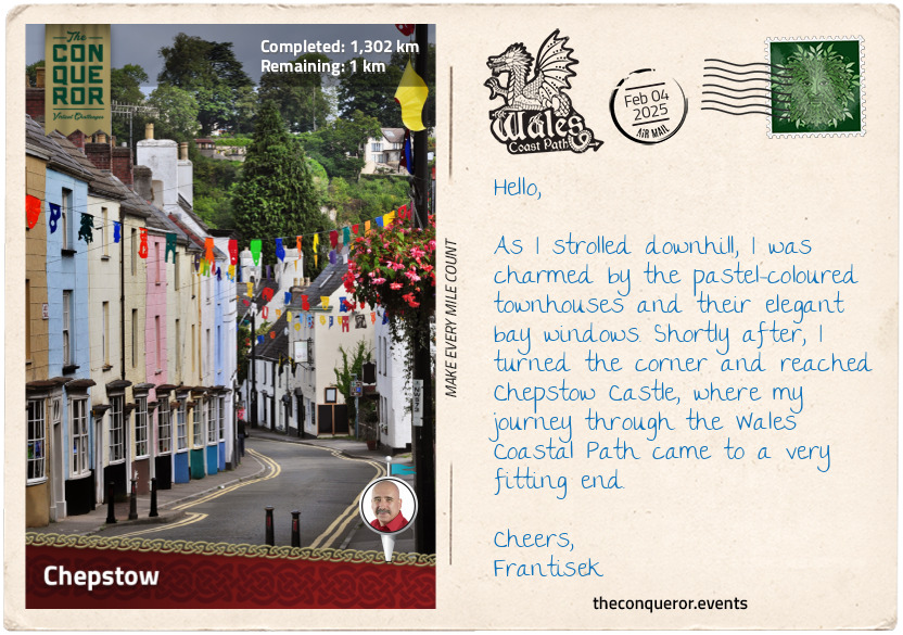
km od začátku : 1302
Chepstow
With a sense of finality, I arrived in Chepstow, the easternmost settlement in Wales, near the border of England. It is located on the doorstep of the Wye Valley, an Area of Outstanding Natural Beauty (AONB), and on the bend of the meandering River Wye. This marked the culmination of my Wales Coastal Path adventure. As I strolled through the town's narrow streets, I felt a deep sense of accomplishment, knowing that I had traversed the coastal landscapes of Wales to reach this destination.
The pleasant facades of the buildings in the town centre were a blend of Georgian townhouses and timber-framed structures. Large pots of greenery decorated the sidewalks while floral baskets dangled outside the local inn, offering a burst of summer colour.
Squeezed tightly between two buildings was the reconstructed 16th-century Town Gate. Only a stone's throw away were traces of the Port Wall, a defensive wall that once encircled the town and linked up with Chepstow Castle. Governed by a noble lord, taxes were imposed on the users of the town's market. To ensure payment of required tolls, the lord oversaw the construction of the wall and the Town Gate, serving as the sole entry point, becoming an essential part of this arrangement.
Once through the gate, I walked by the Castle Terrace, a delightful row of fourteen three-storied townhouses that backed onto Chepstow Castle. It was constructed in the early 1800s by unknown builders at a time when Chepstow was a thriving port town exporting timber. A unique building feature was the single front bay window on each townhouse, except for a few, creating a charming uniform look as I went downhill.
Rounding the corner behind the townhouses, I arrived at Chepstow Castle. It was built in 1067, making it Britain's oldest surviving stone castle. Perched on the cliff's edge, the layout is long and narrow, designed to fit onto a thin ridge between the valley and the river cliff. The castle's original wooden doors were groundbreaking, being the first time they were fortified with iron plates to withstand battery and fire. Currently on display inside the castle, the doors, at more than 800 years old, are recognised as the oldest in Europe.
This is the end of my journey, and as I ponder and reflect on Wales' identity, culture and diverse history, I am reminded of the Welshman's words I mentioned in the beginning, who also said, "…Wales is defined by its persistence more than anything else… it remains distinct in language, customs, folklore…" and then he aptly capped it off with this popular Welsh saying "Ry'n ni yma o hyd" which means "we're still here". Yes indeed.
km od začátku : 0004
ACME Corporation
The ACME Corporation stocks a diverse range of goods - from TNT to giant anvils - all the materials needed to construct elaborate, outlandish traps. Unfortunately, quality control at ACME is rather lacking, and the ingenious products in their catalogue tend to backfire, more likely to leave their operator with a face full of soot or catapulted through the air, than fulfil their intended purpose.
km od začátku : 0057
Road Runner's Traps
Wile E. Coyote’s cunning always seems to be his undoing. No matter how carefully he prepares his traps, and no matter how many guarantees he receives from the ACME company, Road Runner is always able to turn Wile's machinations back onto him, usually resulting in chaos, an injury or two, and worst of all, a wounded ego.
km od začátku : 0064
The Desert
The desert is the scene of Wile E. Coyote and Road Runner’s contest. Always on the lookout for his prey, Wile E. uses the vast open spaces, canyons, tunnels, and long roads as the base for his sneaky strategies. The only problem? The desert’s interstates allow Road Runner to hit top speed, zooming past Wile E.’s traps and frustrating his attempts at catching dinner.
km od začátku : 0090
Wile E. Coyote's Traps
Wile E. Coyote has ordered hundreds of traps and has meticulously set them up, waiting for long hours in the desert heat. He has poured all his attention, care, and sanity into catching Road Runner. Then, he hears the sound - Beep! Beep! Road Runner appears, there’s no chance of failure now. And then an anvil falls from the sky and flattens the coyote as Road Runner speeds off into the sunset.