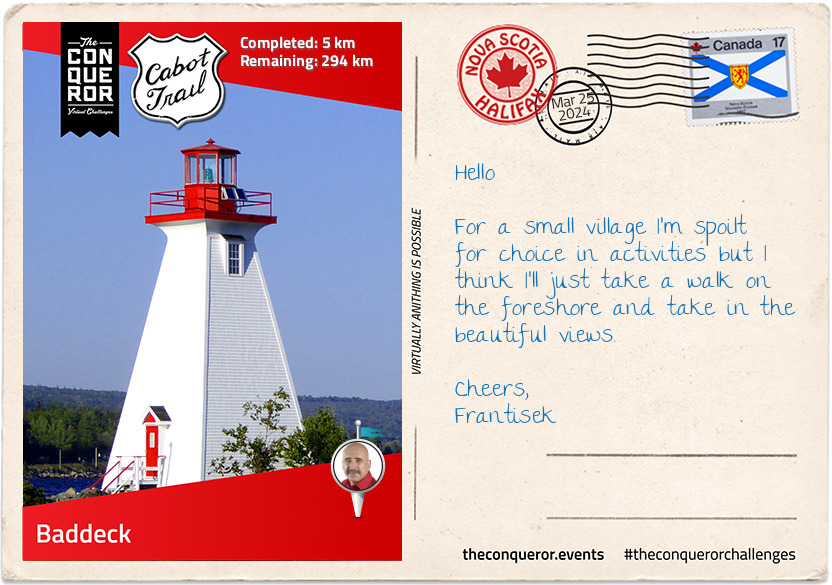
I finally made it to Cape Breton Island, Canada. Having crossed Canso Causeway from Nova Scotia I made my way to the township of Baddeck. Here I'll commence my Cabot Trail journey, a 298km (185mi) loop around the northernmost part of the island.
The Cabot Trail was constructed in 1932 passing through and along Cape Breton Highlands. It was named after John Cabot who is thought to have landed here in 1497 but historians think he most likely landed in Newfoundland instead.
Baddeck is the start and end of the Cabot Trail. It is a bustling resort community established in the mid-1800s as French and British Settlements. Today it is awash with festivals and events celebrating Aviation Day, Celtic Music Festival, relay races, Regattas and Ceildihs (Scottish/Irish folk music, singing, dancing and storytelling).
Baddeck is also a haven for golf enthusiasts, horseback riding and boat chartering. Baddeck sits on the northern shores of Bras d'Or Lake which is connected to the Atlantic Ocean making this large body of water both fresh and salt water. The lake is 100km (62mi) long and 50km (31mi) wide with six rivers emptying into it. Popular with summertime boating, there's a long-standing tradition of sailboat racing. Various yacht clubs host annual regattas and race weeks.
I'm told that Baddeck became a tourist destination after Charles Dudley Warner wrote a travel journal about his visit to the area in his 1874 publication of Baddeck, And That Sort of Thing. Although, I hear that many locals at the time weren't impressed with his description of the people as backward and simple. I may drop into the local library and have a scan of the book.
km od začátku : 0042
Tarbot, St Ann's Bay
I am making my way along St Ann's Bay on the east coast of the trail and it should probably be called "Artisan Coast" because from the tiny rural community of St Ann all the way up to Wreck Cove it is one long list of artisan shops, galleries and studios offering items made of clay, glass, leather, pewter, iron, paint, fibre and canvas.
St Ann is one of the oldest settlements in North America. It acquired its Gaelic roots when the Scottish Reverend Norman McLeod on his way to Ohio was forced ashore during a storm. He setup his ministry and was soon followed by boatloads of Scots from the motherland becoming the first Scots in St Ann. He eventually immigrated to New Zealand with many of his followers and his property in St Ann is today occupied by the Gaelic College of Celtic Arts and Crafts.
While I visited the Gaelic College, I came across another book called Letters to Mac-Talla from John Munro, A Cape Breton Gael in New Zealand 1894-1902, and it is a humorous compilation of 32 letters written home to Nova Scotia. Having lived for 40 years in Nova Scotia, together with 900 fellow Highlanders, John sailed to New Zealand where he spent the next 40 years. In his letters he wrote about St Ann's history, the Mi'kmaq (local indigenous people), first contact with Europeans, the French Occupation, the local flora and fauna along with his experience in New Zealand, the Maori and his fellow Scots.
The nearby Great Hall of Clan Museum took me on a journey of the early settlers from the Highlands of Scotland to their evolution into a Cape Breton way of life and Rev. Norman McLeod's journey from Scotland to St Ann to Waipu, New Zealand.
km od začátku : 0109
Ingonish
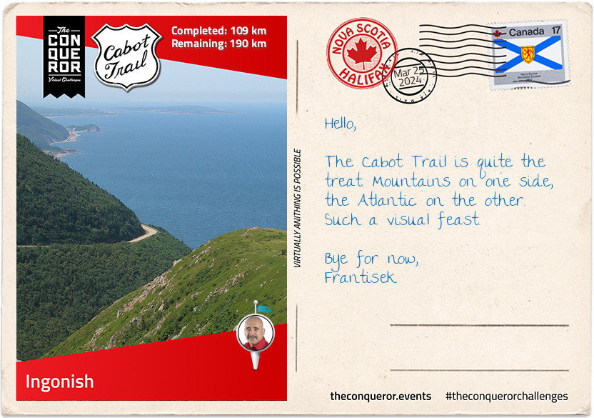
I made it to Ingonish on the north-east coast of Cape Breton. Made up of 5 small communities, their economy centres around tourism and fishing.
Golf seems to prevail and the nearby Highland Links Golf Course regularly ranks in the Top 10 golf courses in Canada. The Scottish influence is evident in holes named Heich O' Fash, meaning Heap of Trouble and Killiecrankie, which is a long narrow pass in the Scottish Highlands and played a significant role in the Battle of Killiecrankie during the 1689 Jacobite Rebellion. Many of the fairways resemble the Scottish topography but the original designer, Stanley Thompson, just called it his "mountain and oceans course" and established himself as the finest golf course architect in Canada.
Next to the golf course is Keltic Lodge which was originally built in 1910 as a summer retreat for the Corson family who owned the land at the time. When the Cape Breton Highlands National Park was developed the Nova Scotia government saw the value of the headland where the lodge was situated and purchased the land from the Corson's. By 1951 the new Keltic Lodge was constructed providing accommodation services to the area.
Just beyond the Keltic Lodge is the Middle Head Peninsula hiking trail. It is a 3.8km trail that follows a narrow peninsula with ocean bays on either side, finishing on headland cliffs overlooking the Atlantic Ocean with views of Cape Smokey Provincial Park to the right and Ingonish Island to the left.
For any ocean enthusiast there is a unique opportunity to swim in both freshwater and saltwater in the same area. At Ingonish Beach the saltwater is off a white sandy beach on one side and the other is the freshwater swimming hole created by waves piling up rocks creating a barrier which then cornered off a cove from the ocean and over time filled with freshwater.
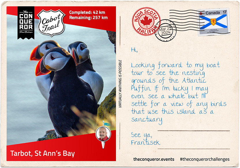
Alternatively, if you don't feel like a swim a boat cruise during the summer months provides for excellent opportunities to see various types of whales, dolphins, seals and puffins.
km od začátku : 0170
Pleasant Bay
On my way to Pleasant Bay, I took a little detour off the main road to explore the Lone Shieling, a Scottish-style sheep crofters hut built from "irregular field stone with a timber and thatch roof". The land it sits on was donated to the Province and the benefactor expressed a wish to have the hut built in the "same design or plan as the lone shieling on the Island of Skye, Scotland". The hut, built in 1942, is now a Recognised Federal Heritage Building.
Pleasant Bay may be small with less than 300 residents but it's widely considered as the halfway mark on the Cabot Trail, however, it is even more widely known as the whale watching capital of Cape Breton. Whale watching enthusiasts come from all over the world to capture a sneak peak of humpbacks playfully breaching, the 100 tonnes blue whales, the endangered North Atlantic right whales or the pilot whales that like to get up close to boats and show off their acrobatic skills.
North of Pleasant Bay via the coast is an arduous 10km hike to Pollett's Cove, a one kilometre long beach at the base of a valley that was forged by the confluence of two rivers. The cove was a fishing community in the early 1830s that at its height housed 9 families. A hundred years later the area was abandoned and by 1947 the remaining buildings were destroyed by wildfires. The Cove was originally a Crown grant to the MacLean family in 1861, who then passed ownership to the McGregor family in 1873. The 2007 unsuccessful sale of the land to the government due to price disagreement was eventually purchased for an undisclosed sum by a local lottery winner. It seems that so far, the new owner has continued to allow Cove access to hikers.
km od začátku : 0236
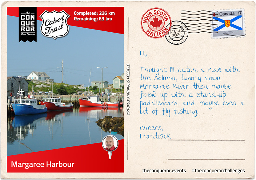
Margaree Harbour
I travelled through Cheticamp on my way to Margaree Harbour. With nearly 4,000 residents and public facilities, Cheticamp services much of the northernmost parts of Cape Breton Island. Cheticamp also makes up the largest Francophone enclave on the island. Whilst the economy traditionally centred around fishing, as demand declined Cheticamp now increasingly relies on tourism and in recent years exhibiting and demonstrating traditional rug hooking.
Margaree Harbour is part of a number of surrounding communities. Many of them named a different version of Margaree. There's Margaree Valley, Margaree Forks, South / East / North-East Margaree altogether referred to as The Margarees.
The communities are dotted along Margaree River with the earliest settlement dating back to 18th century by Acadians followed by the Scots in the 19th century. Split into northeast and southwest branches, the river meets at Margaree Forks and spills into the Gulf of St Lawrence. At 120km long Margaree River is well known for its trout and Atlantic salmon. Anglers from near and far arrive to fly fish throughout the year. During salmon season (June to October) catches can way up to 5.5kg and if particularly lucky it is not unheard of to catch salmon weighing up to 18kg.
However, don't dream of salmon on the dinner table any time soon. As part of the island's conservation practices salmon fishing is catch & release only. However, if you want to catch your dinner the Old Miller Trout Farm U-Fish stocks its ponds with trout. Catch your own fish, pay by the kilo for your catch and cook up a storm with some nicely baked or grilled fish for the table.
Before I head back to Baddeck, I will take in some of the Margaree culture. A blend of Scots, Irish, French-Acadian and British who preserve their old ways through song and dance, arts and crafts and maybe even a little wee dram may just be what I need before I finish my Cabot Trail adventure.
Perhaps John Demont describes the Margarees best.
"It can be a disconcerting thing to stand in Nova Scotia's Margaree River Valley on a clear August night. For if it's possible anywhere to inhale the distilled essence of a single place, it is here, where even a jaded city dweller can experience Cape Breton Island's peculiar soul and overwhelming grace."
km od začátku : 0299
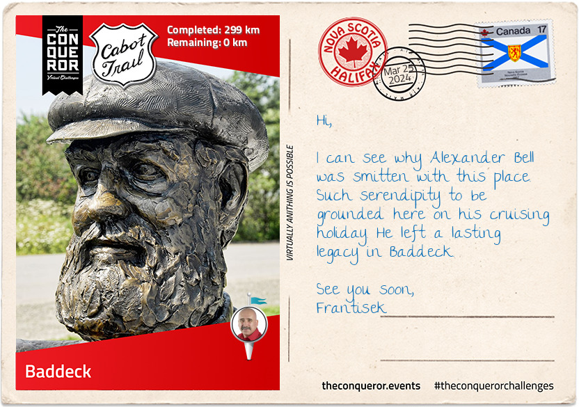
Baddeck
I have reached the end of my journey. Cheers to that I say or better yet "Slàinte" as they say in Scottish Gaelic. This was a splendid mix of cultural diversity, artistry and nature. Music and dance are a way of life with festivals aplenty.
One final stop before I depart at the Alexander Graham Bell Historic Site where they pay homage to his inventions and his life-long pursuit of knowledge.
The story goes that in 1885 Bell was on a summer cruise with his wife when the boat ran aground on the way to Newfoundland and had accidentally discovered Cape Breton. Enthralled with the location, Bell built his summer home "Beinn Breagh" where he spent many summers working on his aircraft Silver Dart and hydrofoil boat which set a world watercraft record of 114km/h (71mi/h) in 1919.
In 2010 during Baddeck's centennial, Canada's telco company, Bell Aliant, gifted a bronze statue of Alexander Bell and his wife, Mabel, as part of Canada Day celebrations. Peter Bustin of Halifax was the sculptor of the statue. The statue sits on the waterfront overlooking the family home, Beinn Breagh.
I'm looking forward to returning home and regaling you with my Cabot Trail adventures.