Welcome to Hadrian's Wall (the Wall), where you will begin your 90mi/145km journey following in the footsteps of the Roman Empire. Beginning in Wallsend on the River Tyne and ending at Bowness-on-Solway, the Wall was a defensive fortification of the Roman Province of Brittania. Construction began in 122AD, during the reign of Emperor Hadrian, marking the northernmost boundary that separated the Roman Empire from the Celts and the Picts. Hadrian's Wall was admitted to the UNESCO World Heritage Site list in 1987.
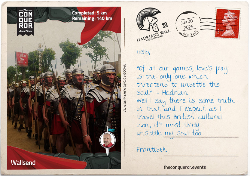
As you take off from Wallsend, start your walk at Segedunum, the ancient remains of a Roman fort. Whilst little remains on site today, imagine that at its peak, up to 600 Roman troops, a combination of cavalry and infantry, were garrisoned here. It is thought that the fort remained occupied until early 400AD when the Roman troops were withdrawn from Britain. The fort was eventually demolished to make way for terrace houses in the late 1800s, which were then also demolished, making way for what is left today and preserved as a historical site.
A small town of about 10,000 people, Wallsend is steeped in the history of shipbuilding and is best known for the shipyard that built RMS Mauritania, the express liner that kept the fastest Atlantic crossing record for 22 years and RMS Carpathia, which rescued the Titanic survivors in 1912.
km od začátku : 0027
Heddon-on-the-Wall
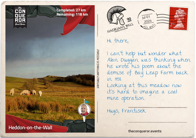
The small village of Heddon-on-the-Wall and its 1500 inhabitants is home to the longest surviving section of the wall, which was built to its original width of 3m (9.8ft). Known as the Broad Wall, this surviving unbroken section of the wall is 100m long. It is assumed that in order to save on resources and funds, the construction of the wall was reduced in width quite early on to 2.5m (8.2ft) and sometimes even as narrow as 1.8m (5.9ft) wide.
At the turn of the 20th century, Heddon was largely a farming village until 1.2 million tonnes of coal reserves were discovered in the late 1950s. The Bays Leap opencast site emerged, covering nearly 300 acres and remained in operation until 1965, when the area was restored and returned to farming.
The original Old Bays Leap farm was a very productive farm until it was bought out in 1957, along with Town House and Heddon Mill, to make way for coal mining. The Bays Leap Farm was rebuilt in 1966 and continues to exist today as a dairy farm and for raising cattle.
To Historic England's delight, in March 2019, builders excavated a site for a new housing development and discovered a new section of the Wall which has since been excavated and preserved.
The nearby hedges and fields are home to a variety of birds that change with the seasons. In winter, listen for the greenfinch and chaffinch. Once spring rolls on, the skylarks sing, and kestrels hover over their prey. By summer, the common whitethroat arrives to breed before moving on to the southern hemisphere for the winter. Bay Leap poem by Alan Duggan 1958.
km od začátku : 0053
Chollerford
As you make your way to Chollerford, you will pass the roadside cross erected in commemoration of the 633-4AD Battle of Heavenfield, a war waged by an invading Welsh army against a Northumbrian army. The battle was heavily favoured towards the Welsh with its larger troop until they were "hemmed in and unable to outflank the Northumbrians". Sensing their loss, the Welsh fled south with the Northumbrians hot on their heels.
A little further down the road, you'll come across the Planetrees Roman Wall. Named after a nearby farm, what remains now is a result of William Hutton's intervention back in 1801 when he witnessed a local removing the Wall stones in order to build a farmhouse. When William visited Planetrees, he expected to see 204m (672ft) of the Wall. Unfortunately, by the time he arrived and intervened, a mere 35m (114m) was left, which survives today.
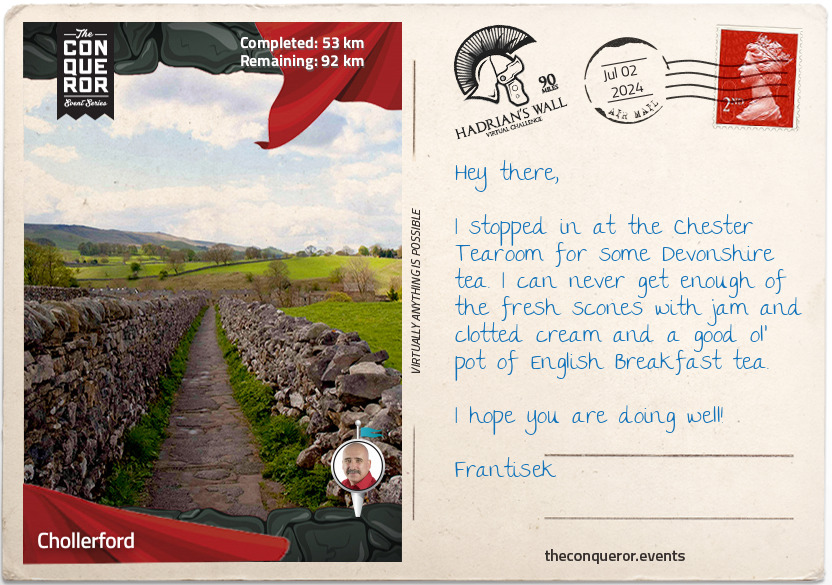
The village of Chollerford is accessed via an 18th century multi-arched stone bridge where at Chester Roman Fort, you will experience the most complete Roman cavalry fort with views over the River Tyne. Chester Fort held a garrison of up to 500 cavalry troops that lasted nearly 300 years.
The nearby Clayton Museum exhibits a collection of Roman artifacts that were discovered and excavated by antiquarian John Clayton during the 19th century. The museum first opened in 1896, and although recently updated, it continues to use many of the original Edwardian display cabinets.
km od začátku : 0070
Housesteads Roman Fort
Vercovicium, as it was once known as, was a powerful power base of the Roman army. The name itself translates as "the place of the effective fighters". Today the fort is known as Housesteads. Uninterrupted views along Hadrian's Wall ensured excellent visibility for potential attacks.
One of the best-preserved examples of Roman Forts in Britain, Housesteads was garrisoned by a mix of infantry and cavalry. Intended to hold a regiment of 800 men, the military cohort was largely recruited from The Tungrians, a German-speaking tribe from what is now modern Belgium.
Taking up 2.2 hectares, the fort was well stocked with granaries, a Commander's house, barracks blocks, a hospital and even communal toilets, making them self-sufficient and secure in their outpost, whilst a civilian settlement sprang up outside the curtain wall.
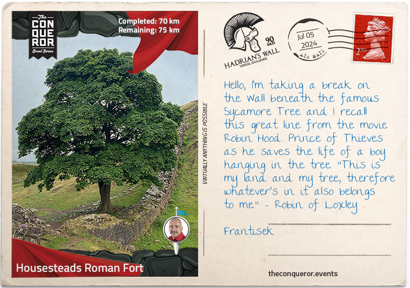
A short distance from Housesteads is the Sycamore Gap Tree, the most photographed tree in the country and the winner of the 2016 England Tree of the Year Award. This spectacular sycamore tree is set in the dip of a rocky outcrop that was formed due to melting glacial waters. A few hundred years old, it stands alone beside Hadrian's Wall. It came to fame in the 1991 film Robin Hood: Prince of Thieves and, as a result, was nicknamed "Robin Hood Tree". Sadly, the tree was felled overnight in late September 2023, and the image above captures its majestic beauty before its untimely demise.
km od začátku : 0090
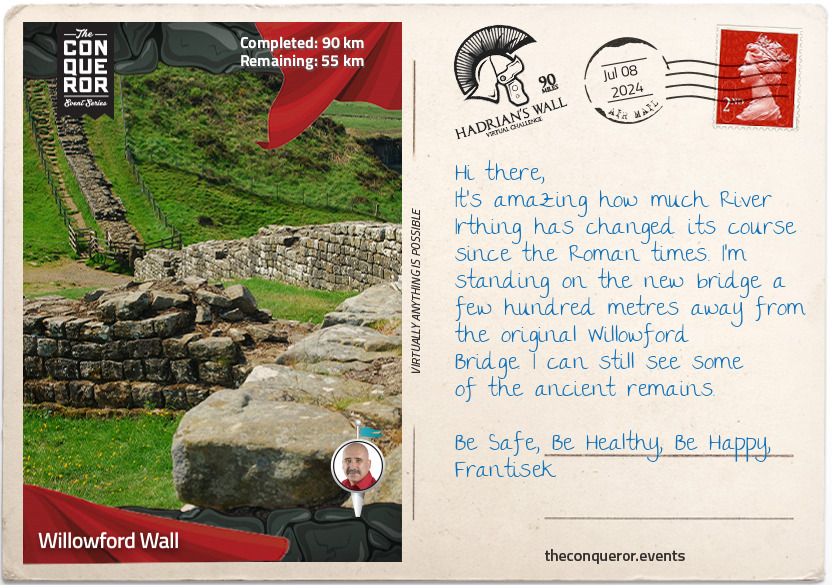
Willowford Wall
On the way to Willowford Wall are the ruins of Thirlwall Castle, a 12th century castle built by John Thirlwall that was later fortified using the stones from Hadrian's Wall. It fell into disrepair by the 18th century and was later abandoned until 1999, when it moved under Northumberland National Park Authority management, protecting it from further decay and making it available for public access.
Willowford Wall is largely known for its two turrets and bridge abutment that carried the Wall across River Irthing. What makes this place fascinating is the irregular application of its original design. When the building began, the first 3-4 layers of stone were at a broad gauge of 3m wide, alongside the abutment and turrets, however, before completion, the Wall width was reduced to 2.2m. What's assumed is that the foundations, turrets and abutment were built independently and separately from the superstructure, and the decision has been changed about the width of the Wall after the foundations have been set.
The original bridge of stone arches was only wide enough to carry the Wall and had a walkway along the top of it. A flood washed the bridge away, and was rebuilt with a timber span in place of the fallen arches. In the second century, it was widened to take a road across it, and by the 4th century, the stone blocks were removed to repair parts of the Birdoswald fort 400m further down the Wall.
Birdoswald is the first site where the Wall was built entirely out of turf. Although the fort initially began as a turf and timber structure, it was never completed, and a stone fort replaced it. Sitting on 2.1 hectares and one of the largest forts on the Wall, its uniqueness lies in its continued occupation well into the 17th century, as evidenced by unearthed foundations of a bastle house (c1650) and traces of a tower house (c1400). The longest-lasting legacy left at Birdoswald was made by the Dacians (present-day Romania), who were recruited by the Roman army. Hadrian's own 1,000-strong unit, the Dacians left inscriptions at Birdoswald of their curved sword known as falx together with a palm frond.
km od začátku : 0145
Bowness-on-Solway
You've reached the end of your journey at Bowness-on-Solway, a tiny village of 1,000 residents. Situated on a headland, the village overlooks Solway Firth, which separates England and Scotland.
A railway viaduct, a mile long (1.6km), was constructed in order to freight hematite from Cumbrian mines to Scottish iron works. Built on 193 piers, the viaduct was an unsuccessful financial venture and in 1880, due to ice floes, 45 of its piers collapsed. Although the viaduct was repaired and continued operating till 1921, it was eventually closed down and dismantled. The bridge was purchased for dismantling, and the materials were repurposed. Interestingly some of the materials were used by the Japanese in the Sino-Japanese War. Today you still see some of the bridge piles jutting out on the embankment.
A humorous feature of St Michael's Church which is located on the Bowness headland is its 2 bells that were stolen from the Scots as revenge for having their original bells taken by Scottish raiders in 1626. The church itself dates back to the 12th century, and it was built using the nearby Hadrian Wall's sandstone. It continues to be an active church today.
To celebrate the completion of your journey, have a rest at The Kings Arms Inn, a family-run pub with home-cooked meals.