Run Forrest Run
Řekl jsem si, že když už jsem tak daleko, otočím se a poběžím dál.   

Dnes je : 14.10.2025 - 01:10:56
Forrest Forrest Forrest    Jarmila Kratochvílová Emil Zátopek    No Humans Is Limited Eliud Kipchoge

Postcard : Kokoda Trail

Obrázek

km od začátku : 0002

Kokoda

Located north of Australia’s mainland is the third largest island country in the world, Papua New Guinea. Its capital, Port Moresby, is on the island’s south-eastern coast. With a population of eight million people, Papua New Guinea (PNG) has 851 known languages making it the most linguistically diverse country in the world. The majority of its people live in remote villages with only 13% of its population located in urban areas. Administered by Australia from the early 1900s, Papua New Guinea gained its independence in 1975.

During World War 2 a series of land battles were fought from July to November 1942 between Australia and Japan. The objective for the Japanese was to capture Port Moresby to take control of Papua and have a base from which to attack the Australian mainland and isolate them from the United States. Their strategy was to advance from the north coast through the Kokoda Trail and over the Owen Stanley Mountain range. The battle for the Australians was extremely difficult. Australian troops consisting of 2,000 soldiers were up against 10,000 elite Japanese troops who were determined to capture the capital.

The battle conditions for both sides were appalling. The Kokoda Trail was a narrow, single dirt track with steep climbs up mountains, followed by steep descents into deep valleys. Surrounded by dense jungle, movement was slow, exhausting and all on foot. Heavy equipment, ammunition and supplies had to be carried and when it rained – daily rainfall of 10in (25cm) was not uncommon - the track turned into calf-deep mud. If this wasn’t hard enough, add mosquitoes, leeches, heat and humidity to the already rain-drenched soldiers. Food supply was limited, a cup of tea or coffee was often just a dream.

Along with hundreds of hikers who walk the trail every year, I embarked on a journey to test my mettle and to honour the soldiers who battled in this campaign. My trek began in the town of Kokoda on the north side of the track where on the edge of a grassy oval were four white memorial stones, dedicated to those who fought here. At the edge of the village, I crossed beneath a set of arches that marked the official start of the Kokoda Trail.

From here I will be heading up the mountain for nearly 50% of the trip and descending for the remainder of the trek to Owers’ Corner. Steep elevation changes, numerous river crossings, deep vegetation and plenty of bogginess awaits.

Without further ado, I headed into the jungle.

Photo © Jonty Crane


Obrázek

km od začátku : 0017

Isurava

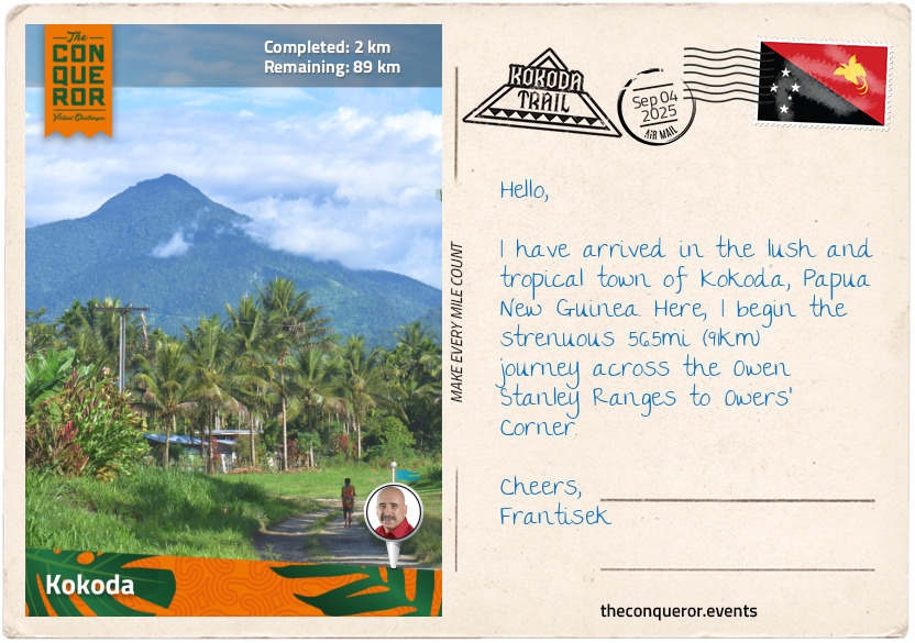
My trek to Kokoda began at an elevation of 984ft (300m) above sea level. Heading up an old tractor track, through a rubber plantation, after only 2mi (3.5km) I reached Kovelo Village located in an open clearing with houses scattered around the edges.

After a brief rest, I entered the jungle via a single track and began climbing. A mist hung over the jungle, making the tropical heat more bearable. Densely forested, the track was wet but at least it wasn’t boggy. I could feel the elevation gain. Every now and then, I would stop to rest my burning calves.

Surfacing from the jungle into another clearing, I arrived at Deniki, a small village that sat at an elevation of 2,624ft (800m). Being on higher ground, Deniki opened to views of Yodda Valley on the north side of Owen Stanley Ranges and the Kokoda airstrip in the distance.

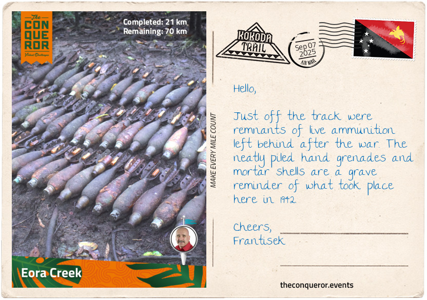
In late July 1942, Kokoda was the scene of a number of small but intensely fought battles. The Australians (Aussies) were waiting for reinforcements to be flown in but upon hearing that another Aussie company was overrun in Oivi (north of Kokoda) they gave up Kokoda and retreated to Deniki. They returned to Kokoda the next day with a force of about 80 men but once the Japanese were reinforced, they attacked the Aussies the day after. The Aussie troops withdrew yet again to Deniki. Joined by other companies, the Aussies tried to take Kokoda once again but were unsuccessful. Tired and short of food, by mid-August the Aussies withdrew to Isurava. It would take another three months (until November 1942) before the Aussie forces returned to Kokoda during their counter-offensive.

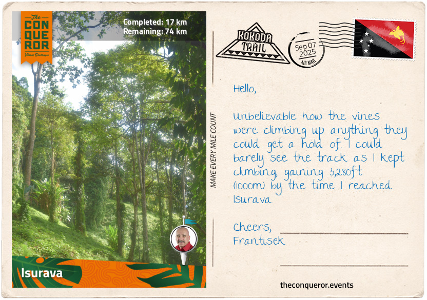
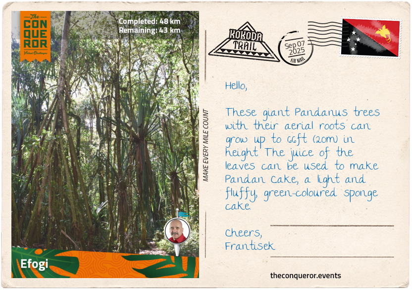
Okari trees grow around Deniki. They are a small mid-canopy tree with edible nuts very similar to almonds. Tucking a couple of them in my pocket, I pressed on and wondered at the same time at the massive vines taking over the abandoned native gardens. As I climbed up a steep, mostly clay track, I saw more vines spreading through the jungle and up the trunks of trees, seemingly wanting to conquer all plant life.

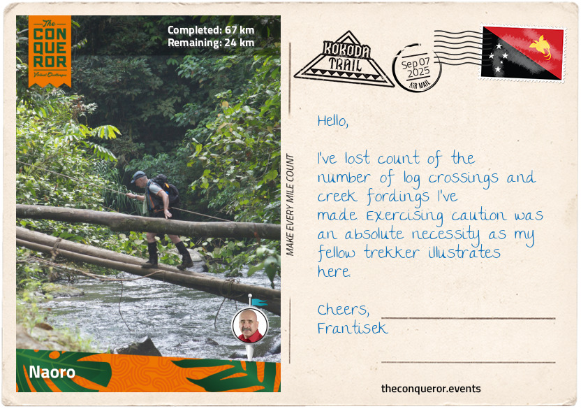
The trail continued on its upward trajectory, with several creek crossings and a couple of false peaks before I arrived at Isurava Village, the site of the Battle of Isurava, where Australian forces resisted the Japanese offensive. Up against machine-gun fire and hand-to-hand combat, the Japanese broke through the Aussie right flank. An Australian attack party countered when Private Bruce Kingsbury, shooting from his hip, charged the Japanese, either killing or scattering them, giving the Australians sufficient time to regain control and stabilise their position. Mortally wounded by a sniper, Kingsbury was awarded the Victoria Cross, Britain’s most prestigious award for valour “in the presence of the enemy”. In 1991, Australia established its own Victoria Cross award.

The Isurava Memorial was opened in 2002, commemorating those who died on the track in 1942. The circular Memorial consists of four black granite sentinel stones, each inscribed with a single word - Courage, Endurance, Mateship, Sacrifice - representing the values and qualities of the soldiers. Incorporated into the Memorial is Kingsbury’s Rock, the location where Kingsbury died.

Holding these four words close to my heart, I took some time at the Memorial, pondering the battle and the men who fought it.

Photo © Jonty Crane


Obrázek

km od začátku : 0021

Eora Creek

A short distance after Isurava was a rest house where the Aussie troops took a defensive position. Slightly to the south of the house was a sizable flat-topped rock, just big enough to lay down a soldier with his feet protruding, that is now referred to as Con’s Rock or Surgeon’s Rock. Under minimal light, it is on this rock that Medical Orderly Con Vapp performed an emergency amputation on an Aussie soldier. The wounded soldier’s name and if he survived remains unknown. Many wounded soldiers had to travel over 44mi (70km) under their own strength to get medical assistance in Port Moresby. The seriously wounded were moved by local native carriers. It would take eight carriers to carry one soldier the full distance.

Above the rock was a plaque dedicated to the memory of Butch Bissett who died in the arms of his brother Stan Bissett. Butch was handing out grenades to his unit when he was shot. Stan was an intelligence officer and survived the war. Nearby was a neatly piled collection of rusty live ammunition - hand grenades and mortars – along with helmets, water flasks and a coil of signal wire. The ‘Do not touch’ advice from the guides seemed rightfully good advice.

The terrain was undulating with vines spreading through the jungle like a rug, followed by several steep uphill motions until I reached a small waterfall and crossed one of the many log bridges. The route was riddled with protruding roots; surefootedness was necessary and using hiking poles helped keep my balance. I came out into a clearing and reached the village of Alola.

Continuing on, the track descended for about 656ft (200m) where I crossed a creek over a beautifully arched sapling and vine bridge, then the ascent began again before it levelled out a bit all the way to Eora Creek. The log crossing here was 62ft (19m) long and somewhat precarious as the Eora is a raging river all year round. Log bridges often get washed away over winter and the locals have to rebuild them each year before the trekking season commences.

A small bronze plaque sat in a clearing describing the two battles fought here. In early September, over two days the retreating Australians successfully defended their position, allowing them sufficient time to fall back towards Port Moresby. Then in mid-October, the Japanese during their retreat dug themselves a solid defensive position. From higher ground, nine artillery units rained fire onto the advancing Australian troops, resisting their frontal attacks. It would take the Australians six days to overcome the Japanese. Once the Japanese found themselves nearly encircled, they abandoned their location and retreated back to Oivi (north of Kokoda).

The Eora Creek Village now lies abandoned with a few rusty pieces of ammunition as evidence of the tough battle fought here.

Photo © Jonty Crane


Obrázek

km od začátku : 0027

Templeton's Crossing

The next round of hiking was extremely difficult. Each short section of the steep climb made me think I had reached the peak of the mountain, only to find out that there was another peak up ahead. The continuous false peaks, burning calves and tight thighs felt eternal. This section of the trek is home to numerous leeches. These very thin black worms like to attach themselves to humans, get their fill until they’re fully bloated and then fall off, many of us, and I’m sure especially the soldiers, found these parasites aggravating. With my long pants tucked into my boots and a good dose of mosquito repellent on - apparently, they hate the chemical DEET in it - I pushed on until I made it to the actual peak of this section of the mountain. I gained 5,249ft (1600m) of altitude since I left Kokoda and I was standing at an elevation 6,266ft (1,910m). However, this wasn’t the highest point on this journey. That was yet to come.

Descending again through swampy creeks, the trail was slippery and boggy, making it hard on the knees. A couple of times, I had to climb over big fallen tree trunks, but I took the time to appreciate the beautiful red foliage of the Cordilyne Fruticosa as it dotted itself amongst the green jungle.

I arrived at Templeton Crossing and just like Eora Creek, it was the site of two separate battles. The retreating Australians fought a short battle in September, but the bigger battle was during the counter-offensive in October.

Although ordered to withdraw, the Japanese were still very keen to capture Port Moresby. With well selected positions at Templeton, they lay in wait for the advancing Aussies. Not seeing the camouflaged machine gun muzzles until it was too late, the Aussies suffered severe casualties until they came back with fresh troops and managed to dislodge the Japanese and push them back to Eora Creek.

Crossing yet another river, I climbed onto the single plank bridge and held onto the single rope, slowly and carefully walking over it. Once on the other side, I took a load off, had a bite to eat, refreshed myself and mentally prepared for the steep climb to the highest point on this trek.


Obrázek

km od začátku : 0048

Efogi

The climb up to Mount Bellamy was so steep in some places I thought I was walking vertically. The ground was very muddy and slippery. The small brown snake slithering across the path just added to the mental challenge, although I’ve been reassured that it was not poisonous. Of the 100 snake species in PNG, 53 are poisonous, never mind the spiders, scorpions, wild bees, and numerous other critters making the jungle their home. I know I’d prefer to see PNG’s national bird, the Raggiana bird-of-paradise, with their fantastic reddish-orange plumage and long tail feather or Queen Alexandra’s Birdwing, the world’s largest butterfly - it has a wingspan of 12in/30cm, 10 times larger than the average butterfly.

Anyway, I managed to stay upright, not burying myself in the mud and with a great deal of elation reached the highest point on this journey, Mount Bellamy’s summit of 7,185ft (2,190m). I cannot fathom the difficulties the soldiers endured carrying supplies or the stretcher bearers carrying wounded men.

Having made it to the highest point, I thought I was on the home run, but what went up had to come down. The incredibly steep descent was eye-watering. Though the track was drier, I felt the load on my knees, and I needed to be wary of the kunai grass flanking the trail before Kagi Gap. This perennial grass has a fluffy white, cylindrical flower but it is the sharp blade-like edges of the grass that is of concern as it easily cuts the skin. The leaf has silica crystals embedded in its finely toothed margins and as the soldiers moved through the trail it would tear through their clothing, slashing their skin.

As I exited the forest into the open grassland, I could see Kagi Village downhill in the distance and after a descent of 2,296ft (700m) I walked into the village. I stopped long enough to refresh myself and pushed on further downhill on an even steeper track until I reached a small creek at an elevation of 3,215ft (980m). After another log crossing, I was back up a very steep ascent. The track opened up into a clearing and into Launumu Village.

A small Japanese monument was raised in the village by Corporal Nishimura who was the sole survivor of his troop of 42 men. He survived by hiding in a hollow tree stump for two days. He pledged that he would return to release the spirits of his men and he did so 37 years after the war.

After another steep descent, I entered Efogi, a large village with a population of 350 residents. It was kitted out with both a primary and secondary school, a health centre, and a communal campsite.

Making my weary muscles as comfortable as possible, I settled in my tent and fairly swiftly dozed off, fitfully dreaming about the next significant downhill trek.

Photo © Jonty Crane


Obrázek

km od začátku : 0067

Naoro

Following a short descent, I hiked up a very steep section, hugging the mountainside before the track became “just” steep. I emerged onto the grassy ridge of Brigade Hill. The biggest battle of the campaign was fought here in early September. Brigadier Arnold Potts decided that Brigade Hill was an excellent defensive position due to its high ground. He set up his headquarters near a knoll and had three infantry battalions, spread apart on the opposite side of the hill on Mission Ridge. This strategy created a weakness which the Japanese exploited by infiltrating the line and cutting Potts off from the rest of his troops. Suffering heavy casualties, Potts ordered a withdrawal. The retreat was disorderly, with one of the units finding themselves deep in the jungle, taking weeks of trudging before they reunited with their comrades.

During the campaign the mountain ridge was forested but today it was cleared for a campsite and a very simple war memorial that consisted of a plaque and several rows of sapling trees equally distanced, representing each Australian who died defending the hill.

From Brigade Hill there was an extremely steep and tiresome descent dropping 2,296ft (700m) of elevation, placing a significant amount of pressure on all the major muscles in the legs and the glutes.

Another log crossing later, I walked into Menari, a village where Potts’ troops withdrew to. It was also the site of a famous photo of the 39th Battalion taken after weeks of fighting in the dense jungle. The photo became the cover of the book, Those Ragged Bloody Heroes by Peter Brune.

A steep climb up to the saddle was rewarded with views back to Menari and the nearby peaks of Mt Tamata and Mt Victoria. The final descent was met with swampy terrain, where the trail was difficult to follow. Reaching the wide Brown River, the typical tree logs used for crossing were under water in several sections. Removing my boots and socks whilst standing on the muddy bank was a fine balancing act. Holding onto a rope, I made my way into the fast-flowing river and cautiously moved through it until I reached the other side of the bank.

With my boots back on, I trudged through the swampy track. With each step, my boots sunk into the muddy holes, the excess water spilling into my shoes and wetting my socks. I carried on until I finally reached Naoro where I cleaned myself up, gave my boots a good scrubbing and put them out to dry. Exhausted, I passed out into a deep sleep. No dreaming this time.