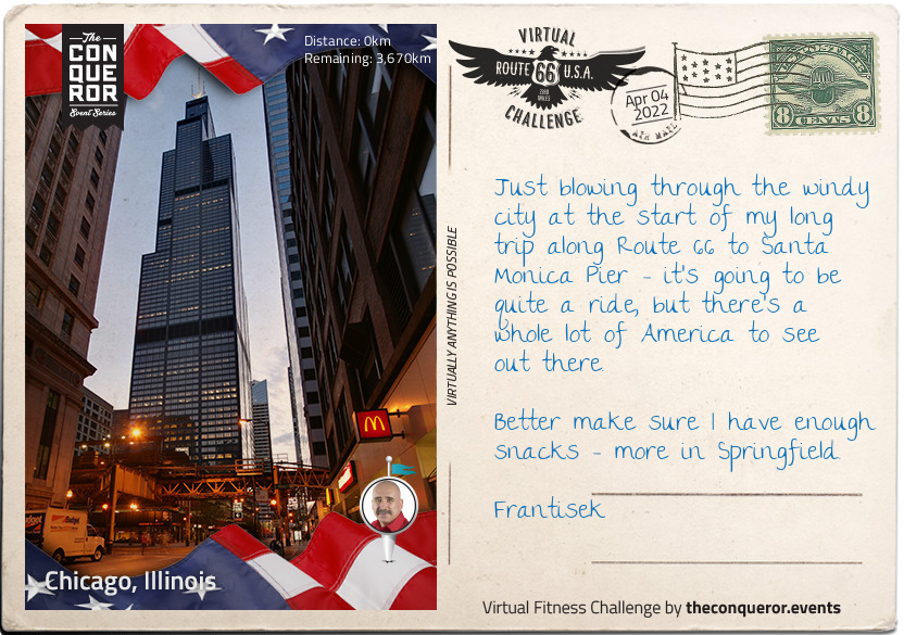
Welcome to Chicago, Illinois Frantisek, the third largest city in the United States of America, and a trading post since the late 17th century. The first permanent resident was a free Haitian man, Jean Baptiste Point du Sable - little is known of him before he first appears in Chicago in the 1770s, but he was certainly resident there from 1790 and is known as the founder of the city. By the time Mark Twain said "she outgrows [a man's] prophecies faster than he can make them" in 1883, Chicago had gone from trading post on the river to thriving town.
When the Willis Tower - formerly known as the Sears Tower - was completed in 1973, it was the tallest building in the world, and remained so for 25 years. Although still impressive, the tower is only the second tallest in the States, and has slumped to 14th in the world. It gets its original name from Sears Roebuck, who at the time of construction required a staggering 3,000,000 square feet of office space for its employees.
After 40 years, Sears' naming rights bizarrely expired, and in March 2009, Willis Group Holdings not only leased part of the building but obtained naming rights too. Potentially, the name could change again in 2024, when rights become available again, although the Chicago Tribune notes that "we're stubborn about such things", and that the current name hasn't yet stuck in the mind of locals, let alone the world.
km od začátku : 0005
Chicago, Illinois
Welcome to Chicago, Illinois Frantisek, the third largest city in the United States of America, and a trading post since the late 17th century. The first permanent resident was a free Haitian man, Jean Baptiste Point du Sable - little is known of him before he first appears in Chicago in the 1770s, but he was certainly resident there from 1790 and is known as the founder of the city. By the time Mark Twain said "she outgrows [a man's] prophecies faster than he can make them" in 1883, Chicago had gone from trading post on the river to thriving town.
When the Willis Tower - formerly known as the Sears Tower - was completed in 1973, it was the tallest building in the world, and remained so for 25 years. Although still impressive, the tower is only the second tallest in the States, and has slumped to 14th in the world. It gets its original name from Sears Roebuck, who at the time of construction required a staggering 3,000,000 square feet of office space for its employees.
After 40 years, Sears' naming rights bizarrely expired, and in March 2009, Willis Group Holdings not only leased part of the building but obtained naming rights too. Potentially, the name could change again in 2024, when rights become available again, although the Chicago Tribune notes that "we're stubborn about such things", and that the current name hasn't yet stuck in the mind of locals, let alone the world.
km od začátku : 0306
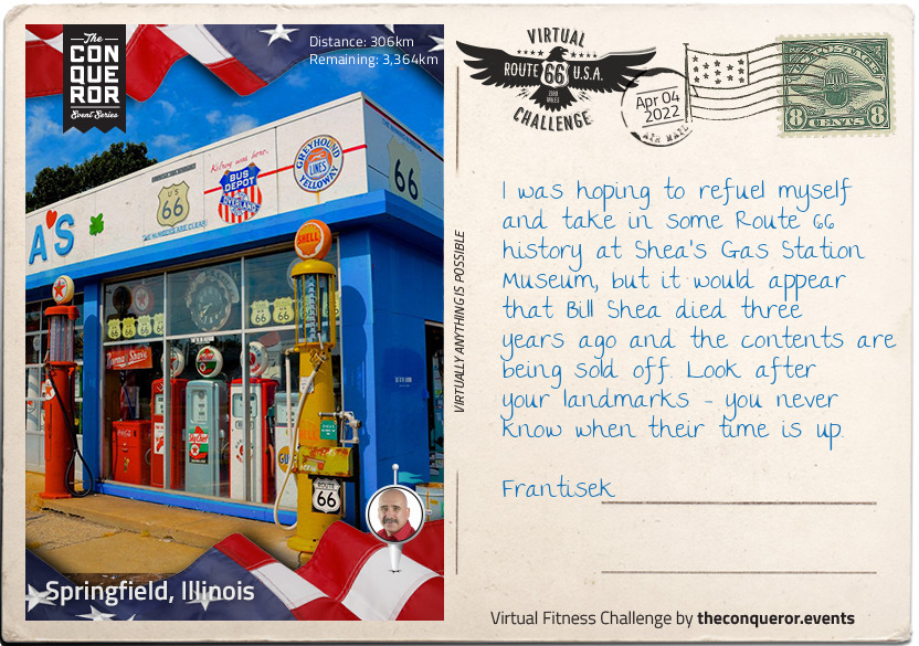
Springfield, Illinois
You've made it to Springfield, Frantisek, capital of Illinois and sixth most populated town in the state. Like Chicago, Springfield's early history is intertwined with the fortunes of travelling fur trappers and traders. By the time a young Abraham Lincoln moved here in 1837, Springfield was an established town.
Lincoln met his wife, Mary, in Springfield, and practised law there for 24 years, also taking a healthy interest in politics - a good pursuit for a future president. He was elected to office in November 1860, although was singularly unpopular in slave states; in fact, he only won two of 996 counties in the South that year.
A two-term president, Lincoln can also be credited with founding Thanksgiving as a national holiday in America. Before, it had been a small holiday in New England, but he fixed it as the final Thursday in November; something we can be certain retail employers don't thank him for today, with Black Friday falling the following day.
Although buried in Springfield, Lincoln is perhaps best known for being murdered in a theatre. John Wilkes Booth, his assassin, was a well-known actor and a vocal racist; Lincoln promoting equal voting rights for freed slaves didn't go down well, and when watching Our American Cousin in Ford's Theatre in April 1865, he was shot in the back of the head at point blank range. African-Americans, whose rights Lincoln championed, openly wept at their president's death.
km od začátku : 0484
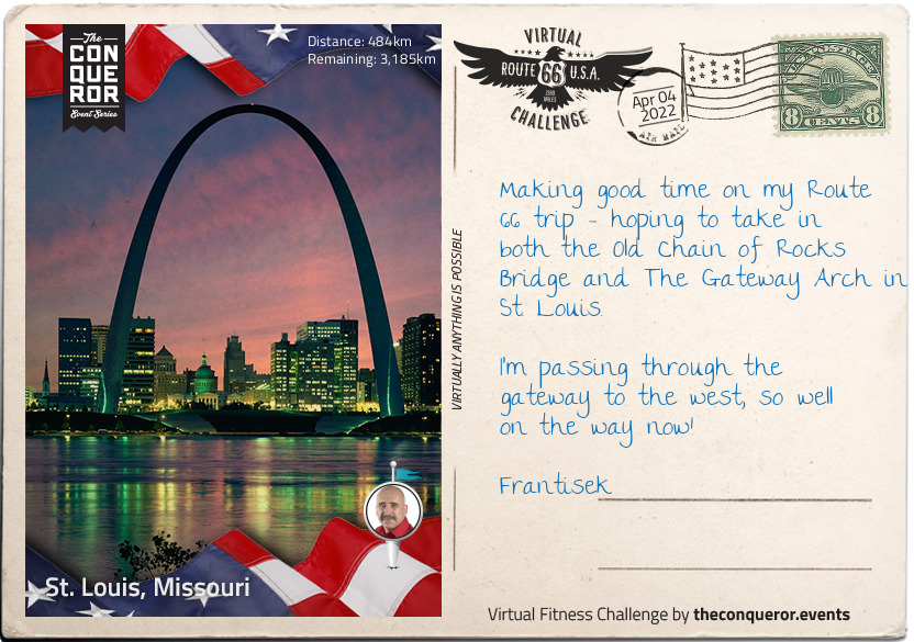
St. Louis, Missouri
Historic St. Louis was founded over 250 years ago, Frantisek, and before the French fur trappers and traders that settled there arrived, it was a centre of Native American Mississippian culture. Evidence of a sophisticated society dating back at least a thousand years before the city was established as a French territory was all around, including earthworks, a complex social structure, and advanced farming techniques.
European exploration of the area first took place in the late 17th century, and the early French settlers grew wealthy from the fur trade, relying on slave labour to provide the workforce. By 1821, Missouri was a state in its own right, with St. Louis serving as the state capital until 1826, when Jefferson City was decided upon as being more central.
St. Louis is also well-known for two spectacular landmarks; the Chain of Rocks Bridge, with its strange 30 degree turn halfway across, prompted by the water safety advice of boatmen who frequented that stretch of the Mississippi. Out of general use since 1968, the bridge is now a monument to early 20th century construction.
Discussions for a structure in St. Louis to commemorate the first settlers and pioneers were mooted as early as 1933, with Eero Saarinens's designs in place for the Gateway Arch itself by 1947. Plagued by delay, funding issues, and red tape, preparation of the ground didn't begin until 1959, and construction proper didn't start until 1963. It's also one of the few major world monuments where no construction workers died during building, despite an actuarial firm's estimate of an unlucky 13 potential deaths.
km od začátku : 0586
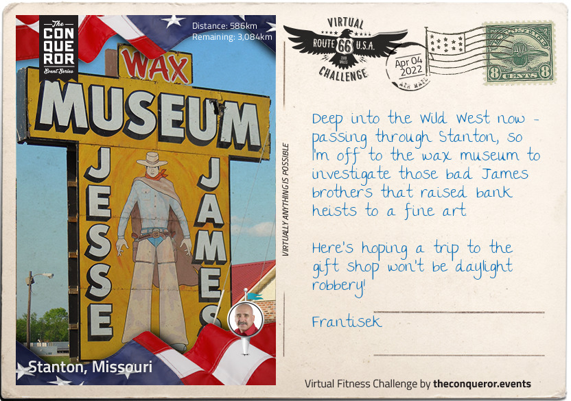
Stanton, Missouri
At first glance, Stanton might not appear to have much to recommend it to someone taking in the sights and landmarks of historic Route 66, but this small, unincorporated community is up there with every other example of not judging a book by its cover. It has even apparently shrunk since Rittenhouse's 1946 Guidebook to Highway 66 - then it had a garage, a gas station, a café, a shop, and a few cabins. Now, the only business open year round is the gas station, although the famed Jesse James Wax Museum does a good trade in the Summer, when it is open daily, and at the weekends in Spring and Autumn. Like the town, it pretty much closes down in Winter.
Stanton is, however, close to the famous Meramec Caverns, where the James gang holed up to avoid arrest. The caves are natural limestone, formed more than 400 million years ago, and have been used variously for shelter by Indian tribes, to collect saltpetre for the production of gunpowder in the 18th century, and even as a venue for ballroom dances in the 1890s - the same area of the caves can still be rented today for private special events.
The wax museum is devoted to all things Jesse James - including photographs of the outlaw, plus several personal items and vintage firearms. You will also hear the legend of what was possibly the greatest feat of James' criminal career; officially, he was gunned down by Bob Ford, a member of his own gang, in 1882, but legend has him escaping and dying at the grand old age of 101 in Texas in 1951. It would make a fitting end to the tale of the modern-day Robin Hood, but family questioning and recent DNA evidence have sadly debunked this.
km od začátku : 0664
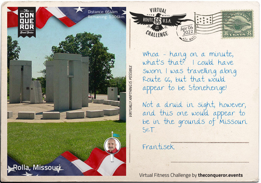
Rolla, Missouri
For a relatively small place, Rolla produces a lot of professional sports men and women, and also an impressive crop of politicians. Although incomes are a little below the national average, the surrounding area and amenities help rate the town higher than it might otherwise sit for quality of life.
In terms of its history, it's a relatively short one - the first house within the current Rolla city limits was built in 1844 by one John Webber. The following year, the railway came to town - or at least the reconnaissance mission did - led by James Abert, the first professor of Civil Engineering at the Missouri School of Mines, which later became Missouri S&T. The official town founder, however, was Edmund Ward Bishop, a construction contractor who was tasked with the job of building that branch of the Southwest Railroad.
There are two entertaining stories about the name; both might be true, or at least contain a grain of truth. In the 1860s, Rolla and neighbouring Dillon were in competition to be the county seat. Rolla won, but part of Dillon's consolation prize was to choose the name of the new city, which they did - after a particularly useless hunting dog. The official version is that it is a phonetic corruption of Raleigh in the emerging North Carolina accent, the origin of many of the settlers.
The modern Stonehenge reconstruction in the grounds of Missouri S&T is a must-see; partial, and a scale model it might be, not to mention erected with the use of modern equipment, but it underlines rather than detracts from the fact that the original prehistoric monument was an incredible feat of engineering.
km od začátku : 0889
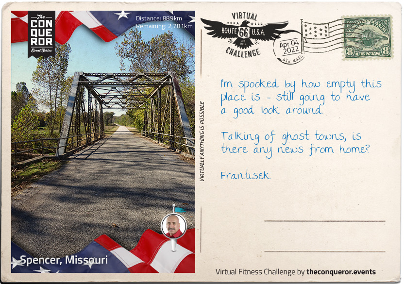
Spencer, Missouri
Congratulations on making it to Spencer, Missouri Frantisek, an actual real-life ghost town. Although Spencer was never much more than a wide place in the road, it did actually have not just people but a post office in the late 1870s. The local population were nearly all connected with agriculture, and Spencer gained both a church and a general store to cater to them.
However, less than forty years later, the road became unusable, and the town more or less emptied - at least for a while. By the late 1920s, when Route 66 was constructed to pass through the derelict buildings, the town reopened for business, with two shops - one grocery, one dry goods, a barber, a garage, and a Tydol station. The second death of Spencer occurred when Route 66 was bypassed by I-44 and until recently, the whole town was a row of vacant premises left over from the still rather quiet heyday of the 1920s.
In recent years, the site has been purchased by the Ryan family - bought from the Caseys, who first owned the land the 'town' was built on in 1925. The gas station has been restored, and although non-operational, is full of authentic memorabilia of the period it was first constructed, including a vintage police car parked in front. Spencer never required or got its own police station, but it's a nice touch.
Just to prove that vandals really will trash anything, the restored (but closed) barber shop was damaged in 2015, including the theft of its nostalgic red and white pole. They may have caused a few thousand pounds worth of damage, but Spencer will carry on - a lovingly-restored, slightly creepy non-town along historic Route 66.
km od začátku : 0944
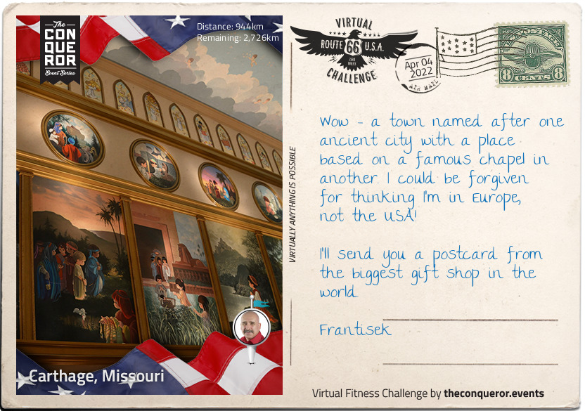
Carthage, Missouri
Carthage, Missouri is, in many ways, as fascinating as its ancient namesake. Birthplace of senators, suffragists and sportspeople, it's also the birthplace of perhaps the most famous female outlaw of the wild west, Belle Starr, who died in 1889. The wonderfully-named Myra Maybelle Shirley Reed Starr (known to her family as May) was from a reasonably well-to-do family, and even received a private classical education at the higher end of what a girl might expect in the 19th century. Her father, however, had been the black sheep of his own family (who were even more well-to-do) and something of that rebel streak obviously passed down to Belle, who fell in with the notorious James brothers, Frank and Jesse - she had, in fact, known them since childhood, and they grew up together.
Belle's personal style fed the later legend; she was a crack shot, and rode dressed in black velvet and a plumed hat, carrying two holstered pistols on her hips. Having buried her first husband, Jim Reed, Belle married Sam Starr, a Cherokee man and famed bootlegger and horse thief.
Belle Starr's legend extends to her death, two days short of her 41st birthday - shot multiple times, it's unsure whether it was a simple ambush, a lover's tiff, or conspiracy between her third husband (Sam Starr had been killed a few years earlier) and her children. Her daughter, Pearl, became something of a legend in her own right - a Bordello queen, operating several properties until the end of the First World War.
Modern day Carthage boasts the Precious Moments Park and Chapel, inspired by the Sistine Chapel in Rome. The mural artworks throughout the Chapel depict Bible stories, both Old and New Testament, and cover nearly 5000 square feet. The Chapel and Park also boasts the world's largest gift shop - a must for lovers of kitsch memorabilia.
km od začátku : 1116
Foyil, Oklahoma
Foyil, Oklahoma is tiny, Frantisek, absolutely tiny. In the 2000 census, there were only 68 families, 97 households, and 234 people in the town. However, over the next decade, the population grew by almost 50%, reaching a booming 344 - the largest population that Foyil has had since its first US census in 1920.
The area used to be part of the Cherokee Nation, but like much of the rest of the American Midwest, the railway brought a small and thriving settlement of rail worker, and in 1890, a postmaster, Alfred Foyil. The town was built on his farmland, and with the addition of a general store (also owned by Foyil), a chemist, and a furniture shop by 1898, then a bank in 1905, Foyil might have been small (at around 150 residents), but it was perfectly formed. In 1911, it was home to - amongst others - two doctors, two blacksmiths, a lawyer, nine teachers, and even its own newspaper.
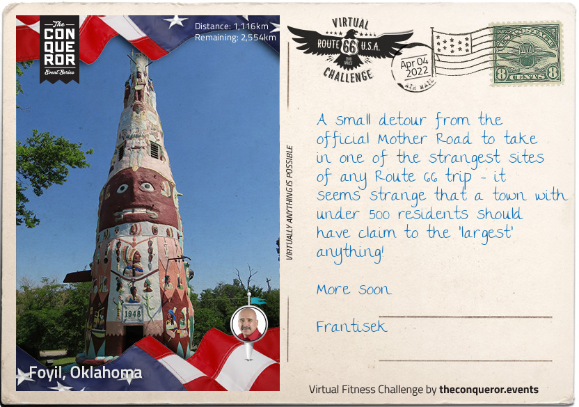
Route 66, helped the small town survive, but like many other small communities, boom and recession affected the size of the population. However, in 1937, Foyil started to garner fame as the home of a rather strange and wonderful piece of folk art - the world's largest totem pole. Nathan Edward Galloway's concrete construction wasn't finished until 1948, and although it was hailed as a wonderful monument to the former Native American history of the area, Galloway later stated it was just to give him "something to do" in retirement.
km od začátku : 1181
Tulsa, Oklahoma
Welcome to Tulsa, Oklahoma Frantisek, the very birthplace of Route 66, and home of the one and only Route 66 Village. It takes its name from the name for 'old town' - Tallasi - in the language of the Lochapoka and Creek tribes who officially settled here in 1836, and who were part of the so-called 'Five Civilised Tribes'. Descendants of the Mississippian culture societies, they were largely farming and agricultural communities, and appropriated many aspects of the colonising and displacing pioneers - although the absorption wasn't always peaceful, or welcome.
Oklahoma still wasn't a state by the time of the American Civil War, but that didn't stop Tulsa both seeing its fair share of skirmishes, and later on some of the more notorious outlaws of the Wild West, not least the Wild Bunch, and the Dalton Gang. In the 20th century, oil protected Tulsa from the worst of the Great Depression, and the city's Greenwood neighbourhood was the home of what was termed 'Black Wall Street' - a highly successful and wealthy black community. Horrifying race riots - sparked by an alleged assault on a white 17 year old girl - in 1921 led to the shameful massacre of hundreds of black residents; the neighbourhood was razed to the ground in the space of just a few hours. Those who survived and chose to stay rebuilt Greenwood, and it thrived. The massacre itself was rarely mentioned in history books or classrooms, and not at all in the press.
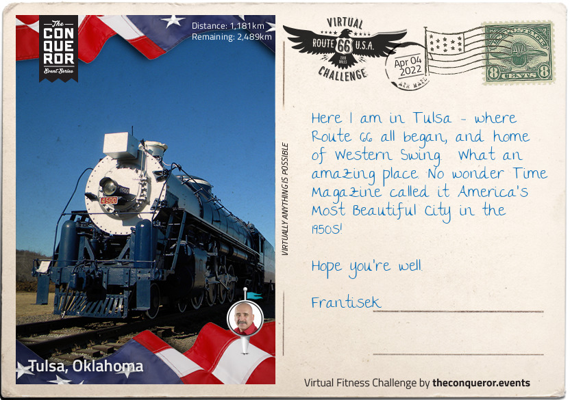
When Cyrus Avery, a local businessman, had the idea for a Chicago to Los Angeles road in 1925, little did he know that Route 66 would become world-famous. The Route 66 Village in Tulsa is a must-see transportation museum, complete with rail cars and other memorabilia from the early days of the town.
km od začátku : 1293
Chandler, Oklahoma
Welcome to Chandler, Oklahoma Frantisek, county seat of Lincoln, and home to many Route 66 attractions. It didn't have the smoothest of starts, however; due to be 'opened' on 22nd September 1891 as part of a land run - literally a first-come, first-served rush to previous restricted territory, usually previous Native American settlements - Chandler was already 'settled' insofar as there was already a post office and several other official buildings. However, the site survey wasn't in place, so Chandler had its own separate, exclusive run six days later.
The Chandler courthouse seems to have had a run of bad luck too - torn down by a tornado in 1897 (17 town residents died), a stone courthouse eventually replaced it, but this was burned down in December 1967, and rebuilt again. Third time lucky for the courthouse, it's still standing today.
Despite oil discoveries in the surrounding area, Chandler has surprisingly never become a boom town. Additionally, the population has always been relatively small - less than 3000 inhabitants.
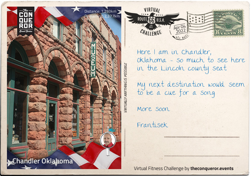
The Lincoln County Historical Society and Museum of Pioneer History is full of thought-provoking information about the area, not to mention photographs and mementos of families dating back to before the land rush of 1891. Records of business, people and the general history of the whole county is on display, dating as far back as the Spanish American War in 1898.
km od začátku : 1366
Oklahoma City, Oklahoma
Oklahoma City was founded in the Land Run of 22nd April 1889, and within a few hours of its official foundation, already had a population of over 10,000 people. Within a decade, the population had doubled, and by the time it was admitted to the Union in 1907, was streets ahead of Guthrie - the territory capital - both as a population centre and a successful industrial and commercial hub.
Oklahoma enjoyed a rich and prosperous reputation, largely due to oil, and also as a centre of federal government. In April 1995, however, the Murrah Building was subjected to the deadliest act of domestic terrorism in American history, and the worst act of terrorism on American soil until September 11th 2001. 168 people died, and over 600 were injured.
Gulf War veteran Timothy McVeigh detonated a truck bomb in front of the building as revenge for the government handling of the Waco siege, which killed 76 people exactly two years earlier. McVeigh was a decorated soldier, and shocked by his orders to execute Iraqi prisoners who were surrendering. On his return from the Gulf, he appears to have become completely disillusioned by government, and even wrote a letter to a local newspaper containing the line "do we have to shed blood to reform the current system?"
By 1995, he was completely radicalised, and turned to violent terrorism. His 168 victims at the Murrah Building included 19 children in a second-floor daycare centre; something which he said would have given him cause to choose another target had he known (although it is widely thought that he did know, and didn't care). McVeigh was convicted, and was executed by lethal injection at 7.14am on 11th June 2001.
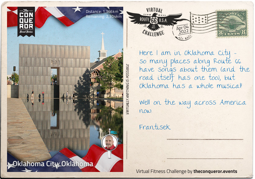
Rescue and recovery operations went on at the site for over a week until the ruined building was demolished a month later, and on the fifth anniversary of the bombing in April 2000, the Oklahoma City National Memorial was formally dedicated, commemorating all those affected by the atrocity, including rescuers and family members.
km od začátku : 1684
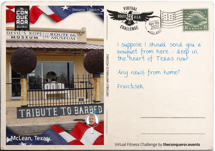
McLean, Texas
You could be forgiven, Frantisek, for thinking that McLean's day has been and gone. Alfred Rowe, an Englishman who perished on the Titanic in 1912, gave land for a cattle loading stop and town in the area in 1901, and that community grew very rapidly. Three years later, it not only had a newspaper, but a bank, three general stores, wagon yards and stables, and a wood yard. Tourism arrived with Route 66 in 1927, and by 1940, there were six churches and some 59 businesses, not to mention around 1,500 people living there - a number that trebled when a prisoner of war camp was built close to the town in 1945 to house 3000 German prisoners.
It has shrunk somewhat since then, with fewer than 900 people currently living there. It is, however, home to one of the strangest museums on earth - a museum entirely dedicated to barbed wire. Fencing wire in itself might not seem particularly fascinating, but although several patents were issued between 1853 and 1868, only one of them had projections, or 'barbs' - what we recognise as barbed wire was developed by Joseph F. Glidden in 1874, now known as the Father of Barbed Wire. Today, there are more than 2000 types.
The Museum itself was opened in 1991, and took over the premises of a disused bra factory - thankfully those underwires are barb-free. Dedicated to not just the history of barbed wire but to ranching and fencing, the exhibits also include location-relevant artifacts from McLean's Route 66 history.
There's also a gift shop with a different. Whereas other museums sell tea towels and tote bags alongside books and postcards, the Devil's Rope Museum sells, you guessed it, different kinds of barbed wire as a memento of your visit.
km od začátku : 1758
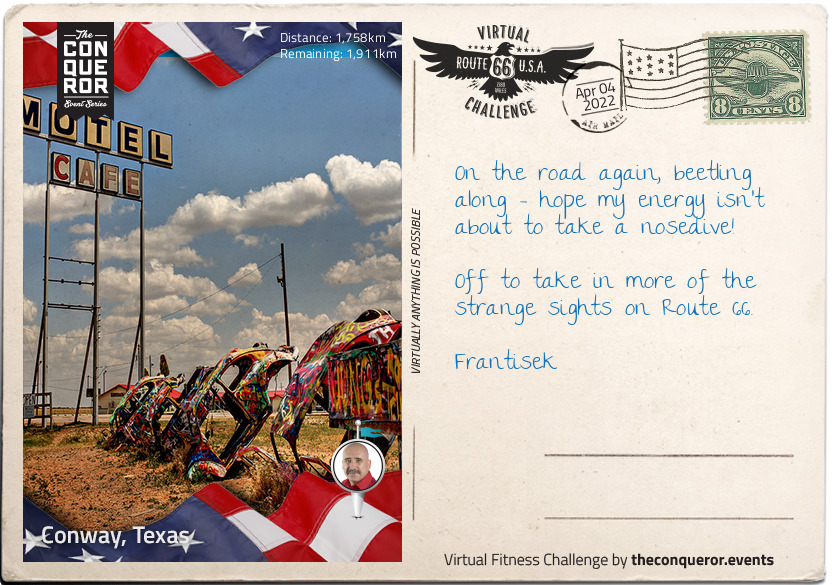
Conway, Texas
If you're not looking for it, Frantisek, you might miss Conway, what with it only having a population of 20 at the time of the census in 2000. However, it's real panhandle territory, and was more densely populated some 10000 years ago by hunter-gatherers, as evidenced by the stone tools they left behind.
Prior to any European discovery and invasion, those early Native Americans hunted on foot - the Spanish introduced European horses in the 15th century, and were soon completely outstripped in terms of horsemanship. The native population here - as elsewhere along Route 66 - was confined to reservations, and the territory was up for a succession of land runs.
Before Conway was Conway, it had a school, a post office, and a railway. In 1905, it acquired a name, and an increased population - in 1939, there were 125 residents, in spite of hard financial times across the country. However, decline began in the late 1960s; the post office and railway closed, and the I-40 bypassed the town, leading to a population today that you can literally count on your fingers and toes.
That late 1960s decline, however, gave Conway - and Route 66 - one of the strangest sights along the route; burying five Volkswagen Beetles nose-down in the dirt. No-one 'owns' the site as such now, and visitors are encouraged to bring spray paint to leave their own mark behind.
km od začátku : 1819
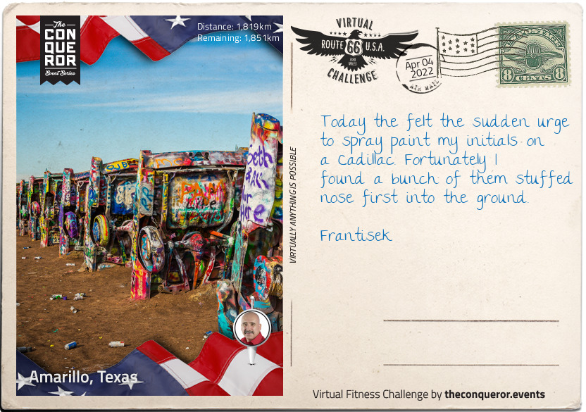
Amarillo, Texas
By the time the 19th century ended, Amarillo was a cow-town, and not just any cow-town; it was one of the biggest and busiest cattle-points in the world. However, it wasn't cattle that made the town's fortunes. Gas and oil reserves led to the Federal Bureau of Mines operating the Amarillo Helium Plant from 1929, and it remained the only producer of helium for commercial purposes in the world for many years.
Amarillo isn't just famous for producing gas - it also makes its cowboys tough. Thomas Everett Blasingame was born on 12th February 1898 in Ellis County, and decided as a small child that he would work on a ranch when he grew up - he started riding at the age of six. In 1918, he headed to the Texas Panhandle, and began work, not stopping for 73 years; he was still putting in full days on the job at the age of 91. In fact, Tom Blasingame almost died in the saddle; two days after Christmas in 1989, he got off his horse, laid on the grass, folded his arms over his chest, and died - he inspired writer Linda M. Hasselstrom to write her moving poem, 'Death of the Last Cowhand', and with Blasingame, an era ended.
One of Amarillo's other great legends is the Cadillac Ranch, twin to the Bug Ranch in Conway (or rather, the other way around!). Myth has it that an eccentric Amarillo millionaire would bury his cars nose down on his land when he got a new one, but it's actually a great deal more planned than that. The millionaire in question was an eccentric, but he was also something of a visionary; representing the 'golden age' of American motoring, they were junk yard purchases, costing around $200 each.
km od začátku : 1987
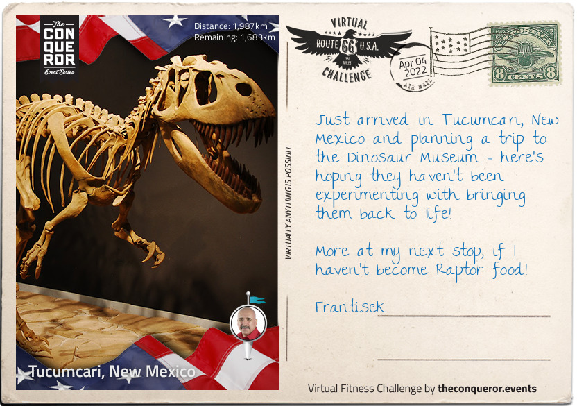
Tucumcari, New Mexico
As with many of the other towns and cities we've reached so far, the real founder of Tucumcari, New Mexico was the Chicago, Rock Island and Pacific Railroad, which built a construction camp in what is now the town in 1901. Initially called Ragtown, the camp's reputation for lawlessness quickly earned it the popular name of Six Shooter Siding, with the official name - Douglas - hardly used at all. By 1908, the settlement had settled a little, and with that, took its second and permanent official name; Tucumcari, after a nearby mountain. Although it's not known where the mountain got its name from, it's very similar to the Comanche word for 'ambush'.
The town might be 'run down' according to tourist reviews, but the Dinosaur Museum is something of a hit. Opened to the public in 2000, the Mesalands Community College Dinosaur Museum has around 14,000 visitors each year, from all over the world. The exhibits are a mixture of fossil findings, bronze skeletons, and replica dinosaurs and other animals, with the bronzes made onsite in the College foundry.
Concentrating on the Mesozoic Period - the 'Age of Dinosaurs' - the museum prides itself on its children's activity area, and that most of the exhibits are touchable. Pride of place - and sadly not touchable - is given to the Torvosaurus skeleton, a relative of the Tyrannosaurus Rex. This rare skeleton presented the small museum with a first; they were the only museum in the world which had one on display.
km od začátku : 2268
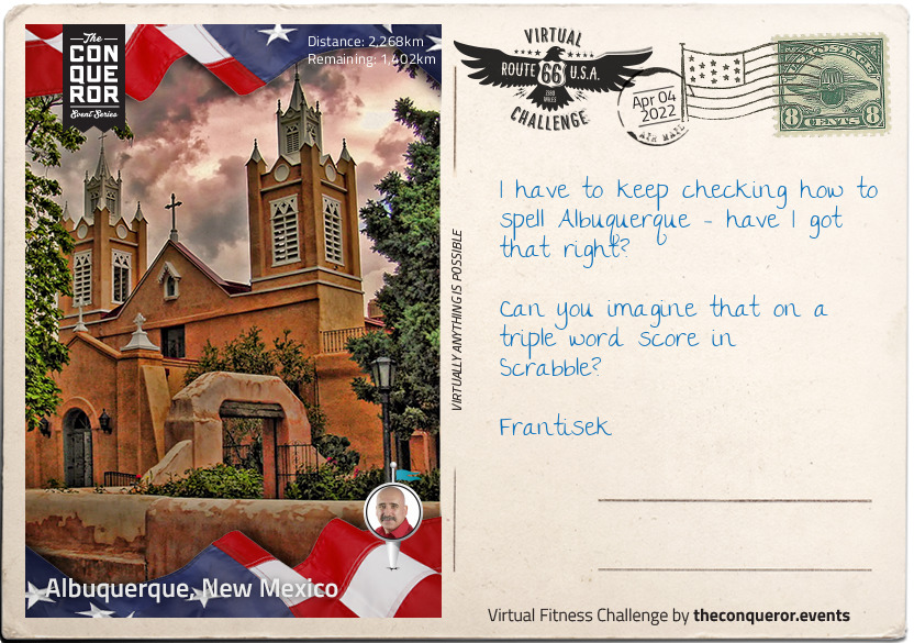
Albuquerque, New Mexico
The origins of Albuquerque's strange name are as fascinating as its history. You could be forgiven for thinking that it's a Native American place name, or a word that describes some feature of the surrounding landscape. However, it was named after Francisco, Duke of Alburquerque - in one surviving portrait, he had incredible moustache. Alburquerque (with the extra 'r') is close to the Portuguese border in Spain, and was a Moorish colony in the 8th century.
Looking into the meaning of the name, it becomes clear that Latin and Arabic have some similarities - the Latin source would appear to come from albus quercus (white oak), and the Arabic from Abu al-Qurq (father of the oak). The border town in Spain was - and still is - a major player in the Spanish cork industry, with coats of arms depicting a white cork oak.
Albuquerque Old Town doesn't look a great deal different today to when it was built in the 18th century. The town was founded in 1706, and the San Felipe de Neri Church, dating from 1793, is the oldest building in the city. The buildings have a particularly Spanish/Arabic flavour, with flat roofs and covered porches. The Old Town area is still home for many of the descendants of the town founders.
km od začátku : 2610
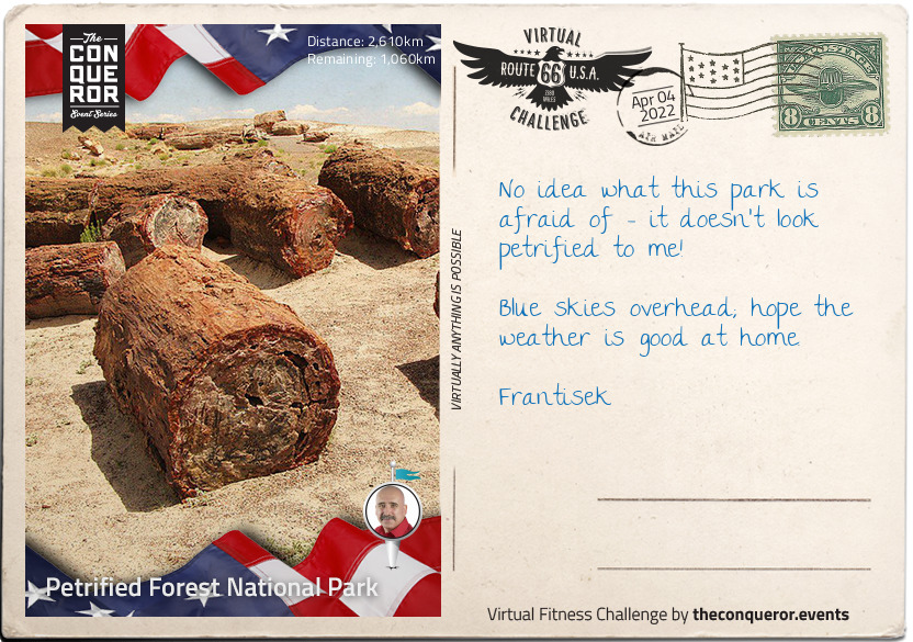
Petrified Forest National Park
Welcome to the Petrified Forest National Park, Arizona, Frantisek, 230 square miles of desert and Badlands. There's so much to see here over such a wide area that it's probably a trip in its own right. The park has over three-quarters of a million visitors every year, with a good few hiking and backpacking over the course of a few days.
The part itself was declared a national monument in 1906, and Route 66 goes right through it, guaranteeing that casual sightseeing can be done from the comfort of an air-conditioned car! Made a national park in 1962, it's not just notable for the landscape; around 400 species of plants can be found across the park, and in addition to other animals, birdwatchers will be keen to spot over 200 separate species, some migratory, some permanent residents.
But onto the petrified bit - the park is particularly noted for its fossils, not least the fallen trees that give it its name, and which grew during the late Triassic Period, some 225 million years ago. Animal fossils include giant phytosaurs (an extinct group of semi-aquatic reptiles), and a probable sister evolutionary group of the branch from which both birds and crocodiles descend, and also early dinosaurs.
Human habitation came somewhat later, with evidence of tribal groups dating back around 8000 years, and farming culture from around 2000 years ago.
km od začátku : 2795
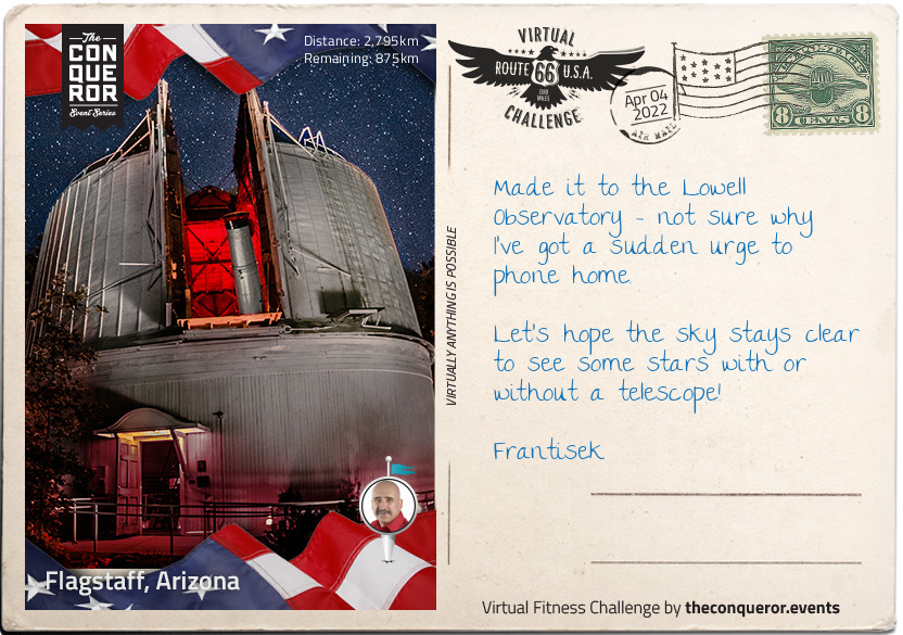
Flagstaff, Arizona
Flagstaff, Arizona and the Lowell Observatory are a perfect match - as the scout for an observatory site stated in the 1890s when tasked with looking for a suitable place "other things being equal, the higher we can get, the better".
Established in 1894, Frantisek the Lowell Observatory is one of the oldest in the United States, and worthy of being designated one of "The World's 100 Most Important Places" by TIME magazine in 2011. The Observatory's major claim to fame is for the discovery of Pluto by Clyde Tombaugh in 1930.
Tombaugh had an unusual path to astronomy; part of a farming family, his college plans had to be put aside when a storm ruined the farm's crops. He started to build his own telescopes at the age of 20, in 1926, testing them by digging himself caves to keep the air temperature constant - this also doubled neatly for family use as a cellar and emergency shelter. He sent his detailed drawings of Jupiter and Mars to the Lowell Observatory, who decided to offer him a job in 1929. The young researcher was given the job of looking for Planet X - predicted by research by Percival Lowell and William Pickering - and conclusively proved on 18th February 1930.
Tombaugh was also keenly-interested in the possibility of UFOs. In the mid-1950s, he went on record as saying there had been three objects over the past seven years for which he could find no scientific explanation, and thought that other reputable sources were being "unscientific" in refusing to believe the possibility that aliens might exist.
km od začátku : 2845
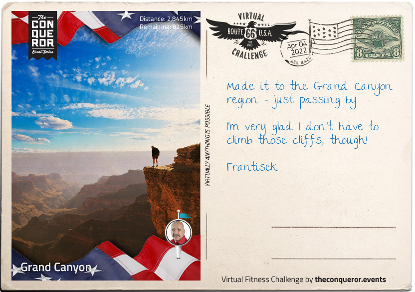
Grand Canyon
The site of the Grand Canyon is so overwhelming that it is no surprise that the Pueblo Native American population used to view it as a holy site, and to make pilgrimages there. The valley itself displays around two billion years of geology in the exposed rock walls of the canyon, with the site itself thought to have its origins around 17 million years ago, although there are several credible scientific arguments that it is anything between six and 70 million years old.
In terms of human occupation, there is some debate as to when a distinct group with their own culture emerged, but there is considerable evidence to suggest that the ancient Puebloan people referred to as the Anasazi ('Ancient Ones' in Navajo) who lived there around 3200 years ago are the ancestors of today's modern Pueblo-identifying population.
By the time the Europeans arrived in the mid 16th century, there was a complex society of many different tribes, co-existing and frequently intermarrying. The Spanish didn't have it easy in 1540 - it's likely that their Hopi guides could have found them an easy route to the canyon floor, but the apparent difficulty meant that no European bothered with the canyon again for over 200 years.
The Grand Canyon is a US National Monument, and has Theodore Roosevelt - a conservationist as well as President - to thank for it. After a 1903 visit, he established a game preserve, and also eradicated natural predators. Land claim holders, mining prospectors, and other opponents tried to get his best efforts blocked, but the Grand Canyon was eventually established as the 17th US National Park by Woodrow Wilson in 1919.
It doesn't get any easier for conservationists; recent concerns include the leaching of uranium into the water supply should mining recommence in the area - it has been suspended since 2009. The case rumbles on through the courts.
km od začátku : 2916
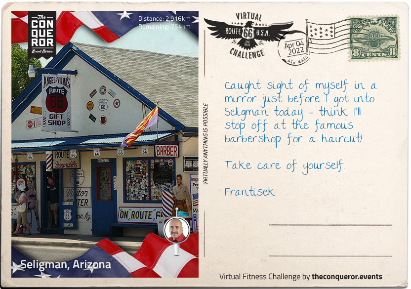
Seligman, Arizona
You are doing an amazing job, Frantisek - here we are at Seligman, Arizona home to fewer than 500 people, and popular stopping point for Route 66 travellers. This area was historically the home of the Yuman-speaking Havasupai Native American people, who have been settled in the area for almost a thousand years. Formerly surviving through agriculture and hunter-gatherer culture, tourism is their modern day main source of revenue as Supai, their major city in the Havasupai Reservation, has around 20000 visitors a year, despite having the reputation as being one of the most remote cities in the United States, ultimately reachable only by hike, horse, or helicopter.
It is often said that Seligman wouldn't exist without Route 66, and Route 66 wouldn't exist without Seligman, or at least, famous resident Angel Delgadillo. Of an age with the route itself - he was born in 1927 when the roads that formed Route 66 were first being connected up - Angel followed the family trade, and became a barber just like his father, Angel Delgadillo Sr. In 1972, Angel moved his barber shop from its previous location so that he could take advantage of the slightly adjusted route of Route 66, which now went through Seligman - everything went with him; his father's 1926 barber chair, and three pool tables. With close to 10000 cars passing through every day, trade was brisk for Angel and the rest of Seligman's businesses.
Until 1978. On September 22nd, the cars disappeared. The new Interstate 40 had opened two miles to the south, and as Angel puts it "the world forgot about us". Angel and his brother discovered that the only signage which even mentioned Seligman was 16 miles away, and campaigned for another four more useful mentions, but it still wasn't enough.
Not to be beaten, Angel tapped into the one thing that most Route 66 travellers are interested in - nostalgia. Seligman took the bait, and is now known as "The Birthplace of Historic Route 66".
km od začátku : 3221
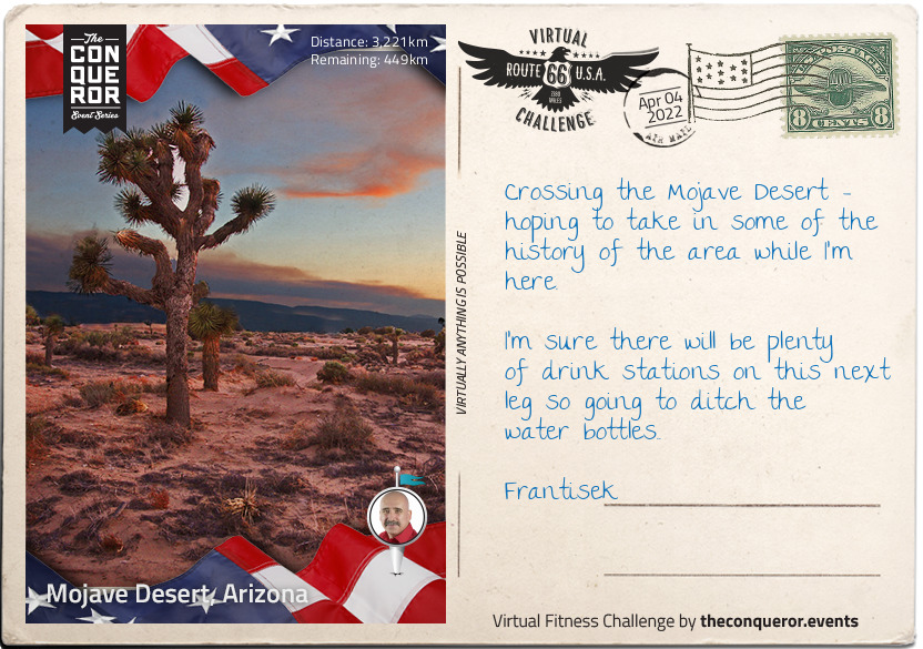
Mojave Desert, Arizona
For over a hundred years, the name Mojave (and its alternate spelling, Mohave) has been used to describe 'the people who live along the water' - the Native American tribe who lived there, and whose descendants still live there.
The driest desert in the United States, the Mojave boundaries are marked by Joshua trees, which are only native to this area, and also by other desert areas, and both the San Gabriel and San Bernardino mountain ranges; both of this are on fault lines, notably the San Andreas fault.
Desert implies a certain lack of population, but the Mojave has urbanised areas, notably Las Vegas, with a population of over two million, and the 29th most populated city in the United States. Founded as a city in 1905, it didn't take long for Las Vegas to acquire its first casinos, and a prime place to live if you needed a quickie divorce. The 1950s also brought nuclear testing, with residents and visitors able to watch the mushroom clouds - and experience the fallout - from testing in the Nevada Desert some 65 miles away.
Known for shopping, gambling, and nightlife, Las Vegas bills itself as 'The Entertainment Capital of the World'. However, before Tom Jones and Elvis headlined at The International, nomadic tribes left their mark on the area around 10000 years ago.
Not so long to go now Frantisek - the end is in sight!
km od začátku : 3543
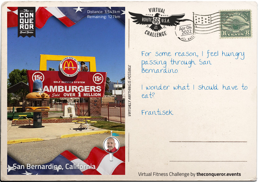
San Bernardino, California
Home of California State University, San Bernardino is home to many cultural and artistic sites. And also to the McDonald's Museum.
One of the oldest cities in California, San Bernardino was settled in 1810, but didn't really establish itself for another 40 years when it became an important trading hub. It continued to be a busy and thriving community, including the establishment of Norton Air Force Base in the Second World War. And also a restaurant called McDonald's.
You can't get away from mentioning McDonald's when talking about San Bernardino, as the two have become inextricably linked in each other's histories. Dick and Mac McDonald were brothers and fast food pioneers; their first stab at success had been a hot dog stand in Pasadena in 1937 (not a hamburger in sight), but when the opportunity came to open a restaurant in San Bernardino in 1940, they closed the hot dog stand and jumped at the chance. It's no longer a McDonald's, but it does now serve as the company museum.
McDonald's was a hit. So much so that within 13 years, they began franchising their restaurant - or at least the system; franchising the entire concept, including the famous golden arches, came later. The brothers were still thinking small in terms of global domination, however, and it wasn't until partnering with Ray Kroc, who turned their ideas into what became the McDonald's Corporation - he purchased the company from the brothers for $2.7 million in 1961.
In 1984, the 50 billionth McDonald's hamburger was served - to Dick McDonald, the first cook behind any McDonald's grill.
km od začátku : 3643
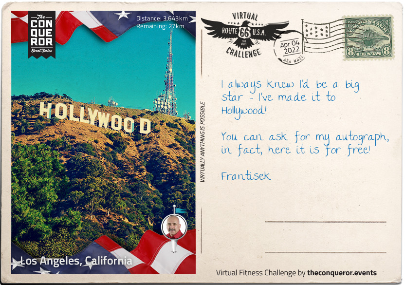
Los Angeles, California
Your last stop before your last stop, Frantisek - you've made it almost all the way across Route 66!
Los Angeles, California is the second largest urban area in the U.S. It extends more than 40mi from the mountains to the sea.
The Spanish explorer Gaspar de Portolá visited the site in 1769. On Sept. 4, 1781, the Mexican provincial governor, Filipe de Neve, founded "El Pueblo de Nuestra Señora la Reina de Los Angeles," meaning "The Village of Our Lady, the Queen of the Angels." The pueblo became the capital of the Mexican province, Alta California, and it was the last place to surrender to the United States at the time of the American occupation in 1847. By the Treaty of Guadalupe Hidalgo in 1848, Mexico ceded California to the United States, and Los Angeles was incorporated as a city in 1850.
Los Angeles is a major hub of shipping, manufacturing, industry, and finance, and is world-renowned in the entertainment and communications fields
In the Santa Monica mountains is perhaps the most famous American monument this side of the Empire State Building and the Statue of Liberty - the Hollywood Sign. Erected in 1923 as a real estate advertisement - then left behind - it eventually became synonymous with the blossoming film industry, and a symbol of aspiration to budding hopefuls. It was also connected with tragedy - Peg Entwistle was a Welsh-born actress whose stage career in her adopted America drew considerable acclaim; she even drew a 17 year old Bette Davis to tell her mother "I want to be exactly like Peg Entwistle". Nobody knows precisely what caused Peg to jump to her death from the H of the sign - her career was going well, and her final jobs were a film with Myrna Loy and Irene Dunn, and a play opposite Humphrey Bogart - but on 18th September 1932, her body was found in a ravine below the sign. She was only 24 years old.
km od začátku : 3670
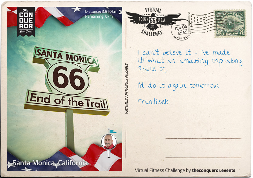
Santa Monica, California
Congratulations Frantisek, you're here at Santa Monica Pier, and officially at the end of Route 66.
The pier is actually two piers, both over a hundred years old, which originally had separate owners. The narrower Municipal Pier had a less appealing function, which was to carry sewage beyond the breakers. The Pleasure Pier, built seven years later in 1916 originally housed a theatre, and is now the site of the carousel - built in 1922, the carousel was restored in 1990 and placed inside the former theatre building.
The first heyday of the pier was during the 1920s, but like much else during the Great Depression, spending on non-essentials suffered greatly, and the pier was mainly used as a ferry port with many of the amusements sold off. The 1940s brought country music star Spade Cooley's television show, broadcast from the pier ballroom, and during the 1950s, the ballroom served as a roller skating rink.
Storms, recessions, strange redevelopment ideas, and other peaks and troughs of the popularity of pier-style entertainment have all beset Santa Monica Pier since it was built, but still it stands - a feature of television and film, and the official end of Route 66; it's a long way back to Sears Tower!
From the team and My Virtual Mission - Congratulations, you've done it!